This is Chapter Four of eight. In this chapter of the Gore narrative, we are documenting a momentous century in the lives of the men and women in two more generations of our family. They journey from their homes in Roxbury, Massachusetts Colony, to the Connecticut Colony, and eventually find themselves facing the American Revolution.
Our ancestors were born into a world already in transition… before we venture further, it is important to understand some of what had been occurring in the New England area of their births.
Preface: Troubles Brewing — Change is Fomenting
The English Monarchy governed its far-flung colonies by the power of extracting resources, then having those resources shipped to England for their own manufacturing use. These raw materials were then processed into goods (for example, textiles such as blankets), which were then shipped to the North American Colonies, sold and taxed. This scheme worked very well for England, but added to a growing sense of displacement which many Colonists felt about their place in the world. What were their rights to self-governance? How did a distant, far off monarchy fit into their worldviews?
Literally and figuratively, boundaries were shifting.
Literally, with the actuality that colonies, territories, and borders, were all shifting in a state of flux. Unlike today, as we move through a highly-bound, demarcated world, they were somewhat unbound, trying to figure it out as they went along. Figuratively, our ancestors were starting to form a ‘mental map’ of a world which was really quite different from that of their forbearers.
The English Monarchy was also going through some important changes. From essayist Joerg Knipprath: “There have been few times as crucial to the development of English constitutional practice as the 17th century. The period began with absolute monarchs ruling by the grace of God and ended with a new model of a constitutional monarchy under law created by Parliament. That story was well known to the Americans of the founding period.”
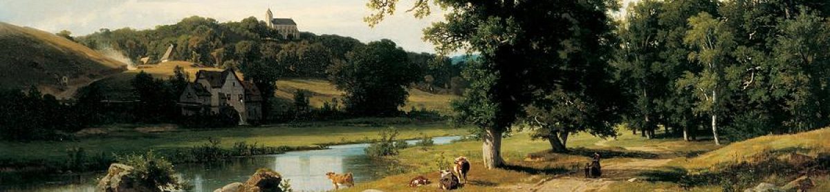
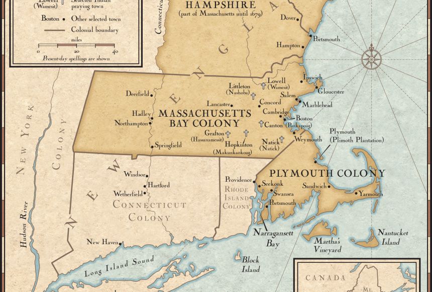
The Gore family had settled in Roxbury, Massachusetts, which is on the far eastern shore of the North American continent. As time went on, more colonists arrived and land holdings expanded to fill what was available under British governance. People wanted stability and prosperity, but the choices about where to further go were somewhat limited. For the settlers, this meant that ‘you’ needed to expand to the colonies to the north, or to the south. Movement into the western areas, was prohibited, but also, those areas in the 17th century were wilderness, unexplored, and generally hostile. (1)
King Philip’s War

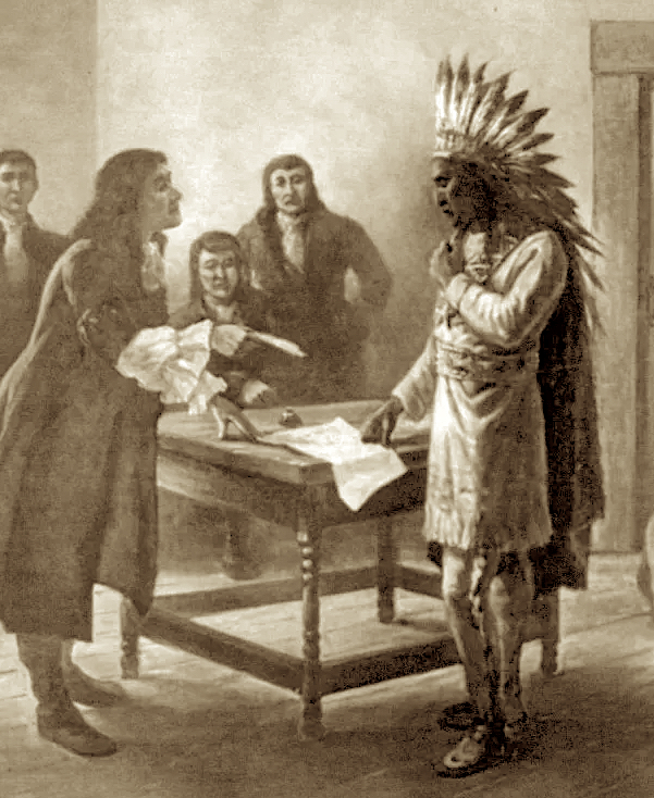

Our ancestors were used to thinking about kings and queens of the European sort, but now they were going to meet a local king, who was new to their understanding. The following is excerpted from the Native Heritage Project article, King Philip’s War:
“King Philip’s War was sometimes called the First Indian War, Metacom’s War, or Metacom’s Rebellion and was an armed conflict between Native American inhabitants of present-day southern New England, English colonists and their Native American allies in 1675–76. The war is named after the main leader of the Native American side, Metacomet, known to the English as “King Philip”.
“Throughout the Northeast, the Native Americans had suffered severe population losses due to pandemics of smallpox, spotted fever, typhoid and measles, infectious diseases carried by European fishermen, starting in about 1618, two years before the first colony at Plymouth had been settled. Plymouth, Massachusetts, [which]was established in 1620 with significant early help from Native Americans, particularly… Metacomet’s father and chief of the Wampanoag tribe.”
“Prior to King Philip’s War, tensions fluctuated between different groups of Native Americans and the colonists, but relations were generally peaceful. As the colonists’ small population of a few thousand grew larger over time and the number of their towns increased, the Wampanoag, Nipmuck, Narragansett, Mohegan, Pequot, and other small tribes were each treated individually (many were traditional enemies of each other) by the English colonial officials of Rhode Island, Plymouth, Massachusetts Bay, Connecticut and the New Haven colony.”
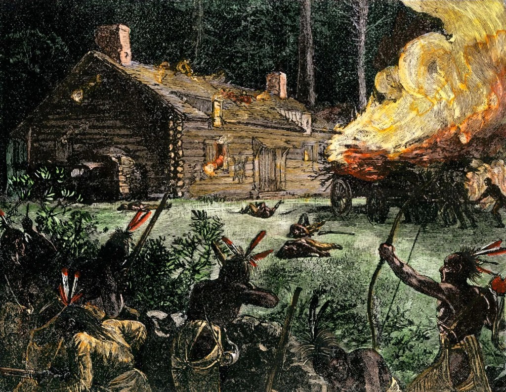
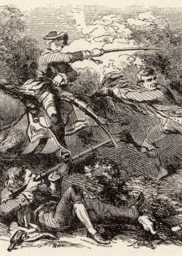
Over time, “…the building of [Colonial] towns… progressively encroached on traditional Native American territories. As their population increased, the New Englanders continued to expand their settlements along the region’s coastal plain and up the Connecticut River valley. By 1675 they had even established a few small towns in the interior between Boston and the Connecticut River settlements. Tensions escalated and the war itself actually started almost accidentally, certainly not intentionally, but before long, it has spiraled into a full scale war between the 80,000 English settlers and the 10,000 or so Indians.”

From Wikipedia: “The war was the greatest calamity in seventeenth-century New England and is considered by many to be the deadliest war in Colonial American history. In the space of little more than a year, 12 of the region’s towns were destroyed and many more were damaged, the economy of Plymouth and Rhode Island Colonies was all but ruined and their population was decimated, losing one-tenth of all men available for military service. More than half of New England’s towns were attacked by Natives.” (2)
King Philip’s War began the development of
The Name of War:
an independent American identity.
The New England colonists faced their enemies without support
from any European government or military,
and this began to give them a group identity separate and distinct from Britain.
King Philip’s War and the Origins of American Identity
by Jill Lepore
Philip Wells and The Dominion of New England,
1686-1689
The institution of The Dominion of New England by the Royal Fiat of King Charles II added to an already existing stew of tensions in the colonies. It didn’t last that long, and Sir Edmund Andros was dispatched by the Colonists fairly quickly. For our family, the most important resulting aspect was this:
The British rulers knew that when you have accurate maps, you have power.
From the Historical Journal of Massachusetts: “The arrival of Wells and Andros’s government in Massachusetts signaled a major change in how the colonists described borders. In late 1686, King James II appointed Edmund Andros as the governor of the Dominion of New England, an administrative body that combined all the colonies.”

“While previously Massachusetts colonists selected their governors, Andros was an imposition from the King. King James II aimed to streamline the administration of the small New England colonies and bring their unruly subjects more directly under imperial control. A stark contrast to the less experienced, agrarian focused, and rurally raised leaders of early New England.”
“Although Massachusetts colonists had begun to gradually embrace mapping as a tool after the 1650s, the Dominion, an imperial tool, accelerated this process. Unsurprisingly, Andros employed familiar tools of state building and state power, including maps. He gave Wells a new appointment as the head surveyor for the Dominion and hired at least three deputy surveyors, Richard Clements, John Gore, and John Smith. Each man generally operated in a particular area…John Gore in ‘Napmuge [Nipmuck] Country’ in present-day central Massachusetts.” (3)
Did the Gore Brothers See An Opportunity?
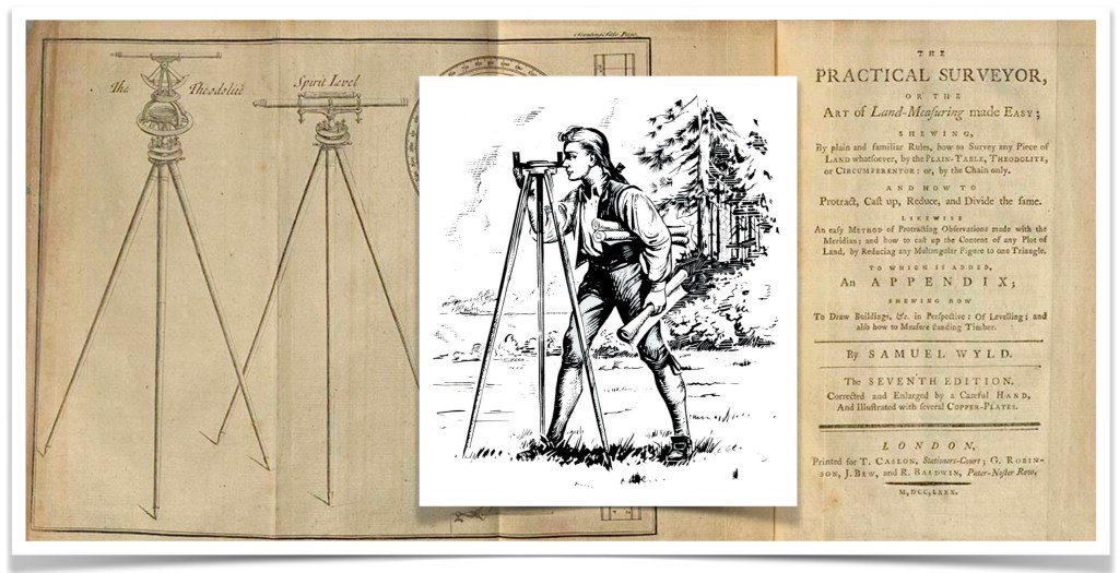
When we first met our ancestor Samuel Gore (1) in The Gore Line — Three, we learned that he had been born in Roxbury, Massachusetts Colony, in October 1652. He was not the oldest surviving son in the family. That distinction belonged to his older brother John (2), who was the (part-time) Writ for the town of Roxbury, and was also a sought-after, skilled surveyor. These positions would have required some degree of formal education, and would be in demand in a fast-growing colony.
Notes: As the oldest son, John (2) would have benefited from primogeniture*, which was the standard for that time. (This meant that the Lions Share of the father’s estate went to the oldest son before any other person.) However, this did not always happen in the Northern Colonies, and in his father’s Will of 1657, this did not happen for John (2), as he had already received his portion of his father’s estate. Hence, his younger brother Samuel (1) likely benefited somewhat.
*primogeniture (noun)
– the state or fact of being the firstborn of children of the same parents.
– Law. the system of inheritance or succession by the firstborn, specifically the eldest son.
Observation: Additionally, as a surveyor, he was involved in projects which may have influenced the younger Samuel in his choices about where his family would live. They appear to have interacted frequently throughout their lives, as they both did surveying work, and were land-holders themselves. During a time of frequent land speculation, it seems quite likely, that they both benefited from information gained while doing their professions. From the Cameron County Genealogy Project: “Samuel Gore came into the sole possession of his father’s common lands in 1716… On 2 March 1712/13 he was elected one of the Fence Viewers of Roxbury and 3 March 1717 was one of the Surveyors of Highways.” (4)
The New Roxbury Colony, and The Mashamoquet Purchase
The people of Roxbury, Massachusetts Colony had run out of land and they decided to do something about it rather than wait for permission from, or action by, their British Governor-by-fiat, Sir Edmund Andros.
The town of Roxbury was one of the most ancient and influential
Ellen D. Larned
in Massachusetts Colony.
The Roxbury people were the best that came from England,
and filled many of the highest offices in the colonial government.
Nothing was lacking for their growth and prosperity
but a larger area of territory, then “limits being so scanty and not capable of enlargement that several persons…
— were compelled to remove out of the town and colony.
author of The History of Windham County,
page 18
In 1642, the Woodward and Saffery line was established as the southern border of the Massachusetts Colony, and thus, the northern border of the Connecticut Colony. Within a couple of decades of that date, in the rough-and-tumble early Colonial period, the people of Massachusetts wanted more land, and their neighbors to the south in the Connecticut Colony, started to take issue with what they felt was their land. It all got very complicated.
In addition, many skirmishes between the Colonists and the Native American tribes had resulted in King Philip’s War, which had destroyed much infrastructure and weakened both sides. The ‘Indians’ in shock from their defeat, had started to return to their old haunts, which the Colonists were looking to expand into. Perhaps the Roxbury settlers were spurred on by the arrival of The Dominion, because by 1686, boundaries and settlements were changing.
There was a grant for ‘Indian’ lands that consisted of two portions in Nipmuck County — one portion was called Myanexet, and the other Quinnatesset. This land had been acquired by the English representatives William Stoughton and Joseph Dudley; purchased in 1682 from the Indian representative Black James, for £50 by the English Government. From The History of Windham County: Among the first to “The land thus purchased was laid out in June, 1684, by John Gore [2], of Roxbury, under the supervision of Colonel William Dudley.”

Circa May 1686 —
“In May, they were visited by Samuel Williams, Sen., Lieutenant Timothy Stevens and John Curtis, who, with John Gore as surveyor, came as committee from Roxbury, ‘to view the land, in order to the laying out of the same; settle the southern bounds (upon or near the colony line)… Eleven days were spent by Mr. Gore in making the needful surveys and measurements — Massachusetts’ South boundary line evaded their search, so they made a station about one and a half miles south of Plaine Ilill, and thence marked trees east and west for the south line of their grant, nearly two miles south of the invisible Woodward’s and Safferys line, thus securing to Massachusetts another strip of Connecticut territory”.
Problems arose due to the perceived position of the Woodward and Saffery line, and then it was not clear who exactly who was at fault with information from 1642. (Remember, earlier maps were not very precise before this period). Ultimately, what was surveyed created problems for both Colonies.

This chart from page 15 of Windham County shows the survey work by John Gore (2) that was completed for the Quinnatesset portion of the land purchase. The horizontal line is the Woodward and Saffery line. Above that line is Massachusetts and below it is Connecticut. The small letter ‘e’ on the left portion is the designation for Samuel Gore (1)’s purchase — the father of John Gore (2). For whatever reason, land purchased by both Thompson and Gore ended up “being-kind-of-ish” in Connecticut, not Massachusetts. This was a problem in the fact that the Colonies were (of course) governed by Britain, and these two colonies had separate governments whose interests were not aligned.
Further excerpted material from Windham County: “No attempt was made to occupy and cultivate these farms by their owners. Thompson’s land remained in his family for upwards of an hundred years, and the town that subsequently included it was named in his honor”.
As time went on, Mashamoquet was the name of a river which was frequently used as a boundry marker. By 1686, the land was known as the Mashamoquet Purchase, and the village settlement was called New Roxbury.
“The survey and divisions (of land) were accomplished during the winter, and on March 27th, 1694, nearly eight years after the date of purchase, the several proprietors received their allotments in the following order: 1, Esther Grosvenor; 2, Thomas Mowry; 3, John Ruggles; 4, John Gore; 5, Samuel Gore [1]’s heirs; 6, Samuel Ruggles; 7, John Chandler; 8, Jacob, Benjamin and Daniel Dana; 9, Benjamin Sabin; 1 0, Thomas and Elizabeth Ruggles; 11, John White; 12, Joseph Griffin… Note that Samuel Gore’s heirs received his allotment of land. Samuel died in 1694, age 41, two years before the division of land in Connecticut was completed”.
In 1690, the village was renamed Woodstock.

“By the settlement of Massachusetts boundary line in 1713… Massachusetts was forced to admit that Woodward’s and Saffery’s line ran some miles south of the bound prescribed by her patent… That Connecticut had a lawful right to the fee as well as jurisdiction of this land no one could deny, but beset by enemies at home and abroad she was forced to yield it to the stronger Colony, and allowed Massachusetts, by formal agreement and covenant, to keep the towns laid out by her in Connecticut territory, and the various grantees to retain possession of this land, receiving as equivalent an equal number of acres in distant localities. Under this arrangement, Connecticut yielded: To the town of Woodstock, 50,410 acres. …To John Gore, 500 acres… ”
…and in 1749 the town officially chose to became part of Connecticut.
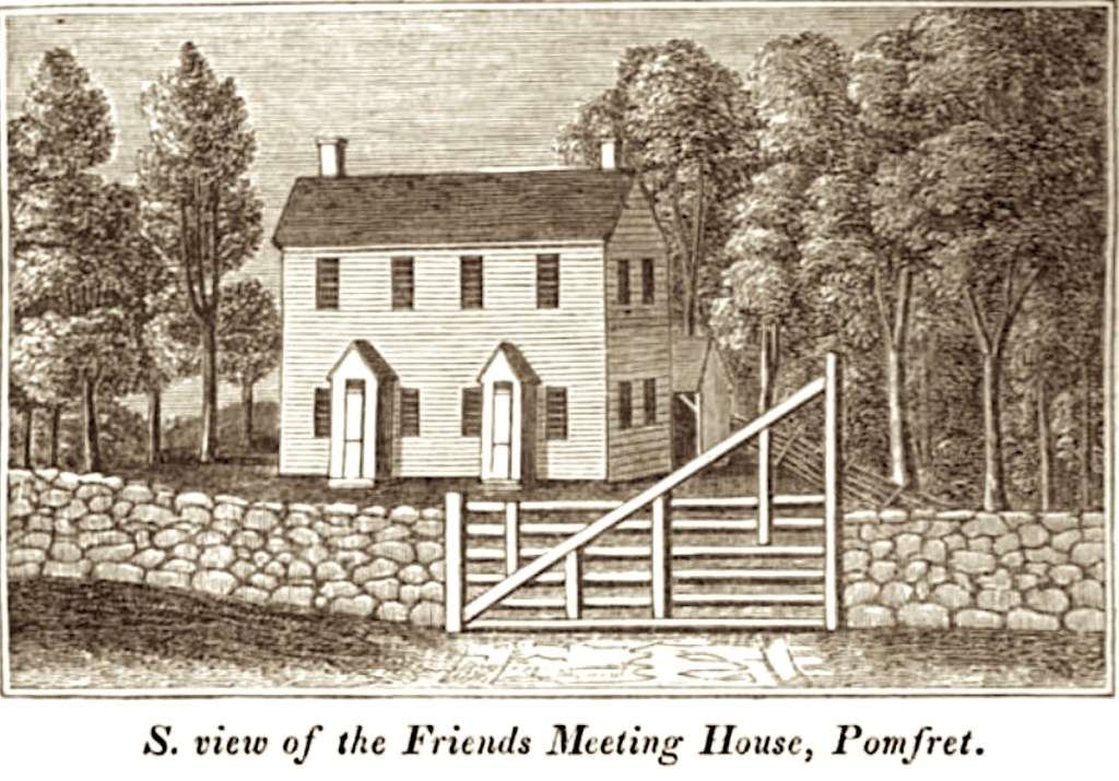
In the more southern portion of the Mashamoquet Purchase, below the village of Woodstock (formerly New Roxbury), another small township was established named Pomfret. It was incorporated in 1713, and is important to the next generation of the Gore Family. (5)
Captain Samuel Gore (2) Marries Hannah Draper
Samuel Gore (2) was born on October 20, 1681, in Roxbury, Massachusetts Colony – died May 27, 1756, in Norwich, Connecticut Colony. He married Hannah Draper about 1703, when he was 22 and she was 17 years old. Hannah was born April 8, 1686 in Roxbury, Massachusetts Colony and died July 11, 1741, in Norwich, Connecticut Colony. They are both buried in the Eliot Burying Ground in Roxbury, Suffolk County, Massachusetts.
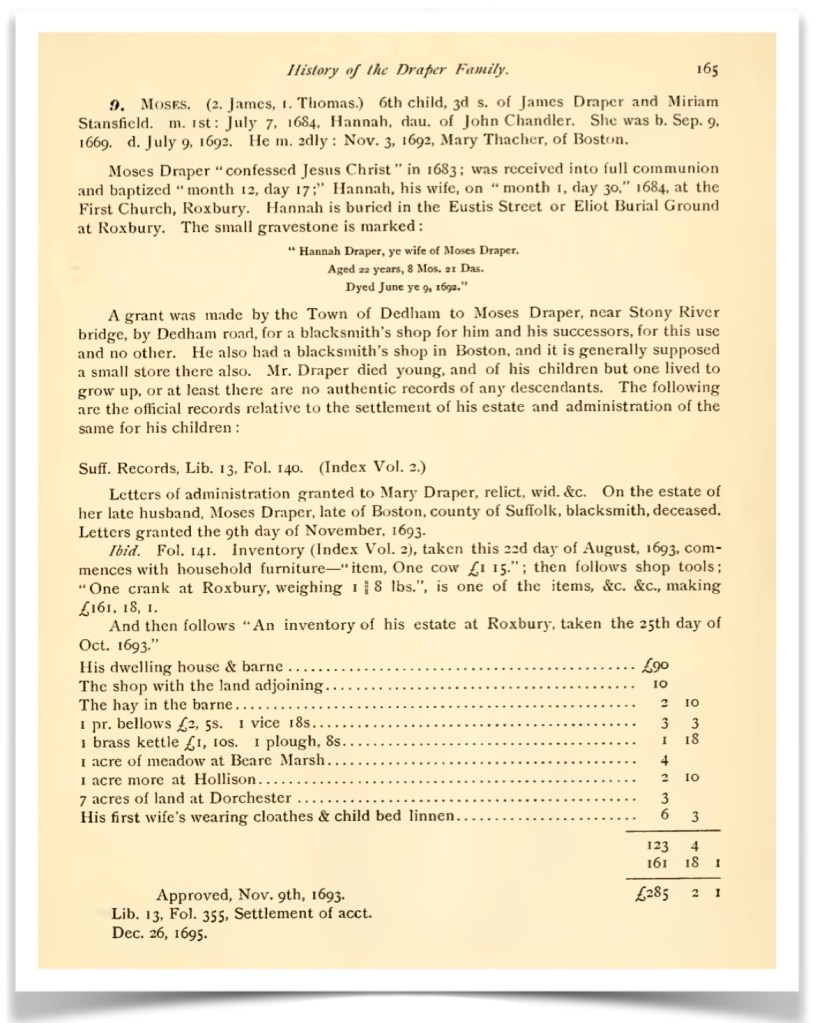
Hannah was the daughter of Moses Draper and Hannah Chandler. He was born on September 15, 1664 in Dedham, Massachusetts – died August 14, 1693 in Boston, Massachusetts Colony, age 29. His parents were James Draper and Miriam Stansfield.
Hannah (Chandler) Draper, was born September 19, 1669 in Roxbury, Suffolk, Massachusetts Colony – died June 9, 1692 in Roxbury, Massachusetts, age 22. Her parents were John Chandler and Elizabeth Douglass.

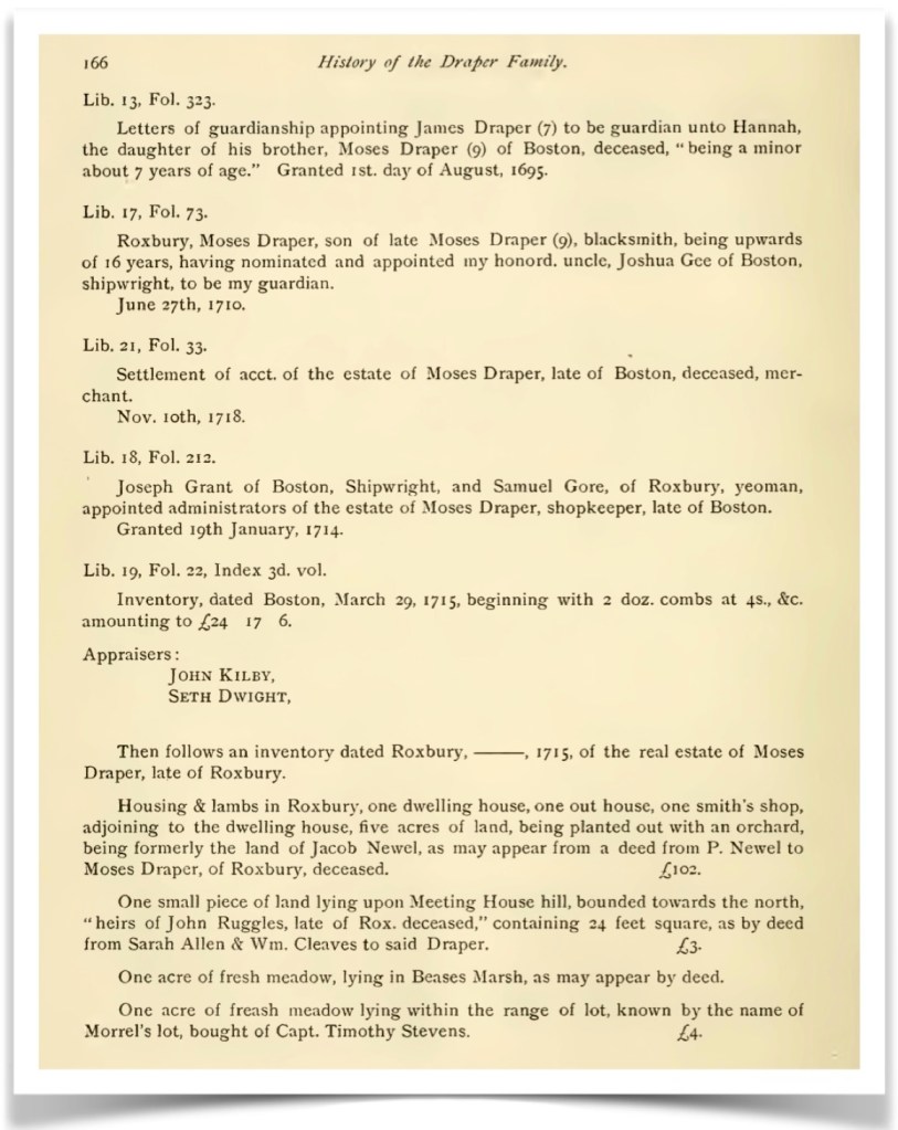
Hannah (Draper) Gore was six years old when her mother died in July 1692. In November 1962 her father, Moses Draper, married Mary Thatcher. A child, Moses Draper, Jr. was born September 12, 1693. However, the father, Moses, had died the month before his birth. By age seven, Hannah was an orphan. Her guardianship was given to her Uncle James Draper on August 1, 1695. It is unclear if she was raised by him, or remained with Mary (Thatcher) Draper and her step-brother Moses. Below is interesting information regarding the settlement by 1715 of Moses Draper’s estate.

Samuel Gore (2) and Hannah (Draper) Gore Family
For the first eleven years of their marriage Samuel (2) and Hannah lived in Roxbury, Massachusetts where the first six of their nine children were born.
Note: CTC = Connecticut Colony, CT = Connecticut State
- Elizabeth (Gore) Witter, born January 12, 1704 – died April 9, 1761 Preston, CTC
- Samuel Gore, born March 26, 1705 – died May 22, 1706 (one year old)
- Samuel Gore (3), born May 29, 1707 – died July 26, 1791 Voluntown, CT
(We are descended from Samuel 3). - Moses Gore, born September 23, 1709 – died 1786 Cornwallis, Kings, Nova Scotia, Canada
- John Gore, born October 11, 1711 – died January 19, 1735, Norwich CTC
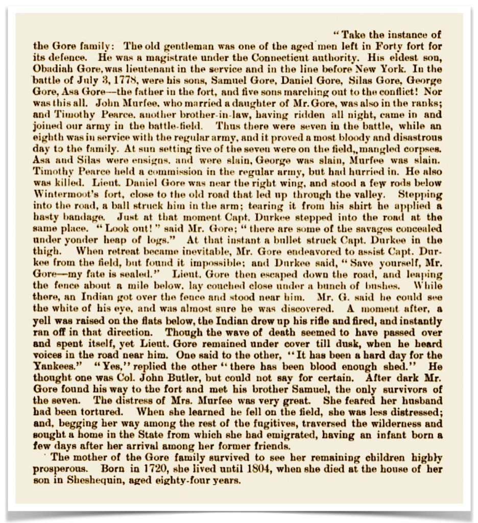
- Obadiah Gore, born July 26, 1714 – died 10 January 1779, of smallpox in Wyoming, Pennsylvania. Notably, he lost several adult children in another Native American ‘Indian War’ — the Wyoming Valley Massacre July 3, 1778.
Their youngest three were born in Norwich, Connecticut Colony (CTC): - Daniel Gore, born September 6, 1719- died October 4, 1719 (one month old)
- Hannah (Gore) Burrow Gallup, born December 20, 1720 – died March 19, 1810 Stonington, CT
- Sarah (Gore) Hobart born January 15, 1723 – died July 28, 1743 Stonington, CTC
After his wife Hannah (Draper) Gore died in 1741, Samuel (2) married for a second time to Mrs. Dorcas Blunt on May 13, 1742. (6)
What The Connecticut Charter of 1662 Accomplished
The Conneticut Charter was remarkable for several reasons. From Wikipedia: The English Parliament restored the monarchy in 1660, and King Charles II assumed the English throne. Connecticut had never been officially recognized as a colony by the English government, so the General Court determined that the independence of Connecticut must be legitimized... The key document mapping out Connecticut’s original boundaries wasn’t in fact a map. It was, instead, a royal charter… arguably the most important document in Connecticut’s history—contains among its other provisions a written description of the colony’s boundaries that served the same function as a drawn map.

The document described Connecticut’s western borders extending through Pennsylvania-claimed lands all the way to the ‘southern sea”. From Connecticut History.org: “The ‘South Sea’—what we call the Pacific Ocean—was well known to early navigators, but its exact location in relation to Connecticut Colony was unclear in 1662. What England’s King Charles II effectively granted Connecticut through that grandiose wording was a swath of land some 70 miles north to south, stretching from the Narragansett Bay on the east to the northern California/Oregon coast just west of Mount Shasta...”
“Historians have long marveled at the generous provisions of the 1662 royal charter. In addition to the transcontinental footprint, the king also granted Connecticut virtually complete governmental autonomy more than a century before the Declaration of Independence. The charter’s provisions in this regard were so complete that when other states scrambled to create new constitutions at the start of the American Revolution, Connecticut simply replaced the king’s name with ‘the people of Connecticut’ and continued using the charter as its constitution until 1818”.
Observations: It is plausible that these boundaries would could have influenced the choices of the ancestral descendants found further on in The Gore Line after this era. For us in the present day, the ‘western’ boundary became a defining feature of where we grew up in Ohio. (7)


The Houses of Stuart and Orange: Queen Anne (reigned 1702 – 1707), and then she continued as Queen under The House of Stuart, (reigned 1707 – 1714), The House of Hanover, George I (reigned 1714-1727), George II (reigned 1727 – 1760).
The Samuel Gore Family Moves to Norwich in the Connecticut Colony
Observation: Samuel Gore (2), was the son of a carpenter and part-time surveyor, but most importantly, he was connected through his relatives to land investments in New England. Land ownership may have been his primary means of retaining wealth. He may have been a farmer (yeoman), but we doubt that he ever pushed a plow in his early life. He likely leased his lands and had other people to do much of the hard labor. (This may have been different for his children and grandchildren…)
The History of Windham County records that John Chandler, the grandfather of Hannah (Chandler) Gore purchased Pomfret land from Samuel Gore (2) about 1716. It is probable that Samuel (2) had likely acquired the land he sold, through his inheritance from his father Samuel (1). John then moved his family from Roxbury, Massachusetts Colony to Pomfret, Connecticut Colony. Pomfret was then a newly established area formed from the Mashamoquet Purchase.
Additionally, the Weld Collections, by Charles Frederick Robinson, records of Samuel (2)… “He was of Roxbury in 1719, and 20 July, 1734, he was of Norwich, Conn. He sold on the former date [1719] land in Roxbury on the Dedham road, for £420, Hannah his wife releasing her right of dower (SD 57.16)”. It is likely that this land ‘on Dedham Road’ was the original land of Moses Draper, the father of his wife Hannah, (see Drapers in America, p 165 above).
In 1721, Samuel (2) was commissioned Captain of the 5th Company, Connecticut Militia, located in Norwich. (8)


The Susquehanna Company
Can we acquire that land?
… this refrain seems to be a dominant theme for these generations of the Gore Family. From Connecticut History.Org: “In 1753, amidst a flurry of land speculation and westward expansion that captivated the imagination of American colonists, Connecticut settlers formed the Susquehanna Company for the purposes of developing the Wyoming Valley in northeastern Pennsylvania... a shortage of farmland and a growing population had encouraged some in Connecticut to revisit the terms of the colony’s original land grant…” — the one that promised that Connecticut’s borders extended ever westward. See above: What The Connecticut Charter of 1662 Accomplished
“Pennsylvania also had a royal charter, issued in 1681 by the same king, that gave it title to the territory in question. This was not unusual, as the imperial bureaucracy back in England often possessed only rudimentary knowledge of the vast American terrain”.
“So, in 1754, when the Susquehanna Company acquired the land for 2,000 pounds from an Iroquois delegation at a conference in Albany, New York, many called the validity of the transaction into question. Settlement of the area (which also included land west of the Wyoming Valley and made up almost one-third of Pennsylvania) quickly became a divisive issue among Connecticut, Pennsylvania, and several tribal nations, as well as within the Connecticut colony itself.”
Samuel Gore (2) and his son, Obadiah Gore, had become members of The Susquehanna Company. As owners of one right, or share, their names appear among the names of the grantees in the Indian deed of July 11, 1754. Twenty-four years later the younger Gore generation would fight in the Battle of Wyoming (a county in Pennsylvania).
Ultimately by 1799, Connecticut gave up any claim it had to lands in Pennsylvania, but this was not before one particularly famous, but truly terrible battle, changed the lives of some of our ancestors. (9)
The Battle of Wyoming (County), Pennsylvania
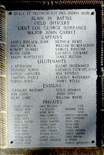
The situation in Pennsylvania came to a head in the Wyoming Valley Massacre of July 3, 1778. The family of Captain Obadiah Gore did not fare well. (10)

“When the Battle of Wyoming was fought, Capt. Obadiah Gore was one of the small company of old men who remained in Forty fort for its defense…” Three of Obadiah Gore’s sons and two sons-in-law died in the Battle of Wyoming that day fighting for The Continental Army. Fully recounted below, more than a century later, in A History Of, Luzerne County, Pennsylvania, 1893 edition:


Samuel Gore (3) Marries Desire Safford
Samuel Gore (3) was born on May 29, 1707, in Roxbury, Massachusetts Colony – died July 26, 1791, in Voluntown, Connecticut, USA. He moved with his parents to Norwich, Connecticut sometime in his childhood. He married Desire Safford, February 25, 1735/36 in Norwich, New London County, Connecticut Colony. She was born on October 18, 1717 in Voluntown, Connecticut Colony – died September 11, 1772, same location. Desire was the daughter of John Safford and Dorothy Larrabee.
From Family Search.org: “Before 1881, Voluntown belonged to Windham County, Connecticut, instead of New London County. Much of the land situated in what is now Voluntown was granted to the volunteers of the Narragansett War in 1700. The name Volunteer’s Town turned into what is now known as Voluntown.”
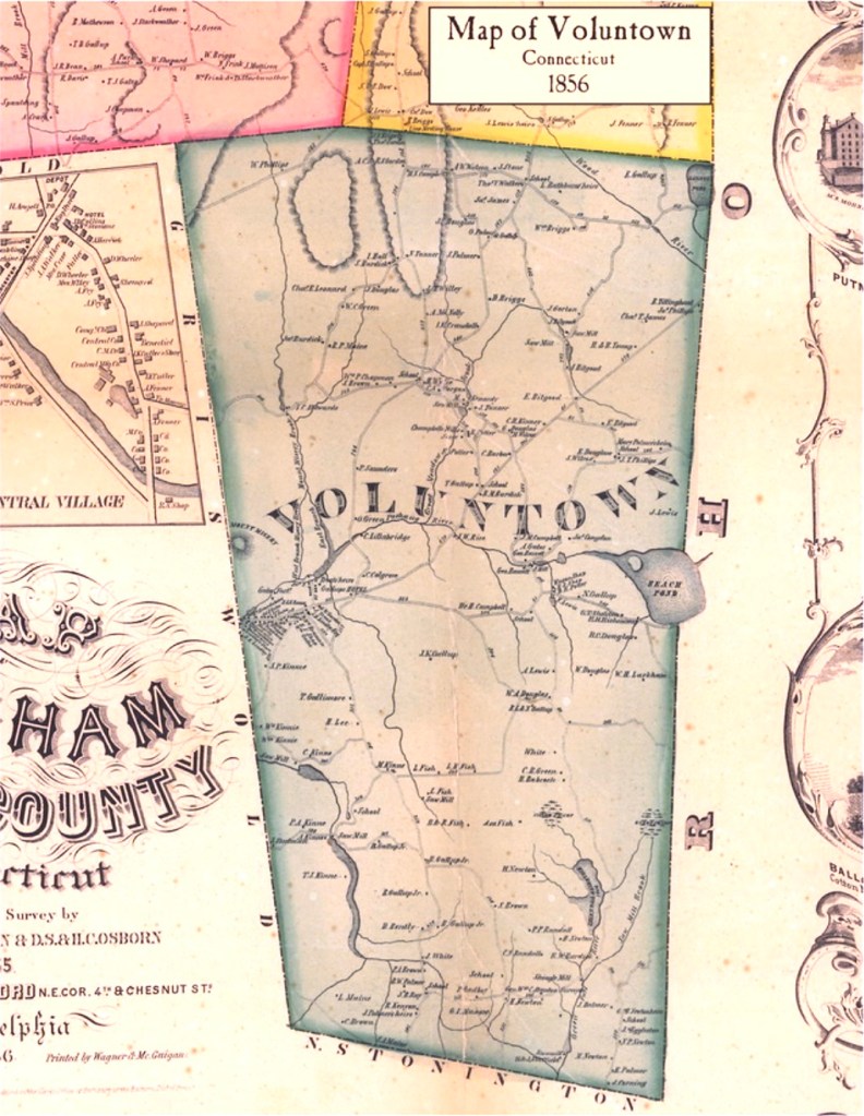
Samuel Gore (3) and Desire had nine children. He moved his family from Voluntown, some 14 miles north east of Norwich, and then returned to Norwich, and even later returned to Voluntown. He owned land in both places, and where they were living influenced where each child’s birth was recorded, as noted below — all were born in either Norwich, New London County, or Voluntown, Windham County, Connecticut Colony.
Note: CTC = Connecticut Colony, CT = Connecticut State
- John Gore, born November 15,1736, Norwich, New London, CTC – died August 15, 1773, Norwich, CT
- Elizabeth (Gore) Eddy, born December 15, 1738, Voluntown, New London, CTC – died March 14, 1790, Salisbury, Litchfield, CT
- Hannah Gore, born June 26, 1741, Voluntown, CTC – death date unknown
- Dorothy (Gore) Titus, born February 6, 1746/47, Norwich, New London, CTC- died 1816, Stirling City, Windham, CT
- Desire Gore, born April 19, 1750, Norwich, New London, CTC – death date unknown
- Elijah Gore, born February 11, 1754, Norwich, CTC – died after 1791 Halifax, Windham, Vermont.
(We are descended from Elijah). - Amos Gore, born October 9, 1755, Norwich, New London, CTC- died June 11, 1827, Halifax, Windham, Vermont
- Esther (Gore) Stafford, born January 22, 1759, Norwich, New London, CTC – October 24, 1836, Halifax, Windham, Vermont
- Ebenezer Gore, born February 3, 1762, Voluntown, New London, CTC- died September 30, 1790, Killingly, Windham, CT
Observation: Elijah Gore and family along with his siblings, Amos and Lydia (Carpenter) Gore, and Samuel and Esther (Gore) Stafford, moved to Halifax, Windham, Vermont, where they lived for the rest of their lives. Note that the name Windham County (confusingly!) repeats in Vermont.
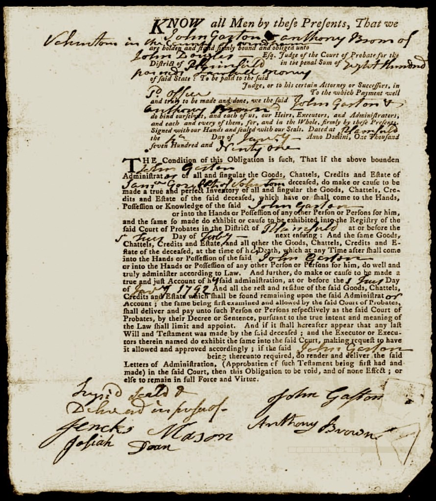
Samuel Gore (3) was a beneficiary of his father’s estate, so this may have provided him with the economic means to live the life of a gentleman farmer: he was a land-holder, who also did some farming. It also seems that his life was quieter than those of his father’s and grandfathers’ generations. The administrative documents for his estate are interesting, extensive, and quite illegible. In those times, all debts were to be settled when the Will was probated, so sometimes an extensive inventory of assets were necessary.
Comment: The frequent bane of our research, is trying to interpret the poor quill-penmanship of court administrators and census takers! ‘Our hats are off to you’ if you can read the 34 administrative papers!) (11)
The Last King of America
From Wikipedia.org: “George III’s life and reign were marked by a series of military conflicts involving his kingdoms, much of the rest of Europe, and places farther afield in Africa, the Americas and Asia. Early in his reign, Great Britain defeated France in the Seven Years’ War, becoming the dominant European power in North America and India. However, many of Britain’s American colonies were soon lost in the American War of Independence… [The War] was the culmination of the civil and political American Revolution. In the 1760s, a series of acts by Parliament was met with resistance in Britain’s Thirteen Colonies in America. In particular they rejected new taxes levied by Parliament, a body in which they had no direct representation. The colonies had previously enjoyed a high level of autonomy in their internal affairs and viewed Parliament’s acts as a denial of their rights as Englishmen… The colonies declared their independence in July 1776…” (12)

In the next chapter, The Gore Line — Five, we will feature the last of our Gore relatives who live in Connecticut. They venture on to Vermont, and then move westward to New York state. Indeed very soon, the people of the newly formed United States of America begin their westward journey.
Following are the footnotes for the Primary Source Materials,
Notes, and Observations
Preface: Troubles Brewing — Change is Fomenting
(1) — two records
National Geographic | Education
The New England Colonies in 1677
https://education.nationalgeographic.org/resource/massachusetts-1677/
Note: For the map image.
King vs. Parliament in 17th Century England: From Absolutism to Constitutional Monarchy, Influence on American Governing
https://constitutingamerica.org/90day-aer-king-vs-parliament-17th-century-england-from-absolutism-to-constitutional-monarchy-influence-on-american-governing-guest-essayist-joerg-knipprath/
Note: For the data.
King Philip’s War
(2) — seven records
Native Heritage Project
King Philip’s War
https://nativeheritageproject.com/2012/09/02/king-philips-war/
Note: For the text and the image.
King Philip’s War
https://en.wikipedia.org/wiki/King_Philip’s_War
Note: For the text.
World History Encyclopedia
Death of King Philip or Metacom
https://www.worldhistory.org/image/13670/death-of-king-philip-or-metacom/
Note: For the illustration.
Encyclopædia Britannica
King Philip’s War
https://www.britannica.com/event/King-Philips-War
Note: For the illustration, Metacom (King Philip), Wampanoag sachem, meeting settlers, c. 1911
A group of Indians armed with bow-and-arrow, along with a fire in a carriage ablaze, burn a log-cabin in the woods during King Philip’s War, 1675-1676, hand-colored woodcut from the 19th century.
https://commons.wikimedia.org/wiki/File:KingPhilipsWarAttack.webp
Note: For the illustration.
America’s Best History, Pre-Revolution Timeline — The 1600s
1675 Detail
https://americasbesthistory.com/abhtimeline1675m.html
Note: For the illustration depicting the capture of Mrs. Rolandson during the King Philip’s War between colonists and New England tribes, 1857, Harper’s Monthly.
The Name of War: King Philip’s War and the Origins of American Identity
by Jill Lepore
Vintage Books, 1999
Book pages: 5-7
Note: For the pull quote.
Philip Wells and The Dominion of New England,
1686-1689
(3) — one record
Historical Journal of Massachusetts, Winter 2020
Article: Colonial Mapping in Massachusetts, 1629-1688
by Thomas Graves and Phillip Wells
https://www.westfield.ma.edu/historical-journal/wp-content/uploads/2020/Colonial-Mapping-FINAL1.pdf
Downloadable .pdf document, Page 165
Note: For the text.
Did the Gore Brothers See An Opportunity?
(4) — four records
Medium
Ink sketch of young George Washington…
https://medium.com/@NGA_GEOINT/plotting-the-course-5b9a35d24a01
Note: “Ink sketch of young George Washington surveying the area around the Popes Creek plantation. Credit: National Park Service, U.S. Dept. of the Interior, National Park Service Historical Handbook Series No. 26, frontispiece”.
Note: For the illustration.
American Philosophical Society
A Few Technical Items: Questions about 18th Century Surveying Instruments Answered (Part I)
by Erin Holmes
https://www.amphilsoc.org/blog/few-technical-items-questions-about-18th-century-surveying-instruments-answered-part-i
Note: For the background image.
Dictionary.com
primogeniture
https://www.dictionary.com/browse/primogeniture
Note: For the data.
Cameron County Genealogy Project, Gore Family
Contributed by Mike Wennin
https://sites.rootsweb.com/~pacamero/gorefam.htm
Note: For the text.
The New Roxbury Colony, and The Mashamoquet Purchase
(5) — six records
History of Windham County, Connecticut
Volume 1 1600 – 1760
Ellen D. Larned, 1874 edition
https://archive.org/details/historywindhamc01larngoog/page/n10/mode/2up
Note: For the text.
George Washington, Surveyor
https://images.slideplayer.com/9/2519012/slides/slide_1.jpg
Note: For the illustration.
Woodstock, Connecticut
https://en.wikipedia.org/wiki/Woodstock,_Connecticut
Note: For the data.
Sutori
The Connecticut Colony
https://www.sutori.com/en/story/the-connecticut-colony–koYJgeyWL5FQjAtCQWEP3yzM
Note: For the image and data.
[For the list of siblings]
Lt Samuel Gore Jr
https://www.ancestry.com/family-tree/person/tree/40371118/person/28057081430/facts
and
Saved Ancestry Family Trees for Lt Samuel Gore Jr
https://www.ancestry.com/family-tree/pt/PersonMatch.aspx?tid=40371118&pid=28057081430&src=m
Note: For the data.
Captain Samuel Gore Marries Hannah Draper
(6) — eight records

History of the Town of Stonington, County of New London, Connecticut,
from its First Settlement in 1649 to 1900
by Richard Anson Wheeler
https://archive.org/details/historytownston00wheegoog/mode/2up
Digital pages: 398-399/754
Note: For the data.
The Drapers In America, Being a History and Genealogy Those of That Name and Connection
by Thomas Wall-Morgan Draper, 1892
https://ia600905.us.archive.org/26/items/drapersinamerica00drap/drapersinamerica00drap.pdf
Downloadable .pdf document, Book pages: 165-167
Note: For the data.
Genealogy of the Kennan Family
by Thomas Lathrop Kennan
https://archive.org/details/genealogyofkenna00kenn/page/n7/mode/2up
Book pages: 94-98, Digital pages: 94-98/164
Note: For the data.

The Genealogy of the Payne and Gore Families
Compiled by W. H. Whitmore
https://archive.org/details/genealogypaynea00whitgoog/page/n21/mode/2up
Book Pages: 28, Digital Pages: 38/80
Note: For the data.
Weld Collections
by Charles Frederick Robinson
https://www.familysearch.org/search/catalog/2558919
and
ibid.
https://www.familysearch.org/library/books/viewer/357789/?offset=0#page=59&viewer=picture&o=download&n=0&q=
Downloadable .pdf document, Section No. 9,
Book page: 59/267, Left column center.
Note: For the data.
Capt Samuel Gore Jr.
[Samuel Gore 2]
https://www.findagrave.com/memorial/129489751/samuel-gore
Note: For the data.
Samuel Gore III
[Samuel Gore 3]
https://www.findagrave.com/memorial/129491438/samuel-gore?_gl=1*19z07sy*_gcl_au*OTc0NzY2ODkxLjE2OTA5MjM3MzU.*_ga*MTU4MTY5MjA2NC4xNjkwOTIzNzM2*_ga_4QT8FMEX30*OWE5NjcyMGEtZTNmMC00ZjRlLWFjYTctNTNkYzMyMzFmMmY5LjIwLjEuMTY5NjE5NjczMC41OS4wLjA.*_ga_LMK6K2LSJH*OWE5NjcyMGEtZTNmMC00ZjRlLWFjYTctNTNkYzMyMzFmMmY5LjMuMS4xNjk2MTk2NzMwLjAuMC4w
Note: For the data.
What The Connecticut Charter of 1662 Accomplished
(7) — seven records
History of the Connecticut Constitution
https://en.wikipedia.org/wiki/History_of_the_Connecticut_Constitution
Note: For the text.
Connecticut History.org
From the State Historian: The Map That Wasn’t a Map
https://connecticuthistory.org/from-the-state-historian-the-map-that-wasnt-a-map/
Note: For the text and image.
List of English Monarchs
Houses of Stuart and Orange
https://en.wikipedia.org/wiki/List_of_English_monarchs
Note: For their portraits.
List of British monarchs
https://en.wikipedia.org/wiki/List_of_British_monarchs
Note: For the data.
Queen Anne
File:Dahl, Michael – Queen Anne – NPG 6187.jpg
https://commons.wikimedia.org/wiki/File:Dahl,Michael–Queen_Anne-_NPG_6187.jpg
Note: For her portrait.
King George I
File:King George I by Sir Godfrey Kneller c.1715-1719.jpg
Note: For his portrait.
King George II
https://commons.wikimedia.org/wiki/File:King_George_II_by_Charles_Jervas.jpg
Note: For his portrait.
The Samuel Gore Family Moves to Norwich in the Connecticut Colony
(8) — four records
CT Genealogy
Early Settlement of Pomfret Connecticut
by Dennis Partridge
https://connecticutgenealogy.com/windham/pomfret_early_settlement.htm
Note: For the text.

Connecticut Historical Collections, Containing a General Collection of Interesting Facts, Traditions, Biographical Sketches, Anecdotes &c, Relating to the History and Antiquities of Every Town in Connecticut
by John Warner Barber
https://www.google.pt/books/edition/Connecticut_Historical_Collections/zQwWAAAAYAAJ?hl=pt-PT&gbpv=1&dq=John+Warner+Barber&printsec=frontcover
Book pages and Digital pages are the same:
Woodstock, 294-304
Pomfret, 437-440
Norwich, 294-304
Note: For the illustrations.
Maps Of The Past
Historic State Map – Connecticut Colony – 1766 – 23 X 31.56 – Vintage Wall Art
https://www.mapsofthepast.com/colony-of-connecticut-county-map-1766.html
The Susquehanna Company
(9) — two records
Connecticut History.org
The Susquehanna Settlers
https://connecticuthistory.org/the-susquehanna-settlers/
The Gore Family History — Jeff Gore’s Blog
https://jgoredotorg.wordpress.com/2018/05/27/the-gore-family-history/
The Battle of Wyoming (County), Pennsylvania
(10) — three records
The Battle of Wyoming
Painting by Alonzo Chapel, 1858
https://pabook.libraries.psu.edu/literary-cultural-heritage-map-pa/feature-articles/neighbor-vs-neighbor-wyoming-valley
Note: For the battle image.
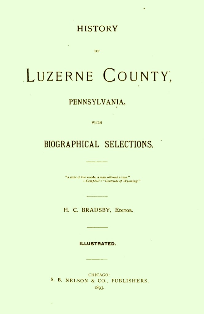
A History of Luzerne County, Pennsylvania, 1893 edition [only]
by H. C. Bradsby, editor
https://www.google.pt/books/edition/History_of_Luzerne_County_Pennsylvania/4BkVAAAAYAAJ?hl=pt-PT&gbpv=1&dq=A+History+Of+Wilkes-Barre,+Luzerne+County,+Pennsylvania,+c1893,+Chapter+XII&pg=PR6&printsec=frontcover
Book pages and digital pages are the same: 347-348 (Chapter XII)
Gallery photos courtesy of:
Wyoming Commemoration Association Facebook Group
https://www.facebook.com/Wyomingcommemorative/photos
Samuel Gore (3) Marries Desire Safford
(11) — eleven records
Dorothy Larrabee
https://www.familysearch.org/tree/person/details/LHRW-J5S
and
https://www.familysearch.org/tree/pedigree/landscape/LH2S-MS8
and
https://www.familysearch.org/tree/pedigree/landscape/LH2S-MS8
Elijah Gore
in the Connecticut, U.S., Town Marriage Records, pre-1870 (Barbour Collection)
Voluntown Vital Records 1708-1850
https://www.ancestry.com/discoveryui-content/view/225419:1062?tid=&pid=&queryId=1d2415c4e44686d563db8be245d11749&_phsrc=DZs10&_phstart=successSource
Book page: 180, Digital page: 52/122, Lower portion of page.
Note: For the Gore family children born in Voluntown, Connecticut.
Amos Gore
https://www.findagrave.com/memorial/43068929/amos-gore
Esther Gore Stafford
https://www.findagrave.com/memorial/60666654/esther-stafford

Old Maps
Voluntown , Connecticut 1856 Windham Co. – Old Map Custom Print
https://shop.old-maps.com/connecticut/towns/windham-co-ct-1856-town/voluntown-connecticut-1856-windham-co-old-map-custom-print/
Note: For map image.
Grammarist.com
Hats Off (to You) – Idiom & Meaning In English
https://grammarist.com/idiom/hats-off-to/
Voluntown, New London County, Connecticut Genealogy
https://www.familysearch.org/en/wiki/Voluntown,_New_London_County,_Connecticut_Genealogy
Samuel Gore
in the Connecticut, U.S., Wills and Probate Records, 1609-1999
https://www.ancestry.com/discoveryui-content/view/2422197:9049?tid=&pid=&queryId=8b401cb68de4c847bc225eb31904b5ab&_phsrc=qGQ4180&_phstart=successSource
Digital pages: 682-716/1402
Note: There are 35 images in this docket.
The Last King of America
(12) — two records
George III
https://en.wikipedia.org/wiki/George_III
King George III Coronation Portrait
by Allan Ramsay, circa 1765
https://commons.wikimedia.org/wiki/File:Allan_Ramsay_-_King_George_III_in_coronation_robes_-_Google_Art_Project.jpg
Note: For his portrait.
