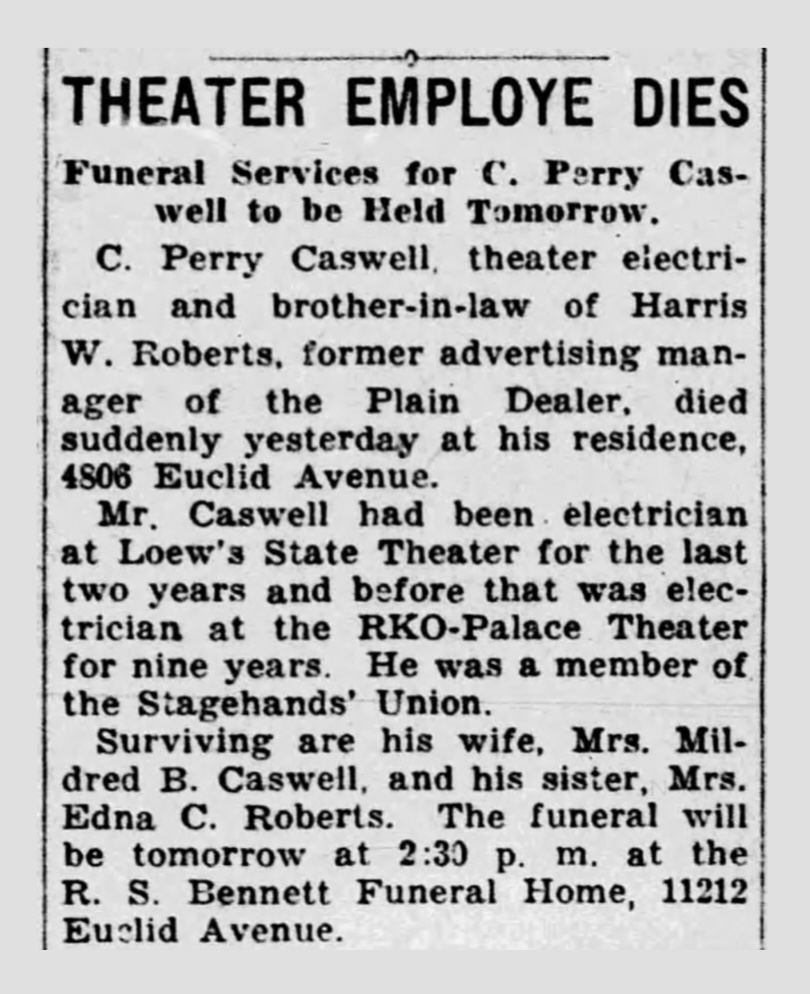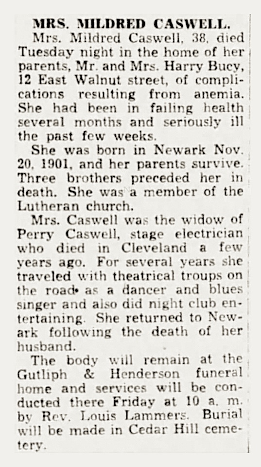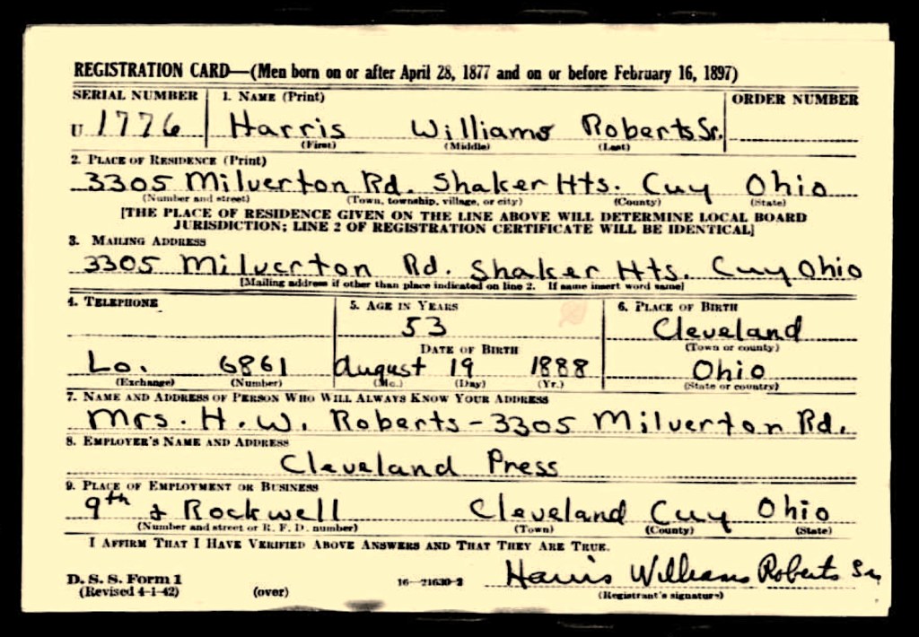
The Williams / Harris Line, A Narrative — Twelve

This is Chapter Twelve of twelve, the final chapter of the Williams / Harris Line. All of the previous chapters are like intertwined journeys which eventually lead us back to Northeast, Ohio. This chapter brings us to Trumbull County, in the area of the former Connecticut Western Reserve, where we meet the Young family.

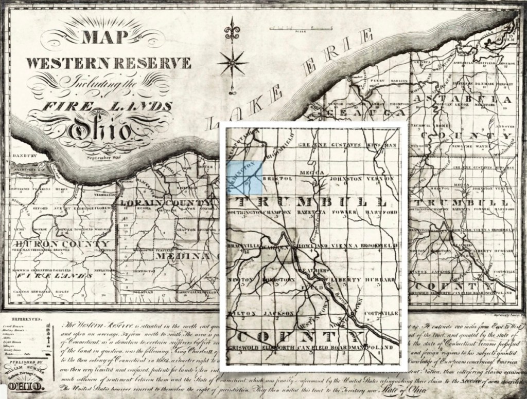
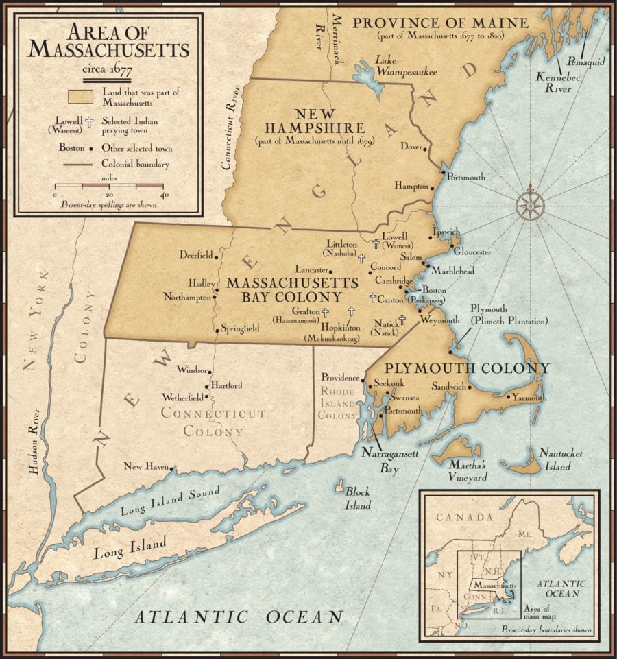
Map of the Western Reserve Including the Fire Lands 1826. On this map, Trumbull County is on the eastern border of the Western Reserve, with Farmington township shown in pale blue.
(Image courtesy of Wikimedia Commons).

The Connecticut Western Reserve

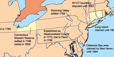
From Wikipedia: “The Connecticut Western Reserve was a portion of land claimed by the Colony of Connecticut and later by the state of Connecticut in what is now mostly the northeastern region of Ohio. The Reserve had been granted to the Colony under the terms of its charter by King Charles II.

Connecticut relinquished its claim to some of its western lands to the United States in 1786 following the American Revolutionary War and preceding the 1787 establishment of the Northwest Territory. Despite ceding sovereignty to the United States, Connecticut retained ownership of the eastern portion of its cession, south of Lake Erie. It sold much of this ‘Western Reserve’ to a group of speculators who operated as the Connecticut Land Company; they sold it in portions for development by new settlers… The territory was originally named ‘New Connecticut’ (later discarded in favor of ‘Western Reserve’), and settlers began to trickle in during the next few years. Youngstown was founded in 1796, Warren in 1798, Hudson and Ravenna in 1799, Ashtabula in 1803, and Stow in 1804.”

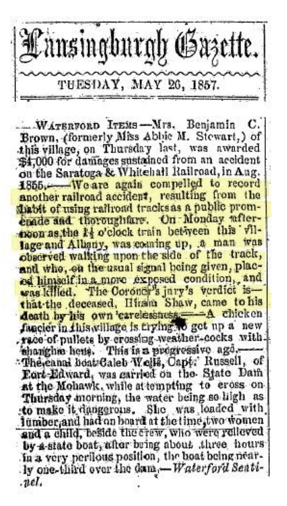
Trumbull County was formed in 1800. On July 10 of that year Governor St. Clair proclaimed that ‘all that territory included in Jefferson County, lying north of the forty-first degree of north latitude and all that part of Wayne County included in the Connecticut Western Reserve’ should constitute a new county to be known by the name of Trumbull and that the seat of justice should be Warren. This made the new county co-extensive with the Western Reserve.” In other words, “Trumbull County comprised the entire Western Reserve until the formation of the state of Ohio in 1803.

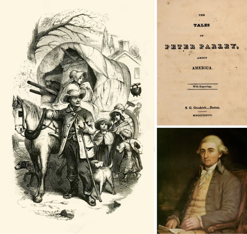
The engraving at left is attributed to Peter Parley’s Recollections and is titled “Emigrating to New Conneticut, 1817-1818”. The portrait on the right is Jonathan Trumbull Jr., the Governor of Connecticut, for whom the county was named. (Trumbull image courtesy of wikipedia.com).

“The county was named for Governor Johnathan Trumbull, Jr., then governor of Connecticut. His family was a prominent one. His father, Johnathan Trumbull, Sr., also governor of Connecticut, was the only royal governor at the outbreak of the Revolution who supported the colonists and continued in office.” (Trumbull County OHGenWeb)

This brings us to Farmington Township, designated as a pale blue square on the Western Reserve map shown above at the chapter opening.

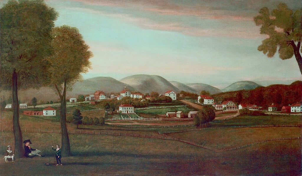
“The township, named Henshaw initially after one of its key landowners, Samuel Henshaw, saw its first settlers in 1806 with David Curtis and Captain Lewis Wolcott from Connecticut. Josiah Wolcott also played a notable role by purchasing a large tract of land from Samuel Bond, leading to the construction of a log cabin in the winter of 1806-07. Despite many hardships, including a fatiguing journey, Josiah Wolcott returned to Connecticut to move his family to the Farmington Township… Farmington Township experienced a swift transformation from the humble log cabins of its early settlers to a well-established township. In 1828, residents of Farmington Township began raising funds to establish Farmington Academy, a college. James Greer was the first principal, and the academy flourished, attracting nearly three hundred students.” (West Farmington Village) (1)

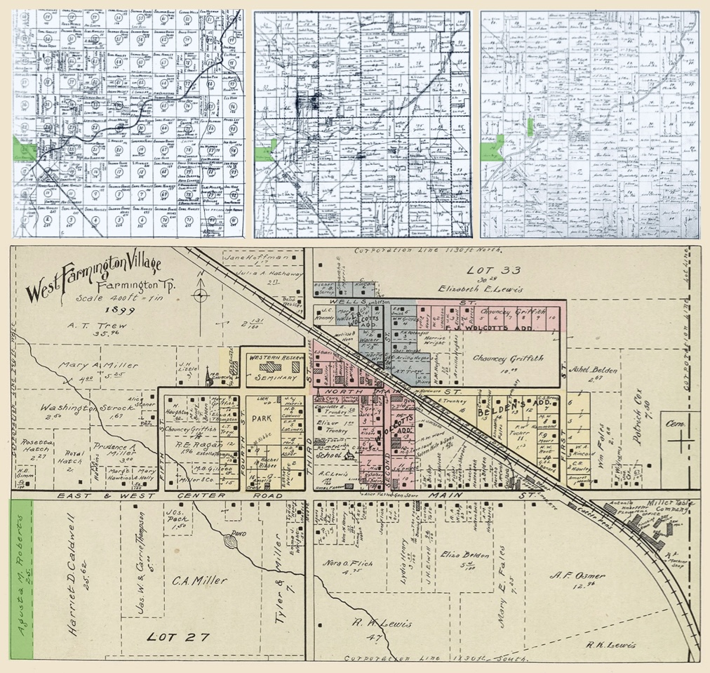
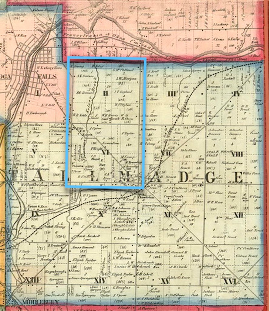
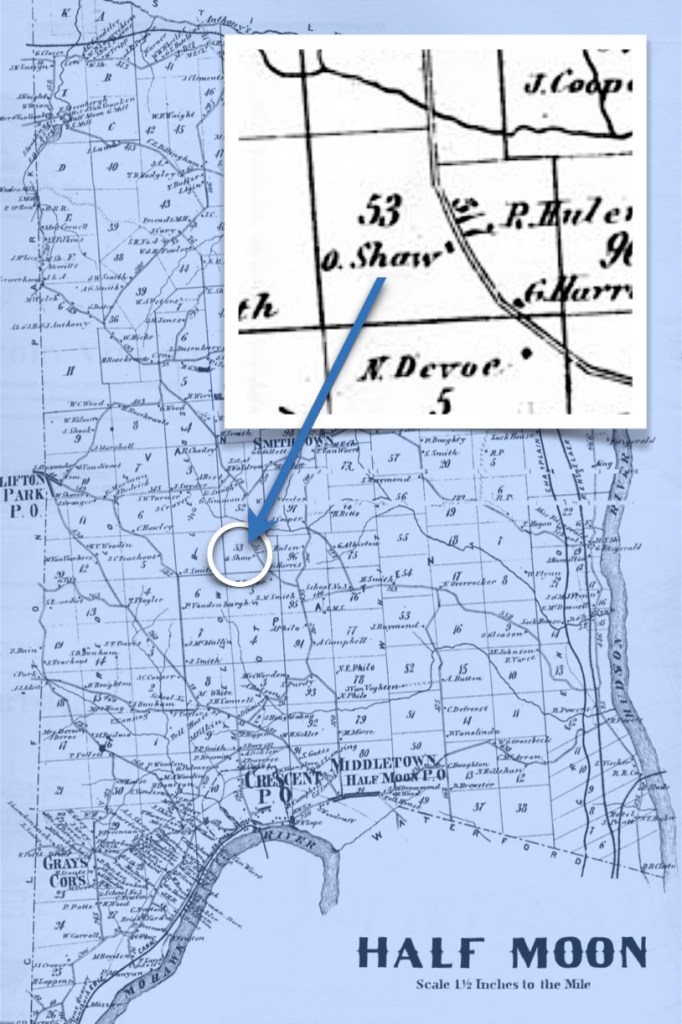
The Young Family held land in Farmington township for many decades. The three maps at the top (show in green, from left to right) property held first by Ely Young, and then by his son Stephen Young. The bottom map indicates property that Stephen Young willed to his daughter Augusta M. (Young) Roberts, as shown on this 1899 map. (See footnotes).

The Young Family of Farmington

It was in this time frame that Eli Young and his wife Catherine (Bellesfelt) Young settled in Farmington township to undertake farming. They had married in 1812, and were and an early family in the area. We have records of Eli paying property taxes starting in 1826. He was born circa 1789 and died May 9, 1861. Catherine was born circa 1793 and died July 9, 1853. (Both Eli and Catherine died in West Farmington, Trumbull County, Ohio.) On the 1850 Census, we learned that they came from Pennsylvania.

Censuses prior to 1850 did not list all household members, but we learned of their children’s names through Property Deeds and Wills. The children we know of are:

  • Sarah Ann (Young) Hewitt
  • Stephen Young, January 21, 1816 – February 14, 1898.
    Stephen carries the family line forward.
  • Mary Young
  • Newton Young
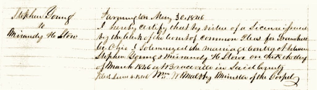
The marriage record for Stephen Young and Miranda Stowe
in Trumbull County, Ohio, on March 18, 1846.

Their son named Stephen, continued on as a farmer in the area, and married Miranda Stowe on March 18, 1846, in Trumbull County. She was born October 28, 1823, in nearby Braceville township – died, April 17, 1895. Both Stephen and Miranda, like his parents, died in West Farmington. They had three children:

  • Leora J. (Young) Pixley, born 1847
  • Augusta M. (Young) Roberts, born 1849, Augusta carries the family line forward.
  • Howard Young, born 1859

On the 1870 Census, we noted the sister Leora was teaching at the community school, and Howard, being somewhat younger, was at school. What was interesting to note is this: for 30 years of censuses, Augusta M. Young was only noted for being at home.

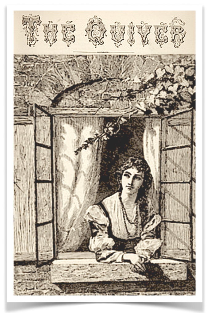
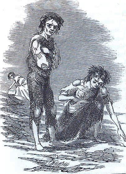
This illustration is titled The West Window from The Quiver magazine, which was
a publication for Sunday and General Reading from 1877. We think a better title
would be Augusta At The Window. More than half a century would pass
before Disney would release its famous Snow White movie with the heartfelt song,
Someday, My Prince Will Come…” 🎵

We keep wondering about that… what was she doing for all those years? (2)

What The Censuses Tell Us

We can infer some things about Joseph A. Roberts, Augusta’s future husband: In 1860, his father had a farm in Palmyra township, Portage County. Then his mother Elvira died in 1861 and things shifted for the family. By 1870, we see Joseph working in the home of the David E. Jones, in Paris township, Portage County, as an agricultural laborer. By 1880, he is doing the same work, but living in the home of the Lewis Taft family in West Farmington Village, Farmington Township, Trumbull County.

When we examined the various censuses that came before Joseph and Augusta met, they seem very straightforward. We know that they married in 1881, but no evidence has survived showing how they met. It’s a conjecture on our part that they met through friends, or family members who were acquainted with each other, since they both were living in West Farmington at the time.

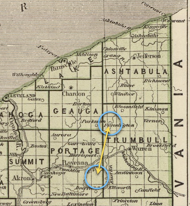
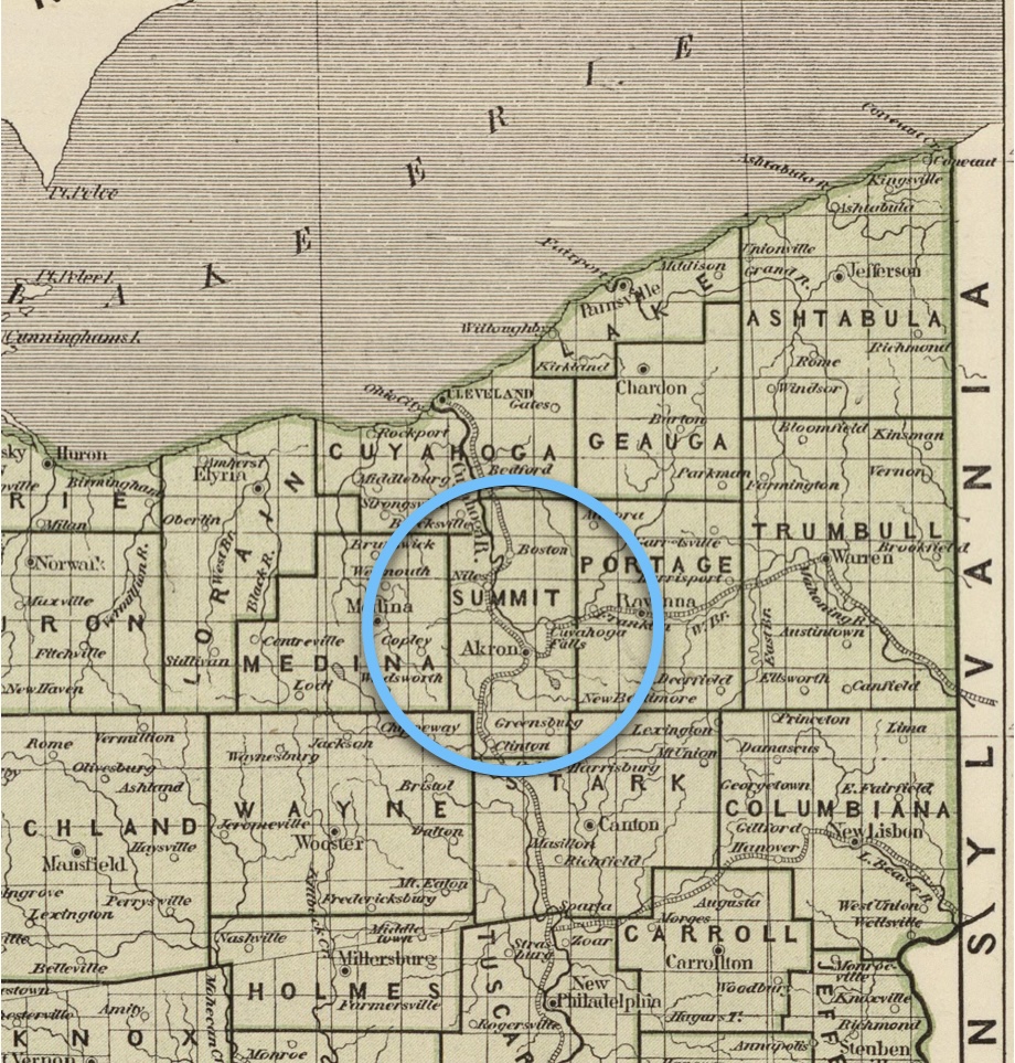
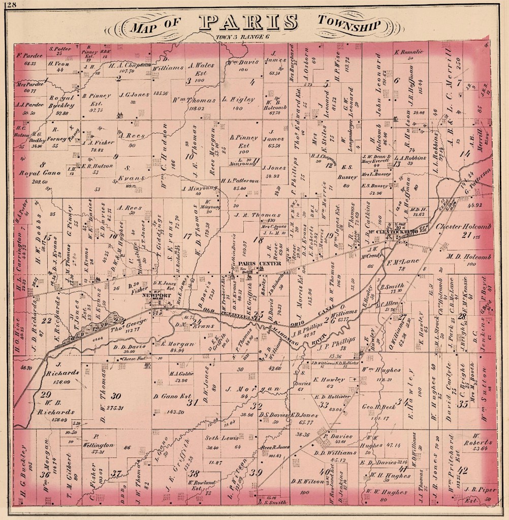
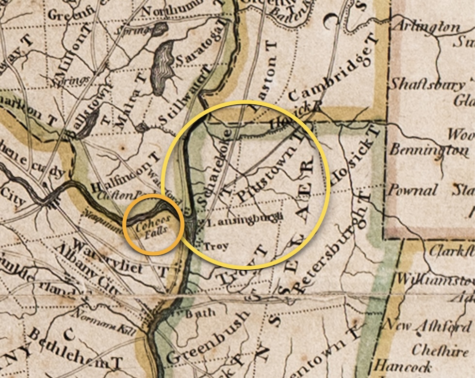
Portage County and Trumbull County are adjacent to each other, and these two townships are about 25 miles apart (40 km). (Image courtesy of the David Rumsey Map Collection).

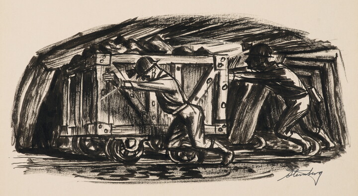
It appears that Joseph was not interested in following the path his father had taken in pursuing mining as a vocation. This makes some sense when you consider that he had spent much of his life surrounded by the cycles of nature, rather than the coal dust of the mines. This connection with the natural environment came to have a big effect on his choice of career.

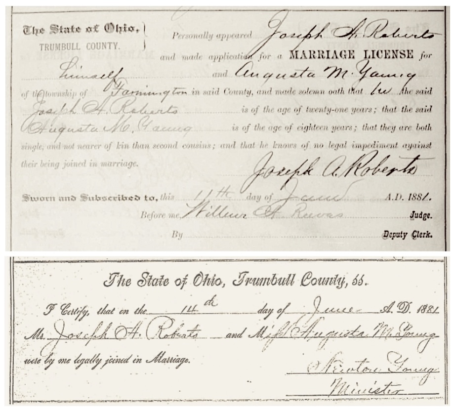
June 1881 Marriage license and marriage record for
Joseph A. Roberts and Augusta M. Young, in Trumbull County, Ohio. You can see that Joseph had beautiful handwriting by his signature on the marriage license.

When they married in June 1881, Joseph A. Roberts and Augusta M. Young were in their early 30s. The Young surname then gave way to the Roberts surname. We wonder if they chose to marry at this time, because their lives were going to change much in the next few months and they wanted to be together. Very soon, they would be living in Cincinnati, Ohio, on the opposite side of the state. Once there, Joseph would be seeking his medical education to become a general practitioner doctor. He was following his interest in what was then called Eclecticism — a movement about nature-driven principles of medical care, which peaked in the 1880s and 1890s. (3)

Medical Training in the Early 1880s

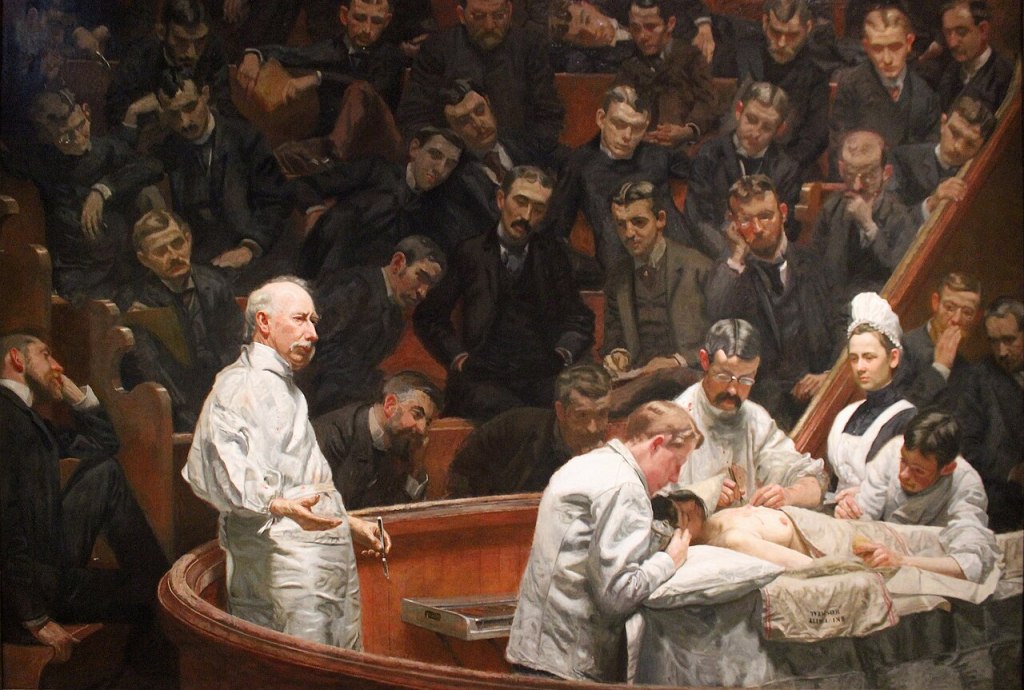
In the 1880s, a prospective physician in Ohio would likely attend a proprietary medical college, many of which were for-profit and independent from universities. During this era, medical education was in a state of transition.

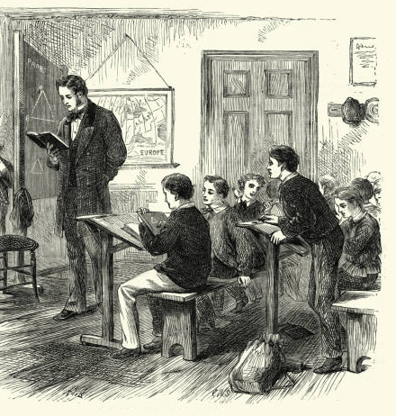
Most programs required two years of lectures, though the curriculum was often repetitive—students would sometimes attend the exact same set of lectures both years. Instruction was primarily lecture-based rather than clinically-based. Students sat for 6 to 8 hours a day in large amphitheaters. Practical experience was rather rare in the classroom. Students often had to arrange their own private clinical instruction or work as an apprentice to a local doctor to see actual patients. Requirements were minimal; a basic “common school education” was often the only prerequisite for entry.

The Agnew Clinic, by Thomas Eakins, 1889.(Image courtesy of Wikimedia Commons).

A student would typically choose between several types of medical institutions based on their philosophy of care. Joseph A. Roberts, being an Ohio resident, received a medical education in Eclectic Medicine. Ohio was then a hub for this type of thinking. Here is a bit of the movement’s history — the Eclectic Medical Institute of Cincinnati was the leading school of this type.

“Eclectic medicine was a branch of American medicine that made use of botanical remedies along with other substances and physical therapy practices, popular in the latter half of the 19th and first half of the 20th centuries.

The Eclectic Medical Institute in Worthington, Ohio graduated its first class in 1833. After local body snatching led to the notorious ‘Resurrection Riot’ of 1839, the school was evicted from Worthington and settled in Cincinnati during the winter of 1842–43. The Cincinnati school, incorporated as the Eclectic Medical Institute (EMI), continued until its last class graduation in 1939, more than a century later. The American School of Medicine (Eclectic) trained physicians in a dozen or so privately funded medical schools, principally located in the midwestern United States. By the 1850s, several ‘regular’ American medical tradespersons… had begun using herbal salves and other preparations.” (Wikipedia)

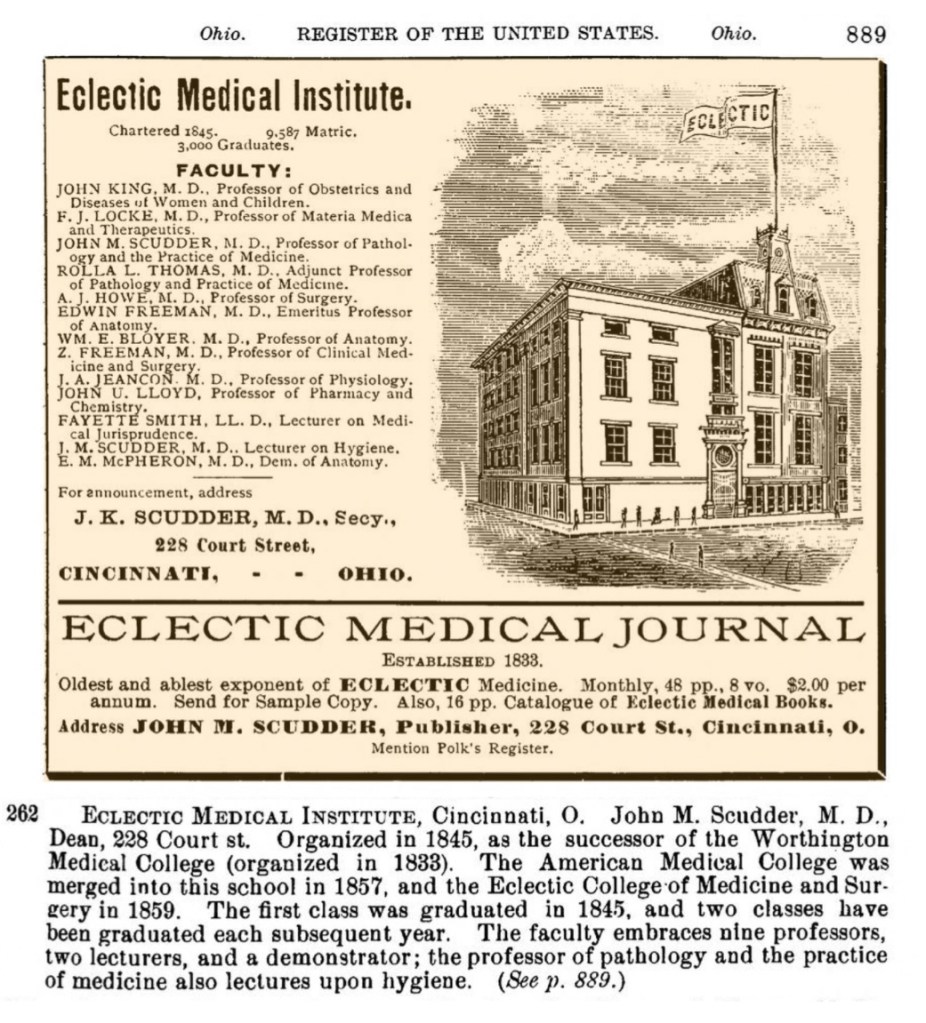
Advertisent for and description of the Eclectic Medical Institute
from Polk’s Medical Register and Directory of North America, 1890.

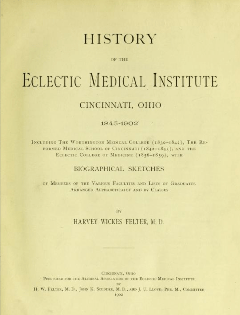
The following are excerpts from the History of the Eclectic Medical Institute, Cincinnati, Ohio, 1845-1902. They describe the education Joseph would have received during his tenure at the school.

“The following is a resume of the minimum requirements for graduation… In 1879, the length of the term was increased to twenty weeks, with no holidays, and one week for examinations. This gave nineteen weeks of solid lectures — thirty-six each week (with twelve hours per week additional in hospital) — making a total of 684 lectures per session. Thus, in the two sessions (40 weeks), 1,368 lectures were given the classes. Besides this, dissections were held at night. Under the previous twenty weeks’ course, with holidays out, and one or two weeks for examinations, not more than seventeen weeks were actually consumed in instruction— the lectures numbering from 24 to 28 per week, or from 408 to 476 per session. The old sixteen weeks’ session had thirty-six lectures a week (15 weeks), making 558 lectures.

From 1879 to 1887-8, no change was made in the personnel of the Faculty. However, some additions were made to the duties of some of the teachers. Thus, in 1883-4, Professor Howe was made Lecturer on Forensic Medicine, and Professor Scudder Lecturer on Hygiene, while Pharmacy was added to the chair of Chemistry under Professor Lloyd.”

From Polk’s Medical Register and Directory of North America, 1890.

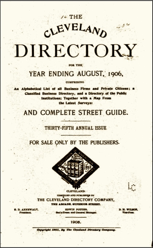
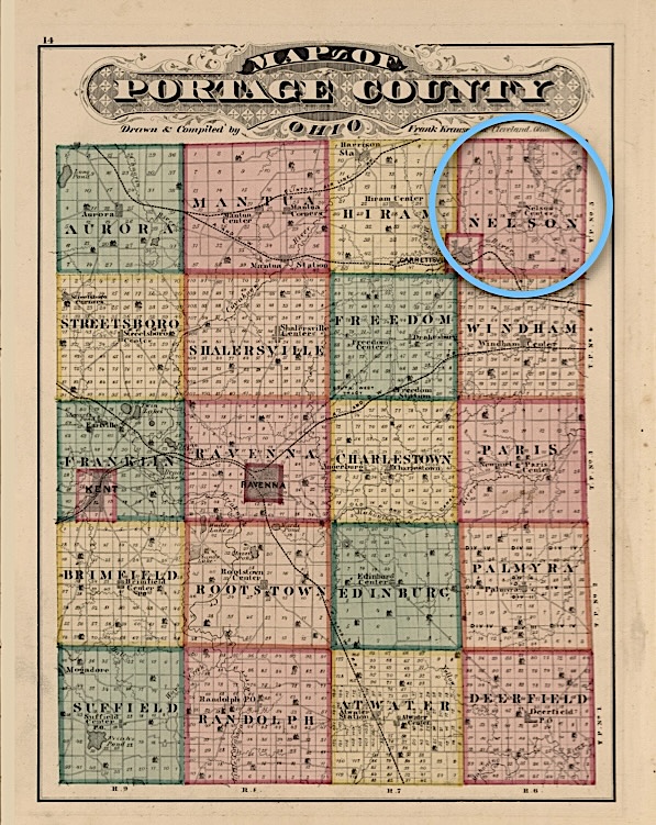
After he graduated from school in the class of 1884 and received his diploma, Polk’s Registry has him listed as having a practice in Nelson township, Portage County, Ohio. We know that by 1891 he was listed as a physician in the Cleveland Business Directory, and already living in that city. At that point, the Polk Registry may have been a little bit out of date. (4)

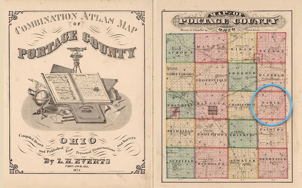
Portage County map from the
Combination Atlas Map of Portage County, Ohio, by L.H. Everts, 1874.
(Image courtesy of David Rumsey Map Collection).

The Cleveland Business Directory Records
(Instead of an 1890 Census)

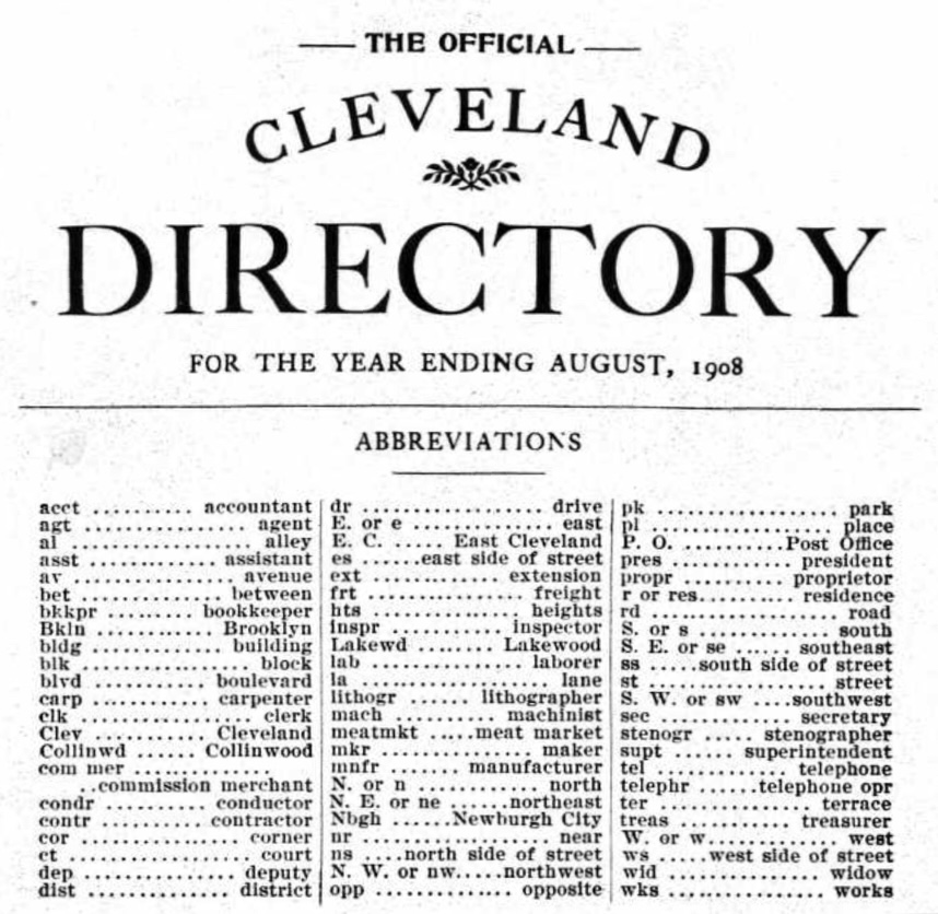
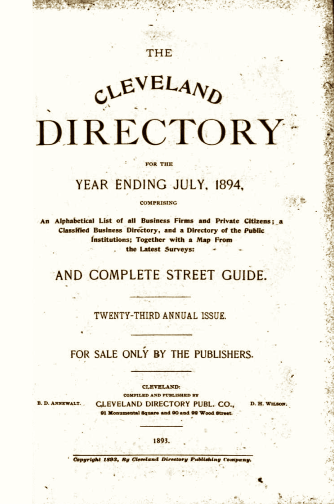
Since we have already learned that there is no US 1890 Census available, we turned to Cleveland Business Directories to tell us what was happening in their lives during that decade. Throughout the decade he worked at various locations in Cleveland, but he always posted his business address in the directory each year.

When we analyzed his address listings for his General Physician practice, it appears that he moved around nearly every year. This probably means that he was renting office space and did not work at a dedicated facility. He was usually listed under occupation, or family name, depending upon the year. Here are the locations during the 1890s:

YearCleveland LocationPHYsician ROBerts
1891106 Euclid Avenuex
1892Hough Avenue near Crawfordx
1894684 Hough Avenuexx
189534 Princetonx
18971568 East Madison Avenuex
1898(same location)x
18992795 Superior Avenuex
1900(same location)x
1910954 Parkwood Drive NEx
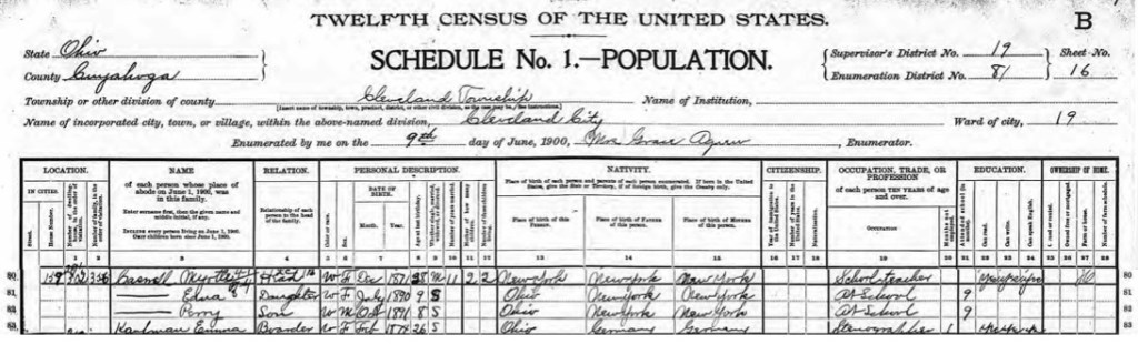
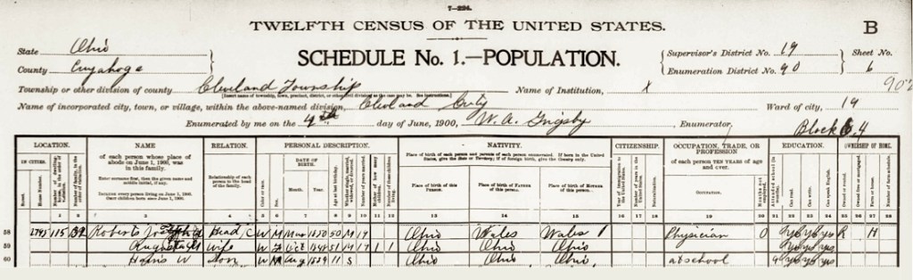
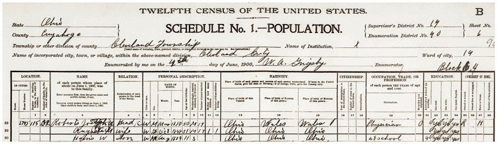
The June 1900 Census of the United States for the Joseph A. Roberts family.

In the year 1900, at the start of the 20th century, we have another Census for the Roberts family. Here we see that they have a son named Harris and that he is 11 years old, having been born in August 1889. An important fact about Joseph is that he states on this census that his birthplace is in Ohio, in March 1850. This is the only specific record for that event which we have found.

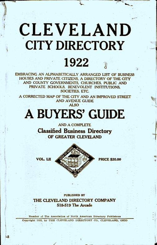
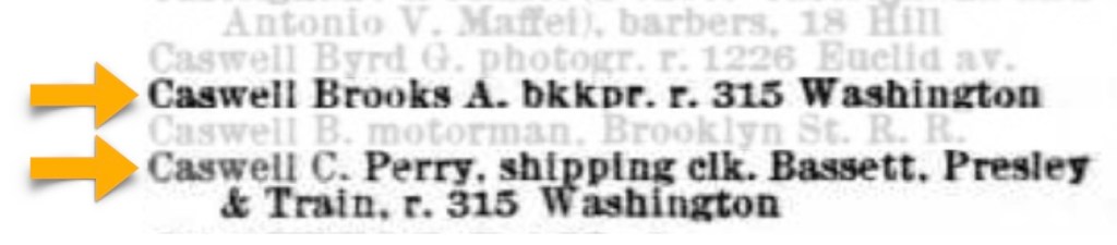
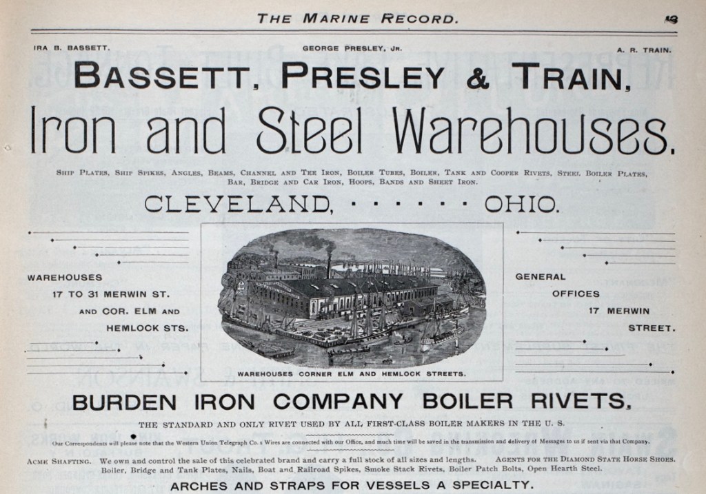
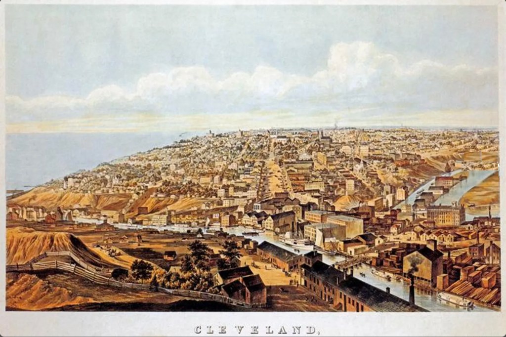
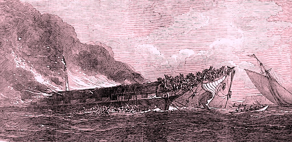
It appears that advertising in the Cleveland Business Directory was something he viewed as important during the first decade of his medical practice. (Likely, it helped to build awareness and keep his clients aware of his office location). After 1910, we do not see additional entries until 1923 when he is located at 8423 Brookline Avenue, and then again in 1926, when he is located at 1696 Crawford Road. “The Roaring Twenties was a prosperous decade for Cleveland. By 1920, the year in which the Cleveland Indians won their first World Series championship, Cleveland had grown into a densely populated metropolis of 796,841 with a foreign-born population of 30%, making it the fifth largest city in the nation.” (Wikipedia)

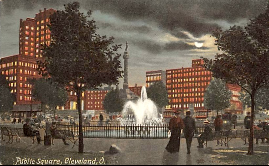
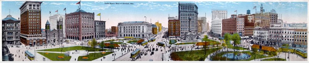
Panoramic View of Public Square, Cleveland, O., circa 1900-1927.
(Image courtesy of the Cleveland Memory Project .org).

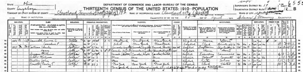
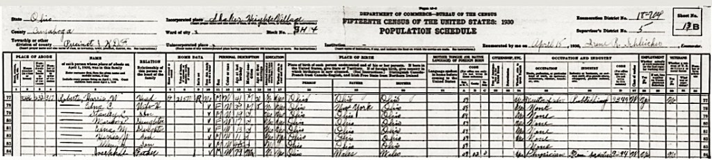
Records for the period outside of the Cleveland Business Directories are very, very scarce. For some reason, it appears that by circa 1910, Joseph was living separately from Augusta and she was living with their son Harris W Roberts. Ten years later, in 1920, Joseph appears on the Census in the home of the Thomas Anderson family, as one of four lodgers. By 1930, he is living with his son Harris W. We know that Augusta has passed away before the 1930 Census. (5)

William H. Roberts and Mrs. George Stitt

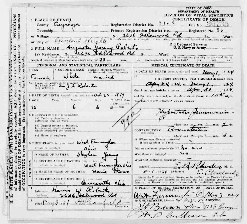
Augusta M. (Young) Roberts died in 1924 from a bout of pneumonia. Her husband Jospeh A. Roberts followed her almost six years later, of the same malady, but he contracted pneumonia as a consequence when recovering from having his stomach resected in surgery. Augusta was buried with her parents and brother in the Hillside Cemetery, West Farmington, Trumbull, Ohio. Joseph was buried in Knollwood Cemetery in Mayfield Heights, Cuyahoga, Ohio.

Joseph had a brother and sister who were mentioned in his obituary (which is located within his Find A Grave file), but none of his other siblings were mentioned. His brother William H. Roberts lived in Indiana for part of his life, and then relocated to the Cleveland area and lived there for nearly 30 years. His sister, known through the censuses as Sarah M. became Mrs. George Stitt, is also mentioned. (6)

The Nightingale

If you recall, at the end of Chapter 6 we wrote about the marriage of Henry and Ann Harris’s daughter Elvira to George Williams. That marriage is where the family lines from two countries, England and Wales, came together. The youthful deaths of Elvira (Harris) Williams in 1889, and her husband George Williams in 1893 were woeful, but… In a figurative sense, those events essentially brought into being our narrative of the Williams / Harris line.

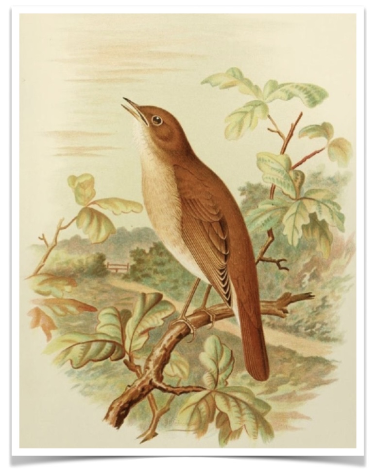
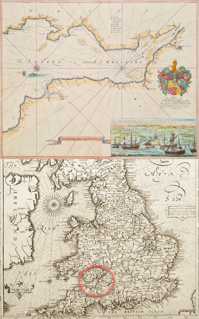
Our narrative on this family line began with a very old map that showed the Bristol Channel and the river Severn. To the north is Wales, and to the south is England. This is the territory of Luscinia megarhynchos, more commonly known as the Nightingale. What a beautiful bird, and what better friend to guide us as we look back at the Williams and Harris family lines.

Nightingale, Luscinia megarhynchos, illustration.
(Image courtesy of Hare and Tabor, via Etsy.com).

Imagine yourself as The Nightingale, flying over the twilight skies of the Bristol Channel, surveying first the bank on one side and then the other. Over time you see the progression of the Harris and Roberts families of Wales as they make their way through time, and cross the Atlantic Ocean to America. Then you cast your glance southward and see the Williams family, as they do the same in England, and then also, make their way to America. Once there they meet, and the Joseph A. Roberts family then creates a new family of their very own, through the adoption of a boy named Benny H. Williams, who then takes the name of each family. In his new life he becomes Harris Williams Roberts, and the intertwined golden braid, is complete.

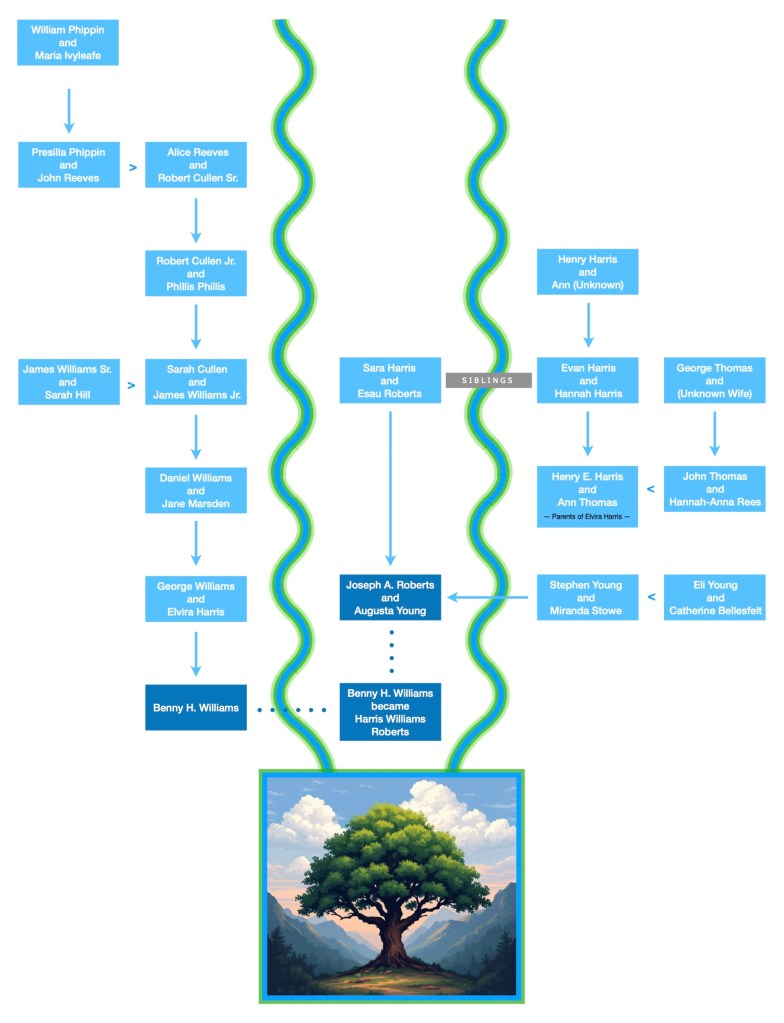
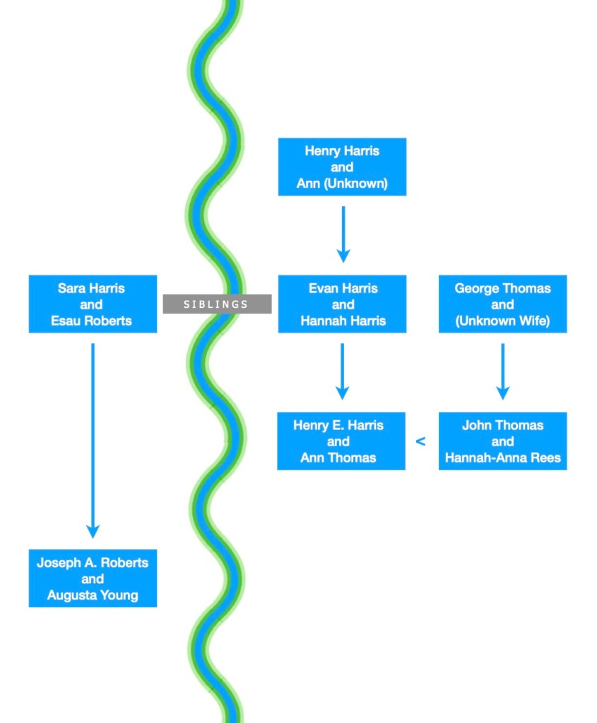
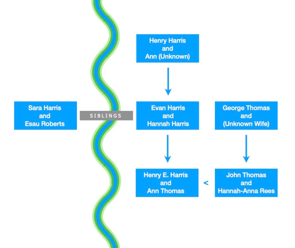
The complete Williams / Harris / Roberts family lines pedigree flow chart. What is important to understand when viewing this illustration, is that it documents relationships, and it is not the same as a traditional and typical family tree chart.

The above graphic presents an image of two Bristol Channel banks, where the waters flow toward their new beginning in America. Sara (Harris) Roberts was the sister of Evan Harris, and it is through her marriage to Esau Roberts, that the Williams, Harris, Roberts family lines combine.

Let’s explain this more fully, starting with Sara (Harris) Roberts and Evan Harris’s relationships —

  • Sara (Harris) Roberts’s son was Joseph A Roberts.
  • Her brother was Evan Harris.
  • Evan’s son was Henry E. Harris.
  • Therefore, Henry E. Harris was Sara’s nephew, and a 1st cousin of Joseph A. Roberts.
  • Henry E. Harris’s daughter was Elvira (Harris) Williams.
  • Elvira was a first-cousin-once-removed to Joseph A. Roberts because she was the daughter of his 1st cousin Henry E. Harris.
  • Elvira’s son was Benny H. Williams. Therefore Benny, as the child of a first-cousin-once-removed, was a second cousin (or a 1st-cousin-twice-removed) to Joseph A. Roberts.
  • When Joseph A. Roberts adopted Benny H. Williams, he was adopting a second cousin, who was then renamed as his son: Harris Williams Roberts.

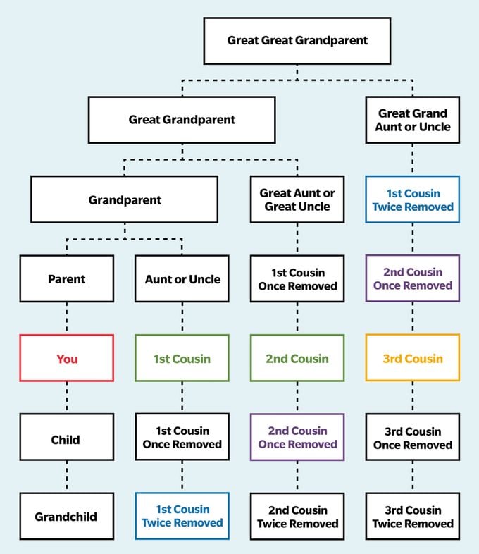
    Since some readers may not be used to seeing phrases like “first-cousin-once-removed”… there is an article (with charts) at the end of the footnotes, which explains these cousin relationships more fully.

We hope you have enjoyed the chapters on the William and Harris family lines, as much as we enjoyed creating and writing them. As we said at the beginning, “Both histories enlighten, helping us understand not only the families we are born into, but also the families we create.” (7)

Following are the footnotes for the Primary Source Materials,
Notes, and Observations

The Connecticut Western Reserve

(1) — four records

Western Reserve Including the Fire Lands 1826
https://commons.wikimedia.org/wiki/File:Western_Reserve_Including_the_Fire_Lands_1826.jpg
Note: For the map image and history.

Connecticut Western Reserve
https://en.wikipedia.org/wiki/Connecticut_Western_Reserve
Note: History references and the contemporary map.

Trumbull County OHGenWeb
History & Genealogy
https://trumbull.ohgenweb.org/history/

Jonathan Trumbull Jr.
https://en.wikipedia.org/wiki/Jonathan_Trumbull_Jr.
Note: For his portrait.

The Young Family of Farmington

(2) — twenty-five records

For the maps presented in this section we relied on the:
Trumbull County
Records Center & Archives Department
http://www.archives.co.trumbull.oh.us/archives_maps.html
Farmington, 1830
https://www.co.trumbull.oh.us/archives/Maps%201830/Farmington%20%201830.pdf
Farmington, 1859
https://www.co.trumbull.oh.us/archives/Maps%201859/Farmington%201859.pdf
Farmington, 1870
https://www.co.trumbull.oh.us/archives/Maps%201870/Farmington.pdf

Augusta M Roberts
in the U.S., Indexed County Land Ownership Maps, 1860-1918
https://www.ancestry.com/search/collections/1127/records/397340
and, here is a better version of the map:
ebay
1899 Map of West Farmington Village Trumbull County Ohio
https://www.ebay.ca/itm/394854290214
Note: For the property labeled Augusta M. Roberts in the lower left corner.

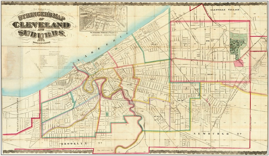
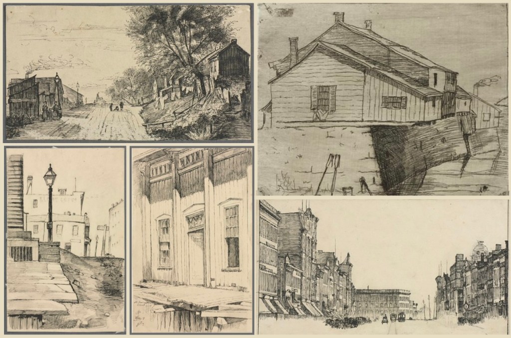
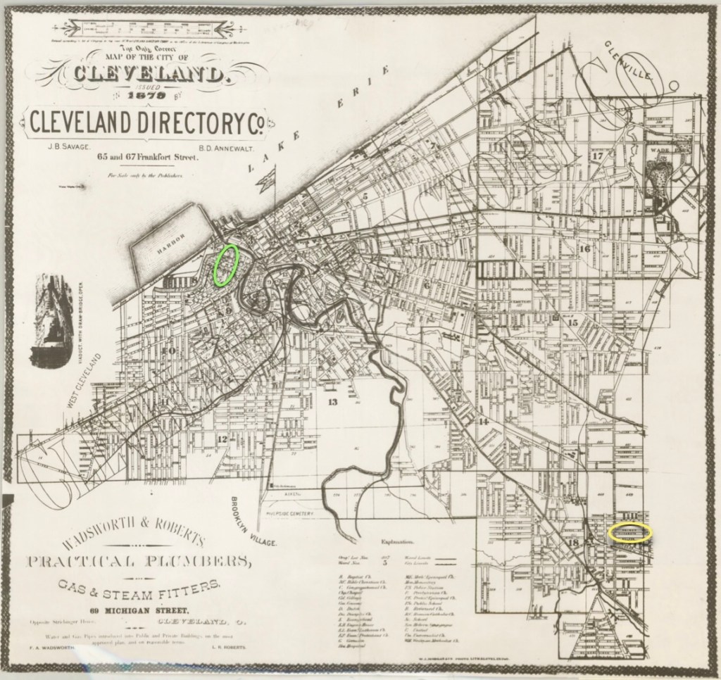
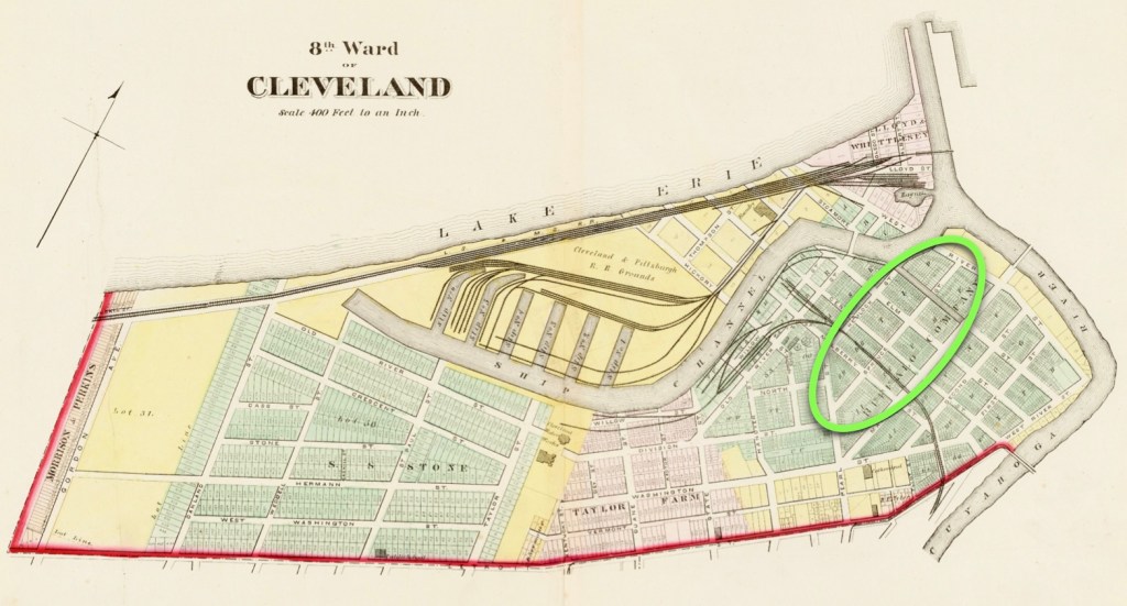
An Image of Cleveland, Ohio in the 1800s, via
https://www.etsy.com/listing/979025989/1800s-panoramic-view-map-cleveland-ohio

West Farmington Village
A Brief History of Our Village, Early Beginnings
https://westfarmingtonvillage.com/history
Note: For the text.

1812
Daughters of The American Revolution
North America, Family Histories, 1500-2000
for Eli Young
D > Daughters of the American Revolution > Lineage Book : NSDAR : Volume 163 : 1921
https://www.ancestry.com/imageviewer/collections/61157/images/46155_b290465-00125?ssrc=&usePUB=true&pId=3759181
Book page: 124, Digital page: 126/340
Note: Documents the 1812 marriage of Eli Young to Catherine Bellesfelt.

1826 >
Eli Young
Tax – Ohio, Tax Records, 1800-1887
https://www.familysearch.org/ark:/61903/1:1:J96B-1NB?lang=en
Note: Eli Young is paying property taxes in Farmington township as early as the 1826, and then paying them continuously for many years.

1830
Eli Young
in the 1830 United States Federal Census
Ohio > Trumbull > Farmington
https://www.ancestry.com/search/collections/8058/records/394289
Digital page: 5/8, Bottom third of the page.

1839
Deed Record: Trumbull. Deeds 1838–1839
#005641221
https://www.familysearch.org/ark:/61903/3:1:3QS7-89SY-T3DQ?view=explore&lang=en&groupId=TH-1961-29635-4858-23
Digital page: 104/554
Note: Quit claim deed of Eli Young to Stephen Young.

1840
Eli Young
in the 1840 United States Federal Census
Ohio > Trumbull > Farmington
https://www.ancestry.com/search/collections/8057/records/1752472
Digital page: 7/14, Bottom third of the page.

1853
Deed Record: Trumbull. Deeds 1853–1854
#005756392
https://www.familysearch.org/ark:/61903/3:1:3QSQ-G935-2R95?view=explore&lang=en&groupId=TH-1971-30440-21605-74
Digital page: 461/553
Notes: Land transfer from Sarah Young Hewitt to her brother Stephen Young. Land was given by John Young to Eli and Catherine Young and then to their children, including Sarah and Stephen.

1854
Deed Record: Trumbull. Deeds 1853–1854
#005756392
https://www.familysearch.org/ark:/61903/3:1:3QS7-L935-2529?view=explore&lang=en&groupId=TH-1971-30440-21605-74
Digital page: 462/553
Note: From the Will of John Young, his father—
He had willed that his land be used by Eli and Catherine Young, and their four children: Sarah Ann, Stephen, Mary, and Newton.

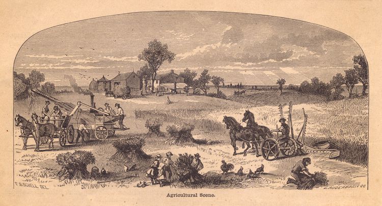
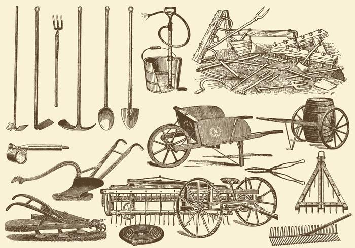
19th Century Agricultural Scene, via
https://www.thoughtco.com/history-of-american-agriculture-farm-machinery-4074385

1850
Eli Young
1850 United States Federal Census
Ohio > Trumbull > Farmington
https://www.ancestry.com/search/collections/8054/records/14616320
Digital page: 24/31, Lines 12 through 15.
Notes: By the age of 60, he is a shoemaker. His daughter Sarah Hewitt and her husband John live with them. She must have had 2 husbands because of the Trumbull County book entry, and the DAR entry> The second husband is named John Sager.

1853
Catharine Bellesfelt Young
https://www.findagrave.com/memorial/81181131/catharine-young
Note: Her dates are 1793 to July 9, 1853.

1860
Eli Young
Census – United States, Census, 1860
https://www.familysearch.org/ark:/61903/1:1:MCGG-XFR?lang=en
Book page: 219, Digital page: 398/405, Lines 18 through 23.
Note: At the end of his life, his wife has already passed on and he is living in the home of his youngest son Newton and his family.

1861
Eli Young
https://www.findagrave.com/memorial/81181130/eli-young
Note: His dates are 1789 to May 9, 1861.

1816 – 1898
Stephen Young
https://www.findagrave.com/memorial/81181132/stephen-young?
His dates are: January 21, 1816 to February 14, 1898.

1823 – 1895
Miranda A Stowe Young
https://www.findagrave.com/memorial/81181133/miranda-a-young
Her dates are October 28, 1823 to April 17, 1895.

1846
Stephen Young
in the Ohio, U.S., County Marriage Records, 1774-1993
Trumbull > 1842 – 1849
https://www.ancestry.com/search/collections/61378/records/3718218?tid=&pid=&queryId=42394630-5f1e-4ca6-8229-110bfb5cb236&_phsrc=nqI1&_phstart=successSource
Book page: 208, Digital page: 106/179, Right page, second entry.
Note: Their marriage record which recognizes March 18, 1846 as their actual wedding date. (The June 4, 1846 date on the Ancestry file is incorrect).

Stephen Young
Death – Ohio, County Death Records, 1840-2001
https://www.familysearch.org/ark:/61903/1:1:F6LZ-5ZW?lang=en
Book page: 316, Digital page: 166/169, Top third of the page.
Note: His death date is the only entry for 1898.

Leora J Young Pixley
in the U.S., Find aA Grave Index, 1600s-Current
https://www.findagrave.com/memorial/73438883/leora-j-pixley
Note: For her data.

Howard C Young
https://www.findagrave.com/memorial/81181134/howard_c-young
Note: For his data.

What The Censuses Tell Us

(3) — twelve records

Typical cover for The Quiver magazine, via
https://www.abebooks.com/Quiver-Illustrated-Magazine-Sunday-General-Reading/31815987787/bd

ebay
The Quiver,
An Illustrated Magazine for Sunday and General Reading
The West Window
Illustration by A.J. Prescott, 1877
https://www.ebay.co.uk/itm/176823928729
Note: For the illustration.

Observation: Going forward, Augusta M. Young is noted on the 1850, 1860, 1870, and 1880 censuses, as being at home.

1850
Augusta Young
in the 1850 United States Federal Census
Ohio > Trumbull > Farmington
https://www.ancestry.com/search/collections/8054/records/14616316
Digital page: 24/31, Lines 5 through 9.
Note: Stephen 34, Miranda 27, Leora 3, Augusta 1.

1860
Augusta Young
in the 1860 United States Federal Census
Ohio > Trumbull > Farmington
https://www.ancestry.com/search/collections/7667/records/42510341
Book page: 218, Digital page: 25/30, Lines 11 through 15.
Note: Stephen 44, Miranda 36, Lora 13, Augusta 11, Howard 1.

1860
Esay [Esau] Roberts
in the 1860 United States Federal Census
Ohio > Portage > Palmyra
https://www.ancestry.com/search/collections/7667/records/41939084?tid=&pid=&queryId=1b5f435d-cb53-481c-ba89-b0848e8e4693&_phsrc=nJE3&_phstart=successSource
Note 1: Joseph is living in the home of his parents.
Note 2: Esau 42, Sarah 17*, Eliza 17, Morris 15, John 13, Ann 10, Joseph 9, Benjamin 6, Henry** 5, Sarah M. 2, Hiram 3/12.
*The mother is mis-labeled? She should be about 43 years old at this point.
** This is William Henry Roberts.

1870
Augusta M Young
in the 1870 United States Federal Census
Ohio > Trumbull > Farmington
https://www.ancestry.com/search/collections/7163/records/38417787
Book page: 25, Digital page: 25/27, Lines 22 through 26.
Note: Stephen 54, Miranda 47, Lora 23, Augusta 21, Howard 10.

1870
Joseph Roberts
in the 1870 United States Federal Census
Ohio > Portage > Paris
https://www.ancestry.com/search/collections/7163/records/41005032?tid=&pid=&queryId=0080c454-41cb-4ffb-b2c0-aaacb81f051e&_phsrc=KEb10&_phstart=successSource
Book page: 18, Digital page: 18/18, Line 15.
Note: He is living in the home of the David E. Jones family, and working as an agricultural laborer.

1880
Augusta M Young
in the 1880 United States Federal Census
Ohio > Trumbull > Farmington > 189
https://www.ancestry.com/search/collections/6742/records/26788128
Book page: 8, Digital page: 8/23, Lines 22 through 26.
Note: Stephen 64, Miranda 57, Augusta 31, Howard 20.

1880
Joseph Roberts
in the 1880 United States Federal Census
Ohio > Trumbull > West Farmington > 189
https://www.ancestry.com/search/collections/6742/records/25290656?tid=155025192&pid=262048917062&ssrc=pt
Book page: 18, Digital page: 4/6, Line 28.
Note 1: He is living in the home of the Lewis Taft family, and working as an agricultural laborer, (a farmer).
Note 2: Why did he indicate a Pennsylvania birthplace, instead of Ohio?

David Rumsey Map Collection
Ohio
by Samuel Breese and Sidney E. Morse, 1842
https://www.davidrumsey.com/luna/servlet/detail/RUMSEY~8~1~21740~660104
Note: For the map image, as originally published in Morse’s North American Atlas, 1842.

Joseph A. Roberts
Marriage – Ohio, County Marriages, 1789-2016
https://www.familysearch.org/ark:/61903/1:1:Z8MP-3DMM?lang=en
Book page: 3, Digital page: 7/292, Right page middle entry.
and
Marriage Record: Trumbull. Marriage Records 1877–1886
https://www.familysearch.org/ark:/61903/3:1:939K-BJ3L-TT?view=index&personArk=/ark:/61903/1:1:XZNK-1YM&action=view&cc=1614804&lang=en&groupId=M96N-9ZY
Book page: 28, Digital page: 137/299, Left page middle entry.
Note: For the marriage record of June 11, 1881.

Medical Training in the Early 1880s

(4) — six records

The Agnew Clinic
File:The Agnew Clinic – Thomas Eakins.jpg
https://en.wikipedia.org/wiki/File:The_Agnew_Clinic_-_Thomas_Eakins.jpg
Note: For the time period appropriate painting of lecture-based medical training.

Eclectic medicine
https://en.wikipedia.org/wiki/Eclectic_medicine
Note: For the text.

History of the Eclectic Medical Institute, Cincinnati, Ohio, 1845-1902
Harvey Wickes Felter, 1902
https://archive.org/details/b24867500/page/n201/mode/2up
Notes: Various reference points throughout as follows —
p.55-56, A description of the school curriculum and syllabus.
p. 146, There are 83 graduates for the Class of 1884.
p. 188-189, A list of the 1884 graduates including Joseph A. Roberts.

Polk’s Medical Register and Directory of North America
by R.L. Polk, 1890
https://archive.org/details/McGillLibrary-103412-265/page/n1549/mode/2up?q=
Notes: Various reference points throughout as follows —
p.889, An advertisement for the Eclectic Medical Institute.
p. 927, Nelson, Portage. 900. Roberts Joseph A (Ecl), 262, ’84. Right page, first column.
p. 1557, Roberts Joseph A 927, His listing is on the right page, third column at center.
Note: For the references and artwork.

Cincinnati Public Library
Cincinnati & Hamilton County Library
History of the Eclectic Medical Institute, Cincinnati, Ohio, 1845-1902: including the Worthington Medical College (1830-1842), the Reformed Medical School of Cincinnati (1842-1845), and the Eclectic College of Medicine (1956-1859), with biographical sketches of members of the various faculties and lists of graduated arranged alphabetically and by classes.
1884. Roberts, Joseph A.
https://digital.cincinnatilibrary.org/digital/collection/p16998coll15/id/215729
Book page: 163, Center column.
Note: For the reference.

David Rumsey Map Collection
Map of Portage County, Ohio
from the Combination Atlas Map of Portage County, Ohio
by L.H. Everts, 1874
https://www.davidrumsey.com/luna/servlet/detail/RUMSEY~8~1~229977~5508293:Portage-County%2C-Ohio-?sort=pub_list_no_initialsort%2Cpub_date%2Cpub_list_no%2Cseries_no&mi=1&trs=11&qvq=q:Nelson%20township;sort:pub_list_no_initialsort%2Cpub_date%2Cpub_list_no%2Cseries_no;lc:RUMSEY~8~1
Book page: 14, Digital page: Follow the link above.
Note: For the 1874 Portage County map.

The Cleveland Business Directory Records
(Instead of an 1890 Census)

(5) —sixteen records

1891
U.S., City Directories, 1822-1995
for Joseph A Roberts
https://www.ancestry.com/search/collections/2469/records/1100175408?tid=&pid=&queryId=50b81a67-b3d9-4f3c-892a-febfd10c7793&_phsrc=aIv1&_phstart=successSource
Book page: 1038, Digital page: 596/667, Left page in the right column.
Note: The page heading is PHY (for Physicians), at 106 Euclid Avenue.

1894
Joseph A Roberts
U.S., City Directories, 1822-1995
https://www.ancestry.com/search/collections/2469/records/1106578783?tid=&pid=&queryId=9a0dbc0c-4fb9-447a-aa6c-336f80ce606f&_phsrc=aIv3&_phstart=successSource
Book page: 1191, Digital page: 662/731, Right page in the right column.
Note: The page heading is PHY (for Physicians), at 684 Hough Avenue.

1895
Joseph A Roberts
U.S., City Directories, 1822-1995
https://www.ancestry.com/search/collections/2469/records/1099606214?tid=&pid=&queryId=9135982e-abae-40f5-8faa-480f4d6a6713&_phsrc=aIv9&_phstart=successSource
Book page: 1226, Digital page: 662/731, Left page in the left column.
Note: The page heading is PHY (for Physicians), at 34 Princeton.

1898
Joseph A Roberts
U.S., City Directories, 1822-1995
https://www.ancestry.com/search/collections/2469/records/1110634942?tid=&pid=&queryId=56938574-6b86-4d48-aff5-89f9febad62c&_phsrc=aIv11&_phstart=successSource
Book page: 1354, Digital page: 703/772, Left page in the left column.
Note: The page heading is PHY (for Physicians), at 1568 East Madison Avenue.

1900
Joseph Roberts
Census – United States, Census, 1900
12th Census of Population 1900: Cleveland. Census 1900
https://www.familysearch.org/ark:/61903/1:1:MMZV-V46?lang=en
Book page: 6B, Digital page: 199/619, Lines 58 through 60.
Note 1: Joseph states that his birthplace is in Ohio in March 1850, and that both of his parents were born in Wales.
Note 2: This is the first census son Harris appears in, because the 1890 Census is lost. Harris’s birthdate of August 1889 is noted, and his age is 11.
and
Joseph A Roberts
U.S., City Directories, 1822-1995
https://www.ancestry.com/search/collections/2469/records/278306625?tid=&pid=&queryId=18d90601-f012-48d5-a846-1c6eda9e2c7f&_phsrc=aIv14&_phstart=successSource
Book page: 1354, Digital page: 716/786, Right page in the right column.
Note: The page heading is PHY (for Physicians), at 2795 Superior.

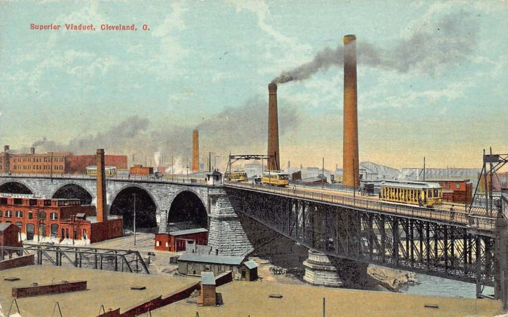
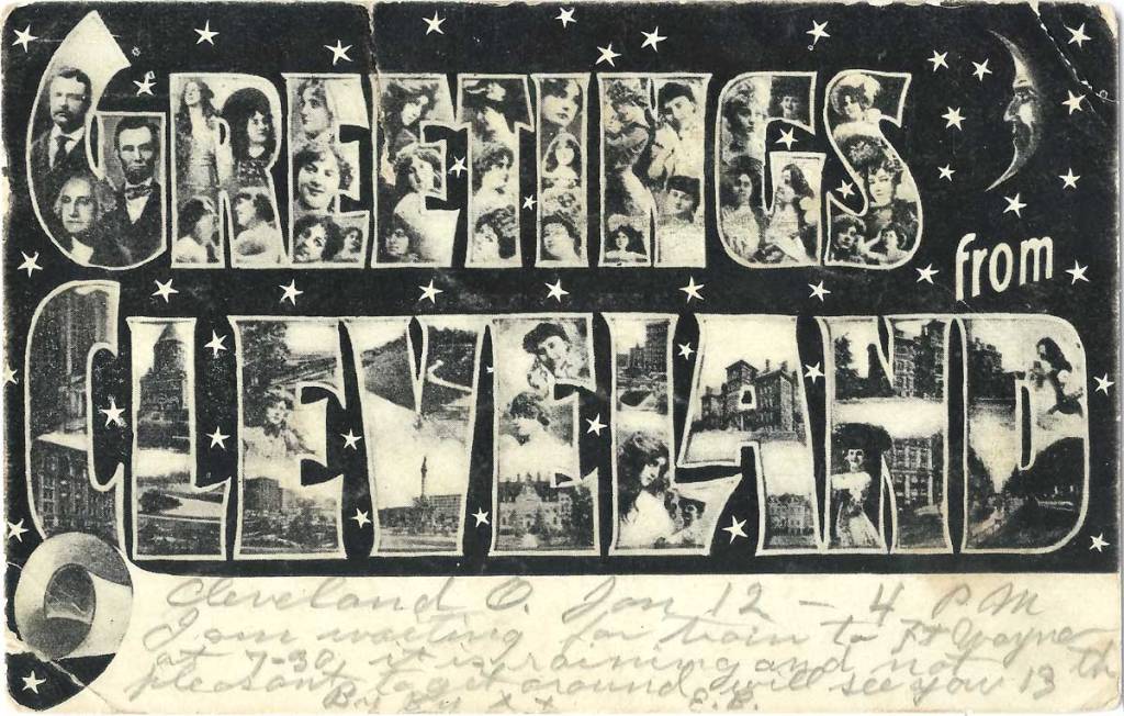
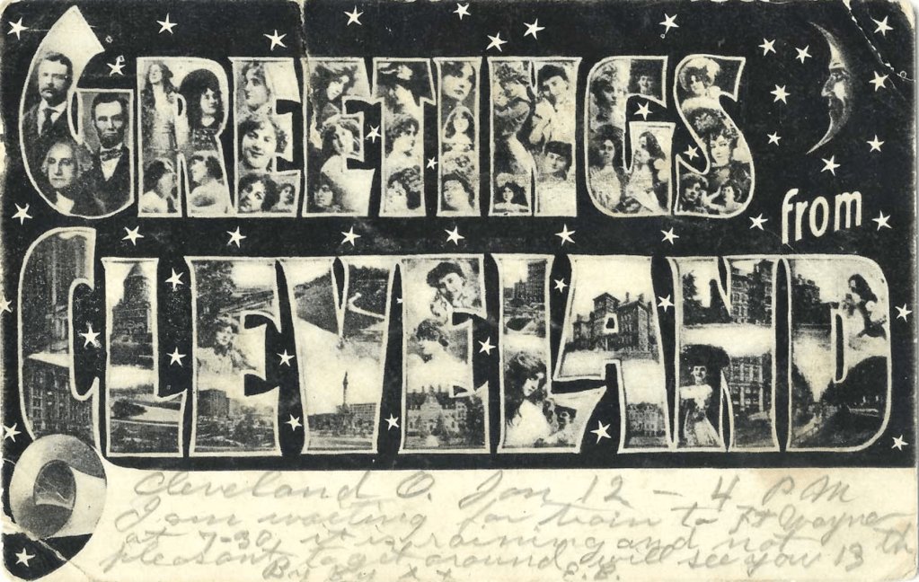
Vintage Greetings From Cleveland postcard, circa 1908, via https://www.freshwatercleveland.com/features/PFTL-Greetings-From-Cleveland-Ohio-Part-3-The-Variants_111025.aspx

1910
In 1910, Augusta is living with her son Harris W:
https://www.ancestry.com/search/collections/7884/records/21511720?tid=&pid=&queryId=effb7b42-3fed-4254-a86a-b4513e5373ed&_phsrc=ZPY20&_phstart=successSource
and
Joseph A Roberts-Con [con designates: continued]
in the U.S., City Directories, 1822-1995
Ohio > Cleveland > 1910 > Cleveland, Ohio, City Directory, 1910
https://www.ancestry.com/search/collections/2469/records/1344265383?tid=&pid=&queryId=1ed22da5-3787-4635-b954-471db5ddaa68&_phsrc=ZPY16&_phstart=successSource
Book page: 1291, Digital page: 1424/1879
Notes: Joseph A. and his son Harris W. are listed as living at 954 Parkwood Drive. Augusta is listed at another address, 1474 Addison Road.

1917
Mrs Augusta M Roberts
in the U.S., City Directories, 1822-1995
Ohio > Cleveland > 1917 > Cleveland, Ohio, City Directory, 1917
https://www.ancestry.com/search/collections/2469/records/315763762?tid=&pid=&queryId=febebf43-88e3-4d86-bd79-416f933169d5&_phsrc=ZPY1&_phstart=successSource
Book page: 1503, Digital page: 754/1225
Note: Augusta is living at 12009 Castlewood Dr. Her son Harris W. is also living at the same address, (Book page: 1504). Joseph A Roberts is not listed.

1920
In 1920, Augusta is living with her son Harris W:
https://www.ancestry.com/search/collections/6061/records/33261605?tid=&pid=&queryId=e7fc4745-ff9e-4776-9fec-2194303f30df&_phsrc=ZPY22&_phstart=successSource
and
1920
Joseph Roberts
in the 1920 United States Federal Census
Ohio > Cuyahoga > Cleveland Ward 20 > District 0396
https://www.ancestry.com/search/collections/6061/records/112203893?tid=&pid=&queryId=99482ed4-a36d-47f5-be83-4e59935fda41&_phsrc=KEb4&_phstart=successSource
Book page: Digital page: , Line 79.
Note 1: At 69, Joseph appears to be living as one of four lodgers in the home of Thomas Anderson.
Note 2: He seems to be retired? (Profession is None.)
Note 3: Why does he indicate that each of his parents were born in Ohio, when they were born in Wales?

1923
Joseph A Roberts
U.S., City Directories, 1822-1995
https://www.ancestry.com/search/collections/2469/records/292366965?tid=&pid=&queryId=8863e3d5-0b08-4b58-8023-55ca7514d9f9&_phsrc=bEi4&_phstart=successSource
Book page: 2223, Digital page: 1124/1675, Right column at 23rd entry.
Note: Cleveland, Ohio, City Directory, 1923. He worked at several locations over the years.

History of Cleveland
https://en.wikipedia.org/wiki/History_of_Cleveland
Note: For the text about the 1920s in Cleveland, Ohio.

Cleveland Memory Project .org
Panoramic View of Public Square, Cleveland, O., circa 1900-1927
https://clevelandmemory.contentdm.oclc.org/digital/collection/postcards/id/3229/rec/2
Note: The postcard verso reads, “The Heart of Cleveland, Ohio. The Public Square is located in the center of the business district. It contains the Soldiers’ and Sailors’ Monument, which rises to a height of 125 feet, also a statute of Moses Cleveland, the founder of the City. It is the starting point of al the street car lines, also the many inter-urban lines that run out of Cleveland and traverse all parts of Ohio. It contains several shelter houses and is divided in four sections, all beautifully kept and arranged. A splendid fountain surrounded by gravel walks and beautiful flower beds, occupies the center of each section.”

1930
Joseph A Roberts
Census – United States, Census, 1930
https://www.familysearch.org/ark:/61903/1:1:X4QN-6VZ?lang=en
Book page: Digital page: 727/1,133, Lines 77 through 84.
Note: He is living in the home of his son Harrison W. Roberts and his family.

William H. Roberts and Mrs. George Stitt

(6) — sixteen records

William Henry Roberts, the brother of Joseph A. Roberts was living in the Cleveland, Ohio area for about 30 years.

1910
William H Roberts
1910 United States Federal Census
https://www.ancestry.com/search/collections/7884/records/21539401
Book page: 2A, Digital page: 3/9, Line 21.
Notes: Wales is noted for both parents. Birthdate calculates to 1858.

1920
William H Roberts
1920 United States Federal Census
Ohio > Cuyahoga > Cleveland Ward 26 > District 0495
https://www.ancestry.com/search/collections/6061/records/76442276
Book page: 7A, Digital page: 13/35, Lines 37 through 39.
Notes: He is married and has a daughter. Wales is noted for the father, and England for the mother.
Note 1: William Roberts wife is Frances Thomas.
Note 2: Their daughter is Catherine E. (Roberts) Hallock, born 1912.

Frances M Thomas
in the Indiana, U.S., Marriage Certificates, 1960-201
https://www.ancestry.com/search/collections/61009/records/94221013
Note 1: Their marriage date is October 19, 1904.

1940
Wm Henry Roberts
Ohio, U.S., Death Records, 1908-1932, 1938-2022
https://www.ancestry.com/search/collections/5763/records/6451731
Note: William passed on in Cleveland on August 25, 1940.

Sarah M Stitt
https://www.findagrave.com/memorial/78161907/sarah_m-stitt
Note: This sister of Joseph A. Roberts, Sarah M. (Roberts) Stitt, was traceable only through his obituary information.

1924
Augusta M Young Roberts
https://www.findagrave.com/memorial/81181135/augusta_m-roberts
Note 1: Her dates are October 25, 1849 to May 1, 1924.
Note 2: Her birth year here is recorded as 1849,but some other sources cite 1848.

1924
Augusta Young Roberts
Death – Ohio, Deaths, 1908-1953
https://www.familysearch.org/ark:/61903/1:1:X6MF-Y5C?lang=en
Digital page: 610/3,295 
Notes: Her death certificate. The information was provided by her son Harris Sr. Her birthdate is listed as being October 25, 1849, which is one year later than other records.

Dr Joseph A Roberts
U.S., Find A Grave Index, 1600s-Current
https://www.findagrave.com/memorial/177407157/joseph-a-roberts
Note 1: His birth year is circa 1851, not 1862. His death age should be 79.
Note 2: His obituary information as noted on his Find A Grave file, is as follows —
Name: Roberts, Dr. Joseph, Date: Mar 4 1930, Source: unknown, Reel #69.
“Roberts-Dr. Joseph, father of Harris W., brother of William and Mrs. George Stitt and husband of the late Augusta M., passed away Monday evening. Now at R. S. Bennett Co. Funeral Home, 1940 E. 90th Street, where services will be held Wednesday, March 5, 1930, at 2 p. m. Age 68. Knollwood Cemetery. Cleveland, Ohio.”

Dr Joseph A Roberts
Death – Ohio, Deaths, 1908-1953
https://www.familysearch.org/ark:/61903/1:1:XZX9-SL2?lang=en
Note 1: For his March 3, 1930 death record. His dates are March 1850 to March 3, 1930.
Note 2: He states on the 1900 Census that his birthdate is March 1850, see — https://www.familysearch.org/ark:/61903/1:1:MMZV-V46?lang=en .
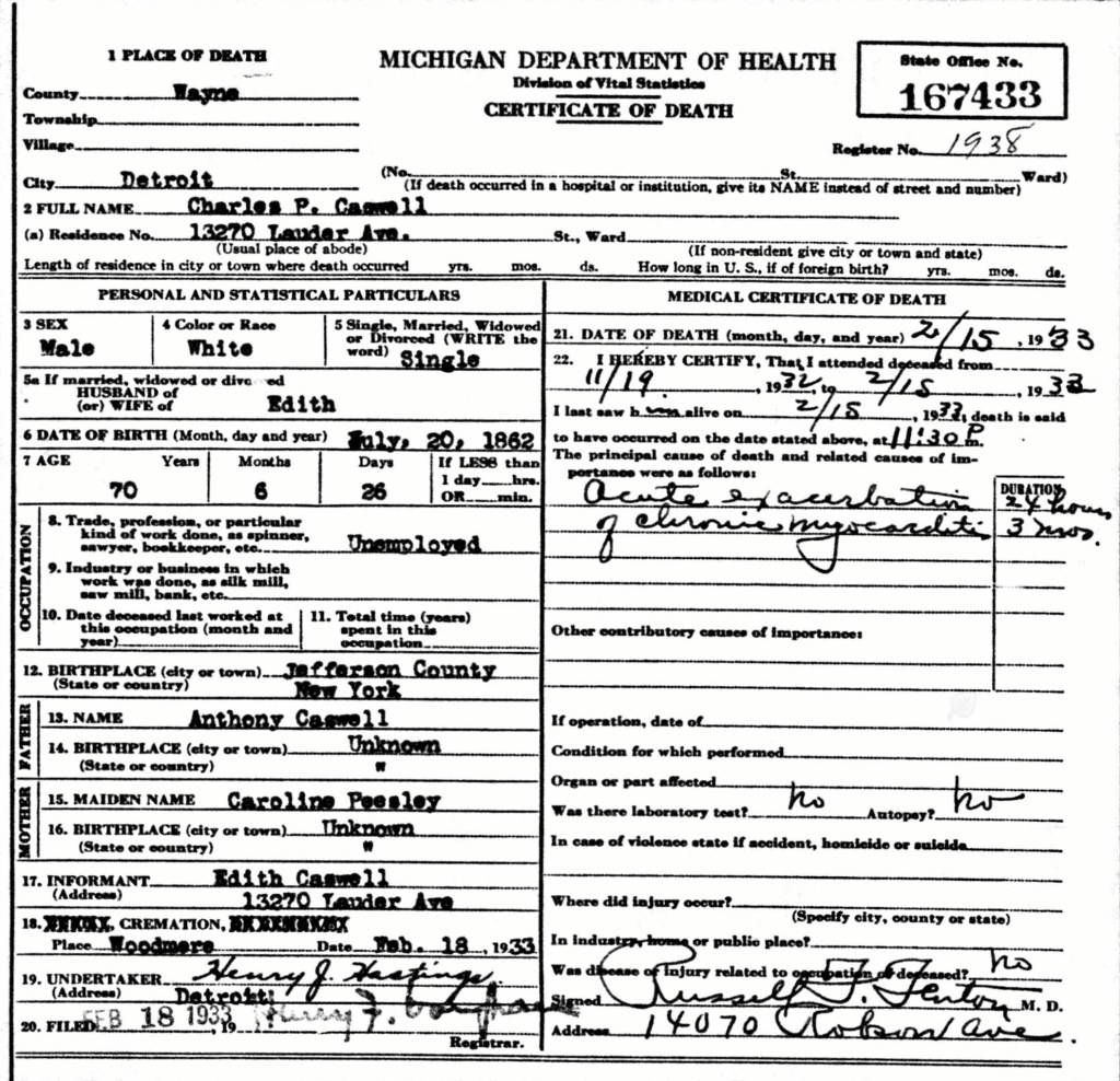
Note 3: The person reporting is death is his daughter-in-law Mrs. W. Roberts, who is Edna (Caswell) Roberts. She probably didn’t know his correct age. He is recorded as being about 68 at death which would make his birth year 1862.
Note 3: His birth year in March 1850. (See this on the 1900 US Census). The person who reported the information clipped about 12 years off of his age.

Elvira Williams
in the U.S., Find A Grave Index, 1600s-Current
https://www.ancestry.com/search/collections/60525/records/102869719
and
https://www.findagrave.com/memorial/12416409/elvira-williams
Note: Her gravestone indicates these dates, February 16, 1863 – October 12, 1889.

George Williams
in the U.S., Find A Grave Index, 1600s-Current
https://www.ancestry.com/search/collections/60525/records/102869707?tid=&pid=&queryId=4258b3af-1bc6-4dfe-a2cb-04a03c42166b&_phsrc=lFv3&_phstart=successSource
and
George Williams
https://www.findagrave.com/memorial/12416396/george-williams
Note 1: His gravestone indicates these dates, August 5, 1856 – March 30, 1893.
Note 2: The citations from the Akron City Directories from Find A Grave. The notes are in error, since these records are for another man named George Williams, and not the man who is from our family. We believe that our ancestor likely worked in agriculture in Paris Township, Portage County, Ohio.

Elmer George Williams
https://www.findagrave.com/memorial/12416370/elmer-george-williams
Note: His birth and death dates are, April 3, 1882 – December 2, 1966. From 1955 to 1965, he lived at this address: Elmer G. Williams, (Rose J.), home – 2124 4th St., (Cuyahoga Falls, Ohio). Rose was his wife and is interred near him.
and
Elmer D. Williams
in the Ohio, U.S., Births and Christenings Index, 1774-1973
https://www.ancestry.com/search/collections/2541/records/1383300
Note: For Elmer’s birth confirmation.

The Nightingale

(7) — seven records

Nightingale
https://www.hareandtabor.co.uk/store/p31/Nightingale_greetings_card.html
Note: From the website description, “The nightingale (Luscinia megarhynchos) is a bird of legendary singing abilities, and continues its’ song after dark.  Its’ Old English form, nihtgale, actually means ‘night songstress’, although it is the male that actually sings.”

YouTube.com
Bird sounds – Common nightingale (Luscinia megarhynchos)
> Click on the link below for a short 2:32 minute video and hear the Nightingale sing.
https://www.youtube.com/watch?v=gokHFCrYGU8
Notes: Form the YouTube.com video page —
“The common nightingale (Luscinia megarhynchos) is considered the best bird singer in the world. It usually sings in dense vegetation near water where it lives and breeds. Its amazing song can often be heard even during the night. Not many birds can sing so loudly and persistently as a male nightingale. His concert is a true master’s performance because he has a wide variety of chirping, tweeting and shrieking sounds in his repertoire. Enjoy the world’s most beautiful bird song!”

Majestic Mountain Tree
Illustration from Stock Cake
https://stockcake.com/i/majestic-mountain-tree_1765988_1255094
Note: Illustration used for The Williams and Harris Families ancestral chart.

Reader’s Digest
What Is a Second Cousin vs. Second Cousin Once Removed?
by Lambeth Hochwald and Chloë Nannestad
https://www.rd.com/article/second-cousin-once-removed/
Note 1: For the reference and the charts.
Note 2: To our understanding, the phrases ‘second cousin’ and ‘1st-cousin-twice-removed’ are used equally for the same designation.

_____________________________

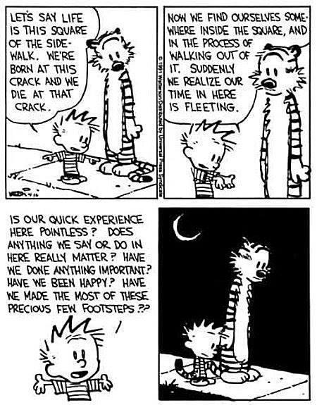
Since Benny H. Williams and Harris Williams Roberts were the same small boy, we thought that this Calvin and Hobbes comic strip was quite apropos as a closing to these footnotes —

Calvin And Hobbes was a comic strip published by Universal Syndicate from November 18, 1985 to December 31, 1995. Created by Bill Watterson (1958-present), the strip follows six-year-old Calvin and his best friend, a tiger named Hobbes. Calvin and Hobbes draws heavily upon Watterson’s experiences growing up in CHAGRIN FALLS, a neighborhood of Cleveland, Ohio.”
—–
This specific Calvin and Hobbes comic strip by Bill Waterston, featuring their philosophical discussion about life on a sidewalk square, was first published on April 16, 1991. Thanks Bill!

Case Western Reserve University
Encyclopedia of Cleveland History
Calvin and Hobbes
https://case.edu/ech/articles/c/calvin-and-hobbes
Note: For the history.

The Williams / Harris Line, A Narrative — Eleven

This is Chapter Eleven of twelve, where we are nearing the finish to our exploration of the Williams and Harris family lines. Here we introduce another family from Wales, the Roberts family, who were friends with the Harris family in Wales.

The same Thomas and Harris families family pedigree flow chart —
but now with the addition of the Roberts family line.

Genealogy Gold!

Well, that exciting subtitle might let you believe that we discovered something that made our lives easier. That is partially true, but not the whole truth. Let us explain…

We found two obituaries for the main ancestors within this family line: Esau Roberts, and Sara (Harris) Roberts. Both were very long, rather detailed, and not in complete agreement about all of the facts. We spent much time (as genealogy writers do) mucking about in the dustbins of history to figure out what was likely true and what was just not quite true. So, here we are —

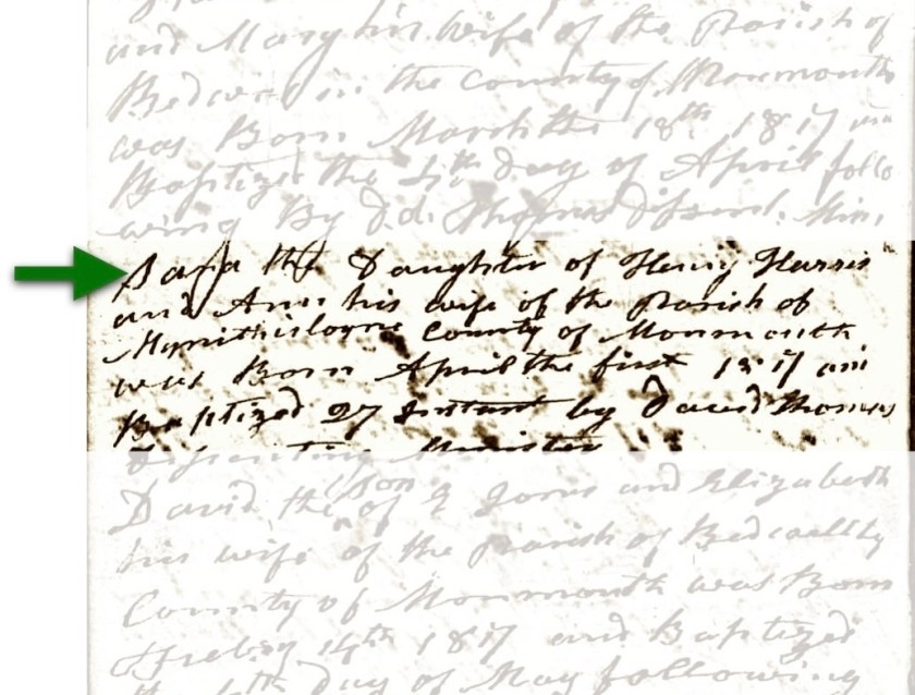
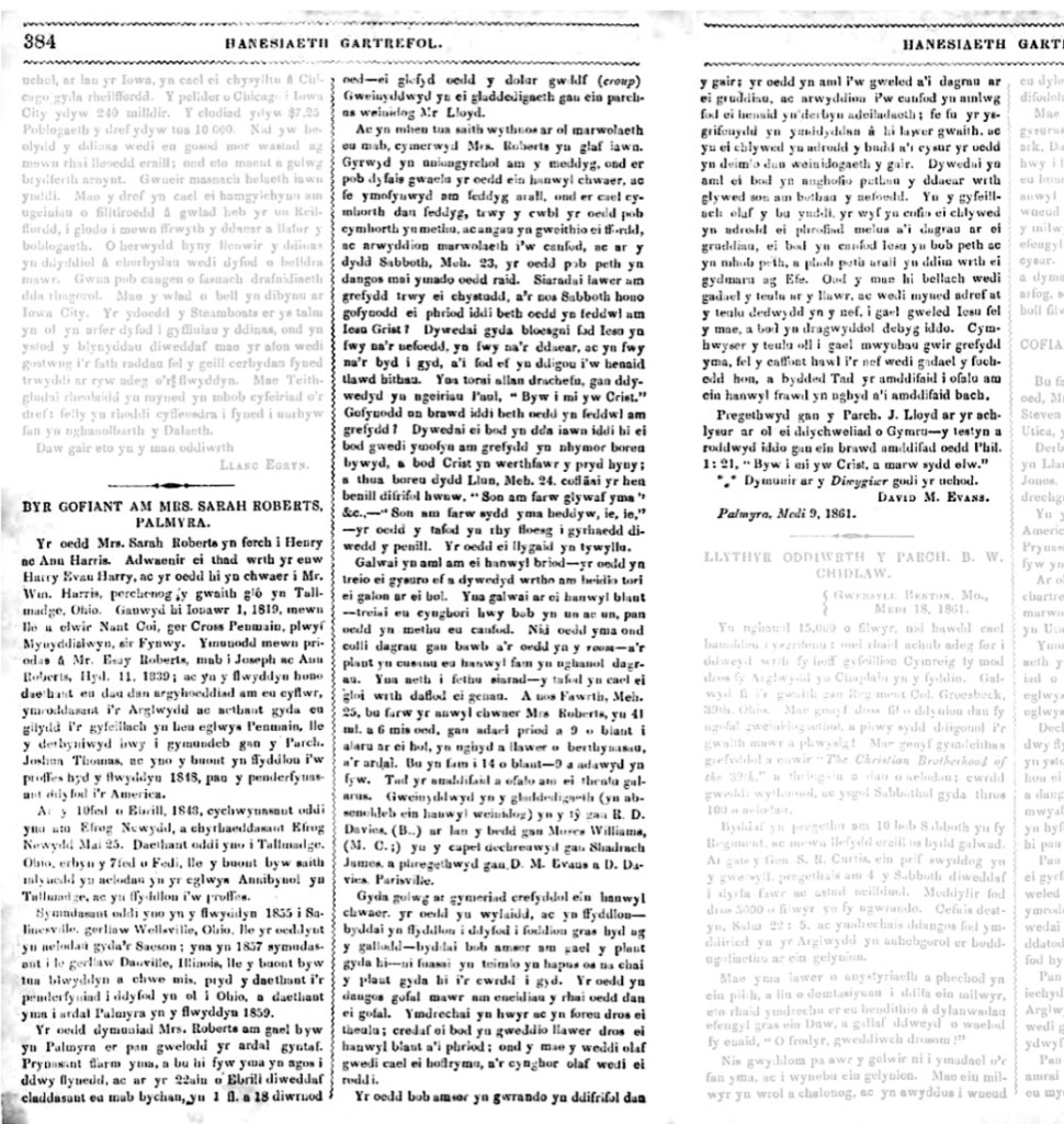
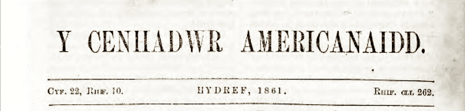
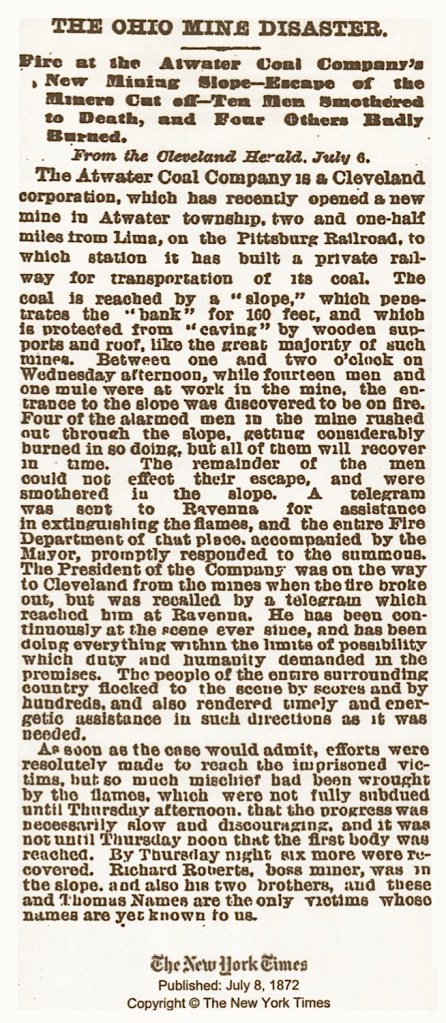
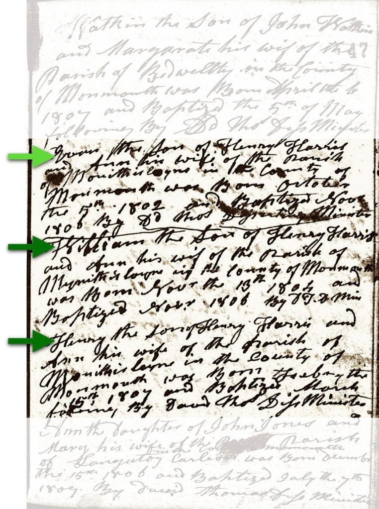
Mrs. Sarah [Harris] Roberts died at a somewhat young age and her very long obituary was published in the Y Cenhadwr Americanaidd (The American Messenger), newspaper, Autumn 1861 issue. We learned that they wrote her birthdate as “January 1, 1819.” ( A New Years Day baby!) Actually, her birthday was April 1, 1819 (Ok, an April Fools Day baby! Even better.)

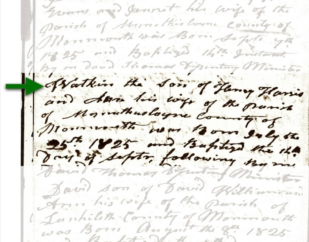
Registration of both the April 1, 1817 birth and baptism dates for Sara Harris. From the
Mynyddyslwyn, Beulah Chapel (Baptist) Registry, in Monmouthshire, Wales.

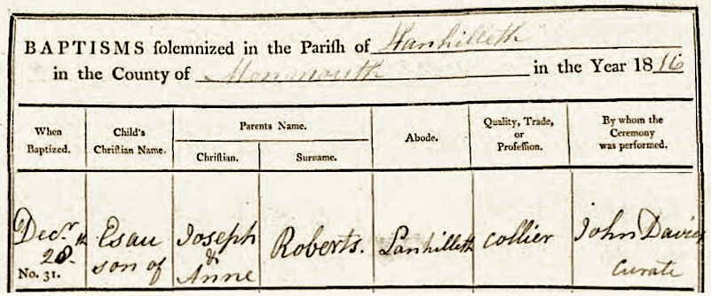
We believe that Esau Roberts (her future husband) was born in the same year, 1817. His baptismal record indicates a couple of things to examine: his record says 1816 in the upper corner of the page but it is also notes very clearly in the margins of the actual document, that it was the last entry for 1817. We went with 1817 for his birth year, even though future records are all over the map.

The December 28, 1817 baptism registry for Esau Roberts,
in Lianhilleth, Monmouthshire.

Comment: Try to understand that for our ancestors, who lived in a preliterate world, knowing your exact age was just not an important fact. Most people signed their names with an X, and counted grocery items on their fingers. A birth date, was an idea, not a fact. Specifically, their mental map was different. It was not like today where you need to produce: an identity card, a social security number, bank card, proof of citizenship, and your blood type just to purchase something like bottle of wine!

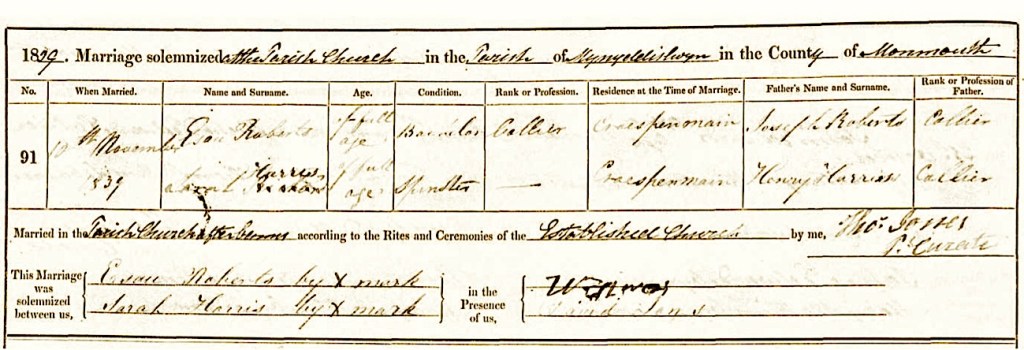
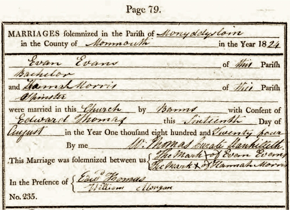
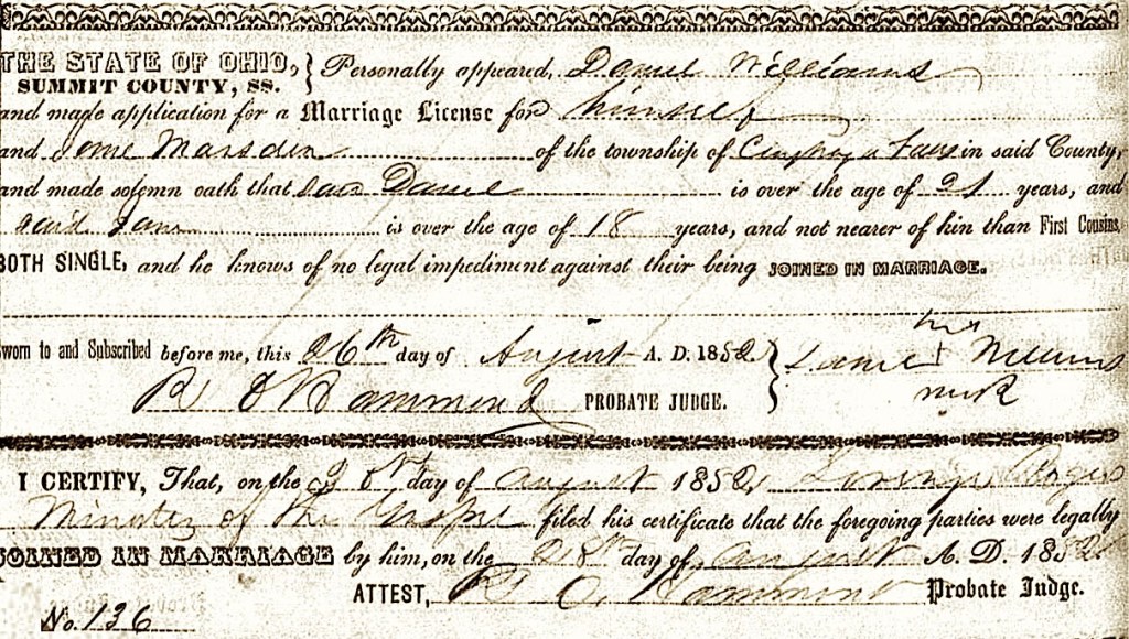
The November 19, 1839 Mynyddyslwyn, Monmouthshire marriage record
for Esau Roberts and Sara Harris.

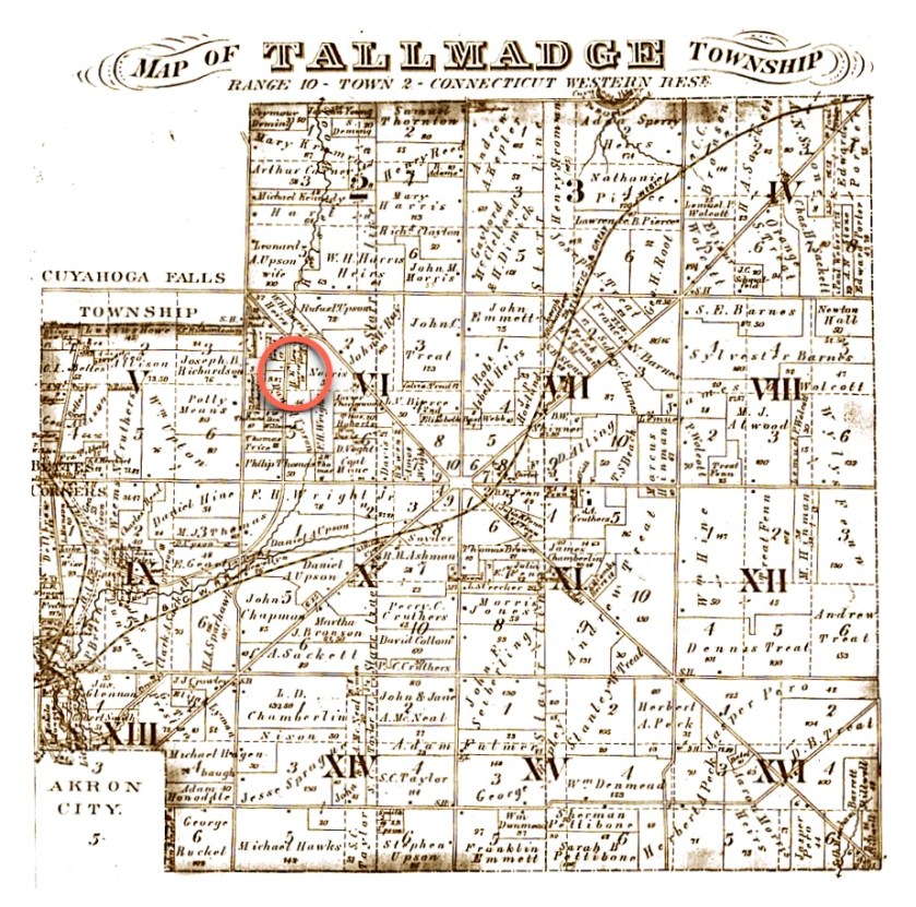
“They joined in marriage [on] October 11, 1839.” It was not October, it was November 19, 1839. Additionally, “…that year they both left under conviction for their condition, they dedicated themselves to the Lord and went with each other for fellowship in the old church of Penmain, where they were received into communion by Rev. Joshua Thomas, and there they practiced their profession until the year 1838, when they decided to come to America.” That being said, they decided to immigrate to America in 1848, ten years later. (1)

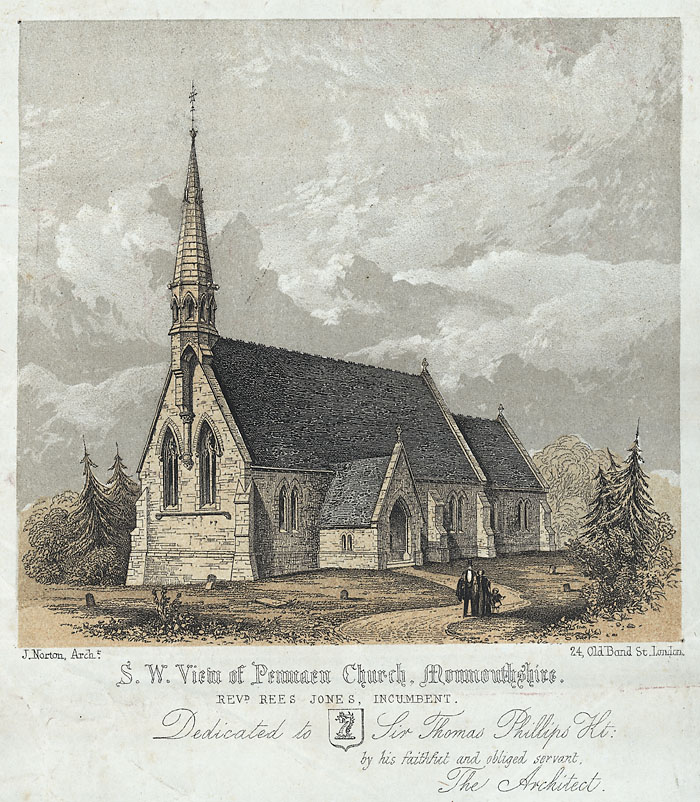
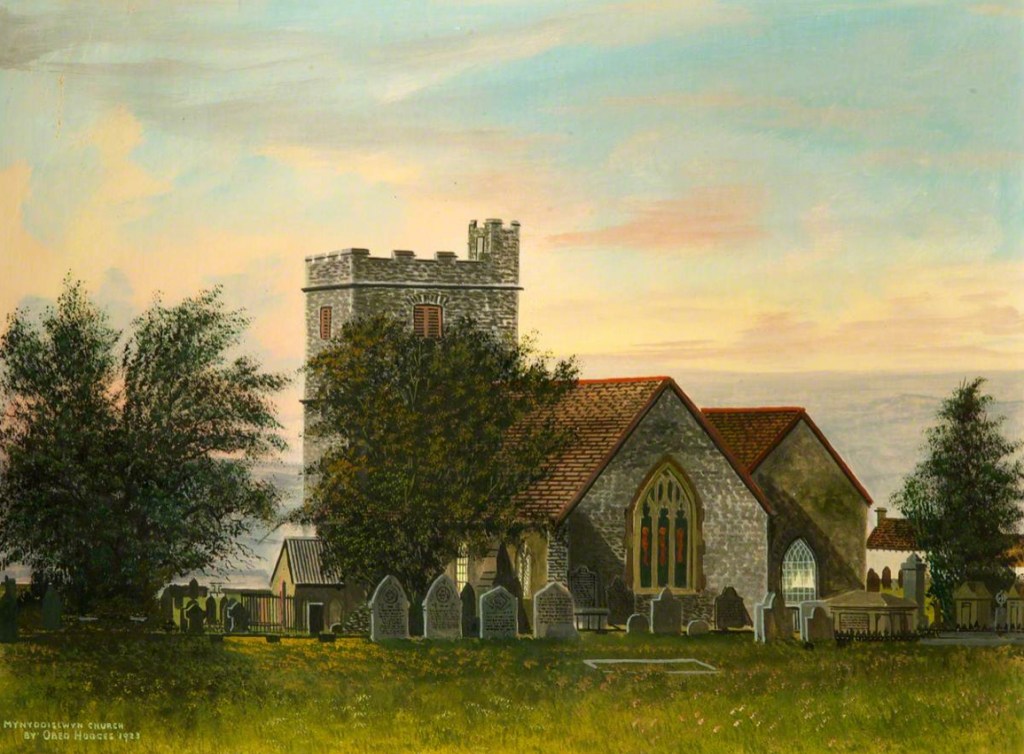
The Old Church of Penmain

From Wikipedia, this is the history of where we believe that they actually resided before immigrating to America — “In 1845, the district of Penmain became an ecclesiastical parish, formed out of the parish of Mynyddislwyn, and in 1855 the Church of St. David was built, having seating for 300 worshippers. Its registers started from 1866.

A View of Penmaen Church, by John Norton, circa 1855.
(Image courtesy of Wikimedia Commons via The National Library of Wales).


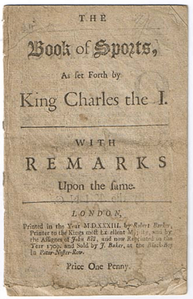
[Prior to that] In 1618, King James issued the Book of Sports, which relaxed the previous attitudes to Sunday amusements, and set out which times were to be allowed on the Sabbath for these amusements. There was much opposition to this by the clergy, and it continued up to the English Civil War. Afterwards, in 1660, when Charles II came to the throne, he re-introduced it. Many clergymen refused to obey, including Henry Walter, who was dismissed from his position in the Church. He then set up the Independent Chapel at Penmain, although the Nonconformist chapel building was not completed until 1691. Services were held in Welsh. It was rebuilt in 1828, renovated in 1888, and is the second oldest existing Independent Chapel in Wales.” (Wikipedia)

So we can see, that this was a location with a long venerable history. (2)

On the Caleb Grimshaw Ship Manifest

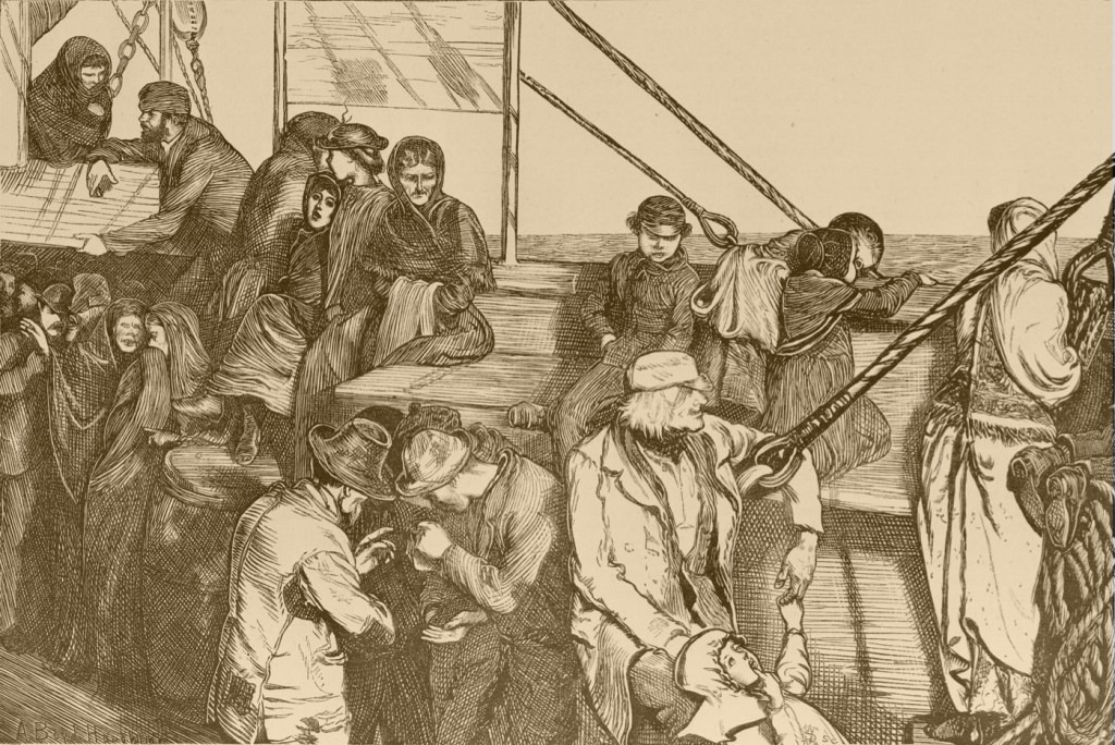
In the late 1840s, many ships were sailing between Great Britain and the New York Harbor area, transporting immigrants who were fleeing the devastation of the “An Gorta Mór or The Great Hunger” in Ireland. But there were many people also traveling from Wales, to work in the coal fields of Ohio and Appalachia.

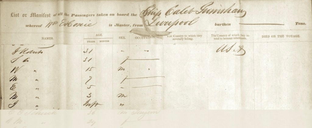
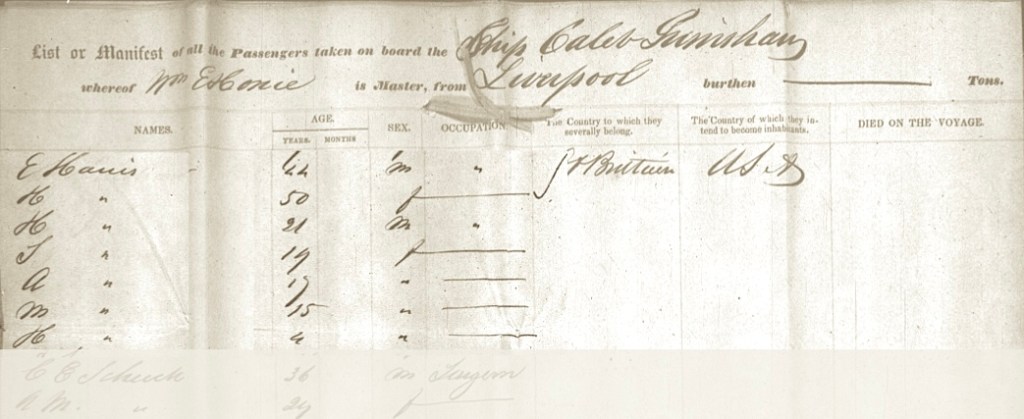
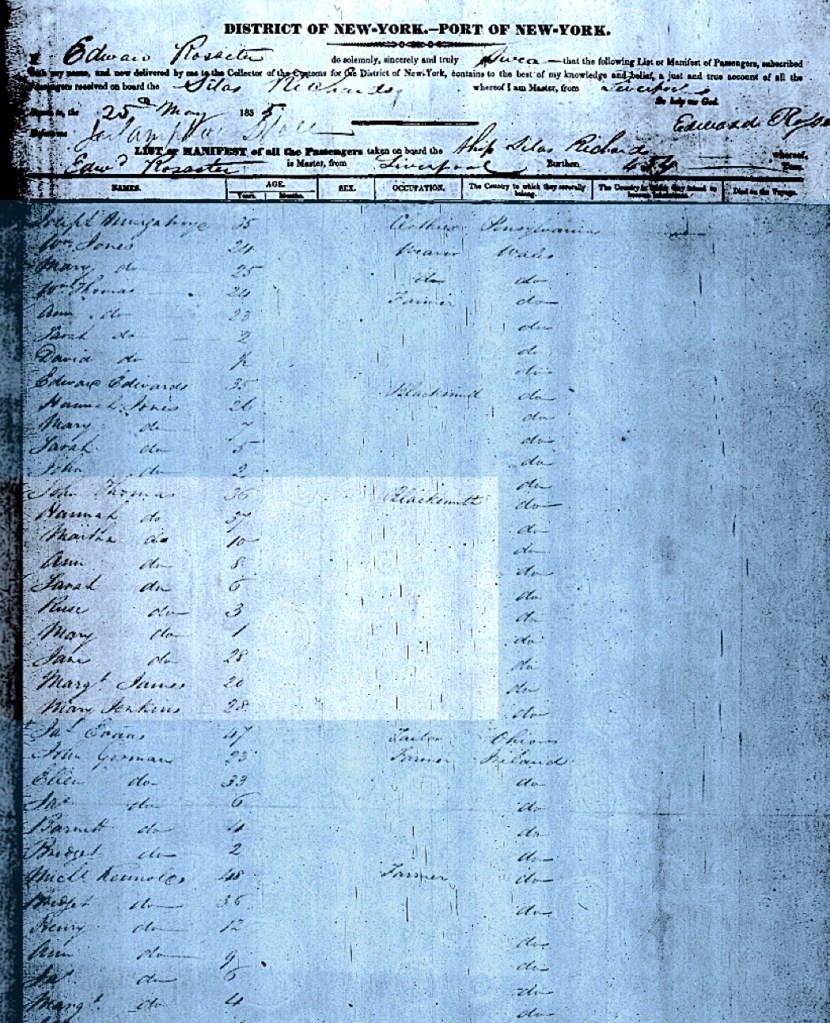
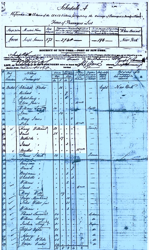
The long obituary of both Sarah (Harris) Roberts, as published in the Y Cenhadwr Americanaidd (The American Messenger), newspaper, Autumn 1861 issue, states; “On the 7th of April, 1848, they started from there to New York, and they arrived in New York on May 25.” We found them, but it was a bit startling (and also delightful for us) because they were on the Caleb Grimshaw packet ship. This Is the exact same ship voyage and passenger manifest under which the Evan Harris family had traveled. (In fact, the two families are listed near each other on the same page of the manifest. (Please see Chapter Nine on the Harris family, and also for the dramatic history of the Caleb Grimshaw ship).

The Roberts family listed on the manifest for the ship Caleb Grimshaw,
with the arrival date in New York of May 27, 1848.

Since Evan Harris and Sara (Harris) Roberts were siblings, this fact reinforces the idea that these two families knew each other in Monmouthshire, Wales. The ship manifest is just further support. Traveling together on this ship was certainly a planned event, since Sara was very pregnant at the time of the ship’s departure from Liverpool. She gave birth to her son John on the voyage.

Of note: Traveling with the Roberts family is a 15 year old young man named ‘W’, as he is listed with them on the Caleb Grimshaw ship manifest. He must have been a relative, but we are not sure of he was connected to Esau and Sara Roberts.

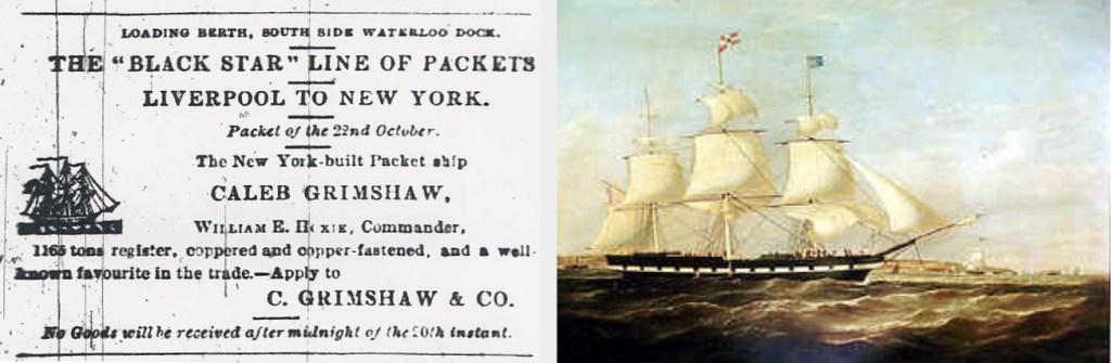
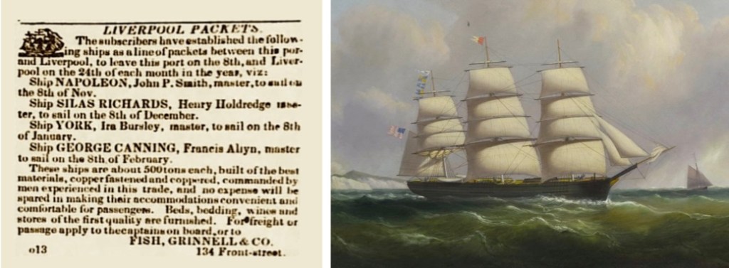
Left to right: Sailing notice for the Caleb Grimshaw to New York,
from the Liverpool Mercury, 1849. Oil painting of the Caleb Grimshaw by Samuel W. Walters,
circa 1848. Walters was considered to be Liverpool’s leading marine artist at the time.
(Both images courtesy of Wikimedia Commons).

We had trouble locating this Roberts family because the passenger manifest had named him Isiah Roberts. Observation: With a traditional Welsh name like E-s-a-u, the head of this family was probably used to having his biblical name misinterpreted by record-keepers in America — or perhaps not? (One gets the feeling that he laughed it off and kept on moving on…) His Welsh accent probably did not help them understand what name he was saying either.

We have encountered his name spelled many ways. Here are a few examples:
Esau, Esay, Essa, Easy, Asa, and Isiah.

Going on, now we can learn about their many children — who are in number, only a few more than the spelling variations which existed for their father Esau’s first name. (3)

On Two Continents and One Ocean

Sarah and Esau had children born over two continents, with one child even being born at sea (between continents!). Consequently, records are a bit scattered.

Birth and death dates for their children
Sarah (Harris) Roberts obituary claims that she was the mother of 14 children. We have been able to locate 10 of them, and wonder if 14 was an accurate number for live births? To reconcile all of these children, we analyzed genealogy records, census data, and cemetery records. We feel that the two lists below are the most accurate representation we can present. Some of the children have left enough records that we have created footnotes for them.

Born In Wales
These children were born in Monmouthshire, Wales and immigrated to America with their parents in 1848.

  • Mary Roberts, born circa 1841
  • Eliza Roberts, circa 1843
  • George Moses Roberts, born circa 1844-1917
  • John Roberts, born at sea on the Caleb Grimshaw, circa 1847

Born in America
These children were born at various locations in Ohio, and Illinois:

  • Anna (Roberts) Miles, 1849-1895
  • Joseph A. Roberts, March 1850- March 1930,
    Joseph carries the family line forward.
  • Benjamin Roberts, 1854-1915
  • William Henry Roberts, 1858-1940
  • Sarah M. (Roberts) Stitt, 1859-1936
  • Hiram Roberts, 1860-1861

They moved quite a bit, which makes us wonder if they were following work locations? The logistics must have been difficult. (4)

Living Here, and Then There…

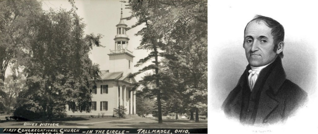
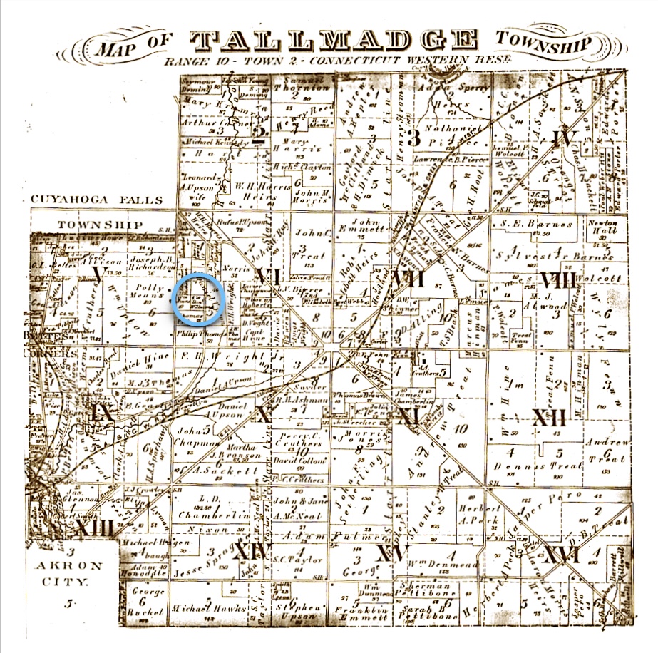
After they arrived in America, from the obituary of Sara (Harris) Roberts, “They came from there [New York] to Tallmadge. Ohio, [in Summit County] by the 7th September, where they lived seven months in the Independent church of Tallmadge, and loyal to his profession. [During this period, Esau became a naturalized US Citizen at the Summit County Court of Common Pleas in 1853].

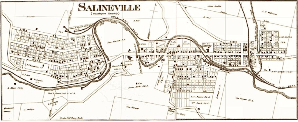
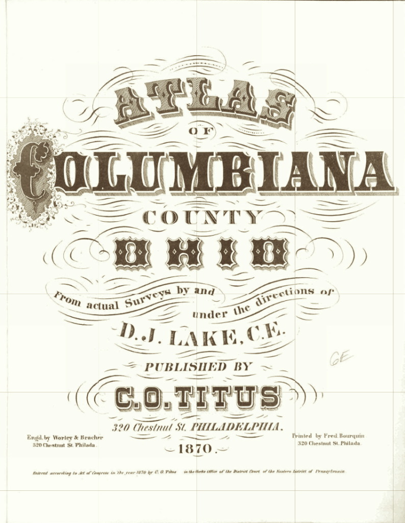
1870 map of Salineville, Washington township, Columbiana County, Ohio.
(Images from the Atlas of Columbiana County, Ohio, 1870, via Family Search).

“They moved from there in the year 1855 to Salinesville, near Wellsville, Ohio. Where they were close with the English; then in 1857 they moved to a place near Danville, Illinois where they lived for about a year and eight months, when they came to the decision to come back to Ohio, and they came here to the Palmyra area in the year 1859.” (Y Cenhadwr Americanaidd)

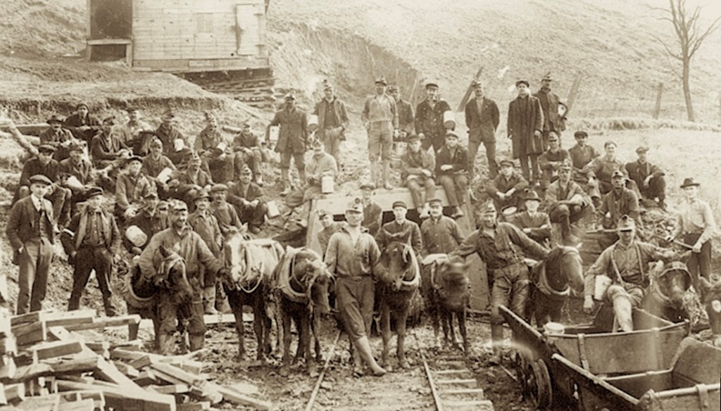
In Wales, Esau had been a collier, which is the British term for a coal miner. When the arrived in America, it appears that he continued that profession for a few years. They likely moved south to Salineville in Columbiana County because there was coal mining work there.

However, before coal was mined, the area was famous for its salt — an early industry driven by the local brine springs. “…Salt has always played a special role in Salineville’s history, hence the name… Most of the salt mining was not done by sending men down into mines but rather with salt wells that used pressurized water to bring salt to surface. From there the water was boiled off and the salt was transported to the Ohio River where it was then exported around the across the country.” (The Review)

The family only stayed in Salineville for about two years, and then they moved to Illinois for another two years, but after that, they returned to Ohio. (5)

1860 Agricultural Schedule for Palmyra township, Portage County, Ohio

Palmyra

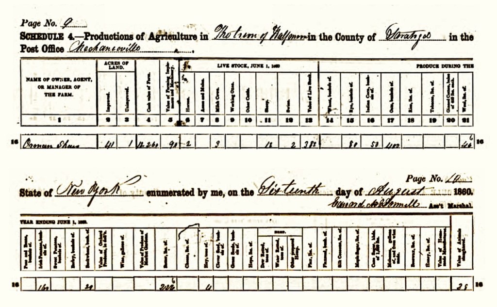
The next time we encounter a record about this family, they are back in Ohio according to the 1860 US Census. It looks as if prosperity has finally arrived on their doorstep (!), and that Esau has decided to be a farmer. He reports the following for the July 1860 Agricultural Schedule:

  • 96 acres of land
  • $3,400 Cash value of the farm
  • $100 value of farming equipment
  • 3 horses
  • 9 milking cows
  • 3 other cattle
  • 65 sheep
  • 100 bushels of ‘Indian’ corn (field corn)
  • 100 bushels of oats

So, where did all of this prosperity come from (so quickly) for a man who was a coal miner most of his life? When did he develop the desire to be a farmer?

We are not sure what happened, but at this same time, Sara’s two brothers (Evan and William H.) who lived in nearby Tallmadge, were making quite a bit of money from their work with coal mining leases. Perhaps they decided to help out their sister and her husband and their very large family. Being settled in the area, with other family members around, provided some comfort and stability.

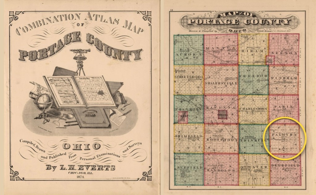
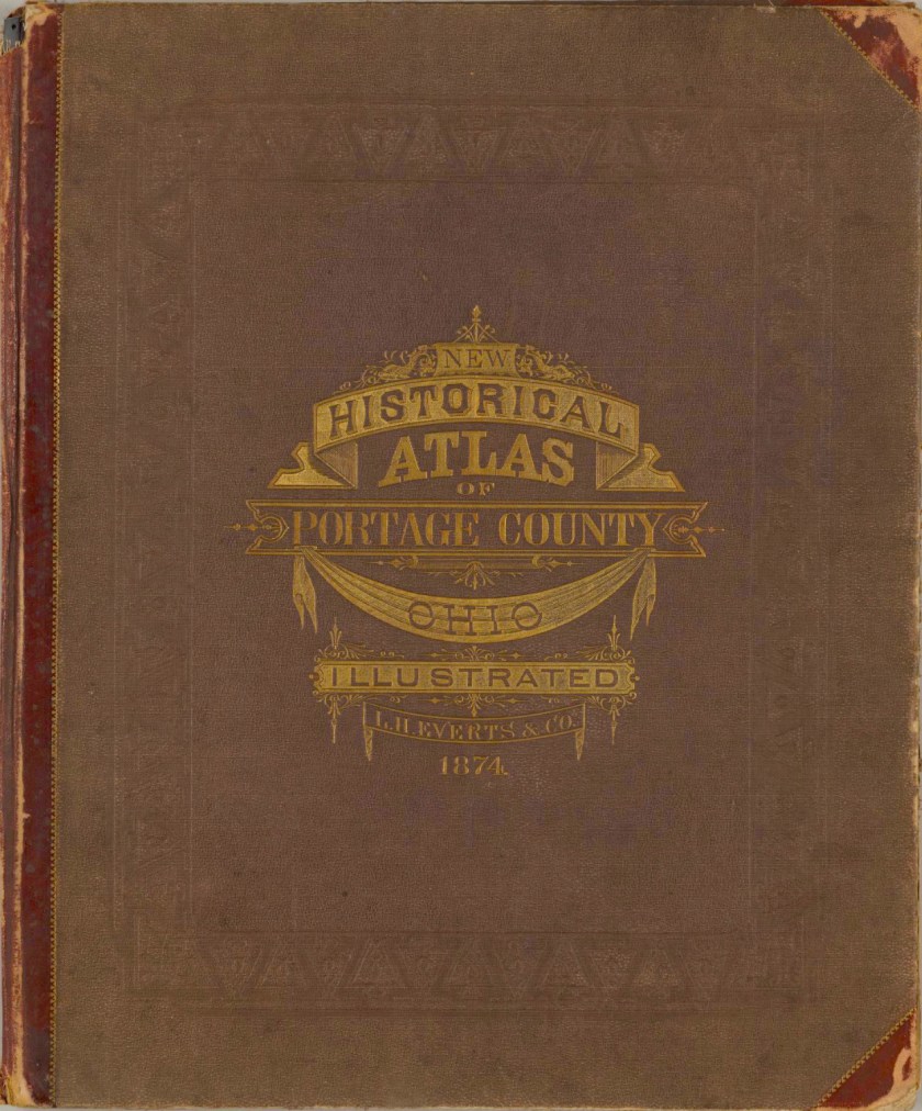
Frontispiece and Portage County map from the
Combination Atlas Map of Portage County, Ohio, by L.H. Everts, 1874.
(Image courtesy of David Rumsey Map Collection).
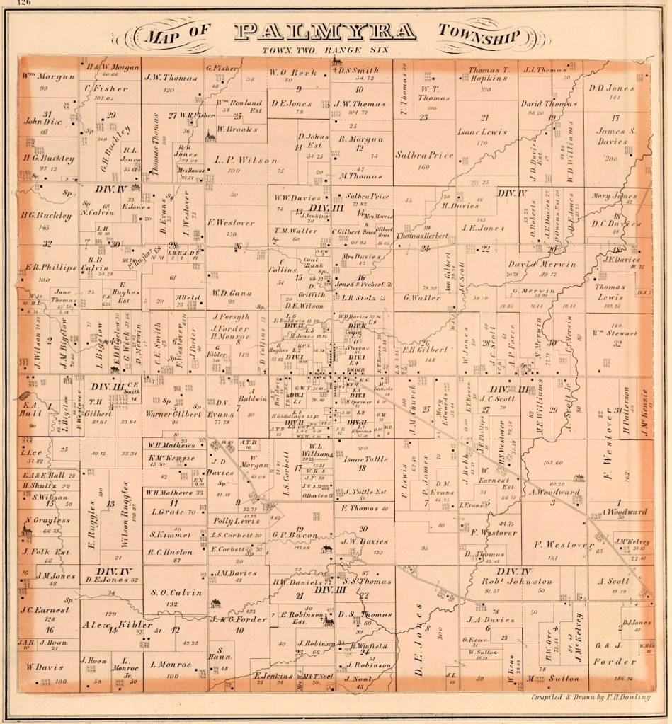
Page 126, Palmyra Township, Portage County, Ohio,
by L.H. Everts, 1874. (Image courtesy of David Rumsey Map Collection).

“The wish of Mrs. Roberts was to live in Palmyra since she first saw the area. They bought a farm here, and she lived here for nearly two years, and on the 22nd of April last they buried their little son, of 1 year and 18 days old — his disease — was (croup). The funeral was officiated by our parish minister Mr. Lloyd.” (Y Cenhadwr Americanaidd)

The child who died was their youngest son Hiram Roberts. “And after about seven weeks after the death of their son, Mrs. Roberts is very sick. The doctor was immediately sought, but despite all the ill devices our dear sister, and another doctor was requested, but despite getting help from a doctor, through everything all comfort failed, he could not work his way, and signs of death were to be found…” (Y Cenhadwr Americanaidd)

Sara (Harris) Roberts passed away on June 25, 1861, from causes that are not indicated in the records. She was 44 years old. In the footnotes, we have included her actual obituary originally published in the Welsh language. We have also translated the document into English.

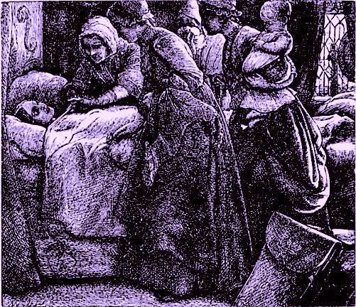
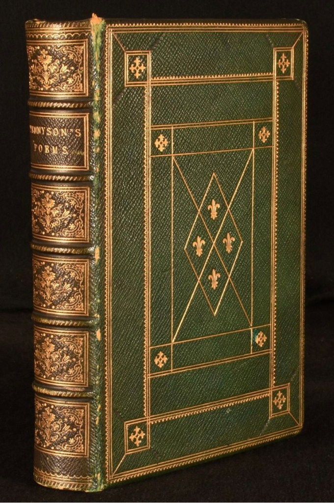
Deathbed engraving from The Lord of Burleigh, by John Everett Millais, circa 1857.
From an 1857 London book titled, Poems by Alfred Tennyson.
(Image courtesy of The Victorian Web).

Her death must have been devastating for Esau. These dark clouds in his life were about to get even darker because 1861 was also the beginning of the American Civil War. “The American Civil War (1861–1865) is the deadliest war in U.S. history, with an estimated 620,000 to 750,000 soldiers dying. This death toll exceeds the combined fatalities of Americans in World War I and World War II, representing a higher loss of life than all other American wars combined until roughly the Vietnam War.” (American Battlefield Trust)

When looking at the patterns in his life, and considering that his wife had just suddenly died, one gets the impression that he decided to just withdraw into himself. This is reinforced from reading the comments about him in his obituary, such as “He buried his wife, July, in 1861, which greatly affected his mind, and in poor health for some years after that… [and], He saw a lot of success and failure. He collected a lot of money through his zeal, and he lost a lot of money because of commercial misfortunes, and his willingness to put too much trust in men. He seems to be a man without a bad mind, and believes the best about people and things, or is thus caught unawares to himself.”

He changed his life away from the farmer’s life he had adopted, and retreated into what he knew earlier in life. (6)

The background map is derived from Ohio, by Samuel Augustus Mitchell, circa 1890. (Image courtesy of the David Rumsey Map Collection).

Esau’s Life After Sara’s Death

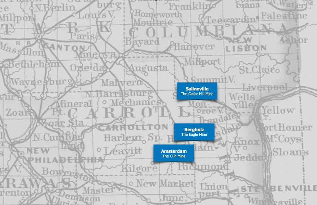
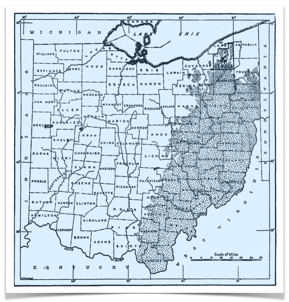
The borders where Columbiana County and Carroll County meet, contains the Amsterdam / Salineville coalfield, where there is a cluster of several mines. Esau could have worked at any of these locations when he was younger, but as he aged, he likely stayed near the Salineville coal mines. Among the mine names from that era are the following:

  • Salineville: The Cedar Hill Mine
  • Bergholz: The Eagle Mine, and the Lewis Mine
  • Amsterdam: The O.P. Mine, the Amsterdam Mine, the Wolf Run Mine, and the Jessie Mine

In The 1870 and 1880 Censuses, we see that Esau had returned to the part of Ohio where he lived before his wife Sara passed away. In 1870, he is found in Fox township, Carroll County, working again (at age 53), as a coal miner. Ten years later in 1880, the Census notes that “He is noted as a retired coal dealer.” We observed that his age is correctly recorded as his being 63.

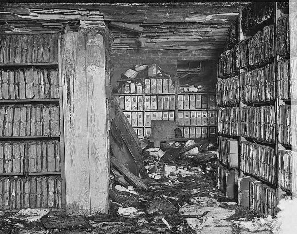
A fire destroyed the majority of the 1890 Census records stored in the basement
of the U.S. Department of Commerce on January 10, 1921.
(Image courtesy of The United States Census Bureau).

The 1890 Census was lost in a fire in the 1920s, so for the last full decade of his life, we do not know where he is. The United States Census Bureau writes about this tragedy, “A January 10, 1921 fire at the U.S. Department of Commerce building in Washington, DC, destroyed the majority of the population schedules from the 1890 Census. The fire left an enormous gap in many families’ genealogical record. Although alternative records may provide some information, the loss of the 1890 Census schedules remains an insurmountable obstacle for many researchers attempting to trace families between the 1880 and 1900 censuses.” (Census.gov) Between the fire, the water used to put the fire out, and the subsequent degradation of what was left through mold, mildew and decay… much was utterly lost.

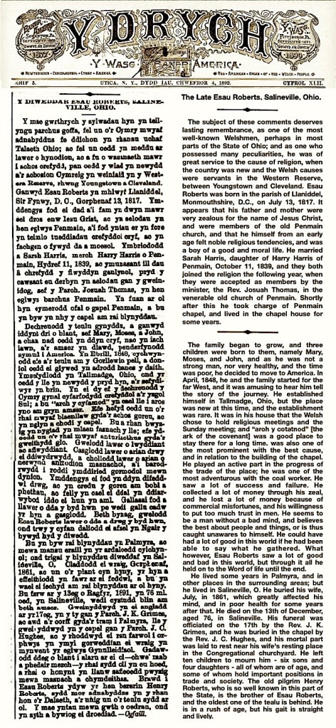
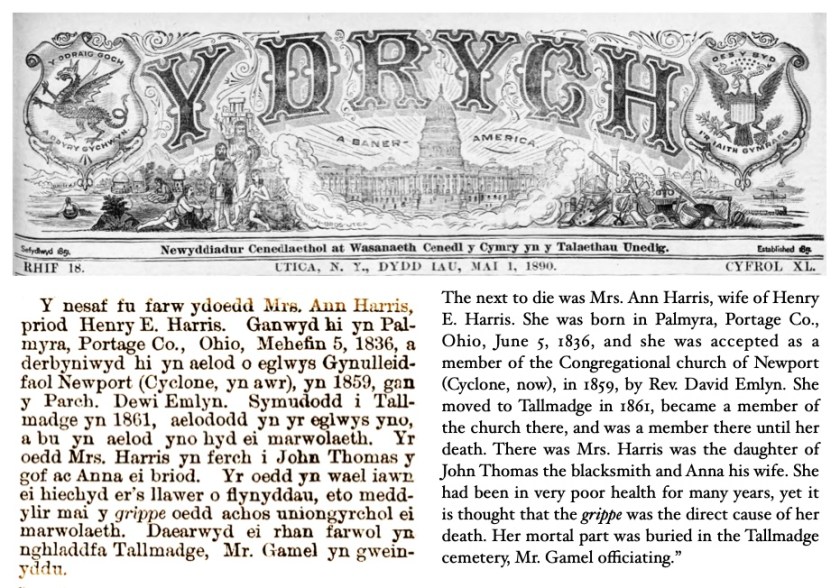
Esau passed away in June 1891, just over 30 years after his wife Sarah had passed away. He was about 74 years old when he finally set down his coal shovel. Like his wife, there was a very long obituary published about his life. His is in the Welsh language newspaper Y Drych, in the February 2, 1892 issue. In the footnotes, we have included his actual obituary originally published in the Welsh language. We have also translated the document into English.

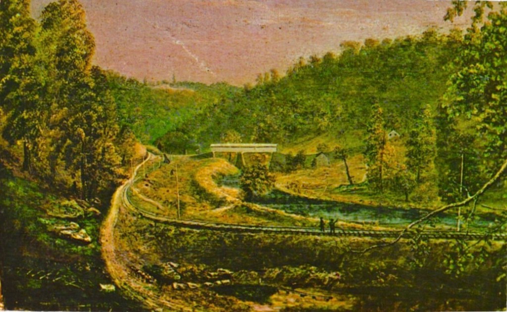
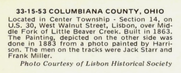
Vintage postcard of a Covered Bridge in Columbiana County, Ohio, circa 1883.
(Image courtesy of Ebay, via The Lisbon Historical Society).

The Find A Grave file for Esau closes with this comment, “The old pilgrim Henry Roberts, who is so well known in this part of the State, is the brother of Esau Roberts, and the oldest of the tealu that remains. He is also in the push of age, but his gait is straight and lively. – Friend.

The old Welsh word tealu, translates as the English word for — family.

Upcoming is our last chapter in the Williams / Harris Line, in which we learn about the life of Esau’s son Joseph A. Roberts, and his wife Augusta Young.

Following are the footnotes for the Primary Source Materials,
Notes, and Observations

Genealogy Gold!

(1) — three records

Y Cenhadwr Americanaidd (The American Messenger)
Autumn 1861
https://viewer.library.wales/2834819#?xywh=-3911,-1023,10309,5902
Book pages: 384-385, Digital pages: 24-25/40, (see the note following)
Note: The link above is the Permalink for the publication. To get to the file “A Brief Memory of Mrs. Sarah Roberts” you must enter 24 of 40 into the upper data field. This obituary covers two pages, 24 and 25.

Sara Harris
in the England & Wales, Non-Conformist and Non-Parochial Registers, 1567-1936
Rg4: Registers of Births, Marriages and Deaths > Monmouthshire > Independent > Piece 1246: Penmain (Independent), 1787-1833
https://www.ancestry.com/search/collections/2972/records/168121?tid=11298446&pid=182338476831&ssrc=pt
Digital page: 90/159, Left page.
Note 1: For her April 1, 1817 birth date and baptism record.
Note 2: Even though her FindaGrave file lists an 1819 birthdate, her birth / baptism record from Wales is 1817.

Esau Roberts
in the Monmouthshire, Wales, Anglican Baptisms, Marriages and Burials, 1551-1994
Llandenny > Mixed > 1710-1919
https://www.ancestry.com/search/collections/62107/records/215961?tid=&pid=&queryId=20a43592-6a87-4e7d-951e-989f80bb91e4&_phsrc=Lml27&_phstart=successSource
Book page: 4, Digital page: 212/1070, Left page, Entry No. 31, 7th of 8 entries. 
Note 1: His actual baptism date is December 28, 1817. It appears that he was the very last entry for the year 1817. > Lianhilleth, Monmouthshire
Note 2: His parents names are Joseph and Anne.
Note 3: His father is also a collier, (a coal miner).

The Old Church of Penmain

(2) — five records

Sarah Harris
in the Monmouthshire, Wales, Anglican Baptisms, Marriages and Burials, 1551-1994
Mynyddislwyn > Marriages and Banns > 1777-1906
https://www.ancestry.com/search/collections/62107/records/549329?tid=&pid=&queryId=a8dd07e6-6d4b-4589-96e2-e3189a00161e&_phsrc=ZcF21&_phstart=successSource
Book page: 46, Digital page: 279/933, Upper entry.
Note 1: The actual marriage date is November 19, 1839.
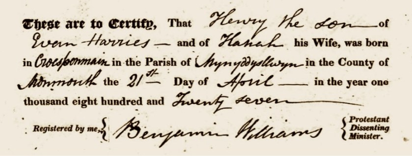
Note 2: We can see that his father’s name is Joseph, and her father’s name is Henry Harries.

This is what caused all of the hubbub in Penmain. (Image courtesy of https://en.wikipedia.org/wiki/Declaration_of_Sports#/media/File:Book_of_Sports.jpg).

Penmaen, Caerphilly
https://en.wikipedia.org/wiki/Penmaen,_Caerphilly
Note:
For the text.

A View of Penmaen Church
by John Norton, circa 1855
File:S. w. view of Penmaen Church, Monmouthshire.jpeg
https://commons.wikimedia.org/wiki/File:S._w._view_of_Penmaen_Church,_Monmouthshire.jpeg
Note: For the church image.

Essa Roberts
in the 1841 Wales Census
Monmouthshire > Mynyddyslwyn > ALL > District 5
https://www.ancestry.com/search/collections/8979/records/8358032?tid=&pid=&queryId=3478cf31-8920-4554-b4ce-375451305f30&_phsrc=wFr2&_phstart=successSource
Book page: 6, Digital page: 3 /9, Right page, middle.
Note 1: Essa 20, Sara 20, Mary 8 months.
Note 2: This Census was conducted in June 6, 1841, therefore, daughter Mary was born in September 1840.
Note 3: His profession is as a collier (a coal miner).

On the Caleb Grimshaw Ship Manifest

(3) — five records

Isiah Robert
in the New York, U.S., Irish Immigrant Arrival Records, 1846-1851
https://www.ancestry.com/search/collections/5969/records/512126?tid=&pid=&queryId=c14b932a-3a3b-4b44-b74f-43453e5d89fb&_phsrc=vDv43&_phstart=successSource
Note: For the passenger ship record.

New York, Passenger Lists, 1820-1920
Path: Follow these links to arrive at the Caleb Grimshaw passenger manifest for May 27, 1848:
> https://www.familysearch.org/en/search/image/index?owc=http://platform.prod.us-east-1.prod.fslocal.org/records/collections/1849782/waypoints
>> NARA Roll Number – Content, 0072 – 9 May 1848-31 May 1848
>>> https://www.familysearch.org/ark:/61903/3:1:939V-5K6B-8?wc=MX62-DZS:165749401&cc=1849782&cc=1849782&lang=en&i=525
Digital page: 526/838, Film # 004678332,
Note 1: There are 7 people listed at the bottom of the page, by their first initial and then the Roberts surname.
Note 2: Esau Roberts is listed under the name Isiah Robert along with his family.
Note 3: This is the same ship the Evan Harris family traveled on, and they are listed on the same page of the passenger manifest.

Willm. Robert
in the New York, U.S., Irish Immigrant Arrival Records, 1846-1851
https://www.ancestry.com/search/collections/5969/records/512133?tid=&pid=&queryId=962cf719-1047-4b48-83a5-5c11de55bc64&_phsrc=upI15&_phstart=successSource
Note: This is the file for the 15 year old young man who was traveling with the Esau and Sara Roberts family on the Caleb Grimshaw and is listed with them on the ship manifest. He must have been a relative, but we are not sure of he was connected to Esau and Sara Roberts.

Caleb Grimshaw
https://en.wikipedia.org/wiki/Caleb_Grimshaw#:~:text=4%20References-,Construction,May%201848%20and%20August%201849.
Note: For the Liverpool Mercury sailing notice and oil painting portrait of the ship.

On Two Continents and One Ocean

(4) — seven records

Mary Roberts
The 1841 Wales Census was conducted in June 6, 1841, when Mary was reported as being 8 months old. Therefore, she was born in September 1840.
https://www.ancestry.com/search/collections/8979/records/8358032?tid=&pid=&queryId=3478cf31-8920-4554-b4ce-375451305f30&_phsrc=wFr2&_phstart=successSource

Pvt George Moses Roberts
in the U.S., Find A Grave Index, 1600s-Current
https://www.ancestry.com/search/collections/60525/records/14346230
Note: George’s dates are August 10, 1844 to October 7, 1917.

Anna Roberts Miles
https://www.findagrave.com/memorial/80507437/anna-miles
Note: Anna’s dates are 1849 to December 4, 1895.

Benjamin Roberts
in the West Virginia, U.S., Deaths Index, 1853-1973
https://www.ancestry.com/search/collections/2568/records/2433079?tid=&pid=&queryId=db2c1a03-880f-400e-bebe-cb200b3fe816&_phsrc=dRA9&_phstart=successSource
Note: Benjamin’s dates are September 16, 1853 to August 3, 1915.

William H Roberts
in the 1910 United States Federal Census
https://www.ancestry.com/search/collections/7884/records/21539401
Note: For his birth year of 1858.
and
Wm Henry Roberts
in the Ohio, U.S., Death Records, 1908-1932, 1938-2022
Note: For his death date of August 25, 1940. Therefore, William’s dates are 1858 to August 25, 1940.

Sarah M Stitt
https://www.findagrave.com/memorial/78161907/sarah_m-stitt
Note: Sarah’s dates are 1859 to September 28, 1936.

Hiram Roberts
https://www.findagrave.com/memorial/89972944/hiram-roberts
Note: Hiram’s dates are April 5, 1860 to April 21, 1861

Living Here, and Then There…

(5) — five records

Asa [Esau] Roberts
in the 1850 United States FederalCensus
Ohio > Summit > Tallmadge
https://www.ancestry.com/search/collections/8054/records/19600952?tid=&pid=&queryId=591d7f74-4498-4108-a115-cbca010a5633&_phsrc=CZn1&_phstart=successSource
Digital page: 22/60, Lines 36 through 42
Note: ‘Asa’34, Sarah 20*, Mary 9, Eliza 7, Moses 5, John 4, Ann 7/12.
*The mother is mis-labeled? She should be about 33 years old at this point.
Observation: All the people in this census, including this family, are listed as being from England. For some reason, no one is listed as being from Wales. Was this a problem with the enumerator, or were the census-takers guided to write England, or United Kingdom if someone was from Wales?

Easy [Esau] Roberts
in the Ohio, U.S., County Naturalization Records, 1800-1977
https://www.ancestry.com/search/collections/60096/records/89211
Note: In the Court of Common Pleas, Summit, Ohio

Salineville, Ohio
https://en.wikipedia.org/wiki/Salineville,_Ohio

Atlas of Columbiana County, Ohio, 1870
by DJ Lake and Jean Sansenbaugher Morris
https://www.familysearch.org/library/books/records/item/619005-atlas-of-columbiana-county-ohio-1870-1902?offset=503981
Note 1: Salineville is located within Washington township. That map is plate 49, Digital page 45 of 266.
Note 2: The Salineville map is plate 53, which follows on Digital pages 46 -47 of 266.

The Review
https://www.reviewonline.com/news/community-news/2013/07/salt-festival-begins-today/
Note: For the text about the salt mining history in Salineville, Ohio.

Palmyra

(6) — nine records

David Rumsey Map Collection
Palmyra Township, Portage County, Ohio
from the Combination Atlas Map of Portage County, Ohio
by L.H. Everts, 1874
https://www.davidrumsey.com/luna/servlet/detail/RUMSEY~8~1~230086~5508390:Palmyra-Township%2C-Portage-County%2C-O?sort=pub_list_no_initialsort%2Cpub_date%2Cpub_list_no%2Cseries_no&mi=3&trs=7&qvq=q:Palmyra%20Township;sort:pub_list_no_initialsort%2Cpub_date%2Cpub_list_no%2Cseries_no;lc:RUMSEY~8~1
Book page: 126, Digital page: Follow the link above.
Note: For the 1874 Palmyra township map, the Atlas frontispiece, and the Portage County map.

Easy [Esau] Roberts
in the U.S., Selected Federal Census Non-Population Schedules, 1850-1880
Ohio > Agriculture > 1860 > Portage > Palmyra
https://www.ancestry.com/search/collections/1276/records/5895680?tid=&pid=&queryId=4b9cbced-d8c7-4659-96b7-9354811f43a7&_phsrc=nJE6&_phstart=successSource
Digital page: 1/6, Line 25.

Esay [Esau] Roberts
in the 1860 United States Federal Census
Ohio > Portage > Palmyra
https://www.ancestry.com/search/collections/7667/records/41939084?tid=&pid=&queryId=1b5f435d-cb53-481c-ba89-b0848e8e4693&_phsrc=nJE3&_phstart=successSource
Book page: Digital page, Lines through
Book page: 19, Digital page, 19/28 Lines 2 through 11.
Note: Esau 42, Sarah 17*, Eliza 17, Morris** 15, John 13, Ann 10, Joseph 9, Benjamin 6, Henry*** 5, Sarah M. 2, Hiram 3/12.
*The mother is mis-labeled? She should be about 43 years old at this point.
**This is George Morris Roberts.
*** This is William Henry Roberts.

Sarah Roberts
in the U.S., Find A Grave Index, 1600s-Current
https://www.ancestry.com/search/collections/60525/records/22712016
and
Sarah Harris Roberts
https://www.findagrave.com/memorial/43457288/sarah-roberts
Note 1: Her dates are 1819* to June 25, 1861.
Note 2: *Her actual birthdate is 1817 as per her birth record.
Note 3: About Alice Holland…

Y Cenhadwr Americanaidd (The American Messenger)
Autumn 1861
https://viewer.library.wales/2834819#?xywh=-3911,-1023,10309,5902
Book pages: 384-385, Digital pages: 24-25/40, (see the note following)
Note: The link above is the Permalink for the publication. To get to the file “A Brief Memory of Mrs. Sarah Roberts” you must enter 24 of 40 into the upper data field. This obituary covers two pages, 24 and 25.

Here is her obituary translated into English, but please remember that there are many factual errors (in the original below) which we have corrected (in this narrative).

__________________________________

A Brief Memory of Mrs. Sarah Roberts

It was Mrs. Sarah Roberts daughter of Henry and Ann Harris. Her father is known as the boy Harry Evan Harry, but she was the sister of Mr. Wm. Harris, owner of a colliery in Tallmadge, Ohio. She was born January 1, 1819, in a place called Nant Coi, near Cross Penmain, Mynyddislwyn, Monmouthshire.

He joined in marriage to Mr. Esay Roberts, son of Joseph and Ann Roberts, Oct. 11, 1839; and yes that year they both left under conviction for their condition, they dedicated themselves to the Lord and went with each other for fellowship in the old church of Penmain, where they were received into communion by Rev. Joshua Thomas, and and there they practiced their profession until the year 1818, why they decided to come to America.

On the 7th of April, 1848, they started from there to New York, and and they arrived in New York on May 25. They came from there to Tallmadge. Ohio, by the by the 7th September, where they lived seven months in the Independent church of Tallmadge, and loyal to his profession.

They moved from there in the year 1855 to Salineville, near Wellsville, Ohio. Where they were close with the English; then in 1857 they moved to a place near Danville, Illinois where they lived for about a year and eight months, when they came to the decision to come back to Ohio, and they came here to the Palmyra area in the year 1859.

The wish of Mrs. Roberts was to live in Palmyra since she first saw the area. They bought a farm here, and she lived here for nearly two years, and on the 22nd of April last they buried their little son, of 1 year and 18 days old — his disease — was (croup). The funeral was officiated by our parish minister Mr. Lloyd.

And after about seven weeks after the death of their son, Mrs. Roberts is very sick. The doctor was immediately sought, but despite all the ill devices our dear sister, and another doctor was requested, but despite getting help from a doctor, through everything all comfort failed, he could not work his way, and signs of death were to be found, and on the Sabbath day, June 23, everything showed that it was necessary to leave. She spoke a lot about religion through her affliction, and that Sunday night her husband asked her what she thought of Jesus Christ? He said with pride that Jesus was greater than the heavens, greater than the earth, and greater than the whole world, and that he was angry with his poor little soul. Then he broke out again, saying in Paul’s words, “Christ is my life.” A brother asked her what she thought about religion? He said that it was the dawn season of life, and that Christ was precious at that time; and about Monday morning, June 24, he remembered that old solemn verse, “I hear talk of death here’ & c., — Talk of death here today, yes, yes” — the tongue was too weak to reach the end of the verse. Eyes were darkening.

She often called for her beloved husband — she tried to comfort him and told him not to break his heart after her. Then she called her beloved children — she tried to advise them one by one, when she couldn’t find them. There was nothing but tears to be shed by everyone who was here but tears to be shed by everyone who was in the room — and the children kissing their dear mother in the midst of tears. Then she became unable to speak — the tongue was locked to the roof of her mouth. And Tuesday night, Jun. 25, the dear sister Mrs Roberts died at 41 years and 6 months old, leaving a spouse and 9 children to mourn her, along with many relatives, and the area. She was the mother of 14 children — 9 of whom were left alive. The father of the orphans will take care of her mourning. The funeral was officiated (in the absence of our beloved pastor) in the house by R. D. Davies (b..) at the graveside of Moses Williams, (M.C.;) in the chapel started by Shadrach James, and preached by D. M. Evans and D. Davies, Parisville.

With regard to the religious character of our dear sister she was humble, and faithful — she would be willing to come and meet grace as far as she could — but she always wanted to have the children with her — she would not have felt happy if the children were not with her for all the meetings. She showed great care for the souls of those under her care. She struggled day and night for her family; I believe that she prays a lot for her beloved children and her husband; but the last prayer has been offered, and the last advice has been given.

He always listened seriously under the word; she was often to be seen with tears on her cheeks, and signs to be found clearly that her soul was receiving edification; he wrote that he spoke to her many times, and hearing her recount the benefit and comfort she felt under the ministry of the word. She often says that she forgets the things of the earth when she hears talk of the things of the heavens. In the last friendship she had, I remember her saying her sweet experience and her tears on her cheeks, that she finds Jesus in everything and in everything, and everything else is nothing compared to Him. But she has now left the family on the floor, and gone home to the happy family in heaven, to be able to see Jesus as he is, and be eternally like him. Let the whole family be allowed to increase true religion here, so that they will have a right to heaven after leaving this life, and may the Father of the orphans take care of our dear brother together with his little orphans. Preached by Rev. J. Lloyd on the occasion after his return from Wales – the text given to him by our orphan brother was Phil. 1:21, “To me is Christ, and to die is gain.”

It is desired that the Reformer raise the above.
David M. Evans
Palmyra, September 9, 1861
__________________________________

American Battlefield Trust
Civil War Casualties
The Cost of War: Killed, Wounded, Captured, and Missing

https://www.battlefields.org/learn/articles/civil-war-casualties#:~:text=The%20Civil%20War%20was,casualties%20unprecedented%20in%20American%20history.
Note: For the statistics and text.

The 1857 edition of Tennyson’s Poems, via: Rooke Books,
https://www.rookebooks.com/1857-poems-alfred-lord-tennyson-first-illustrated-edition

The Victorian Web
Deathbed engraving from The Lord of Burleigh
by John Everett Millais, circa 1857
https://www.victorianweb.org/art/illustration/millais/18.html
Note: This was used in an 1857 London book titled, 
Poems by Alfred Tennyson, D.C.L., Poet Laureate.

Esau’s Life After Sara’s Death

(7) — eleven records

Amsterdam-Salineville Coalfield
https://www.coalcampusa.com/eastoh/amsterdam/amsterdam.htm
Note: For the mine location information.

David Rumsey Map Collection
Ohio. (Mitchell, Samuel Augustus), 1890
[Full title — County & township map of the states (sic) of Ohio and (sic).]
by Samuel Augustus Mitchell, (1890)
https://www.davidrumsey.com/luna/servlet/detail/RUMSEY~8~1~30579~1140106:County-&-township-map-of-the-states
Note: For the grouping of northeastern and eastern Ohio counties: Summit, Portage, Columbiana, and Carroll County.

Esay [Esau] Roberts
in the 1870 United States Federal Census
Ohio > Carroll > Fox
https://www.ancestry.com/search/collections/7163/records/39503557
Book page: 19, Digital page, 19/28 Lines 2 through 11.
Note 1: The location is Fox township, Carroll County, Ohio and he is again working as a miner — Esau 53, William H. 13, Sarah M. 11. We believe that Richard 30, could be a relative. Joseph 22 may also be another relative, but he is not his son. (His son Joseph is 20 years old and living in Paris township, Portage County).
Observation: As in 1850, all the people in this census, including this family, are listed as being from England. For some reason, no one is listed as being from Wales. Was this a problem with the enumerator, or were the census-takers guided to write England, or United Kingdom if someone was from Wales?
Note 3: Richard is likely a relative, we just have not learned how he connects to the family, but we discovered this —
Note 2:
Richard Roberts
https://www.findagrave.com/memorial/135279983/richard-roberts
Richard died in the Atwater Mining Disaster in Portage County, Ohio, see: https://atwaterhistoricalsociety.wordpress.com/coal-mines/
Also, here is an article from the Atwater Historical Society link (just above), which records the disaster:

Atwater Mine Disaster article courtesy of the Atwater Historical Society.

Esay [Esau] Roberts
in the 1880 United States Federal Census
Ohio > Carroll > Fox > 034
https://www.ancestry.com/search/collections/6742/records/25102186?tid=&pid=&queryId=711124be-5614-4da4-b181-1a5dd56ffc35&_phsrc=nJE4&_phstart=successSource
Book page: 31, Digital page,31/31 Line 6.
Note: He is noted as a retired coal dealer.

Census.gov
The United States Census Bureau
History and the Census: 1890 Census Fire
https://www.census.gov/about/history/stories/monthly/2021/january-2021.html
Note: For the text about the 1921 fire and the photograph.

Esau Roberts
in the U.S., Find A Grave Index, 1600s-Current
https://www.ancestry.com/search/collections/60525/records/54645622?tid=&pid=&queryId=25484045-65d5-4857-94c3-d4545252d23a&_phsrc=CZn3&_phstart=successSource
Note 1: There is an extensive Welsh newspaper entry for Esau posted at this file. There are some errors in information.
Note 2: We believe that the person listed as a child of this couple, Alice Gray Holland, is a mistaken data entry.
and
Esau Roberts
https://www.findagrave.com/memorial/89972947/esau-roberts?
Note: His dates are July 13, 1817 to December 13, 1891.
Monmouthshire, Wales > Ohio

The obituary for Esau Roberts as published in the Y Drych (Welsh newspaper),
for the February 2, 1892 issue. Notes: We compiled this specific piece of artwork from original sources for this chapter, and carefully managed a new and accurate translation of Esau’s obituary. The English translation is shown at right.
(Source: Llyfrgell Genedlaethol Cymru, The National Library of Wales).
—–
We have attempted to correct any factual errors from Esau’s obituary within this narrative.

Llyfrgell Genedlaethol Cymru
The National Library of Wales
Y Drych
(Welsh newspaper), February 4, 1892 issue
https://newspapers.library.wales/view/3540792/3540794
Newspaper page: 2, Right column, lower portion.
Note 1: The plain text version can be accessed through the manual links (which partition the articles) and are found on the lower portion of the webpage.

Ebay, via The Lisbon Historical Society
Vintage postcard of a Covered Bridge
in Columbiana County, Ohio, circa 1883.
https://www.ebay.com/itm/235364406307
Note: From the verso of the postcard…

The Williams / Harris Line, A Narrative — Ten

This is Chapter Ten of twelve, the chapter in which the life of Henry E. Harris, the son of Evan Harris, carries the family line forward. He joins with Ann Thomas in America, (whose family we profiled in Chapters Seven and Eight).

Before We Leave Mynyddyslwyn Parish

We could not help but notice that the record below that even though it is the same Beulah Chapel location as the previous chapter — it looks quite different from the previous generation, doesn’t it? Maybe someone decided that the amount of historical illegible calligraphy was just too much of a hassle and then decided to update their process? We think it was a good idea.

Henry E. Harris April 21, 1827 birth record in the register of the
Mynyddyslwyn (Beulah Chapel), Monmouthshire, Wales.

When Henry E. Harris was born in Mynyddyslwyn, Monmouthshire, Wales in 1827, he certainly had no idea that he would sail across the Atlantic Ocean and live his life in America. We thought it might be a good idea to have a look around the Mynyddyslwyn Parish before we leave it forever.

View of a stone bridge across the valley and river at Risca in Monmouthshire,
Coloured aquatint by Edward Pugh, circa 1810.
(Image courtesy of Wikimedia Commons via The National Library of Wales).

Monmouthshire has two main rivers which flow through the area of Mynyddislwyn and embrace the borders of the parish. On the western side there is River Sirhowy, and on the eastern side there is the River Ebbw. The painting above is typical of a scene which Henry would have seen in this parish.

Back then, this part of Wales was giving way from an agricultural economy, to an industrial economy which was based mostly on the mining and the processing of coal and metals. If you look carefully in the 1810 painting at the abundance of trees and the verdant green hills… you can observe a factory in the background billowing smoke into the distant background. An unforeseen circumstance of societal change from this time period was the degradation of the natural environments. The waterways especially became very polluted, and soils were degraded.

“Coal helped pave the way for the Industrial Revolution. But the benefits of coal did not come without a cost… Few places embody the latter view as much as South Wales, once the largest global producer of coal.” (Medium) Eventually, environmental laws reigned in these problems.The long and complicated clean-up process, which has been ongoing for decades, has transformed many former industrial sites into green spaces. (1)

Henry Harris & Ann Thomas’s April 30, 1861 marriage record in Portage, Ohio.

Henry Harris Marries Ann Thomas

We do not know how they met, but it’s probable that they were introduced through family or friends. In a community that was dominated by many Welsh immigrants, people just knew one another.

When they married, Henry was about 34 and Ann was almost 25 years old. (With this marriage, the Thomas name gave way to the Harris name). Within two years, their first child was born. Amongst their children, it is clear that they named their two oldest ones after Henry’s family members: Elvira, in remembrance of his young sister who had passed away, and Evan, in honor of his father.

  • Elvira (Harris) Williams, 1863 – 1889, Elvira carries the family line forward.
  • Evan Harris, 1864 – 1910
  • Rosanna ‘Rose Ann’ (Harris) Sasce, 1866 – 1944
  • Justin Harris, 1868 – 1903
  • John Harris, 1871 – 1906
  • Sarah ‘Sadie’ Harris, 1874 – 1906

What do the Censuses tell us?
Prior to their 1861 marriage, Henry and Ann each lived in the home of their parents. Henry was living in Tallmadge township, Summit County, Ohio. Ann was in living in the adjacent county to the East, in Palmyra township, Portage County.

They appear to have been a stable household for many years. In 1870, Henry’s mother Hannah was living with them. We did observe something intriguing in the 1880 Census. It could be that daughter Elvira may have been counted twice that year? In the Ancestry file, the Harris family is listed on the right-hand page, but on the left-hand page, a 17 year old girl with the (same) name of Elvira Harris is working at the nearby Richardson family home as a ‘hired girl’. Even though this ‘hired girl Elvira’ is one year younger, perhaps our Elvira Harris was counted twice in this census? (See footnotes).

1874 Tallmadge Township map showing property locations. The red circle indicates where the Henry E. Harris family had their property.
The Williams family (from Chapter 5), was living very close by.

When we studied the Census data for this family, we saw that Henry had been identified as coal digger, or a miner, for about 30 years, starting in 1840. That is a very long time to do what must have been rather difficult work. By the time of the 1870 Census, he seemed to change his hats, (so to speak) about his profession. He traded in his miner’s helmet for a straw farmer’s cap. Even then, being a farmer was still a lot of hard work!

As we shall see next, this combination of being a miner, or a farmer, was quite typical of Welsh immigrants. It was normal to seek out what they knew from their old communities in Wales. (2)

When Coal Was King

If there is something we all learn in life, it is that change is constant. In these decades, Tallmadge had a long run of prosperity through the mining of coal. But coal seams do eventually run out. This is how eventuality affected the community and may have influenced Henry E. Harris to put on his farmer’s hat.

“Two additional factors played important roles in the growth of the coal industry in Tallmadge: the completion of both the Ohio Canal through Akron in 1827 and the Pennsylvania & Ohio Canal in 1841 and the construction of Atlantic and Great Western Railroad lines through Tallmadge in 1864-1865. The connection by canal from Akron to Cleveland enhanced the ability of Tallmadge coal operators to efficiently supply fuel to steamers on the Great Lakes as well as Canadian gasworks in Toronto and Kingston. The Pennsylvania and Ohio Canal enabled Tallmadge coal operators to ship their coal from Akron to Beaver, Pennsylvania, on the Ohio River, thus opening up a still larger market. The coming of the railroad to Tallmadge permitted operators to ship their coal via rail to Akron as well as to Kent, Ravenna, and other points east. Within about twenty years, however, such shipments were abandoned due to the exhaustion of many of the larger veins of mineral in the Tallmadge mine fields. (A  History of Tallmadge Coal…)

In retrospect, it is difficult to actually see the traces that the coal industry left on Tallmadge all these years later. It doesn’t seem that the environmental impacts around there were as profound as they were in other parts of Ohio, (or in South Wales for that matter). Most people living today would look around at Tallmadge, and be completely unaware of the period when coal was king. (3)

An 1841 poster advertising passage to America, written in English and Welsh.
(Image courtesy of Wikimedia Commons via The National Library of Wales).

The Welsh Population of Ohio

This account of Welsh immigration from the BBC News service begins in Cardiganshire [now named Ceredigion], Wales, which was located northwest of Monmouthshire by the Irish Sea (the Atlantic Ocean).

“A total of 36 people left Aberaeron for Ohio in 1818, but by the end of the 19th Century there was a Welsh community there numbering close to 6,000.

Today, it is thought there may be about 100,000 people in the state who can claim some Welsh descent… The group landed at Chesapeake Bay, Baltimore, where their travails began in earnest. Traveling in wagons to Pittsburgh and then onwards by raft down the Ohio River, they intended to reach a pre-existing Welsh community in Cincinnati, 500 miles (800km) away. Exhausted, they spent the night in Gallia County – where their rafts blew away in a storm – and from there they never moved.

They subsidised their living farming poor land by working on the highway between Chillicothe and Gallipolis. From those harsh beginnings, Wales-Ohio project historian Arwel Jones explains the Welsh immigrants’ luck was about to change. ‘For a decade or more life was very tough and not many more followed the 36 to Ohio, then came the railways, and not long after, the civil war. The Welsh were hard workers, and used to iron, so they formed co-operative forges which made rails all over the US, and produced cannonballs for both the Unionists and the Confederates. That encouraged 3,000 or 4,000 more to leave Cardiganshire between 1830 and the end of the century, spawning success stories” (BBC News)

Further, we learned more about this mass migration of Welshmen. “In the early nineteenth century most of the Welsh settlers were farmers, but later there was emigration by coal miners to the coalfields of Ohio and Pennsylvania and by slate quarrymen from North Wales… As late as 1900, Ohio still had 150 Welsh-speaking church congregations.” (Wikipedia) (4)

We have written previously, an immigrant population seeks out what they know when relocating to a new community. This was very true for many of our family lines. For the Williams, Harris, and Thomas lines, almost all generations were either farmers, or miners. Although that is indeed true and this generation continued to do the same vocations, the world was changing again and becoming much more modern.

Just think of all the changes

Ann Harris died on April 11, 1890 of pneumonia. We were able to locate her obituary in the Y Drych Welsh language newspaper. Originally published in Welsh, we translated it into English (as shown below on the right). “Y Drych, established in 1851, was a weekly Welsh-language newspaper published by Mather Jones. It contained news and information, focusing on religious matters.” (Wikipedia)

The obituary for Ann (Thomas) Harris as published in the Y Drych (Welsh newspaper),
for the May 1, 1890 issue. Notes: We compiled this specific piece of artwork from original sources for this chapter, and carefully managed a new and accurate translation of Ann’s obituary. The English translation is shown at right.
(Source: Llyfrgell Genedlaethol Cymru, The National Library of Wales).

Henry E. Harrris seemed to have lived his life like the Welsh rivers that he viewed as a child — flowing from the landscape Wales, across the Atlantic Ocean, to the farm fields and coal seams of Northeast Ohio. Henry lived much longer than his wife, carrying on well into the 20th century, passing away on April 25, 1920, just after his 93rd birthday. Just think of all the changes he bore witness to in his long life! (5)

Following are the footnotes for the Primary Source Materials,
Notes, and Observations

Before We Leave Mynyddyslwyn Parish

(1) — three records

Henry Harries
in the England & Wales, Non-Conformist and Non-Parochial Registers, 1567-1936Rg4: Registers of Births, Marriages and Deaths
Monmouthshire > Baptist > Piece 0630: Mynyddyslwyn, Beulah Chapel (Baptist), 1803-1837
https://www.ancestry.com/search/collections/2972/records/45968
Book page: 19 or 21, Digital page: 25/119, Last entry on page.
Note: For the record of his April 21, 1827 birth.

The National Library of Wales
View of a stone bridge across the valley and river at Risca in Monmouthshire,
Coloured aquatint by Edward Pugh, circa 1810
https://commons.wikimedia.org/wiki/File:View_of_a_stone_bridge_across_the_valley_and_river_at_Risca_in_Mon.jpeg
Note: A view of the bridge at Risca, showing horses pulling ore and coal wagons along the tramroad. The copper works can be seen in the distance.

Medium
A Future Black as Coal? — The Underground Heritage of Wales
https://medium.com/tourism-geographic/a-future-black-as-coal-a019113680db
Note: For the text.

Henry Harris Marries Ann Thomas

(2) — twelve records

Henry E. Harris
Marriage – Ohio, County Marriages, 1789-2016
https://www.familysearch.org/ark:/61903/1:1:XZD5-64M?lang=en
Book page: 1216 Digital page: 628/637, Left page, first entry.
Note: For the copy of the April 30, 1861 marriage record.
and
Henry E. Harris
in the Ohio, U.S., County Marriage Records, 1774-1993
https://www.ancestry.com/search/collections/61378/records/2833785
Note: Their marriage date is April 30, 1861.

For the names and dates of their children we looked at and reconciled many sources, such as family trees, Find A Grave profiles, etc. Here is one example for a family tree (which is not ours):
https://www.ancestry.com/family-tree/person/tree/62607448/person/282197451285/facts

H. E. Harris
in the U.S., Indexed County Land Ownership Maps, 1860-1918
Ohio > Summit, 1874
https://www.ancestry.com/search/collections/1127/records/3962102
Digital page: 85/138

1850
Evan Harris
in the 1850 United States Federal Census
Ohio > Summit > Tallmadge
https://www.ancestry.com/search/collections/8054/records/19601199?tid=62607448&pid=282197451798&ssrc=pt
Digital page: 28/60, Lines 31 through 36.
Note 1: Evan 46, Hannah 58, Henry 23, Mary 16, Hannah, Alvira 10.
Note: Evan is listed as a coal digger (miner).
Note 3: Contributor C. E. Tabbert’s notes on daughter Elvira from the FindaGrave website:
https://www.findagrave.com/memorial/269329914/elvira-harris

1850
Ann Thomas
in the 1850 United States Federal Census
Ohio > Portage > Palmyra
https://www.ancestry.com/search/collections/8054/records/19581414
Book page: 207(?), Digital page: 8/26, Lines 28 through 35.
Note: John 51, Hannah 52, Rees 19, Ann 15, Margaret 12, David 9, John 6, Anna Jenkins 4.

1860
Hannah Harris
in the 1860 United States Federal Census
Ohio > Summit > Tallmadge
https://www.ancestry.com/search/collections/7667/records/42152554
Digital page: 15/30, Lines 1 through 9.
Note 1: Hannah 58, Henry 53*, Sarah 30, Mary 26, Anna (Hannah) 22, Thomas 3, Daniel 1, Henry Rees 9, Eliza Rees 7
*His age should be listed as 33.
Note 2: Where is the father Evan? Henry is listed working as a miner.
Note 3: Daughter Sally had previously married Solomon Reese (presumably by the 1850 Census, because she is not listed). Her children, Henry (9) and Eliza (7) are living with this family. (See footnotes in Chapter Nine).

1860
Ann Thomas
in the 1850 United States Federal Census
Ohio > Portage > Palmyra
https://www.ancestry.com/search/collections/7667/records/41939194
Book page: 66-67, Digital page: 8-9/26, See note below.
Note 1: John 61, Anna 62, Rees 19, Ann 24, Margaret 22, David 19, John1 6, Anna Jenkins 14.
Note 2: This census carries over two pages. The parents are on lines 39-40 on page 66; the rest follow lines 1-5 on page 67.

1870
Henry Harris
in the 1870 United States Federal Census
Ohio > Summit > Tallmadge
https://www.ancestry.com/search/collections/7163/records/37748887
Book page: 7, Digital page: 7/32, Lines 10 through 16.
Note: Her parents are Henry and Ann.
Note: Henry 43, Ann 32, Elvira 8, Evan 6, Rosanna 4 , Justin 1, Hannah 72.
Note: Henry Harris, his wife Ann*, and his mother Hannah are born in Wales; all others, Ohio.
Note 1: * This is an enumeration error. Ann was born in Ohio.
Note 2: His occupation is Miner.

1880
Henry E. Harris
in the 1880 United States Federal Census
Ohio > Summit > Tallmadge > 181
https://www.ancestry.com/search/collections/6742/records/18590812
Book page: 21, Digital page: 21/30, Lines 16 through 23.
Note: Henry 53, Ann 44, Elvira 18, Evan 16, Rosanna 14 , Justin 12, John 10, Sarah 6.
Note: It is interesting to note on the adjacent left page (Digital page: 20/30), on line 49 — https://www.ancestry.com/search/collections/6742/records/18590623
A 17 year old girl with the (same) name of Elvira Harris is working at the nearby Richardson family home as a ‘hired girl’. Even though this ‘hired girl Elvira’ is one year younger, perhaps our Elvira Harris was counted twice in this census?

When Coal Was King

(3) — two records

Akron-Summit County Public Library
A  History of Tallmadge Coal:
A Tale of Woodchucks, Welshmen, and a Canal
by Judy Anne Davis, 2006
https://www.akronlibrary.org/images/SpecCol/TallmadgeCoal_.pdf#:~:text=
Notes: In library reference use only. For the texts about the mining operations
and coal seams running out, etc.

Vector
Agriculture Tools
https://www.freevector.com/agriculture-tools-111636
Note: For the image of farm tools.

The Welsh Population of Ohio

(4) — three records

The National Library of Wales
An 1841 poster advertising passage to America,
written in English and Welsh
https://en.wikipedia.org/wiki/Welsh_Americans#/media/File:Emigration_To_New_York_1841.jpg

BBC News
Marking 200 years since Welsh settlers arrived in Ohio
https://www.bbc.com/news/uk-wales-44240447
Note: For the text about Welsh immigrants to Ohio.

Welsh Americans
https://en.wikipedia.org/wiki/Welsh_Americans
Note: For the text.

Just think of all the changes

(5) — seven records

Ann Harris
in the U.S., Find a Grave Index, 1600s-Current
https://www.ancestry.com/search/collections/60525/records/125051575
Note: Census data documents and her birth record, and her obituary say that she was born in OHIO. Only the 1870 Census indicates Wales for her birth, which is likely an error.
and
Ann Thomas Harris
https://www.findagrave.com/memorial/151377869/ann-harris
Note: Her dates are from June 5, 1836 to April 11, 1890.

Anna Harris
in the Summit County, Ohio, U.S., Death Records, 1866-1908
Death Index Registers, 1869-1908 > E – K
https://www.ancestry.com/search/collections/1596/records/47484
Book page: 110, Digital page: 160/169
Note: This confirms her death date of April 11, 1890, (pneumonia).

Llyfrgell Genedlaethol Cymru
The National Library of Wales
Y Drych
(Welsh newspaper), May 1, 1890 issue
https://newspapers.library.wales/view/3539982/3539985
Newspaper page: 3, Right column, lower portion.
Note: Center section of an article titled Tallmadge, Summit Co., O.
Note: The plain text version can be accessed through the manual links (which partition the articles) and are found on the lower portion of the webpage.

Y Drych
https://en.wikipedia.org/wiki/Y_Drych
Note: For the data.

Henry E. Harris
in the U.S., Find a Grave Index, 1600s-Current
https://www.ancestry.com/search/collections/60525/records/240217665?tid=&pid=&queryId=3ce57210-d200-4299-8f41-578eb079cf81&_phsrc=NmT5&_phstart=successSource
and
Henry E. Harris
https://www.findagrave.com/memorial/269323209/henry_e-harris
Note: His dates are, 1827 to April 25, 1920.

The Williams / Harris Line, A Narrative — Nine

This is Chapter Nine of twelve, where for a period of time, packet ships dominated travel and immigration between the United Kingdom and America. Once in America, the Harris brothers — Evan and William — make their mark in Tallmadge, Ohio.

We are fortunate in our research when we come across a birth register in which there are many answers for what we are seeking with a family line. Such is the case with the Mynyddyslwyn, Beulah Chapel (Baptist) Registry, in Monmouthshire, Wales.

A Registry for 3 Sons

We meet our ancestor Evan Harris in Monmouthshire when his birth and baptism is recorded, along with those of his brothers William and Henry Jr.. As we learned in the last chapter, their parents are named are Henry Harris and Ann (Unknown). (Observation: In some other records, Harris is sometimes spelled as Harries, when we know we are reading records about the same people).

Registration of both the birth and baptism dates for Evan Harris (at top),
along with his brothers William, and Henry Jr. (following). From the
Mynyddyslwyn, Beulah Chapel (Baptist) Registry, in Monmouthshire, Wales.

In the 1806 baptismal record for Evan Harris, the entry states that he was “October the 5th 1802 and baptized November _?_ 1806”. Throughout his life, it became clear that Evan (and also his wife Hannah) were unclear on their exact ages, because the records vary somewhat. We have seen this with many other family lines, when the ancestors lived in a pre-literate world. (1)

Evan Harris Marries Hannah Morris

It took us a long while to locate his marriage record and make sense of what we found. Does the name Evan Evans sound familiar? (Of course not). We had been looking for our Grandfather who was named Evan Harris. It seems that whoever was writing this record was a bit confused when writing with their quill pens. We know that this is the correct marriage because of the ages of the people involved, their ages, and the parish. We’ll explain further below the marriage record .

This image has an empty alt attribute; its file name is page-79-marriage-record.1.jpeg
Marriage record for Evan Harris and Hannah Morris in Mynyddyslwyn Parish, Monmouthshire, Wales, on August 16, 1824. Please notes that there are recording errors which we explain below.

When you look at the details, the parish name is misspelled, as Monyddysloin. This name never existed as a real parish, but is certainly a phonetic spelling of the true name Mynyddyslwyn. (Historic records confirm this). Also, it is clear that in a preliterate world, Evan Harris and Hannah (Morris) Harris signed their names with an X, as most of our ancestors did before (circa) the 1880s. They couldn’t verify what was written, but had to rely on the kindness of others for this type of thing.

This image has an empty alt attribute; its file name is rris.1.jpeg

Further, if you look at the actual penmanship for their recorded names, it appears that the last portion, the ‘r-r-i-s’ letters, which both surnames share, look very much the same. as in H-a-r-r-i-s, not E-v-e-r-r-i-s. We don’t know what was going on in the room at the time, put whomever recorded this made a mistake.

Finally, there is a man named Evan Evans living in Monmouthshire at this time, in another parish. In 1824, he is marrying a woman named Rachel Thomas. (Please see the footnotes). (2)

Mysteries Concerning Young Elvira From 1840

We know that Evan and Hannah had at least six children. All of them were born in Mynyddyslwyn Parish, Monmouthshire, Wales.

  • Henry E. Harris, 1827-1920, Henry carries the family name forward.
  • Sally [or] Sarah (Harris) Reese Lewis, 1829-1894*
  • Ann Harris, 1831-Unknown date
  • Mary (Harris) Morris, 1833-1890
  • Hannah (Harris) Thomas, 1838-1910
  • Elvira Harris, 1840-Unknown date
    *She was recorded as Sarah on the 1841 Wales Census, but it appears she used the name Sally in America.

There are a couple of mysteries about their youngest daughter Elvira...
We know she was born in Wales and came to America with her family. For that journey she would have been 8 years old, but mysteriously, she is not listed on the manifest. We thought that perhaps she could have come over with Evan’s younger brother William, since his family moved to America in the same time frame. We found no evidence of that. We poured over the 10 page manifest for their ship, the Caleb Grimshaw, but did not see any entry for an E. Harris at 8 years of age. We noticed that in the entire manifest, there is only one additional mark — it is a deliberate checkmark [√] next to the mother Hannah Harris’s name. Could this notation be the only indication that there was a young child being carried in her mother’s arms?

Elvira is listed on the 1841 Wales Census as being one year old, and she is also found on the 1850 Tallmadge, Ohio Census. Therefore, we know that she traveled from Wales to Ohio by some means. Perhaps the record keeper at the immigration point in New York just missed her?

The Harris family listed on the manifest for the ship Caleb Grimshaw,
with the arrival date in New York of May 27, 1848.

We learned from the Find A Grave website [contributor C. E. Tabbert’s notes] that Elvira “was listed on the 1850 Tallmadge Census age 10… as deaf and dumb… [and] the 1860 census does not have her listed… [nor is she listed in the 1868 draft of her father Evan’s Will]. The name in the Tallmadge Cemetery Lot Book is written over and illegible. There is a headstone in that area of the cemetery that has fallen on its face and is also unreadable. I believe that Elvira is buried in Grave 6. Her parents, brother and other family members are buried in this same lot.” (3)

It’s True. Timing Really Is Everything.

We have speculated about why the Harris family came to the decision to immigrate to America. The only thing that has made sense is the idea that they learned through either friends or (perhaps) family that there were riches to be made, and opportunity to be had, in America. An old story, that was new at that time. The point is, they came and prospered.

This family immigrated to America in 1848 on board the packet ship Caleb Grimshaw. It appears from the ships short history that they were likely on the premier voyage (or close to the premier) when the ship left Liverpool for New York. Their timing was a blessing.

Left to right: Sailing notice for the Caleb Grimshaw to New York,
from the Liverpool Mercury, 1849. Oil painting of the Caleb Grimshaw by Samuel W. Walters,
circa 1848. Walters was considered to be Liverpool’s leading marine artist at the time.
(Both images courtesy of Wikimedia Commons).

Here is the history of the Caleb Grimshaw ship…
“When the influx of Irish migrants hit Liverpool [England] with the start of the potato famine in 1845, an estimated 1.5 million desperate people crossed the Irish Sea heading for the city, three quarters of which then boarded ships to New York, Philadelphia, or elsewhere.

Whilst living in New York in 1818, British merchant Jeremiah Thompson had pioneered the concept of the sailing packet which was guaranteed to depart on schedule rather than (the traditional) waiting until its hold was full. Offering a time table, his Black Ball Line revolutionized the transatlantic trade. British and American merchants joined forces to take full advantage of the migration boom. The Liverpool firm of Caleb Grimshaw & Company, specialists in migration traffic, teamed up as agents for Thompson in 1842 to take charge of the Liverpool to New York route.

It is not often that we get to show the beginning and ending points for a journey like this one.
Left to right: The Liverpool port area, showing the Waterloo Dock, where their ship
would have departed England. Then, the Lower Part of New York City, 1851, with an arrow indicating the Black Star Line piers, where their ship would have docked.
(Images courtesy of Grimshaw Origins and History).

One of the vessels operated by Grimshaw was the wooden packet ship Caleb Grimshaw (named after the company’s late founder). Built at William Henry Webb’s shipyard in New York and launched in early 1848, she sailed from Liverpool’s Waterloo Dock to New York under command of Captain William Hoxie with a crew of thirty men, carrying a maximum of 427 migrants.

The ship completed a total of five trips before disaster struck on her sixth crossing in November 1849 with 425 migrants aboard. A fire created panic and chaos. A lack of leadership drove some passengers to take matters into their own hands, lowering one of the ship’s boats which crashed into the water. Twelve people were swept away and drowned. Another boat was lowered by the crew, equipped with supplies of food and water for a select number of passengers.

The next morning, with the blaze raging, a boat was reserved for the captain’s wife and daughter who were joined by some of the first-class cabin travelers. Later that day Hoxie himself abandoned ship. The unfortunate migrants in steerage were left behind to fend for themselves, building survival rafts with remaining members of the crew on board.

This engraving shows a similar incident from the same year.
Fire Consumes The American Packet Ship Ocean Monarch,
English Wood Engraving by Morel Fatio, 1848. (Image courtesy of Amazon.com).

Help arrived on the fourth day when the trading barque Sarah, sailing from London to Halifax, drew alongside. Her master David Cooke first rescued the passengers on the boats and rafts, leaving more than 250 passengers on board clinging to the burning wreckage. It took a total of ten days to save the last of the survivors and deliver them safely to the port of Flores in the Azores. When the Caleb Grimshaw finally sank, the lives of ninety migrants had been lost.” (New York Almanack) The Caleb Grimshaw only made five voyages, and this disaster was obviously her last trip.

Since our ancestors lived in a community where many immigrants from Wales and Ireland had moved to, it is likely that they eventually learned of this disaster. One wonders what they may have thought? (4)

Enlarged detail from Ohio, as originally published in Morse’s North American Atlas, 1842.
(Image courtesy of the David Rumsey Map Collection).

The Harris Brothers Make Their Mark

Evan’s brother William H. Harris was living in the area near to Tallmadge township, Ohio in the very early 1840s, so he obviously immigrated to America before his brother’s family. We know this from records in the Tallmadge cemetery which correspond to the larger family circle*. Since William arrived at least seven years before his brother Evan did, he was established and connected to the community in the area.
*Please see the footnotes regarding his 1841 marriage, and the 1842 birth of his oldest son John Harris.

Communication back then took much more time, but when there is work and opportunity, word still travels pretty far. We are sure that both word-of-mouth and Welsh language newspapers carried the news that coal mining was available and would let you transplant your family to the opportunities in America.


Black ink wash on paper Coal Mining Scene, by Harry Sternberg.
(Image courtesy of the Amon Carter Museum of American Art).

The following is both derived from and quoted from in several sections: A History of Tallmadge Coal: A Tale of Woodchucks, Welshmen, and a Canal, by Judy Anne Davis. It is one of the few publications which document the life of the Welsh community in Tallmadge.

“Coal was first discovered in the southeast corner of the township, with another discovery attributed to a woodchuck digging on ‘Coal Hill’ around 1810. In 1819 or 1820, Samuel Bronson and Samuel Newton opened a mine in the bluff of Coal Hill. By 1827, Henry Newberry began hauling coal by wagon to Lock 16 on the Ohio Canal to sell in Cleveland, although initial sales were slow. Daniel Upson arrived in 1832, recognized the potential, and secured a charter from the Ohio State Legislature in 1838 for the Tallmadge Coal Company. This company consolidated most of the mining rights in Coal Hill, excluding Newberry’s, ultimately controlling around 500 acres.

[This made us take notice…] By 1852, Upson and another major operator, William H. Harris, were shipping 10 to 20 tons of coal daily. In 1855, the Tallmadge Coal Company produced 23,000 tons of coal. The mines operated heavily through the 1850s, with over 300,000 tons removed from just 60 acres by 1857. The industry largely defined the industrial development of early Tallmadge before fading in the late 19th century.”

Tallmadge, Ohio 1856 Old Town Map. This image shows Tracts II and VI where William
and Evan Harris held their coal land dealings, during the period matching their records.
(Image courtesy of Old Maps).

Specifically, this document went into more detail about our ancestors. Evan’s brother William was very successful in this business enterprise. From page 13 of the same document —

“By the early 1840’s another Welshman, William Harris, had arrived in Tallmadge and quickly started operations of his own in a coal bank in Tract 2, east of Long Swamp and northeast of Howe Road. He soon had three mines in operation and employed 50 men. Harris is noted especially for his efforts to not only recruit Welshmen to the community but also to assist them in establishing themselves once they arrived. Many of the men he recruited came directly from Wales; when they arrived, he frequently supplied furnished living quarters for them until they had earned enough to go out on their own. The efforts of Harris undoubtedly drew many additional families from Wales into this area.”

These records are excerpted from the indexes in the A History of Tallmadge Coal… document.

“Harris, too, increased his holdings both by purchase and lease. Land transaction records show that he concentrated his efforts in Tracts 2 and 6. Harris is known to have operated three mines in the area; in addition to the two which were served by his rail road and located east of his home in Tract 2, he also had an entry in the high ground of Tract 1 between Northwest Avenue and Howe Road at the northwest six corners.” (A  History of Tallmadge Coal…) (5)

The Old Welsh Church in Tallmadge

In chapter 5 we wrote about the famous Congregational church which stands to this day at the center of Tallmadge Township. The Harris family may have attended services there, but they could have preferred services at a chapel which conducted services in their native Welsh language.

“Despite this acceptance on the part of the Congregational Church, many of the Welsh longed for a church of their own where services could be conducted in their native language. This was particularly true of those for whom English was an insurmountable challenge.” In about 1860 the town erected a building.

The Old Welsh Church after it had been abandoned, circa 1920s.
(Image courtesy od Summit Memory).

“Mrs. Martha P. Bierce provides a personal sketch of the church in an article she wrote for the Tallmadge Sesqui-Centennial which was then published in the book, A History of Tallmadge, Ohio. According to her description, the church… ‘was a small frame building with a seating capacity of 75 to 100. Perhaps its only claim to beauty was the unusual fan light (window) centered over the double front door, door, There were nice pews with green cushions, a chandelier for coal-oil lamps, and a coal burning stove. Upon the wall hung an antique clock…

Finally, there came a day when all of the church founders were gone. Their descendants having become thoroughly Americanized, gradually drifted away from the old church and from the mother tongue. For many years the old landmark stood abandoned, clinging helplessly to its foothold on the hill. The land reverted to the farm of which it was originally a part. Grading for a paved road made the position of the building precarious and it was thought best to tear it down.” (A  History of Tallmadge Coal…) (6)

Where Was Evan in 1860?

When we see the Tallmadge United States Census for 1850, nothing that unusual stands out. Evan describes himself as a coal digger. The 1860 Census is the similar, where his son Henry describes himself as a miner. There is one thing however on the 1860 Census, — where is Evan? His entire family is listed, but he is not there. We have a record of him paying taxes in Tallmadge in 1861, so likely wasn’t too far away for the rest of the decade. (This 1860 Census mystery is one that we have not yet solved, since he lived until 1869).

Evan Harris died on March 9, 1869 and his Will, which was drafted a year earlier, provides for his wife Hannah and each of his children, as well as some of his grandchildren. Hannah lived on after him for nearly ten years, passing on December 26, 1878 while living in the home of her son, Henry E. Harris, and his family.

It is his family, that of Henry E. Harris and Ann Thomas, which we will be writing about in the next chapter. (7)

Following are the footnotes for the Primary Source Materials,
Notes, and Observations

A Registry for 3 Sons

(1) — five records

Evan Harris
in the England & Wales, Non-Conformist and Non-Parochial Registers, 1567-1936
Rg4: Registers of Births, Marriages and Deaths > Monmouthshire > Independent > Piece 1246: Penmain (Independent), 1787-1833
https://www.ancestry.com/search/collections/2972/records/150167990
Digital page: 53/159, Right page.
Note: His baptism record. Three records for sibling births and baptisms are recorded at the same time in this register — Evan 1802, William 1804, Henry 1807.

Evan Harris
in the U.S., Find A Grave Index, 1600s-Current
https://www.ancestry.com/search/collections/60525/records/125051446
and
Evan Harris
https://www.findagrave.com/memorial/151377723/evan-harris
Note 1: His birth and death dates are, 1801 – March 9, 1869.
Note 2: From the Find A Grave file, Evan was the brother of William H. Harris. Both brothers were from Wales and settled in Tallmadge around 1840.

Hannah Harris
in the U.S., Find A Grave Index, 1600s-Current
https://www.ancestry.com/search/collections/60525/records/125051509
and
Hannah Harris
https://www.findagrave.com/memorial/151377791/hannah-harris
Note: Her birth and death dates are 1796 – December 26, 1878.

Evan Harris Marries Hannah Morris

(2) — two records

Evan Evans
in the Monmouthshire, Wales, Anglican Baptisms, Marriages and Burials, 1551-1994
Mynyddislwyn > Marriages and Banns > 1777-1906
https://www.ancestry.com/search/collections/62107/records/548206
Book page: 79, Digital page: 154/933, Right page, top.
Notes: The parish name is misspelled, and Evan Harris’s surname was incorrectly noted when the record was recorded. Observe that they signed their names with an X, so they likely could not read the record to verify it.

(The real Evan Evans…)
Evan Evans
in the Breconshire, Wales, Marriage Index, 1813-1837
https://www.ancestry.com/search/collections/1175/records/4372
Note: See the suggested search items which support that this person is not the husband of Hannah (Morris) Harris.

Mysteries Concerning Young Elvira From 1840

(3) — three records

Henry Harries
in the England & Wales, Non-Conformist and Non-Parochial Registers, 1567-1936
Rg4: Registers of Births, Marriages and Deaths
Monmouthshire > Baptist > Piece 0630: Mynyddyslwyn, Beulah Chapel (Baptist), 1803-1837
https://www.ancestry.com/search/collections/2972/records/45968
Book page: 19 or 21, Digital page: 25/119, Last entry on page.
Notes: His birth record with his parents Evan and Hannah Harries. The Harris surname is misspelled as Harries on the Ancestry file name.

Birth and death dates for their children
Note: we have compiled and reconciled the birth and death years from various sources for the family from the following link, and other sources.
https://www.ancestry.com/family-tree/person/tree/62607448/person/282197451798/facts , and associated links

Evan Harris
in the New York, U.S., Irish Immigrant Arrival Records, 1846-1851
https://www.ancestry.com/search/collections/5969/?pg=6&f-F000981E=CalebGrimshaw40927May1848
Note: The ship they sailed on from Liverpool was the Caleb Grimshaw, with the arrival date in New York of May 27, 1848.

It’s True. Timing Really Is Everything.

(4) — six records

New York, Passenger Lists, 1820-1920
Path: Follow these links to arrive at the Caleb Grimshaw passenger manifest for May 27, 1848:
> https://www.familysearch.org/en/search/image/index?owc=http://platform.prod.us-east-1.prod.fslocal.org/records/collections/1849782/waypoints
>> NARA Roll Number – Content, 0072 – 9 May 1848-31 May 1848
>>> https://www.familysearch.org/ark:/61903/3:1:939V-5K6B-8?wc=MX62-DZS:165749401&cc=1849782&cc=1849782&lang=en&i=525
Digital page: 526/838, Film # 004678332,
Note: There are 7 people listed in the middle of the page, by their first initial and then the Harris surname.

New York Almanack
Massacres & Migrants at Sea: Deadly Voyages To New York
by Jaap Harskamp
https://www.newyorkalmanack.com/2023/01/migrants-at-sea-deadly-voyages-to-new-york/
Note: For the text.

Caleb Grimshaw
https://en.wikipedia.org/wiki/Caleb_Grimshaw#:~:text=4%20References-,Construction,May%201848%20and%20August%201849.
Note: For the Liverpool Mercury sailing notice and oil painting portrait of the ship.

Grimshaw Origins and History
Beginnings, History, Emigration Patterns, Prominent Families
The Caleb Grimshaw
http://grimshaworigins.org/prominent-grimshaw-individuals/the-caleb-grimshaw-immigrant-ship/
Note: For the Waterloo and Black Star Line dock maps.

Fire Consumes The American Packet Ship Ocean Monarch
English Wood Engraving
by Morel Fatio, 1848
https://www.amazon.ca/Shipwreck-Accidental-Brazilian-Survivors-Engraving/dp/B07DPGS51D
Note: For the illustration as a parallel 1848 example of what also happened on the Caleb Grinshaw packet ship.

The Harris Brothers Make Their Mark

(5) — eight records

David Rumsey Map Collection
Ohio
by Samuel Breese and Sidney E. Morse, 1842
https://www.davidrumsey.com/luna/servlet/detail/RUMSEY~8~1~21740~660104
Note: For the map image, as originally published in Morse’s North American Atlas, 1842.

William H. Harris
https://www.findagrave.com/memorial/10969120/william_h-harris
Note: “Husband of Mary Harris. William was the brother of Evan Harris. William came from Wales and settled in Tallmadge around 1840.”

William Harris
in the Ohio, U.S., County Marriage Records, 1774-1993
https://www.ancestry.com/search/collections/61378/records/2846284?tid=&pid=&queryId=c4ba7271-7af4-4973-9640-f6a6844396f5&_phsrc=NFU21&_phstart=successSource
Note: For his June 19, 1841 marriage record to Mary Lewis.

John Harris
https://www.findagrave.com/memorial/261975898/john-harris
Note: William Harris’s oldest child, with notes from his Find A Grave file —
“was born in Middlebury, East Akron [on March 9, 1842]. He is the son of Will H. Harris (b. Wales) and Mary Lewis (b. England). The informant on his death certificate is Stanley Harris of Akron.”

Amon Carter Museum of American Art
Coal Mining Scene, Black ink wash [drawing] on paper
by Harry Sternberg
https://www.cartermuseum.org/collection/coal-mining-scene-1998121
Note: For the artwork.

Akron-Summit County Public Library
A  History of Tallmadge Coal:
A Tale of Woodchucks, Welshmen, and a Canal
by Judy Anne Davis, 2006
https://www.akronlibrary.org/images/SpecCol/TallmadgeCoal_.pdf#:~:text=
Notes: In library reference use only. For the texts about the mining operations, and the Harris brothers.

Old Maps
Tallmadge, Ohio 1856 Old Town Map Custom Print – Summit Co.
https://shop.old-maps.com/ohio/towns/summit-co-oh-1856-town/tallmadge-ohio-1856-old-town-map-custom-print-summit-co/?srsltid=AfmBOoqBXTOqBHIS8GqjhNgXCYqzxlkZKeSGmQogsdpHa8y8cLxklOcH
Note: For the 1856 map image.

The Old Welsh Church in Tallmadge

(6) — two records

Akron-Summit County Public Library
A  History of Tallmadge Coal:
A Tale of Woodchucks, Welshmen, and a Canal
by Judy Anne Davis, 2006
https://www.akronlibrary.org/images/SpecCol/TallmadgeCoal_.pdf#:~:text=
Notes: In library reference use only. For the text about the old Welsh church.

Summit Memory
Old Welsh Church (photograph)
by Unknown photographer, circa 1925
https://www.summitmemory.org/digital/collection/tallmadge/id/8/rec/1
Notes: “Located at the Northwest Six Corners, the Welsh Church played an important role in the religious life of Tallmadge.  Many people emigrated from Wales to Tallmadge to take advantage of the coal mining industry, at its peak in this area between 1860 and 1870.   A religious people, they soon formed a church. The Welsh Congregational Church disbanded by the 1890s, and the building was abandoned.  It was demolished about 1925.”

Where Was Evan in 1860?

(7) — seven records

Eran Harris [Evan Harris]
in the 1841 Wales Census
Monmouthshire > Mynyddyslwyn > ALL > District 5
https://www.ancestry.com/search/collections/8979/records/8358140
Book page: 8-9, Digital page: 5-6/9, Right page, bottom.
Note 1: This census covers two pages. It carries over from the bottom of one page, to the top of the following page.
Note: Evan 35, Hannah 40, Henry 14, Sarah [or] Sally 12, Mary 10, Hannah 3, Alvira 1.

Evan Harris
in the 1850 United States Federal Census
Ohio > Summit > Tallmadge
https://www.ancestry.com/search/collections/8054/records/19601199?tid=62607448&pid=282197451798&ssrc=pt
Digital page: 28/60, Lines 31 through 36.
Note 1: Evan 46, Hannah 58, Henry 23, Mary 16, Hannah, Alvira 10.
Note: Evan is listed as a coal digger (miner).
Note 3: Contributor C. E. Tabbert’s notes on daughter Elvira from the FindaGrave website:
https://www.findagrave.com/memorial/269329914/elvira-harris

Hannah Harris
in the 1860 United States Federal Census
Ohio > Summit > Tallmadge
https://www.ancestry.com/search/collections/7667/records/42152554
Digital page: 15/30, Lines 1 through 9.
Note 1: Hannah 58, Henry 53*, Sarah 30, Mary 26, Anna (Hannah) 22, Thomas 3, Daniel 1, Henry Rees 9, Eliza Rees 7
*His age should be listed as 33.
Note 2: Where is the father Evan? Henry is listed working as a miner.
Note 3: Daughter Sally had previously married Solomon Reese (presumably by the 1850 Census, because he is not listed). Her children, Henry (9) and Eliza (7) are living with this family.

Sarah Harris
in the Ohio, U.S., County Marriage Records, 1774-1993
Summit > 1840 – 1861
https://www.ancestry.com/search/collections/61378/records/903330820
Book page: 535, Digital page: 599/667, Right page, 2nd entry.
Note: Sally married first Solomon Rees [Reese] who died in 1855, then she married second Caleb Lewis, in 1857.

Evan Harris
in the Ohio, U.S., Wills and Probate Records, 1786-1998
Summit > Old Original Wills, No 9-5296, 453, 1840-1884
https://www.ancestry.com/search/collections/8801/records/15505944?tid=62607448&pid=282197451798&ssrc=pt
Digital pages: 2,159 – 2,163/5,157
Note: The file information indicates that he drafted his four page Will in 1863.

Hannah Harris
in the 1870 United States Federal Census
Ohio > Summit > Tallmadge
https://www.ancestry.com/search/collections/7163/records/40038061
Book page: 7, Digital page:7/32, Lines 10 through 15.
Note 1: Evan Harris has passed away and Hannah is living on the home of her son Henry E. Harris and his family.
Note 2: The notation that Henry’s wife Ann was born in Wales is a mistake by the enumerator. She was born in Palmyra township, Summit County, Ohio.

The Williams / Harris Line, A Narrative — Eight

This is Chapter Eight of twelve. This chapters is also set in Wales, where we learn about more family origins, this time with — the Harris family. From their beginnings here, they eventually make their way to America.

Yes, you are! No, we’re not!

In the past, Monmouthshire was sometimes considered part of England, and sometimes part of Wales. This debate dragged on for several centuries, to the point that sometimes competing maps were published at the same time, putting Wales either here, or there… It always depended upon whom you asked, (and honestly, whether they were speaking English, or Welsh).

Yes! No! The center political cartoon is by JM Staniforth, circa 1899. It was captioned
“Dame Wales reads through a long list of desired laws and regulations for the benefit of Wales at Parliament.” The right text translates from Welsh as: No, I am not English! I am Welsh!
(Center image courtesy of Picryl).

From Wikipedia, we see that,“the Laws in Wales Act 1535 integrated Wales directly into the English legal system and the ‘Lordships Marchers within the said Country or Dominion of Wales’ were allocated to existing and new shires. Some lordships were annexed to existing counties in England and some were annexed to existing counties in Wales, with the remainder being divided up into new counties, one of which was Monmouthshire.” What this means is, that as a border area with England, people agonized over who was in charge. This went back-and-forth for much, much time and was eventually resolved by laws passed between 1972-74.

The civil parish where our family lived was called Mynyddyslwyn Parish. It may seem like a detail, but the present name is spelled slightly different today, as Mynyddislwyn, where the y at the center has changed to an i. The governance of the area is quite different also from that earlier era, but it’s not really something we need to go into, because it is quite complicated. The local history reads like a child’s game where a big fish keeps swallowing a smaller one, and this behavior just goes on and on… We feel that what is important is this: what were things like back then where our family experienced them?

Monmouthshire County, drawn by R. Creighton, and published by S. Lewis, 1844.
(Image courtesy of David Rumsey Map Collection).

“Mynyddyslwyn was one of the largest parishes in old Monmouthshire, covering nearly 16,000 acres of land. On the westerly side, it adjoined the parishes of Bedwellty and Bedwas although in one place it extended right to the border with the county of Glamorgan. From early times, the parish was divided into three hamlets, Clawrplwyf in the south, Penmaen in the north, and Mynyddmaen in the east. 

The western parts of Monmouthshire was mostly mountainous, richly forested from early times, with the main routes and trackways running along the tops of the mountains. There was only a small and scattered population. Even as late as 1801, only about 1,500 persons were recorded as living in the whole Parish. 

The Parish Church, dedicated to St. Tudor, is situated in a remote position beside the old road, which crosses Mynyddislwyn Mountain on its way to Risca. It stands 1,000 ft above sea level. The original church was one of those granted to Glastonbury Abbey about the year 1102, but later it became a possession of Llantarnam Abbey. The registers started in 1664. The Church was rebuilt in 1820 on the site of the earlier structure. 

St Tudor’s Church, Mynyddislwyn, by Obediah Hodges, circa 1923. (image courtesy of ArtUK).

The lordship of Mynyddislwyn and Abercarn was granted to William, Earl of Pembroke, about the year 1650, but it was sold by his son about the year 1722. Having been passed on by inheritance, it was sold in 1807 to Richard Crawshay, the ironmaster, who gave it to his daughter on her marriage to Benjamin Hall. Their son, also named Benjamin, was Government Commissioner of Works, and was responsible for beautifying some of London’s parks. The bell in the famous clock tower outside the Houses of Parliament was named after him —Big Ben. He later became Lord Llanover.” (Oakdale Village) (1)

Let’s Meet Henry Harris & His Wife Ann ______

We do not know much more about the parents due to the scarcity of records and their very common names.

Throughout the many family lines we have written narratives about, it was quite common for couples to have many children. Usually, every two to three years, or so. This was a common practice because of the high rates of child mortality — many children died before the age of 5 years. With this family, for whatever reason, surviving records are quite scarce. We have discovered verifiable records for five children: their sons Evan, William, Henry, and Watkin, and their daughter Sara.

All records are from the Mynyddyslwyn, Beulah Chapel (Baptist) Registry, in Monmouthshire, Wales. It appears that the first three, Evan, William, and Henry, were all recorded in this register at the same time, even though they had baptisms on different days. Since we are looking at quill pen writing, some details are illegible.

  • Evan Harris — born “October the 5th 1802 and baptized November _ 1806”
  • William Harris — born “November 13th 1804 and baptized November _ 1806”
  • Henry Harris — born “February 15th 1807 and baptized March (illegible)”
Registration of both the birth and baptism dates for Evan Harris (at top),
along with his brothers William, and Henry Jr. (following). From the
Mynyddyslwyn, Beulah Chapel (Baptist) Registry, in Monmouthshire, Wales.

The next child is Sara, and the same warning about quill pen writing applies here too.

  • Sara Harris – born “April the 1st 1817 and baptized 21 (illegible).”
Registration of both the birth and baptism dates for Sara Harris. From the
Mynyddyslwyn, Beulah Chapel (Baptist) Registry, in Monmouthshire, Wales.

The last child is Watkin, who we do not know much about.

  • Watkin Harris – born “July 25th 1825 and baptized 14th day of September following”
Registration of both the birth and baptism dates for Watkin Harris. From the
Mynyddyslwyn, Beulah Chapel (Baptist) Registry, in Monmouthshire, Wales.

Of these 5 children, Evan carries the family line forward, but his younger sister Sara also features very prominently in Chapter Eleven. She is fundamentally important for uniting future family lines.

Throughout his life, it became clear that Evan (and also his wife Hannah) were unclear on their exact ages, because the records vary somewhat. We have seen this same phenomena with many other family lines, when the ancestors lived in a pre-literate world. (2)

At left:William the Conqueror, William I of England (circa 1028-1087). First Norman King of England, by Matthew Paris circa 1250-1259. Center: An example of the Harris family Coat-of-Arms. At Right: The Stuarts, King James I (reigned 1603 – 1625). Painting of James VI and I, circa 1605, (after) John de Critz . (See footnotes).

The Origins of the Surname Harris

Harris is an English and Welsh patronymic [based on the name of the father] surname derived from the personal name Harry (a vernacular form of Henry) and the genitive ending –s. [Genitive indicates possession, or ownership]. The given name Henry itself was introduced to England as Henri by the Normans following the Conquest of 1066, and subsequently became widespread, giving rise to surnames such as Harris and Harrison… Harris is most common surname in South Wales.

Francis Jobson’s ‘Ulster’ (c. 1598) This provided representations of the
Gaelic lordships in Ulster, but also imposed England’s vision
for the creation of a new county system onto the provincial landscape.
(Image courtesy of Trinity College, Dublin)

The name Harris also found in Ireland, largely as a result of the Plantation of Ulster, though it may in some cases represent an anglicized form of the Gaelic name Ó hEarchadha.

The Plantation of Ulster was the organized colonization (‘plantation’) of the Irish province of Ulster by people from Great Britain in the early 17th century, during the reign of King James I. Most of it was on confiscated Irish land.” (Wikipedia, for all text) (3)

In the next chapter, the Harris family leaves the old ways of Europe behind, and heads across the Atlantic Ocean to create a new life in America.

Following are the footnotes for the Primary Source Materials,
Notes, and Observations

Yes, you are! No, we’re not!

(1) — six records

The Royal Visit, by JM Staniforth,
from https://picryl.com/media/the-royal-visit-jm-staniforth-70301f .

Picryl
Wales Before Parliament (political cartoon)
by JM Staniforth, circa 1899
https://picryl.com/media/wales-before-parliament-jm-staniforth-0b7998
Note: Public domain vintage political cartoon. “Dame Wales reads through a long list of desired laws and regulations for the benefit of Wales at Parliament.”

Monmouthshire (historic)
https://en.wikipedia.org/wiki/Monmouthshire_(historic)
Note: For the text, and for reference.

David Rumsey Map Collection
Monmouthshire County
Drawn by R. Creighton, and published by S. Lewis
https://www.davidrumsey.com/luna/servlet/detail/RUMSEY~8~1~337359~90105199:Monmouthshire-County
Note:
From the Atlas to the Topographical Dictionaries of England and Wales published by S. Lewis and Co. in 1844.

Oakdale Village
History of Mynyddislwyn — Portrait of a Parish
https://web.archive.org/web/20081121034133/http://www.oakdalevillage.net/history5.html
Note: For the text.

ArtUK
St Tudor’s Church, Mynyddislwyn
by Obediah Hodges, circa 1923
https://artuk.org/discover/artworks/mynyddislwyn-church-153332
Note: For the painting of the church.

Let’s Meet Henry Harris & His Wife Ann ______

(2) — three records

Evan Harris
in the England & Wales, Non-Conformist and Non-Parochial Registers, 1567-1936
Rg4: Registers of Births, Marriages and Deaths > Monmouthshire > Independent > Piece 1246: Penmain (Independent), 1787-1833
https://www.ancestry.com/search/collections/2972/records/150167990
Digital page: 53/159, Right page.
Note 1: Note: For their birth dates and baptism records.
Note 2: Three records for sibling births and baptisms are recorded at the same time in this register — Evan 1802, William 1804, Henry 1807.

Sara Harris
in the England & Wales, Non-Conformist and Non-Parochial Registers, 1567-1936
Rg4: Registers of Births, Marriages and Deaths > Monmouthshire > Independent > Piece 1246: Penmain (Independent), 1787-1833
https://www.ancestry.com/search/collections/2972/records/168121?tid=11298446&pid=182338476831&ssrc=pt
Digital page: 90/159, Left page.
Note: For her 1817 birth date and baptism record.

Watkin Harris
in the England & Wales, Non-Conformist and Non-Parochial Registers, 1567-1936
Rg4: Registers of Births, Marriages and Deaths > Monmouthshire > Independent > Piece 1246: Penmain (Independent), 1787-1833
https://www.ancestry.com/search/collections/2972/records/169025?tid=11298446&pid=182338476830&ssrc=pt
Digital page: 118/159, Left page.
Note: For his 1825 birth date and baptism record.

Origins for the Surname Harris

(3) — seven records

Alamy
William the Conqueror, William I of England (circa 1028-1087). First Norman King of England (1066-1087), holding Battle Abbey, illuminated manuscript portrait painting 
by Matthew Paris circa 1250-1259
https://www.alamy.com/william-the-conqueror-william-i-of-england-circa-1028-1087-first-norman-king-of-england-1066-1087-holding-battle-abbey-illuminated-manuscript-portrait-painting-by-matthew-paris-circa-1250-1259-image545386459.html
Note: For the portrait of William the Conqueror.

History of the Commoners of Great Britain and Ireland
by John Burke
https://archive.org/details/bwb_KU-314-176_1/page/558/mode/2up
Book page: 559, Digital page: 590/764
Note: For the Harris of Hayne coat-of-arms.

Painting of James VI and I Wearing the Jewel Called the Three Brothers in His Hat, circa 1605
by (after) John de Critz 
https://commons.wikimedia.org/wiki/File:Portrait_of_James_I_of_England_wearing_the_jewel_called_the_Three_Brothers_in_his_hat.jpg
Note: For the portrait of James I.

Harris (surname)
https://en.wikipedia.org/wiki/Harris_(surname)
and
Plantation of Ulster
https://en.wikipedia.org/wiki/Plantation_of_Ulster

Trinity College Dublin
New exhibitions spotlight 400 years of Ireland in maps
News & Events
https://www.tcd.ie/news_events/articles/2025/the-island-of-ireland-in-maps/
Note: For the actual Ulster map image.
and
History Ireland
Visualising the Plantation: mapping the changing face of Ulster
https://historyireland.com/visualising-the-plantationmapping-the-changing-face-of-ulster/
Note: For the caption under the map image.

The Williams / Harris Line, A Narrative — Seven

This is Chapter Seven of twelve, in which we move across the Bristol Channel from England to Wales. We also meet a new family with a new surname — the Thomas family. By the way, we wish you good luck with pronouncing some of these Welsh words!

Y Seren OrllewinolWhat’s That Again?

One of the things that presents a challenge in genealogy research is locating exactly where your ancestors are from, if the records are scarce. This is especially true when dealing with the mysteries of the Welsh language. (We swear, that when deciphering Welsh — one dreams of standing before Vanna White on the Wheel of Fortune game show and saying in a demanding voice: “Vanna! I’d like to buy a vowel.”)

Our research eventually led to the discovery of an unfortunate death…

Martha (Thomas) Jenkins 1847 obituary, as seen in the
Y Seren Orllewinol — The Western Star, from October 1847.
(Image courtesy of Llyfrgell Genedlaethol Cymru — The National Library of Wales).

Without getting too far ahead of ourselves with this history, the oldest child in this family line died of tuberculosis as a young adult. Her obituary fortunately stated exactly where in Wales her family had lived. So this confirmed other records we had located, but it was the linchpin we needed to honor this family’s origins. (Please see the footnotes for the English translation of her obituary).

The family pedigree flow chart, for the Thomas and the Harris families.

In the following chapters seven through ten, we are learning some of the history of the Thomas and the Harris families. We begin in Ceredigion, Wales, which used to be called Cardiganshire. (1)

Map of the Principality of Wales and Bordering Districts,
[Engraved for Nicholson’s Cambrian Guide], by S.J. Neele, circa 1813.
Notice the locations of the Bristol Channel above Somerset, England in th closer right,
and the Liverpool seaport in northern England, in the upper right.
(Image courtesy of B.B. Williams Antique Maps & Prints).

Welsh Place Names Are Tongue Twisters!

The three locations in Wales that feature in this chapter, are discussed below as follows — OK. Now say those names three times fast! We dare you.

The same map as shown above, just enlarged for clarity on locations.

With so many little parishes, in a not very big country, trying to understand what the various points-of-view were for the different communities required due diligence. We found records that match up with our family in the Horeb Independent Chapel in Llandysul, Cardiganshire. Not much was recorded about the actual building, except for this —“Horeb Independent Chapel was built in 1784, enlarged in 1826 and 1832. The chapel was rebuilt again in 1879 in the Classical style of the gable entry type and with a large arch in the facade.” (Coflein)

What did it mean to be Independent?
In the 1830s in Wales, having a chapel or church recognized as independent (often referred to as Annibynwyr), signified that the congregation was a self-governing, democratic body that operated outside the structure of the Anglican Established Church. This status represented a significant shift toward local democracy, theological autonomy, and a Welsh-speaking cultural identity, separate from the Anglican church and state in England. (Google)

Baptismal record for the children of George Thomas, found in the Llandysul, Cardiganshire, Wales Horeb (Independent) Register of Births, 1797-1837.

Despite the very difficult-to-decipher page photograph above, (the original source was likely semi-transparent vellum paper), we determined that the patriarch of the family is George Thomas. (Mrs. Thomas is not recorded). Below are the baptismal records for his seven children from the Horeb Welsh Independent Chapel. The most important person for our family line is listed second, John Thomas.

  • Mary Thomas, baptism: March 1797
  • John Thomas, baptism February 1799, John carries the family line forward.
  • Hanna Thomas, baptism March 1800
  • Ann Thomas, baptism May 1803
  • Sarah Thomas, baptism August 1805
  • Rachel Thomas, baptism January 1807
  • George Thomas Jr., baptism, November 1809

As sometimes happens with research work like this, we do not know much about George Thomas’s life. This is because his name was just too common for credible records. So we move on from there to his oldest son, John Thomas*, who surfaces in nearby Carmarthenshire about twenty years later.
* John Thomas also seems like a very common name, but in his case, we had other evidence with which to locate him. (2)

John Thomas Weds Hannah Rees

On February 16, 1821, John Thomas wed Hannah Rees in Betws*, Carmarthenshire, Wales. With this marriage, her Rees surname gave way to the Thomas surname. We believe that they married in this location because this is where her family was from. When you peruse the registry in which this record was found, there are many families recorded with the Rees family surname.
*That is not a typo. Betws is an old Welsh word which means Chapel.

John Thomas and Hannah Rees 1821 Betws, Carmarthenshire, Wales marriage record.

As we already know, John was baptized in 1799 at Llandysul, Cardiganshire. His marriage record cites that his parish is Llangyfelach Parish, which is in present day Swansea, Wales, on the Gower Peninsula. We do not know how long he was part of that parish, but we know that after they married, they moved back up to Llandysul Parish, Cardiganshire. The distance from Llandysul and Betws is about 34 miles (54.7 km), and they were connected by a major road.

Hannah Rees was born in 1798. However, her community of Betws was at one point separated from Swansea, and then became part of Carmarthenshire.

We know that John Thomas was a blacksmith and that he brought those skills to America. He continues to cite this as his profession through the 1850 US Census. (3)

Their Voyage to America On A Liverpool Packet

In the 18th century, transatlantic travel changed much due to so many people immigrating to countries outside of the European kingdoms. In researching how this family left Wales and journeyed to America, we had to learn about packet ships. From the New York Times, “Before steamships started crossing the North Atlantic, the best way to travel between Europe and America was by the sailing ships called packets. Built and run mainly by Americans, the packet lines introduced new concepts and comfort levels for ocean voyages. They dominated the transatlantic traffic for decades, setting key precedents for the steamships that eventually replaced them. Along with their more famous contemporaries, the whaling and clipper ships, they comprised the golden age of American sail. Of these three types, the packets lasted the longest and made the most voyages and money for their owners and crews.”

At left, a Fish, Grinell & Co. advertisement for the Silas Mariner packet ship. A typical 3-masted packet ship example, the Patrick Henry. (See footnotes).

“Fish, Grinnell, & Co. began the Swallowtail Line, known as the ‘Fourth Line of Packets for New York,’ their first ships being the Silas Richards, Napoleon, George, and York, which soon moved to bi-weekly service. By 1825, vessels were advertised as leaving New York on the 8th and leaving Liverpool on the 24th of every month. Their actual schedules eventually varied, sometimes wildly, due to weather and other conditions.” (Wikipedia)

It is quite likely that our ancestors were on a ship that was transporting mail, because this is what all packet ships were known for. “Packet boats were medium-sized boats designed mainly for domestic mail and freight transport in European countries and in North American rivers and canals. Eventually including basic passenger accommodation, they were used extensively during the 18th and 19th centuries, and had regularly scheduled services.” (Wikipedia)

Our ancestors sailed on the Silas Richards, which had departed from Liverpool England. They arrived in New York on May 25, 1835. Note that John Thomas is recorded on the manifest below, as being a blacksmith.

The John Thomas family as shown on the passenger manifest
for the ship Silas Mariner, on May 25, 1835 in New York harbor. (See footnotes).

A very interesting account of travel between Great Britain and Ohio is found within the article Emigration Voyages, which features the account by a man named Thomas Tear who immigrated with his extensive family from the Isle of Man to Leroy Townhip, Geauga County, Ohio. “The account left by Thomas Tear is probably much more typical of the type of conditions encountered by the the ‘middle class’ Manx emigrants of the 1820s and 1830s.”

Cultural and location explanations as follows:

  • Manx refers to anything from the Isle of Man.
  • The Isle of Man is a large island located in the Irish Sea between Ireland and Great Britain.
  • Leroy Township, Geauga County, Ohio became part of Lake County, Ohio in 1840.

Thomas Tear was an educated man, who kept a journal and wrote letters about being an immigrant to the state of Ohio. His records about sailing on a packet ship, and the odyssey of traveling from New York harbor to Ohio in that era, are likely similar to the experiences our ancestors also faced. Here is what he had to say:

“We were finally put on board a small brig, if I remember rightly, of 200 tons, but seems wrong, to me, as she had on 200 passengers, mostly Irish which limited passengers 2 per 5 ton burthen. Her name was Amelia of Liverpool, at the helm was, Captain Tagert. They had no such accommodations, as they advertised. We occupied what was called the second cabin, with some English people, and a few better class Irish, on the opposite side of the cabin. But It was not separated from the steerage, as I think it was called, by any door, which was on the same deck, and just forward of us, and was filled with Irish. It was separated from the cabin by a rough board partition, with cracks that the children could peek through.

The passenger quarters had three rows of berths all around, and there were two low benches, which was all the furniture there was in our part. There were two hatches over the passengers, affording all the light and ventilation that passengers had, and if It was rough, these were partly closed. There was a coal fire, in a grate on deck for the passengers to cook by. One man died on the passage, but to me, the wonder, is that half of them were not dead. The scent down there in that dirty, ill-ventilated hole, was anything but sweet. Mother was sick all the way, also Mrs. Gawne, but the rest, stood it well. The burden of cooking fell on my oldest sister, but she seemed to benefit by it. The passengers carried and cooked their own provisions, and as the fire would not accommodate them all at once. This made considerable dissatisfaction, eating was done, without setting of tables, and just as you could catch it.”

Tear’s initial voyage from England took some 40 days, a few days longer than the average by the faster packets for that time of year.

A Connected View of The Whole Internal Navigation of the United States…
by Henry S. Tanner, 1830. (Image courtesy of the David Rumsey Map Collection).
— — — 
Their journey from Liverpool England, to Ohio charted.
The dashed lines represents the 3043 mile segment from Liverpool, England to New York harbor.
From there they traveled by boat up the Hudson River to Albany, New York. Then, via the Erie Canal to Buffalo, New York, and lastly by lake steamer ship to Cleveland, Ohio.

Thomas Tear’s accounts continue, “I will mention here, before reaching Liverpool, they [his parents] expected to take passage to Philadelphia, Pennsylvania. Then travel by wagon, across the country to Jefferson County, Ohio. Two families were there, who had left the Island some 4 years before. At Liverpool, they were informed of the recent completion, of the Erie Canal, enabling them to reach Ohio by way of New York, by water, which was far more preferable. So they went to New York.”

“We were in New York only a few hours, before starting for Albany, on the river. We were on some kind of boat, that was fastened to the side of a steamer, and drawn along, or towed. The boat was open and there were two boats on one side and one on the other side of the steamer. Thus we went up the Hudson River to Albany, in not over 24 hours.

View on the Erie Canal (1830-32) by John William Hill 
via The New York Public Library.

We had gotten to Albany and while waiting on the dock, for a canal boat, on which to take passage, there was a great strife among the boats for the passengers. We finally got aboard a boat, and reached Buffalo in a week.

At Buffalo, we were put aboard a schooner called,‘The Lady of the Lake’; because of foul wind, the flat bottom of the vessel, and the unskillfulness of the seamen, we were two weeks in reaching Fairport, 160 miles. We landed early in the morning, before sunrise, on the 5th of July, 1826. A boat came from shore to take us in, the schooner was not able to enter the harbor, because of a [sand] bar.” (4)

After the Thomas family made their way westward from New York, they settled in the northeast section of Ohio.

The Censuses and Their Family

John and Anna settled with their family in Palmyra township, Portage County, Ohio. This community 52 miles (84 km) southeast of the city of Cleveland, where they arrived via a lake steamer ship. As we learned in the previous chapter, there were many immigrants from Wales already living in the area. So it was certainly an area with many familiar cultural touch points.

They appear on US Censuses for the years 1840, 1850, and 1860. (See footnotes). John continues to identify his occupation as blacksmith through 1850, but by 1860, he identifies it as a farmer. We do not know if he actually owned farming property in Palmyra township, or if they rented rather than owned, since he had maintained his blacksmithing profession for many years. The 1874 Palmyra township map below, is intriguing for the number of Thomas-named families scattered throughout, but nothing is labeled simply as John Thomas. (And, he had passed on five years before this map was created… we do not know if one of his children, married or otherwise, inherited any property).

His wife Hannah, by 1860, had started to refer to herself as Anna, which we observed in that census. (This is the name was also used on her grave marker). There are a couple of plausible reasons why she dropped the two h’s and simplified her name. It is likely that people just called her Anna as a nick name, or perhaps it was over the death of her daughter, who was also named Hannah. (See below).

Frontispiece and Portage County map from the
Combination Atlas Map of Portage County, Ohio, by L.H. Everts, 1874.
(Image courtesy of David Rumsey Map Collection).
Page 126, Palmyra Township, Portage County, Ohio,
by L.H. Everts, 1874. (Image courtesy of David Rumsey Map Collection).

John and Anna had ten children. The first five were born in Llwynrhydowen, Llandysul, Ceredigion (Cardiganshire), Wales:

  • Martha (Thomas) Jenkins, 1823 – 1847
  • Anne Thomas, 1827 – 1836
  • Sarah (Thomas) Williams, 1827 – 1899
  • Rees J. Thomas, 1831 – 1905
  • Mary (Thomas) Jones, 1834 – 1854

The next five children were born in Palmyra Township, Portage County, Ohio:

  • Ann (Thomas) Harris, 1836-1890, Ann carries the family line forward.
  • Margaret Evelyn (Thomas) Hughes, 1838 – 1915
  • Hannah Thomas, after the 1840 Census – 1843
  • David J. Thomas, 1841 – 1916
  • John O. Thomas Jr., 1845 – 1863

The mother of the family, Anna (Rees) Thomas passed away first, on February 16, 1867. The father John Thomas Sr., soon followed her, passing away on November 27, 1869. Their daughter Ann Thomas is the ancestor who carries the family line forward with her marriage in Chapter Nine. (5)

We will also learn why Monmouthshire is sometimes included in English maps and not Wales maps, and then sometimes included in Wales maps, but not English maps. This seesaw effect was rather confusing to figure out what people were then thinking, but we figured it out.

Following are the footnotes for the Primary Source Materials,
Notes, and Observations

Wheel of Fortune screen capture form the Today show, via: https://www.today.com/popculture/tv/vanna-white-recalls-wheel-fortune-mistake-left-mortified-rcna13056

Y Seren OrllewinolWhat’s That Again?

(1) — one record

Llyfrgell Genedlaethol Cymru
(The National Library of Wales)
Y Seren Orllewinol (The Western Star)
Hydref 1847 (October 1847)
Martha (Thomas) Jenkins 1847 obituary
https://viewer.library.wales/2726714#?xywh=-2424,0,6958,3511&cv=19
Book page: 246/250, Left column, upper portion.
Note: Her place of origin is recorded in this obituary.

A translation from Welsh to English of the most relevant section states:
“Glyn Wylofain August 18, 1847.                            Pilgrim.
In Palmyra, Portage county, Ohio, August 14, 1847, Mrs. Martha Jenkins, wife of David Jenkins, who joined in a matrimonial bond about three years ago. Martha was the daughter of John and Hannah Thomas, a blacksmith, formerly Llwynrhydowen, Llandysul, Ceredigion [Cardiganshire]; her disease from tuberculosis, her age about 24 years. She left a husband and one girl, aged eighteen months, to mourn her…”

Welsh Place Names Are Tongue Twisters!

(2) — five records

B.B. Williams Antique Maps & Prints
Map of the Principality of Wales and Bordering Districts
[Engraved for Nicholson’s Cambrian Guide]
by S J Neele, circa 1813
https://www.antique-prints-maps.com/acatalog/Map-of-the-Principality-of-Wales-and-Bordering-Districts-Engraved-for-Nicholsons-Cambrian-Guide-by-S-J-Neele–8984182.html
Note: For the locations of their baptisms and marriage.

Geo Thomas
in the England & Wales, Non-Conformist and Non-Parochial Registers, 1567-1936
Rg4: Registers of Births, Marriages and Deaths > Cardiganshire > Independent > Piece 1684: Llandysul, Horeb (Independent), 1797-1837
https://www.ancestry.com/search/collections/2972/records/15287637
Note: Baptismal record for George Thomas’s children and when they were baptized —

  • Mary Thomas, baptism: March 1797
  • John Thomas, baptism February 1799
  • Hanna Thomas, baptism March 1800
  • Ann Thomas, baptism May 1803
  • Sarah Thomas, baptism August 1805
  • Rachel Thomas, baptism January 1807
  • George Thomas Jr., baptism, November 1809

Coflein
Site Record for the Horeb Welsh Independent Chapel, Horeb
https://coflein.gov.uk/en/sites/7283
Note: For the text.

Llangyfelach
https://en.wikipedia.org/wiki/Llangyfelach#:~:text=Llangyfelach%20is%20a%20village%20and,to%20combine%20them%20for%20Llangyfelach.
and
Llangyfelach Parish Church
https://parishofllangyfelachwithclase.org.uk/#:~:text=The%20religious%20site%20at%20Llangyfelach,in%20a%20converted%20Tithe%20Barn.
Note: For the data.

John Thomas Weds Hannah Rees

(3) — seven records

John Thomas
in the U.S., Find a Grave Index, 1600s-Current
https://www.ancestry.com/search/collections/60525/records/28467460
and
John Thomas
https://www.findagrave.com/memorial/43726665/john-thomas
Note: His dates are birth, 1799; death, November 27, 1869, in Palmyra, Portage County.

Anna Thomas

in the U.S., Find a Grave Index, 1600s-Current
https://www.ancestry.com/search/collections/60525/records/28467276?tid=62607448&pid=282197285918&ssrc=pt
and
Anna Rees Thomas
https://www.findagrave.com/memorial/43726451/anna-thomas
Note: Her dates are, birth, 1798 in Wales; death, February 16, 1867, in Palmyra, Portage County.

Hannah Rees
in the Carmarthenshire, Wales, Anglican Baptisms, Marriages and Burials, 1560-1994
Betws > Marriages > 1813-1837
https://www.ancestry.com/search/collections/62102/records/286341?tid=&pid=&queryId=7de970db-a16a-4204-b2f1-5661d20f32e2&_phsrc=Ffd7&_phstart=successSource
Book page: 14, Digital page: 9/23, Entry No. 42, on the left page bottom.
Note: Their marriage date is February 16, 1821.

Betws, Carmarthenshire
https://en.wikipedia.org/wiki/Betws,_Carmarthenshire
Note: For the data.

TuckDB Postcards
The Village Blacksmith
https://www.tuckdbpostcards.org/items/16508-the-village-blacksmith
Note: For the postcard image.

Their Voyage to America On A Liverpool Packet

(4) — seven records

New York, Passenger Lists, 1820-1920
NARA Roll Number – Content > 026 – 26 Mar 1835-22 Jun 1835
https://www.familysearch.org/ark:/61903/3:1:939V-5T27-1?wc=MX62-2NL:165726301&cc=1849782&cc=1849782&lang=en&i=444
Digital Images: 445, 446, and 448/702
Note: The Silas Richards was  a Clipper Packet Ship.
Note: The childrens’ ages are an admixture —some are exactly correct, others are close, but technically not correct.

The Silas Richards 1835 manifestAgeOccupation
John Thomas36Blacksmith
Hannah37
Martha10
Ann8
Sarah6
Rees3
Mary1
Jane28
Margaret James20
Mary Jenkins28

Packet boat
https://en.wikipedia.org/wiki/Packet_boat
Note: For the text, and the Chesterton and Baltimore packet-boat image.

Patrick Henry (packet)
https://en.wikipedia.org/wiki/Patrick_Henry_%28packet%29
Note: For the ship image.

Manx, Isle of Man
History of Manx People Who Came to America
by Mildred Steed, and published by
The Lake County Genealogical Society
https://www.isle-of-man.com/manxnotebook/famhist/genealgy/miom1991.htm
Note: Manx refers to anything from the Isle of Man. The Isle of Man is a large island located in the Irish Sea between Ireland and Great Britain.
and
The above link then leads to this derived article:
Emigration Voyages
https://www.isle-of-man.com/manxnotebook/famhist/genealgy/voyages.htm
Note: See the References from this article for the original sources.

David Rumsey Map Collection
A Connected View of The Whole Internal Navigation of the United States…
by Henry S. Tanner, 1830
https://www.davidrumsey.com/maps1781.html
Note: For the map. The websitemap provides a link, which makes it zoomable for definition and clarity.

CBS News
All Hail The Erie Canal
View on the Erie Canal (1830-32)
by John William Hill 
via The New York Public Library
https://www.cbsnews.com/news/all-hail-the-erie-canal-200th-anniversary/
Note: For the Erie Canal landscape painting.

The Censuses and Their Family

(5) — nineteen records

David Rumsey Map Collection
Palmyra Township, Portage County, Ohio
from the Combination Atlas Map of Portage County, Ohio
by L.H. Everts, 1874
https://www.davidrumsey.com/luna/servlet/detail/RUMSEY~8~1~230086~5508390:Palmyra-Township%2C-Portage-County%2C-O?sort=pub_list_no_initialsort%2Cpub_date%2Cpub_list_no%2Cseries_no&mi=3&trs=7&qvq=q:Palmyra%20Township;sort:pub_list_no_initialsort%2Cpub_date%2Cpub_list_no%2Cseries_no;lc:RUMSEY~8~1
Book page: 126, Digital page: Follow the link above.
Note: For the 1874 Palmyra township map, the Atlas frontispiece, and the Portage County map.

John Thomas
in the 1840 United States Federal Census
Ohio > Portage > Palmyra
https://www.ancestry.com/search/collections/8057/records/3328150?tid=&pid=&queryId=4bd43007-e83a-4cf4-aaa7-eb12c53c13c7&_phsrc=oNB1&_phstart=successSource
Book page: 4, Digital page: 3/18, Center of page, entry 18.
Note: This early census does not list who actually lived in the home, other than John.
Note: This census reconciles to John 41, Hannah, 42, Martha 15, Mary 6, Rees 9, Ann 5, Margaret 2. (Based upon the Silas Richards 1835 ship manifest).

Between censuses, after 1840 > 1843
There is a daughter who was born and died between censuses:
Hannah Thomas
https://www.findagrave.com/memorial/116259443/hannah-thomas
Note: This daughter’s birth is after the 1840 census, and she not on the 1835 manifest for the Silas Richards ship. She is also buried in a Palmyra Welsh Cemetery, separate from the other family members.

John Thomas
in the 1850 United States Federal Census
Ohio > Portage > Palmyra
https://www.ancestry.com/search/collections/8054/records/19581411?tid=&pid=&queryId=0fe2cd28-3dcb-4a92-8ee1-6bb342ad3af9&_phsrc=oNB4&_phstart=successSource
Book page: 207(?) , Digital page: 8/26, Lines 28 through 35.
Note: John 51 [He is a blacksmith], Hannah 52, Rees 19, Ann 15, Margaret 12, David 9, John 6, Anna Jenkins 4.

John Thomas
in the 1860 United States Federal Census
Ohio > Portage > Palmyra
https://www.ancestry.com/search/collections/7667/records/41939242?tid=&pid=&queryId=e72e20be-db5b-4ab7-bc1b-b17f22592b6a&_phsrc=oNB7&_phstart=successSource
Book page: 66-67, Digital page: 8-9/26, Lines 39, 40, 1 through 5.
Note: This census carries over two pages. The parents are on lines of page 66; the rest follow on page 67.
Note 1: John 61 [He is a farmer], Anna 62, Rees 19, Ann 24, Margaret 22, David 19, John1 6, Anna Jenkins 14.
Note 2: Hannah now records herself as Anna.

Martha (Thomas) Jenkins
1823 – 1847
Martha Thomas
in the Ohio, U.S., County Marriage Records, 1774-1993
https://www.ancestry.com/search/collections/61378/records/902850028
and
Martha Jenkins
https://www.findagrave.com/memorial/43726679/martha-jenkins
Note 1: Marriage and then an early death. This is the daughter whose obituary was published in the October 1847 issue of Y Seren Orllewinol — The Western Star.
Note 2: This surname explains who Mary Jenkins is on the Silas Richards manifest: a relation to David Jenkins, and the girl Anna Jenkins who is listed on the 1850 and 1860 censuses.

Anne Thomas
1827 – 1836
Anne Thomas
https://www.findagrave.com/memorial/226240808/anne-thomas
Note: Died on June 14, 1836. Her younger sister was born June 5, 1836, and was likely named Ann in remembrance of her.

Sarah (Thomas) Williams
c. 1827 – 1899
Sarah Thomas
in the Ohio, U.S., County Marriage Records, 1774-1993
https://www.ancestry.com/search/collections/61378/records/902845084
and
Sarah Williams
https://www.findagrave.com/memorial/117162899/sarah-williams
Note: There is an extensive biographic memorial.

Rees Thomas 1905 obituary from the Findagrave.com website.

Rees J Thomas
1831 – 1905
Rees J Thomas
https://www.findagrave.com/memorial/18990337/rees_j-thomas
Note: His newspaper obituary included above. Observe that marked numeral ‘1’ in a couple of places, so there may be errors in the obituary.

Mary Jones Thomas
1834 – 1854
Note: Although not clearly on the 1850 Census, she is reconciled to the 1840 census; also on the Silas Richards manifest at the age of one.
and
Mary Jones Thomas
https://www.findagrave.com/memorial/226240878/mary-thomas
Note: ‘Mary, daughter , died at Pittsburg, PA July 29, 1854 age 20 yrs buried with John’.

Images from the Findagrave.com website.

Margaret Evelyn (Thomas) Hughes
1838 – 1915
Margaret Evelyn Hughes
in the U.S., Find a Grave Index, 1600s-Current
https://www.ancestry.com/search/collections/60525/records/109127874
and
Margaret Evelyn Thomas Hughes
https://www.findagrave.com/memorial/132158422/margaret-evelyn-hughes

Portrait from the Findagrave.com website.

David J Thomas
1841 – 1916
David J Thomas
in the U.S., Find a Grave Index, 1600s-Current
https://www.ancestry.com/search/collections/60525/records/85955222
and
David J. Thomas
https://www.findagrave.com/memorial/18990432/david-j-thomas

Hannah Thomas
After the 1840 census – 1843
https://www.findagrave.com/memorial/116259443/hannah-thomas
Note: This daughter’s birth is after the 1840 census, and she is not on the 1835 manifest for the Silas Richards ship. She is also buried in a Palmyra Welsh Cemetery, separate from the other family members.

He was a Civil War soldier who died at a military hospital in Tennessee,
and is buried in the national cemetery in the same location.

John O. Thomas Jr.
1845 – 1863
John O Thomas
Death – Find a Grave Index
https://www.familysearch.org/ark:/61903/1:1:QVKX-RKFT?lang=en
and
PVT John O Thomas
https://www.findagrave.com/memorial/43457214/john-o-thomas
Note: He died young as a Civil War soldier.

The Williams / Harris Line, A Narrative — Six

This is Chapter Six of twelve, where we wrap up the story of our (English) Willams ancestors who lived south of the Bristol Channel. In the next chapter, we begin another family history, but now we will be north of the Bristol Channel in Wales.

On repeat, on repeat, on repeat, on repeat…

In 1981, the American country band the Oak Ridge Boys had a massive #1 hit with their earworm* of a song called Elvira. When we learned of our ancestor Elvira Harris, that particular earworm turned on and hasn’t shut off yet. “In 1982, at the 24th Annual Grammy Awards, Elvira by the Oak Ridge Boys won the Grammy for Best Country Performance by a Duo or Group with Vocal.” (Wikipedia)
*It is our nominee for the Earworm Hall of Fame, (please see the footnotes).

Paris Township

The Summit County, Ohio marriage record for
George Williams and Elvira Harris, for May 25, 1881.

In May 1881, George Williams married Elvira Harris in Cuyahoga Falls, Ohio. They settled, not in Summit County where he was from, but in Paris Township, Portage County which was the adjacent county just east. Elvira’s mother Ann (Thomas) Harris had been born and raised in Palmyra township, just below Paris Township. It’s quite plausible that they chose this area to settle in because there were other family members nearby who could helpful. With this marriage, the Harris name gave way to the Williams family name.

Frontispiece and Portage County map from the
Combination Atlas Map of Portage County, Ohio, by L.H. Everts, 1874.
(Image courtesy of David Rumsey Map Collection).
Page 128, Paris Township, Portage County, Ohio,
by L.H. Everts, 1874. (Image courtesy of David Rumsey Map Collection).

Wikipedia relates that “Paris Township was established around 1810. The community derives its name from Paris, New York.” Therefore, it is a very old community for that part of the United States. Additionally, it was intriguing to read that, “In the year of 1831 John Morgan arrived in the township from Wales and purchased part of Lot 32, erecting a log cabin thereon. From this beginning, other countrymen of Morgan’s came from time to time and it is said that by 1885, the population of Paris was two-thirds Welsh. Today a large number of these people have descendants in Paris.” (Portage Heritage)

Sadly, for this generation, we do not have any census information, because they married in 1881, and therefore are listed separately on the 1880 Census, (each in the home of their respective parents). The 1890 Census was lost…

Destruction of the 1890 Census by the Great Fire of 1921 at the Commerce Department Building
in Washington, D.C. (Image courtesy of Random Acts of Genealogical Kindness).

Due to a major fire in 1921, and the subsequent water damage, there are almost no 1890 Census records existing. “A January 10, 1921 fire at the U.S. Department of Commerce building in Washington, DC, destroyed the majority of the population schedules from the 1890 Census. The fire left an enormous gap in many families’ genealogical record. Although alternative records may provide some information, the loss of the 1890 Census schedules remains an insurmountable obstacle for many researchers attempting to trace families between the 1880 and 1900 censuses”. (Census.gov)

What this means for the history of George and Elvira Williams is that we do not know exactly where they lived in Paris Township, nor specifically what they did to earn a living. Everything we can know about them is mostly due to inference and educated guess work. What we do know is this:

It is probable that George worked in agriculture, and that Elvira was keeping house. On the 1880 Census, he is noted to be working as a teamster, which was a role that his father Daniel had been noted with ten years earlier on the 1870 Census. Google defines this occupation as, “In 19th-century agriculture, a teamster was a skilled worker who drove a team of draft animals—typically horses, mules, or oxen—to pull wagons, plows, or other farming equipment. They were essential to the rural economy, responsible for transporting heavy loads such as crops, timber, or supplies, and for breaking ground during planting season.”

Artist’s renderings of some of the local homes and farms found in Paris Township in the 1874. From the Combination Atlas Map of Portage County, Ohio, by L.H. Everts, 1874.
(Image courtesy of David Rumsey Map Collection).

From the illustrations above, one can discern the well-kept farms, gardens, and pastures of the neighbors of George and Elvira Williams. It is interesting to see neither telephone poles, nor paved roads. In fact, the bucolic scenes look a bit idealized. The world was probably much quieter then… (2)

The Five Williams Children

George and Elvira had five children, their oldest Elmer was born about 11 months after they married — and then went on repeat (just like our familiar song). All of the children were born in Paris Township, Portage County, Ohio:

  • Elmer George Williams, April 3, 1882 – December 2, 1966
  • Berl G. Williams Sr., 1883-1965
  • May Williams, February 12, 1885 – May 31, 1898
  • Clyde Williams, November 1, 1886 – April 17, 1889
  • Benny H. Williams, August 20, 1888 – 1968.

Observation: It is refreshing to see that this generation has evolved the naming conventions of their children. We see (for then) modern, new names: Elmer, Bearl, May, Clyde, and Benny. So many generation prior to this one, fell into patterns where some names such as William and Henry, although nice enough, were used generation-after-generation-after-generation. Repetition seems to be a theme in this chapter?

Sadness came into their lives when son Clyde died at the age of about two and a half; a brief life for one so young. (3)

Of Unknown Causes

Neither Elvira, nor her husband George had long lives. Elvira died on October 12, 1889, of unknown causes. When she passed, this left her youngest child Benny at the age of 1 year, 1 month, and 22 days old. He was probably still nursing and just learning how to walk. Their father, George Williams, was now alone with five very young children to raise… However, he then also died not long after his wife, Elvira. George passed away on March 30, 1893, and son Benny was 4 years, 7 months, and 10 days old. We mention Benny because — somewhere in that time frame (between Elvira’s death and George’s death), Benny was adopted, and the trajectory of his life changed dramatically.

We have been pondering what happened to them? In another family line, from the same timeframe, we had some ancestors who were parents of a similar age and circumstance. — Those ancestors just disappeared, and very quickly. — It took us much time to figure out that they may have died in a Cholera epidemic in Cincinnati, but honestly, we could not concretely prove it. It is just that all signs pointed in that direction. In our present age, and due to the many advancements of medical science in the nearly 140 years since George and Elvira passed on, we are not used to thinking about the many real possibilities of that era. The article, There Were a Million Ways to Die In Old Cincinnati; Here Are 17, is very enlightening. (See the footnotes). (4)

We include here a repeat of the Williams family pedigree flow chart, to review the progression of that family through time, before we transition to the history of the Harris family.

Going forward, we need to go back — back to Europe, and back in time. We are going to cross the Bristol Channel above Somerset, England, and venture into the country of Wales, to learn about the Thomas, and the Harris families.

Following are the footnotes for the Primary Source Materials,
Notes, and Observations

On repeat, on repeat, on repeat, on repeat…

(1) — two records (no pun intended)

Slip jacket for the single version of Elvira by the Oak Ridge Boys, circa 1981.

Elvira (song)
https://en.wikipedia.org/wiki/Elvira_(song)
Note: For the reference and text.

John F. Kennedy Center for the Performing Arts
Your Brain on Music: Earworms
When songs get stuck… get stuck… get stuck… in our brains

https://www.kennedy-center.org/education/resources-for-educators/classroom-resources/media-and-interactives/media/music/your-brain-on-music/your-brain-on-music/your-brain-on-music-earworms/
Note: For the reference. “Usually an earworm is a fragment of music, usually three or four bars, which go round and round and round,” Dr. Oliver Sacks said in an interview. Dr. Sacks is a neurologist and author who studies music and the brain. “This is a special form of involuntary musical imagery which is out of control and can become…”

Paris Township

(2) — nine records

George Williams
in the Ohio, U.S., County Marriage Records, 1774-1993
Summit > 1881 – 1887
https://www.ancestry.com/search/collections/61378/records/1090220?tid=&pid=&queryId=c1702219-87e8-4a0a-9505-29336083f251&_phsrc=wzL1&_phstart=successSource
Book page: 21, Digital page: 51/495, Right page, last entry.
Note: Marriage record information, for May 25, 1881.

David Rumsey Map Collection
Paris Township, Portage County, Ohio
from the Combination Atlas Map of Portage County, Ohio
by L.H. Everts, 1874
https://www.davidrumsey.com/luna/servlet/detail/RUMSEY~8~1~230088~5508392:Paris-Township,-Portage-County,-Ohi
Book page: 128, Digital page: Follow the link above.
Note: For the 1874 Paris township map, the Atlas frontispiece, and the Portage County map.

Paris Township, Portage County, Ohio
https://en.wikipedia.org/wiki/Paris_Township,_Portage_County,_Ohio
Note: For the text.

Portage Heritage
by James B. Holm
https://archive.org/details/portageheritageh00holm/page/408/mode/2up
Book page: 409 – 415, Digital page: 412 – 419/832
Note: For the quote about Welsh settlers, found in Chapter XXXII, by Elizabeth Thomas.

Random Acts of Genealogical Kindness
Fate of the 1890 Population Census
https://raogk.org/census-records/1890-fire/
Note: For the image.

The United States Census Bureau
U.S. Census Bureau History: 1890 Census Fire, January 10, 1921
https://www.census.gov/history/www/homepage_archive/2021/january_2021.html#:~:text=A January 10, 1921 fire,in many families’ genealogical record.

Note: For the text.

Daniel Williams
in the 1870 United States Federal Census
Ohio > Summit > Tallmadge
https://www.ancestry.com/search/collections/7163/records/38420169
Book page: 10, Digital page: 10/32, Lines 1 through 8.
Note: On this census, George Williams is noted as at home, and his father is noted as a teamster.

Daniel Williams
in the 1880 United States Federal Census
Ohio > Summit > Tallmadge
https://www.ancestry.com/search/collections/6742/records/18590601
Book page: 18, Digital page: 18/30, Lines 24 through 30.
Note: George is 23 and noted as a teamster.

David Rumsey Map Collection
Views of Various Paris Township Homes
from the Combination Atlas Map of Portage County, Ohio
by L.H. Everts, 1874
https://www.davidrumsey.com/luna/servlet/view/search?search=Submit&cat=0&q=Combination+Atlas+Map+of+Portage+County%2C+Ohio&dateRangeStart=&dateRangeEnd=&sort=pub_list_no_initialsort%2Cpub_date%2Cpub_list_no%2Cseries_no
Book pages: 129-130, Digital page: Follow the link above.
Note: All 3 images follow after the Paris Township map page on 128.

The Five Williams Children

(3) — fourteen records

George Williams
in the U.S., Find a Grave Index, 1600s-Current
https://www.ancestry.com/search/collections/60525/records/102869707?tid=&pid=&queryId=4258b3af-1bc6-4dfe-a2cb-04a03c42166b&_phsrc=lFv3&_phstart=successSource
and
George Williams
https://www.findagrave.com/memorial/12416396/george-williams
Note 1: His gravestone indicates these dates, August 5, 1856 – March 30, 1893.
Note 2: The citations from the Akron City Directories (found here) are in error, since these records are for other men named George Williams, and not the man who is from our family. We believe that our ancestor likely worked in agriculture in Paris Township, Portage County, Ohio.

Elvira Williams
in the U.S., Find a Grave Index, 1600s-Current
https://www.ancestry.com/search/collections/60525/records/102869719
and
https://www.findagrave.com/memorial/12416409/elvira-williams
Note: Her gravestone indicates these dates, February 16, 1863 – October 12, 1889.

Elmer George Williams
https://www.findagrave.com/memorial/12416370/elmer-george-williams
Note: His birth and death dates are, April 3, 1882 – December 2, 1966. From 1955 to 1965, he lived at this address: Elmer G. Williams, (Rose J.), home – 2124 4th St., (Cuyahoga Falls, Ohio). Rose was his wife and is interred near him.
and
Elmer D. Williams [the middle initial should be G., not D]
in the Ohio, U.S., Births and Christenings Index, 1774-1973
https://www.ancestry.com/search/collections/2541/records/1383300
Note: For Elmer’s birth confirmation.

Berl G. Williams Sr.
https://www.findagrave.com/memorial/12416382/bearl-g-williams
Note: 1883 – 1965
and
Berl Williams
in the Ohio, U.S., Births and Christenings Index, 1774-1973
https://www.ancestry.com/search/collections/2541/records/1388862
Note: For Berl’s birth confirmation.

May Williams
https://www.findagrave.com/memorial/42507751/may-williams
Note 1: Her birth and death dates are February 12, 1885 – May 31, 1898
Note 2: She was born as Dora Mable Williams, as shown below.
and
Dora Mable Williams
in the Ohio, U.S., Births and Christenings Index, 1774-1973
https://www.ancestry.com/search/collections/2541/records/4429523
Note: For Dora Mable’s birth confirmation.

Clyde Williams
https://www.findagrave.com/memorial/42507745/clyde-williams
Note: His birth and death dates are, November 1, 1886 – April 17, 1889
and
Clyde Williams
in the Ohio, U.S., Births and Christenings Index, 1774-1973
https://www.ancestry.com/search/collections/2541/records/1408501
Note: For Clyde’s birth confirmation.

Benny H. Williams
in the Ohio, U.S., Births and Christenings Index, 1774-1973
https://www.ancestry.com/search/collections/2541/records/1420081?tid=&pid=&queryId=27150e26-be10-4ea3-890f-0c782158bbd3&_phsrc=abx23&_phstart=successSource
and
Benny H. Williams
in the Ohio, U.S., Births and Christenings Index, 1774-1973
https://www.ancestry.com/search/collections/2541/records/1420081
Note: For Benny’s birth confirmation on August 20, 1888.

Of Unknown Causes

(4) — two records

 A single week registered 53 deaths in Cincinnati in 1866, with two-thirds being children under 10 years of age. (Image and text extracted from the Cincinnati Magazine article linked below).

Cincinnati Magazine
There Were a Million Ways to Die In Old Cincinnati; Here Are 17
by Greg Hand
https://www.cincinnatimagazine.com/article/there-were-a-million-ways-to-die-in-old-cincinnati-here-are-17/

George Williams
in the Summit County, Ohio, U.S., Death Records, 1866-1908
Death Index Registers, 1869-1908 > S – Z
https://www.ancestry.com/search/collections/1596/records/35519?tid=&pid=&queryId=d1703b33-a6b4-4864-8c19-e310261b6ffe&_phsrc=Lzl1&_phstart=successSource
Book page: 94, Digital page: 150/156, 12th and 16th entries.
Notes: Something odd about the dates on this file — why are there 2 entries for the same person? It appears that first entry for his death date is March 30, 1893, and the second entry is the same person, but uses a date of one year later, March 30, 1894. His gravestone records the 1893 date.

The Williams / Harris Line, A Narrative — Five

This is Chapter Five of twelve, and we follow the Williams families as they begin their new lives in America. From New York they make their way west to the farm fields of Ohio.

Setting New Horizons

“Beginning in the mid-19th century, waves of new immigrants arrived from Europe, dramatically changing the composition of the city and serving as workers in the expanding industries. Throughout its history, New York has served as a main port of entry for many immigrants, and its cultural and economic influence has made it one of the most important urban areas in the United States and the world.” (Wikipedia)

Illustration of the City of New York — 1851, by Wilhelm Heine.
(Image courtesy of Geographic Guide, Old New York, 19th Century).

This aerial view of Manhattan in 1850 is remarkable not only for the number of ships that are shown in the harbor, but also, because there were no large bridges spanning the waterways. The famous immigration processing centers had not opened yet — Castle Garden (1855) and Ellis Island (1892) — so the Henry Williams family arrived at one of these many piers.

1850: Busy Scene at The South Street Seaport, by A.R. Waud. (Image courtesy of History101.nyc).

On the actual manifest below, we can see that Daniel Williams is traveling with his brother Henry Williams, and Henry’s wife Mathilda and their children. Note that the son James is only three and the baby Martha is just 11 months old. We comment on that, because we know that the trip must have been challenging for all of them. In that decade, steamships were starting to come to replace sail driven ships, but passage cost much more. Since the Williams family (generally speaking) was not known for having a lot of resources, it is certain that they traveled in steerage, as the manifest shows. The trip would have taken about 4-6 weeks.

The Daniel Williams family as shown on the passenger manifest
for the ship Java, on June 22, 1850 in New York harbor. (See footnotes).

When the Williams family departed England, they sailed from the nearby city of Bristol, as the ship manifest clearly states, (see Port of Embarkation). Bristol and Liverpool were the primary ports where ships sailed from Great Britain to North America, but eventually Liverpool surpassed Bristol in sheer numbers. This ship, which was named Java, and it was likely registered in Liverpool, as the ship’s master was from there also.

We have spent much time trying to ascertain the exact history of this ship, but have not been able to discover her origins. There were at least four other ships with the same name, but two were lost at sea before 1850, and the other two were exclusively chartered for other uses, (such as prisoner and troop transport to Australia). A key determinant for finding this ship is not the actual name, but its tonnage. In this case, it was 572 tons, which is not a very big ship. It is quite possible that this ship, while named Java, was eventually renamed and the records have simply been absorbed into the shadows of history. (1)

Daniel Willams Marries Jane Marsden

The next place that records appear for Daniel Williams is far away from the ports of Manhattan, and in the southern portion of the Connecticut Western Reserve of Ohio. Specifically, he is found in Cuyahoga Falls, Summit County, Ohio when he marries Jane Marsden.

It was about two years between his arrival as an English immigrant to being a married man in northeast Ohio. He, his brother Henry, and Henry’s family all likely came to Ohio via the railroads, which were being built across the country on a massive scale at that point in time. So, the pace of life was speeding up by mid-century. Certainly, it was faster than it had been in sleepy Somerset.

Cuyahoga Falls township, Ohio, Summit County Marriage Record
for the wedding of Daniel Williams and Jane Marsden, on August 28, 1852.

We do not know how Daniel and Jane met. In fact, not much information has turned up thus far on her life before they met. All that we know about her background is that she was noted on the 1850 US Census as being born in England. At 19, she is living in the home of David Thomas and his family, who are from Wales. They reside in the town of Chippewa, Wayne County, which is southwest of Summit County.

Enlarged detail from Ohio, as originally published in Morse’s North American Atlas, 1842. If you look closely at the center of the blue circle, you can see the town of Cuyahoga Falls, where Daniel and Jane were married. (Image courtesy of the David Rumsey Map Collection).

Since we know where Jane Marsden was for the 1850 Census, we have wondered if Daniel was also recorded on an 1850 US Census, but we have not yet located a record for this. That census was conducted in Tallmadge in September 1850. He arrived in the port of New York on June 22, and his immediate family members, with whom he had traveled, were counted in the Tallmadge Census. So somehow he fell through the cracks when it came to being counted in September.

Since we know much about the new country and community they lived within, let’s learn a bit about Tallmadge, Ohio. (2)

Tallmadge Township

“Tallmadge was founded in 1807 by Reverend David Bacon and is the second-oldest city in Summit County. Before its founding, the town was a part of the Connecticut Western Reserve, a three million acre plot of land in northeast Ohio. The town was named after Benjamin Tallmadge, an American Revolutionary War figure and local landowner. Prior to being named, Tallmadge was a part of Town 2, Range 10 in the Western Reserve.” (The Tallmadge Historical Society)

“At the center of the town is the Historic Tallmadge Church (built in 1825), recognized as a historic place by the Ohio Historical Society, and was featured on the cover of the November 20, 1944, edition of Life magazine. An intersection surrounds the church and a small park, the Tallmadge Circle Park, on which the church sits.” (Wikipedia) If you look closely at the township map below, you can observe that before the center of town became a circle, it was a square, similar to many that would have been known to the New England founders of the town. (3)

Left: The famous First Congregational Church of Tallmadge. At right: Portrait of the Reverend David Bacon. (Both images courtesy of the Tallmadge Historical Society).
1874 Tallmadge Township map showing property locations. The blue circle indicates where the Daniel Williams family had their farm. Note: This location is important because it is adjacent to the coal mines written about in Chapter 8.

Daniel Was a Farmer at Heart

After they had settled in Summit County, we have found nearly 40 years of census data which tells us much about the family. We did observe that Daniel was either guessing his age on some future censuses, or whoever answered the door was trying to puzzle things out, (or perhaps both things!)

Daniel spent his life as he had when a young man in England, working on agricultural endeavors. Two censuses list him as a farmer, and one lists him as a teamster. In that period of time, when you were identified as a teamster, this meant that you were a person who drove a team of draft animals, usually a wagon drawn by oxen, horses, or mules.

Together, Daniel and Jane had 10 children. We have discovered those following, but our list may not be complete, (see footnotes).

  • Mary (Williams) Gehring, 1853 – 1893
  • John H. Williams, 1855 (born & died)
  • George Williams, 1856 – 1893, George carries the family line forward.
  • Sarah Ann (Williams) Hinman, 1859 – 1935
  • Albert Williams, circa 1862 – 1916
  • Samuel Williams, 1863 – 1879
  • Henry Williams, 1866 – 1868
  • Frank Williams, 1868 – 1874
  • Emma Jane Williams, 1871 – 1948
  • Walter Williams, 1875 – 1941

Even though Daniel was a farmer at heart, many of the people in his community chose to follow another profession, familiar from the old England and Welsh landscapes… (4)

Seeking What They Know

During these decades that they lived in Summit County, we have been thinking a lot about ‘what was it?’ that attracted the Williams family there in the first place. We believe that they must have known other families in the area. If you recall, Jane Marsden initially lived in a nearby county that had many immigrants from Wales already residing there. The Williams family was from Somerset, just across the Severn, or the Bristol Channel from Wales, so it makes much sense that English and Welsh people from the United Kingdom would settle near each other. Even to this day, immigrant communities seek what they know when venturing into a new land.

This period was one of great change across the midwestern United States. Northeast Ohio was a very important part of the (figurative) Underground Railroad during the Civil War. But the literal railroads were also criss-crossing the countryside enabling farm products to reach markets much more quickly, and these railroads needed fuel to run. Thus, they needed coal.

Mules, horses, oxen, goats, and dogs were used to haul coal in Ohio coal mines in the 19th and 20th centuries. (Image courtesy of Ohio Geology, the History of Coal Mining in Ohio).

This caught our eye, “Had it not been for the discovery of coal in Tallmadge and the resultant need for men to work those mines, it is unlikely that the Welsh community that became a viable part of the township would have grown to the size that it did. Even though many of the Welshmen who came to Tallmadge were, by most accounts, actually shoemakers, butchers, tailors, farmers, and blacksmiths, they were drawn to mine work because it was the only thing available at the time that would pay them in cash money. Many families came into the area, worked the mines in order to save a nest egg, and then moved on only to be replaced by others seeking to do the same.” (A History of Tallmadge Coal…)

This map circa 1944 from The Ohio Journal of Science shows the distribution of the
Pennsylvanian and Permian Systems across Ohio counties, i.e. the Coal Measures.
This includes the Zeil Pfouts farm, marked at the top by a small x.
(Image courtesy of The History of Ohio’s Northernmost Coal Mine, by Myron T. Sturgeon, 1944).

In our modern era, we have moved away from using coal to obtain energy, hence it is not top of mind anymore — but previous generations used a lot of it. Interestingly, it came right up to our doorways from where we grew up as children. “The Zeil Pfouts farm, located 2.7 miles northwest of Burton Village in Geauga County, Ohio, is similar in appearance to many of the well kept farms in that vicinity. The Pfouts farm, however, has one distinction that is shared with no other farm in the vicinity for miles around; for between 40 and 60 years ago coal was mined from beneath its acres. This mine was unique in that it was the farthest north of any coal mine ever operated in Ohio.”

Artist’s conception of a Permian Age forest. (Image courtesy of SciTech Daily).

So work in mines, or work in agriculture, and familiarity with English and Welsh families is most likely what brought the Williams family to Northeast Ohio. We just didn’t think that we would need to go back to the Pennsylvanian and Permian Ages to truly understand this. (5)

The second generation in America is the son George Williams. It is at this point that a fundamentally important event happened with their lives, which ultimately affected the Williams / Harris family connection.

Following are the footnotes for the Primary Source Materials,
Notes, and Observations

Setting New Horizons

(1) — five records

History of New York City
https://en.wikipedia.org/wiki/History_of_New_York_City
Note: For the text.

Geographic Guide
Old New York, 19th Century
Illustration of the City of New York — 1851
by Wilhelm Heine
https://www.geographicguide.com/united-states/nyc/antique/19th-century/ny-19th-century.htm
Note: For the panoramic harbor scene.

Immigrant Processing Centers for New York City
https://www.genealogybranches.com/ellisisland/#:~:text=August%203%2C%201855%20%2D%20April%2018,1900%20%2D%20July%201924:%20Ellis%20Island
Note: For the data.

History101.nyc
1850: Busy Scene at The South Street Seaport
by A.R. Waud
https://www.history101.nyc/busy-wharf-scene-at-south-street-seaport-1850
Note: This is a restored image by Fine Print Design Studio, from original artwork which is not available online.

Mathilda Williams
in the New York, U.S., Arriving Passenger and Crew Lists (including Castle Garden and Ellis Island), 1820-1957
Date > 1850 > June > 22 > Java
https://www.ancestry.com/search/collections/7488/records/1023754579
Digital page: 6/8, Entries 156 through 160.
Note 1: Ship manifest for Daniel’s immigration passage from England to the United States on June 22, 1850. He is traveling with the family of his older brother Henry Williams and Henry’s wife Mathilda.
Note 2: The ship’s master is from Liverpool. The actual record details the original embarkation point as Bristol, England, not Liverpool, England as the Ancestry record indicates.

Daniel Willams Marries Jane Marsden

(2) — five records

Daniel Williams
in the Ohio, U.S., County Marriage Records, 1774-1993
Summit > 1849 – 1861
https://www.ancestry.com/search/collections/61378/records/3987653
Book page: 288, Digital; page: 158/577, Left page, bottom.
Notes: Their August 28, 1852, marriage license and certificate. His wife is named Jane Marsden.

Jane Marsden
in the 1850 United States Federal Census
Ohio > Wayne > Chippewa
https://www.ancestry.com/search/collections/8054/records/16019445
Digital page: 48/63, Line 17.
Note: For the data. At 19, she is living in the home of David Thomas and his family, who are from Wales.

David Rumsey Map Collection
Ohio
by Samuel Breese and Sidney E. Morse, 1842
https://www.davidrumsey.com/luna/servlet/detail/RUMSEY~8~1~21740~660104
Note: For the map image, as originally published in Morse’s North American Atlas, 1842.

The National Archives
1850 Census Records
https://www.archives.gov/research/census/1850
Note: For the data.

Henry Williams
in the 1850 United States Federal Census
Ohio > Summit > Tallmadge
https://www.ancestry.com/search/collections/8054/records/19600983?tid=113814444&pid=320147487152&ssrc=pt
Note: For the 1850 Census data.

Tallmadge Township

(3) — four records

Tallmadge, Ohio
https://en.wikipedia.org/wiki/Tallmadge,_Ohio

Tallmadge Historical Society
Records > Photos

https://www.tallmadgehistory.com/tallmadge-historical-society-records
Note: For the images of David Bacon and The First Congregational church.

Daniel Williams
in the U.S., Indexed County Land Ownership Maps, 1860-1918
Ohio > Summit, 1874
https://www.ancestry.com/search/collections/1127/records/3962098
Note: For the township image.

The cover for the November 20, 1944, edition of Life magazine.
(Image courtesy of Abe Books, at https://www.abebooks.com/magazines-periodicals/LIFE-Magazine-November-20-1944-Time/31081870142/bd).

Daniel Was a Farmer at Heart

(4) — ten records

Daniel Williams
in the U.S., Find A Grave Index, 1600s-Current
https://www.ancestry.com/search/collections/60525/records/130014389
and
Daniel Williams
https://www.findagrave.com/memorial/158271603/daniel-williams
Note: This file has these dates February 15, 1825 — September 3, 1896, for his lifetime.

Jane Williams
in the U.S., Find A Grave Index, 1600s-Current https://www.ancestry.com/search/collections/60525/records/130014767and
and
Jane Marsden Williams
in the U.S., Find A Grave Index, 1600s-Current
https://www.findagrave.com/memorial/158272097/jane-williams
Note 1: This file has these dates February 10, 1831 — February 16, 1890, for her lifetime.
Note 2: The online death certificate for their daughter, Sarah Hinman, indicates both parents were born in England. Burial location and dates for Jane came from Ohio Genealogy Express web site. The O.G.E. information listed her maiden name as Marsden, which agrees with Sarah’s death certificate.

Tallmadge Cemetery, Summit County, Ohio
https://www.findagrave.com/cemetery/269913/tallmadge-cemetery
Note: In this chapter, we compiled and amended our list of their children sourcing from the Find-a-Grave files (just above), others as noted below, and analysis of the Williams family graves found in the Tallmadge Cemetery.

Albert Williams
https://www.findagrave.com/memorial/177297763/albert-williams
Note: For his birth and death dates.

Walter Williams
https://www.findagrave.com/memorial/11900980/walter-williams
Note: For his birth and death dates.

Daniel Williams
in the 1860 United States Federal Census
Ohio > Summit > Tallmadge
https://www.ancestry.com/search/collections/7667/records/42151587
Book page: 82, Digital page: 4/30, Lines 36 through 40.
Note: Parents are Daniel and Jane Williams, working as farmers. All are noted as being born in England.
Note: Daniel 38, Jane 29, Mary 7, George 4, Sarah 1.

Daniel Williams
in the 1870 United States Federal Census
Ohio > Summit > Tallmadge
https://www.ancestry.com/search/collections/7163/records/38420169
Book page: 10, Digital page: 10/32, Lines 1 through 8.
Note: Daniel 46, Jane 38, George 14, Sarah A. 11, Albert 9, Samuel 7, Frank 2.
Note: All of the children are noted as being born in Ohio.

Daniel Williams
in the 1880 United States Federal Census
Ohio > Summit > Tallmadge
https://www.ancestry.com/search/collections/6742/records/18590601
Book page: 18, Digital page: 18/30, Lines 24 through 30.
Note: Daniel 56, Jane 48, George 23, Sarah 21, Albert 18, Emma J. 9, Walter 5.

Seeking What They Know

(5) — five records

Ohio Geology
Geo Facts No. 14
History of Coal Mining in Ohio
https://www.ohiocoal.com/downloads/history-ohio-coal-mining.pdf
Note: For the photograph of the miners.

Akron-Summit County Public Library
A  History of Tallmadge Coal:
A Tale of Woodchucks, Welshmen, and a Canal
by Judy Anne Davis, 2006
https://www.akronlibrary.org/images/SpecCol/TallmadgeCoal_.pdf#:~:text=
Note: For the text.

The Ohio State University
The History of Ohio’s Northernmost Coal Mine
by Myron T. Sturgeon
https://kb.osu.edu/server/api/core/bitstreams/cd2dbd16-eb3c-5690-bfeb-b24d0a004c88/content
Book pages: 255-264.
Note 1: For the text and coal measure map. This article appeared in The Ohio Journal of Science, Volume 44, No. 6, pages 255-264, with a publication date of November 1944. 
Note 2: This .pdf is credited to the Michigan State Normal College, Ypsilanti, Michigan, and archived with The Ohio State University.

So, if you are as curious as we are, where do you think that Tallmadge, Ohio is located
on this map of the Pennsylvanian and Permian Ages?
(Image courtesy of Wikipedia, https://en.wikipedia.org/wiki/Pennsylvanian_%28geology%29).

SciTech Daily
Scientists Reconstruct Ancient Permian Ecosystem from Ash-Covered Plants
https://scitechdaily.com/scientists-reconstruct-ancient-permian-ecosystem-from-ash-covered-plants/
Note: For the illustration of the Permian forest. However, the article is very interesting!

The Williams / Harris Line, A Narrative — Four

This is Chapter Four of twelve. When we started to research this generation of the Williams family we came to understand that the primary ancestors we are talking about, James Williams Jr. and Sarah Cullen, became adults during the Regency era. Hoping for a bit of Bridgerton glamour… we had to (of course)… recalibrate those expectations.

The engraving at left features the posh life of the well-to-do during the Regency Era.
It has a curious caption which reads, “Highest Life in London, Tom & Jerry ‘Sporting a Toe’ among the Corinthians, at Almacks in the West.
At right: Portrait of King George IV, by Thomas Lawrence, circa 1814. (See footnotes).

The Siren Song of Shepton Mallet

During this period of time, it seems that everyone in the surrounding communities was drawn by the allure of Shepton Mallet. It’s credible that this was due to the fact that there was much work to be had there, that wasn’t necessarily agricultural in nature. It was also the Regency Era in England — a period of great contrasts — the landed gentry thrived, and the poor struggled.

“The Regency era of British history is commonly understood as the years between c. 1795 and 1837, although the official regency for which it is named only spanned the years 1811 to 1820. King George III first suffered debilitating illness in the late 1780s, and relapsed into his final mental illness in 1810. By the Regency Act 1811, his eldest son George, Prince of Wales, was appointed Prince Regent to discharge royal functions. The Prince had been a major force in Society for decades. When George III died in 1820, the Prince Regent succeeded him as George IV.

While the Regency is noted for its elegance and achievements in the fine arts and architecture, there was a concurrent need for social, political and economic change. The country was enveloped in the Napoleonic Wars until June 1815 and the conflict heavily impacted commerce at home and internationally. There was mass unemployment and, in 1816, an exceptionally bad harvest. In addition, the country underwent a population boom and the combination of these factors resulted in rampant poverty.

Essentially, England during the Regency era, was a stratified society in which political power and influence lay in the hands of the landed class. Their fashionable locales were worlds apart from the slums in which the majority of people existed… The population boom, comprising an increase from just under a million in 1801 to one and a quarter million by 1820, heightened the crisis.” (Wikipedia) (1)

We are quite certain that the actual marriage ceremony of James Williams Jr. and Sarah Cullen was certainly not as posh as this illustration indicates.
–––––
Upper image: Illustration to Crabbe’s poems in the Royal Supplement Pocket Atlas, circa 1810. (Image courtesy of The Trustees of the British Museum via All Things Georgian).
Lower image: James Williams Jr. and Sarah Cullen’s marriage record for the Shepton Mallet Parish, Somerset, on October 4, 1813.

We Love a Name Like ‘Shadrach’

James Jr. and Sarah had several children. We know this because we have been able to discover the birth/baptismal record of their son Shadrach Williams. He was born on April 6, 1816, and baptized September 21 of that same year. It is fantastic that we located him, because with a name like that*, he is essential to helping us understand the rest of this family’s history. No other birth records for their children have surfaced, which makes us believe that the original birth/ baptism registrations exist in records that have either not survived, or have not yet been made available online.
*As was very common then, first names tend to be common and repeated generation-to-generation which makes research much more complicated. (We thank our lucky stars when we find a first name such as Shadrach).

Birth and baptism record for Shadrack Williams, April 6 -September 21, 1816, Shepton Mallet Parish, Somerset County.

So, when we do not have birth records, we look at census materials to infer the other children in the family, and their possible birth years. It is also likely that James Jr. and Sarah had more children than these census records document, because that was quite normal in their era. Many children are born, and sadly, some pass away. Our research has found the following children:

  • Shadrach Williams, born April 6, 1816
  • Henry Williams, born circa 1822
  • Daniel Williams, born February 15, 1825, Daniel carries the family line forward.
  • Mary Joseph (Williams) Weeks, born circa 1826
  • Ann Williams, born September 6, 1829
  • Eliza Williams, born May 15, 1833

We have a couple of additional observations on 30 years of census data, before going further —

Observation One: Even though the 1841, 1851, and 1861 censuses we evaluated, were conducted on different months in each decade, it is clear that the ages of the parents are a bit off. We have seen documents where James Williams Jr. and his wife Sarah signed their names with an X. This was quite normal for earlier periods where you needed to work if you wanted to eat. Education was an undreamed of luxury for almost everyone. Therefore, things like your age were just not that important.

Observation Two: Even though it is possible, the parents seem just a bit on the older side for their ages, as compared to their children? (Especially for that era…) It is possible, but is it plausible…

We observed that James Williams Jr. was always listed as an agricultural laborer on these censuses. When evaluating the baptism records of his children, before the modern census existed, he noted in 1829 that he was a shoemaker.

The 1841 England Census for Somerset, Coombe Lane in Shepton Mallet.

The 1841 Census
(Conducted June 1841)
If you recall, the 1841 Census is considered the first modern census completed in the United Kingdom. Every member of the household is accounted for, along with their ages, and professions (if they have one). Specifically, we can see that they are living on Coombe Lane in Shepton Mallet. (The patriarch James Jr., continued to live there for the rest of his life). The following people are recorded: James 55, Sarah, 55, Mary 15, Ann 12, Eliza 8, Ameli Speed 25 (a boarder). James is an agricultural laborer, and Sarah was presumably tending the house because no occupation is listed.

The sons, Shadrock, Henry, and Daniel, are all living in other places. Shadrock and Henry are married and live with their new families. Daniel is living in the home of George Jewel, and at the age of 15, is working as an agricultural laborer. (We will write about Daniel in the next section).

What is quite striking to note is that the three daughters, ages 15, 12, and 8, were all working in one of the cloth manufacturing factories, even though they were still children. All three were employed as Silk Winders. From Family Researcher, here is the definition for that old occupation: “Silk Winder: wound silk onto spools or bobbins prior to the silk being twisted.” The boarder Amelia Speed, being a few year older, is listed as a Velvet Weaver.

The 1851 England Census for Somerset, Coombe Lane in Shepton Mallet.

For a better understanding of the conditions of both adult and child laborers in these factories, please see the history of Shepton Mallet, The 18th and 19th Century Textile Industries in Chapter Two, or the footnotes for this chapter.

The 1851 Census
(Conducted March 1851)
This census has gotten a little more comprehensive: birth places are also noted now. James has listed his birthplace as West Compton, Somerset (this is a hamlet inside Pilton, Somerset. Sarah lists her birthplace as Stoke Lane, and the daughters are noted as being born in Shepton Mallet. The following people are recorded: James 64, Sarah, 66, Ann 22, Eliza 17, Maria Millard (a boarder). All are listed as Pauper on [the] Parish*, except for daughter Elizabeth who is a Silk Thrower. Again from Family Researcher, “Silk Thrower: prepares silk for weaving by spinning or twisting silk thread.”

* Pauper on [the] Parish
“The New Poor Law altered the system from one which was administered haphazardly at a local parish level to a highly centralized system which encouraged the large-scale development of workhouses by poor law unions.”(Wikipedia)

From Family Search, we learned about what being a pauper on [the] parish actually meant — “Somerset Poor Law: An Act of Parliament in the year 1834 took the responsibility of administering to the poor from the local parish church to the doorstep of civil government. The government grouped each civil parish into a union of parishes. There were nearly 600 such unions throughout England, each one comprising close to 20 or more parishes, and were specifically setup to meet the demands of the poor among their local populations, with a workhouse on the premises.

Well…this certainly doesn’t look like a fun place to hang out.

The responsibility was transferred from local parishes to a Board of Guardians in each union. These groupings or unions were known as poor-law unions. Somerset had the following poor-law unions within its boundaries:
Axbridge, Bath Poor Law Union, Bedminster (Long Ashton), Bridgwater, Chard, Clutton, Dulverton, Frome Poor Law Union, Keynsham, Langport, Shepton Mallet, Taunton, Wellington, Wells, Williton, Wincanton, Yeovil Poor Law Union.”

The 1861 England Census for Somerset, Coombe Lane in Shepton Mallet.

The 1861 Census
(Conducted April 1861)
Their household has grown smaller. It appears that their daughter Ann had not married, but spent her time supporting and caring for her parents. She was working in one of the cloth factories as a Velvet Weaver. The following people are recorded: James 73, Sarah, 74, Ann 32. (2)

Almost Any Book by Charles Dickens

As we mentioned above, the 15 year old son Daniel Williams was working as an agricultural laborer in the home of the George Jewel family in nearby Pilton. We do not know anything about this arrangement, nor why he was not living at home and doing the same thing. However, in an era when child labor was rampant, it could make sense that this is what was necessary for him to do to help his family and/or for his own well being.

The 1841 England Census for Pilton Parish, Somerset.

Our research has shown that there are other boys named Daniel Williams also living in the larger Somersetshire area. We sorted through them seeking our ancestor. We feel that the 1841 Census above makes sense.

We did come across another record for Daniel Williams and we were not sure what to make of it. It is possible that at the age of 16, Daniel was arrested for larceny (stealing), but we cannot confirm if this was truly him, or another Daniel… The record indicates that this person was imprisoned for six weeks of hard labor at Wilton Goal (prison), for stealing coal from a John Standfast. It is plausible that this was our relative — he was poor, he was a teenager, and teenage boys sometimes do foolish things.

If you have ever read any books by Charles Dickens, you would understand that back then there were no youth detention centers, and no slaps on the wrist. If you committed a crime, the consequence was hard labor. The record indicates that (this particular) Daniel was admitted to Wilton Goal in Taunton, Somerset. That is about 20-22 miles, or 32-35 km to the west of Pilton, Somerset.

Upper image: [A] Daniel Williams in the Somerset, England, Wilton Gaol Prison Register, for 1842. Lower images: Cover and frontispiece for editions of Charles [ Oliver Twist, a typical government workhouse, the Poor Laws Amendment of 1835. (See footnotes).

We were able to locate a unique map which shows a birds eye view of this section of Somerset and think it might be a good place to summarize the close-knit communities which they lived in over five generations. The total area is not that large — If you were to start in East Pennard and walk northeast toward Stoke Lane, the distance is 9.1 miles (or 14.7 km). (3)

Early Detailed Old Map of Shepton Mallet Somerset England, (1805-1845)
by Archi UK Early OS. (See footnotes).

There was change in the air, as ancestors like the Williams family were becoming aware of many English, Irish, and Welsh families relocating to America. This feeling was different from earlier migrations which had happened in other centuries — America held the promise of a modern future — one that was less constrained by the past. Sometimes it takes a new generation to seek change…

Following are the footnotes for the Primary Source Materials,
Notes, and Observations

The Siren Song of Shepton Mallet

(1) — six records

Regency Era
https://en.wikipedia.org/wiki/Regency_era
Note: For the text.

The Royal Look For Less
Royal Journal
Bridgerton Fact Check: What was the Regency era really like?
https://theroyallookforless.com/blogs/blog/what-was-the-regency-era-like?srsltid=AfmBOooPsdSSWgnNuIQFbrv_fAQLEPfy-x8d4FFb6ez8ZNKpaABkaP6Z
Note: For the image captioned, “.

King George IV
by Thomas Lawrence, circa 1814
https://en.wikipedia.org/wiki/File:George_IV_bust1.jpg
Note: For his portrait. “George IV of the United Kingdom as the Prince Regent, circa 1814. He served as king of the United Kingdom of Great Britain and Ireland from 1820 to 1830. The Regency, George’s nine-year tenure as Prince Regent, which commenced in 1811 and ended with George III’s death in 1820, was marked by victory in the Napoleonic Wars in Europe.”

James Williams [Jr]
in the Somerset, England, Marriage Registers, Bonds and Allegations, 1754-1914
Marriage Registers > Shepton Mallet > 1813-1837
https://www.ancestry.com/search/collections/60858/records/1551442
Book page: 5, Digital page: 5/137, Right page, top.
Note: Their marriage date is October 4, 1813; his spouse’s name is Sarah Cullen.
and
James Williams [Jr]
in the Somerset, England, Marriage Registers, Bonds and Allegations, 1754-1914
Marriage Registers > Shepton Mallet > 1790-1816
https://www.ancestry.com/search/collections/60858/records/399634?tid=&pid=&queryId=a9eb2021-1240-4554-ba95-8c882f93e698&_phsrc=CCG3&_phstart=successSource
Digital page: 188/199, Right page, 4th entry.
Note: Banns notification(s) record.

All Things Georgian
The Tale of the Exploding Wedding Goose
by Sarah Murden
https://georgianera.wordpress.com/tag/regency/
Note: For the marriage illustration and the story of the exploding goose.

We Love a Name Like ‘Shadrach’

(2) — sixteen records

Shadrach Williams
in the Somerset, England, Church of England Baptisms, 1813-1914
Shepton Mallet > 1813-1833
https://www.ancestry.com/search/collections/60857/records/222400?tid=&pid=&queryId=ab20a7c6-964c-4196-ad42-e2eb310a063e&_phsrc=Ixg7&_phstart=successSource
Book page: 56, Digital page: 31/154, Entry No. 448, last entry on the left page.
Note: His birthdate is April 6, 1816.

Henry Williams
in the England, Select Marriages, 1538-1973
Marriage Registers > Ditcheat > 1837-1914
https://www.ancestry.com/search/collections/60858/records/2997588
Note: His marriage record to Matilda Reines provides his 1822 birth year.

Daniel Williams
in the U.S., Find a Grave Index, 1600s-Current
https://www.ancestry.com/search/collections/60525/records/130014389?ssrc=pt&tid=22318082&pid=162120441149
and
Daniel Willams
https://www.findagrave.com/memorial/158271603/daniel-williams
Note: His birthdate is February 15, 1825.

Ann Williams
in the Somerset, England, Church of England Baptisms, 1813-1914
Shepton Mallet > 1813-1833
https://www.ancestry.com/search/collections/60857/records/223908?tid=22318082&pid=162120441148&ssrc=pt
Book page: 293, Digital page: 150/154, Entry No. 2340 on the right page.
Note: Her birthdate is September 6, 1829.

Eliza Williams
in the Somerset, England, Church of England Baptisms, 1813-1914
Shepton Mallet > 1813-1833
https://www.ancestry.com/search/collections/60857/records/224293?tid=22318082&pid=162120441152&ssrc=pt
Book page: 293, Digital page: 150/154, Entry No. 2340 on the right page.
Note: Her birthdate is May 15, 1833 .

Shepton Mallett Nub News
The Shepton Riots
by Laura Linham
https://sheptonmallet.nub.news/news/local-news/the-shepton-riots-252234
Notes: For the reference regarding the history of factory laborers.

James Williams
in the 1841 England Census
Somerset > Shepton Mallet > ALL > District 7
https://www.ancestry.com/search/collections/8978/records/13563167
Book page: 31, Digital page: 3/12, Right page, center.
Notes: He is listed as an Agricultural Laborer.

Family Researcher
Dictionary of Old Occupations
https://www.familyresearcher.co.uk/glossary/Dictionary-of-Old-Occupations-Index.html#Old-Occupations-S
> Silk Winder:
https://www.familyresearcher.co.uk/glossary/Dictionary-of-Old-Occupations-jobs-beginning-S5.html#Silk-Winder
Note: For the data.

James Williams
in the 1851 England Census
Somerset > Shepton Mallet > ALL > 4c
https://www.ancestry.com/search/collections/8860/records/7359373
Book page: 31, Digital page: 32/47
Note: These is when Englands Poor Laws enter their lives.

Family Researcher
Dictionary of Old Occupations
https://www.familyresearcher.co.uk/glossary/Dictionary-of-Old-Occupations-Index.html#Old-Occupations-S
> Silk Thrower:
https://www.familyresearcher.co.uk/glossary/Dictionary-of-Old-Occupations-jobs-beginning-S5.html#Silk-Thrower
Note: For the data.

Interior of an English Workhouse Poster
Under the New Poor Law Act, 1837, via The National Archives, UK
https://www.nationalarchives.gov.uk/education/resources/voices-of-the-victorian-poor/have-we-underestimated-the-victorian-poor/poor-law-poster/ .

English Poor Laws
https://en.wikipedia.org/wiki/English_Poor_Laws
Note: For the text.

Somerset Poor Law
https://www.familysearch.org/en/wiki/Somerset_Poor_Law
Note: For the text.

The Workhouse, The Story of an Institution
Shepton Mallet, Somerset
https://www.workhouses.org.uk/SheptonMallet/
Note: For the photograph.

James Williams
in the 1861 England Census
Somerset > Shepton Mallet > ALL > 4c
Somerset > Shepton Mallet > All > District 10
https://www.ancestry.com/search/collections/8767/records/18023200
Book page: 30, Digital page: 36/46
Note: James 73, Sarah 74, Ann 32.

Almost Any Book by Charles Dickens

(3) — four records

Daniel Williams
in the Somerset, England, Gaol Registers, 1807-1879
Wilton Gaol > Register of Prisoners 1831 – 1847
https://www.ancestry.com/search/collections/60900/records/51791
Digital page: 172/296, Entry 373 near the middle of the left page.
Note: At 16, he was imprisoned for six weeks of hard labor at Wilton Goal, for stealing coal from John Standfast. (Larceny)
Note: Admission date is April 9, 1842, at Wilton Goal, Taunton, Somerset.

Oliver Twist
https://en.wikipedia.org/wiki/Oliver_Twist
Note: For the “Cover, first edition of serial, entitled The Adventures of Oliver Twist, January 1846, and the “Frontispiece and title-page, first edition 1838, Illustration and design by George Cruikshank.”

Traveling Through History
The Influence of Art on History, Part 3: Oliver Twist
by Erin
https://www.travelingthruhistory.com/the-influence-of-art-on-history-part-3-oliver-twist/

Archi Early OS (1805-1845)
https://www.archiuk.com/cgi-bin/get_victorian_old_maps_of_the_british_isles_ordnance_survey_1inch_1mile.pl?map_location=Shepton%20Mallet%20%20somerset%20England&point_title=Shepton%20Mallet%20%20somerset%20England&ngr=&is_sub=&pwd=&lidar_model_key=Lidar_Composite_Elevation_LZ_DSM_1m&county=&placename=Shepton%20Mallet%20%20somerset%20England&latitude=51.192330&longitude=-2.561744&postcode=POSTCODE&lidar_template=lidar_simple
Note: “These rare early Ordnance Survey maps (1805–1845) help family historians pinpoint ancestral homes and workplaces, support archaeologists and metal detectorists in researching land terrain and Roman roads, and provide landscape historians with a snapshot of Britain before modern development reshaped the countryside.”

The Williams / Harris Line, A Narrative — Two

This is Chapter Two of twelve, in which we continue with the Reeves family line in Somersetshire, England. This generation of our family begins with the birth of Robert Cullon Jr. in East Pennard Somerset, England.

Quitting The Parish of East Pennard

As such, it is to this day a small parish known for being the home of the hamlets of Stone, Parbrook, and Huxham. In the present day, only 348 people live there. We write this bit of information, because it appears that it wasn’t very long before our ancestors decided to quit East Pennard and move somewhat north to the bright lights of Shepton Mallet.

Christening record for Robert Cullen Jr. East Pennard Parish,
Somerset, for February 12, 1771.

We have observed that these maps look busy with so many little communities identified on them. This tends to make destinations look further apart than they actually are — things are actually much closer. For example… Why did they move about 3-4* miles north? We will never know with certainty, but it doesn’t really matter, because it may have had something to do with having more economic opportunities in the neighboring community. (1)
*This equals about 5.5 to 6.5 kilometers. This distance could be walked in two hours or less with the wind at your back. (This, they probably did).

Enlarged detail from, Map of 24 miles round the City of Bath. Most humbly dedicated …,
by C. H. Masters, circa 1800. (Image courtesy of The National Library of Scotland).

Shepton Mallet, A Market Town

We do not know what the Robert Cullen Jr. family did to earn their income. We already know that his father was a highly respected Master Butcher. Perhaps Robert Jr. had this profession too? The move to Shepton Mallet was likely due to the fact that it was an ancient and well respected market town. The local economy was driven by the propagation of animal husbandry with sheep. This pursuit supplied the local populace with protein, (hence, local meat products) and more importantly, it supplied wool to the many, many cloth factories that populated the Shepton Mallet area.

The Barren Down is located just north of the town center.
(Image courtesy of rareoldprints.com).

Ancient Times Through the Roman Period
“The name Shepton derives from the Old English scoep and tun, meaning sheep farm; the Domesday Book of 1086 records a settlement known as Sceaptun in the hundred of Whitstone. The current spelling is recorded at least as far back as 1496, in a letter from Henry VII. The second part of the name derives from that of the Norman family of Malet. Gilbert Malet, son of William Malet, Honour of Eye, held a lease from Glastonbury Abbey around 1100.

Examples of prehistoric and Roman era artifacts found in the Somerset area.
(Various sources, see footnotes).

Archaeological investigations have found evidence of prehistoric activity in the Shepton Mallet area, with large amounts of Neolithic flint and some pottery fragments of the late Neolithic period. Two barrows on Barren Down, to the north of the town centre, contained cremation burials from the Bronze Age; another Bronze Age burial site contained a skeleton and some pottery. Shepton Mallet is about halfway between the Roman towns of Bath and Ilchester on the Fosse Way. Although there are no visible remains apart from the line of the Roman road, there is archaeological evidence for early military and later civilian settlement lasting into the 5th century.

A Tuck & Sons postcard from 1903 features Picturesque Somerset, Glastonbury Abbey,
by Artist Unknown. (Image courtesy of Wikimedia Commons).

The Saxon and Norman Periods, and the Early Middle Ages
A charter of King Ine of Wessex, from 706, witnessed by nine bishops including the Archbishop of Canterbury, records that the area where Shepton Mallet now stands was passed to Abbot Berwald of Glastonbury Abbey.” (Wikipedia) The Middle Ages were an especially fraught time for the area. The Black Plague would seem like enough to deal with — but like a relentless tide washing in-and-out, the ownership and governance of the area changed with the centuries depending upon who was in power.

Five Kings of England — Left to right: King John, 1199 – 1216. Edward III, 1327- 1377.
Henry VI, 1422 – 1461 and 1470 – 1471. Henry VI, 1461 – 1470. Edward IV, 1509 – 1547.
(All images courtesy of Wikimedia Commons, see footnotes).

“…around 1100, the land passed to the Malets, a Norman family whose name was added to that of the settlement. The Malets retained the estate until the reign of King John, when on the death of William Malet (fl. 1192–1215) and the payment by his sons-in-law of a fine of 2000 marks for participating in a rebellion against the king, it passed through his daughter Mabel to her husband Hugh de Vivonne. Some generations later, the part of the estate containing Shepton Mallet was sold to a relative, Sir Thomas Gournay. His son, also Thomas, took part in the murder of Edward II. His estates were confiscated by Edward III in 1337, but returned some years later.

When Mathew de Gournay died childless in 1406, the estate reverted to the Crown and [it] was then granted to Sir John de Tiptoft. It was again confiscated from his son by Henry VI during the Wars of the Roses, when the family sided with Edward IV, but [then] restored to Sir John’s grandson, Edward Tiptoft, when Edward IV regained the throne. He died without issue, and there followed a succession of grants and reversions until Glastonbury Abbey was dissolved by Henry VIII, and its lands, including Shepton Mallet, were granted to the Duchy of Cornwall in 1536.” (Wikipedia)

At left: The Dance of Death, circa 1493, by Michael Wolgemut.
At right: Der Doctor Schnabel von Rom (aka The Plague Doctor), by Paul Fürst.
(Both images courtesy of Wikimedia Commons).

The Black Death and The Late Middle Period
“Charters for markets and fairs were granted in 1235, but revoked in 1260 and 1318 after objections by the Bishop of Wells to the competition it represented to the market in his city. This shows that the town was developing and prospering in the 13th and early 14th centuries. The Black Death struck in 1348, reducing the population to about 300.

In the late 14th and early 15th centuries, the population and economy were boosted by craftsmen and merchants arriving from France and the Low Countries, who were escaping wars and religious persecution. They introduced cloth-making, which together with the local wool trade, became a major industry in Shepton and other Somerset and Wiltshire towns.” (Wikipedia) As a consequence, “… before long, West County cloth was considered the best in the country.” (Shepton Mallett Nub News)

England’s story has been called
‘an interwoven pattern of history and legend’, and
the history of Somerset is a good example of this.

The short dark history of Somerset
by Mike Dean, via The History Press

The 18th and 19th Century Textile Industries
“Many of the workers in the mills were children, some as young as five years old. They had some of the most awful jobs, including cleaning the wool cloth by trampling it in vats of fuller earth and urine… then came the Agricultural and Industrial revolutions — with fewer people needed to do the same amount of work, and once again, it meant more profits for businesses and land-owners, and more local people unemployed and made homeless. The Spinning Jenny was invented by James Hargreaves in 1764. It could spin eight threads at once and there were claims that new machines could do the job of twenty workers.” (Shepton Mallett Nub News)

A Spinning Jenny weaving machine, by Artist Unknown.
(Image courtesy of Shepton Mallett Nub News).

Fluctuating Fortunes
“In 1790 Shepton Mallet was flourishing once again. Unfortunately, its fortunes were to change once more. Advancements in spinning machinery left many workers feeling insecure and riots [again] broke out. These were violent and on a large scale. Local factory owners subsequently failed to install the new machinery available and Shepton Mallet struggled to compete in the market place. Factories closed and hundreds of families suffered. The subsequent manufacture of silk and velvet employed some, but the market suffered. As a result potential new transportation links were abandoned. The 1851 census lists the population for Shepton Mallet as 3,885 and the number of inhabited houses at 825.” (The Cross at Croscombe)

We believe that it was around this point that our ancestors decided to immigrate to America. However, before we sail across the Atlantic Ocean, we still need to cover what happened with this generation of our family (and the next) here in England. (2)

A Tuck & Sons postcard from 1903 features Picturesque Somerset. Shepton Mallet, Market Cross,
by Artist Unknown. (Image courtesy of Wikimedia Commons).

The Parish of Stoke St. Michael, or Stoke Lane

Robert Cullen Jr. and his family likely lived just north of Shepton Mallet, in the village and parish of Stoke St. Michael. (Which is also known as Stoke Lane). We know this because both his marriage and the baptisms of his children were recorded there. On May 6, 1787, Robert Cullen Jr. married (this is not a typo) Phillis Phillis at Stoke St. Michael Parish in Somerset. The Phillis surname then gave way to the Cullen name.

Enlarged detail from, Map of 24 miles round the City of Bath. Most humbly dedicated …,
by C. H. Masters, circa 1800. (Image courtesy of The National Library of Scotland).

This “village became a centre for cloth manufacture with fulling mills being established on the River Frome to the north of the village. Henry Fussell established paper mills in 1803, and his family, who came from the village, including James Fussell established their iron works and edge-tool business in Mells.” (Wikipedia)

The reason they chose to live in this area, may have been influenced by where his wife’s family was living. Certainly, their proximity to the market town of Shelton Mallett was also important.

Banns of Marriage record for Robert Cullen Jr. and Phillis Phillis,
at Stoke St Michael Parish, Somerset, for May 28, 1787.

Less than two years later, Phillis gave birth to a daughter named Sarah Cullen, born on March 25, 1789. They likely had more children, but we can only verify Sarah and her brother Thomas Hobbs Cullen, who was born on August 29, 1810. For us, Sarah’s birth is important, because it is from her that the family line continues.

Daughter Sarah Cullen’s birth record at Stoke St Michael Parish, Somerset,
for March 25, 1789, and baptism record for September 6, 1789.
One of the two death records for Robert Cullen Jr., from the Church of England
Burial Records for Shepton Mallet, Somerset, in 1841.

We do not know what became of Phillis (Phillis) Cullen, but we have found two records that indicate Robert Cullen Jr. passed away in 1841. One record indicates February 1841, and another, March 1841. (3)

Phillis and Demophoön, by John William Waterhouse, 1905.
(Image courtesy of Wikimedia Commons).

Phillis Was Transformed Into An Almond Tree, Who Knew?

We’ve never before had an ancestor (that we know of) with the truly fabulous name of Phillis Phillis (!), and one cannot help but think it sounds a bit like a modern day showgirl, which we are sure Phillis was not. So we looked up her name and learned a few things. “Phillis is a feminine given name of Greek origin meaning foliage. Phillis is a minor figure in Greek mythology who killed herself in despair when Demophoön of Athens did not return to her and who was transformed into an almond tree by the gods. The name has been in modern use since the 17th century when it was used by English poets John Wilmot, 2nd Earl of Rochester, and Matthew Prior, probably taken from the supposed mistress of Aristotle, or other classical examples.” (Wikipedia)

A traditional family tree is how many people think of genealogy (family roots, branches, etc.) We guess that not many people have an ancestor who was named after someone who (allegedly) literally grew into a tree. Our history continues with the eventual marriage of Phillis’s daughter Sarah Cullen, to James Williams Jr. (4)

Following are the footnotes for the Primary Source Materials,
Notes, and Observations

Quitting The Parish of East Pennard

(1) — two records

Robt Cullen
in the Somerset, England, Church of England Baptisms, Marriages, and Burials, 1531-1812
East Pennard > 1747-1812
https://www.ancestry.com/search/collections/60856/records/1822099
Digital page: 101/171, Second entry after the heading “Christenings in the year 1771”
Note 1: His christening date is February 12, 1771.
Note 2: His parents names are Robert and Alice (Reeves) Cullen. Observe that the recorder originally wrote the name John, and then tried to correct that by overwriting with (what is likely) the name of Robert.

East Pennard
https://en.wikipedia.org/wiki/East_Pennard
Note: For the text.

Shepton Mallet, A Market Town

(2) — twenty records

The National Library of Scotland
Map of 24 miles round the City of Bath. Most humbly dedicated …
by C. H. Masters, circa 1800
https://maps.nls.uk/counties/rec/13617
Note: Enlarged for detail to show the Somerset villages of East Pennard and Shepton Mallet.

Rare Old Prints.com
Shepton Mallett from Barren Down
from Twenty Four Views of Spepton Mallett & Neighborhood
by Kershaw & Son and J. S. & Co., 1812
http://www.rareoldprints.com/p/7184
Note: For the artwork.

Shepton Mallet
https://en.wikipedia.org/wiki/Shepton_Mallet 
Note: For the text.

The Shepton Mallet Silver Amulet
by Stephen Minnitt and Matthew Ponting
https://sanhs.org/wp-content/uploads/2020/11/2-Minnitt-and-Ponting.pdf
Note: For the Shepton Mallett Silver Amulet photograph found on page 2/8.

Britain Express
The Somerset Military Museum
The Low Ham Mosaic
https://www.britainexpress.com/attractions.htm?attraction=2390
Note: For the mosaic image.
“This magnificent mosaic floor is one of the finest Roman artefacts in Britain. The mosaic depicts the tragic love story of Dido and Aeneas, as it was related in the poems by Virgil around 25 BC. The mosaic was discovered in the bath complex of a Roman villa at Low Ham, near Langport, where it formed part of an entry to a cold plunge pool. The mosaic was made of over 120,000 individual coloured tiles, or tesserae, made from local limestone and clay. The mosaic was created around AD 350.”

BBC News
Roman cemetery found at Somerton new school site
https://www.bbc.com/news/uk-england-somerset-51018178
Note: For the image of a Roman burial pot.

BBC News
Hoard of Roman silver coins bought by council
by Inaya Mohmood
https://www.bbc.com/news/uk-england-south-yorkshire-65244111
Note: For the image of the coins. “Septimius Severus was Roman emperor from 193 to 211 AD”

Prehistoric Britain, The Trilogy That Changed History
Minerals found in Prehistoric and Roman Quarries
https://prehistoric-britain.co.uk/minerals-found-in-prehistoric-and-roman-quarries#14_Flint
Note: For the peat excavation and flint arrowhead images.

Another Tuck & Sons postcard from Somerset featuring the nearby city of Bath.
(Found at:https://www.ebay.co.uk/b/bn_3326125).

Tuck & Sons 1903 Postcard
Picturesque Somerset, Glastonbury Abbey
by Artist Unknown
https://commons.wikimedia.org/wiki/File:Picturesque_Somerset._Glastonbury_Abbey_(NBY_439956).jpg
Note: For the image of the Glastonbury Abbey ruins.

John, King of England
Effigy of King John on his monument in Worcester Cathedral
https://en.wikipedia.org/wiki/John,_King_of_England#/media/File:Jan_tomb.jpg

Edward III
File:Edward III of England (Order of the Garter).jpg
An illuminated manuscript miniature, c.1430-1440,
of Edward III of England

https://commons.wikimedia.org/wiki/File:Edward_III_of_England_(Order_of_the_Garter).jpg

Henry VI of England
File:Henry VI of England, Shrewsbury book.jpg
Illuminated miniature of Henry VI of England —
between 1444 and 1445
https://commons.wikimedia.org/wiki/File:Henry_VI_of_England,_Shrewsbury_book.jpg

Edward IV
File:Edward IV Plantagenet.jpg
Edward IV York (1442-1483), circa 1520 –
posthumous portrait from original circa 1470-1475
https://commons.wikimedia.org/wiki/File:Edward_IV_Plantagenet.jpg

Henry VIII
File:1491 Henry VIII.jpg
Portrait by Joos van Cleve —
between circa 1530 and circa 1535
https://commons.wikimedia.org/wiki/File:1491_Henry_VIII.jpg

The Dance of Death
by Michael Wolgemut, c. 1493
https://commons.wikimedia.org/wiki/File:Nuremberg_chronicles_-_Dance_of_Death_(CCLXIIIIv).jpg
Note: For the illustration from the Nuremberg Chronicle of Hartmann Schedel

Paul Fürst
Der Doctor Schnabel von Rom (coloured version).png
https://commons.wikimedia.org/wiki/File:Paul_Fürst,_Der_Doctor_Schnabel_von_Rom_(coloured_version).png
Note: For the colored Black Plague doctor image.

The History Press
The short dark history of Somerset
by Mike Dean
https://thehistorypress.co.uk/article/the-dark-history-of-somerset/
Note: For the pull-quote.

Shepton Mallett Nub News
The Shepton Riots
by Laura Linham
https://sheptonmallet.nub.news/news/local-news/the-shepton-riots-252234
Notes: For various texts, and the Spinning Jenny illustration.

From A Potted History of Shepton Mallet, titled
“How Croscombe (and my premises) used to look.”

The Cross at Croscombe
A Potted History of Shepton Mallet
https://www.cross-croscombe.co.uk/blog/potted-history-shepton-mallet/
Note: For the text.

The Parish of Stoke St. Michael, or Stoke Lane

(3) — eight records

Shepton Mallet, Market Cross postcard back from:
https://www.tuckdbpostcards.org/items/64387-shepton-mallet-market-cross

Tuck & Sons 1903 Postcard
Picturesque Somerset. Shepton Mallet, Market Cross
by Raphael Tuck & Sons
https://commons.wikimedia.org/wiki/File:Picturesque_Somerset._Shepton_Mallet,_Market_Cross_(NBY_440238).jpg
Note: For the illustration of the market.

Stoke St Michael
https://en.wikipedia.org/wiki/Stoke_St_Michael
Note: For the text.

Robert Cullen
in the Somerset, England, Marriage Registers, Bonds and Allegations, 1754-1914 > Marriage Registers > Stoke St Michael > 1754-1808
https://www.ancestry.com/search/collections/60858/records/184825
Digital page: 35/53 , Entry No. 9, right page top.
Note 1:  Their marriage date is May 28, 1787.
Note 2: One of the witnesses to his wedding is John Cullen, who is likely a relative.

Sarah Cullen
in the Somerset, England, Church of England Baptisms, Marriages, and Burials, 1531-1812
Stoke St Michael > 1783-1812
https://www.ancestry.com/search/collections/60856/records/181224?tid=&pid=&queryId=a6c8ff92-7620-4472-ab5d-22274c117c74&_phsrc=OwZ3&_phstart=successSource
Digital page: 11/64, Entry 22 on the right page.
Note: Sarah’s birthdate is March 25, 1789, and her baptism was on September 6, 1789.

Robert Cullen
in the Somerset, England, Church of England Baptisms, Marriages, and Burials, 1531-1812
Shepton Mallet > 1791-1812
https://www.ancestry.com/search/collections/60856/records/150264637
Book page: 222 Digital page: 114/213
Note: Thomas Hobbs Cullen’s birth date is August 29, 1810, and his baptism date is nearly a year later, on July 20, 1811.

Robert Culler [Robert Cullen]
in the Somerset, England, Church of England Burials, 1813-1914
Shepton Mallet > 1839-1863
https://www.ancestry.com/search/collections/60859/records/242299
Book page: 34, Digital page: 20/153, Entry No. 269 on the left page.
Note: His estimated birth year is 1762.
Note: His burial record.

Robert Cullen
in the England & Wales, Civil Registration Death Index, 1837-1915
1841 > Q1-Jan-Feb-Mar > C
https://www.ancestry.com/search/collections/8914/records/8179784
Book page: 144, Digital page: 47/60, Right page, second entry at the top.
Note: His civil registration death index.

Phillis Was Transformed Into An Almond Tree, Who Knew?

(4) — two records

Phyllis
https://en.wikipedia.org/wiki/Phyllis
Note: For the text.

Phyllis and Demophoön
by John William Waterhouse, 1905
File:John William Waterhouse – Phyllis and Demophoon.jpg
https://commons.wikimedia.org/wiki/File:John_William_Waterhouse_-_Phyllis_and_Demophoon.jpg
Note: For the painting, via Wikimedia Commons.

The Williams / Harris Line, A Narrative — One

This is Chapter One of twelve — these chapters for the Williams / Harris line will take us back into the past centuries of England and Wales, and then eventually they lead us to America, through family migrations. There are three family lines involved: two lines are from Wales, and one family line is from England. A significant adoption between family lines opened up new and compelling avenues of exploration for us to investigate.

Detail of a vintage Storkgram card by the Western Union Telegraph Company.
(Image courtesy of the Smithsonian National Museum of American History).

Two Different Windows Into The Past

In the past few years there has been a tremendous boom in people’s interest in genetic ancestry. However, there is much more to genealogy than the blueprints of genetics. As explained by the 24 Genetics Academy, “Genealogy connects us with the recent history of our families, gives us names and dates, and allows us to piece together an intimate and direct account, attempting to identify specific people in our family tree. Genetics, on the other hand, offers us a broader, long-term perspective, inviting us to look back not only as individuals, but as part of a collective history… and [our] genetic legacy.”

Without getting too complicated, human genetics are driven through inheritance, based upon on the structure of the DNA molecule. “Cells are the fundamental structural units of all living things; DNA is the information molecule housed within those units.” (Medline Plus)

What is the nature of the DNA double helix?
(Image courtesy of BrainKart.com).

DNA’s structure consists of two molecular strands which wrap around each other as a double helix. This provides an apt analogy for this family history. Like an intertwined, golden braid — one strand is genetics; the other, genealogy. In working together, each family bestows a unique contribution. Both histories enlighten, helping us understand not only the families we are born into, but also the families we create.

This is the Williams family line pedigree flow chart.
Just as DNA progresses with a spiral stand, this family history eventually unfolds in two parallel time lines near in time, but physically disconnected from each other.

Staring with this chapter, we will be looking at aspects of the Williams family in Somerset, England, and then in America for the next five generations — chapters One through Six. At that point, we will be introducing members of the Harris Line. (1)

The top map is known as The Severn or Channell of Bristoll, by Captain Greenville Collins,
as published in The British Coasting Pilot, c. 1693. The bottom map is Britain, also known as
Britain as it was divided in the tyme of the Englifhe Saxons efpecially during their heptarchy,
by John Speed, 1623-27. (Both images are courtesy of Antique Maps Online).

Along The Severn, or The Channel of Bristol

As the southern edge of Wales comes together with the southwest corner of England, we encounter an area known as The Severn, or The Bristol Channel. This location is where this family history commences. Below the channel is Somerset, or Somersetshire, England where the ancestors of the Williams Line resided. Above the channel is the country of Wales. The district known as Monmouth, or Monmouthshire, Wales is where the ancestors for the Harris Line are found. These two families were located very close to each other in the United Kingdom, yet despite that, they did not come together until nearly 200 years after this narrative begins. (2)

The Domesday Book was a comprehensive survey and record of all the landowners, property, tenants and serfs of medieval Norman England. It was compiled in 1086-7 under the orders of William the Conqueror (r. 1066-87).

The Domesday Book

There were then, and are still to this day, many ancient parishes, villages and towns in Somerset. Our family has lived there for more generations than there are existing records.

Oxford Reference defines the Domesday Book as “A survey of property in England conducted in 1086. Conceived by William I, but probably to some extent based on pre-Conquest administrative records. It was the most comprehensive assessment of property and land ever undertaken in medieval Europe. Its purpose was to maximize the revenues from the land tax…”

Two locations which have come up in the early surviving records are Doulting and East Pennard. Doulting is so old that it is mentioned in the Domesday Book, in the Folio Somerset X (Ten).

Excerpted text from the Domesday Book, Doulting, Somerset folio 10.

The Open Domesday website notes these statistics from nearly 1,000 years ago: “It had a recorded population of 20 households in 1086: 18 villagers, 12 smallholders, 4 cottagers, 6 slaves. Additionally, there were: 20 ploughlands, 3 lord’s plough teams, 8 men’s plough teams, 12.0 lord’s lands, Meadow — 53 acres, Pasture — 70 acres, Woodland — 90 acres, 1 mill, value 7 pence, 1 cob [a stocky, sturdy riding horse], 4 cattle, 15 pigs, 340 sheep.”

Hundreds of years later, Wikipedia writes, “The parish of Doulting was part of the Whitstone Hundred. Doulting village dates from the 8th century when King Ine of Wessex gave the local estate to Glastonbury Abbey after his nephew St Aldhelm died in the village in 709. In his honor the local spring which is the source of the River Sheppey, is called St Aldhelm’s Well.” (3)

Illustration of St. Aldhelm’s Well as published in
Shepton Mallet: Notes On Its History, by John E. Farbrother.

Let’s Begin in The Hundred of Doulting

In a somewhat young country like the United States, people are very used to understanding that areas are generally organized to function along these lines: town-village / townships / cities / counties / states / country. That is pretty straightforward, but not as easy to understand in a much older country like England.

Wells Cathedral, Somerset, by John Syer. This famous cathedral is located not far from the parishes of Doulting and East Pennard in Somerset. (Image courtesy ArtUK, via The Cheltenham Trust and Cheltenham Borough Council).

This becomes confusing when trying to ascertain locations for record verification. There is a lot of jurisdictional overlap in the way locations are noted on documents — so the assessment of records must be very carefully vetted. For example, two or three different locations could be noted for the same event, depending upon the record, who was writing things down, and when.

Historically, the English terms are different in both scale and meaning. Roughly, they are: hamlet / parish / village / town-township / hundred / district, or county, or shire / city / region / kingdom, or country. Even though America imported some of this thinking from the United Kingdom, some of the older organizational designations were just eventually phased out. One such designation is called a hundred.

From Wikipedia, “In southern and western England, a hundred was the division of a shire [like a county] for military and judicial purposes under the common law, which could have varying extent of common feudal ownership… Until the introduction of districts by the Local Government Act 1894, hundreds were the only widely used assessment unit intermediate in size between the parish… and the county, with its formal ceremonial functions.” So, a hundred was an amorphous thing — bigger than a parish, but not as big as a county? (4)

Map of Somerset by John Cary. Published in Britannia by William Camden, c. 1789.
The very small villages are marked with ovals as follows: Doulting – the upper blue oval,
and East Pennard — the lower red oval. (Image courtesy of Antique Maps Online).
Inset detail map: Enlarged from, Map of 24 miles round the City of Bath. Most humbly dedicated …,
by C. H. Masters, circa 1800. (Image courtesy of The National Library of Scotland).

The Phippin and Reeves Families

We begin with a man named William Phippin, who was married to a woman named Maria Ivyleafe. They were from the Doulting, Somerset, England area, and on May 29, 1695, they baptized their daughter Presilla Phippin.

She went on to marry a man named John Reeves, on September 7, 1713, also in Doulting. With this marriage the Phippin surname gave way to the Reeves surname.

As was typical for that era, they likely had many children. We are able to verify six of them through records. Luckily for us, the one we needed to verify is the most important one for this history — their youngest daughter, Alice Reeves.

  • Edith Reeves, born June 1721
  • William Reeves, born September 27, 1726
  • Priscilla Reeves, born December 29, 1729
  • Thomas Reeves, born April 8, 1734
  • John Reeves, born August 17, 1736
  • Alice Reeves, born April 11, 1739, Alice carries the family line forward.

We found the burial record for their mother Presilla (Phippen) Reeves. She lived about 74 years — until June 10, 1769 (which is her burial date).

Observation: We have noted that there are several Reeves family generations (delineated in online family trees) which venture back to circa 1580. The consistent problem with many of them is that specific dates and locations are indicated, yet there is a lack of documentation provided. When this happens, we choose not to include information that we cannot verify.

Alice Reeves and Robert Cullen Sr.
We have been able to learn some things about this family, despite scant records. We do know that Alice Reeves married Robert Cullen Sr. on March 31, 1766, in East Pennard, Somerset. She was about 27 years old. Conversely, we do not know when either of these ancestors passed on, nor exactly how many children they had. With this marriage, the Reeves surname gave way to the Cullen surname.

Marriage record for Robert Cullen Sr. and Alice Reeves, on March 31, 1766.

They were living in a nearby village, also located in the Whitstone Hundred, named East Pennard. “The village takes its name from the Brythonic family of Celtic languages: penn-ardd meaning high hill. The estate was granted by King Edred to Aelfgyth, a nun of Wilton and she transferred it to Glastonbury Abbey which retained it until the Dissolution of the monasteries in 1539. It was then given to William Paulet and eventually to his descendants the Napiers of Tintinhull.” (Wikipedia)

Observation: We have observed that this family signed their respective names with their Mark, which was typically an X. This means that they had to rely on the kindness of others to record information for them. Hence, sometimes their family surname is spelled an e (Cullen), or an o (Cullon).

Rob Cullen, in the March 1776 UK Register of Duties Paid for Apprentices’ Indentures, page 43.

Robert Cullen Sr. (sometimes recorded as Rob), didn’t earn his living as a farmer, as many of his neighbors did. He was a tradesman. Specifically, he was a Master Butcher, as the above records indicates, when he was compensated for mentoring an apprentice named John Hoskins. According to Google, “Being a Master Butcher in Somerset, England, in 1776 was a physically demanding yet highly respected skilled trade that placed a person at the heart of their local community’s economy. It was a period where butchers were valued for their deep knowledge of animal anatomy and food safety, with some even viewed as holding a superior knowledge similar to practitioners in medical fields.”

The Village Butcher, by John Cranch, circa 1785-1800.
(Image courtesy of the Royal Albert Memorial Museum & Art Gallery Collections).

About five years after their marriage, the family welcomed a baby boy, who they named Robert Jr. in honor of his father. Robert Jr. carries the family line forward into the next chapter. (5)

Following are the footnotes for the Primary Source Materials,
Notes, and Observations

Two Different Windows Into The Past

(1) — five records

Smithsonian National Museum of American History
Western Union Telegraph Company Records
Storkgram telegram blank, c. 1950
https://americanhistory.si.edu/ko/collections/archival-item/sova-nmah-ac-0205-ref11320
Note: For the image.

24 Genetics Academy
Differences Between Genealogy and Genetic Ancestry
https://academy.24genetics.com/topics/differences-between-genealogy-and-genetic-ancestry/
Note: For the text.

Medline Plus
Help Me Understand Genetics
Cells and DNA
https://medlineplus.gov/download/genetics/understanding/basics.pdf
Note: For the data.

What is the nature of the DNA double helix?
BrainKart.com
Note: For the DNA double helix illustration.

Genetic Ancestry Doesn’t Tell Your Whole Story
by Carles Lalueza-Fox
The MIT Press Reader
https://thereader.mitpress.mit.edu/dna-and-its-discontents/
Note: For reference.

Along The Severn, or The Channel of Bristol

(2) — three records

Antique Maps Online
The Severn or Channell of Bristoll
by Capt. Greenville Collins
https://www.antique-maps-online.co.uk/bristol-channel-collins-4191.html
Note: For the map image, as published in The British Coasting Pilot, c. 1693

Antique Maps Online
Britain, also known as Britain as it was divided in the tyme of the Englifhe Saxons efpecially during their heptarchy
by John Speed, 1623-27
https://www.antique-maps-online.co.uk/britain-speed-3646.html
Note: For the Somerset map image, as published by Sudbury and Humble in The Theatre of the Empire of Great Britaine

The National Library of Scotland
Map of 24 miles round the City of Bath. Most humbly dedicated …
by C. H. Masters, circa 1800
https://maps.nls.uk/counties/rec/13617
Note: Inset map for detail to show the Somerset villages of East Pennard and Shepton Mallet.

The Domesday Book

(3) — three records

The Domesday Book (as illustrated) by William Andrews, circa 1900, from “Historic Byways and Highways of Old England” (Image courtesy of Wikipedia.org).

World History Encyclopedia
Domesday Book
by Mark Cartwright
https://www.worldhistory.org/Domesday_Book/
Note: For the text and image.

Open Domesday
by Anna Powell-Smith
https://opendomesday.org
and
Somerset, page 10, Left column, middle.
https://opendomesday.org/book/somerset/10/

Shepton Mallet: Notes On Its History
by John E. Farbrother
https://archive.org/details/sheptonmalletnot00farbuoft/mode/1up
Note: For the illustration of St. Aldhelm’s Well.

Let’s Begin in The Hundred of Doulting

(4) — three records

Hundred (county division)
https://en.wikipedia.org/wiki/Hundred_(county_division)#:~:text=In%20southern%20and%20western%20England,on%20the%20number%20of%20hides

Wells Cathedral, Somerset
by John Syer
https://artuk.org/discover/artworks/wells-cathedral-somerset-62060
Note: The image is provided via The Cheltenham Trust and Cheltenham Borough Council.

Doulting
https://en.wikipedia.org/wiki/Doulting
Note: For the text.

The Phippin and Reeves Families

(5) — twenty-one records

Antique Maps Online
Somerset
by John Cary
https://www.antique-maps-online.co.uk/somerset-cary-3980.html
Note: For the map image, as published in Britannia by William Camden, c. 1789

Gulielmus Phippin
Somerset, England, Church of England Baptisms, Marriages, and Burials, 1531-1812
Wedmore > 1663-1727
https://www.ancestry.com/search/collections/60856/records/290723
Digital page: 54/109, Right page, 6th entry from the botttom. 
Note 1: Their marriage date is recorded as January 10, 1692. In that era, the Church utilized the Julian calendar year, which began on March 25 and ended on March 24 each year. Using the modern standard of the Gregorian calendar, their actual marriage date is January 10, 1693.
Note 2: In 17th-century England, scribes frequently translated the name William into its Latinized equivalent, Gulielmus.
Note 3: His wife’s name is actually Maria Ivyleafe. Her maiden name as Mariam (is from the Latin), and Jueleast (is from modern machine reading of the document).
Note: 4: Maria Ivyleafe’s baptism record follows with the next footnote.

Marriage record for William Phippin and Maria Ivyleafe.

Maria Ivyleafe
https://www.ancestry.com/family-tree/person/tree/58968748/person/422091224949/facts
Note 1: The linked image is located left of the header for this file titled Maria Ivyleafe. It was provided by another researcher in a Gallery —
https://www.ancestry.com/mediaui-viewer/tree/58968748/person/422091224949/media/1374ff04-5eb2-479d-8a30-3fb9a9678eed
Note 2: The actual notation is found on the lower right page as an entry for January 28, 1673. Applying the same rules for dating as described in the above footnote, her actual baptism date is January 28, 1674.

Baptism record for Maria Ivyleafe.

Priscilla Phippin
in the England, Select Births and Christenings, 1538-1975
https://www.ancestry.com/search/collections/9841/records/24912344
Note: Her baptism date is May 29, 1695.
Note: Her father’s name is William Phippin.
Note: The location is Doulting, Somerset, England, which is near Shelton Mallet.
and
William Phippin
in the England, Select Births and Christenings, 1538-1975
https://www.ancestry.com/search/collections/9841/records/24912343
Note: For the record.

John Reeves
in the Somerset, England, Church of England Baptisms, Marriages, and Burials, 1531-1812
Doulting > 1685-1733
https://www.ancestry.com/search/collections/60856/records/1699333
Book page: Digital page: 12/36, Right page, near the bottom.
and
John Reeves
in the England, Select Marriages, 1538-1973
https://www.ancestry.com/search/collections/9852/records/21523531
Notes: The marriage date is September 7, 1713, and his wife is named Presilla Phippen.

We have been able to verify the following Reeves / Phippen children through the Somerset, England  Church Records, 1501-1999, found on Family Search:

Edith Reeves, baptism June 1721
https://www.familysearch.org/ark:/61903/1:1:6D9N-XG89?lang=en

William Reeves, baptism September 27, 1726
https://www.familysearch.org/ark:/61903/1:1:6D9N-8KQ1?lang=en

Priscilla Reeves, baptism December 29, 1729
https://www.familysearch.org/ark:/61903/1:1:6D9N-K3HV?lang=en

Thomas Reeves, baptism April 8, 1734
https://www.familysearch.org/ark:/61903/1:1:6D9N-XGCR?lang=en

John Reeves, baptism August 16, 1736
https://www.familysearch.org/ark:/61903/1:1:6D9N-FRDD?lang=en

Alice Reeves, baptism April 11, 1739
https://www.familysearch.org/ark:/61903/1:1:6D9N-NB27?lang=en

Alice Reeves
in the Somerset, England, Church of England Baptisms, Marriages, and Burials, 1531-1812
East Pennard > 1608-1747
https://www.ancestry.com/search/collections/60856/records/1493779
Digital page: 29/45, Left page, the first entry at the top.
Note: Her baptism date is April 11, 1739.

Priscilla Reeves
Vital – England, Somerset, Church Records, 1501-1999
https://www.familysearch.org/ark:/61903/1:1:6D99-31FH?lang=en
Note: Her 1769 burial record.

Alice Reeves
in the Somerset, England, Marriage Registers, Bonds and Allegations, 1754-1914
Marriage Registers > East Pennard > 1755-1800
https://www.ancestry.com/search/collections/60858/records/900764042
Book page: 18, Digital page: 12/43, Left page top.
Note: The marriage date for Robert Cullen and Alice Reeves is March 31, 1766.

An example of a rural English fingerpost sign. Before this time, crossroads were typically marked by long-lived yew trees. Note the name of East Pennard in the lower right corner.
(Image courtesy of the National Survey of Wayside Features by The Milestone Society, https://www.geograph.org.uk/photo/6051069).

East Pennard
https://en.wikipedia.org/wiki/East_Pennard
Note: For the text.

Rob Cullen
in the UK, Register of Duties Paid for Apprentices’ Indentures, 1710-1811
Country Registers > 1776 Oct-1779 Feb
https://www.ancestry.com/search/collections/1851/records/316499
Book page: 43, Digital page: 87/449, Upper portion, 16th line, noted as a Butcher.
Note: This file indicates that he worked as a Master Butcher, and that he was compensated for the training an Apprentice named John Hoskins.

Robert Cullen
in the Somerset, England, Church of England Baptisms, Marriages, and Burials, 1531-1812
East Pennard > 1747-1812
https://www.ancestry.com/search/collections/60856/records/1822099
Digital page: 101/171, Second entry after the heading “Christenings in the year 1771”
Note 1: His christening date is February 12, 1771.
Note 2: His parents names are Robert and Alice (Reeves) Cullen. Observe that the recorder originally wrote the name John, and then tried to correct that by overwriting with (what is likely) the name of Robert.

The Williams / Harris Line, A Narrative — Three

This is Chapter Three of twelve, where we finally meet the family for whom we have named this family narrative. It is Sarah Cullen’s 1813 Regency era marriage to James Williams Jr. that connects us to this family.

The Parish of Pilton, Somersetshire

At the same time that Robert Cullen Jr. and his wife Phillis were raising their family in Stoke Lane just north of Shepton Mallet, the Williams family were doing the same, only south of that same small city. This generation of the Williams family has left few records, but what we have found provides enough essential information to sketch their lives with some clarity: births, a marriage, a family, deaths.

Enlarged detail from, Map of 24 miles round the City of Bath. Most humbly dedicated …,
by C. H. Masters, circa 1800. (Image courtesy of The National Library of Scotland).

If you look carefully at the map above, to the southwest of the village of Pilton (circled with an oval), is the town of West Pennard. In modern times, Pilton is frequently found associated with the parish of West Pennard — but, to add confusion to the situation, there is another hamlet in the same area spelled as: Piltown (note the added ‘w’).

At left: An 1840 map demonstrates the confusion with names: Pilton versus Piltown. At right: A map of the Pilton parish in 1809. It is probable that some members of our family lived somewhere within the area of this map at that time.

“Piltonis a village andcivil parish in Somerset, England, located about 3miles (or 5km) southwest of Shepton Mallet. The parish includes the hamlets of West Compton, East Compton, Westholme, Beardly Batch, and Cannards Grave.

The village…is almost 20 miles (30km) from the sea but sits on the edge of the Somerset Levels, an area which has now been drained but was once a shallow tidal lake. According to legend in the 1st century, being a landing place then known as Pooltown, it is where Joseph of Arimathea landed in Britain. This is highly unlikely, as the suffix ‘ton’ is Saxon, and therefore cannot be from before 450-500 AD at the earliest.” (Wikipedia) (1)

James Williams Sr. and Sarah Hill’s marriage record,
Pilton Parish, for January 13, 1788.

The Williams Family Branches Out

Starting in the new year of 1788, James Williams and Sarah Hill married in the Parish of Pilton. (Contemporary records indicate that this would be The Church of St. John the Baptist, see footnotes). A child was quickly on the way as ten months later, they welcomed their new son into the family. They named him James Williams Jr. in honor of his father. It is quite likely that they had many more children, or sadly, that they also lost some children. (We have discovered no records either way at this point in time). It is perhaps important to note that this record does not indicate his birth year, and that as he aged, he seems to be guessing at this information on the censuses.

The baptism record of James Williams Jr., Pilton Parish, Somerset, on October 12, 1788.

What we do know is this: a number of years later, they had another son in 1810, and named him Samuel. This younger son stayed in Pilton and figures into the latter life of his father James Sr.

How did they support themselves?
To answer this question, we need to infer what we see on the maps and what we can glean from the 1841 Census. It’s certain that all the members of the Williams family were agricultural laborers, or tradesman in support of the community. On the 1841 census, James Williams Jr. and his brother Samuel Williams are identified as —Laborers, or Agricultural Laborers.

The bucolic life of Somerset, The Holiday County of Infinite Charm, by Herbert Alker Tripp.
British Railways Vintage Travel Poster, (Image courtesy of Mutual Art).

Around 1800, West Somerset agriculture was dominated by traditional farming techniques focused on raising arable crops. This means that the lands were suitable for growing crops. (This is different from lands only considered generally suitable for animal grazing).

Key crops included: wheat, barley, oats, and turnips (as fodder for animals). Field peas and beans were grown to help fix nitrogen in the soil. Apple orchards were vital for producing cider.

Animals were raised for wool, dairying, and meat:
Sheep — were raised for wool and meat, with wool being very important for the nearby Shepton Mallet cloth factories.
Cattle — known for dairy farming, particularly for cheddar cheese and butter, as well as raising beef cattle.
Pigs — were kept for meat and bacon.
Horses — were used primarily for transportation and for labor on farms. (Extracted from Wikipedia) (2)

Change Was in The Wind

The Industrial Revolution was slowly underway. The Industrial Revolution was the transition from small cottage industries in which goods were mostly made by hand to new, mass-produced goods in factories using steam and water power.

The Industrial Revolution began in Great Britain around 1760 and many of the early technological innovations happened there. Textiles were the dominant industry of the early Industrial Revolution. The textile industry was also the first to use modern production methods. The Industrial Revolution marked a major turning point in history and almost every aspect of daily life was influenced in some way.” (Students of History)

Cheffin’s Map – [The] Route of Great Western Railway, 1850. If you observe carefully at the lower left corner, you will see the village of West Pennard, and the city of Shepton Mallet…. (long dramatic sigh)… so close, and yet, so far. (Image courtesy of Wikimedia Commons).

The world was changing, but traditional life in the tiny parish of Pilton would stay the same for a while longer. Specifically, in West Somerset where they lived, industrialization was not as uniform, nor as rapid as in the North of England, but significant development occurred from the late 18th century into the early 19th century, particularly driven by the textile industry. The Great Western Railway pushed westward into the area, but went north to connect London, to the Somerset cities of Bath and Bristol — thereby passing well above the villages, parishes, and hamlets to the south. It reached Bath and Bristol circa 1840-ish, right near the of end-of-life for this generation. In fact, the working residents probably stood in the farm fields, arms akimbo, looking at the distant trail of coal smoke from the train line that would never reach them.

These cultural shifts would affect a place like Shepton Mallet much earlier than an outlying parish like Pilton. It is probable that none of this generation of the Williams family ever experienced any of these changes. The mother of the family, Sarah (Hill) Williams, passed away before her husband James, in early 1833. (3)

Burial record for Sarah (Hill) Williams. Note that even though the year noted on the page is 1832, she likely died in early 1833. (See footnotes).

The First Modern Census

James Williams Sr. likely never appeared in a Census until his life was nearly over. At 85 years old, he appears in the 1841 Census of England, living in the home of his younger son Samuel, and his family. Between 1801 and 1841, the British government had a rather haphazard approach in trying to capture this information. No one yet seemed to comprehend the pragmatic usefulness of this kind of data.

“There was widespread opposition to an official census until the end of the 18th century. This finally withered away after demographer Thomas Malthus, published his essay on the ‘principle of population’ in 1798. [He] caused great concern by suggesting that population growth would soon outstrip supplies of food and other resources. Unable to support itself, Britain would be hit by famine, disease and other disasters.* Concerned at this alarmist view of the future, people began to see the need for a census. Parliament passed the Census Act in 1800 and the first official census of England and Wales was on March 10, 1801… but the 1841 census, run by the new registration service, is regarded as the first modern census.
*Think of the Irish Potato Famine of 1845 to 1852 — An Gorta Mór(the Great Hunger), see footnotes.

1841 Census of Pilton, Whitstone Hundred, Shelton Mallet District, Somerset.

Since 1801 there has been a census every ten years except in 1941, during the Second World War. For the first time, the head of each household was given a form to fill in on behalf of everyone in the household on a certain day. This system has stood the test of time, and it still forms the basis of the method we use today.” (The Office for National Statistics)

Burial record for James Williams Sr. Even though the year noted on the page is 1841, he likely died at end of 1841, or very early in 1842. (See footnotes).

James Williams Sr. passed away within a decade of his wife Sarah’s death. He lived to be about 86 years old, which is quite impressive when you consider the times within which he lived. He was born circa 1765 — a year notable for Great Britain’s Stamp Act. You wonder if his cries at being born, had to compete with the howls of the American Colonists in British North America over yet another tax. That charged event and their response to it, became an ignition point that helped build momentum toward the American Revolution. (See footnotes).

The Chair Mender, attributed to Francis Wheatley, 18th century.
(Image courtesy Strickland & Russell, UK).

At the end of his life, we ponder what James William Sr.’s life was truly about and how he must have felt, as he reflected on the many days which had passed. He probably missed his wife Sarah greatly, but then took some joy in his son Samuel’s home, surrounded by his grandchildren. In the next chapter, we will be looking at the life of his other son James Jr. and his wife Sarah Cullen, who then carry on our Williams family line. (4)

Following are the footnotes for the Primary Source Materials,
Notes, and Observations

The Parish of Pilton, Somersetshire

(1) — five records

The National Library of Scotland
Map of 24 miles round the City of Bath. Most humbly dedicated …
by C. H. Masters, circa 1800
https://maps.nls.uk/counties/rec/13617
Note: Enlarged for detail to show the Somerset villages of East Pennard and Shepton Mallet.

Pilton, Somerset
https://en.wikipedia.org/wiki/Pilton,_Somerset
Note: For the text.

Shepton Mallet
https://en.wikipedia.org/wiki/Shepton_Mallet
Note: For the reference.

BHO | British History Online
Parishes: West Pennard
https://www.british-history.ac.uk/vch/som/vol9/pp142-154
Note: For the 1840 map documenting both Pilton and Piltown.

Roads around Pilton — Illustrated Talk
P.V.H.G. (Pilton History The Heritage of a Somerset Parish)
by Richard Raynsford, January 2025
https://www.piltonhistory.org.uk/topics/travel-and-transport/roads-around-pilton-talk-by-richard-raynsford
Note: For data and 1809 map documenting Pilton.

The Williams Family Branches Out

(2) — seven records

James Williams [Sr]
in the England, Select Marriages, 1538-1973
https://www.ancestry.com/search/collections/9852/records/6807903?tid=&pid=&queryId=8863a398-2bbd-4284-a80c-807c49794e3d&_phsrc=giE15&_phstart=successSource
Note: Their marriage date is January 13, 1788; his wife’s name is Sarah Hill; Pilton, Somerset, England.
And
James Williams [Sr]
in the Somerset, England, Marriage Registers, Bonds and Allegations, 1754-1914
Marriage Registers Pilton 1783-1812
https://www.ancestry.com/search/collections/60858/records/4351154
Digital page: 23/43, Entry No. 39 on the left page.

Pilton Parish Church in the Snow of 2010, photograph by Heather Hall.
(Imagery courtesy of the Pilton Parish Council).

James Williams [Jr]
in the England, Select Births and Christenings, 1538-1975
Pilton 1783-1813
https://www.ancestry.com/search/collections/9841/records/107149488
Digital page: 9/66, Second entry from the top.
Note: His October 12, 1788 baptismal record.
Note: On the 1851 Census, he states that his birthplace was West Compton, Somerset. (West Compton is a street of, and a very small hamlet in Pilton).

Samuel Williams
in the Somerset, England, Church of England Baptisms, Marriages, and Burials, 1531-1812
Pilton 1783-1813
https://www.ancestry.com/search/collections/60856/records/4350084
Book page: 45, Digital page: 25/66, Sixth entry on the right page.
Note: His September 13, 1801 baptismal record.

Pilton Parish Council,Gallery
Pilton Parish Church in the Snow of 2010.
Contemporary photo by Heather Hall
https://www.piltonparishcouncil.org/gallery?pgid=l5mc2pat-9666a9a3-327e-4bbd-a6d6-f3657d57b912

Mutual Art
British Railways Vintage Travel Poster
Somerset, The Holiday County of Infinite Charm
by Herbert Alker Tripp
https://www.mutualart.com/Artwork/Somerset/0C00B030E62ED037412AA502A8844BF1

British Agricultural Revolution
https://en.wikipedia.org/wiki/British_Agricultural_Revolution
Note: For the extracted data.

Change Was In The Wind

(3) — five records

Students of History
The Beginning of the Industrial Revolution
https://www.studentsofhistory.com/why-the-industrial-revolution-began-in-england
Note: For the text about the beginning of the Industrial Revolution in England.

An assortment of 20th century Great Western Railroad travel posters from the article, The Farthing Layouts, A blog by Mikkel. (Image courtesy of RMweb, via https://www.rmweb.co.uk/blogs/entry/26677-edwardian-gwr-posters-an-overview-of-sorts/).

Great Western Railway
https://en.wikipedia.org/wiki/Great_Western_Railway
Note: For both the reference, and for
Cheffin’s Map — Route of Great Western Railway, 1850 map,
by Charles F. Cheffins, circa 1850.

Sarah Williams
in the Somerset, England, Church of England Burials, 1813-1914
Pilton 1813 1913
https://www.ancestry.com/search/collections/60859/records/4979797
Book page: 45, Digital page: 25/103, Entry No. 360 on the right page, (last entry at bottom).
Note: Her birth year is circa 1768, and her burial date was February 3, 1833.
and
Sarah Williams
Vital – England, Somerset, Church Records, 1501-1999
https://www.familysearch.org/ark:/61903/1:1:6D99-397B?lang=en

The First Modern Census

(4) — nine records

The Office for National Statistics
The Modern Census
https://www.ons.gov.uk/census/2011census/howourcensusworks/aboutcensuses/censushistory/themoderncensus#:~:text=The%20first%20official%20census%20was%20in%201801%2C,modern%20census.%20Last%20updated:%2018%20January%202016.
Note: Information about the only Census that James William Sr. ever appeared in (that we have discovered).

James Williams
[Sr]
in the 1841 England Census
Somerset Pilton ALL District 13
https://www.ancestry.com/search/collections/8978/records/13558430
Book page: 1 (or 23?), Digital page: 2/7, Left page, 7th entry for the Samuel Williams family.
Note: At 85, he is in the home of his son Samuel Williams.

Boy and Girl at Cahera, by James Mahony, 1847.
As published in The Illustrated London News.
“The first Sketch is taken on the road, at Cahera, of a famished boy and girl turning up the ground to seek for a potato to appease their hunger. Not far from the spot where I made this sketch, says Mr. Mahoney, and less than fifty perches from the high road, is another of the many sepulchres above ground, where six dead bodies had lain for twelve days, without the least chance of interment, owing to their being so far from the town.” (https://commons.wikimedia.org/wiki/File:Skibbereen_by_James_Mahony,_1847.JPG)

Great Famine (Ireland)
https://en.wikipedia.org/wiki/Great_Famine_(Ireland)#:~:text=The%20Great%20Famine%2C%20also%20known%20as%20the,and%20disease%20in%20Ireland%20from%201845%20to
and
UK Parliament
The Great Famine
https://www.parliament.uk/about/living-heritage/evolutionofparliament/legislativescrutiny/parliamentandireland/overview/the-great-famine/#:~:text=Between%201845%2D52%20Ireland%20suffered,a%20disease%20destroying%20the%20crop.
Note: For the data.

James Williams [Sr]
in the England, Select Deaths and Burials, 1538-1991
https://www.ancestry.com/search/collections/9840/records/4658434
and
James Williams
in the Somerset, England, Church of England Burials, 1813-1914
Pilton 1813-1913
https://www.ancestry.com/search/collections/60859/records/4979987
Book page: 69, Digital page: 37/103, Entry No. 550 on the right page.
Note: The right margin notation indicates that he was the first entry for 1842.

Encyclopædia Britannica
Stamp Act, Great Britain [1765]

https://www.britannica.com/event/Stamp-Act-Great-Britain-1765
Note: For the data.

Strickland & Russell
Selling Antiques
The Chair Mender,
attributed to Francis Wheatley, 18th century
https://www.sellingantiques.co.uk/1051310/attributed-to-francis-wheatley-ra-original-late-18th-century-antique-oil-painting-on-board-the-chair-mender-english-country-landscape
Note: For the image.

The Bond Line, A Narrative — Eight

This is Chapter Eight of eight: where we conclude our family narrative moving through the 20th century and into the 21st. Thanks for paying attention and riding along with us.

Out of The Great Depression and Into World War II

Our Pop, Dean Phillip Bond, attended Shaw High School in East Cleveland and took a great deal of pride in the fact that the comic actor Bob Hope had also gone there. As teenagers, when we quizzed him about why he left school, he was always a bit hesitant, and there was never a direct answer. In researching this blog, we came across high school class pictures of him which we had never seen before. He appeared in group photos in 1937 and 1938. We thought he had left school in his sophomore year, but these were Junior and Senior year photos. Honestly, we’re not really sure what happened.

1938 The Shuttle yearbook, Shaw High School, East Cleveland, Ohio,
Senior B, Room 107. Dean is pictured in the upper right corner.

When he was a young adolescent, Pop was bitten by a mosquito, contracted the yellow fever virus, and got very sick. (A vaccine had yet to be developed, and later came into use in 1938). Unfortunately, the fevers resulted in partial deafness in his left ear.

When World War II came around, he was classified as 4F — not able to serve. This caused him a lot of shame and anxiety. He was determined to serve. He said that he went to a doctor and “got the problem fixed”. We know that he continued to have partial hearing problems throughout his life by the way he sometimes tilted his head to listen. So we are not sure how his medical problem was resolved to the satisfaction of the draft board.

Pop’s Selective Service Draft Card, completed on October 16, 1940. Interestingly, his brothers Robert and John Allen completed their respective cards on the same day.

We know that he served honorably in the Pacific Fleet on two destroyer escort ships, the U. S. S. Keith, DE-241 and the U. S. S. Oliver Mitchell DE-417.

Pop had different jobs on these ships, including being a fireman. He was reticent to share stories, but at one point he stated that Japanese planes were attacking his ship. He had to man the gun turret to fight them off, all the while being surrounded by bullets. His friend, next to him, died.

One job came late in the war when when it still seemed that Japan was not going to surrender. His job was to drive this flat-style of boat on to the beach, the sides would go down, and everyone would scramble to shore. We didn’t understand this role until seeing the opening scenes to the movie, Saving Private Ryan. The army and navy were training troops for an invasion of Japan. Fate intervened, and the atomic bombs were dropped, which brought about the end to the war in the Pacific.

Pop’s Campaign Service Medals from WWII: Staring clockwise from the left: American Campaign, Asiatic Pacific Campaign, World War II, Occupation Service. These hung on his bedroom wall for years. (Family photograph).

Pop passed through Honolulu in the Hawaiian Territory several times. Once he was able to meet up with his younger brother Edward Lee who was also in the Navy. San Francisco [he called it Frisco] was a big hub for the war effort and he mentioned that he liked to go to The Top of The Mark in the Mark Hopkins Hotel on Nob Hill. (1)

A bottle of whiskey sits on the bar at the Top of Mark
in San Francisco. During WWII, servicemen would buy
and leave a bottle in the care of the bartender
so that the next soldier from their squadron could enjoy a free drink; the only requirement being whoever had the last sip
would buy the next bottle.

Top of The Mark history, at the Mark Hopkins Hotel

All It Took Was A White Flower

Pop was on leave when he and Mom went on a date at Chin’s Golden Dragon Restaurant in Cleveland, Ohio in the Summer of 1945. (Family photograph).

Our parents had a mutual attraction to each other. They talked about Mom being a waitress at the White Horse Inn in Cleveland during WWII. She was wearing a white flower in her hair and that caught his attention. Many years later, I asked her to write me (Thomas) a letter and tell me what that time was like for her. [The complete letter is in the footnotes]. Here is a partial transcription:

Nov. 1, 1981
My Dear Son Tom,

You asked for something and I shall try. The years have rolled away and I no longer feel I am on a threshold with all the tomorrows stretching ahead forever; instead I seem to wake each morning a little surprised and sometimes lay there and try to figure what day it is; a temporary vacuum — it will pass as all things do. Nature’s way perhaps of saying “get your act together” no one is going to do it for you.

It was June 1945. The guns had stopped in Europe, but they still blazed with fury in the Pacific. There had been three and a half years of furious warfare. My own life had gone through a raging battle. As in all battles there was no victor, only the process of rebuilding.

A sailor was home on leave from the Pacific, our paths crossed. An electrical charge passed between us. We had two weeks of fun, dancing-laughing — just fun. He left. A couple of letters, but both of us had been emotionally burned and very wary.

February 1946 — a knock on my door and there stood a sailor. The guns had stopped in the Pacific. The men were coming home.

June 1946. Your father and I were married in front of the fireplace at Grandma’s. Aunts, Uncles, Cousins and a handful of friends. A Happy Wedding.

The ensuing years had many ups and downs. I suppose I had always dreamed of being pampered and adored. It is a little hard to pamper a head strong, independent woman. Your father had always dreamed of having someone look up to him. It is hard to look up to a “Happy Irishman” when necessities are knocking at the door.

But, we have survived. We love our children and our home and we love each other, but probably neither of us will ever let the other really know.

On their wedding day, June 22, 1946. (Family photograph).

Our Pop was the third son in the family, born at home in East Cleveland, Cuyahoga County, Ohio on August 15, 1919. He died on September 24, 1996 in Chardon, Geauga County, Ohio. Dean Phillip Bond married our mother Marguerite Lulu (Gore) Peterman on June 22, 1946 in Newbury, Geauga County, Ohio. She was born Marguerite Lulu Gore on August 15, 1912, in Russell, Geauga County, Ohio. She died on March 4, 1999, in Burton, Geauga County, Ohio.

June 1946 Wedding movie of Dean and Marguerite Bond. (Length: 3-1/2 minutes)
In looking at this document, it seems obvious to us that Reverend Clarence E. Hall was descended from a long line of quill pen scribblers.

Note: This marriage was the second marriage for Marguerite. For the details of her first marriage, please see the blog chapter The Peterman Line — A Narrative.

This is a pencil rendering I did in the Spring of 1980, based upon a photograph of our mother Marguerite, and our oldest sister Jo Ann. The photo was taken in the east yard of our Grandmother Lulu Gore’s home in Newbury Township, Ohio circa 1945. (Thomas)

Together they had six children:

  • Jo Ann (Peterman) Bond White, born May 9, 1939, in Bedford, Cuyahoga County, Ohio — died August 6, 2010, Chagrin Falls, Cuyahoga County, Ohio
    Married Wayne Ronald White, October 5, 1958 — divorced November 16, 1977
  • John Alfred (Peterman) Bond, born 1940
    First Marriage: Marjorie Ann (Narusch) Bond, October 28, 1961 — divorced November 29, 1977. Second Marriage: Susanne (Ficht) Bond, July 17, 1987
  • Susan Deanna Bond, born 1947
  • Daniel Earl Bond, born 1950
    Married Betty Jane Roberts, November 21, 1975
  • Richard Dean Bond, born December 20, 1952, in East Cleveland, Cuyahoga County, Ohio — died May 15, 2022, in Ravenna, Portage County, Ohio
  • Thomas Harley Bond, born 1958
    Married Leandro José Oliveira Coutinho, June 26, 2008
John and Jo Ann Peterman — this is a film still from the wedding movie
of Dean and Marguerite, June 22, 1946. (Family photograph).

Dean Bond adopted both Jo Ann and John Alfred Peterman as his children. Their surnames changed from Peterman to Bond after the adoption was completed.

Dean Phillip Bond at various stages of his life. From left to right: Early 1920s, Early 1930s, Late 1940s, Summer 1979. (2)

Moving Around Until February 1957

Our parents did not have their own home for the first eleven years of their marriage. They spent almost all of their married life living in rural Geauga County, Ohio. The 1950 Federal Census locates them on Music Street, in Newbury township. Our brother John has recounted that he and Pop would climb up to the water cisterns for the house, and scrub them until they were very, very clean… because this was the water source for their home.

1950 Federal Census for Newbury township, Ohio

While their family continued to grow, they went back and forth between living with the Grandmothers: one time with Grandma Mary Bond in East Cleveland, Ohio and two other times with Grandma Lulu Gore in Newbury township. In 1956, ten years into their marriage, they started to build a home on the corner of the farm property owned by Grandma Lulu. It was an old orchard, filled with way past their prime apple trees and many briar bushes. All of that was cleared away, they broke land, and commenced to build. They moved in on February 1957. (Susan says that it was very exciting!)

This image has an empty alt attribute; its file name is bond-home-before-1977-.jpg
This is the home we grew up in, before they did quite a bit of remodeling in 1977. Observe Pop’s garden on the far left. He did love his summer garden! (lalala).

Our mother described her 30s as being a period of great satisfaction because she and Dean had achieved much. Owning their own home made them particularly proud, and educating their children gave them great satisfaction. As with many other mid-century families — who had lived through the Great Depression and WWII — they found happiness in the stability and the freedom of choice which they could provide to their children. (3)

The Early Bird Catches the Worm

Pop spent many years working in the insurance industry (similar to his brothers Uncle Bob and Uncle Al.) During the Kennedy and Johnson eras, he worked at Sears Roebuck & Co., selling refrigerators and other large appliances. In those days, Sears was at its peak as a department store. It was fun to go to the Southgate Mall and open the refrigerators, looking at the fake food inside. Later in life, he worked as a machinist at Newbury Industries.

Mom spent some years at home with the kids, but around 1960, she went to work as the manager of the Executive Dining Room for the Lear Seigler Corporation. In 1964, she took a position at Kent State University and became their Manager of Banquet Sales. This was a position which she held until her retirement in 1986, having made many friends within the University. All six children attended/graduated from Kent State University. (4)

They Loved Having a Family

One thing that was very true about our family was that each child was viewed as an individual with their own interests. Our parents worked very hard with our various educations, sports, 4-H clubs, Boy Scouts… many of the things that other mid-century families did as part of their community involvement. In those days, airline flights were out of reach, so we traveled by car, visiting national parks and camping within the Midwest and the East Coast. Family reunions and birthday parties were never missed. These were busy years.

Various selected family photos —
Starting clockwise with the upper left photo: June 1980, Back row – Jo Ann, John, Daniel, and Susan. Front row – Richard, Mom, Thomas, and Pop. Right column top: Spring 1954, Left to right – John, Susan, Pop holding Richard, Jo Ann, Daniel. Middle – Pop at The Grill, circa 1950. Bottom – Summer 1962, Left to right – Pop, Thomas, Richard, Daniel on the lookout for the Blue Ridge Parkway. Left corner bottom – Duke and Rasha, circa 1982. Middle left – Easter 1954, Susan, Richard (with arms extended), and Daniel. (Family photographs). (5)

As the 20th Century Winds Down…

Mom and Pop at Ocean Beach, visiting San Francisco, California in 1985. (Family photograph).

50 years to the day, and at the same location, with some of the same people present, Dean and Marguerite celebrated their 50th wedding anniversary on June 22, 1996. Old friends and family members from several generations were there. Pop was in very ill, having had heart problems, as well as recently being diagnosed with stage four lung cancer. His mind was still sharp and he reveled in having achieved this moment. Three months later he died.

Dean and Marguerite with their extended family, celebrating their 50th wedding anniversary on June 22, 1996. (Family photograph).

Mom, however, was another story. We had been noticing for years that her memory was slipping… slipping some more… then, slipping much more. She was diagnosed with Alzheimers disease, and had been living in assisted care after breaking her hip. It was both interesting and sad to watch how she changed over the years. It was like her life was a movie that had started to run backwards. She was good at acting like she knew you, but eventually she would slip up. What was weird was how this consciousness came and went… almost like the way a turtle peaks its head above the ocean waves and peers around. She could be in the present for a moment, and then she was gone somewhere into the depths of the past. She died in March 1999, of uterine cancer, but the Alzheimers had taken her away long before.

Our parents lived their lives completely bound by the arc of the 20th century. In many ways, their experiences were similar to others in their generation, but to us — they were quite simply, and uniquely, our parents. (6)

Now We Step Aside to Present the First James Bond 007

Television was a new and exciting invention in the 1950s. Throughout our history of The Bond Line, we have inserted cheeky asides featuring famous actors who have played 007. Quoting directly from the online article: James Bond (Barry Nelson)

James ‘Jimmy’ Bond appeared in the Climax episode ‘Casino Royale’, a television adaptation of Ian Fleming’s first novel which aired in 1954. Though this is regarded as the first onscreen appearance of the character James Bond, the character is an American agent with ‘Combined Intelligence’. He was portrayed by American actor Barry Nelson. (7)

Following are the footnotes for the Primary Source Materials,
Notes, and Observations

Out of The Great Depression and Into World War II

(1) — six records

D Bond
in the U.S., School Yearbooks, 1900-2016

https://www.ancestry.com/discoveryui-content/view/965258197:1265?tid=&pid=&queryId=35c3e6469233fb2b21ec490adae5be9d&_phsrc=EOk2&_phstart=successSource
Digital page: 48/152

Yellow fever vaccine
https://en.wikipedia.org/wiki/Yellow_fever_vaccine

Dean Phillip Bond
in the U.S., World War II Draft Cards Young Men, 1940-1947

Ohio > Berik-Brahler > Bonaminio, Alberto-Bonhaus, Harry
https://www.ancestry.com/discoveryui-content/view/199603501:2238?tid=&pid=&queryId=70197222adcf3145aa083a838456f92b&_phsrc=tZI1&_phstart=successSource
Digital page: 528/2227

Dean P Bond
in the U.S., World War II Navy Muster Rolls, 1938-1949 U. S. S. Keith, DE-241

https://www.ancestry.com/discoveryui-content/view/33825260:1143?tid=&pid=&queryId=b48ef695b271f4a936a3559886032a8c&_phsrc=vFr2&_phstart=successSource
Book page: 2, Digital page: 67/98

Dean P Bond
in the U.S., World War II Navy Muster Rolls, 1938-1949 U. S. S. Oliver Mitchell DE-417
https://www.ancestry.com/discoveryui-content/view/45422270:1143?tid=&pid=&queryId=b48ef695b271f4a936a3559886032a8c&_phsrc=vFr5&_phstart=successSource
Digital page: 15/46

The Orange County Register
Article: We’ll meet again at the “Top of the Mark”
https://www.ocregister.com/2009/05/22/well-meet-again-at-the-top-of-the-mark/

Note: These photos were taken on a trip to San Francisco, California in December 2022. The bottle on the right is from the present day, but the brand is known as Woodford Reserve Bourbon, which is a brand I created in the 1990s for the Brown-Forman Company. (Thomas)

All It Took Was A White Flower

(2) — nineteen records

November 1, 1981, personal letter from Marguerite Bond to her son,
Thomas Harley Bond
Note: Our Mother went to secretarial school for a brief time when she was a young, woman and she always claimed that learning “shorthand” ruined her writing. We could not disagree.

Here is a full transcription of the letter:

Nov. 1, 1981
My Dear Son Tom,

You asked for something and I shall try. The years have rolled away and I no longer feel I am on a threshold with all the tomorrows stretching ahead forever; instead I seem to wake each morning a little surprised and sometimes lay there and try to figure what day it is; a temporary vacuum — it will pass as all things do. Nature’s way perhaps of saying “get your act together” no one is going to do it for you.

It was June 1945. The guns had stopped in Europe, but they still blazed with fury in the Pacific. There had been three and a half years of furious warfare. My own life had gone through a raging battle. As in all battles there was no victor, only the process of rebuilding.

A sailor was home on leave from the Pacific, our paths crossed. An electrical charge passed between us. We had two weeks of fun, dancing-laughing — just fun. He left. A couple of letters, but both of us had been emotionally burned and very wary.

February 1946 — a knock on my door and there stood a sailor. The guns had stopped in the pacific. The men were coming home.

June 1946. Your father and I were married in front of the fireplace at Grandma’s. Aunts, Uncles, Cousins and a handful of friends. A Happy Wedding.

The ensuing years had many ups and downs. I suppose I had always dreamed of being pampered and adored. It is a little hard to pamper a head strong, independent woman. Your father had always dreamed of having someone look up to him. It is hard to look up to a “Happy Irishman” when necessities are knocking at the door.

But, we have survived. We love our children and our home and we love each other, but probably neither of us will ever let the other really know.

I feel a deep fulfillment in life. Gad gave me what I asked for. It wasn’t easy but no one ever said achieving was easy. Our home was always open to all, I can hear the footsteps, hear the laughter and the tears. See the dreams of each of our children building, some shattering, but it is always home. I know each of you have the tools to build your own lives and an inner strength to withstand the storms that will beat inevitably at your doors. And you have each other. Brothers and Sisters will never be alone.

I am a very private person. It is difficult to — impossible to share my inner being. As I grow older, I realize I am regressing into myself, but that is alright. It must be the way the Lord meant it. As the tomorrows come and go — accept — What I was born for has been achieved. God Bless you always Tom. You are very special. I rejoice in the world I have been permitted to share with you and I know when you have children you too will share, as generation passes into a fresh generation, but Love, the dominating force goes on forever.  Mother


Jo Awhite
in the Ohio, U.S., Death Records, 1908-1932, 1938-2022

https://www.ancestry.com/discoveryui-content/view/8822354:5763

Jo Ann White 2010 death certificate.

Joann White
in the Ohio, U.S., Divorce Abstracts, 1962-1963, 1967-1971, 1973-2007

https://www.ancestry.com/discoveryui-content/view/93176060:2026

Richard Dean Bond in the 
U.S., Cemetery and Funeral Home Collection, 1847-Current

https://www.ancestry.com/discoveryui-content/view/308822264:2190?tid=&pid=&queryId=579906553f7b188b1e8e83b9ab04753a&_phsrc=GgW5&_phstart=successSource

Richard Dean Bond in the 
U.S., Cemetery and Funeral Home Collection, 1847-Current

https://www.ancestry.com/discoveryui-content/view/308822264:2190?tid=&pid=&queryId=579906553f7b188b1e8e83b9ab04753a&_phsrc=GgW5&_phstart=successSource

Official Obituary of
Richard Dean Bond
December 20, 1952 – May 15, 2022 (age 69)

https://www.bestfunerals.com/obituary/RichardDean-Bond

Richard Dean Bond 2022 death certificate.

Moving Around Until February 1957

(3) — two records

Dean P Bond
in the 1950 United States Federal Census

Ohio > Geauga > Newbury > 28-23
https://www.ancestry.com/discoveryui-content/view/208113634:62308
Book page: 32, Digital page: 33/54, Entries 13 through 18.

Vintage Aerial
https://vintageaerial.com/photos/search?q=Newbury,+Ohio&ref=home-search
Note: The photo of the Bell Street home is circa 19

The Early Bird Catches the Worm

(4) — three records

Marguerite Bond
Photo by Lou Copeland, 1967.

Life Magazine
May 15, 1970
Volume 68, Number 18
https://books.google.com/books?id=mlUEAAAAMBAJ&printsec=frontcover#v=onepage&q&f=false
Note: You can scroll through the entire issue at this link:

Kent State University Seal
https://www.kent.edu/ucm/kent-state-university-seal

Kent State History: Digital Archive, 1970-1979
Kent Student Center Scene
https://omeka.library.kent.edu/special-collections/items/show/237

They Loved Having a Family

(5) — no records, family photographs and ephemera only

As the 20th Century Winds Down…

(6) — no records, family photographs and ephemera only

Dean Phillip Bond 1996 death certificate.

Marguerite L Bond
in the Ohio, U.S., Death Records, 1908-1932, 1938-2018

https://www.ancestry.com/discoveryui-content/view/134310:5763?tid=&pid=&queryId=4404f0d13f01ed1fb0a5e97d79a54ea2&_phsrc=Pul2&_phstart=successSource

Marguerite Lulu (Gore) Peterman Bond 1999 death certificate.

Now We Step Aside to Present the First James Bond 007

(7) — three records

Fandom
James Bond 007 Wiki
James Bond (Barry Nelson)
https://jamesbond.fandom.com/wiki/James_Bond_(Barry_Nelson)

James Bond Museum
Barry Nelson, the first actor to play James Bond onscreen…
https://www.007museum.com/Barry-Nelson.htm

YouTube.com
Climax! Casino Royale (TV-1954) JAMES BOND
https://www.youtube.com/results?search_query=Casino+royale+barry+nelson

A Linha do Coutinho / Oliveira, Uma Narrativa — Capítulo Três

Este é o Capítulo 3 de 3, sendo o último capítulo que acompanha esta linhagem familiar. (De relembrar que, no total, existem 6 capítulos: o primeiro conjunto de 3 capítulos está escrito em inglês; o segundo conjunto de 3 capítulos está traduzido para português.

Cartaz de viagem de Jatos da Varig Airlines para a Bahia, por volta de 1960.
(Imagem cortesia da Librairie Elbé, Paris).

Um Lugar Completamente à Parte

As famílias Coutinho e Oliveira são famílias tradicionais católicas romanas brasileiras, descendentes de imigrantes portugueses. No entanto, o estado da Bahia, no nordeste do Brasil, para onde imigraram, é um local único, bastante distinto do resto do país. Há razões históricas para isso… (1)

O Catolicismo é a Religião Fundamental do Brasil

Segundo a tradição, a primeira missa católica celebrada no Brasil ocorreu a 26 de abril de 1500. Foi celebrada por um padre que chegou ao país juntamente com os piratas e exploradores portugueses para reivindicar a posse das terras recém-descobertas. A primeira diocese do Brasil foi erigida mais de 50 anos depois, em 1551.

A forte herança católica do Brasil remonta ao zelo missionário ibérico, cujo objetivo no século XV era difundir o cristianismo. As missões da Igreja começaram a dificultar a política governamental de exploração dos povos indígenas. Assim, em 1782, os jesuítas foram suprimidos e o governo intensificou o controlo sobre a Igreja. Atualmente, a Igreja Católica é a maior denominação religiosa do país, com 119 milhões de pessoas, ou 56,75% da população brasileira, a declarar-se católica em 2022. Estes números fazem do Brasil o país com a maior comunidade católica do mundo. Existe um vasto panteão de santos na tradição católica. (Wikipedia e Google)

Em cima, à esquerda: Exterior da Igreja de Nosso Senhor do Bonfim, Salvador. Canto superior direito: Fitas atadas à vedação que circunda a igreja. Leem ‘Lembrança do Senhor do Bonfim da Bahia’ e estão ligados à crença de verem os seus desejos atendidos. Em baixo: Vista interior da Igreja e Convento de São Francisco / Igreja e Convento de São Francisco.

Comentário: Há mais católicos romanos no Brasil do que em Itália, simplesmente porque a população do Brasil é muito maior do que a da Itália. Seria muito apropriado dizer que o catolicismo é uma religião institucionalizada na Bahia. Especificamente, as fontes citam que existem mais de 365 catedrais e igrejas históricas só em Salvador, na Bahia. (Uma para cada dia do ano — o que nos leva a pensar: e o dia 29 de fevereiro? Em vez de ir à igreja, todos ganham um dia de folga para ir à praia?) (2)

A Escravatura só Terminou Oficialmente em 1888

“Durante o período do tráfico atlântico de escravos, o Brasil importou mais africanos escravizados do que qualquer outro país do mundo. Dos 12 milhões de africanos trazidos à força para o Novo Mundo, aproximadamente 5,5 milhões foram levados para o Brasil entre 1540 e a década de 1860. A escravização em massa de africanos desempenhou um papel fundamental na economia do país e foi responsável pela geração de vastas riquezas. Nos primeiros 250 anos após a colonização do território, cerca de 70% de todos os imigrantes que chegaram à colónia eram pessoas escravizadas.

A escravatura não foi legalmente abolida em todo o país até 1888, quando Isabel, Princesa Imperial do Brasil, promulgou a Lei Áurea. A Lei Áurea foi precedida pela Lei Rio Branco, de 28 de setembro de 1871 (Lei do Nascimento Livre), que libertou todas as crianças nascidas de pais escravizados, e pela Lei Saraiva-Cotegipe, de 28 de setembro de 1885, que libertou os escravos quando estes completassem 60 anos. O Brasil foi o último país do mundo ocidental a abolir a escravatura.” (Wikipedia, ver notas de rodapé).

À esquerda: Isabel, Princesa Imperial do Brasil, fotografada por Joaquim Insley Pacheco, cerca de 1870. À direita: Manuscrito da Lei Áurea do Arquivo Nacional do Brasil.

Candomblé e Sincretismo

Quando vivíamos na Bahia, por vezes assistíamos a partes de cerimónias de Candomblé realizadas num local chamado terreiro. Estes espaços sagrados são centrais para o Candomblé, servindo como local de culto comunitário, rituais e ligações com os espíritos ancestrais. Ambos achávamos notável que muitos Pai-de-santos ou Mãe-de-santos diferentes pudessem olhar para ti e dizer-te exatamente qual o Orixá que te estava a proteger. (E entre eles, em diferentes épocas e lugares, eram sempre os mesmos).

“O Candomblé desenvolveu-se entre as comunidades afro-brasileiras no meio do tráfico atlântico de escravos, entre os séculos XVI e XIX. Surgiu da fusão das religiões tradicionais africanas dos povos iorubá, bantu e fon, trazidas para a América do Sul, com o catolicismo romano, especialmente os santos católicos. Consolidou-se principalmente na região da Bahia durante o século XIX.” (Wikipédia e Altar Gods)

Uma das tradições religiosas centrais do Candomblé é a veneração dos Orixás, energias divinas associadas a diferentes elementos da natureza. Acredita-se que os indivíduos se identificam com um dos Orixás como o seu espírito tutelar. (Altar Gods)

Quando muitos escravizados chegaram à Baía durante a diáspora, encontraram os colonialistas portugueses católicos romanos que controlavam a região. De forma muito astuta, mantiveram as suas afiliações religiosas, ocultando secretamente os seus próprios santos, que estavam associados a santos católicos, como forma de preservar as crenças africanas apesar da conversão religiosa forçada. Isso chama-se sincretismo. Exemplo disso é o Orixá Ogun, que representa São Jorge, São Sebastião ou Santo António, dependendo da região. O Candomblé pode ser considerado uma religião não-institucionalizada na Bahia.

Imagem superior: Obra de arte contemporânea representando três Orixás. Inferior esquerda: Grupo de praticantes de Candomblé fotografados em 1902. (Ambas as imagens são cortesia de Altar Gods). Em baixo, à direita: Fotografia de família da festa de Iemanjá realizada todos os anos em fevereiro em Salvador, Bahia.

Em síntese, “o Candomblé é uma religião exclusivamente afro-brasileira, possibilitada pela mistura de tradições africanas, europeias e indígenas no Novo Mundo. O Candomblé é mais forte na Bahia, Brasil, um importante porto para a chegada de africanos. A sua principal cidade, Salvador, foi a primeira capital do Brasil. O primeiro terreiro de Candomblé foi construído em Salvador no século XIX, após a abolição da escravatura.” (Wikipédia) (4)

A Família Oliveira de Ubaitaba por volta de 1949-50. Da esquerda para a direita: Raynelde Dantas Motta, Laura (Oliveira) Motta, Lourdes Oliveira, João Celestino de Oliveira, Maria (Almeida) de Oliveira, Lindaura de Almeida Oliveira e José Oliveira. (Foto de família).

A Família Oliveira de Ubaitaba

Ubaitaba é uma pequena cidade ribeirinha localizada num trecho remanescente da Mata Atlântica antiga, no estado da Bahia, entre as cidades de Salvador e Ilhéus. Esta região “era anteriormente habitada por povos indígenas [Tupi] até à chegada dos colonizadores portugueses. Após o contacto com os portugueses e o estabelecimento das Capitanias do Brasil pelo Rei Manuel I de Portugal a partir de 1504, o território do município passou a fazer parte das terras da Capitania de São Jorge dos Ilhéus. A vila de São Jorge dos Ilhéus foi fundada em 1536 como Vila de São Jorge dos Ilhéos. O nome moderno de Ubaitaba tem origem na língua Tupi.

Ao longo do século XVIII, desenvolveu-se a Capitania de São Jorge dos Ilhéus e estabeleceram-se quintas ao longo da costa da vasta região. A origem da vila está relacionada com a criação das fazendas do Arraial de Tabocas e do Arraial de Faisqueira (em 1783), área então utilizada para a extração de madeira, cultivo de cana-de-açúcar, cereais e cacau.

This is a excerpted portion of the General Map of Brazil published in January 1911, and organized by the company Hartmann-Reichenbach. The red lines are railways. (Map image courtesy of Mapas Históricos da Bahia).

A 28 de janeiro de 1914, uma cheia destruiu o Arraial de Tabocas, dispersando a sua população. Coordenados pelo médico Francisco Xavier de Oliveira, residente na aldeia, as vítimas reconstruíram a aldeia, erguendo-a acima das águas. O nome escolhido foi Itapira. [Este nome foi alterado para] Ubaitaba, concedido em 1933, uma combinação das palavras indígenas “ubá, que significa canoa pequena, ‘y’, que significa rio, e ‘taba’ que significa vila/cidade.

Ao analisar as poucas fotografias históricas disponíveis da cidade, percebe-se que o traçado é constituído por duas ruas paralelas que acompanham a margem do rio. Entre as duas ruas, encontra-se um amplo meridiano arborizado, com a Igreja Católica numa das extremidades da cidade. As lojas e comércios têm um ou dois andares e estão virados para a rua. Fornecemos esta descrição porque a família Oliveira possuía um armazém em Ubaitaba, do tipo então conhecido por mercearia.

À esquerda: Uma das duas ruas principais da cidade de Ubaitaba, na Bahia, no século XIX. À direita: a igreja que marcava o fim das ruas. O mercado geral, “mercearia”, gerido pela família Oliveira, situava-se provavelmente em algum lugar ao longo desta rua e poderia ter sido semelhante ao apresentado na fotografia inferior. (Para créditos das fotografias, ver notas de rodapé).

Antes do aparecimento das grandes cadeias de retalho, as mercerias gerais serviam como lojas de bairro essenciais, onde as pessoas podiam comprar uma variedade de produtos do dia-a-dia, funcionando como um ponto central nas comunidades locais. Vendiam uma grande variedade de produtos básicos e importados, incluindo artigos essenciais como arroz, feijão e açúcar, bem como produtos indispensáveis ​​como sabão e fósforos, e uma seleção de alimentos e bebidas importadas. Também ofereciam produtos locais, como café, queijo e fruta.

Algumas mercearias raras ainda existem até hoje, mas este nome evocativo em particular deu lugar ao nome bastante genérico e universal de mini-mercado. (Pense em bilhetes de lotaria, cigarros, um pacote de leite e talvez alguns snacks, ou donuts). Nesta era moderna do Walmart em que vivemos, existem poucos lugares nas comunidades locais onde se pode entrar numa pequena loja familiar e todos saberem o seu nome.

À família de Oliveira…
Podemos começar por Manoel Celestino de Oliveira, nascido (provavelmente) no Brasil. Casou com Rita Celestino de Oliveira. Tiveram um filho, cujo nome é —

João Celestino de Oliveira, nascido a 6 de novembro de 1890 — em Maceió, Alagoas (estado) faleceu a 25 de novembro de 1968, em Ubaitaba. Casou duas vezes: primeiro com Eufrosina Souza Oliveira, até à sua morte antes de 1925. Tiveram um filho.

Em segundo lugar, casou com Maria de Almeida em 1925. Nasceu a 20 de março de 1900 em Maracás — faleceu a 5 de outubro de 1968, em Ubaitaba. Tiveram mais quatro filhos. Os pais de Maria de Almeida eram: Cândido Olegário de Almeida e Balbina Olegário.

Juntos, João Celestino de Oliveira e Maria de Almeida criaram 5 filhos. Todos os nascimentos e óbitos ocorreram na Bahia, Brasil, salvo indicação em contrário:

  • Agostinho Celestino de Oliveira, nascido a 13 de Agosto de 1919 — falecido a 12 de Abril de 1983. (A sua mãe biológica foi a primeira mulher Eufrosina Souza Oliveira). Casou com Ana Eusátquio de Souza a 24 de abril de 1944.
  • Lindaura de Almeida (Oliveira) Coutinho, nascida a 24 de outubro de 1927 em Ubaitaba — falecida a 19 de junho de 2020 em Salvador. (Lindaura leva a linhagem familiar mais longe. Veja o seu cônjuge e filhos abaixo).
  • Laura de Almeida (Oliveira) Motta, nascida a 27 de março de 1929. Casou com Raynelde Dantas Motta, a 30 de março de 1949.
  • José Celestino de Oliveira, nascido a 20 de dezembro de 1937 — falecido em 1992. Casou com Nidia Maria Amado de Oliveira em maio de 1968.
    Era prima do querido romancista brasileiro Jorge Amado (ver notas de rodapé).
  • Maria Lourdes de Almeida (Oliveira) Cunha, nascida a 11 de Novembro de 1938. Casou com Humberto Olegário da Cunha a 28 de Dezembro de 1965. (5)
Paulo de Azevêdo Coutinho, cerca de 1966, e
Lindaura Almeida (Oliveira) Coutinho, cerca de 1950.
(Fotos de família).

“Nem imaginas o quanto senti a tua falta…”

Antes de se casarem, Paulo e Lindaura trocaram cartas durante cerca de dois anos, até ficarem noivos em setembro de 1950. (Nessa altura, as cartas eram a única forma de comunicação. Os telefones residenciais ainda eram uma novidade e bastante caros no Brasil daquela época). Nenhuma destas cartas de namoro sobreviveu, mas algumas outras foram preservadas. Ao analisá-las, notamos a ternura com que ainda escrevia à sua mulher, Lindaura, mesmo muitos anos após o casamento. Numa carta de 1968 (que incluímos nas notas de rodapé), lemos estas palavras —

11 de abril de 1968

Minha querida Lindaura,

Saúde, juntamente aos nossos queridos filhos.

Estou arranjando as coisas para que possa vir no início de maio. Rivaldo conseguiu uma casa na Piranga, mas tem que fazer grandes reformas. Não pagarei aluguel, nem concerto.

Acho que na Piranga, os nossos filhinhos não extranharão muito o clima de Piranga. Breve lhe escreverei, carta mais minuciosa. Não calcula você, o quanto de saudade tenho sentido. Muitos beijos para os nossos filhos. Saudoso abraço do seu Paulo.

PS: A gratificação vai ser compensadora. NBR$ 500,00. Se a camioneta da “Ritom” não chegar até o dia 17 deste, mandarei os vestidos de Maria Celeste de avião.

Fotografia do seu casamento em março de 1952. (Family photograph).

Paulo de Azevêdo Coutinho, nascido a 29 de junho de 1919 em Lençóis — falecido a 28 de novembro de 1990 em Salvador. Casou com Lindaura Almeida de Oliveira a 19 de março de 1952 em Ubaitaba. Nasceu a 24 de outubro de 1927 em Ubaitaba — faleceu a 19 de junho de 2020 em Salvador.

O casal teve cinco filhos, como se descreve abaixo. Todos os nascimentos e óbitos ocorreram na Bahia, Brasil, salvo indicação em contrário:

  • Maria Celeste Oliveira Coutinho, nascida a 14 de julho de 1953 em Salvador. Casou com Bernardino Dantas de Santana, em 28 de Julho de 1989, (termina) data desconhecida.
  • Maria Angela Oliveira (Coutinho) Martins Bass, nascida a 11 de Abril de 1955 em Salvador. Casou duas vezes, a primeira vez com Antonio Martins Jr., 1985 — (termina) antes de 2002. Casou a segunda vez com Robert Bass, 2002 — 2010, (a sua morte). Morreu no condado de Sarasota, Flórida, Estados Unidos.
  • Maria Cristina Oliveira (Coutinho) Pinheiro, nascida a 27 de maio de 1961 em Ilhéus. Casou com Antonio Carlos Marques Pinheiro, em 1983. Tiveram dois filhos.
  • Paulo Emilio Oliveira Coutinho, nascido a 17 de setembro de 1963 em Ilhéus. Casou uma vez, primeiro com Marizela Cardoso Sales, 1991 — (termina) antes de 2009. Tiveram dois filhos. Em segundo lugar, juntou-se a Sonia Alves Silva Chagas, em 2023. Têm um filho.
  • Leandro José Oliveira Coutinho, nascido a 30 de setembro de 1965 em Ilhéus. Casou com Thomas Harley Bond em 26 de Junho de 2008.

Antes de conhecer Lindaura Almeida Oliveira, Paulo de Azevêdo Coutinho manteve uma relação anterior com uma mulher de nome Zulmira Silva. Embora nunca tenham se casado, e ela tenha falecido em 1952, desta união nasceram dois filhos, meios-irmãos da família (em cima). Paulo foi então pai de sete filhos.

À esquerda: Paulo, Lindaura, e Sonia Coutinho, cerca de 1950. À direita: Newton numa fotografia escolar, cerca de 1954. (Fotografias de família).
  • Sonia Maria De Azevêdo (Coutinho) Costa, nascida a 5 de novembro de 1942, em Salvador. Casou com Jorge Augusto de Oliveira Costa em 1969. Tiveram dois filhos.
  • Newton de Azevêdo Coutinho, nascido a 25 de setembro de 1944 — falecido a 27 de maio de 2000, ambos em Salvador. Casou com Titê _____ em 1971. Tiveram uma filha. (6)
Edição de 21 de julho de 1967 do jornal Diário de Itabuna:
“Com a presença do presidente da Câmara José de Almeida Alcântara, vereadores, autoridades e imprensa, o coronel Paulo Coutinho tomou posse como chefe da polícia de Itabuna ontem às 15h00. Durante o seu discurso (foto), o presidente da Câmara Alcântara (na foto) enfatizou a necessidade de ‘um combate mais eficaz ao infame jogo do bicho [um jogo ilegal de números, ver notas de rodapé], que é abertamente desenfreado na cidade”. (Fotografia de família).

Coronel Paulo Coutinho

A fotografia acima, tirada num jornal, mostra o Coronel Paulo Coutinho como o recém-empossado Chefe de Polícia de Itabuna, em Julho de 1967. O homem animado, gesticulando com o braço, é José de Almeida Alcântara, o presidente da Câmara local, que parece bastante incomodado com as actividades de um jogo ilegal de números chamado Jogo de Bicho. Este era um jogo extremamente popular e, ao mesmo tempo, extremamente ilegal. Explorava pessoas que simplesmente não tinham condições para jogar. Segundo a Wikipédia: “Diz-se que o jogo se popularizou porque aceitava apostas de qualquer valor, numa época em que a maioria dos brasileiros lutava para sobreviver a uma profunda crise económica. ‘Se vir duas cabanas perdidas algures no interior’, observou certa vez um diplomata brasileiro, ‘pode apostar que um bicheiro [alguém ligado ao jogo] vive numa delas e um apostador assíduo na outra’”.

Era dever do Coronel Coutinho reprimir a operação ilegal. Esta era uma oportunidade para alguém na sua posição aceitar subornos e dinheiro por baixo dos panos para fazer vista grossa, mas nunca o fez. Até hoje, a sua família afirma categoricamente que ele era aquilo que se poderia descrever como um homem íntegro, que acreditava que viver uma vida honesta era melhor do que ascender através da corrupção. (E isto durante a era de uma ditadura militar repressiva, da qual a sua família também afirma que ele se manteve afastado).

A designação Polícia Militar só foi padronizada em 1946, durante o governo de Getúlio Vargas, com a nova Constituição de 1946, após o período Vargas do Estado Novo (1937-1945), que tinha como objetivo limitar a capacidade militar das Forças Armadas para que estas se concentrassem exclusivamente nas suas funções policiais. Historicamente, no Brasil, Após a Segunda Guerra Mundial, a Polícia Militar tornou-se uma força policial mais tradicional, semelhante à gendarmaria, subordinada aos estados’. Os gendarmes raramente são mobilizados em situações militares, exceto em missões humanitárias no estrangeiro. Num país como os Estados Unidos, as forças armadas e a polícia actuam de forma separada em termos de interacção com a comunidade.” Portanto, para quem não é brasileiro, este termo pode ser enganador.

“De acordo com o artigo 144.º da Constituição Federal, a função da Polícia Militar é servir como uma força policial visível e preservar a ordem pública. [Ela] está organizada como uma força militar e tem uma estrutura hierárquica militar. O comandante da Polícia Militar de um estado é geralmente um Coronel. O comando está dividido em regiões policiais, que mobilizam batalhões e companhias policiais.” (Wikipédia)

O Coronel Coutinho trabalhou em várias comunidades diferentes durante a sua carreira: Ilhéus, Itabuna, Juazeiro, e Salvador. Algumas destas missões separaram-no, por vezes, da sua família em crescimento por períodos de tempo. (7)

A casa dos Coutinho quando viviam em Ilhéus, na Bahia, situada na Rua Almiro Vinhas, 13.

Vivendo em Ilhéus e depois em Piranga

A família Coutinho era uma família de classe média numa época no Brasil em que existiam muito poucas famílias deste perfil. De facto, das décadas de 1950 a 1980, a classe média era muito pequena. Depois, as coisas começaram a mudar com o avanço da democracia e a prosperidade económica. A classe média representava 15% da população brasileira no início da década de 1980 e abrange agora quase um terço dos 190 milhões de habitantes do país. Este crescimento deve-se ao bom desempenho económico do Brasil nos últimos anos, às políticas de redução da pobreza, às novas oportunidades de emprego e a uma força de trabalho mais qualificada. (World Bank Group)

A família Coutinho, cerca de 1967. Primeira fila, da esquerda para a direita: Paulo e Cristina. Segunda fila, da esquerda para a direita: Ângela, Celeste, Lindaura, Paulo pai, e Leandro.
(Fotografia de família).

Por volta de 1969, a família mudou-se para a região norte da Bahia durante um ano, vivendo em Piranga, na fronteira norte do estado. Como escreveu Paulo numa carta a Lindaura em Abril de 1968: “O bónus valerá a pena. R$ 500,00”. Isto indica-nos que a mudança para o norte se deveu provavelmente a uma promoção na carreira de Paulo, que passou a coronel da Polícia Militar.

Trata-se de um excerto do Mapa Geral do Brasil publicado em janeiro de 1911. Piranga é um pequeno município situado nas margens do rio São Francisco, no alto estado da Bahia. (Imagem do mapa cortesia de Mapas Históricos da Bahia).

A comunidade de Piranga é um pequeno município e um subúrbio de Juazeiro, que “está geminada com Petrolina, no estado [adjacente] de Pernambuco. As duas cidades estão ligadas por uma ponte moderna que atravessa o rio São Francisco. Juntas, formam a região metropolitana de Petrolina-Juazeiro, um conglomerado urbano de cerca de 500.000 habitantes”. (Wikipédia) A família regressou a Ilhéus antes de se mudar finalmente para Salvador em 1970. (8)

Pensando em Helena e Maria

Observação: Quando vivi pela primeira vez em Salvador, na Bahia, fiquei surpreendido com a enorme quantidade de pessoas que tinham outras disponíveis para trabalhar como empregadas domésticas. Como criança americana de classe média, isto não era algo remotamente acessível para nós. Tínhamos sempre muitas tarefas para fazer, para além de todas as outras responsabilidades que tínhamos enquanto adolescentes. — Thomas

“O fim da escravatura em 1888 não foi acompanhado de qualquer plano para integrar os ex-escravos negros numa sociedade capitalista baseada no trabalho remunerado. Embora fossem oferecidos empregos remunerados aos europeus que emigraram para o Brasil depois disso, para muitas mulheres negras pobres e sem instrução, a única possibilidade era continuar a trabalhar como empregadas domésticas”. Como recorda o escritor Mike Gatehouse: ‘As mulheres… viviam num pequeno quarto na zona de serviço do nosso apartamento. Isto era comum para todas as minhas amigas, como tinha sido para os nossos pais. Durante esses anos, as tarefas domésticas nunca fizeram parte da minha rotina ou algo com que tivesse de me preocupar. A casa funcionava como um hotel, onde os quartos eram limpos, as roupas lavadas e as refeições apareciam como que por magia.’” (LAB — Latin American Bureau, ver notas de rodapé.)

Cerca de 1970, Paulo foi novamente promovido. Este levou a família à cidade costeira de Salvador, no bairro de Canela.

Em Ilhéus, Piranga e Salvador, Helena desempenhou o importante papel de auxiliar doméstica. Viveu com a família Coutinho até aos 21 anos e ajudou a cuidar das crianças. Além disso, uma outra mulher chamada Maria assumia a função de empregada doméstica, mas não vivia na casa.

À esquerda: A casa dos Coutinho quando viviam em Salvador, Bahia, situada no Edifício Júpiter,
Avenida Sete de Setembro, 2155, no bairro da Vitória. À direita: Helena, com Leandro.
(Fotos de família).

Em 1975, mudaram-se pela última vez para uma nova casa num moderno arranha-céus chamado Edifício Júpiter, localizado no famoso Corredor da Vitória. (No Brasil, é muito comum identificar os edifícios pelo nome, em vez da morada). Este edifício e o bairro vizinho de Vitória proporcionavam à família um fácil acesso a comodidades, boas escolas para os filhos e, muito importante, segurança, durante um período de grande tensão no Brasil. Lindaura, a mãe da família, viveu no Edifício Júpiter durante 45 anos.

Mapa da cidade de Salvador, Brasil. A área circulada a verde engloba os bairros da Canela e da Vitória, onde residia a família Coutinho.
(Imagem cedida por Geographicus Rare Antique Maps).

“Com menos de um quilómetro de extensão, o Corredor da Vitória alberga o Museu de Arte da Bahia, o Museu Carlos Costa Pinto e o Museu Geológico da Bahia. Vitória é uma das áreas urbanas mais valorizadas do Nordeste do Brasil.” (Wikipédia)

Leandro recorda-se das muitas mangueiras e das grandes casas antigas que ainda ladeavam a rua. Por vezes, com o falecimento das famílias mais antigas, as suas casas e jardins eram abandonados e deterioravam-se. (A maioria destas casas acabou por ser demolida para dar lugar a modernos prédios de apartamentos). Até hoje, conta histórias de como a sua paixão pelas mangas o levava a invadir estes antigos jardins, a subir às árvores e a sair furtivamente com um cacho de mangas frescas. (9)

A Culpa é da Bossa Nova

Quando eu e o Leandro nos conhecemos, foi um verdadeiro encontro entre a América do Norte e a América do Sul, porque o inglês dele não era muito bom e o meu português era inexistente. (Tinha vivido na Alemanha na década anterior e, antes disso, na França, pelo que o seu francês e alemão eram bastante bons). Como norte-americano, eu era (e ainda sou, em certa medida) um grande contraste com a sua capacidade linguística. Sempre me impressionou a facilidade com que transita fluentemente para outras línguas em jantares.

Inicialmente, nessa altura, pensei no que sabia sobre o Brasil, e a resposta era: não muito. Quando eu era rapaz, o Brasil mergulhou num regime militar repressivo e simplesmente não havia notícias sobre isso nos jornais locais. Quando a democracia regressou ao Brasil entre 1985 e 1988, ninguém que eu conhecesse prestou muita atenção, embora estivéssemos conscientes desta mudança.

Como a maioria dos americanos, se sabia alguma coisa sobre o Brasil, era basicamente Carmen Miranda e alguns êxitos de bossa nova nas rádios. A Sra. Miranda era famosa por usar um chapéu de banana nos filmes, sempre linda (e parecendo divertir-se imenso a fazê-lo). A música Bossa Nova foi depois traduzida para inglês para agradar ao público americano (e, claro, para vender mais discos).

A maioria de nós conhecia o êxito “Garota de Ipanema”, que ouvíamos nos rádios AM a pilhas. Influenciada pela música, a banda Sergio Mendes & Brazil ’66 era extremamente popular em meados da década de 1960 (na altura em que Leandro nasceu). Aliás, eram tão famosos que ainda me lembro perfeitamente de estar num campo enlameado em Newbury Township, Ohio, depois de uma tempestade, quando tinha uns 10 anos. Assisti à banda marcial da Newbury High School a tocar uma versão muito boa da música Mas Que Nada (que, ironicamente, era cantada em português). Diria que era de dar vontade de bater o pé ao ritmo, mas as minhas botas estavam atoladas na lama.

Mas Que Nada interpretada por Sergio Mendes e Brasil ’66.

Para Leandro e a sua família, os Coutinhos e os Oliveiras — passados ​​muitos e muitos anos, a vida completou um ciclo, pois regressámos à terra ancestral dos seus antepassados. Vemos o mundo através das nossas lentes modernas, pensando sempre naqueles que aqui viveram antes de nós. Para esta família, invertemos o rumo da sua imigração passada, pois agora vivemos em Lisboa, Portugal. (10)

— Thomas

A seguir são apresentadas as notas de rodapé para os Materiais de Fonte Primária, Notas e Observações

Um Lugar Completamente à Parte

(1) — um registos

Librairie Elbé Paris
Jets to Brazil, Varig Airlines cartaz de viagem
por artista desconhecido, cerca de 1960
https://www.elbe.paris/en/vintage-travel-posters/1618-vintage-poster-1960-jets-brazil-varig-airlines.html
Nota: Para a arte do cartaz vintage.

O Catolicismo é a Religião Fundamental do Brasil

(2) — quatro registos

Catholic Church in Brazil
(Igreja Católica no Brasil)
https://en.wikipedia.org/wiki/Catholic_Church_in_Brazil
Nota: Para o texto.

Alguns santos do panteão Católico romano.

Estátuas de Santos em Ouro Preto, Minas Gerais
por Fotógrafo desconhecido
https://en.wikipedia.org/wiki/Catholic_Church_in_Brazil#/media/File:-i—i-_(6288973445).jpg
Nota: Para a fotografia acima

Afar
The São Francisco Church e Convent
Igreja e Convento de São Francisco

https://www.afar.com/places/igreja-e-convento-de-sao-francisco-salvador
Nota: Para a fotografia.

Igreja de Nosso Senhor do Bonfim, Salvador
https://en.wikipedia.org/wiki/Church_of_Nosso_Senhor_do_Bonfim,_Salvador
Nota: Para o texto explicativo “Lembrança do Senhor do Bonfim da Bahia”

A Escravatura só Terminou Oficialmente em 1888

(3) — quatro registos

Escravatura no Brasil
https://en.wikipedia.org/wiki/Slavery_in_Brazil
Nota: Para o texto.

Isabel, Princesa Imperial do Brasil
https://en.wikipedia.org/wiki/Isabel,_Princess_Imperial_of_Brazil
Nota: Para referência.

Isabel, Princesa Imperial do Brasil
fotografado por Joaquim Insley Pacheco, cerca de 1870
https://en.wikipedia.org/wiki/Isabel,_Princess_Imperial_of_Brazil#/media/File:Isabel,_Princesa_do_Brasil,_1846-1921_(cropped).jpg
Nota: Para o retrato dela.

Lei Áurea
https://en.wikipedia.org/wiki/Lei_Áurea
Nota: Para a imagem do documento.

Candomblé e Sincretismo

(4) — três registos

Ilustração Carybé do Orixa Yemanjá.
(Imagem cortesia do Pinterest).

Candomblé
https://en.wikipedia.org/wiki/Candomblé
Nota: Para o texto e a fotografia histórica de 1902.

Altar Gods
Candomble: Afro-Brazilian Faith and the Orixas
(Candomblé: A Fé Afro-Brasileira e os Orixás)
https://altargods.com/candomble/candomble/
Nota: Referente ao texto e às obras de arte.

A Família Oliveira de Ubaitaba

(5) — cinco registos

> A fotografia de família nesta secção faz parte da coleção pessoal de fotografias de família.

Ubaitaba
https://pt.wikipedia.org/wiki/Ubaitaba
Nota: Para o texto.

Mapas Históricos da Bahia
Mapa da Bahia de 1911
https://www.historia-brasil.com/bahia/mapas-historicos/seculo-20.htm
Nota: Trata-se de um excerto do Mapa Geral do Brasil publicado em janeiro de 1911 e organizado pela empresa Hartmann-Reichenbach. As linhas vermelhas representam caminhos-de-ferro.

Ubaitaba.com
História Regional e História
http://ubaitaba.com/historia-regional/
Nota: As fotografias superiores são da secção do website com a etiqueta História Regional e História.

Restos de Colecção
Mercearias e Mini-Mercados
https://restosdecoleccao.blogspot.com/2013/05/mercearias-e-mini-mercados.html
Nota: Para a fotografia inferior intitulada Antigas Mercearias.

“Nem imaginas o quanto senti a tua falta…”

(6) — nove registos

> As fotografias de família desta secção fazem parte da coleção pessoal de fotografias de família.

Carta de Paulo para a sua esposa Lindaura, datada de 11 de abril de 1968, pouco antes da sua mudança para Piranga, na Bahia.

Jorge Amado, (10 de agosto de 1912 — 6 de agosto de 2001) “…foi um escritor brasileiro da escola modernista. Continua a ser o mais conhecido dos escritores brasileiros modernos, com a sua obra traduzida em cerca de 49 línguas e popularizada no cinema, entre as quais Dona Flor e Seus Dois Maridos, em 1976, e tendo sido nomeado para o Prémio Nobel da Literatura pelo menos sete vezes.

Retrato do romancista Jorge Amado.

A sua obra reflete a imagem de um Brasil mestiço* e é marcada pelo sincretismo religioso. Retratou um país alegre e otimista que, ao mesmo tempo, era assolado por profundas diferenças sociais e económicas.” (Wikipédia) *Mestiço é um termo português que se refere a pessoas de raça mista, ou seja, pessoas de ascendência europeia e indígena não europeia.

Jorge Amado
https://en.wikipedia.org/wiki/Jorge_Amado
Nota: Para o texto.

Fundação Casa de Jorge Amado
https://www.jorgeamado.org.br/
Nota: Para o seu retrato.

Editoras Brasileiras
3 Livros para Conhecer a Obra de Jorge Amado,
Mestre do Realismo Social e da Imaginação Baiana
https://brazilianpublishers.com.br/en/noticias-en/3-books-to-get-to-know-the-work-of-jorge-amado-master-of-social-realism-and-bahian-imagination/
Nota: Para o texto.

O site da Editoras Brasileiras recomenda estes “três livros essenciais [que devem ser lidos] para descobrir a força e a diversidade da sua literatura”. (O texto descritivo abaixo é do site deles).

  • Capitães da Areia
    No livro, acompanhamos Pedro Bala, Professor, Gato, Sem Pernas e Boa Vida, jovens marginalizados que crescem nas ruas de Salvador. Vivendo juntos no Trapiche, formam uma comunidade unida. A chegada de Dora e do seu irmão Zé Fuinha, trazidos por Professor, causa alvoroço entre os rapazes, que não estão habituados à presença feminina. Aos poucos, desenvolve-se um laço afetivo entre o líder do grupo e a menina.

    Capitães da Areia
    (Captains of the Sands)
    https://en.wikipedia.org/wiki/Captains_of_the_Sands
    Nota: Para referência.
  • Dona Flor e Seus Dois Maridos
    A história começa durante o carnaval de 1943 na Bahia, quando Vadinho, um mulherengo e jogador inveterado, morre subitamente. Dona Flor, sua mulher, fica inconsolável. Algum tempo depois, casa com Teodoro Madureira, um farmacêutico que é o oposto do seu primeiro marido. Juntos, levam uma vida estável e tranquila, mas monótona, até ao dia em que o fantasma de Vadinho aparece na cama de Dona Flor.

Dona Flor e Seus Dois Maridos (romance)
(Dona Flor and Her Two Husbands) (novel)
https://en.wikipedia.org/wiki/Dona_Flor_and_Her_Two_Husbands_(novel)Nota: Para referência.

  • Gabriela, Cravo e Canela
    O livro narra o romance entre Nacib e Gabriela, passado em Ilhéus na década de 1920, durante o auge do desenvolvimento da cidade impulsionado pelo cacau. A sensualidade de Gabriela conquista Nacib e muitos outros homens, desafiando a lei contra o adultério feminino. Publicado em 1958, o livro foi um sucesso mundial e tornou-se uma aclamada telenovela brasileira.

Gabriela, Cravo e Canela
(Gabriela, Clove and Cinnamon)
https://en.wikipedia.org/wiki/Gabriela,_Clove_and_Cinnamon
Nota: Para referência.

Mestiço
https://en.wikipedia.org/wiki/Mestiço
Nota: Para os dados.

Coronel Paulo Coutinho

(7) — quatro registos

> A fotografia de família nesta secção faz parte da coleção pessoal de fotografias de família.

Jogo do bicho
https://en.wikipedia.org/wiki/Jogo_do_bicho
Nota: Para referência.

Polícia Militar (Brasil)
Military Police [Brazil]
https://en.wikipedia.org/wiki/Military_Police_(Brazil)#:~:text=The Military Police was founded,on being exclusively police forces.
Nota: Para o texto.

Gendarmerie
https://en.wikipedia.org/wiki/Gendarmerie
Nota: Para referência.

Vivendo em Ilhéus e depois em Piranga

(8) — três registos

> As fotografias de família desta secção fazem parte da coleção pessoal de fotografias de família.

World Bank Group
No Brasil, uma classe média emergente arranca
(In Brazil, an emergent middle class takes off)
https://www.worldbank.org/en/news/feature/2012/11/13/middle-class-in-Brazil-Latin-America-report
Nota: Para o texto.

Cenas de Salvador da Bahia de Carybé.

Exposição “Carybé e o Povo da Bahia”
celebra a identidade cultural no Museu de Arte da Bahia

https://jornalgrandebahia.com.br/2024/12/exposicao-carybe-e-o-povo-da-bahia-celebra-a-identidade-cultural-no-museu-de-arte-da-bahia/
Nota: Para as ilustrações de Carybé acima.

Juazeiro
https://en.wikipedia.org/wiki/Juazeiro
Nota: Para o texto.

Pensando em Helena e Maria

(9) — quatro registos

> A fotografia de família nesta secção faz parte da coleção pessoal de fotografias de família.

LAB – Latin American Bureau
Empregadas domésticas brasileiras: um ensaio fotográfico
(Brazilian Maids: A Photo Essay)
por Mike Gatehouse
https://lab.org.uk/brazilian-maids-a-photo-essay/
Nota: Para o texto.

Vitória (Salvador)
https://pt.wikipedia.org/wiki/Vitória_(Salvador)
Nota: Para o texto.

Geographicus Rare Antique Maps
1931 Papelaria Brazileira City Plan of Salvador, Brazil
https://www.geographicus.com/P/AntiqueMap/salvadorbahia-papelariabrazileira-1931
Nota: Para a imagem do mapa.

A Culpa é da Bossa Nova

(10) — dois registos

Sérgio Mendes
https://en.wikipedia.org/wiki/Sérgio_Mendes
Nota: Para referência.
é também
Herb Alpert Apresenta Sergio Mendes & Brasil ’66
(Herb Alpert Presents Sergio Mendes & Brasil ’66)
https://en.wikipedia.org/wiki/Herb_Alpert_Presents_Sergio_Mendes_%26_Brasil_%2766
Nota: Referente à arte da capa do álbum.

The Coutinho / Oliveira Line, A Narrative — Three

This is Chapter 3 of 3, being the last chapter that follows this family line. (Again, as a reminder), in total there are 6 chapters: the first set of 3 chapters is written in English; second set of 3 chapters is translated into Portuguese.

Varig Airlines Jets to Bahia travel poster, circa 1960.
(Image courtesy of Librairie Elbé, Paris).

A Place Quite Apart

The Coutinho and Oliveira families are traditional Brazilian Roman Catholic families, descended from Portuguese immigrants. However, the northeastern state of Bahia, which they immigrated to, is a unique place quite apart from the rest of Brazil. There are historical reasons for this… (1)

Catholicism is the Foundational Religion of Brazil

“According to the tradition, the first Catholic mass celebrated in Brazil took place on April 26, 1500. It was celebrated by a priest who arrived in the country along with the Portuguese pirates and explorers to claim possession of the newfound land. The first diocese in Brazil was erected more than 50 years later, in 1551.

Brazil’s strong Catholic heritage can be traced to the Iberian missionary zeal, with the 15th-century goal of spreading Christianity. The Church missions began to hamper the government policy of exploiting the natives. [Thus] in 1782 the Jesuits were suppressed, and the government tightened its control over the Church. [In the present day,] the Catholic Church is the largest denomination in the country, where 119 million people, or 56.75% of the Brazilian population, were self-declared Catholics in 2022. These figures make Brazil the single country with the largest Catholic community in the world.” There is a large pantheon of saints in the Catholic tradition. (Wikipedia and Google)

Top left: Exterior of the Church of Nosso Senhor do Bonfim, Salvador. Top right: Ribbons tied to the fence which surrounds the church. They read ‘Lembrança do Senhor do Bonfim da Bahia’ (Remembrance of the Lord of Bonfim of Bahia) and are linked to the belief of having your wishes granted. Bottom: Interior view of the Igreja e Convento de São Francisco / The São Francisco Church and Convent.

Comment: There are more Roman Catholics in Brazil than there are in Italy, simply because the population of Brazil is much greater than that of Italy. It would be very appropriate to say that Catholicism is an institutionalized religion in Bahia. Specifically, sources cite that there are more than 365 historic cathedrals and churches just in Salvador da Bahia alone. (One for each day of the year — So this makes us ponder, what about Leap Year Day? Instead of going to church, does everyone get a day off to go to the beach?) (2)

Slavery Did Not Officially End Until 1888

“During the Atlantic slave trade era, Brazil imported more enslaved Africans than any other country in the world. Out of the 12 million Africans who were forcibly brought to the New World, approximately 5.5 million were brought to Brazil between 1540 and the 1860s. The mass enslavement of Africans played a pivotal role in the country’s economy and was responsible for the production of vast amounts of wealth. In the first 250 years after the colonization of the land, roughly 70% of all immigrants to the colony were enslaved people.

Slavery was not legally ended nationwide until 1888, when Isabel, Princess Imperial of Brazil, promulgated the Lei Áurea (Golden Act). The Lei Áurea was preceded by the Rio Branco Law of September 28, 1871 (the Law of Free Birth), which freed all children born to slave parents, and by the Saraiva-Cotegipe Law (the Law of Sexagenarians), of September 28, 1885, that freed slaves when they reached the age of 60. Brazil was the last country in the Western world to abolish slavery.” (Wikipedia, see footnotes). (3)

At left: Isabel, Princess Imperial of Brazil, photographed by Joaquim Insley Pacheco, circa 1870.
At right: Manuscript of the Lei Áurea from the Brazilian National Archives.

Candomblé and Syncretism

When we lived in Bahia, we would sometimes view portions of Candomblé ceremonies that were held at a place called a terreiro, (a temple or house of worship). These sacred spaces are central to Candomblé, serving as the location for community worship, rituals, and connections with ancestral spirits. We both felt that it was rather remarkable that many different  Pai-de-santos (father of the saint) or Mãe-de-santos could look at you and tell you exactly which Orirá looked over you. (And among them in different times and places, they were always consistent).

“Candomblé developed among Afro-Brazilian communities amid the Atlantic slave trade of the 16th to 19th centuries. It arose through the blending of the traditional African religions from the Yoruba, Bantu, and Fon people brought to South America, along with Roman Catholicism, especially the Catholic saints. It primarily coalesced in the Bahia region during the 19th century.” (Wikipedia and Altar Gods)

One of the central religious traditions of Candomble is veneration of the Orixas, divine energies associated with different elements of nature. Individuals are believed to identify with one of the Orixas as their tutelary spirit. (Altar Gods)

When these many enslaved peoples arrived in Bahia during this diaspora, they encountered Roman Catholic Portuguese colonialists who then controlled the area. Very cleverly, they maintained their religious affiliations by covertly hiding their own saints who were linked to Catholic saints as a way to preserve African beliefs despite forced religious conversion. This is called syncretism. An example of this is the Orixa Ogun, who stands-in for, Saint George, Saint Sebastian, or Saint Anthony, depending upon your location. Candomblé can be thought of as a non-institutionalized religion in Bahia.

Image at top: Contemporary artwork representing three Orixas. Bottom left: A group of Candomblé practitioners photographed in 1902. (Both images are courtesy of Altar Gods). Bottom right: Family photograph of the Yemanjá festival held every February in Salvador, Bahia.

In summary, “Candomblé is a uniquely Afro-Brazilian religion, made possible by mixing African, European, and native Indian traditions in the New World. Candomblé is strongest in Bahia, Brazil, a major port for arriving Africans. Its principal city, Salvador, was the first capital city of Brazil. The first Candomblé temple was built in Salvador in the 19th century after the abolition of slavery.” (Wikipedia) (4)

The Oliveira Family of Ubaitaba circa 1949-50. Left to right: Raynelde Dantas Motta, Laura (Oliveira) Motta, Lourdes Oliveira, João Celestino de Oliveira, Maria (Almeida) de Oliveira, Lindaura de Almeida Oliveira, and José Oliveira. (Family photograph).

The Oliveira Family of Ubaitaba

Ubaitaba is a small river city found in section of the remaining ancient Atlantic rainforest, in the state of Bahia, between the cities of Salvador and Ilhéus. This region “was formerly inhabited by Indigenous peoples [Tupi] until the arrival of Portuguese colonizers. After contact with the Portuguese and the establishment of the Captaincies of Brazil by King Manuel I of Portugal from 1504 onwards, the municipality’s territory became part of the lands of the Captaincy of São Jorge dos Ilhéus. The village of São Jorge dos Ilhéus was founded in 1536 as Vila de São Jorge dos Ilhéos. The modern name of Ubaitaba is from the Tupi language.

Throughout the 18th century, the Captaincy of São Jorge dos Ilhéus developed, and farms were established along the coast of the vast region. The origin of the village is related to the creation of both the Arraial de Tabocas and the Arraial de Faisqueira farms (in 1783), an area then used for timber extraction, sugar cane, cereal and cocoa cultivation.

This is a excerpted portion of the General Map of Brazil published in January 1911, and organized by the company Hartmann-Reichenbach. The red lines are railways. (Map image courtesy of Mapas Históricos da Bahia).

On January 28, 1914, a river flood destroyed the Arraial de Tabocas, scattering its population. Coordinated by physician Francisco Xavier de Oliveira, a resident of the village, the victims rebuilt the settlement, rising above the floodwaters. The name chosen was Itapira. [This name was changed to] Ubaitaba, conferred in 1933, a combination of the Indigenous words ‘ubá, meaning small canoe, ‘y,’ meaning river, and ‘taba’ meaning village / city.

When reviewing the very few historic photographs available of the city, the layout is two parallel roads which run along the river’s edge. Between the two streets is a wide, park-like meridien, with the Catholic Church anchoring one end of town. Shops and stores are one or two stories tall, and facing the street. We provide this description because the Oliveira family ran a general market store in Ubaitaba, of the type then known as a mercearia.

Left: One of the two main streets of the town of Ubaitaba, Bahia in the 19th century. Right: the church which anchored the end of the streets. The general market ‘mercearia’ which the Oliveira family operated, would have been somewhere along this street, and could have looked like the one shown in the lower photograph. (For photograph credits, see footnotes).


Before the rise of large retail chains, mercerias gerais (general stores) served as essential neighborhood stores where people could buy a range of everyday products, acting as a central point in local communities. They sold a wide variety of basic and imported goods, including staples like rice, beans, and sugar, along with everyday essentials like soap and matches, and a selection of imported foods and liquors. They also offered locally made products such as coffee, cheese, and fruits.

Some rare mercearias still exist to this day, but that particular evocative name has given way to the rather bland and universal name of mini-market. (Think lottery tickets, cigarettes, a carton of milk, and perhaps some chips, or donuts). In this modern Walmart era in which we live, very few places still exist in local communities, where you can walk into a small family store and everyone knows your name.

For the de Oliveira family
We can begin with, Manoel Celestino de Oliveira, born (likely) in Brazil. He married Rita Celestino de Oliveira. They had a son, who is named —

João Celestino de Oliveira, born November 6, 1890 — in Maceió, Alagoas (state) died November 25, 1968, in Ubaitaba. He was married two times: first to Eufrosina Souza Oliveira, until her death before 1925. They had one child.

Second, he married Maria de Almeida in 1925. She was born on March 20, 1900 in Maracás — died October 5, 1968, in Ubaitaba. They had four more children.
Maria de Almeida’s parents were: Cândido Olegário de Almeida and Balbina Olegário.

Together, João Celestino de Oliveira and Maria de Almeida raised 5 children. All births and deaths are in Bahia, Brazil, unless noted otherwise:

  • Agostinho Celestino de Oliveira, born August 13, 1919 — died April 12, 1983.
    (His birth mother was first wife Eufrosina Souza Oliveira). He married Ana Eusátquio de Souza on April 24, 1944.
  • Lindaura de Almeida (Oliveira) Coutinho, born October 24, 1927 in Ubaitaba — died June 19, 2020 in Salvador.
    (Lindaura carries the family line forward. See her spouse and children below).
  • Laura de Almeida (Oliveira) Motta, born March 27, 1929. She married Raynelde Dantas Motta, on March 30, 1949.
  • José Celestino de Oliveira, born December 20, 1937 — died 1992. He married Nidia Maria Amado de Oliveira in May 1968.
    She was a cousin of the beloved Brazilian novelist Jorge Amado, (see footnotes).
  • Maria Lourdes de Almeida (Oliveira) Cunha, born November 11, 1938. She married Humberto Olegário da Cunha on December 28, 1965. (5)
Paulo de Azevêdo Coutinho, circa 1966, and
Lindaura Almeida (Oliveira) Coutinho, circa 1950s.
(Family photographs).

You can’t imagine how much I’ve missed you…”

Before they were married, Paulo and Lindaura corresponded via letters for about two years before becoming engaged in September 1950. (At that time, letters were the only way they could communicate. Home telephones were still rather new and quite expensive, in the Brazil of that that era). None of those courtship letters have survived, but a few others have. When we looked at them we noted the degree of tenderness with which he still wrote to his wife Lindaura, even many years after they were married. In a 1968 letter (which we have placed the in the footnotes), we read these words —

April 11, 1968

My dear Lindaura,

Wishing you health together with our dear children.

I’m arranging things so that you can come here in the beginning of May. Rivaldo has found a house in Piranga, but he has to make major repairs. I won’t be paying rent, nor for any repairs.

I think that our little ones won’t be too unfamiliar with the climate in Piranga. Soon, I’ll write you a more detailed letter. You can’t imagine how much I’ve missed you. Many kisses to our children. A melancholic hug from your Paulo.

PS: The bonus will be worth it. NBR 500.00. If the “Ritom” truck doesn’t arrive by the 17th of this month, I’ll send Maria Celeste’s dresses by plane.

Their March 1952 wedding photograph. (Family photograph).

Paulo de Azevêdo Coutinho, born June 29, 1919 in Lençóis — died November 28, 1990 in Salvador. He married Lindaura Almeida de Oliveira on March 19, 1952 in Ubaitaba. She was born October 24, 1927 in Ubaitaba — died June 19, 2020 in Salvador.

They had five children together, as follows below. All births and deaths are in Bahia, Brazil, unless otherwise noted:

  • Maria Celeste Oliveira Coutinho, born July 14, 1953 in Salvador. She married Bernardino Dantas de Santana on July 28, 1989, — (ends) unknown date.
  • Maria Angela Oliveira (Coutinho) Martins Bass, born April 11, 1955 in Salvador. She married two times, first to Antonio Martins, Jr., 1985 — (ends) before 2002. She married second Robert Bass, 2002 — 2010, (his death). He died in Sarasota County, Florida, United States.
  • Maria Cristina Oliveira (Coutinho) Pinheiro, born May 27, 1961 in Ilhéus. She married Antonio Carlos Marques Pinheiro on September 17, 1983. They had two children.
  • Paulo Emilio Oliveira Coutinho, born September 17, 1963 in Ilhéus. He married once, first to Marizela Cardoso Sales, 1991 — (ends) before 2023. They had two children. Second, he was domestic-partnered to Sonia Alves Silva Chagas, in 2023. They have one child.
  • Leandro José Oliveira Coutinho, born September 30, 1965 in Ilhéus. He married Thomas Harley Bond on June 26, 2008.

Prior to knowing Lindaura Almeida Oliveira, Paulo de Azevêdo Coutinho had a previous relationship with a woman named Zulmira Silva. Even though they never married, and the fact that she passed on in 1952, from this union there were two children who were half-siblings of the (above) family. Paulo was then the father to seven children.

Left: Paulo, Lindaura, and Sonia Coutinho, circa 1950. Right: Newton in a school photograph, circa 1954. (Family photographs).
  • Sonia Maria De Azevêdo (Coutinho) Costa, born November 5, 1942, in Salvador. She married Jorge Augusto de Oliveira Costa in 1969. They had two children.
  • Newton de Azevêdo Coutinho, born September 25, 1944 — died May 27, 2000, both in Salvador. He married Titê _______ in 1971. They had one child. (6)
The July 21, 1967 edition of Diário de Itabuna newspaper:
“With Mayor José de Almeida Alcântara, council members, officials, and the press in attendance, Colonel Paulo Coutinho was sworn in as Itabuna Police Chief yesterday at 3 p.m. During his speech (photo), Mayor Alcantara (pictured) emphasized the need for ‘a more effective fight against the infamous jogo do bicho [an illegal gambling numbers game, see footnotes], which is openly rampant in the city.” (Family photograph).

Colonel Paulo Coutinho

The above newspaper photograph shows Colonel Paulo Coutinho as the newly-sworn-in Itabuna Police Chief in July 1967. The excited man waving his arm is José de Almeida Alcântara, the local mayor who seems quite upset about the local goings-on of an illegal gambling numbers enterprise called Jogo de Bicho. This was a game that was extremely popular, and at the same time, extremely illegal. It preyed upon people who simply could not afford to gamble. From Wikipedia, “The game is said to have become popular because it accepted bets of any amount, in a time when most Brazilians struggled to survive a very deep economic crisis. ‘If you see two shacks lost somewhere in the backlands’ a Brazilian diplomat once observed, ‘you can bet that a bicheiro [someone connected to the game] lives in one of them and a steady bettor in the other.’” 

It was Colonel Coutinho’s job to crack down on the illegal operation. This was an opportunity for someone in his position to take bribes and accept money under the table to look the other way, but he never did this. To this day, his family is quite clear that he was what could be described as a straight-arrow, who thought that living an honest life was better than advancing through corruption. (And this was during the era of a repressive military dictatorship, which his family also maintains that he steered clear of too).

“The name Military Police was only standardized in 1946 under the regime of Getúlio Vargas, with the new Constitution of 1946 after the Vargas Era of the Estado Novo (1937-1945), which had the objective of limiting the military capacity of the Public Forces in order to focus on being exclusively police forces. Historically in Brazil, ‘After World War II, the Military Police became a more traditional police force, similar to a gendarmerie, subject to the states’. Gendarmes are very rarely deployed in military situations, except in humanitarian deployments abroad. In a country like the United States, the military and police are separate in terms of they interact with the community.” Therefore, for those who are not from Brazil, this term may be misleading.

“According to Article 144 of the federal constitution, the function of the Military Police is to serve as a conspicuous police force and to preserve public order. [They] are organized as a military force and have a military-based rank structure. The commandant of a state’s Military Police is usually a Colonel. The command is divided into police regions, which deploy police battalions and companies.” (Wikipedia)

Colonel Coutinho worked in several different communities during his career: Ilhéus, Itabuna, Juazeiro, and Salvador. Some of these assignments sometimes separated him from his growing family for periods of time. (7)

The Coutinho home when they lived in Ilheus, Bahia, located at Rua Almiro Vinhas, 13.

Living in Ilhéus and then Piranga

The Coutinho family was a middle-class family during a time in Brazil when there were very few similar families. Indeed, from the 1950s through the 1980s, the middle class of was very small. Then things started to shift with the advancement of democracy and further economic prosperity. The “middle class comprised 15% of the Brazilian population in the early 1980s, and now they encompass nearly a third of the country’s 190 million inhabitants. It rose thanks to Brazil’s good economic performance in the recent years, poverty reduction policies, new work opportunities, and a better-educated workforce. (World Bank Group)

The Coutinho family, circa 1967. Front row, left to right: Paulo and Cristina. Back row, left to right: Angela, Celeste, Lindaura, Paulo Sr., and Leandro. (Family photograph).

Circa 1969, the family moved to the northern part of Bahia for a year and lived in Piranga, at the northern border of the Bahia state. As Paulo had written in his letter to Lindaura in April 1968, “The bonus will be worth it. NBR 500.00.” This informs us that their move north was likely due to a work promotion for his career as a Colonel with the Military Police.

This is an excerpted portion of the General Map of Brazil published in January 1911. Piranga is a small municipality located on the São Francisco river in the very upper portion of Bahia. (Map image courtesy of Mapas Históricos da Bahia).

The Piranga community is small municipality and a suburb of Juazeiro, which “is twinned with Petrolina, in the [adjacent] state of Pernambuco. The two cities are connected by a modern bridge crossing the São Francisco River. Together they form the metropolitan region of Petrolina-Juazeiro, an urban conglomerate of close to 500,000 inhabitants’. (Wikipedia) The family returned to Ilhéus again before finally moving to Salvador in 1970. (8)

Thinking of Helena and Maria

Observation: When I was first living in Salvador da Bahia, I was startled by the sheer abundance of people who had other people available to work for them as household staff. As a middle class American child, this was not something that was even remotely available to us in any form. We always had many chores to do, in addition all the other responsibilities we bore as adolescents. — Thomas

“The end of slavery in 1888 didn’t come with any plan to integrate the black ex-slaves into a capitalist society based on paid work. While the paid jobs were offered to the Europeans that emigrated to Brazil after that time, for many of the poor and uneducated black women the only possibility was to continue working as maids”. As recalled by writer Mike Gatehouse, ‘The women… would live in a small bedroom in the working area of our flat. This was common for all my friends, as it had been for our parents. During those years chores were never part of my routine or something I had to worry about. The house worked like a hotel where rooms were cleaned, clothes washed and meals appeared as if by magic.’” (LAB — Latin American Bureau, see footnotes.)

Circa 1970, Paulo was promoted again. This took the family to the coastal city of Salvador, and into the Canela neighborhood.

In Ilhéus, Piranga, and Salvador, Helena was the person who fulfilled the important role of the home-helper. She lived with the Coutinho family until she was 21 years old, and assisted with looking after the children. Furthermore, another woman named Maria worked as a domestic servant, but she did not live in the house.

Left: The Coutinho home when they lived in Salvador, Bahia, located at Edificio Júpiter,
Avenida Sete de Septembre, 2155, in the Vitória neighborhood. Right: Helena, with Leandro. (Family photographs).

In 1975 they moved one last time, into a new home in a modern skyscraper named Edificio Júpiter, located on the celebrated Corredor da Vitória. (In Brazil, it is very common to identify buildings by their name, rather than their address). This building and the adjacent Vitória neighborhood afforded the family easy access to conveniences, good schools for the children, and quite importantly — safety, during a period of much tension in Brazil. Lindaura, the family’s mother, lived in Edificio Júpiter for 45 years.

Papelaria Brazileira City Plan of Salvador, Brazil. The area circled in green encloses
the Canela, and the Vitória districts where the Coutinho family lived.
(Image courtesy of Geographicus Rare Antique Maps).

“Less than a kilometer long, the Corredor da Vitória is home to the Bahia Art Museum, the Carlos Costa Pinto Museum, and the Bahia Geological Museum. Vitória is one of the most valued urban areas in Northeast Brazil.” (Wikipedia)

Leandro remembers the many mango trees and the grand old homes which still then lined the street. Sometimes, as the older families from the previous era passed away, their homes and gardens would become abandoned, and fall into disrepair. (Most of these homes were eventually razed to make way for modern high-rise apartment buildings). To this day, he shares tales that his passion for mangos would seduce him into sneaking into these old gardens, climbing the trees, and furtively sneaking away with a clutch of fresh mangos. (9)

Blame It On The Bossa Nova

When Leandro and I met, it was truly North America meets South America because his English was not very good, and my Portuguese was non-existent. (He had been living for the previous decade in Germany, and France before that, so his French and German were quite good). As the North American, I was then, (and am still somewhat now), a big contrast to his skillful linguistic ability. I have always been humbled by the ease with which he fluently slips into other languages at dinner parties.

Initially at that time, I thought about what I knew about Brazil, and the answer was not too much. When I was a boy, Brazil vanished in to repressive military regime and there just wasn’t any news about it in the local newspapers. When democracy returned to Brazil between 1985 — 1988, no one I knew was paying much attention, even though we were aware of this change.

Like most Americans, if I knew much about Brazil, it was simply Carmen Miranda, and some Bossa Nova radio hits. Ms. Miranda was famous for her flair for wearing a banana hat in movies while looking lovely, (and also like she was having a lot of fun while doing this). Bossa Nova music was then translated into English for palatability to American audiences (and of course, to sell more records).

Most of us were aware of the hit song The Girl from Ipanema, which we heard on AM transistor radios. Influentialy, the band Sergio Mendes & Brazil ’66 was extremely popular in the mid-1960s, (around the time that Leandro was born). In fact, they were so famous that I still have a distinct memory of standing in a muddy field in Newbury Township, Ohio, after a rainstorm, when I was about 10 years old. I watched the Newbury High School Marching Band knock-out a pretty good version of the song Mas Que Nada (which ironically, was sung in Portuguese). I would say that it was toe-tapping good, but my boots were stuck in the mud.

Mas Que Nada as performed by Sergio Mendes and Brasil ’66.

For Leandro and his family lines, the Coutinhos and the Oliveiras — after many, many years, life has come full circle as we have returned to the ancient land of his ancestors. We see the world through our modern lens, thinking always about those who lived here before us. For this family line, we have reversed the tide of their past immigration, for we now live in Lisbon, Portugal. (10)

— Thomas

Following are the footnotes for the Primary Source Materials,
Notes, and Observations

A Place Quite Apart

(1) — one record

Librairie Elbé Paris
Jets to Brazil, Varig Airlines travel poster
by Artist unknown, circa 1960 
https://www.elbe.paris/en/vintage-travel-posters/1618-vintage-poster-1960-jets-brazil-varig-airlines.html
Note: For the vintage poster artwork.

Catholicism is the Foundational Religion of Brazil

(2) — four records

Catholic Church in Brazil
https://en.wikipedia.org/wiki/Catholic_Church_in_Brazil
Note: For the text.

Some of the Saints in the Roman Catholic pantheon.

Statues of Saints in Ouro Preto, Minas Gerais
by Photographer unknown
https://en.wikipedia.org/wiki/Catholic_Church_in_Brazil#/media/File:-i—i-_(6288973445).jpg
Note: For the photo shown above.

Afar
The São Francisco Church and Convent
Igreja e Convento de São Francisco

https://www.afar.com/places/igreja-e-convento-de-sao-francisco-salvador
Note: For the photograph.

Church of Nosso Senhor do Bonfim, Salvador
https://en.wikipedia.org/wiki/Church_of_Nosso_Senhor_do_Bonfim,_Salvador
Note: For the text explaining “Lembrança do Senhor do Bonfim da Bahia” (Remembrance of the Lord of Bonfim of Bahia).

Slavery Did Not Officially End Until 1888

(3) — four records

Slavery in Brazil
https://en.wikipedia.org/wiki/Slavery_in_Brazil
Note: For the text.

Isabel, Princess Imperial of Brazil
https://en.wikipedia.org/wiki/Isabel,_Princess_Imperial_of_Brazil
Note: For the reference.

Isabel, Princess Imperial of Brazil
photographed by Joaquim Insley Pacheco, circa 1870
https://en.wikipedia.org/wiki/Isabel,_Princess_Imperial_of_Brazil#/media/File:Isabel,_Princesa_do_Brasil,_1846-1921_(cropped).jpg
Note: For her portrait.

Lei Áurea
https://en.wikipedia.org/wiki/Lei_Áurea
Note: For the document image.

Candomblé and Syncretism

(4) — three records

Carybé illustration of the Orixa Yemanjá.
(Image courtesy of Pinterest).

Candomblé
https://en.wikipedia.org/wiki/Candomblé
Note: For the text and historical photograph from 1902.

Altar Gods
Candomble: Afro-Brazilian Faith and the Orixas 
https://altargods.com/candomble/candomble/
Note: For the text and artworks.

The Oliveira Family of Ubaitaba

(5) — five records

> The family photograph in this section is from the personal family photograph collection.

Ubaitaba
https://pt.wikipedia.org/wiki/Ubaitaba
Note: For the text.

Mapas Históricos da Bahia
Mapa da Bahia de 1911
https://www.historia-brasil.com/bahia/mapas-historicos/seculo-20.htm
Notes: This is a excerpted portion of the General Map of Brazil published in January 1911, and organized by the company Hartmann-Reichenbach. The red lines are railways.

Ubaitaba.com
História Regional and História
http://ubaitaba.com/historia-regional/
Note: Upper photographs are from the website section labeled História Regional and História.

Restos de Colecção
Mercearias e Mini-Mercados
https://restosdecoleccao.blogspot.com/2013/05/mercearias-e-mini-mercados.html
Note: For the lower photograph titled Antigas Mercearias.

You can’t imagine how much I’ve missed you…”

(6) — nine records

> The family photographs in this section are from the personal family photograph collection.

The April 11, 1968 letter from Paulo to his wife Lindaura, just before their move to Piranga, Bahia.

Jorge Amado, August 10, 1912 — August 6, 2001) “…was a Brazilian writer of the modernist school. He remains the best-known of modern Brazilian writers, with his work having been translated into some 49 languages and popularized in film, including Dona Flor and Her Two Husbands in 1976, and having been nominated for the Nobel Prize in Literature at least seven times.

Portrait of novelist Jorge Amado.

His work reflects the image of a Mestiço* Brazil and is marked by religious syncretism. He depicted a cheerful and optimistic country that was beset, at the same time, with deep social and economic differences.” (Wikipedia) *Mestiço is a Portuguese term that refers to persons of mixed race, as people from European and Indigenous non-European ancestry.

Jorge Amado
https://en.wikipedia.org/wiki/Jorge_Amado
Note: For the text.

Fundação Casa de Jorge Amado
https://www.jorgeamado.org.br/
Note: For his portrait.

Brazilian Publishers
3 Books to Get to Know The Work of Jorge Amado,
Master of Social Realism and Bahian Imagination

https://brazilianpublishers.com.br/en/noticias-en/3-books-to-get-to-know-the-work-of-jorge-amado-master-of-social-realism-and-bahian-imagination/
Note: For the text.

The Brazilian Publishers website recommends that these “three essential books [which should be read] to discover the strength and diversity of his literature”. (The descriptive text below is from their website).

  • Captains of the Sands (Capitães da Areia)
    In the book, we follow Pedro Bala, Professor, Gato, Sem Pernas and Boa Vida, marginalized young people who grow up on the streets of Salvador. Living together at Trapiche, they form a close-knit community. The arrival of Dora and her brother Zé Fuinha, brought by Professor, causes a stir among the boys, who are not used to the female presence. Slowly, an emotional bond develops between the group’s leader and the girl.

    Captains of the Sands
    https://en.wikipedia.org/wiki/Captains_of_the_Sands
    Note: For the reference.
  • Dona Flor and Her Two Husbands (Dona Flor e Seus Dois Maridos)
    The story begins during the 1943 carnival in Bahia, when Vadinho, a womanizer and inveterate gambler, suddenly dies. Dona Flor, his wife, is inconsolable. Some time later, she marries Teodoro Madureira, a pharmacist who is the opposite of her first husband. Together, they have a stable and peaceful, but boring, life until the day when Vadinho’s ghost appears in Dona Flor’s bed.

    Dona Flor and Her Two Husbands (novel)
    https://en.wikipedia.org/wiki/Dona_Flor_and_Her_Two_Husbands_(novel)Note: For the reference.
  • Gabriela, Clove and Cinnamon (Gabriela, Cravo e Canela)
    The book tells the story of the romance between Nacib and Gabriela, set in Ilhéus in the 1920s, during the city’s cocoa-driven development. Gabriela’s sensuality wins over Nacib and many men, defying the law against female adultery. Published in 1958, the book was a worldwide success and became an acclaimed Brazilian soap opera.

Gabriela, Clove and Cinnamon
https://en.wikipedia.org/wiki/Gabriela,_Clove_and_Cinnamon
Note: For the reference.

Mestiço
https://en.wikipedia.org/wiki/Mestiço
Note: For the data.

Colonel Paulo Coutinho

(7) — four records

> The family photograph in this section is from the personal family photograph collection.

Jogo do bicho
https://en.wikipedia.org/wiki/Jogo_do_bicho
Note: For the reference.

Military Police (Brazil)
https://en.wikipedia.org/wiki/Military_Police_(Brazil)#:~:text=The Military Police was founded,on being exclusively police forces.
Note: For the text.

Gendarmerie
https://en.wikipedia.org/wiki/Gendarmerie
Note: For the reference.

World Bank Group
In Brazil, an emergent middle class takes off
https://www.worldbank.org/en/news/feature/2012/11/13/middle-class-in-Brazil-Latin-America-report
Note: For the text.

Living in Ilhéus and then Piranga

(8) — three records

> The family photographs in this section are from the personal family photograph collection.

Scenes of Salvador da Bahia by Carybé.

Exposição “Carybé e o Povo da Bahia”
celebra a identidade cultural no Museu de Arte da Bahia

https://jornalgrandebahia.com.br/2024/12/exposicao-carybe-e-o-povo-da-bahia-celebra-a-identidade-cultural-no-museu-de-arte-da-bahia/
Note: For the Carybé illustrations above.

Juazeiro
https://en.wikipedia.org/wiki/Juazeiro
Note: For the text.

Thinking of Helena and Maria

(9) — four records

> The family photograph in this section is from the personal family photograph collection.

LAB – Latin American Bureau
Brazilian Maids: A Photo Essay
by Mike Gatehouse
https://lab.org.uk/brazilian-maids-a-photo-essay/
Note: For the text.

Vitória (Salvador)
https://pt.wikipedia.org/wiki/Vitória_(Salvador)
Note: For the text.

Geographicus Rare Antique Maps
1931 Papelaria Brazileira City Plan of Salvador, Brazil
https://www.geographicus.com/P/AntiqueMap/salvadorbahia-papelariabrazileira-1931
Note: For the map image.

Blame It On The Bossa Nova

(10) — two records

Sérgio Mendes
https://en.wikipedia.org/wiki/Sérgio_Mendes
Note: For the reference.
and
Herb Alpert Presents Sergio Mendes & Brasil ’66
https://en.wikipedia.org/wiki/Herb_Alpert_Presents_Sergio_Mendes_%26_Brasil_%2766
Note: For the album cover artwork.


A Linha do Coutinho / Oliveira, Uma Narrativa — Capítulo Dois

Este é o Capítulo 2 de 3, sendo a continuação da história deste ramo da família. Aqui, aprofundamos a chegada das nossas famílias a Minas Gerais, Bahia e Paraíba, e outros estados do Brasil. Tendo em conta que, no total, existem 6 capítulos: o primeiro conjunto de 3 capítulos está escrito em inglês; o segundo conjunto de 3 capítulos está traduzido para português.

O Sr. Peabody e o Sherman estão a delinear estratégias para encontrar os registos da família Coutinho / Oliveira, que estão amplamente dispersos.

Senhor Peabody e Sherman*

Uma queixa comum entre aqueles que fazem investigação genealógica deveria ser: “Sherman, configura a Máquina do Tempo para…”

Este capítulo da história da família Coutinho / Oliveira é aquele em que gostaríamos, por algum milagre, de ter acesso à Máquina do Tempo do Sr. Peabody e Sherman. (porque > razões de pesquisa)

Os registos da linhagem das famílias Coutinho e Oliveira são muito escassos. Na verdade, só conseguimos traçar a linhagem durante algumas gerações. No Brasil daquela época, o registo de informação não parecia ser muito importante, a não ser que se fosse uma pessoa de estatuto muito elevado. Aliás, a maioria dos registos parece ter sido mantida pela Igreja, e não pelo governo. Portanto, temos a sorte de termos encontrado o que encontrámos até agora.

Além disso, é bastante provável que muitos registos ainda não tenham sido disponibilizados nas bases de dados online. Assim, estamos a torcer para que isso aconteça em breve, pois continuaremos a pesquisar esta linhagem familiar.

Finalmente, como escrevemos no Capítulo Um, quando estávamos a documentar a heráldica familiar em Portugal, há uma coincidência em que ambos os nomes Azeredo e Azevêdo são utilizados nos registos que encontrámos. Estes apelidos pertencem à mesma família, e esta variação deve-se sobretudo a quem registou a informação. Este é um padrão observado na variação normal da manutenção de registos, que começou num mundo pré-letrado e continuou até ao século XX. (1)

*Conhecido no Brasil pelo nome: As Aventuras de Peabody e Sherman

Trata-se de um excerto do Mapa Geral do Brasil publicado em janeiro de 1911 e organizado pela empresa Hartmann-Reichenbach. As linhas vermelhas representam caminhos-de-ferro. (Imagem do mapa cedida por Mapas Históricos da Bahia).

Ah Bahia!

Foi aqui que começou o Brasil português — em Porto Seguro, na Baía, por volta de 1500.

A maioria das pessoas não compreende a dimensão do Brasil. É o 5º maior país do mundo, com 26 estados. O estado da Bahia, onde se desenrola grande parte da história desta família, tem uma área ligeiramente maior que a da França ou, similarmente, a da Espanha. Vários dos mais pequenos países europeus caberiam facilmente dentro dele, com alguma folga. A questão é esta: as distâncias são realmente vastas e podem não ser compreendidas apenas consultando o mapa abaixo.

A história das famílias Coutinho e Oliveira desenrola-se sobretudo dentro de um triângulo delimitado pelas cidades de Lençóis, Ilhéus, e Salvador da Bahia. (2)

A Família de Azevedos Chega ao Brasil Vinda de Portugal

Vamos recuar no tempo e ver como o nosso ramo da família de Azevedo chegou ao Brasil e como acabou por se ligar à família Coutinho. Será que algum deles chegou a saber da antiga aliança entre as suas famílias nobres, a Casa de Azerêdo-Coutinho?


Brasão de Manoel de Azeredo Coutinho Messeder, Fidalgo Cavaleiro,
Do acervo do Arquivo Nacional do Brasil, cerca de 1855.
(Imagem cortesia de Wikimedia Commons).

A história da família Azevêdo remonta a antes de 1740 em Portugal. Desta geração, temos apenas o nome de Domingos Gomes de Azevêdo da Costa. Crê-se que terá chegado ao Brasil como o antepassado original, algures nas primeiras décadas do século XVIII. Como o mapa abaixo mostra claramente, era assim que muitas pessoas imaginavam o Brasil naquele início do século. Repare como era natural que os imigrantes se estabelecessem ao longo da costa, devido ao facto de viajar de navio ser a única forma de se deslocarem por um território tão vasto.

Mapa Geográfico Recentemente Elaborado do Reino do Brasil na América do Sul,
por Matthias Seutter, cerca de 1740. (Imagem cedida pela Old World Auctions).

Sabemos que o filho do antepassado original no Brasil era o seu filho (do mesmo nome): Domingos Gomes de Azevêdo, que nasceu em 1740 em Diamantina, Minas Gerais, Brasil — e faleceu a 2 de outubro de 1831. Casou com Ana Joaquina Sofia de Jesus, nascida em 1762 em Caetité, Bahia, Brasil. É frequentemente registado em documentos como Capitão Domingos Gomes de Azevêdo e também como Domingos Gomes da Costa. A sua esposa adotou o apelido de Azevêdo em vez de Jesus, transmitindo-o aos seus dez filhos.

O Family Search apresenta a seguinte biografia sobre ele —
“O ilustre Comandante Domingos Gomes de Azevêdo foi o responsável pela criação da povoação no Distrito de Paz do Gentio, no município de Guanambi, Bahia [perto de Caetité]. Nasceu no estado de Minas Gerais, muito provavelmente na região de Caetité, em 1740. Durante as perseguições que se seguiram após fracasso da Conspiração de Minas Gerais, da qual fez parte — fugiu com toda a sua família, bens, associados e amigos para a Bahia. A família Gomes de Azevêdo chegou à cidade de Caetité no final do último trimestre de 1700 (ou seja, entre 1775 e 1792), vinda do povoado de Tijuco (em Diamantina, Minas Gerais). Domingos Gomes de Azevêdo faleceu na cidade de Caetité a 2 de outubro de 1831.” (3)

À esquerda: Joaquim José da Silva Xavier [Tiradentes], vestido com o relatório de alferes da tropa remunerada de Minas Gerais, de José Wasth Rodrigues, cerca de 1940. (Imagem cortesia do Museu Histórico Nacional, via Wikipedia Commons). Ao centro: A Bandeira dos Conspiradores, por Carlos Oswald, cerca de 1939. À direita: Tiradentes Esquartejado, de Pedro Américo, cerca de 1893. (As duas últimas imagens são cortesia da Wikimedia Commons).

A Inconfidência Mineira (ou A Conspiração de Minas Gerais)

Este acontecimento histórico “… foi um movimento separatista falhado no Brasil colonial em 1789. Foi o resultado de uma confluência de causas externas e internas. A inspiração externa foi a independência das treze colónias britânicas na América do Norte após a Guerra da Independência Americana, acontecimento que impressionou a elite intelectual de muitos — particularmente a capitania de Minas Gerais.

A principal causa interna da conspiração foi o declínio da mineração de ouro naquela capitania. Com a escassez de ouro, os mineiros da região enfrentavam crescentes dificuldades para cumprir as suas obrigações fiscais junto da coroa portuguesa (o imposto sobre o ouro era de um quinto). Quando a capitania não conseguia satisfazer a procura real de ouro, era onerada com um imposto adicional sobre o ouro, denominado derrama.

O líder da conspiração foi Joaquim José da Silva Xavier, também conhecido por Tiradentes. Quando a conspiração foi descoberta pelas autoridades, Tiradentes foi preso, julgado e enforcado publicamente. [E depois esquartejado!] O aniversário da sua morte é comemorado como feriado nacional no Brasil.” (Wikipédia) (4)

O estado de Minas Gerais localiza-se a sul da Bahia. Este é um excerto do Mapa Geral do Brasil publicado em janeiro de 1911. Estamos a utilizá-lo novamente para manter a continuidade e porque permite mostrar as comunidades nos seus locais corretos. Os mapas anteriores a essa época não apresentam todas as localidades. (Imagem do mapa cedida por Mapas Históricos da Bahia).

Estes Nomes de Lugares São Verdadeiros Trava-Línguas!

Os nomes das cidades e vilas são uma salada de palavras, derivadas tanto das línguas de vários povos indígenas como do português imigrante. Retomando a história da família Domingos Gomes de Azevêdo, segundo o Family Search: “De acordo com estudos e documentos encontrados nos arquivos de Itacambira, Minas Gerais, perto de Grão-Mogol, residia no Sítio Bananal, em Itacambira. O seu filho Joaquim foi batizado na igreja de Itacambira, saindo assim de Itacambira para Ceraima, perto de Caetité e Guanambi.”

Registo de batismo de Joaquim Venâncio de Azevedo, a partir dos registos de
Igreja de Santo Antônio de Itacambira, Minas Gerais. (Family Search)

Assim, o filho de Domingos, Joaquim Venâncio Gomes de Azevêdo, leva a linhagem por mais uma geração. Nasceu em 1797 e foi batizado em Santo Antônio de Itacambira, Grão Mogol, Minas Gerais, a 7 de julho de 1797. Faleceu a 25 de outubro de 1844, em Caetité, Bahia e está sepultado na Igreja Matriz de Sant’Anna, em Caetité, Bahia. A sua esposa chama-se Maria Rosa de Azevêdo, mas não há mais informações sobre ela. Joaquim foi conhecido como Intendente de Caetité desde 1838 até à sua morte em 1844. Tiveram 12 filhos.

A assinatura de Joaquim Venâncio Gomes de Azevêdo, data desconhecida. (Family Search)

Filho de Joaquim e Maria Rosa, José Venâncio Gomes de Azevêdo dá continuidade à história. Provavelmente nasceu em Caetité, por volta — faleceu em 1874, em Lençóis, na Baía. Casou com Virgínia Josefina Gomes de Azevêdo, nascida cerca de 1818 — falecida em data desconhecida, ambas provavelmente em Caetité, Bahia.

José Venâncio Gomes de Azevêdo e Laura Angelica Viveiros Azevêdo, datas desconhecidas.
(Fotos de família).

Tiveram 11 filhos, um dos quais é:
José Venâncio Gomes de Azevêdo, nascido a 4 de agosto de 1861* — falecido a 7 de maio de 1916, ambos os eventos em Lençóis, Bahia. Casou com Laura Angélica Angelica Viveiros de Azevêdo a 3 de fevereiro de 1889. Esta nasceu a 17 de dezembro de 1869 em Mucugê, Bahia — faleceu a 7 de agosto de 1939 em Salvador, Bahia. Encontra-se sepultada no Cemitério do Campo Santo. Está registado como Coronel Comandante do 442º Batalhão de Infantaria.

*Um mês após o casamento, os recém-casados ​​fizeram o Registo Civil (Certidão de Casamento) no dia 2 de março de 1889. Ele declarou que tinha 27 anos e ela 19 anos à data do casamento.

Assento de casamento do casal, datado de 2 de março de 1889. O texto sublinhado confirma os nomes e as idades registadas. (Family Search).

O Family Search possui a seguinte anotação nos registos de Laura Angélica Viveiros de Azevêdo: “Era uma católica devota e vivia na cidade de Lençóis, Bahia, onde teve 14 filhos, um dos quais faleceu ainda jovem. Em homenagem aos seus 13 filhos vivos, celebrava com uma festa e missa em sua casa, onde tinha um altar dedicado a Santo Antônio, uma tradição herdada da sua família nos Açores, em Santo Antônio da Costa Delgada, Portugal. Assim, a cada ano, um dos seus 13 filhos era homenageado na festa de devoção ao referido Santo António.” Até à data, as nossas fontes indicam 15 filhos.

De entre os seus numerosos filhos, uma filha, Guiomar Viveiros de Azevêdo, é a avó do meu marido (que, por coincidência, também se chama Leandro, em homenagem ao avô). A história destes avós está descrita na secção abaixo intitulada, Conhecer a Família Leandro e Guiomar Coutinho de Lençóis. (5)

Postal antigo dos Sertões do Brasil (Festival Sul-Americano dos Divinos Nativos), certa de 1900, na região da Chapada Diamantina, Brasil. (Imagem central cortesia do eBay e imagens dos selos à esquerda e à direita obtidas em pesquisas no Google).

Diamantes em Gema Bruta

O Ciclo Diamantífero de Lençóis
Os primeiros registos que conhecemos desta família levam-nos à cidade de Lençóis, localizada na região central da Bahia, conhecida como a porta de entrada para o Parque Nacional da Chapada Diamantina. “A cidade foi fundada quando foram descobertos depósitos de diamantes em Mucugê, em meados do século XIX. Nessa época, os aventureiros chegaram em grande número e montaram tendas que, à distância, pareciam lençóis esticados, dando nome à cidade. Esta origem do nome reflete a estética do local e está intrinsecamente ligada à história da cidade e ao seu desenvolvimento durante o Ciclo Diamantífero.”

Mapa desdobrável intitulado Esboço do Autor dos Distritos de Ouro e Diamante da Bahia
Derivado de: The Diamond Trail: An Account of Travel Among the Little Known
Bahian Diamond Fields of Brazil
, por Hugh Pearson, 1926. Note que Salvador (indicada como Bahia) fica mesmo ao leste, no lado direito do mapa. (Courtesy of the Internet Archive).

Lençóis era a cidade mais rica da Chapada durante o Ciclo do Diamante. Chegou a ser aí estabelecido um Consulado Francês para facilitar a exportação das pedras preciosas. No entanto, quando os depósitos se esgotaram, Lençóis entrou em decadência, sobrevivendo da extração de carbonatos [sais] e tendo de suportar os excessos dos coronéis, que provocaram grandes conflitos na região. O mais famoso deles foi o Coronel Horácio de Mattos*, que teve grande influência política, inclusive junto do Governo Federal.” (Texto derivado de, História e Atrações Turísticas de Lençóis na Chapada Diamantina)
*Veja ‘O Problema com o ‘Coronelismo’ abaixo.

O mundo já tinha visto febres como esta… Em 1849, a descoberta de ouro em Sutter’s Mill, na Califórnia, deu origem à famosa Corrida ao Ouro da Califórnia, um acontecimento que mudou para sempre a história do Oeste americano. Como aprendemos sobre Lençóis, o mesmo fenómeno aconteceu na vizinha cidade de Andaraí, na Bahia, e esta família estava mesmo no meio de tudo.

Andaraí localiza-se na região central da Bahia, a sul de Lençóis, na Chapada Diamantina. Trata-se de um excerto do Mapa Geral do Brasil publicado em janeiro de 1911 e organizado pela empresa Hartmann-Reichenbach. As linhas vermelhas são caminhos-de-ferro. (Imagem do mapa cortesia de Mapas Históricos da Bahia).

Andaraí situa-se também na Chapada Diamantina (que pode ser traduzida livremente como o Planalto dos Diamantes), a sul de Lençóis. “A descoberta de depósitos de diamantes em Andaraí ocorreu em 1845 ou 1846, (e) …em consequência, um grande número de pessoas ávidas pelo mineral chegou à região”, — tal como na Corrida ao Ouro na Califórnia. “A aldeia de Andaraí formou-se na área mineira mais conhecida, ativa e de maior qualidade da região, que cresceu e, com ela, chegou o comércio e as indústrias de transformação. Após o fim do Ciclo do Diamante, a economia de Andaraí passou a basear-se no cultivo do café e na pequena mineração.” (Wikipédia) (6)

Alfredo Viero de Azevêdo Coutinho e Suas Famílias

Alfredo Viero de Azevêdo Coutinho, nascido a 2 de maio de 1854, em Andaraí, Bahia — falecido a 31 de março de 1941, em Palmeiras, Bahia. Casou com Carolina Athahydes de Molina; a data exata é desconhecida, pois não possuímos registo de casamento. Contudo, acreditamos que o casamento tenha ocorrido por volta de 1880, e que ele fosse cerca de dez ou quinze anos mais velho que ela. Alfredo e Carolina são os bisavós da geração atual.

Carolina nasceu provavelmente no final da década de 1860 e consta que faleceu em 1898. O seu nome está registado em vários documentos civis nos Lençóis até vários anos após a sua morte. Através de uma pesquisa minuciosa, conseguimos apurar que Alfredo e Carolina tiveram pelo menos quatro filhos (e provavelmente mais), todos provavelmente nascidos em Lençóis, na Bahia.

  • Leandro de Azevêdo Coutinho, nascido a 15 de abril de 1883 nos Lençóis — faleceu a 6 de agosto de 1965 em Salvador.
    (Leandro leva mais longe a linhagem familiar. Veja abaixo a sua mulher e filhos).
  • Ana de Azevêdo Coutinho, nascida cerca de 1887 — morreu em data desconhecida — mas provavelmente entre 1911 e 1941*.
  • Manoel de Azevêdo Coutinho, nascido cerca de julho de 1890 — faleceu a 23 de janeiro de 1891, em Itaparica, na Baía, com cerca de 7 meses de idade.
Assento de óbito de Manoel de Azevêdo Coutinho, datado de 23 de janeiro de 1891.
  • Álvaro de Azevêdo Coutinho, nascido cerca de 1892/93 — faleceu, data desconhecida. Casou com Maria Juliana Paraguassu em 1915, em Lençóis, Bahia.

*Os registos sobre Ana de Azevêdo Coutinho são bastante escassos. Encontrámos o seu nome numa lista de passageiros de um navio de 1911, juntamente com o do seu pai (ver notas de rodapé). É também mencionada no testamento dele, de 1941, como tendo deixado uma “herança perpétua” aos seus irmãos mais novos. Isto leva-nos a crer que ela já havia falecido.

Alfredo Viero de Azevêdo Coutinho e seu filho Leandro de Azevêdo Coutinho, cerca de 1903. (Fotografia de família).

Após a morte da sua mulher Carolina, Alfredo teve uma longa relação com outra mulher, mas não parece que tenham se casado. Ainda assim, foram registados os nascimentos dos seus filhos e, a seu pedido, os seus nomes foram incluídos no seu testamento de 1941. Chama-se Ernestina Francisca Oliveira. Ernestina nasceu por volta de 1884 e faleceu a 21 de setembro de 1954 na Bahia. Era também bisavó da geração atual.

Alfredo é pai de nove (ou mais) filhos no total. Juntos, ele e Ernestina tiveram cinco filhos, todos nascidos em Lençóis.

  • Alcides de Oliveira Vieira, nascido cerca de 1907
  • Edgard de Oliveira Vieira, nascido cerca de 1909
  • Lamartine de Oliveira Vieira, nascido a 7 de fevereiro de 1911 — falecido a 12 de outubro de 1983. Casou com Lealdina Pereira Courado, nascida a 15 de novembro de 1915 — falecida a 19 de maio de 1999. Teve um filho de nome Waldemar Dourado Vieira (cuja filha, Isa Gunes Vieira, foi muito prestável na pesquisa sobre esta linhagem familiar). Obrigado, Isa!
  • Liduina Vieira de Oliveira, nascida cerca de 1913
  • Alice Vieira de Oliveira, nascida cerca de 1915

Estas linhagens familiares que remontam a mais tempo e ainda estão a ser pesquisadas:

Os trisavós desta geração Lourenço Vieira de Azeredo Coutinho Filho (que significa: Junior) e Antonia Coutinho. As suas origens podem estar na área em redor do Grão Mogol em Minas Gerais, Brasil.

Os tetravós desta geração são (o mesmo nome) Lourenço Vieira de Azeredo Coutinho e Maria Pereira de Araujo.

Este ramo da família teve origem por volta de 1754 com o casamento de José Vieira de Figueiredo e Andresa Teodora Grinalda (que seriam os 4x Bisavós). Adotaram da mãe o apelido Azeredo Coutinho para os filhos, e criaram a família Vieira de Azeredo Coutinho.

Alfredo Viero De Azevêdo Coutinho, Exportador de Gado e Produtos Agrícolas
Diário do… Estado da Bahia, Volume III de 1924

Descobrimos que, durante vários anos, numa publicação oficial brasileira intitulada Diário Oficial do Município, Alfredo constava como exportador de gado e produtos agrícolas. Sabemos que era proprietário de terras com consideráveis ​​recursos. Nota: Com base na forma como aparece bem vestido na fotografia acima com o filho Leandro, parece bastante bem-sucedido. (7)

À esquerda: Capa do livro da Exposição Mundial Colombiana, realizada em Chicago em 1893. À direita: O Pavilhão do Brasil na Exposição. “O Brasil contribuiu com 50 mil dólares para a construção do seu pavilhão. Todo o primeiro piso foi dedicado a uma exposição detalhada sobre o café brasileiro, com variedades regionais de São Paulo, Rio de Janeiro e Minas Gerais em exposição. Nas traseiras, uma instalação que simulava uma plantação de café paulista servia café gratuitamente aos visitantes”. (Biblioteca Pública de Chicago).

Memórias de O Estado da Baía, cerca de 1893

O Estado da Bahia encomendou e preparou um livro intitulado Memórias do Estado da Bahia para a Exposição Mundial Colombiana realizada em Chicago em 1893.

Observação: Poderíamos pensar que este livro teria sido escrito com a intenção de apresentar uma visão favorável de Lençóis na época, mas estaríamos enganados. A opinião dos autores foi algo lacónica. (Parte disto pode ser atribuído ao declínio da cidade devido ao esgotamento das minas).

Os tempos mudam — Hoje, Lençóis é considerada uma cidade muito bonita, com uma natureza exuberante e casas lindíssimas da época colonial.

“A cidade é composta por 1500 casas. [e] Esta cidade está situada num terreno declive [que significa: que se inclina para baixo] nos vales dos rios Lençóis e São José, sendo as duas margens deste último ligadas por uma ponte, e não muito longe dos rios Santo Antônio e Ulinga.”

Exemplar do livro, Memoir of The State of Bahia, cerca de 1893.

Eis o que o Coronel Durval de Aguiar afirma sobre a cidade:
“A cidade, situada num terreno inclinado, não tem qualquer beleza. Uma praça em declive, com algumas árvores e rodeada de casas altas, cujos pisos térreos são ocupados por estabelecimentos comerciais, conduz em todas as direções a ruas muito desinteressantes, algumas das quais pavimentadas com as próprias pedras da rocha onde foram talhadas. Uma grande e antiga casa de madeira na praça serve de câmara municipal, e atrás dela, na rua Mineiros, vê-se uma casa com piso [apenas uma?], que é usada como prisão e quartel. A igreja paroquial nunca foi concluída, pelo que as suas funções são desempenhadas na igreja consagrada a Nossa Senhora do Rosário, na rua Baderna.

Imagem de postal antigo do final do século XIX com a legenda “Praça da cidade dos Lençóis em dia de feira.” (Imagem cedida por Universidade Federal da Bahia – UFBA).

Existia um movimento comercial activo, que diminuiu bastante depois de as minas terem começado a perder a sua importância. Realiza-se todas as segundas-feiras uma feira muito desinteressante e pouco frequentada. Existem duas escolas na cidade.

Com o abandono das minas, os habitantes do concelho dedicaram-se ao cultivo do cafeeiro, de rara qualidade, plantado em locais denominados grotas, ou seja, em vales atravessados ​​​​por rios e ribeiros, situados em terrenos rochosos, formados por numerosas montanhas, que foram reviradas após o início das actividades mineiras. Estas grotas são extremamente férteis e, até aos dias de hoje, produzem uma grande quantidade de café. A extracção de carbonatos, hoje muito valorizados e remunerados, é a principal actividade dos mineiros.” (8)

Leandro de Azevêdo Coutinho e Guiomar Viveiros (de Azevêdo) Coutinho. Estas fotos impressas foram tiradas no final da vida, mas as datas reais são desconhecidas. (Fotos de família).

Conhecer a Família Leandro e Guiomar Coutinho de Lençóis

Quando Guiomar casa com Leandro de Azevêdo Coutinho, o apelido de família dá lugar ao apelido de Coutinho. Todos os seus filhos nasceram em Lençóis.
Leandro de Azevêdo Coutinho, casou com Guiomar Viveiros de Azevêdo antes de 1908. Nasceu a 28 de Março de 1890, provavelmente nos Lençóis – faleceu a 17 de Março de 1975 em Salvador. Tiveram oito (ou mais) filhos em comum, conforme segue abaixo:

Comentar: Agradecendo às nossas estrelas da sorte!
Encontrámos registos de nascimento de duas filhas: Dulce e Eunice, o que foi extremamente útil para a nossa pesquisa. A partir destes registos, conseguimos confirmar exatamente quem eram os pais e os avós do Leandro e do Guiomar.

  • Dulce de Azevêdo (Coutinho) Antunes, nascida a 22 de Maio de 1908 — faleceu a 29 de Fevereiro de 2000. Casou com António Cardoso Antunes.
  • Carmen Viveiros de Azevêdo (Coutinho) Carrera, nascida a 5 de julho de 1910 — falecida cerca de 2004. Casou com José Carrera.
  • Possível criança do sexo masculino, de identidade desconhecida, por volta de 1911. (Ver notas de rodapé).
  • Clarisse de Azevêdo Coutinho, nascida possivelmente em 1914 / falecida, data desconhecida. Casou com Carlos Lopes Bittencourt.
  • Eunice de Azevêdo Coutinho, nascida a 24 de maio de 1917 — faleceu Data desconhecida; solteiro.
  • Almir de Azevêdo Coutinho, nascido/falecido, datas desconhecidas.
  • Paulo de Azevêdo Coutinho, nascido a 29 de junho de 1919 nos Lençóis — faleceu a 28 de novembro de 1990 em Salvador. Casou com Lindaura Almeida Oliveira. (Paulo e Lindaura levam mais longe a linhagem familiar).
  • Waldette de Azevêdo Coutinho, nascida a 15 de dezembro de 1923 — faleceu Data desconhecida; solteiro.
  • Humberto de Azevêdo Coutinho, nascido a 20 de abril de 1927 — falecido a 24 de junho de 1971. Casou com Regina Chetto.
O edifício da farmácia ainda hoje existe na Avenida Rui Barbosa, 846, Lençóis.
(Imagens da localização atual obtidas através da Pesquisa de Imagens Google).

‘O Dr. Leandro’ e a Farmácia
Leandro d’Azevedo Coutinho formou-se em Medicina Dentária, mas nunca exerceu a profissão. Em vez disso, foi farmacêutico durante muitos anos, com um estabelecimento localizado no centro da cidade, na Avenida Rui Barbosa, 846, Centro, Lençóis. O edifício ainda existe e hoje alberga uma loja da cadeia O Boticário, que vende produtos de beleza e cosméticos. A sua neta, Cristina Pinheiro, conta que, “O Leandro morava perto da farmácia e ia a pé para o trabalho de manhã cedo. O Avô Leandro era como o médico da cidade. Examinava sempre as pessoas e prescrevia medicamentos eficazes. Não cobrava a quem não podia pagar e muitas vezes recebia galinhas, perus e fruta como pagamento. Era amado por todos. As pessoas o tratavam por Dr. Leandro.” (9)

Os Conflitos

Peste, bandidos e coronéis… meu Deus!
Como família, sempre nos interrogámos, com muita seriedade, sobre os motivos que levaram o Dr. Leandro Coutinho a abandonar a sua vida em Lençóis e a instalar-se com a família em Salvador, na Bahia. Acreditamos que diversos fatores contribuíram para esta decisão. Tinha uma mulher e muitos filhos pequenos para proteger num ambiente bastante perigoso e, por isso, difícil de suportar. Perante tantas dificuldades, podemos compreender porque é que finalmente sentiu que “Já chega deste disparate, obrigado, e adeus!”

Peste Bubónica
Como alguém com formação médica, o Dr. Leandro provavelmente preocupou-se (com o tempo) com o facto de Lençóis estar tão longe de um hospital urbano que pudesse prestar o nível de cuidados adequados à sua família, quando necessário. Segundo o Instituto Nacional de Saúde, “A chegada da peste [bubónica] ao Brasil no início do século XX marcou um novo capítulo na história da saúde pública do país. A doença atingiu primeiro a cidade portuária de Santos em 1899, espalhando-se rapidamente para outros grandes centros urbanos, como o Rio de Janeiro, Salvador e Recife. Estes surtos motivaram uma resposta urgente tanto do governo como da comunidade científica, levando à implementação de medidas de quarentena, campanhas de saúde pública e à criação de instituições de saúde especializadas. Com o tempo, a incidência da peste no Brasil diminuiu, graças à melhoria das medidas de saúde pública; no entanto, a doença continuou a ocorrer em algumas zonas rurais, com casos esporádicos.”

“Durante grande parte da sua história, a população do Brasil manteve-se confinada ao longo da costa. As características geográficas, como as cadeias montanhosas costeiras e a relativa escassez de rios navegáveis, dificultaram os esforços para povoar e explorar o vasto interior… no final do século XIX, os esforços para ligar o interior ao litoral fizeram-se através do telégrafo e da ferrovia… “Ao mesmo tempo, [isto] criou condições para a intensificação dos conflitos entre os recém-chegados e aqueles que há muito consideravam o interior a sua casa.” (História da América Latina) Comparativamente às zonas costeiras do Brasil, poucas pessoas migraram para o interior do país e, até hoje, a grande maioria da população ainda vive no litoral atlântico.

À esquerda: Retrato do bandido Lampião (Virgulino Ferreira da Silva), cerca de 1926. (Fotografia atribuída a Benjamin Abrahão Botto). À direita: Por volta de Julho de 1938, as cabeças decepadas do bando de Lampião expostas em frente ao Instituto Médico Legal do Estado [em Salvador]. No nível mais baixo, a cabeça de Lampião; imediatamente acima, a de Maria Bonita. (Fotógrafo desconhecido).

Lampião e Maria Bonita
Viver no vasto interior do Brasil tornou provavelmente a sua família mais vulnerável às ações de pessoas que (para dizer o mínimo) tinham comportamentos antissociais profundamente problemáticos. Lampião foi, provavelmente, o líder do banditismo tradicional mais bem sucedido do século XX. O banditismo endémico do Nordeste do Brasil era designado por Cangaço. O cangaço teve origem no final do século XIX, mas foi particularmente prevalente nas décadas de 1920 e 1930. Lampião liderava um bando de até 100 cangaceiros, que ocasionalmente tomavam pequenas cidades e que travaram várias batalhas bem sucedidas contra a polícia paramilitar, mesmo em grande desvantagem numérica. Os feitos e a reputação de Lampião o transformaram num herói popular, o equivalente brasileiro de Jesse James ou Pancho Villa. A sua imagem, assim como a da sua companheira Maria Bonita, pode ser vista em todo o Nordeste do Brasil.

O sertão tinha pouca lei e ordem, e mesmo os poucos polícias existentes estavam geralmente ao serviço de um Coronel — um latifundiário influente que era também um chefe político regional — e que normalmente tomava partido em qualquer disputa. (Wikipédia) Lampião e Maria Bonita e o seu extenso bando adquiriram a reputação de serem a versão brasileira de Bonnie e Clyde. A sua onda de crimes durou anos, mas foram detidos e decapitados numa emboscada em Julho de 1938.

À esquerda: Coronel Horácio de Matos, cerca de 1900. (Fotógrafo desconhecido). À direita: Jornal sobre a Coluna Prestes na Bahia. (Ver notas de rodapé).

O Problema com o ‘Coronelismo’
Em Lençóis, “Nessa época, esta parte da Baía era uma zona pobre sujeita ao Coronelismo, o domínio dos Coronéis, que exerciam poderes quase feudais no sertão do Brasil.” (Latin American Bureau)

“Horácio de Queirós Matos foi um político e coronel do sertão baiano durante a primeira metade do século XX. [Ele] liderou um verdadeiro exército de pistoleiros, envolvendo-se em inúmeros conflitos armados ao longo da sua vida — incluindo um papel crucial na perseguição à Coluna de Miguel Costa-Prestes (um movimento rebelde social que eclodiu no Brasil entre 1925 e 1927). Governou durante um quarto de século… [de forma semelhante à] da Cosa Nostra siciliana… com mão de ferro no sertão da Chapada Diamantina e da Chapada Velha, onde vivia o clã Matos. A sua carreira política começou com a sua promoção a tenente-coronel da Guarda Nacional, herdando o comando da família de um tio.

Horácio foi prefeito de Lençóis, então um rico centro mineiro, e senador estadual, um verdadeiro símbolo do ‘Coronelismo’ que moldou a política brasileira durante a República Velha. Apesar de uma vida marcada por tendências bélicas, ambicionava o desarmamento do sertão, e quando este finalmente aconteceu, foi assassinado em circunstâncias misteriosas após ter sido preso injustamente pelo governo de Getúlio Vargas (por volta de 1930) na capital baiana.

Parece que o Leandro tinha dois empregos…
Ao pesquisar sobre os filhos de Leandro e Guiomar, encontramos indícios muito sutis de que Leandro já trabalhava como cobrador de impostos do governo durante o período em que viveram em Lençóis. (Esta foi a profissão que sabemos que exerceu mais tarde em Salvador, na Bahia). Faz sentido que pudesse ter mais do que uma profissão, pois precisava de sustentar uma família em crescimento. Especulamos que talvez este trabalho de cobrador de impostos possa ter gerado conflitos com o ‘Coronelismo’ e os seus associados. (10)

Terreno em Lençóis e Usucapião

‘O Dr. Leandro’ era também proprietário de terras com consideráveis ​​recursos. Quando levou a sua família e deixou os Lençóis rumo a Salvador, permanece um mistério para nós, hoje, o que fez às suas terras. Existiam aproximadamente muitos, muitos hectares de terreno. Contam histórias da família que, segundo o entendimento familiar, estas terras seriam distribuídas pelos herdeiros após o falecimento do último filho de Leandro e Guiomar — Waldette de Azevêdo Coutinho. Os herdeiros, em geral, compreenderam e aceitaram isso, mas ninguém zelava pela propriedade com a devida atenção.

Cartaz de viagem contemporâneo do Parque Nacional da Chapada Diamantina.
(Imagem cortesia de Etsy).

No Brasil, existe uma lei chamada “Usucapião” que permite que alguém se aproprie legalmente de um terreno, mesmo que, à primeira vista, pareça ser um ocupante ilegal. O requisito é o seguinte: que a pessoa se mude para o terreno e siga um procedimento específico. Num relato semelhante no Reddit, sobre um terreno familiar em Minas Gerais, encontramos a seguinte história — “o facto de alguém estar a ocupar o terreno, a cuidar dele, a pagar os impostos, as contas da luz e da água, dá a essa pessoa o direito de reivindicar a propriedade. Se alguém ocupa e cuida do terreno durante cinco anos consecutivos, pode reivindicar a posse. Portanto, com base no seu relato, não há como reaver o terreno nem lucrar com ele.” (Veja as notas de rodapé para esta e outras fontes jurídicas).

Este tipo de coisas pode ter acontecido com as terras da nossa família. Assim, sendo este o Brasil, a posse de terras tornou-se mais complicada através da ‘usucapião’. (11)

Mapa de 1895 das rotas de navegação e de passageiros do Oceano Atlântico, de Lisboa, Portugal, para a Baía, Brasil. Impresso na Alemanha. (Imagem cortesia da Etsy).

Viajar no RMS Magdalena

Em épocas passadas, a única forma prática de chegar ao Brasil era viajando de barco. (A não ser, claro, que se quisesse ir a pé, e podemos presumir que isso teria sido muito mais complicado para os antepassados ​​de Coutinho e Oliveira!)

Neste período, Portugal e as suas antigas colónias mantiveram-se interligados pelo comércio. As pessoas deslocavam-se para encontrar trabalho ou para negociar. É importante salientar que muitas famílias tinham laços com ambos os países, pelo que viajar era comum para visitas ou para reencontrar familiares. Ao contrário de Portugal, a maioria das pessoas no Brasil vive no litoral. Este tornou-se tão historicamente enraizado na cultura que se transformou numa expressão comum.

“…a raspar-se pelo mar como caranguejos…”
“Os brasileiros agarram-se ao litoral como caranguejos.”

Acima, atribuída ao historiador Frei Vicente do Salvador, por volta de 1627,
e Abaixo, o mesmo sentimento aprimorado pelo autor Jorge Amado.

Quando se sai de um país, a isto chama-se Emigração. Quando se entra num país, isso chama-se Imigração. Estivemos muito tempo a rever os registos de navios destas duas famílias, referentes às embarcações que faziam o percurso entre Portugal e o Brasil. A maioria das viagens da Europa para a América do Sul partia de Southampton ou Liverpool, na Inglaterra, e fazia escala em vários portos ao longo do percurso.

Ao que tudo indica, os vários indivíduos do início do século XX encarregados de manter os registos dos navios nestas rotas anotavam sempre diligentemente as nacionalidades e os destinos. Repararam que quase todas as pessoas que entravam no Brasil estavam registadas como imigrantes. Seria porque não havia espaço para indicar se eram emigrantes ou imigrantes? Talvez esta forma de categorização fosse simplesmente entendida como a prática normal?

O registo de bordo do navio RMS Magdalena, datado de 8 de abril de 1904, indica Leandro d’Azevedo Coutinho como passageiro com destino ao Brasil.

Encontrámos registos de navios datados de 8 de Abril de 1904 (e também de 1914) que indicam que Leandro d’Azevedo Coutinho navegou para o Brasil a partir de Lisboa, Portugal. (Existem outros registos semelhantes, mas cremos que estes dois são certamente dele). Ele consta como brasileiro. Optámos por nos concentrar na viagem de 1904, pois acreditamos que esta ocorreu antes do nascimento do seu primeiro filho. Porque viajou em 1904? Não temos forma de saber ao certo, mas as possibilidades incluem:

  • Sua viagem de lua de mel com sua esposa Guiomar.
  • Sua formação acadêmica. (Ainda não sabemos onde ele cursou odontologia e nem farmácia).
  • Outras viagens de negócios, como a compra de materiais para a sua farmácia. O seu pai, Alfredo, tinha uma empresa de importação/exportação, talvez por isso também.
  • Talvez ele estivesse visitando amigos ou familiares em Portugal.

Seu destino final foi a Bahia ou o Rio de Janeiro, mas os registros do navio indicam Rio. (Nunca saberemos com certeza, mas isso pode ter sido um erro de digitação ou talvez ele realmente tenha ido inicialmente para o Rio de Janeiro por algum motivo).

O RMS Magdalena, navio no qual Leandro d’Azevedo Coutinho viajou de Portugal para o Brasil em 1904. (Imagem cedida pela Scottish Built Ships).

O navio chamava-se RMS Magdalena e viajava regularmente como “um navio a vapor britânico construído em 1889 como um navio de correio real e transatlântico para a Royal Mail Steam Packet Company até 1923”. Um anúncio publicado no jornal The Times de Londres, no sábado, 20 de outubro de 1900, dizia o seguinte:

ROYAL MAIL STEAM PACKET COMPANY, sob contrato para o correio de Sua Majestade para as Índias Ocidentais, Brasil e Rio da Prata. Datas de Southampton:—Madalena, 5362 toneladas, (Para zarpar) 26 de Outubro, Portos: Cherbourg, Vigo, Lisboa, São Vicente, Pernambuco, Baía, Rio, Montevideu e Buenos Aires. (12)

As belas casas que existiam no antigo bairro Jardim de Nazaré, em Salvador, na década de 1930. (Imagem cedida pelo Facebook).

Em Salvador, Leandro Muda de Profissão

Os anos em que Leandro e Guiomar viveram em Salvador são geralmente enquadrados no contexto da “Quarta República Brasileira, também conhecida como ‘República Populista’ ou ‘República de 46’… [Este] é o período da história brasileira entre 1946 e 1964. Foi marcado pela instabilidade política e pela pressão dos militares sobre os políticos civis, que culminou com o golpe de Estado brasileiro de 1964 e o estabelecimento da ditadura militar no Brasil”. (Wikipédia)

Em Salvador, Leandro mudou de profissão e trabalhou como cobrador e auditor de impostos federais. Ele e a sua mulher, Guiomar, viviam no bairro da Nazaré. Na longa história de Salvador, esta foi uma das primeiras zonas a ser povoada. Situa-se não muito longe do troço histórico denominado Pelourinho, que é hoje Património Mundial da UNESCO. (Ver notas de rodapé). A Nazaré alberga ainda “numerosas estruturas históricas da cidade; além disso, é sede de vários centros governamentais e académicos”. (Wikipédia)

Circulam histórias de família que contam que Guiomar estava sempre vigilante no seu desejo de garantir que os netos tinham comida suficiente — mesmo quando já tinham comido. Cristina Pinheiro relata, “Cada vez que visitávamos a avó, ela torrava pão com manteiga e caramelizava o açúcar que colocava por cima. Nós adorávamos! Era sempre meiga e calma”.

(Esta é uma imagem de exemplo — veja o link abaixo para ver o vídeo).

Cidade do Salvador (1949, dir. Humberto Mauro). Esta curta-metragem tem cerca de 21 minutos de duração, mas vale muito a pena vê-la para apreciar a cidade de Salvador, na Bahia, em meados do século XX. Está apenas disponível em português, mas não desesperem, falantes de inglês, não deixa de ser bastante interessante!

Clique neste link para assistir à curta-metragem:
https://www.youtube.com/watch?v=Qf2vyJLy_Eo

Comentário da investigação: O famoso realizador Orson Welles foi à Bahia e ao estado vizinho do Ceará, no nordeste do país, em 1941, para filmar cenas para um filme proposto intitulado It’s All True, [Tudo é Verdade], que nunca foi concluído. Se estiver interessado, há um link e algumas belas imagens de vídeo de um mundo há muito desaparecido, publicadas nas notas de rodapé. (13)

À esquerda: Uma das cadeiras de madeira de pau-santo da família (fotografia de família). À direita: Ilustração botânica colorida à mão “Botanical Magazine” de Samuel Curtis, Londres, 1822. (Esta ilustração foi feita na época em que estas cadeiras foram criadas).

Pedra de Toques

Por vezes, na vida, temos a sorte de herdar algo significativo que nos liga às gerações que nos antecederam. É o caso de um par de cadeiras (uma das quais é mostrada acima), que foram herdadas pelo meu marido, Leandro Coutinho (nascido em 1965), neto de Leandro e Guiomar Coutinho. Recebeu-as através da sua tia paterna, Carmen Viveiros (Coutinho) Carrera. As cadeiras são feitas à mão em madeira de pau-santo da Amazónia e têm mais de 200 anos.

A seguir, temos mais um capítulo das famílias Coutinho e Oliveira. Avançamos para a geração de que o meu marido, Leandro, faz parte, em meados do século XX. (14)

A seguir são apresentadas as notas de rodapé para os Materiais de Fonte Primária, Notas e Observações

(1) — dois registos

Senhor Peabody e Sherman

Ultra Swank
Mr Peabody and Sherman – The Original Cartoon
por Koop Kooper
https://www.ultraswank.net/television/mr-peabody-sherman-original-cartoon/
Nota: Fotograma do filme da década de 1960.

Wayback Machine (Peabody’s Improbable History)
https://en.wikipedia.org/wiki/Wayback_Machine_(Peabody%27s_Improbable_History)
Nota: Para referência.

Ah Bahia!

(2) — one registo

Mapas Históricos da Bahia
Mapa da Bahia de 1911
https://www.historia-brasil.com/bahia/mapas-historicos/seculo-20.htm
Nota: Trata-se de um excerto do Mapa Geral do Brasil publicado em janeiro de 1911 e organizado pela empresa Hartmann-Reichenbach. As linhas vermelhas representam caminhos-de-ferro.

A Família de Azevedos Chega ao Brasil Vinda de Portugal

(3) — quatro registos

The Brazilian National Archives
(Os Arquivos Nacionais do Brasil)
Categoria: Brasões de armas em Arquivo Nacional (Brazil)
https://commons.wikimedia.org/wiki/Category:Coats_of_arms_at_Arquivo_Nacional_(Brazil)
Nota: A referência acima direciona para o ficheiro abaixo.

Collection of The Brazilian National Archives, circa 1855
(Coleção do Arquivo Nacional do Brasil, cerca de 1855.)
Brasão de Manoel de Azeredo Coutinho Messeder, Fidalgo Cavaleiro
https://commons.wikimedia.org/wiki/File:Brasão_de_Manoel_de_Azeredo_Coutinho_Messeder,_Fidalgo_Cavaleiro.tif
Nota: O número de acesso é — BR_RJANRIO_0D_0_0_0103_0003

Observação: Ao fazer pesquisas genealógicas, é bastante comum seguir as linhagens dos antepassados ​​masculinos, pois historicamente existem mais registos sobre os mesmos. Dito isto, é muito gratificante descobrir linhagens bem investigadas para as nossas antepassadas femininas (especialmente quando as linhagens masculinas são, digamos, um pouco escassas). Para a avó do meu marido, Guiomar Viveiros (de Azevêdo) Coutinho, conseguimos aceder aos registos privados do Family Search gentilmente cedidos pela sua prima Maria Patrícia Bittencourt Ferreira. Obrigada, Pat!

> As fotografias de família desta secção fazem parte da coleção pessoal de fotografias de família.

Old World Auctions
Recently Elaborated Geographical Map of the Kingdom of Brazil in South America…
(Mapa Geográfico Recentemente Elaborado do Reino do Brasil na América do Sul…)
por Matthias Seutter, cerca de 1740
https://www.oldworldauctions.com/catalog/lot/128/473
Nota: Para a imagem do mapa.

A bandeira proposta pelos conspiradores para a nova república, que se tornou a base da atual bandeira de Minas Gerais. (Imagem cortesia da Wikipédia).

A Inconfidência Mineira (ou A Conspiração de Minas Gerais)

(4) — cinco registos

Inconfidência Mineira
https://en.wikipedia.org/wiki/Inconfidência_Mineira
Nota: Para o texto referente À Conspiração Minas.

Tiradentes
https://en.wikipedia.org/wiki/Tiradentes
Nota: Para o texto.

Museu Histórico Nacional, através de Wikipedia Commons
Joaquim José da Silva Xavier, dressed in the report of ensigns of the paid troop of Minas Gerais.
por José Wasth Rodrigues, cerca de 1940
https://commons.wikimedia.org/wiki/File:Alferes_Tiradentes_01.jpg
Nota: Para o retrato.

The Flag of the Conspirators (A Bandeira dos Conspiradores)
por Carlos Oswald, cerca de 1939
https://commons.wikimedia.org/wiki/File:Bandeira_da_Inconfidência_1789_Os_Inconfidentes.jpg
Nota: Para a pintura.

Tiradentes Esquartelados
por Pedro Americo, cerca de 1893
https://commons.wikimedia.org/wiki/File:Tiradentes_quartered_(Tiradentes_escuartejado)_by_Pedro_Américo_1893.jpg
Nota: Para a pintura.

Estes Nomes de Lugares São Verdadeiros Trava-Línguas!

(5) — seis registos

Mapas Históricos da Bahia
Mapa da Bahia de 1911
https://www.historia-brasil.com/bahia/mapas-historicos/seculo-20.htm
Nota: Este é um excerto do Mapa Geral do Brasil publicado em Janeiro de 1911. Estamos a utilizá-lo novamente para manter a continuidade e porque permite mostrar as comunidades nos seus locais correctos.

Joaquim Venâncio Gomes de Azevedo
Batismo de Joaquim Venâncio de Azevedo
 https://www.familysearch.org/en/tree/person/sources/GZ6H-WBT
Nota: O nome do ficheiro é, 1305241B-2330-4440-ADD6-8AA2A006184F.jpg

Documentos das Ordenanças em Caetité
The signature of Joaquim Venâncio de Azevedo
(A assinatura de Joaquim Venâncio de Azevedo)
https://www.familysearch.org/en/tree/person/memories/GZ6H-WBT
Nota: O nome do ficheiro é, A02ED4AB-C877-4AF1-AAB1-FF63C664C912.jpg

Ficheiro disponível para download em:
Retrato fotográfico, Arquivo de Memórias do Family Search para
José Venâncio Gomes de Azevedo https://www.familysearch.org/en/tree/person/memories/G92F-5VR
Nota: O nome do ficheiro é, 2657927E-E264-4FFC-AC4B-7FD606A65DE6.jpg

Ficheiro disponível para download em:
Retrato fotográfico, Arquivo de Memórias do Family Search para
Laura Viveiros de Azevedo
https://www.familysearch.org/en/tree/person/memories/G92F-TWM
Nota: O nome do ficheiro é, FFBF93C1-E221-49C1-88AC-1E235E03CC0B.jpg

Ficheiro disponível para download em:
Retrato fotográfico, Arquivo de Memórias do Family Search para
José Venâncio Gomes de Azevedo
https://www.familysearch.org/en/tree/person/memories/G92F-5VR
Nota: O nome do ficheiro é, 02BF08D8-49D4-4F44-8012-F6994AD7922E.jpg

Diamantes em Bruto

(6) — cinco registos

ebay
Brazil South American Festival Of Divine Natives Antique Postcard K72076
(Brasil, Festival Sul-Americano dos Nativos Divinos, Postal Antigo K72076)
https://www.ebay.com/itm/142525773982
Nota: Para a imagem do postal antigo.

História e Atrações Turísticas dos Lençóis na Chapada Diamantina
Lençóis: a porta de entrada para Chapada Diamantina
por Autor desconhecido
https://bahia.ws/en/guia-turismo-lencois-chapada-diamantina/#google_vignette
Nota: Para o texto.

Mapa desdobrável intitulado, Author’s Sketch Map of Gold and Diamond Districts of Bahia
Derivado de:
The Diamond Trail : An Account of Travel Among the Little Known
Bahian Diamond Fields of Brazil

por Hugh Pearson, 1926
https://archive.org/details/DiamondTrailPearson/pearson-h-diamond-1926-RTL013509-LowRes/page/n9/mode/2up
Nota: Para a imagem do mapa.

Mapas Históricos da Bahia
Mapa da Bahia de 1911
https://www.historia-brasil.com/bahia/mapas-historicos/seculo-20.htm
Notas: Este é um excerto do Mapa Geral do Brasil publicado em janeiro de 1911. Estamos a utilizá-lo novamente para manter a continuidade e porque permite mostrar as comunidades nos seus locais corretos.

Andaraí
https://pt.wikipedia.org/wiki/Andaraí
Nota: Para o texto.

Alfredo Viero de Azevêdo Coutinho e Suas Famílias

(7) — seis registos

> As fotografias de família desta secção fazem parte da coleção pessoal de fotografias de família.

Alfredo Viero de Azevêdo Coutinho Assento de óbito do Registo Civil de 1941.

Ca- Athahyde Molina de Azevedo Coutinho
Mencionado no Registo de DESCONHECIDO (em 1916)
Aniversário — Brasil, Bahia, Registro Civil, 1877-2021
https://www.familysearch.org/ark:/61903/1:1:6V4X-G8GG?lang=en
Nota: Este ficheiro de referência está incluído por acreditarmos que representa a melhor documentação do nome de solteira de Carolina de Azevedo Coutinho: Carolina Athahyde Molina. Além disso, estão listados neste registo o seu marido Alfred (como Ido Vieira de Azevedo Coutinho) e o seu filho Álvaro de Azeredo Coutinho.

Registos de passageiros da viagem de Alfredo e Ana de Coutinho no navio Ortega, datados de 2 de julho de 1911.

Alfredo de Coutinho (para entrada de passageiros Ana Coutinho)
Migração — Brasil, Bahia, Salvador, Relações de passagieros e imigrantes, 1855-1964
https://www.familysearch.org/ark:/61903/1:1:71DC-QWW2?lang=en&cid=fs_email
Book page: 86, Digital page: 173/403
Nota 1: As entradas 14 e 15 de cima para baixo são para Alfredo e Anna.
Nota 2: Registos de passageiros da viagem de navio Ortega, datados de 2 de julho de 1911.

Manoel de Azevedo Coutinho
Morte — Brasil, Bahía, Registros da Igreja Católica, 1598-2007
https://www.familysearch.org/ark:/61903/1:1:6BZF-S1JX?lang=en
Digital page: 26/80, Left page near the top.
Nota: Apesar do que o registo indica como ‘zero dias de idade” no momento da morte, o documento refere que tinha 7 meses de idade e morreu vítima de uma infeção gastrointestinal.

Alvaro de Azevedo Coutinho
Casamento — Brasil, Bahia, Registro Civil, 1877-2021
https://www.familysearch.org/ark:/61903/1:1:X9YD-YVPV?lang=en
Nota 1: Registo do seu casamento em 1915 com Maria Juliana Paraguassa.
Nota 2: Os registos indicam que nasceu em 1892.

1954 Death Registration for Ernestina Francisco de Oliveira.

Ernestina Francisca de Oliveira
Death — Brasil, Bahia, Registro Civil, 1877-2021
https://www.familysearch.org/ark:/61903/1:1:Z2ZH-5HW2?lang=en
Nota:Para os dados.

À esquerda: Lamartine de Oliveira Vieira, data desconhecida. É avô de Isa Gunes Vieira (foto à direita), que ajudou na pesquisa desta árvore genealógica. Obrigado, Isa! (Fotografias de família).

Memórias de O Estado da Baía, cerca de 1893

(8) — seis registos

> As fotografias de família desta secção fazem parte da coleção pessoal de fotografias de família.

World’s Columbian Exposition (Exposição Mundial Colombiana)
https://en.wikipedia.org/wiki/World%27s_Columbian_Exposition
Nota: Para referência.

Reflexões dos Arquivos Rosenthal
Associação da Orquestra Sinfónica de Chicago
The World’s Columbian Exposition of 1893
(da Exposição Mundial Colombiana de 1893)
https://csoarchives.wordpress.com/2018/04/23/the-worlds-columbian-exposition-of-1893/
Nota: Para a capa do livro pop-up, cerca de 1893.

Biblioteca Pública de Chicago
Edifícios Rurais Latino-Americanos na Exposição Mundial Colombiana de 1893
https://www.chipublib.org/blogs/post/latin-american-country-buildings-at-the-1893-worlds-columbian-exposition/
Nota: Para os dados e a fotografia do Edifício Brasil.

Memoir of The State of Bahia, circa 1893
(Memórias de O Estado da Baía, cerca de 1893)
por Dr. Francisco Vicente Vianna, José Carlos Ferreira, Dr. Guilherme Pereira Rebello
https://archive.org/details/memoirofstateofb00bahi/page/468/mode/2up
Páginas do livro: 468 – 470, Páginas digitais: 468 – 470/742
Nota: Preparado para a Exposição Mundial Colombiana, Chicago, 1893.

Universidade Federal da Bahia – UFBA
A praça da cidade de Lençóes em dia de feira
por Fotógrafo desconhecido
https://repositorio.ufba.br/bitstream/ri/17582/1/Dissertação Romulo de Oliveira Martins.pdf
Nota: Para a imagem da cidade.

Conhecer a Família Leandro e Guiomar Coutinho de Lençóis

(9) — sete registos

> As fotografias de família desta secção fazem parte da coleção pessoal de fotografias de família.

Leandro de Aze-Cido Coutinho
https://www.familysearch.org/ark:/61903/1:1:6V4H-BBC2?lang=en
Nota: Mencionado nos autos como Pai de Dulce de Azevedo Coutinho, que é irmã de Paulo de Azevêdo Coutinho, seu filho.
e
Gisiomarde Azevedo Coutinho
https://www.familysearch.org/ark:/61903/1:1:6V4H-BBCL?lang=en
Nota: Mencionada no registo como Mãe de Dulce de Azevedo Coutinho, que é irmã de Paulo de Azevêdo Coutinho, seu filho.

Nota: Os registos de nascimento dos filhos de Leandro e Guiomar são escassos, mas localizamos os registos das suas filhas Dulce e Eunice. A partir destes registos, pudemos confirmar quem eram os pais e os avós do Leandro.

Dulce de Azevedo Coutinho
Aniversário — Brasil, Bahia, Registro Civil, 1877-2021
https://www.familysearch.org/ark:/61903/1:1:6V4H-BBCK?lang=en
Nota: Filha, para a sua data de nascimento e confirmação dos pais e avós. (1908)

1911
Lean Dro de Azeredo Coutinho
Mentioned in the Record of de Azevedo Edilude
Aniversário — Brasil, Bahia, Registro Civil, 1877-2021

https://www.familysearch.org/ark:/61903/1:1:6V4C-W5LD?lang=en
Nota: Leandro e a sua filha Carmen são mencionados na certidão de nascimento de um rapaz, cuja identidade era até então desconhecida.

1914
Guiomar de Azevedo Coutinho
Mencionado no Registo de DESCONHECIDO
Aniversário — Brasil, Bahia, Registro Civil, 1877-2021

https://www.familysearch.org/ark:/61903/1:1:6V4D-6PSG?lang=en
Nota: Possível registo de nascimento da filha de Leandro e Guiomar, Clarisse.

Eunice
Aniversário — Brasil, Bahia, Registro Civil, 1877-2021
https://www.familysearch.org/ark:/61903/1:1:6V46-9R7F?lang=en
Nota: Filha, para a sua data de nascimento e confirmação dos pais e avós. (1917)

Humberto de Azevêdo Coutinho with his three children, (left to right) José Leandro, Mariza, and Carlos, circa 1960s. (Family photograph).

Os Conflitos

(10) — sete registos

NIH (National Institute of Health)
A Biblioteca Nacional de Medicina
125 anos de peste no Brasil: lições aprendidas, insights históricos
e desafios contemporâneos

por Igor Vasconcelos Rocha, Matheus Filgueira Bezerra, Marise Sobreira, Alzira Maria Paiva de Almeida
https://pmc.ncbi.nlm.nih.gov/articles/PMC11851657/
Nota: Para o texto.

Esta imagem de um médico da peste foi retirada deste link:
https://www.nationalgeographic.com/animals/article/140129-justinian-plague-black-death-bacteria-bubonic-pandemic

Latin American History (História da América Latina)
Road Building in Brazil (Construção de Estradas no Brasil)
por Emily Story
https://oxfordre.com/latinamericanhistory/display/10.1093/acrefore/9780199366439.001.0001/acrefore-9780199366439-e-992?p=emailAWhHANH3NNSUI&d=/10.1093/acrefore/9780199366439.001.0001/acrefore-9780199366439-e-992
Nota: Para o texto.

Lampião
https://en.wikipedia.org/wiki/Lampião
e
Maria Bonita (bandida)
https://en.wikipedia.org/wiki/Maria_Bonita_(bandit)
Nota: Para o texto e as fotos.

LAB
Escritório Latino-Americano
Brasil: a Coluna Prestes na Bahia
https://lab.org.uk/brazil-the-prestes-column-in-bahia/
Nota: Para o texto e a imagem do jornal.

Horácio de Matos
https://pt.wikipedia.org/wiki/Horácio_de_Matos
Nota: Para o texto e fotos.

Coluna Prestes
https://en.wikipedia.org/wiki/Coluna_Prestes
Nota: Para o texto.

Terreno em Lençóis e Usucapião

(11) — quatro registos

Reddit
Legal Advice: My grandfather’s land in Minas Gerais has had squatters living there for 40+ years. Is it still ours?
(Assessoria Jurídica: As terras do meu avô em Minas Gerais estão ocupadas por invasores há mais de 40 anos. Ainda são nossas?)
https://www.reddit.com/r/Brazil/comments/39tndd/legal_advice_my_grandfathers_land_in_minas_gerais/
Nota: Para o texto.

Etsy
MapometryCo
Chapada Diamantina National Park Panoramic Art Print: Brazil Travel Poster
(Impressão artística panorâmica do Parque Nacional da Chapada Diamantina: poster de viagem ao Brasil)

https://www.etsy.com/listing/1733895652/chapada-diamantina-national-park
Nota: Para a obra de arte.

Machado Meyer Advogados
por Fatima Tadea Rombola Fonseca, Marina Rosa Cavalli,
Iasmim De Souza Nunes, e Marina Rosa Cavalli
STJ Welcomes Action Of Usucapião Of Private Property
Without Real Estate Registration

(STJ Congratula-se com Ação de Usucapião de Propriedade Privada
Sem Registo Imobiliário)

https://www.machadomeyer.com.br/en/recent-publications/publications/real-estate/stj-welcomes-action-of-usucapiao-of-private-property-without-real-estate-registration#:~:text=The Superior Court of Justice,other requirements required by law.
Nota: Para referência.

“A usucapião é um instituto constitucionalmente garantido. Permite a aquisição de bens imóveis mediante a prova da posse exercida sem oposição e por um determinado período, para além de outros requisitos legais. Por se tratar de uma forma originária de aquisição de propriedade, não há transferência de ónus ou encargos sobre o imóvel para a usucapião. O registo da usucapião na caderneta predial, portanto, não visa a concretização da aquisição, mas sim a sua divulgação e o exercício do direito de disposição do bem, para além da regularização do próprio registo.”

A General Introduction to Real Estate Law in Brazil
(Introdução Geral ao Direito Imobiliário no Brasil)
por Pinheiro Neto Advogados 
https://www.lexology.com/library/detail.aspx?g=d95e5bc8-d57e-4ff0-9543-ad013fe64d14#:~:text=In Brazil, the right to,whoever may unlawfully hold it.
Nota: Para referência.

“No Brasil, o direito à propriedade é assegurado pelo Artigo 5º, XXII da Constituição Federal. De acordo com o Código Civil Brasileiro (Lei nº 10.406 de 2002), os proprietários têm o direito de usar, fruir e dispor dos seus bens, bem como de os defender contra quem os ocupe ilegalmente.”

Viajar no RMS Magdalena

(12) — cinco registos

Etsy
Mapa antigo do Oceano Atlântico de 1895
por Autor desconhecido
https://www.etsy.com/listing/1528816009/1895-antique-map-of-the-atlantic-ocean
Nota: Impresso na Alemanha em 1895.

Leandro d’ Azevedo Coutinho
Migração — Brasil, Bahia, Salvador, Relações de passagieros e imigrantes, 1855-1964
https://www.familysearch.org/ark:/61903/1:1:WH84-3MPZ?lang=en
Página do livro: 29, Página digital: 59/400
Nota: Para os dados.

SN, Ships Nostalgia (SN, Nostalgia dos Navios)
SS MAGDALENA Rota em 1900
https://www.shipsnostalgia.com/threads/ss-magdalena-route-in-1900.23933/
Nota: Para os dados.

RMS Magdalena (1889)
https://en.wikipedia.org/wiki/RMS_Magdalena_(1889)
Nota: Para o texto.

Alfredo V de Azevedo Coutinho
Migração — Brasil, Bahia, Salvador, Relações de passagieros e imigrantes, 1855-1964
https://www.familysearch.org/ark:/61903/1:1:WS83-GKW2?lang=en
Nota: Para referência.

Em Salvador, Leandro Muda de Profissão

(13) — sete registos

Facebook
Amo a História de Salvador
oor Louti Bahia
https://www.facebook.com/photo.php?fbid=2630913453614695&id=729832370389489&set=a.729839003722159
Nota 1: Para referência fotográfica.
Nota 2: A legenda original da foto dizia: “As belas casas que existiam no antigo bairro de Jardim de Nazaré na década de 1930.”

Fourth Brazilian Republic (Quarta República Brasileira)
https://en.wikipedia.org/wiki/Fourth_Brazilian_Republic
Nota: Para o texto.

Convenção do Património Mundial da UNESCO
Centro Histórico de Salvador da Bahia
Nota: Para referência.

Nazaré (vizinho)
https://en.wikipedia.org/wiki/Nazaré_(neighbourhood)
Nota: Para o texto.

Youtube.com
CTAv Centro Técnico Audiovisual
Cidade do Salvador (1949, dir. Humberto Mauro)
https://www.youtube.com/watch?v=Qf2vyJLy_Eo

It’s All True (film)
É Tudo Verdade (filme)
https://en.wikipedia.org/wiki/It%27s_All_True_(film)
Nota: Para referência.

(Esta é uma imagem de exemplo — veja o link abaixo para ver o vídeo).

Youtube.com
Orson Welles – Quatro Homens numa Jangada
por Carlos J. Carpio L
https://www.youtube.com/watch?v=GtaYuirQNpo
Notas: Este é um dos melhores excertos de todo o filme rodado em 1941. A parte introdutória explica o contexto, e as cenas com Welles começam aos 2:35. (A duração total é de 9:55).

Pedra de Toques

(14) — três records

> A fotografia de família nesta secção faz parte da coleção pessoal de fotografias de família.

Jacaranda copaia
https://en.wikipedia.org/wiki/Jacaranda_copaia
Nota: Para referência.

Alamy
Jacaranda mimosifolia 
Gravura a cobre colorida à mão por Weddell, a partir de uma ilustração
de John Curtis, da revista “Botanical Magazine”
por Samuel Curtis, Londres, 1822.
https://www.alamy.com/trinidad-fern-tree-jacaranda-mimosifolia-oval-leaved-jacaranda-jacaranda-ovalifolia-handcoloured-copperplate-engraving-by-weddell-after-an-illustration-by-john-curtis-from-samuel-curtiss-botanical-magazine-london-1822-image331462351.html?imageid=6592413D-131B-46C4-808D-92A84A7B07F9&pn=1&searchId=006951c8677a72657123955a412ba84c&searchtype=0
Nota: Para referência.

The Coutinho / Oliveira Line, A Narrative — Two

This is Chapter 2 of 3, being the continuation of the history for this branch of the family. Here we delve into the emergence of our families into Minas Gerais, Bahia, and Paraíba and states in Brazil. As a reminder — in total, there are 6 chapters: the first set of 3 chapters is written in English; the second set of 3 chapters is translated into Portuguese.

Mr. Peabody and Sherman strategizing about their approach into looking for the widely scattered Coutinho / Oliveira family records.

Mr. Peabody and Sherman

A common lament among those people who do genealogy research should be — “Sherman, set the Wayback Machine to…”

This chapter of the Coutinho / Oliveira family history is the one where we wish that through some sort of magic, we had access to Mr. Peabody and Sherman’s Wayback Machine. (because > research reasons)

The records for the Coutinho and Oliveira families line are very scarce. In fact, we are only able to trace the line back for a few generations. In Brazil during this period, record-keeping did not appear to be very important unless you were a person of very high status. In fact, most records seem to have been kept by the Church, rather than the government. Thus, we are fortunate to have found what we have so far.

Also, it is more probable that many records may have not yet found their way to online databases. So, our fingers are crossed that his happens soon, since we will continue to research this family line.

Finally, as we wrote about in Chapter One, when we were documenting family heraldry in Portugal, there is a concurrence where both of the names Azeredo and Azevêdo are used on records we have located. These surnames are the same families, and this variance is mostly due to who was recording the information. This is a pattern seen in the normal variation of record-keeping, which began in a preliterate world, and has continued on into the 20th century. (1)

This is an excerpted portion of the General Map of Brazil published in January 1911, and organized by the company Hartmann-Reichenbach. The red lines are railways. (Map image courtesy of Mapas Históricos da Bahia).

Ah Bahia!

This is where Portuguese Brazil began — at Porto Seguro, Bahia, circa 1500.

Most people do not understand the scale of the country of Brazil. It is the 5th largest country in the world, and has 26 states. The state of Bahia, where most of this family history takes place, has an area slightly larger than France, or similarly, Spain. Several of the smaller European countries could easily fit inside with some room to spare. The point is this — the distances are actually quite vast — and may not be understood by just referring to the map below.

The history of the Coutinho and Oliveira families takes place mostly within a triangle demarcated by the towns of Lençóis, Ilhéus, and the city of Salvador da Bahia. (2)

The de Azevedos Family Arrives in Brazil From Portugal

Let’s step back in time and take a look at how our branch of the de Azevedo family arrived in Brazil, and how they eventually connect with the Coutinho family. We wonder if any of them ever knew (?) of the old alliance of their ancient Noble Families, the House of Azerêdo – Coutinho.


Brasão de Manoel de Azeredo Coutinho Messeder, Fidalgo Cavaleiro,
from the Collection of The Brazilian National Archives, circa 1855.
(Image courtesy of Wikimedia Commons).

The de Azevedos have been traced back to before 1740 in Portugal. From that generation, we have only the name of Domingos Gomes de Azevêdo da Costa. It is believed that he came to Brazil as the original forefather, sometime in the early decades of the 1700s. As the map below clearly shows, this is how many people pictured Brazil in that early century. Notice how it was natural for immigrants to settle along the coastlines, due to the fact that travel via ship(s) was the only way to get around a vast territory.

Recently elaborated Geographical Map of the Kingdom of Brazil in South America,
by Matthias Seutter, circa 1740. (Image courtesy of Old World Auctions).

We know that the son of the original forefather in Brazil was his (same-named) son: Domingos Gomes de Azevêdo, who was born 1740 in Diamantina, Minas Gerais, Brazil — died October 2, 1831. He married Ana Joaquina Sofia de Jesus. She was born in 1762, in Caetité, Bahia, Brazil. He is frequently recorded in documents as Captain Domingos Gomes de Azevêdo, and also as Domingos Gomes da Costa. His wife adopted the surname de Azevêdo instead of de Jesus, passing it on to her ten children.

Family Search has the following biography on him — 
“The illustrious Commander Domingos Gomes de Azevêdo was responsible for the creation of the settlement in the District of Paz do Gentio, in the municipality of Guanambi, Bahia, [near Caetité]. He was born in the state of Minas Gerais, most likely in the Caetité region, in 1740. During the persecutions following the failure of the Minas Conspiracy, of which he was a part — with his entire family, belongings, associates, and friends, they fled from this defeat to Bahia. The Gomes de Azevêdo family arrived in the city of Caetité in the late last quarter of 1700 (meaning between 1775 and 1792), coming from the settlement of Tijuco (in Diamantina, Minas Gerais). Domingos Gomes de Azevêdo died in the city of Caetité on October 2, 1831.” (3)

Left: Joaquim José da Silva Xavier [Tiradentes], dressed in the report of ensigns of the paid troop of Minas Gerais, by José Wasth Rodrigues, circa 1940. (Image courtesy Museu Histórico Nacional, via Wikipedia Commons). Center: The Flag of the Conspirators, by Carlos Oswald, circa 1939. Right: Tiradentes Quartered, by Pedro Americo, circa 1893. (The last two images are courtesy of Wikimedia Commons).

The Inconfidência Mineira (or The Minas Gerais Conspiracy)

This historical event “…was an unsuccessful separatist movement in Colonial Brazil in 1789. It was the result of a confluence of external and internal causes. The external inspiration was the independence of [the] thirteen British colonies in North America following the American Revolutionary War, a development that impressed the intellectual elite of many — particularly the captaincy of Minas Gerais.

The main internal cause of the conspiracy was the decline of gold mining in that captaincy. As gold became less plentiful, the region’s gold miners faced increasing difficulties in fulfilling tax obligations to the Portuguese crown (the tax over gold was one-fifth). When the captaincy could not satisfy the royal demand for gold, it was burdened with an additional tax on gold, called derrama.

The leader of the conspiracy plot was Joaquim José da Silva Xavier, also known as Tiradentes. When the plot was uncovered by authorities, Tiradentes was arrested, tried and publicly hanged. [And then drawn and quartered!] The anniversary of his death is celebrated as a national holiday in Brazil.” (Wikipedia) (4)

The state of Minas Gerais is located just south of Bahia. This is an excerpted portion of the General Map of Brazil published in January 1911. We are using it again for continuity, and because it allows to show the communities in their proper places. The maps older than this era, do not show all of the locations. (Map image courtesy of Mapas Históricos da Bahia).

These Place Names Are Tongue Twisters!

The place names of towns and villages are a word salad, being derived from both the languages of various Native Peoples and the immigrant Portuguese.

Returning to the Domingos Gomes de Azevêdo family history, from Family Search, “According to studies and documents found in the archives of Itacambira, Minas Gerais, near Grão-Mogol, he resided at Sítio Bananal, in Itacambira. His son Joaquim was baptized in the church of Itacambira, thus leaving Itacambira for Ceraima, near Caetité and Guanambi.”

Baptism record of Joaquim Venâncio de Azevedo, from the records of
the Santo Antônio Church of Itacambira, Minas Gerais. (Family Search)

Thus, Domingos’s son Joaquim Venâncio Gomes de Azevêdo carries the line forward for another generation. He was born in 1797, and christened at Santo Antônio de Itacambira, Grão Mogol, Minas Gerais on July 7, 1797. He died October 25, 1844 in Caetité, Bahia and is buried at the Matriz de Sant’Anna Church, in Caetité, Bahia. His wife is named Maria Rosa de Azevêdo, but there is no further information on her. Joaquim was known as the Intendente de Caetité [the Mayor of Caetité ] from 1838, until his death in 1844. They had 12 children.

The signature of Joaquim Venâncio Gomes de Azevêdo, date unknown. (Family Search)

Joaquim and Maria Rosa’s son, José Venâncio Gomes de Azevêdo continues the history. He was likely born in Caetité , circa — died in 1874, in Lençóis, Bahia. He married Virginia Josefina Gomes de Azevêdo, born circa 1818 — died Date unknown, both likely in Caetité, Bahia.

José Venâncio Gomes de Azevêdo and Laura Angelica Viveiros Azevêdo, dates unknown.
(Family photographs).

They had 11 children, one of whom is:
José Venâncio Gomes de Azevêdo, born August 4, 1861* — died May 7, 1916, both events in Lençóis, Bahia. He married Laura Angelica Viveiros de Azevêdo on February 3, 1889. She was born on December 17, 1869 in Mucugê, Bahia — died August 7, 1939, Salvador, Bahia. She is buried in the Cemiterio do Campo Santo. He is recorded as being a Colonel Commandant of the 442nd Infantry Battalion.

*One month after they married, the newlyweds did a Civil Registration (Certidāo da Casamento) of their marriage on March 2, 1889. He stated that he was 27 years old and she was 19 years old at the time of their wedding.

Civil Registration (Certidāo da Casamento) of their marriage on March 2, 1889. The underlined text confirms their names and reported ages. (Family Search).

Family Search has this note attached to the records of Laura Angelica Viveiros de Azevêdo, “She was a devout Catholic and lived in the city of Lençois, Bahia, where she had 14 children, one of whom died at a young age. In honor of her 13 living children, she celebrated with a party and Mass at her home, where she had an altar devoted to Saint Anthony, a tradition that came from her family in the Azores, Santo Antônio da Costa Delgada, Portugal. Thus, each year, one of her 13 children was honored at the feast of devotion to the aforementioned Saint Anthony.” At this point in time, our resources account for 15 children.

Of their large number of children, one daughter, Guiomar Viveiros de Azevêdo, is the Grandmother of my husband, (who is coincidentally also named Leandro, after his Grandfather). This Grandparents history is written about in the section below titled, Getting to Know the Leandro and Guiomar Coutinho Family of Lençóis. (5)

Antique postcard of the Sertões do Brazil, (Brazil South American Festival Of Divine Natives), circa 1900, in the region of Chapada Diamantina, Brazil. (Center image courtesy of eBay and left and right stamp images are from Google searches).

Diamonds In The Rough

The Lençóis Diamond Cycle
The first records we know of for this family take us to the town of Lençóis, located in a central section of Bahia, known as the gateway to the Chapada Diamantina National Park. “The town was founded when diamond deposits were discovered in [the nearby settlement of] Mucugê in the mid-19th century. At that time, adventurers arrived in large numbers and set up tents that, from a distance, looked like stretched sheets, giving the town its name. This origin of the name reflects the aesthetics of the place and is inextricably linked to the history of the town and its development during the Diamond Cycle.”

Fold-out map titled, Author’s Sketch Map of Gold and Diamond Districts of Bahia
Derived from: The Diamond Trail: An Account of Travel Among the Little Known
Bahian Diamond Fields of Brazil
, by Hugh Pearson, 1926. Note that Salvador (labeled as Bahia), is very far to the east, on the right side of the map. (Courtesy of the Internet Archive).

Lençóis was the richest town in the Chapada during the Diamond Cycle. A French Consulate was even established there to facilitate the export of the precious stones. However, when the deposits were exhausted, Lençóis fell into decadence, surviving on the extraction of carbonates [salts] and having to put up with the excesses of the colonels, who provoked major conflicts in the region. The most famous of these was Colonel Horácio de Mattos*, who had great political influence, including with the Federal Government.” (Text derived from, History and Tourist Attractions of Lençóis in Chapada Diamantina)
*See The Problem With The ‘Coronelismo’ below.

The world had seen fevers like this before… In 1849, the discovery of gold at Sutter’s Mill in California gave birth to the famous California Gold Rush, an event which forever changed the history of the American West. As we learned about Lençóis, the same phenomenon happened in nearby Andaraí, Bahia and this family was right in the middle of it.

Andaraí is located in the central region of Bahia, just south of Lençóis in Chapada Diamantina. This is an excerpted portion of the General Map of Brazil published in January 1911, and organized by the company Hartmann-Reichenbach. The red lines are railways. (Map image courtesy of Mapas Históricos da Bahia).

Andaraí is also in the aptly named Chapada Diamantina (loosely translated as the Plateau of Diamonds), just south of Lençóis. “The discovery of diamond deposits in Andaraí occurred in 1845 or 1846, (and) …as a result, a large number of people eager for the mineral arrived in the region,” — just like the California Gold Rush. “The settlement of Andaraí was formed in the best-known, most active and highest quality mining area in the region, which grew and with it, commerce and processing industries arrived. After the end of the Diamond Cycle, the Andaraí economy became based on coffee cultivation and small-scale mining.” (Wikipedia) (6)

Alfredo Viero de Azevêdo Coutinho and His Families

Alfredo Viero De Azevêdo Coutinho, born May 2, 1854, in Andaraí, Bahia — died March 31, 1941 in Palmeiras, Bahia. He married Carolina Athahydes* (or Ataide) de Molina, the exact date is unknown because we do not have a marriage record. However, we believe that they probably married circa 1880, and that he was about ten or fifteen years older than her. Alfredo and Carolina are the Great-Grandparents of the present generation.
*We have seen many, many spelling variations on her name.

Carolina was likely born in the late 1860s, and it is reported that she died in 1898. Her name is recorded on various civil records in Lençóis until several years after her death. Through diligent research, we have been able to ascertain that Alfredo and Carolina had at least four children together (and probably more), all likely born in Lençóis, Bahia.

  • Leandro de Azevêdo Coutinho, born April 15, 1883 in Lençóis — died August 6, 1965 in Salvador.
    (Leandro carries the family line forward. See his spouses and children below).
  • Ana de Azevêdo Coutinho, born circa 1887 — died date unknown — circa 1911 — May 25, 1937*.
  • Manoel de Azevêdo Coutinho, born circa July 1890 — died January 23, 1891, in Itaparica, Bahia, aged about 7 months.
Death Registration record for Manoel de Azevêdo Coutinho, dated January 23, 1891.
  • Alvaro de Azevêdo Coutinho, born circa 1892/93 — died, Date unknown. He married Maria Juliana Paraguassu in 1915, in Lençóis, Bahia.

    * Records on Ana de Azevêdo Coutinho are quite scarce. We found her in a 1911 ship passenger listing along with her father. (See footnotes). She is also mentioned in his 1941 Will as leaving a “perpetual inheritance” to her younger siblings. (Specifically, this meant that she had the foresight to designate money for the perpetual maintenance of her tomb and burial space. She is interred at the Santa Casa de Misercordia cemetery in Salvador da Bahia).
Alfredo Viero de Azevêdo Coutinho and his son Leandro de Azevêdo Coutinho, circa 1903. (Family photograph).

After the death of his wife Carolina, Alfredo had a long-term relationship with another woman, but it doesn’t seem that they married. Even so, the births of their children were registered, and at her request, their names were recorded in his Will of 1941. Her name is Ernestina Francisca Oliveira. Ernestina was born circa 1884 — died September 21, 1954 in Bahia. She is also a Great-Grandmother of the present generation.

Alfredo is the father of nine (or more) children in total. Together, he and Ernestina had five children, all born in Lençóis.

  • Alcides de Oliveira Vieira, born circa 1907
  • Edgard de Oliveira Vieira, born circa 1909
  • Lamartine de Oliveira Vieira, born February 7, 1911 — died October 12, 1983. He married Lealdina Pereira Courado, born November 15, 1915 — died May 19, 1999. He had a son named Waldemar Dourado Vieira, (whose daughter, Isa Gunes Viera, was helpful with research on this family line). Thanks Isa!
  • Liduina Vieira de Oliveira, born circa 1913
  • Alice Vieira de Oliveira, born circa 1915

These family lines which go back further in time and are still being researched:

  • The 2x Great-Grandparents of this generation are Lourenço Vieira de Azeredo Coutinho Filho (meaning: Junior), and Antonia Coutinho. His origins may in the area around Grão Mogol in Minas Gerais, Brazil.
  • The 3x Great-Grandparents of this generation are (the same named) Lourenço Vieira de Azeredo Coutinho, and Maria Pereira de Arujo.

This branch of the family originated around 1754 with the marriage of José Vieira de Figueiredo and Andresa Teodora Grinalda (who would be the 4x Great-Grandparents). They adopted the Azeredo Coutinho surname from their mother for their children, and created the Vieira de Azeredo Coutinho family.

Alfredo Viero De Azevêdo Coutinho, Exporter of Cattle and Agricultural Products
Diary of… The State of Bahia, Volume III for 1924

We discovered that for a number of years in an official Brazilian publication titled Diary of…, Alfredo was listed as an Exporter of Cattle and Agricultural Products. We know that he was a landowner of considerable means. Observation: Based upon how well dressed he appears in the above photograph with his son Leandro, he seems quite successful. (7)

Left: Book cover of the World’s Columbian Exposition, held in Chicago in 1893. Right: The Brazil Building at the Exposition. “Brazil contributed $50,000 to construct its pavilion. The entire first floor was dedicated to a detailed exhibit on Brazilian coffee, with regional varieties from São Paulo, Rio de Janeiro, and Minas Gerais on display. At the rear, a São Paulo coffee plantation installation served complimentary coffee to visitors”. (Chicago Public Library)

Memoir of The State of Bahia, circa 1893

The State of Bahia commissioned and prepared a book titled, Memoir of The State of Bahia, for the World’s Columbian Exposition held in Chicago in 1893.

Observation: You would think that this book would have been written with the idea of comporting a beneficial view of Lençóis at the time, but you would be wrong. The opinion of the authors was somewhat curt. (Some of this may be attributed to the decline of the town due to the mines having been exhausted).

Times change — Today, Lençóis is considered to be a very beautiful city with verdant, abundant nature and beautiful colonial-era homes.

Bookplate from, Memoir of The State of Bahia, circa 1893.

“The town is composed of 1500 houses. [and] This town is situated on a declivous ground [meaning: that it slopes downward] on the valleys of the rivers Lençóes and S. Jose, the two margins of the latter being connected by a bridge, and not far from the rivers S. Antonio and Ulinga.”

Here is what is stated about it by Colonel Durval de Aguiar:
“The town, standing on a declivous ground, has no beauty at all. A slope square, planted with a few trees and surrounded with lofty houses, the ground-floors of which are occupied by commercial establishments, leads on all sides to very uninteresting streets, of which some are paved with the very stones of the rock on which they were cut. A large and old lolly house on the square serves as a town-hall, and back of it, on Mineiros street, a floored house [only one?] is to be seen, which is used as a prison house and barrack. The parish church was never completed, wherefore its functions are performed in the church consecrated to O. L. of the Rosary, on Baderna street.”

Late 19th century antique postcard image captioned, “Lençóis town square on market day.” (Image courtesy of Universidade Federal da Bahia – UFBA).

There was an active commercial movement, which has diminished to a great extent after the mines began to lose their importance. A fair, very uninteresting and little resorted to, is held every Monday. Two schools are at work in the town.

The mines being thus abandoned, the inhabitants of the municipium applied themselves to the cultivation of the coffee-tree, of a rare quality and planted in the places called grotas, that is to say — in valleys crossed by rivers and rivulets and lying in a craggy ground, formed by numerous mountains, which have been turned topsy-turvy after the mining works were commenced. These grotas are extremely fertile and have, up to the present time, produced a great deal of coffee. The digging for carbonates, now highly prized and paid, is nowadays the principal business of the miners.” (8)

Leandro de Azevêdo Coutinho and Guiomar Viveiros (de Azevêdo) Coutinho. These printed photos were taken later in life, but the actual dates are unknown. (Family photographs).

Getting to Know the Leandro and Guiomar Coutinho Family of Lençóis

When Guiomar marries Leandro de Azevêdo Coutinho, her family surname gives way to the surname of Coutinho. All of their children were born in Lençóis.
Leandro de Azevêdo Coutinho, married Guiomar Viveiros de Azevêdo before 1908. She was born March 28, 1890 likely in Lençóis — died March 17, 1975 in Salvador. They had eight (or more) children together, as follows below.

Comment: Thanking Our Lucky Stars!
We did locate records for the births of two daughters: Dulce, and Eunice, which was incredibly helpful for our research. From those records, we were able to confirm exactly who were Leandro’s and Guiomar’s parents and grandparents.

  • Dulce de Azevêdo (Coutinho) Antunes, born May 22, 1908 — died February 29, 2000. She married Antonio Cardoso Antunes.
  • Carmen Viveiros de Azevêdo (Coutinho) Carrera, born July 5, 1910 — died circa 2004. She married José Carrera.
  • Possible unknown male child, circa 1911. (See footnotes).
  • Clarisse de Azevêdo Coutinho, born possibly in 1914 / died, Date unknown. She married Carlos Lopes Bittencourt.
  • Eunice de Azevêdo Coutinho, born May 24, 1917 — died Date unknown; unmarried.
  • Almir de Azevêdo Coutinho, born / died, Dates unknown.
  • Paulo de Azevêdo Coutinho, born June 29, 1919 in Lençóis — died November 28, 1990 in Salvador. He married Lindaura Almeida Oliveira.
    (Paulo and Lindaura carry the family line forward).
  • Waldette de Azevêdo Coutinho, born December 15, 1923 — died Date unknown ; unmarried.
  • Humberto de Azevêdo Coutinho, born April 20, 1927 — died June 24, 1971.
    He married Regina Chetto.
The pharmacy building still stands to this day at Avenida Rui Barbosa, 846, Lençóis.
(Present day location images courtesy of Google Image Search).

‘Dr. Leandro’ and The Pharmacy
Leandro d’Azevedo Coutinho graduated with a degree in Dentistry, but he never practiced the profession. Instead, he was for a number of years, a pharmacist, whose business was located in the center of town at Avenida Rui Barbosa, 846, Centro, Lençóis. The building still stands today and is now an O Boticário store, which sells beauty products and cosmetics. His granddaughter Cristina (Coutinho) Pinheiro relates that, “Leandro lived near the pharmacy and would walk to work early in the morning. Vovô Leandro [grandfather], was like the town doctor. He would always examine people and prescribe effective medicine. He wouldn’t charge people who could not afford to pay and many times he received chickens, turkeys, and fruits as payment. He was loved by everyone. People called him Dr. Leandro.” (9)

The Troubles

Plague, bandits, and colonels… oh my!
As a family, we always wondered quite seriously, the reasons why Dr. Leandro Coutinho chose to give up his life in Lençóis and resettle his family in Salvador da Bahia. We believe that there were a number of contributing factors. Namely, he had a wife and many young children to keep safe in an environment that was rather dangerous, and therefore quite difficult to abide. By the end of all these many troubles, we can understand why he eventually felt that ‘We have had quite enough of this nonsense, thank you, and goodbye!’

Bubonic Plague
As someone who had a medical education, Dr. Leandro probably became concerned (over time) about Lençóis being so very far from an urban hospital which could provide the appropriate level of care for his family, when necessary. From the National Institute of Health, “The arrival of the [bubonic] plague in Brazil at the dawn of the 20th century marked a new chapter in the nation’s public health history. The disease first struck the port city of Santos in 1899, spreading rapidly to other major urban centres such as Rio de Janeiro, Salvador, and Recife. These outbreaks prompted an urgent response from both the government and the scientific community, leading to the implementation of quarantine measures, public health campaigns, and the establishment of specialized health institutions. Over time, the incidence of plague in Brazil declined, thanks to improved public health measures, nevertheless, the disease continued to occur in some rural areas, with sporadic cases.

“For much of its history, Brazil’s population remained bound along the coastline. Geographic features, such as coastal mountain ranges and a relative lack of navigable rivers, stymied efforts to settle and exploit the vast interior… in the late 19th century, efforts to connect the interior to the coast came via the telegraph and railroad… At the same time, [this] created conditions for intensified conflict between newcomers and those who had long called the interior home.”(Latin American History) Compared to Brazil’s coastal-life-zones, not many people had moved to the interior of the country, and to this day, a huge majority of people still live on the Atlantic coast.

At left: Portrait of the bandit, Lampião, (Virgulino Ferreira da Silva), circa 1926. (Photograph attributed to Benjamin Abrahão Botto). At right: Circa July 1938, The severed heads of Lampião’s band exposed before the State Forensic Institute [in Salvador]. On the lowest level, the head of Lampião, immediately above is that of Maria Bonita. (Photographer unknown).
 

Lampião and Maria Bonita 
Living in the vast interior of Brazil, probably made his family more vulnerable to the exploits of people who (to put it politely) had deeply problematic anti-social behaviors. Lampião “was probably the twentieth century’s most successful traditional bandit leader.” The banditry endemic to the Northeast of Brazil was called Cangaço. Cangaço had origins in the late 19th century but was particularly prevalent in the 1920s and 1930s. Lampião led a band of up to 100 cangaceiros, who occasionally took over small towns and who fought a number of successful actions against paramilitary police when heavily outnumbered. Lampião’s exploits and reputation turned him into a folk hero, the Brazilian equivalent of Jesse James, or Pancho Villa. His image, as well as that of his partner Maria Bonita, can be seen across the entirety of the Northeast of Brazil.

The backlands had little in the way of law and order, even the few police in existence were usually in the pocket of a ‘Coronel [Colonel] — a leading landowner who was also a regional political chief – and who would usually take sides in any dispute.” (Wikipedia) Lampião and Maria Bonita and their extensive gang acquired a reputation as the Brazilian version of Bonnie and Clyde. Their crime spree went on for years, but they were stopped and beheaded in an ambush in July 1938.

At left: Colonel Horácio de Matos, circa 1900. (Photographer unknown). At right: Newspaper about the Prestes Column in Bahia. (See footnotes).

The Problem With The ‘Coronelismo’
In Lençóis, At that time this part of Bahia was a poor area subject to Coronelismo, the rule of The Colonels, who exercised near feudal powers in the backlands of Brazil.” (Latin American Bureau)

“Horácio de Queirós Matos was a politician and colonel from the Bahian backlands during the first half of the 20th century. [He] was the leader of a veritable army of gunmen, engaging in numerous armed conflicts throughout his life — including a crucial role in the pursuit of the Miguel Costa-Prestes Column, (a social rebel movement that broke out in Brazil between 1925 and 1927). He ruled for a quarter of a century… [in a manner similar to that] of the Sicilian Cosa Nostra (mafia)… with an iron fist in the backlands of Chapada Diamantina and Chapada Velha, where the Matos clan lived. His political career began with his promotion to lieutenant colonel in the National Guard, inheriting the family command from an uncle. After many battles against adversaries, he became absolute lord of the vast region of Chapada Diamantina.

Horácio served as mayor of Lençóis, then a wealthy mining center, and as a state senator, a true symbol of the Coronelismo that shaped Brazilian politics during the Old Republic. Despite a life marked by warlike tendencies, he longed for the disarmament of the backlands, and when this finally occurred, he was assassinated under mysterious circumstances after being unjustifiably arrested by the Getúlio Vargas administration (circa 1930) in the Bahian capital.”

It Seems That Leandro Held Two Jobs
When researching Leandro and Guiomar’s children, we found some very subtle evidence that Leandro was already working as a government tax collector during the time period in which they lived in Lençóis. (This was the profession that we know he took up in his later life in Salvador da Bahia). It makes sense that he could have had more than one profession, because he needed to support a growing family. We speculate that perhaps this tax collecting work may have created conflicts with The ‘Coronelismo’ and his associates. (10)

Land in Lençóis, and the Usucapião

‘Dr. Leandro’ was also a landowner of considerable means. When he took his family and left Lençóis for Salvador, it is quite unclear to those of us today as to what he did with it. There was many, many hectares of land. Family stories say that it was understood that this land was to be distributed among the generation of heirs after the last child of Leandro and Guiomar had passed on. (This was Waldette de Azevêdo Coutinho). The heirs generally understood and accepted this, but no one was watching the property carefully…

Contemporary Chapada Diamantina National Park travel poster.
(Image courtesy of Etsy).

In Brazil, there is a law known as “Usucapião” which allows for someone to take over the land legally, even though they may appear at first to be property squatters. What is required is this: for someone to move to the land, and follow a very specific procedure of behavior. From Reddit, a similar story about someone else’s family land in the nearby state of Minas Gerais — “the fact [that] someone was occupying the land, taking care of it, paying the taxes, paying for electrical bill and water, empowers them to claim the land. If someone occupies and takes care of it for 5 years in a row, they can claim ownership. So based on your story, there is no way of reclaiming the land and no way of making profit of it.” (See footnotes for this and other legal sources).

This type of thing may have happened to our family lands. Thus, this being Brazil, the land ownership has become more complicated through ‘usucapião’. (11)

1895 Map of the Atlantic Ocean shipping and passenger routes, from Lisbon, Portugal to Bahia, Brazil. Printed in Germany. (Image courtesy of Etsy).

Traveling on the RMS Magdalena

In the past eras, the only practical way to get to Brazil was to travel there by boat. (Unless, of course, you wanted to walk in, and that we can presume, would have been much more complicated for the Coutinho and the Oliveira ancestors!)

In this period, Portugal and its former colonies remained interconnected through trade and business. People traveled to find work, or engage in commerce. Importantly, many families had ties to both countries, so travel was common for visits or to reunite with relatives. Unlike Portugal, most people in Brazil live along the coasts. This has become so historically embedded within the culture, that it has became a common expression.

“…scraped along the sea like crabs…”
“Brazilians cling to the coast like crabs.”

Top, attributed to Historian Friar Vicente do Salvador, circa 1627,
and Bottom, the same sentiment improved upon by the author Jorge Amado.

When you move out of a country, this is called: Emigration. When you move into a country, this is called: Immigration. We have spent much time reviewing ship registers for both of these families, for ships which went back and forth between Portugal and Brazil. Most voyages from Europe to South America started in Southhampton, or Liverpool, England, and had several ports of call along the way.

It appears to us that the various individuals of the early 20th century, who were tasked with keeping the ship registers for these routes — Nationalities and destinations were always dutifully noted. noted that almost all people who were entering Brazil were marked as Immigrants. Is this because there was no place to mark if they were Emigrants, and not Immigrants? So perhaps, this form of categorization was just understood as the normal way of doing things?

The RMS Magdalena ship record for April 8, 1904 listing Leandro d’Azevedo Coutinho as a passenger bound for Brazil.

We found ship records from April 8, 1904 (and also from 1914) that indicate Leandro d’Azevedo Coutinho sailed to Brazil from Lisbon, Portugal. (There are other similar records, but we feel that these two are certainly him). He is recorded as being a Brasileira. We chose to focus on the 1904 journey, because we believe that this occurred before his first child was born. Why did he travel in 1904? We have no way of knowing for certain, but the possibilities include:

  • His honeymoon trip with his wife Guiomar.
  • His education. (We do not yet know where he went to dental school, nor pharmacy school.
  • Other business trips, such as purchasing supplies for his pharmacy business. His father Alfredo had an import/export business, so perhaps this too.
  • Maybe he was visiting friends or family in Portugal.

His final destination was either Bahia, or Rio de Janeiro, but the ship’s records indicate Rio. (We will never know for certain, but this could have been a data entry error, or perhaps he really did initially go to Rio de Janeiro for some reason).

The RMS Magdalena, which Leandro d’Azevedo Coutinho traveled on from Portugal to Brazil in 1904. (Image courtesy of Scottish Built Ships).

The ship was named RMS Magdalena and it regularly traveled as “a British steamship that was built in 1889 as a Royal Mail Ship and ocean liner for the Royal Mail Steam Packet Company until 1923.” An advertisement which ran in The Times newspaper of London, on Saturday, Oct 20, 1900, read as follows:

ROYAL MAIL STEAM PACKET COMPANY, under Contract for Her Majesty’s Mails to West Indies, Brazil, and River Plate. Dates from Southampton:—Madalena, 5362 tons, (To Sail) Oct. 26, Ports: Cherbourg, Vigo, Lisbon, St. Vincent, Pernambuco, Bahia, Rio, Monte Video, and Buenos Ayres. (12)

The beautiful houses that stood in the old Jardim de Nazaré neighborhood of Salvador
in the 1930s. (Image courtesy of Facebook).

In Salvador, Leandro Changes Professions

The years that Leandro and Guiomar lived in Salvador, are generally framed in the context of, “The Fourth Brazilian Republic, also known as the ‘Populist Republic’ or as the ‘Republic of 46’… [This] is the period of Brazilian history between 1946 and 1964. It was marked by political instability and the military’s pressure on civilian politicians which ended with the 1964 Brazilian coup d’état and the establishment of the Brazilian military dictatorship”. (Wikipedia)

In Salvador, Leandro changed professions and worked as a federal tax collector and auditor. He and his wife Guiomar lived in the neighborhood of Nazaré. In the long history of Salvador, this was one of the first areas to be settled. It is located not far from the historical section called the Pelourinho, which is now UNESCO World Heritage site. (See footnotes). Nazaré is also “home to numerous historic structures of the city; it is additionally the home of several government and academic centers.” (Wikipedia)

Family stories circulate that Guiomar was ever vigilant in her desire to make sure that her grandchildren had much to eat — even when they had already eaten. Cristina Pinheiro relates, “Every time we visited Vovô [grandmother] she would toast bread and butter and caramelize the sugar she put on top of it. We loved it so much! She was always sweet and calm”.

(This is the placeholder image — see the link below to watch the film clip).

Cidade do Salvador (1949, dir. Humberto Mauro). This short movie is about 21 minutes long, but quite worth viewing to appreciate the city of Salvador da Bahia in the mid-20th century. It’s available only in Portuguese, but don’t despair English language speakers, it is still quite interesting!

Please click on this link to watch the short film:
https://www.youtube.com/watch?v=Qf2vyJLy_Eo

Research Comment: The famous director Orson Welles, went to Bahia and the adjacent northeastern state of Ceará in 1941, to film footage for a proposed movie titled It’s All True, which was never finished. If you are interested, there is a link and some beautiful video footage of a long-vanished world, posted in the footnotes. (13)

Left: One of the family Jacaranda wooden chairs, (family photograph). Right: Hand-colored botanical illustration from Samuel Curtis’s “Botanical Magazine,” London, 1822. (This illustration was done in the era in which these chairs were created).

Touchstones

Sometimes in life we are fortunate to inherit something meaningful that connects us to the generations that came before us. Such is the case with a pair of chairs (one of which is shown above), that have come down to my husband Leandro Coutihno (born 1965), the grandson of Leandro and Guiomar Coutinho. It came to him through his paternal Aunt Carmen Viveiros (Coutinho) Carrera. The chairs are handmade of Amazonian Jacaranda wood and are over 200 years old.

We have one more chapter of the Coutinho and Oliveira families which follows. We move forward into the generation from which my husband Leandro emerges in the mid-20th century. (14)

Following are the footnotes for the Primary Source Materials,
Notes, and Observations

Mr . Peabody and Sherman

(1) — two records

Ultra Swank
Mr Peabody and Sherman – The Original Cartoon
by Koop Kooper
https://www.ultraswank.net/television/mr-peabody-sherman-original-cartoon/
Note: For the 1960s film still.

Wayback Machine (Peabody’s Improbable History)
https://en.wikipedia.org/wiki/Wayback_Machine_(Peabody%27s_Improbable_History)
Note: For the reference.

Ah Bahia!

(2) — one record

Mapas Históricos da Bahia
Mapa da Bahia de 1911
https://www.historia-brasil.com/bahia/mapas-historicos/seculo-20.htm
Notes: This is a excerpted portion of the General Map of Brazil published in January 1911, and organized by the company Hartmann-Reichenbach. The red lines are railways.

The de Azevedos Family Arrives in Brazil From Portugal

(3) — four records

The Brazilian National Archives
Category: Coats of arms at Arquivo Nacional (Brazil)
https://commons.wikimedia.org/wiki/Category:Coats_of_arms_at_Arquivo_Nacional_(Brazil)
Note: The above reference then links to this file below.

Collection of The Brazilian National Archives, circa 1855
Brasão de Manoel de Azeredo Coutinho Messeder, Fidalgo Cavaleiro
https://commons.wikimedia.org/wiki/File:Brasão_de_Manoel_de_Azeredo_Coutinho_Messeder,_Fidalgo_Cavaleiro.tif
Note: Accession Number is — BR_RJANRIO_0D_0_0_0103_0003

Observation: When doing genealogy research, it is quite common to follow the lines of male ancestors, because historically there are more records for them. That being said, it is quite refreshing to discover lines that are well researched for our female ancestors, (especially when the male lines are, how shall we say, a bit sparse). For my husband’s Grandmother, Guiomar Viveiros (de Azevêdo) Coutinho, we were able to access the private Family Search records kindly provided by his cousin Maria Patrícia Bittencourt Ferreira. Thanks Pat!

> The family photographs in this section are from the personal family photograph collection.

Old World Auctions
Recently Elaborated Geographical Map of the Kingdom of Brazil in South America…
by Matthias Seutter, circa 1740
https://www.oldworldauctions.com/catalog/lot/128/473
Note: For the map image.

The flag proposed by the conspirators for the new republic, which became the basis for the current Flag of Minas Gerais. (Image courtesy of Wikipedia).

The Inconfidência Mineira (or The Minas Gerais Conspiracy)

(4) — five records

Inconfidência Mineira
https://en.wikipedia.org/wiki/Inconfidência_Mineira
Note: For the text regarding The Minas Conspiracy.

Tiradentes
https://en.wikipedia.org/wiki/Tiradentes
Note: For the text.

Museu Histórico Nacional, via Wikipedia Commons
Joaquim José da Silva Xavier, dressed in the report of ensigns of the paid troop of Minas Gerais.
by José Wasth Rodrigues, circa 1940
https://commons.wikimedia.org/wiki/File:Alferes_Tiradentes_01.jpg
Note: For the portrait.

The Flag of the Conspirators
by Carlos Oswald, circa 1939
https://commons.wikimedia.org/wiki/File:Bandeira_da_Inconfidência_1789_Os_Inconfidentes.jpg
Note: For the painting.

Tiradentes Quartered
by Pedro Americo, circa 1893
https://commons.wikimedia.org/wiki/File:Tiradentes_quartered_(Tiradentes_escuartejado)_by_Pedro_Américo_1893.jpg
Note: For the painting.

These Place Names Are Tongue Twisters!

(5) — six records

Mapas Históricos da Bahia
Mapa da Bahia de 1911
https://www.historia-brasil.com/bahia/mapas-historicos/seculo-20.htm
Notes: This is an excerpted portion of the General Map of Brazil published in January 1911. We are using it again for continuity, and because it allows to show the communities in their proper places.

Joaquim Venâncio Gomes de Azevedo
Batismo de Joaquim Venâncio de Azevedo
 https://www.familysearch.org/en/tree/person/sources/GZ6H-WBT
Note: The file name is, 1305241B-2330-4440-ADD6-8AA2A006184F.jpg

Documents of the Ordinances in Caetité
The signature of Joaquim Venâncio de Azevedo
https://www.familysearch.org/en/tree/person/memories/GZ6H-WBT
Note: The file name is, A02ED4AB-C877-4AF1-AAB1-FF63C664C912.jpg

Downloadable file from:
Photographic portrait, Family Search Memories archive for
José Venâncio Gomes de Azevedo https://www.familysearch.org/en/tree/person/memories/G92F-5VR
Note: The file name is, 2657927E-E264-4FFC-AC4B-7FD606A65DE6.jpg

Downloadable file from:
Photographic portrait, Family Search Memories archive for
Laura Viveiros de Azevedo
https://www.familysearch.org/en/tree/person/memories/G92F-TWM
Note: The file name is, FFBF93C1-E221-49C1-88AC-1E235E03CC0B.jpg

Downloadable file from:
Civil registration of marriage, Family Search Memories archive for
José Venâncio Gomes de Azevedo
https://www.familysearch.org/en/tree/person/memories/G92F-5VR
Note: The file name is, 02BF08D8-49D4-4F44-8012-F6994AD7922E.jpg

Diamonds In The Rough

(6) — five records

ebay
Brazil South American Festival Of Divine Natives Antique Postcard K72076
https://www.ebay.com/itm/142525773982
Note: For the antique postcard image.

History and Tourist Attractions of Lençóis in Chapada Diamantina
Lençóis: The Gateway to Chapada Diamantina
by Author unknown
https://bahia.ws/en/guia-turismo-lencois-chapada-diamantina/#google_vignette
Note: For the text.

Fold-out map titled, Author’s Sketch Map of Gold and Diamond Districts of Bahia
Derived from:
The Diamond Trail : An Account of Travel Among the Little Known
Bahian Diamond Fields of Brazil

by Hugh Pearson, 1926
https://archive.org/details/DiamondTrailPearson/pearson-h-diamond-1926-RTL013509-LowRes/page/n9/mode/2up
Note: For the map image.

Mapas Históricos da Bahia
Mapa da Bahia de 1911
https://www.historia-brasil.com/bahia/mapas-historicos/seculo-20.htm
Notes: This is a excerpted portion of the General Map of Brazil published in January 1911. We are using it again for continuity, and because it allows to show the communities in their proper places.

Andaraí
https://pt.wikipedia.org/wiki/Andaraí
Note: For the text.

Alfredo Viero de Azevêdo Coutinho and His Families

(7) — seven records

> The family photographs in this section are from the personal family photograph collection.

Alfredo Viero de Azevêdo Coutinho 1941 Civil Registration death certificate

Ca- Athahyde Molina de Azevedo Coutinho
Mentioned in the Record of UNKNOWN (in 1916)
Birth — Brasil, Bahia, Registro Civil, 1877-2021
https://www.familysearch.org/ark:/61903/1:1:6V4X-G8GG?lang=en
Note: This reference file is included because we believe it represents the best documentation of Carolina de Azevedo Coutinho’s maiden name: Carolina Athahydes Molina. Furthermore, listed on this record is her husband Alfred (as Ido Vieira de Azevedo Coutinho) and her son Alvaro de Azeredo Coutinho. Her name is also recorded on the above 1941 Civil Registration death certificate.

Passenger entries for Alfredo and Ana de Coutinho’s travel on the ship Ortega, dated July 2, 1911.

Alfredo de Coutinho (for Ana Coutinho passenger entry)
Migration — Brasil, Bahia, Salvador, Relações de passagieros e imigrantes, 1855-1964
https://www.familysearch.org/ark:/61903/1:1:71DC-QWW2?lang=en&cid=fs_email
Book page: 86, Digital page: 173/403
Note 1: Entries 14 and 15 from the top for Alfredo and Anna.
Note 2: Passengers entries for ship travel on the Ortega, dated July 2, 1911.

Manoel de Azevedo Coutinho
Death — Brasil, Bahía, Registros da Igreja Católica, 1598-2007
https://www.familysearch.org/ark:/61903/1:1:6BZF-S1JX?lang=en
Digital page: 26/80, Left page near the top.
Note: Despite what the record indicates as ‘zero days age’ at death, the words on the record state that he was 7 months old, and died from a gastrointestinal infection.

Alvaro de Azevedo Coutinho
Marriage — Brasil, Bahia, Registro Civil, 1877-2021
https://www.familysearch.org/ark:/61903/1:1:X9YD-YVPV?lang=en
Note 1: Record of his 1915 marriage to Maria Juliana Paraguassa.
Note 2: The records that he was born in 1892.

1954 Death Registration for Ernestina Francisco de Oliveira.

Ernestina Francisca de Oliveira
Death — Brasil, Bahia, Registro Civil, 1877-2021
https://www.familysearch.org/ark:/61903/1:1:Z2ZH-5HW2?lang=en
Note: For the data.

Left: Lamartine de Oliveira Vieira, date unknown. He is the Grandfather of Isa Gunes Viera, (pictured at right) who was helpful with research on this family line). Thanks Isa! (Family photographs).

Memoir of The State of Bahia, circa 1893

(8) — six records

> The family photographs in this section are from the personal family photograph collection.

World’s Columbian Exposition
https://en.wikipedia.org/wiki/World%27s_Columbian_Exposition
Note: For the reference.

Musings from the Rosenthal Archives
Chicago Symphony Orchestra Association
of the The World’s Columbian Exposition of 1893
https://csoarchives.wordpress.com/2018/04/23/the-worlds-columbian-exposition-of-1893/
Note: For the pop-up book cover, circa 1893.

Chicago Public Library
Latin American Country Buildings at the 1893 World’s Columbian Exposition
https://www.chipublib.org/blogs/post/latin-american-country-buildings-at-the-1893-worlds-columbian-exposition/
Note: For the data and Brazil Building photograph.

Memoir of The State of Bahia, circa 1893
by Dr. Francisco Vicente Vianna, José Carlos Ferreira, Dr. Guilherme Pereira Rebello
https://archive.org/details/memoirofstateofb00bahi/page/468/mode/2up
Book page: 468 – 470, Digital Page: 468 – 470/742
Note: Prepared for the World’s Columbian Exposition, Chicago, 1893.

Universidade Federal da Bahia – UFBA
A praça da cidade de Lençóes em dia de feira
by Photographer unknown
https://repositorio.ufba.br/bitstream/ri/17582/1/Dissertação Romulo de Oliveira Martins.pdf
Note: For the town image.

Getting to Know the Leandro and Guiomar Coutinho Family of Lençóis

(9) — seven records

> The family photographs in this section are from the personal family photograph collection.

Leandro de Aze-Cido Coutinho
https://www.familysearch.org/ark:/61903/1:1:6V4H-BBC2?lang=en
Note: Mentioned in the record as the Father of Dulce de Azevedo Coutinho, who is a sister of Paulo de Azevêdo Coutinho, his son.
and
Gisiomarde Azevedo Coutinho
https://www.familysearch.org/ark:/61903/1:1:6V4H-BBCL?lang=en
Note: Mentioned in the record as the Mother of Dulce de Azevedo Coutinho, who is a sister of Paulo de Azevêdo Coutinho, her son.

Note: Birth records for Leandro and Guiomar’s children are scarce, but we did locate records for their daughters Dulce and Eunice. From those records, we were able to confirm who Leandro’s parents and grandparents were.

Dulce de Azevedo Coutinho
Birth — Brasil, Bahia, Registro Civil, 1877-2021
https://www.familysearch.org/ark:/61903/1:1:6V4H-BBCK?lang=en
Note: Daughter, for her birthdate and confirmation of the parents and grandparents. (1908)

1911
Lean Dro de Azeredo Coutinho
Mencionado no Registo de Azevedo Edilude
Birth — Brasil, Bahia, Registro Civil, 1877-2021

https://www.familysearch.org/ark:/61903/1:1:6V4C-W5LD?lang=en
Note: Leandro and his daughter Carmen are noted in the birth document for a male child, who was previously unknown.

1914
Guiomar de Azevedo Coutinho
Mentioned in the Record of UNKNOWN
Birth — Brasil, Bahia, Registro Civil, 1877-2021

https://www.familysearch.org/ark:/61903/1:1:6V4D-6PSG?lang=en
Note: Possible birth record for Leandro and Guiomar’s daughter Clarisse.

Eunice
Birth — Brasil, Bahia, Registro Civil, 1877-2021
https://www.familysearch.org/ark:/61903/1:1:6V46-9R7F?lang=en
Note: Daughter, for her birthdate and confirmation of the parents and grandparents. (1917)

Humberto de Azevêdo Coutinho com os seus três filhos, (da esquerda para a direita) Carlos, Mariza, e José Leandro, cerca de 1960s. (Foto de família).

The Troubles

(10) — seven records

NIH (The National Institute of Health)
The National Library of Medicine
125 years of the plague in Brazil: lessons learnt, historical insights
and contemporary challenges
by Igor Vasconcelos Rocha, Matheus Filgueira Bezerra, Marise Sobreira, Alzira Maria Paiva de Almeida
https://pmc.ncbi.nlm.nih.gov/articles/PMC11851657/
Note: For the text.

This image of a Plague Doctor is from this link: https://www.nationalgeographic.com/animals/article/140129-justinian-plague-black-death-bacteria-bubonic-pandemic

Latin American History
Road Building in Brazil
by Emily Story
https://oxfordre.com/latinamericanhistory/display/10.1093/acrefore/9780199366439.001.0001/acrefore-9780199366439-e-992?p=emailAWhHANH3NNSUI&d=/10.1093/acrefore/9780199366439.001.0001/acrefore-9780199366439-e-992
Note: For the text.

Lampião
https://en.wikipedia.org/wiki/Lampião
and
Maria Bonita (bandit)
https://en.wikipedia.org/wiki/Maria_Bonita_(bandit)
Note: For the text and photos.

LAB
Latin American Bureau
Brazil: the Prestes Column in Bahia
https://lab.org.uk/brazil-the-prestes-column-in-bahia/
Note: For the text and newspaper image.

Horácio de Matos
https://pt.wikipedia.org/wiki/Horácio_de_Matos
Note: For the text and photos.

Coluna Prestes
https://en.wikipedia.org/wiki/Coluna_Prestes
Note: For the data.

Land in Lençóis, and the Usucapião

(11) — four records

Reddit
Legal Advice: My grandfather’s land in Minas Gerais has had squatters living there for 40+ years. Is it still ours?
https://www.reddit.com/r/Brazil/comments/39tndd/legal_advice_my_grandfathers_land_in_minas_gerais/
Note: For the text.

Etsy
MapometryCo
Chapada Diamantina National Park Panoramic Art Print: Brazil Travel Poster
https://www.etsy.com/listing/1733895652/chapada-diamantina-national-park
Note: For the artwork.

Machado Meyer Advogados
by Fatima Tadea Rombola Fonseca, Marina Rosa Cavalli,
Iasmim De Souza Nunes, and Marina Rosa Cavalli
STJ Welcomes Action Of Usucapião Of Private Property
Without Real Estate Registration

https://www.machadomeyer.com.br/en/recent-publications/publications/real-estate/stj-welcomes-action-of-usucapiao-of-private-property-without-real-estate-registration#:~:text=The Superior Court of Justice,other requirements required by law.
Note: For the reference.

“The usucapio is a constitutionally guaranteed institute. It allows the acquisition of real estate property by proving the possession exercised without opposition and for a certain time, in addition to other requirements required by law. Because it is an original form of acquisition of property, there is no transfer of liens or encumbrances on the real estate property for the plaintiff (the usucapiente). The registration of the usucapio on the enrollment certificate, therefore, is not done to constitute the acquisition, but rather to give publicity to it and allow the exercise of the right to dispose of the property, in addition to regularizing the registry itself.”

A General Introduction to Real Estate Law in Brazil
by Pinheiro Neto Advogados 
https://www.lexology.com/library/detail.aspx?g=d95e5bc8-d57e-4ff0-9543-ad013fe64d14#:~:text=In Brazil, the right to,whoever may unlawfully hold it.
Note: For the reference.

“In Brazil, the right to own property is assured by Article 5, XXII of the Brazilian Federal Constitution. According to the Brazilian Civil Code (Law No. 10,406 of 2002), owners have the right to use, enjoy and dispose of their property, as well as to defend it from whoever may unlawfully hold it.”

Traveling on the RMS Magdalena

(12) — five records

Etsy
1895 Antique Map of the Atlantic Ocean
by Author unknown
https://www.etsy.com/listing/1528816009/1895-antique-map-of-the-atlantic-ocean
Note: Printed in Germany in 1895.

Leandro d’ Azevedo Coutinho
Migration — Brasil, Bahia, Salvador, Relações de passagieros e imigrantes, 1855-1964
https://www.familysearch.org/ark:/61903/1:1:WH84-3MPZ?lang=en
Book page: 29, Digital page: 59/400
Note: For the data.

SN, Ships Nostalgia
SS MAGDALENA Route in 1900
https://www.shipsnostalgia.com/threads/ss-magdalena-route-in-1900.23933/
Note: For the data.

RMS Magdalena (1889)
https://en.wikipedia.org/wiki/RMS_Magdalena_(1889)
Note: For the text.

Alfredo V de Azevedo Coutinho
Migration — Brasil, Bahia, Salvador, Relações de passagieros e imigrantes, 1855-1964
https://www.familysearch.org/ark:/61903/1:1:WS83-GKW2?lang=en
Note: For the reference.

In Salvador, Leandro Changes Professions

(13) — seven records

Facebook
Amo a História de Salvador
by Louti Bahia
https://www.facebook.com/photo.php?fbid=2630913453614695&id=729832370389489&set=a.729839003722159
Note 1: For the photo reference.
Note 2: The original photo caption reads, “The beautiful houses that stood in the old Jardim de Nazaré neighborhood in the 1930s.”

Fourth Brazilian Republic
https://en.wikipedia.org/wiki/Fourth_Brazilian_Republic
Note: For the text.

UNESCO World Heritage Convention
Historic Centre of Salvador de Bahia
https://whc.unesco.org/en/list/309
Note: For the reference.

Nazaré (neighborhood)
https://en.wikipedia.org/wiki/Nazaré_(neighbourhood)
Note: For the text.

Youtube.com
CTAv Centro Técnico Audiovisual
Cidade do Salvador (1949, dir. Humberto Mauro)
https://www.youtube.com/watch?v=Qf2vyJLy_Eo

It’s All True (film)
https://en.wikipedia.org/wiki/It%27s_All_True_(film)
Note: For the reference.

(This is the placeholder image — see the link below to watch the film clip).

Youtube.com
Orson Welles – Four Men on a Raft
by Carlos J. Carpio L.
https://www.youtube.com/watch?v=GtaYuirQNpo
Notes: This is some of the best of all of the film that was shot in 1941. The preliminary portion explains the background, and the Welles footage begins at the 2:35 mark. (Total length is 9:55).

Touchstones

(15) — three records

> The family photograph in this section is from the personal family photograph collection.

Jacaranda copaia
https://en.wikipedia.org/wiki/Jacaranda_copaia
Note: For the reference.

Alamy
Jacaranda mimosifolia 
Handcoloured copperplate engraving by Weddell after an illustration
by John Curtis from Samuel Curtis’s “Botanical Magazine,” London, 1822

https://www.alamy.com/trinidad-fern-tree-jacaranda-mimosifolia-oval-leaved-jacaranda-jacaranda-ovalifolia-handcoloured-copperplate-engraving-by-weddell-after-an-illustration-by-john-curtis-from-samuel-curtiss-botanical-magazine-london-1822-image331462351.html?imageid=6592413D-131B-46C4-808D-92A84A7B07F9&pn=1&searchId=006951c8677a72657123955a412ba84c&searchtype=0
Note: For the reference

A Linha do Coutinho / Oliveira, Uma Narrativa — Capítulo Um

Este é o Capítulo 1 de 3, sendo o primeiro da nossa série de narrativas genealógicas que abordam o sul da Europa e a América do Sul. Assim, esta será também a nossa primeira história familiar bilíngue, escrita em dois formatos.

No total, são 6 capítulos: o primeiro conjunto de 3 capítulos está escrito em inglês e é intitulado Um, Dois e Três. O segundo conjunto de 3 capítulos está traduzido para o português e é intitulado como Primeiro, Segundo, Terceiro.

Após o nosso casamento, comemoramos no restaurante Zuni em São Francisco, Califórnia.
(Fotografia de família).

Entrelaçados

Quando nos casamos em 2008, já tínhamos passado dez anos juntos como casal. Enquanto digito estes capítulos no computador, percebo que estamos nos aproximando de 30 anos juntos como família. Então, o que significa ter uma família como a nossa? Especialmente uma em que, por meio de pesquisas, descobrimos longas histórias familiares que remontam a centenas de anos?

Meu marido, Leandro, é do nordeste do Brasil, do estado da Bahia, e eu [Thomas] sou do nordeste do EUA, do estado de Ohio — e por muitos anos moramos em vários lugares: Califórnia, Ohio, Havaí, Brasil e agora Portugal.

Nossas famílias estão interligadas como duas fitas que se entrelaçaram ao longo do tempo, criando um forte cordão de seda que nos une. Este capítulo trata das linhagens familiares que se originam do lado de Leandro; primeiro em Portugal e depois no Brasil. (1)

— Thomas

A Batalha de Aljubarrota (Castela vs. Portugal, 1385), por Jean d’Wavrin (Chronique d’Angleterre).
(Imagem cedida pela Sociedade Histórica Britânica de Portugal).
A “Batalha de Aljubarrota [foi] travada entre Portugal e Castela perto do mosteiro da Batalha, [e recebeu] esse nome precisamente por ter sido vencida por Portugal com a ajuda de arqueiros ingleses com experiência francesa, no que viria a ser chamado de Guerra dos Cem Anos”. Esta vitória assegurou ao Reino de Portugal a soberania contra as ambições dos seus vizinhos.

Qual o Significado do Sobrenome Coutinho em Portugal?

A história mais aprofundada desta família tem sido esclarecedora. Pelo lado paterno, o pai de Leandro, Paulo, tem o clássico sobrenome português Coutinho. Este nome está ligado aos de Azevedo (ou à variante ortográfica) de Azeredo. [Note a diferença entre a letra v ou r intermediária]. Isso nos levou a muitas descobertas interessantes, mas antes de prosseguirmos, precisamos fornecer algumas informações gerais.

“O sobrenome Coutinho é de origem portuguesa, pertencendo à classe toponímica de sobrenomes, que derivam do local onde o portador original viveu ou possuía terras. Especificamente, Coutinho vem de uma forma diminutiva de couto, que se referia a um local cercado ou fechado, como uma reserva de caça ou uma área protegida. Portanto, Coutinho originalmente denotava alguém que vivia perto ou estava associado a uma pequena área cercada ou reserva.” (Wisdom Library)

A Wikipédia também nos diz que “Coutinho é um sobrenome nobre de língua portuguesa. É do latim tardio cautum, do particípio passado de cavere para tornar seguro.” (Wikipédia) (2)

À esquerda e à direita: Fotografias das ruínas do Castelo de Marialva, no distrito da Guarda, região central de Portugal. Ao centro: O rei Fernando I de Portugal (cerca de 1450), que criou o cargo de Marechal do Reino de Portugal, que posteriormente se tornou o de Conde de Marialva.

Os Marechais do Reino de Portugal

O cargo de Marechal do Reino de Portugal foi criado pelo Rei Fernando I de Portugal em 1382, no âmbito da reorganização dos altos escalões do exército do Reino de Portugal. O Marechal era subordinado diretamente à Condestável de Portugal, sendo o principal responsável pelas questões administrativas de alto nível, incluindo o alojamento das tropas, o abastecimento e outros assuntos logísticos.

O Comandante Gonçalo Vasques de Azevedo foi nomeado o primeiro Marechal do Reino em 1382. Este título passou então a ser conhecido como Conde(s) de Marialva. O cargo passou posteriormente para o seu genro, Dom Gonçalo Vasques Fernandes Coutinho — este cargo manteve-se na família Coutinho até à União Ibérica de 1580.

  • Dom Gonçalo Vasques Fernandes Coutinho, Primeiro Conde de Marialva, (cerca de 1385—cerca de 1450). Em 1412, Fernandes Coutinho casou-se com Dona Maria de Sousa (falecida em 1472), filha natural de Lopo Dias de Sousa, mestre da Ordem de Cristo.
  • Dom Gonçalo Coutinho, Segundo Conde de Marialva, (cerca de 1415 — 20 de janeiro de 1464). Ele morreu em Tânger, Marrocos. Gonçalo era casado com Beatriz de Melo, filha de Martim Afonso de Melo e Briolanja de Sousa.
  • Dom João Coutinho, Terceiro Conde de Marialva, (cerca de 1450 — 24 de agosto de 1471).
  • Dom Francisco Coutinho, Quarto Conde de Marialva, (cerca de 1480 — 19 de fevereiro de 1543). Ele se casou com Beatriz de Meneses, 2ª Condessa de Loulé.
  • Dona Guiomar Coutinho, 5ª Condessa de Marialva, 3ª Condessa de Loulé, que se casou com Fernando, Duque da Guarda (1510-1534). Ele era filho de Manuel I e ​​Maria de Aragão. (Parte do Castelo da Guarda ainda existe até hoje).
Brasão de armas de Coutinho, concedido a Dom Vasco Fernandes Coutinho (nascido em 1385)
pelo Rei Afonso V de Portugal em 1440. (Ver notas de rodapé para todas as fontes).

À primeira vista, pensámos que este brasão contemporâneo era um pouco plain Jane (em português, poderia dizer que necessita de sal e pimenta.). Depois, percebemos que é assim que a autenticidade se manifesta.

Observação da Investigação: É bastante surpreendente, na investigação genealógica, encontrar um caso em que se possa identificar especificamente a origem e a formalização de um apelido de família por decreto real (neste caso, por volta de 1382). Antes deste período, a maioria das famílias comuns não possuía apelidos propriamente ditos.

*Quase todos os descendentes com o nome Coutinho em Portugal descendem provavelmente da linhagem familiar deste homem. O Google indica que este período, desde então até hoje, abrange cerca de 650 anos. (Considerando uma diferença de aproximadamente 25 anos entre gerações, isso permite cerca de 26 gerações de Coutinho(s). (3)

A Antiga Heráldica da Família Coutinho

“A heráldica é praticada em Portugal pelo menos desde o século XII, mas só se tornou padronizada e popularizada no século XVI, durante o reinado de Manuel I de Portugal, que criou as primeiras ordenanças heráldicas no país. Tal como noutras tradições heráldicas ibéricas, a utilização de quartéis e aumentos de honra é muito representativa da heráldica portuguesa, mas, ao contrário de outras tradições ibéricas, a utilização de brasões heráldicos é extremamente popular.”

O Importante Significado do Livro do Armeiro-Mor
O Livro do Armeiro-Mor é um manuscrito iluminado que data de 1509, [criado] durante o reinado de D. Manuel I de Portugal. O códice é um armorial, uma colecção de brasões, da autoria do Rei de Armas, D. João do Cró. É considerado uma das obras-primas dos manuscritos iluminados preservados em Portugal… [É] o mais antigo armorial português que sobreviveu até aos dias de hoje, sendo a fonte mais antiga que temos relativamente a certos brasões, e também pela beleza das suas magníficas iluminuras, sendo considerado o mais importante armorial português. Tem sido chamado o monumento supremo daquilo a que podemos chamar cultura heráldica portuguesa.

Armorial do Conde de Marialva (Coutinho), do fólio 48 do Livro do Armeiro-Mor,
cerca de 1509, de João do Cró para D. Manuel I de Portugal.

A obra… foi confiada à guarda do Armeiro-Mor, Álvaro da Costa, nomeado em 1511, em cuja família o cargo e a custódia do livro permaneceram por mais de dez gerações. Por esta razão, o Livro do Armeiro-Mor escapou ao grande terramoto de Lisboa de 1755, que destruiu, entre muitas outras coisas, a Chancelaria da Nobreza.” (Wikipédia)

Pode observar-se que algumas representações de brasões apresentam o escudo inclinado e a adição de outros elementos decorativos, o que torna a heráldica portuguesa única. Estes elementos, no entanto, foram adicionados por licença artística pelo(s) artista(s) original(ais) que criaram o Livro do Armeiro-Mor. Nota-se ainda que as estrelas não têm 5 pontas, mas sim 7. Assim sendo, estas alterações e adições não fazem parte dos critérios fundamentais originais de um brasão.

Qual o significado das cores?
As cores em heráldica são chamadas de tinturas. As palavras do francês antigo eram utilizadas para descrever as cores do fundo, que passaram a ter significados diferentes. O vermelho era a cor do guerreiro e da nobreza, o azul a da verdade e da sinceridade, o preto a da piedade e do conhecimento, e o verde a da esperança e da alegria. Atualmente, a heráldica portuguesa possui sete cores (tinturas), incluindo dois metais (ouro e prata) e cinco cores (azul, vermelho, roxo, preto, e verde).

  • Estucheon, o formato do escudo. “Desde tempos remotos que o escudo com fundo arredondado é o formato preferido para exibir o brasão de armas em Portugal, fazendo com que este formato seja frequentemente designado por escudo português”.
  • Helm, a parte superior central deste formato, onde as gerações futuras poderiam acrescentar elementos para representar a sua família.
  • Charge, não existe figura, apenas um campo amarelo (ouro).
  • Ordinários, nesta família, existiam 5 estrelas num campo amarelo (ouro), os desenhos que apareciam no campo. Uma estrela com cinco pontas e lados rectos é designada por estrela de cinco pontas.

Nota: Para uma história interessante sobre o porquê de ter surgido a necessidade da heráldica na história inglesa, ver o capítulo, The Ancient Bonds of Erth — One, Family Heraldry. Este capítulo aborda o pensamento simbólico num mundo pré-letrado, o significado de várias formas e cores e o que é, de facto, um brasão de armas, em contraste com um brasão de família. As mesmas razões para estas afirmações aplicam-se, de forma paralela, ao Reino de Portugal, embora fosse um país diferente.(https://ourfamilynarratives.com/2022/06/13/the-ancient-bonds-of-erth-one-family-heraldry/)

Brasões das principais famílias da nobreza portuguesa no Thesouro de Nobreza, 1675. Note-se que a família Coutinho aparece no canto inferior direito da página. O elmo no topo do brasão da família Coutinho parece mostrar um leão vermelho segurando uma coroa de louros. (Imagem cortesia da Wikipédia).

Existem extensos registos sobre as classes nobres de Portugal nos três volumes da obra intitulada Nobreza de Portugal e Brasília. Estes livros apresentam os apelidos acima descritos, entre outros.

“A nobreza portuguesa era uma classe social consagrada nas leis do Reino de Portugal, com privilégios, prerrogativas, obrigações e regulamentos específicos. A nobreza ocupava a posição imediatamente inferior à da realeza e estava subdividida em diversas subcategorias, incluindo a nobreza titulada e a nobreza de sangue no topo, e a nobreza civil na base, abrangendo uma pequena, mas considerável, parcela da população portuguesa.

A nobreza era uma classe social aberta e regulada. O acesso a ela dependia do mérito familiar ou, mais raramente, individual, e da comprovada lealdade à Coroa, na maioria dos casos ao longo de gerações. O acesso formal era concedido pelo monarca através de cartas de enobrecimento, e o estatuto de uma família dentro da classe nobre era determinado por serviços contínuos e significativos prestados à Coroa e ao país.” (Wikipédia)

As categorias da nobreza titulada abaixo da Família Real, embora semelhantes às de outros países europeus, têm as suas peculiaridades em Portugal. Estão aqui listadas por ordem hierárquica e foram ligeiramente simplificadas para esta história familiar. Eis apenas alguns exemplos de um nobre de cada categoria:

  • Ducados — O Duque de Viseu, criado em 1415.
  • Marquisatos — O Marquês de Pombal, criado em 1769. Renomado pela reconstrução de Lisboa após o terramoto, tsunami e incêndio de 1755 que destruíram a cidade.
  • Condados — A família Coutinho como Condes de Marialva, criada em 1440.
  • Viscondados — O Visconde de São Jorge, criado em 1893.
  • Baronias — O Barão da Serra da Estrela, criado em 1818. (4)
O teto da Sala dos Brasões, no Palácio Nacional de Sintra, em Portugal.
(Imagem cedida por Lifecooler).

Somos Descendentes de Duas das 72 Famílias da Nobreza Portuguesa

A família Coutinho uniu-se posteriormente, através do casamento, a outra família da mesma classe nobre. Conhecida por ambas as grafias do apelido, Azerêdo ou Azevêdo, esta consolidação criou a Casa de Azerêdo-Coutinho. O brasão de armas de cada família está exposto no Palácio Nacional de Sintra. “…O Rei Manuel I criou a Sala dos Brasões entre 1515 e 1518, utilizando a riqueza gerada pelas expedições exploratórias da Era dos Descobrimentos. A sala apresenta um magnífico teto abobadado de madeira decorado com 72 brasões do Rei e das principais famílias nobres portuguesas.”

Armorial de Azevedo, do fólio 61 do Livro do Armeiro-Mor, cerca de 1509, de João do Cró
para D. Manuel I de Portugal.

Ao longo desta história, temos vindo a focar-nos na linhagem paterna da família Coutinho. Temos também informações interessantes para partilhar sobre o lado materno, a família Oliveira…

Qual o Significado do Apelido Oliveira em Portugal?

“Oliveira é um apelido português (e galego), utilizado nos países de língua portuguesa e, em menor escala, nas antigas colónias portuguesas e espanholas. A sua origem está na palavra latina olivarĭus, que significa oliveira. A sua primeira utilização documentada remonta ao século XIII, com o nobre de Évora Pedro de Oliveira e o seu filho, o arcebispo de Braga, D. Martinho Pires de Oliveira. Investigações adicionais sobre a sua origem mostram que deriva de antigos aristocratas romanos da gens* Oliva (*Indivíduos que partilhavam a mesma descendência de um antepassado comum).”

À esquerda: Escudos das doze tribos de Israel, de uma obra publicada por Pieter Mortier em Amesterdão, 1705. À direita: Heráldico de Oliveira, do fólio 128 do Livro do Armeiro-Mor, cerca de 1509, de João do Cró para o Rei Manuel I de Portugal. Oliveira encontra-se na última secção, que documenta as “Casas de categoria menor e nobreza mais recente. Estas não eram, em 1509, grandes Casas senhoriais; eram linhagens cujos filhos ocupavam cargos menores na corte ao longo dos séculos XIV e XV”. (Wikipédia)

Além disso, este apelido remete-nos para os tempos bíblicos, em que a oliveira sempre foi muito importante para a cultura hebraica. Uma das doze tribos hebraicas, [conhecida por Asher], tinha uma oliveira no brasão. Esta é uma forte evidência de que o nome da tribo hebraica Aser foi provavelmente transliterado para o apelido português Oliveira, para melhor se adequar à sociedade e cultura cristãs portuguesas.

Em português, de Oliveira pode, portanto, referir-se tanto à oliveira como a proveniente da oliveira. No português arcaico, encontramos registos de apelidos com variações na grafia, como Olveira e Ulveira. No tempo de Dinis I, rei de Portugal em 1281, a família Oliveira era já ‘uma família antiga, ilustre e honrada’, como demonstram os Livros de Inquisição do Rei.

Comentário: Tenho refletido sobre o que a minha sogra, Lindaura, teria pensado sobre esta próxima parte da história. Não sabemos o quanto ela conhecia realmente da história da sua família… No entanto, um facto muito específico que certamente se poderia saber sobre ela é que era uma católica romana muito, muito devota. (Todos os seus caminhos conduziam a Roma). Esta parte seguinte foi uma espécie de revelação para nós.

“É importante referir que os descendentes das [12 Tribos de Israel] se estabeleceram intencionalmente entre a Galiza [noroeste de Espanha] e Portugal por duas razões: primeiro, porque estavam no interior e longe dos grandes centros de Espanha, onde começaram os primeiros assassinatos de judeus (pogroms). Estes pogroms foram promovidos por padres católicos fanáticos das ordens dominicana e carmelita, que incitavam a população cristã ignorante a matar os judeus convertidos e os judeus não convertidos. Segundo, a Galiza e Portugal davam liberdade para atravessar as fronteiras entre os diferentes países, de acordo com as leis de cada Estado.” (Wikitree) Isto levou a que esta população fosse historicamente classificada como judeus sefarditas.

Observação da pesquisa: Sabemos que este apelido é muito antigo em Portugal, no entanto ainda não sabemos quando se liga à linhagem da qual descende a nossa família. Podemos ser do ramo mais antigo, ou do ramo de pessoas que adotaram este apelido durante os períodos de opressão, ou ambos.

Os monarcas ibéricos responsáveis ​​pela expulsão dos judeus de Portugal.
À esquerda: Rei Manuel I de Portugal, por Colijn de Coter, cerca de 1515. Ao centro: Rainha Isabel I de Espanha, por pintor desconhecido, cerca de 1490. À direita: Rei Fernando II de Espanha, por Michael Sittow, cerca de 1450. (Ver notas de rodapé).

Judeus sefarditas
Os apelidos Oliveira, de Oliveira e d’Oliveira foram historicamente utilizados pelos judeus que se fixaram em Portugal e Espanha e adotaram uma forma traduzida do seu apelido para ocultar a sua origem judaica. Os judeus sefarditas são uma população judaica da diáspora associada às comunidades judaicas históricas da Península Ibérica (Espanha e Portugal) e aos seus descendentes. O termo sefardita vem de Sefarad, a palavra hebraica para Ibéria. Estas comunidades floresceram durante séculos na Ibéria até serem expulsas no final do século XV. (Com o tempo, o termo sefardita passou também a referir-se de forma mais ampla aos judeus, particularmente no Oriente Médio e no Norte da África, que adotaram os costumes religiosos e as tradições jurídicas sefarditas, muitas vezes devido à influência dos exilados).

Em 1492, o Decreto de Alhambra, dos Reis Católicos, expulsou os judeus de Espanha e, em 1496, o Rei Manuel I de Portugal emitiu um édito semelhante*. De Oliveira era um dos apelidos de conversos adotados pelas famílias sefarditas após a conversão (frequentemente forçada) ao cristianismo [catolicismo romano]. Esta prática era uma forma de evitar a Inquisição Portuguesa [com elevada probabilidade de] perseguição e possível tortura, caso fossem considerados não católicos.

Ficamos a saber pelo historiador Laurence Bergreen no seu livro, Além do Limite do Mundo (Over The Edge of the World), que “as políticas mais severas de Manuel diziam respeito aos judeus de Portugal, que se destacavam como cientistas, artesãos, comerciantes, estudiosos, médicos e cosmógrafos. Em 1496, quando o rei Manuel desejou tomar a filha de Fernando e Isabel como esposa, foi-lhe dito que só o poderia fazer sob a condição de ‘purificar’ Portugal expulsando os judeus, tal como a Espanha fizera quatro anos antes. Em vez de perder este valioso segmento da população, Manuel incentivou as conversões ao cristianismo — conversões forçadas, em muitos casos. (Bergreen, ver notas de rodapé).

*Tanto o édito espanhol como o português ordenavam aos seus respectivos residentes judeus que escolhessem uma de apenas três opções: 1) Converter-se ao catolicismo e, por conseguinte, ter permissão para permanecer no reino; 2) Permanecer judeu e ser expulso dentro do prazo estipulado; ou 3) Ser sumariamente executado. (Wikitree)

Uma gravura mostra a queima de hereges pela Inquisição Portuguesa.
(Imagem cedida por Turning Portuguese via BBC News e Wikipedia).

Apesar dos apelidos conversos, as pessoas não estavam seguras.
Em 1506, uma multidão lisboeta invadiu um dos antigos bairros judeus da cidade e massacrou cerca de 3.000 pessoas, incluindo mulheres e crianças. Sob o reinado de João III, herdeiro de Manuel, a Inquisição foi instaurada em Portugal em 1536, com o foco nos cristãos-novos suspeitos de praticarem secretamente a sua antiga fé. Acredita-se que mais de 40.000 pessoas foram acusadas pela Inquisição, que durou até 1821, embora o último julgamento público tenha ocorrido em 1765. (BBC News)

Segundo a historiadora Anita Novinsky, da Universidade de São Paulo, especialista na Inquisição Portuguesa, 1 em cada 3 portugueses que chegaram ao Brasil nas primeiras décadas do século XVI… eram de ascendência judaica. Os de Oliveira concentravam-se sobretudo na Região Nordeste e em Minas Gerais, no sudeste do Brasil. As próprias crónicas da época atestam a presença de famílias Levi, Levy e de Oliveira em grande número no Brasil colonial.” (Toda a informação acima, exceto a da BBC News e do Wikitree, foi extraída da Wikipédia).

“O apelido Oliveira é o terceiro mais comum no Brasil e o sexto em Portugal.” (Família Oliveira Ledo, ver notas de rodapé). (6)

À esquerda: Retrato de Henrique, o Navegador, atribuído ao pintor Nuno Gonçalves, cerca de 1450-1470; ao centro: Cristóvão Colombo, por pintor desconhecido, cerca de 1519; O Papa Júlio II, por Rafael, cerca de 1511. (Ver notas de rodapé).

Todos os Olhos Voltados Para o Horizonte

“Os portugueses começaram a explorar sistematicamente a costa atlântica de África em 1418, sob o patrocínio do Infante D. Henrique, o Navegador. Em 1488, Bartolomeu Dias chegou ao Oceano Índico por esta via.”

“Em 1492, os Reis Católicos da Espanha financiaram o plano do navegador genovês Cristóvão Colombo de navegar para oeste e alcançar as Índias, atravessando o Atlântico. Colombo encontrou um continente inexplorado pelos europeus (embora tivesse sido explorado e colonizado temporariamente pelos nórdicos 500 anos antes). Portugal rapidamente reivindicou estas terras nos termos do Tratado de Alcáçovas, mas Castela conseguiu persuadir o Papa, que era castelhano, a emitir quatro bulas papais para dividir o mundo em duas regiões de exploração, onde cada reino teria direitos exclusivos sobre as terras recém-descobertas. Estas bulas foram modificadas pelo Tratado de Tordesilhas, ratificado pelo Papa Júlio II. É importante realçar que, na época, nenhum destes exploradores conhecia a verdadeira extensão do Novo Mundo.

Mapa-mundo em Planisfério, de Francesco Rosselli, cerca de 1508. A linha azul à extrema esquerda representa a Linha do Tratado de Tordesilhas, 1494. A linha amarela tracejada representa a Linha de Demarcação da Bula Papal Inter Caetera, 1493. A linha rosa representa o Tratado de Saragoça, 1529. (Imagem do mapa cortesia do Wikimedia Commons.)

Em 1498, uma expedição portuguesa comandada por Vasco da Gama chegou à Índia navegando à volta da África, abrindo o comércio direto com a Ásia. Enquanto outras frotas exploratórias eram enviadas de Portugal para o norte da América do Norte, as Armadas Portuguesas das Índias Orientais também expandiram esta rota oceânica oriental, chegando à América do Sul e abrindo um circuito do Novo Mundo à Ásia (iniciado em 1500 por Pedro Álvares Cabral), para além de explorarem ilhas do Atlântico Sul e do Oceano Índico Meridional. Os portugueses navegaram ainda mais para leste, até às valiosas Ilhas das Especiarias em 1512, desembarcando na China um ano depois. O Japão foi alcançado pelos portugueses em 1543. A exploração do leste e do oeste sobrepôs-se em 1522, quando uma expedição espanhola navegando para oeste, liderada pelo navegador português Fernão de Magalhães (e, após a sua morte no que são hoje as Filipinas, pelo navegador Juan Sebastián Elcano), completou a primeira circum-navegação do mundo.

À esquerda: Retrato de Vasco da Gama, de artista desconhecido, cerca de 1525. Centro: Ilustração contemporânea de Pedro Álvares Cabral, cerca de 1900. (Não se conhecem retratos dele). À direita: Retrato de Fernão de Magalhães, criado entre 1550 e 1625, após a sua morte. (Ver notas de rodapé).

Os conquistadores espanhóis exploraram o interior das Américas e algumas ilhas do Pacífico Sul. O seu principal objetivo era interromper o comércio português no Oriente.”

Em síntese, “Como um dos primeiros participantes da Era dos Descobrimentos, Portugal fez vários avanços seminais na ciência náutica. Os portugueses estiveram, mais tarde, entre os primeiros europeus a explorar e a descobrir novos territórios e rotas marítimas, estabelecendo um império marítimo de povoações, colónias e entrepostos comerciais que se estendia principalmente ao longo das costas do Atlântico Sul e do Oceano Índico.” (Wikipédia) (7)

“O mar que tem fim pode ser grego ou romano,
mas o mar sem fim é português.”

atribuído ao poeta e escritor português Fernando Pessoa

A Partir de 1500… os Coutinho Como Colonizadores do Novo Mundo

O Brasil é um país notavelmente antigo quando comparado com um país como os Estados Unidos, que se acredita ter cerca de metade da idade do Brasil. Atualmente, estes países têm uma característica importante em comum: ambos são repúblicas democráticas inspiradas pela imigração e cada um tem a sua própria Constituição. Inicialmente, cada um destes locais era uma colónia distante de um reino europeu remoto, e os caminhos que cada um percorreu até aos dias de hoje são bastante diferentes. (8)

Mapa do Brasil no Atlas de Miller de 1519, de Lopo Homem.
(Imagem cortesia do Bibliothèque Nationale de France, via Wikimedia).

O Brasil Antigo: Das Capitanias Coloniais à Primeira República

A Coroa portuguesa, assim como outros reinos marítimos, considerava a extração de recursos a principal razão para manter uma colónia. Por outras palavras, desejavam todos os recursos e a riqueza que isso proporcionava. “O Brasil colonial, por vezes referido como América Portuguesa, compreende o período de 1500, com a chegada dos portugueses (à cidade que então denominaram Porto Seguro), até 1822, quando o Brasil foi elevado à condição de reino em união com Portugal. Durante os 300 anos de história colonial brasileira, as principais atividades económicas do território basearam-se, inicialmente, na extração de pau-brasil (ciclo do pau-brasil), que deu nome ao território; na produção de açúcar (ciclo do açúcar); e, por fim, na mineração de ouro e diamantes (ciclo do ouro). Os escravos, sobretudo os trazidos de África, constituíram a maior parte da força de trabalho da economia exportadora brasileira, após um breve período inicial de escravatura indígena para o corte do pau-brasil.”

Série de Oito Figuras, de Albert Eckout, 1641. (Imagens cedidas pelo Museu Nacional da Dinamarca, via Academia Khan).

“Em 1630, os holandeses conquistaram a próspera região produtora de cana-de-açúcar no nordeste da colónia portuguesa do Brasil. Embora tenha durado apenas 24 anos, a colónia holandesa resultou numa produção artística significativa. O governador Johan Maurits van Nassau-Siegen trouxe o artista Albert Eckhout ao Brasil para documentar a flora, a fauna,
o povo e os costumes locais.”

“A partir do início do século XVI, a monarquia portuguesa utilizou as capitanias — concessões de terras com amplos privilégios de governo — como instrumento para colonizar novas terras… A história das capitanias é turbulenta, refletindo a necessidade dos reis de Portugal, um pequeno país europeu, de colonizar e governar uma vasta extensão da América do Sul. Ao longo do início da era colonial, as capitanias foram concedidas, divididas, subordinadas, anexadas e abandonadas. Em 1548-49, quando a capitania da Baía de Todos os Santos (Bahia) regressou à Coroa devido a um massacre, por indígenas canibais, do seu donatário, Francisco Pereira Coutinho (nomeado a 5 de Março de 1534), e dos seus colonos, o rei Dom João III estabeleceu um governador real (mais tarde governador-geral) na Baía.”

Em 1549, houve mais problemas com os povos nativos locais, e para encurtar uma história complicada — o capitão Francisco Pereira Coutinho “foi devorado pelos Tupinambá num banquete canibal” (!)

Mapa de Capitanias Hereditarias Por Luiz Teixeira, por volta de 1574. Em 1549,
as Capitanias do Brasil foram unidas no Governo Geral do Brasil,
onde eram capitanias provinciais do Brasil. Na lista à direita do mapa, a família Coutinho aparece como a sétima entrada para a Bahia. (Mapa cortesia da Wikipédia).

O Brasil tornou-se independente de Portugal com a assinatura do Tratado do Rio de Janeiro em 1825. Durante três anos houve “uma série de acontecimentos políticos e militares que levaram à independência”, tendo por base a data de 7 de setembro de 1822, “quando o príncipe regente Pedro de Bragança declarou a independência do país do Reino Unido de Portugal, Brasil e Algarves nas margens do ribeiro do Ipiranga… no que ficou conhecido como o Grito do Ipiranga.” (9)

A Cidade de Cachoeira na Província da Baía. (Imagem cortesia de O Globo | Cultura).

As Famílias Coutinho e As Famílias Oliveira Imigram para o Brasil.

A Região Nordeste do Brasil foi a primeira área de descoberta no Brasil, quando chegaram cerca de 1.500 portugueses a 22 de abril de 1500. Em meados do século XVI, colonos de Espanha e de Portugal, Olinda e Itamaracá fundaram Filipéia de Nossa Senhora das Neves (hoje João Pessoa) na foz do rio Paraíba do Norte.

A Família Coutinho
É certo que famílias com o apelido Coutinho imigraram para o Brasil durante o período colonial, como já escrevemos a propósito da morte macabra de Francisco Pereira Coutinho, da Capitania da Baía (ver acima). “Ao saber da morte de Pereira Coutinho, o Rei João apropriou-se imediatamente da capitania do seu herdeiro, Manuel Pereira Coutinho, em troca de uma pensão hereditária de 400 mil reais. [A família não tinha qualquer interesse em permanecer nas Américas de qualquer forma.]” (Wikipédia) Com este conhecimento, estamos certos de que a linhagem da família Coutinho começa noutro lugar do Brasil. Só não sabemos ainda quem foi o primeiro imigrante desta linhagem, nem onde nasceu, até que se encontrem mais registos.

A Família Oliveira como Conversos no Brasil
A história dos judeus no Brasil é bastante longa e complexa, pois estende-se desde o início da colonização europeia no novo continente. Embora apenas os cristãos batizados estivessem sujeitos à Inquisição, os judeus começaram a estabelecer-se no Brasil quando a Inquisição chegou a Portugal, no século XVI. Chegaram ao Brasil durante o período de domínio holandês, estabelecendo no Recife a primeira sinagoga das Américas, a Sinagoga Kahal Zur Israel, logo em 1636. Como colónia de Portugal, o Brasil foi afetado pelos 300 anos de repressão da Inquisição Portuguesa, [que rapidamente] alargou o seu âmbito de operações de Portugal às possessões coloniais portuguesas, incluindo o Brasil, Cabo Verde e Goa, onde continuou a investigar e a julgar casos baseados em alegadas violações do catolicismo romano ortodoxo até 1821.

Centro: Frontispício da primeira edição de A Riqueza das Nações, de Adam Smith, 1776. Em cima ao fundo: Imagem da revista Smithsonian, Mestres do Açúcar num Novo Mundo. Em baixo ao fundo: Engenho de açúcar em Pernambuco, por Franz Post, séc. (Ver notas de rodapé).

A maioria dos colonizadores portugueses no Brasil, que ao longo de todo o período colonial tendiam a ser originários do norte de Portugal, migraram para a região nordeste do país para estabelecer as primeiras plantações de cana-de-açúcar. Na sua obra “A Riqueza das Nações”, Adam Smith atribuiu grande parte do desenvolvimento da indústria e do cultivo da cana-de-açúcar no Brasil à chegada de judeus portugueses que foram expulsos de Portugal durante a Inquisição.

Curiosamente, e de certa forma ironicamente, muitos dos judeus que eram judeus sefarditas fugiram da Inquisição em Espanha e em Portugal para a liberdade religiosa dos Países Baixos. De 1630 a 1654, os holandeses controlaram uma longa faixa da costa nordeste brasileira. Em 1648-49, os brasileiros [portugueses] derrotaram os holandeses na primeira e segunda batalhas de Guararapes e recuperaram gradualmente as colónias portuguesas do Brasil. (Derivado de Wikitree e Wikipédia) (10)

Muitas outras nacionalidades europeias, bem como muitos japoneses, imigraram para o Brasil durante os séculos XIX e XX. (Ver notas de rodapé).

Historicamente, Porque é que os Portugueses se Sentiram Atraídos pelo Brasil?

Os portugueses não foram os únicos imigrantes no Brasil, embora sejam o foco desta história familiar. Ficámos a conhecer alguns pormenores que gostaríamos de discutir para contextualizar o longo e contínuo fluxo migratório de Portugal, na Europa, para o Brasil, na América do Sul:

  • “Desde 1500, quando os portugueses chegaram ao Brasil, até à sua independência em 1822, estabeleceram-se no Brasil entre 500.000 e 700.000 portugueses, dos quais 600.000 chegaram só no século XVIII.
  • Entre 1820 e 1876 entraram no Brasil 350.117 imigrantes. Destes, 45,73% eram portugueses, [quando] o número total de imigrantes por ano era em média de 6.000.
  • De 1877 a 1903, chegaram quase dois milhões de imigrantes, a um ritmo de 71.000 por ano.
  • De 1904 a 1930, vieram para o Brasil 2.142.781 imigrantes; os portugueses representaram 38% das entradas…” (Family Search)
Gravuras realizadas dois anos após o Terramoto de Lisboa de 1755. Fila superior, da esquerda para a direita: Ruínas de: Igreja de São Nicolau, Igreja de São Paulo, Praça Patriarcal.
Fila inferior, da esquerda para a direita: Catedral de Lisboa, Torre de São Roque ou Torre do Patriarca, Ópera Real. Gravuras do artista francês Jacques Philippe Le Bas, 1757.
(Imagens cedidas por get Lisbon).

Depois do terramoto de Lisboa de 1755 ter devastado a cidade, Portugal nunca mais foi o mesmo. Foi (sem trocadilhos) literalmente desenraizado como uma cidade de classe mundial. Ao longo dos séculos, começou a enfrentar graves problemas económicos, instabilidade financeira e turbulência política, o que levou muitos a procurar oportunidades noutros locais. Assim, o Brasil tornou-se um destino importante para aqueles que fugiam da pobreza e procuravam uma vida melhor. Esta sensação de instabilidade impulsionou muitos a emigrar. (Adaptado de Instituto de Ciências Sociasis).

“Os portugueses-brasileiros são cidadãos brasileiros cuja ascendência tem origem total ou parcial em Portugal. A maioria dos portugueses que chegaram ao Brasil ao longo dos séculos procurava oportunidades económicas. Embora presentes desde o início da colonização, os portugueses começaram a migrar para o Brasil em maior número e sem apoio do Estado no século XVIII.”

A maioria fixou-se nos centros urbanos, principalmente em São Paulo e no Rio de Janeiro, trabalhando sobretudo como pequenos comerciantes, lojistas, carregadores, sapateiros e motoristas. Um número menor tornou-se mineiro de carvão, trabalhador de laticínios e pequeno agricultor fora das áreas urbanas. As convulsões em Portugal após a Revolução de 1910 e o estabelecimento da Primeira República Portuguesa provocaram um êxodo temporário de portugueses para o Brasil.” (Wikipédia)

No próximo capítulo, avançamos com o que sabemos sobre as famílias Coutinho e de Azevedo. As suas vidas desenrolam-se nos estados brasileiros de Minas Gerais, Bahia e Paraíba. Ao contrário de muitas linhagens familiares que pesquisámos noutros capítulos, aprendemos muito sobre elas através das linhagens das suas avós, e não dos seus avôs. (11)

A seguir são apresentadas as notas de rodapé para os Materiais de Fonte Primária, Notas e Observações

Entrelaçados

(1) — dois registos

> A fotografia de família (e o anúncio de casamento abaixo) nesta secção são da coleção pessoal da família.

Anúncio de casamento de junho de 2008
para Thomas Harley Bond e Leandro José Oliveira Coutinho

Qual o Significado do Sobrenome Coutinho em Portugal?

(2) — cinco registos

The British Historical Society of Portugal
Battle of Aljubarrota, 1385
https://www.bhsportugal.org/anglo-portuguese-timeline/battle-of-aljubarrota
Nota: Para a imagem e o texto.

Wisdom Library
Meaning of The Name Coutinho
https://www.wisdomlib.org/names/coutinho#google_vignette
Nota: Para o texto.

Coutinho
https://en.wikipedia.org/wiki/Coutinho
Nota: Para o texto.

Ferdinand I of Portugal
https://en.wikipedia.org/wiki/Ferdinand_I_of_Portugal
and
King Ferdinand I of Portugal, (detail)
https://en.wikipedia.org/wiki/Ferdinand_I_of_Portugal#/media/File:Ferdinand_I_of_Portugal_-_Chronique_d’_Angleterre_(Volume_III)_(late_15th_C),_f.201v_-_BL_Royal_MS_14_E_IV_(cropped).png
Nota:  Para a sua imagem.

Os Marechais do Reino de Portugal

(3) — dezasseis registos

Marshal of Portugal
https://en.wikipedia.org/wiki/Marshal_of_Portugal
Nota: Para o texto.

Count of Marialva
https://en.wikipedia.org/wiki/Count_of_Marialva
Nota: Para o texto e o brasão de armas de Coutinho.

Geneall
https://geneall.net/pt/titulo/739/condes-de-marialva/
Nota 1: Este site faz referência a este livro,
Nobreza de Portugal e Brasil
Editorial Enciclopédia, Edição: 2, Lisboa 1989
Disponível neste link:
https://www.livraria-ler-com-gosto.com/nobreza-de-portugal-e-do-brasil-3-vols
Nota 2: Para os dados.

Os volumes acima referidos estão também disponíveis para download em formato .pdf em:
Volume 1
Open Repository of the University of Porto
https://repositorio-aberto.up.pt/handle/10216/9376
Ficheiro: tesedoutnobrezav01000065918.pdf
Volume 2
https://repositorio-aberto.up.pt/handle/10216/9376
Ficheiro: tesedoutnobrezav02000065920.pdf
Volume 3
MOA %E2%80%94 12.pdf

Vasco Fernandes Coutinho, 1st Count of Marialva
https://en.wikipedia.org/wiki/Vasco_Fernandes_Coutinho,_1st_Count_of_Marialva
Nota: Para os dados.

Gonçalo Coutinho, 2nd Count of Marialva
https://en.wikipedia.org/wiki/Gonçalo_Coutinho,_2nd_Count_of_Marialva
Nota: Para os dados.

Francisco Coutinho, 4th Count of Marialva
https://en.wikipedia.org/wiki/Francisco_Coutinho,_4th_Count_of_Marialvaand
Beatriz de Meneses, 2nd Countess of Loulé
https://en.wikipedia.org/wiki/Beatriz_de_Meneses,_2nd_Countess_of_Loulé
Nota: Para os dados.

Count of Loulé
https://en.wikipedia.org/wiki/Count_of_Loulé
and
Infante Ferdinand, Duke of Guarda
https://en.wikipedia.org/wiki/Infante_Ferdinand,_Duke_of_Guarda
Nota: Para os dados.

Costa of of the Coutinho family, counts of Marialva and counts of Loulé
https://commons.wikimedia.org/wiki/File:Armas_condes_marialva.svg
Nota: Ficheiro fonte do brasão de armas de Coutinho.

A Antiga Heráldica da Família Coutinho

(4) — cinco registos

Portuguese Heraldry
https://en.wikipedia.org/wiki/Portuguese_heraldry
Nota: Para o texto e a arte.

Páginas iniciais para o Livro Do Armeiro Mor.

Livro Do Armeiro Mor, João Do Cró (ou João Du Cros)
por João do Cró (ou João du Cros), cerca de 1509
https://archive.org/details/livro-do-armeiro-mor-joao-do-cro-ou-joao-du-cros-backup/mode/2up
Nota: Count of Marialva (Coutinho), fólio 48
https://archive.org/details/livro-do-armeiro-mor-joao-do-cro-ou-joao-du-cros-backup/page/n111/mode/2up
Página digital: 112/292

Coats of arms of principal families of the Portuguese nobility
in the Thesouro de Nobreza, 1675.

https://en.wikipedia.org/wiki/Portuguese_heraldry#/media/File:Fl-_27_Thesouro_de_Nobreza,_Armas_das_Familias_(cropped).jpg
Nota 1: Note-se o brasão da família Coutinho no canto inferior direito.
Nota 2: Para a obra de arte.

Portuguese Nobility
https://en.wikipedia.org/wiki/Portuguese_nobility
Nota: Para o texto.

Somos Descendentes de Duas das 72 Famílias da Nobreza Portuguesa

(5) — quatro registos

Lifecooler
Palácio Nacional de Sintra (Palácio da Vila)
https://lifecooler.com/artigo/dormir/palcio-nacional-de-sintra-palcio-da-vila/326883
Nota: Para a fotografia da Sala dos Brasões.

Desenho do Palácio Real de Sintra em 1509, da autoria de Duarte D’Armas.
(Imagem cortesia do Livro das Fortalezas via Wikimedia Commons).

Sintra National Palace
https://en.wikipedia.org/wiki/Sintra_National_Palace
Nota: Para o texto e a imagem acima.

Livro Do Armeiro Mor, João Do Cró (ou João Du Cros)
por João do Cró (ou João du Cros), cerca de 1509
https://archive.org/details/livro-do-armeiro-mor-joao-do-cro-ou-joao-du-cros-backup/mode/2up
Nota: Azevedo, fólio 61
https://archive.org/details/livro-do-armeiro-mor-joao-do-cro-ou-joao-du-cros-backup/page/n135/mode/2up
Página digital: 136/292

Qual o Significado do Apelido Oliveira em Portugal?

(6) — dezasseis registos

Oliveira (surname)
https://en.wikipedia.org/wiki/Oliveira_(surname)
Nota: Para o texto.

Google Image Search
Shields of the Twelve Tribes of Israel
por Pieter Mortier, 1705
https://www.posterazzi.com/shields-of-the-twelve-tribes-of-israel-from-a-work-published-by-pieter-mortier-in-amsterdam-1705-poster-print-by-ken-welsh-11-x-17/
Note: This image is sourced from the contemporary website Posterazzi, but its original source is the “Shields of the twelve tribes of Israel, from a work published by Pieter Mortier in Amsterdam, 1705”.

Livro Do Armeiro Mor, João Do Cró (ou João Du Cros)
por João do Cró (ou João du Cros), cerca de 1509
https://archive.org/details/livro-do-armeiro-mor-joao-do-cro-ou-joao-du-cros-backup/mode/2up
Nota: Arte heráldica para Oliveira, fólio 128
https://archive.org/details/livro-do-armeiro-mor-joao-do-cro-ou-joao-du-cros-backup/page/n263/mode/2up
Página digital: 264/292, Página da direita, no canto superior esquerdo.

Sephardic Jews
https://en.wikipedia.org/wiki/Sephardic_Jews
Nota: Para o texto.

Alhambra Decree
https://en.wikipedia.org/wiki/Alhambra_Decree
Nota: Para referência.

Wikitree
De Oliveira Name Study
https://www.wikitree.com/wiki/Space:De_Oliveira_Name_Study
Nota: Para o texto.

Manuel I of Portugal
por Colijn de Coter, cerca de 1515
https://en.wikipedia.org/wiki/Manuel_I_of_Portugal
Nota: Para o seu retrato.

Isabella I of Castile
por Artista desconhecido, cerca de 1490
https://en.wikipedia.org/wiki/Isabella_I_of_Castile
Nota: Para o retrato dela.

Ferdinand II of Aragon
por Michael Sittow, cerca de 1450
https://en.wikipedia.org/wiki/Ferdinand_II_of_Aragon
Nota: Para o seu retrato.

Jewish Gen
The Jeff Malka Sephardic Collection: Sephardim.com Namelist
https://jewishgen.org/databases/sephardic/SephardimComNames.html
Nota: Para os dados sobre o apelido da família de Oliveira.

Além do Limite do Mundo (Over The Edge of the World)
por Laurence Bergreen36 / 5,000
Capítulo Primeiro: A Busca, parágrafo 29
Nota: Não temos um link digital para o texto, mas o livro pode ser consultado aqui em inglês:
Além do Limite do Mundo (Over The Edge of the World)
https://en.wikipedia.org/wiki/Over_the_Edge_of_the_World

BBC News
Turning Portuguese
https://www.bbc.co.uk/news/resources/idt-sh/Turning_Portuguese
Nota: Para o texto.

Wikitree
de Oliveira of Paraíba, Brazil
https://www.wikitree.com/wiki/Space:De_Oliveira%27s_of_Paribia%2C_Brazil
Nota: Para o texto sob o subtítulo “Assentamento e expulsão de judeus sefarditas de Espanha e Portugal”.

Selo da Inquisição Portuguesa.

Representation of Executions by Fire in Terreiro do Paço, in Lisbon, Portugal.
(Representação de Execuções a Fogo no Terreiro do Paço, em Lisboa, Portugal).
https://pt.wikipedia.org/wiki/Inquisição
Nota: Para a ilustração gravada.

Martins Castro
Oliveira Ledo Family: From Brick Making to the Colonization of Paraíba
https://martinscastro.pt/en/blogs/familia-oliveira-ledo/
Nota: Para este texto— “O apelido Oliveira é o terceiro mais comum no Brasil e o sexto em Portugal.

Todos os Olhos Voltados Para o Horizonte

(7) — quinze registos

Age of Discovery
https://en.wikipedia.org/wiki/Age_of_Discovery
Nota: Para o texto.

Prince Henry the Navigator
https://en.wikipedia.org/wiki/Prince_Henry_the_Navigator
and
https://en.wikipedia.org/wiki/Prince_Henry_the_Navigator#/media/File:Henry_the_Navigator1.jpg
Nota 1: Retrato atribuído ao pintor Nuno Gonçalves, cerca de 1450.
Nota 2: Da descrição: “Pormenor de um homem de pé com bigode e acompanhante ao estilo borgonhês no Painel do Príncipe (terceiro painel dos painéis de São Vicente, geralmente datado de cerca de 1470, atribuído ao pintor Nuno Gonçalves). Esta figura é mais comummente identificada como o Príncipe Henrique, o Navegador (falecido em 1460, aos 66 anos). Vários estudiosos (por exemplo, Markl, 1994; Salvador Marques, 1998) contestaram recentemente esta identificação e, em vez, propuseram que se tratasse de uma imagem do Rei Eduardo de Portugal (falecido em 1438, com 47 anos), embora tal ainda não seja amplamente aceite.”
Nota 3: Para o seu retrato.

Christopher Columbus
https://en.wikipedia.org/wiki/Christopher_Columbus
e
Portrait of a Man, Said to be Christopher Columbus
por Artista desconhecido
https://en.wikipedia.org/wiki/Christopher_Columbus#/media/File:Portrait_of_a_Man,_Said_to_be_Christopher_Columbus.jpg
Nota: Para o seu retrato.

Pope Julius II
https://en.wikipedia.org/wiki/Pope_Julius_II
e
Portrait if Pope Julius II
por Raphael
https://en.wikipedia.org/wiki/File:Pope_Julius_II.jpg#/media/File:Pope_Julius_II.jpg/2
Nota: Para o seu retrato.

Planisphere World Map
por Francesco Rosselli, cerca de 1508
https://commons.wikimedia.org/wiki/File:World_map_RMG_C4568_1.jpg
Nota: Para a imagem do mapa.

A Partida de Vasco da Gama para a Índia em 1497, de Alfredo Roque Gameiro, por volta de 1900.
(Imagem cortesia da Biblioteca Nacional de Portugal via Wikimedia Commons).

Vasco da Gama
https://en.wikipedia.org/wiki/Vasco_da_Gama
e
Vasco da Gama, anonymous portrait, c. 1525
https://en.wikipedia.org/wiki/Vasco_da_Gama#/media/File:Ignoto_portoghese,_ritratto_di_un_cavaliere_dell’ordine_di_cristo,_1525-50_ca._02.jpg
Nota: Para o seu retrato e para a imagem acima.

Pedro Álvares Cabral
https://en.wikipedia.org/wiki/Pedro_Álvares_Cabral
e
https://en.wikipedia.org/wiki/Pedro_Álvares_Cabral#/media/File:Pedro_Álvares_Cabral.jpg
Nota 1: Da descrição: “Pormenor da pintura “Vaz de Caminha lê ao Comandante Cabral, Frei Henrique e Mestre João a carta que será enviada ao Rei Dom Manuel I”. A obra retrata Pedro Álvares Cabral, líder da expedição portuguesa que descobriu as terras que mais tarde seriam conhecidas como Brasil, em 1500.”
Nota 2: Para o seu retrato contemporâneo, cerca de 1900.

Ferdinand Magellan
https://en.wikipedia.org/wiki/Ferdinand_Magellan
e
Half-length portrait of a bearded Ferdinand Magellan
(circa de 1480-1521) virado para a frente.
https://en.wikipedia.org/wiki/Ferdinand_Magellan#/media/File:Ferdinand_Magellan.jpg
Nota: Para o seu retrato.

A Partir de 1500… os Coutinho Como Colonizadores do Novo Mundo

(8) — um registo

Bibliothèque Nationale de France, através de Wikimedia
Map of Brazil in the Miller Atlas of 1519,
por Lopo Homem
https://en.wikipedia.org/wiki/File:Brazil_16thc_map.jpg
Nota: o nome do ficheiro é, Brazil 16thc mapa.jpg

O Brasil Antigo: Das Capitanias Coloniais à Primeira República

(9) — nove registos

Portugal
https://en.wikipedia.org/wiki/Portugal
Nota: Para o texto.

Captaincy of Bahia
https://en.wikipedia.org/wiki/Captaincy_of_Bahia
Nota: Para o texto.

Fernando Pessoa
https://en.wikipedia.org/wiki/Fernando_Pessoa
Nota: Para referência.

Colonial Brazil
https://en.wikipedia.org/wiki/Colonial_Brazil
Nota: Para o texto.

Museu Nacional da Dinamarca, através de Academia Khan.
Série de Oito Figuras, de Albert Eckout, 1641
por Rachel Zimmerman
https://pl.khanacademy.org/humanities/art-americas/new-spain/colonial-brazil/a/albert-eckhout-series-of-eight-figures
Nota: Referente à obra de arte e ao texto.

Captaincies of Brazil
https://en.wikipedia.org/wiki/Captaincies_of_Brazil
Nota: Para o texto.

Francisco Pereira Coutinho
https://ancestors.familysearch.org/pt/LYPV-1X2/francisco-pereira-coutinho-1450-1549

História do Rio para todos
Mapa de Capitanias Hereditarias
por Luiz Teixeira, cerca de 1574
https://historiadorioparatodos.com.br/timeline/1534-capitanias-hereditarias/km_c258-20190503153124-6/
Nota: Colecção da Fundação Biblioteca da Ajuda, Lisboa.

O Globo | Cultura
De mapas manuscritos a pintura, livro reúne imagens da Bahia entre os séculos XVII e XIX nunca antes publicadas num único volume

por Nelson Vasconcelos
https://oglobo.globo.com/cultura/noticia/2024/11/17/de-mapas-manuscritos-a-pintura-livro-reune-imagens-da-bahia-entre-os-seculos-xvii-e-xix-nunca-antes-publicadas-num-unico-volume.ghtml
Nota: Para a imagem, The Town of Cachoeira in the Province of Bahia. (A cidade de Cachoeira, na província da Baía).

As Famílias Coutinho e As Famílias Oliveira Imigram para o Brasil.

(10) — sete registos

Captaincy of Bahia
https://en.wikipedia.org/wiki/Captaincy_of_Bahia
Nota: Para o texto sobre Manuel Pereira Coutinho.

Die Inquisition in Portugal por Jean David Zunner (1685), através de Wikipedia at: https://en.wikipedia.org/wiki/Portuguese_Inquisition#/media/File:1685_-_Inquisição_Portugal.jpg
Nota: A imagem acima é uma gravura em cobre de um auto de fé em Portugal.

History of the Jews in Brazil
https://en.wikipedia.org/wiki/History_of_the_Jews_in_Brazil
Nota: Para o texto.

Wikitree
de Oliveira of Paraíba, Brazil
https://www.wikitree.com/wiki/Space:De_Oliveira%27s_of_Paribia%2C_Brazil
Nota: Para o texto sob o subtítulo “História do Nordeste do Brasil”

University of St. Andrews
Where we find new old books, chapter 4:
William Creech and a new first edition of Adam Smith’s Wealth of Nations

https://university-collections.wp.st-andrews.ac.uk/2015/12/15/where-we-find-new-old-books-chapter-4-william-creech-and-a-new-first-edition-of-adam-smiths-wealth-of-nations/
Nota: Referente à fotografia da página de rosto do livro.

Smithsonian Magazine
Sugar Masters in a New World
por Heather Pringle
https://www.smithsonianmag.com/history/sugar-masters-in-a-new-world-5212993/
Nota: Para a imagem de fundo superior.

Sugar Mill in Pernambuco
porFranz Post, século XVII
https://commons.wikimedia.org/wiki/File:Frans_Post_-_Engenho_de_Pernambuco.jpg
Nota 1: O nome do ficheiro é, Frans Post – Engenho de Pernambuco.jpg
Nota 2: Para a imagem de fundo inferior.

Historicamente, Porque é que os Portugueses se Sentiram Atraídos pelo Brasil?

(11) — nove registos

Cartaz de Propaganda Brasileira de Incentivo à Imigração Italiana
para o Rio de Janeiro, Década de 1870.
https://www.reddit.com/r/PropagandaPosters/comments/1iio0a3/brazilian_propaganda_poster_incentivizing_italian/
Nota: Para a arte do cartaz.

Estado de São Paulo Brazil O Immigrante (Europa-Santos) 1908
https://pt.wikipedia.org/wiki/Ficheiro:Estado_de_São_Paulo_Brazil_O_Immigrante_(Europa-Santos)_1908.jpg#/media/Ficheiro:Estado_de_São_Paulo_Brazil_O_Immigrante_(Europa-Santos)_1908.jpg
Nota: Para a arte do cartaz.

Cartaz de Propaganda da Emigração Nipo-Brasileira
https://commons.wikimedia.org/wiki/File:Affiche_émigration_JP_au_BR-déb._XXe_s..jpg
Nota: Para a arte do cartaz.

Family Search
Portugal Emigration and Immigration
https://www.familysearch.org/en/wiki/Portugal_Emigration_and_Immigration
Nota: Para os dados.

Derivado de:
Instituto de Ciências Sociais de Universidade de Lisboa
The “Brasileiro”: a 19th century transnational social category
Capítulo 10
por Isabel Corrêa da Silva
https://www.ics.ulisboa.pt/books/book1/ch10.pdf
Nota: Este é um ficheiro .pdf do capítulo 10.

Get Lisbon
The Tragic Earthquake of 1755
https://getlisbon.com/discovering/earthquake-of-1755/
Note: For the engravings made two years after the 1755 Lisbon Earthquake by the French artist Jacques Philippe Le Bas, 1757.

Nota: As gravuras foram realizadas dois anos após o Terramoto de Lisboa de 1755 pelo artista francês Jacques Philippe Le Bas, em 1757.

IMDB
Carmen Miranda
Retrato fotográfico de Donaldson Collection/Getty Images
https://www.imdb.com/name/nm0000544/mediaviewer/rm3875448065?ref_=ext_shr_eml
e
https://www.imdb.com/title/tt0034273/mediaviewer/rm3703311617?ref_=ext_shr_eml
Nota: Para a fotografia dela e para o cartaz do filme.

Portuguese Brazilians
https://en.wikipedia.org/wiki/Portuguese_Brazilians
Nota: Para o texto.

The Coutinho / Oliveira Line, A Narrative — One

This is Chapter 1 of 3, being the very first of our family line narratives that feature southern Europe and South America. Accordingly, this line will also be our first dual language family history, being written in two formats.

In total, there are 6 chapters: the first set of 3 chapters is written in English, and are labeled as One, Two, Three. The following second set of 3 chapters is translated into Portuguese, and are labeled as Primeira, Segunda, Terceira.

Eis um exemplo: No total, existem 6 capítulos: o primeiro conjunto de 3 capítulos está escrito em inglês e intitula-se Um, Dois e Três. O segundo conjunto de 3 capítulos está traduzido para português e intitula-se como Primeira, Segunda, Terceira.

After our wedding, we celebrated at Zuni restaurant in San Francisco, California.
(Family photograph).

Intertwined

When we married in 2008, we had already spent ten years together as a couple. As I sit here and tap the computer keys to write these chapters, I realize that we are coming up on nearly 30 years together as a family. So, what does it mean to have a family like ours? Especially one where, through your research, you discover long generational family histories going back for sometimes hundreds of years? 

My husband Leandro is from northeast Bahia, Brazil, and I [Thomas], am from northeast Ohio, USA — and for many years we have lived in various places: California, Ohio, Hawaii, Brazil, and now Portugal.

Our families are interconnected like two ribbons that have intertwined through time to create a strong silken cord that binds us all together. This chapter is about those family lines that originate from Leandro’s side of things; first in Portugal, and then in Brazil. (1)

— Thomas

The Battle of Aljubarrota (Castile vs Portugal, 1385), by Jean d’Wavrin (Chronique d’Angleterre).
(Image courtesy of the British Historical Society of Portugal).
The “Battle of Aljubarrota [was] fought between Portugal and Castille near the monastery of Batalha, [and was] called this name due precisely to the battle won by Portugal with the help of English archers with experience from France, in what was to be called the 100 year war”. This victory secured for the Kingdom of Portugal sovereignty against the ambitions of its neighbors.

What Does the Coutinho Family Name Mean in Portugal?

The deeper history of this family has been enlightening. On the paternal side of his family, Leandro’s father Paulo has the classic Portuguese surname of: Coutinho. This name is connected to the de Azervedo(s) (or the spelling variant) the de Azeredo(s). [Note the difference between the interim v, or r letter]. This led us to many interesting discoveries, but before we go there, we first we need to provide some general background information.

“The surname Coutinho is of Portuguese origin, belonging to the toponymic class of surnames, which are derived from the place where the initial bearer once lived or held land. Specifically, Coutinho comes from a diminutive form of couto, which referred to a fenced or enclosed place, such as a hunting preserve or a protected area. Therefore, Coutinho would have originally denoted someone who lived near or was associated with a small enclosed area or preserve.” (Wisdom Library)

Wikipedia also tells us that, “Coutinho is a noble Portuguese language surname. It is from Late Latin cautum, from the past participle of cavere to make safe.” (Wikipedia) (2)

Left and right: Photographs of the ruins of Marialva Castle in the Guarda District of central Portugal. Center: King Ferdinand I of Portugal (circa 1450), who created the office of the Marshal of the Kingdom of Portugal, which became the Count of Marialva.

The Marshals of the Kingdom of Portugal

The office of Marshal of the Kingdom of Portugal (Marechal do Reino de Portugal, sometimes Mariscal) was created by King Ferdinand I of Portugal in 1382, in the course of the reorganization of the higher offices of the army of the Kingdom of Portugal. The Marshal was directly subordinate to the Constable of Portugal (Condestável), being principally responsible for the high administrative matters, including the quartering of troops, supplies and other logistical matters.

Commander Gonçalo Vasques de Azevedo was appointed the first Marshal of the Kingdom in 1382. This title then became known as The Count(s) of Marialva. The office then passed to his son-in-law, Dom Gonçalo Vasques Fernandes Coutinho — This office was maintained within the Coutinho family until the Iberian Union of 1580.

  • Dom Gonçalo Vasques Fernandes Coutinho, the First Count of Marialva, (circa 1385— circa 1450). In 1412, Fernandes Coutinho married Dona Maria de Sousa (died 1472), the natural daughter of Lopo Dias de Sousa, master of the Order of Christ.
  • Dom Gonçalo Coutinho, the Second Count of Marialva, (circa 1415 — January 20, 1464). He died in Tangier, Morocco. Gonçalo was married to Beatriz de Melo, daughter of Martim Afonso de Melo and Briolanja de Sousa.
  • Dom João Coutinho, the Third Count of Marialva, (circa 1450 — August 24, 1471).
  • Dom Francisco Coutinho, the Fourth Count of Marialva, (circa 1480 — February 19, 1543). He married Beatriz de Meneses, 2nd Countess of Loulé.
  • Dona Guiomar Coutinho, 5th Countess of Marialva, 3rd Countess of Loulé, who married Fernando, Duke of Guarda, (1510 — 1534). He was the son of Manuel I and Maria of Aragon. (The portion of the Castle of Guarda still stands to this day).
Arms of Coutinho, granted to Dom Vasco Fernandes Coutinho (born 1385)
by King Afonso V of Portugal in 1440. (See footnotes for all sources).

At first glance, we thought that this contemporary coat-of-arms was just a little bit plain Jane, (in Portuguese, you might say that it needs salt and pepper). Then we came to realize that this is what authenticity looks like.

Research Observation: It is rather astonishing in genealogy research, to come across an instance where you can specifically identify the foundational origin and formalization of a family surname by royal decree, (in this case, circa 1382). Prior to this period most common families did not have true surnames.

*Very nearly all Coutinho-named descendants in Portugal likely related to this man’s family line. Google tells us that this timeframe from then-to-now is about 650 years. (If we allow about 25 years or so between generations, this allows for approximately 26 generations of Coutinho(s). (3)

The Ancient Heraldry of the Coutinho Family

“Heraldry has been practiced in Portugal at least since the 12th century, however it only became standardized and popularized in the 16th century, during the reign of King Manuel I of Portugal, who created the first heraldic ordinances in the country. Like in other Iberian heraldic traditions, the use of quartering and augmentations of honor is highly representative of Portuguese heraldry, but unlike in any other Iberian traditions, the use of heraldic crests is highly popular”.

The Important Significance of the Livro do Armeiro-Mor
“The Livro do Armeiro-Mor is an illuminated manuscript dating back to 1509, [created] during the reign of King Manuel I of Portugal. The codex is an armorial, a collection of heraldic arms, authored by the King of Arms João do Cró. It is considered one of the masterpieces of illuminated manuscripts preserved in Portugal… [It is] the oldest surviving Portuguese armorial to this day, being the oldest source we have regarding certain arms, and also for the beauty of its magnificent illuminations, it is considered the most important Portuguese armorial. It has been called the supreme monument of what we can call Portuguese heraldic culture.

The Count of Marialva (Coutinho) armorial, from folio 48 of the Livro do Armeiro-Mor, circa 1509, by João do Cró for King Manuel I of Portugal.

The work… was entrusted to the custody of the Chief Armourer, Álvaro da Costa, appointed in 1511, in whose family the position and the custody of the book remained for more than ten generations. For this reason, the Livro do Armeiro-Mor escaped the great 1755 Lisbon earthquake, which destroyed, among many other things, the Chancellery of Nobility.” (Wikipedia)

One can observe that some representation of Coats-of-Arms feature the escutcheon (shield) tilted at an angle, and the addition of other decorative elements throughout, which make Portuguese armory unique. These elements, however, were added through artistic license by the original artist(s) who crafted the Livro do Armeiro-Mor. Observe also that the stars are not 5-points, but are 7-points. As such, these alterations and additions are not part of the fundamental original coat-of-arms criteria.

What Did the Colors Mean?
The colors in heraldry are called tinctures. Old French words were used to describe the colors of the background, which came to have different meanings. Red (vermelho) was the color of a warrior and nobility, blue (azul) for truth and sincerity, black (negro) for piety and knowledge, and green (verde) for hope and joy. Presently, Portuguese heraldry has seven colors (tinctures) including two metals (gold/ouro, silver/prata) and five colors (blue, red, purple, black, green).

  • Estucheon, the shape of the shield. “Since very early, the round bottom shield has been the preferred shape to display the coat-of-arms in Portugal, causing this shape to often be referred as the Portuguese shield”. 
  • Helm, the top center of this shape, where future generations might add elements to represent their individual family.
  • Charge, there is no charge, but only a yellow (ouro) field.
  • Ordinaries, In this family, they had 5 stars on a yellow (ouro) field, the designs that appeared on the field. A star with five points and straight sides is called a mullet.

Note: For an interesting history as to why the need for heraldry emerged in English history, see the chapter, The Ancient Bonds of Erth — One, Family Heraldry. That chapter covers symbolic thinking in a pre-literate world, the meaning of various shapes and colors, and what a Coat-of-Arms actually is, versus a Family Crest. The exact same reasons for these developments apply in a parallel manner to the Kingdom of Portugal, even though it was a different country. (https://ourfamilynarratives.com/2022/06/13/the-ancient-bonds-of-erth-one-family-heraldry/)

Coats of arms of principal families of the Portuguese nobility in the Thesouro de Nobreza, 1675. Note that the Coutinho family appears in the lower right corner of the page. The Helm at the top of the Coutinho Coat-of-Arms appears to show a red lion holding a laurel wreath. (Image courtesy of Wikipedia).

There are extensive records for the noble classes of Portugal found in the three volume set of books titled, Nobreza de Portugal e Brasilia. These books feature the family names described above, and others.

“The Portuguese nobility was a social class enshrined in the laws of the Kingdom of Portugal with specific privileges, prerogatives, obligations and regulations. The nobility ranked immediately after royalty and was itself subdivided into a number of subcategories which included the titled nobility and nobility of blood at the top and civic nobility at the bottom, encompassing a small, but considerable proportion of Portugal’s citizenry.

The nobility was an open, regulated social class. Accession to it was dependent on a family’s merit, or, more rarely, an individual’s merit and proven loyalty to the Crown over generations. Formal access was granted by the monarch through letters of ennoblement. A family’s status within the noble class was determined by continued and significant services to Crown and country.” (Wikipedia)

The ranks of the titled nobility below The Royals, although similar to those in other European countries, have their idiosyncrasies in Portugal. They are listed here in hierarchical order and are slightly simplified for this family history.
Here are just a few examples of one ranked Noble in each category:

  • Dukedoms — The Duke of Viseu, created 1415.
  • Marquisates —The Marquis of Pombal, created 1769. Renowned for the rebuilding of Lisbon after the 1755 earthquake, tsunami, and fire which destroyed the city.
  • Countships — The Coutinho family as The Counts of Marialva, created 1440.
  • Viscountcies — The Viscount of São Jorge, created 1893.
  • Baronies — The Baron of Serra da Estrela, created 1818. (4)
The ceiling of the Coats-of-Arms Room within the Sintra National Palace, in Portugal.
(Image courtesy of Lifecooler).

We Are From Two of the 72 Portuguese Noble Class Families

The Coutinho Family later combined through marriage with another family from the same noble class. Known by both surname spellings, either Azerêdo or Azervêdo, this consolidation created the House of Azerêdo – Coutinho. The Coat-of-Arms for each family is featured within the Sintra National Place of Portugal. “…King Manuel I created the Coats-of-Arms Room (Sala dos Brasões) between 1515 – 1518, using the wealth engendered by the exploratory expeditions in the Age of Discovery. The room features a magnificent wooden coffered domed ceiling decorated with 72 coats-of-arms of the King and the main Portuguese noble families.”

The Azevedo armorial, from folio 61 of the Livro do Armeiro-Mor, circa 1509, by João do Cró
for King Manuel I of Portugal.

Throughout this history, we have been focusing on the paternal family line of the Coutinho family. We also have interesting things to share about the maternal side, the Oliveira family…

What Does the Oliveira Family Name Mean in Portugal?

“Oliveira is a Portuguese (and Galician) surname, used in Portuguese-speaking countries, and to a lesser extent in former Portuguese and Spanish colonies. Its origin is from the Latin word olivarĭus , meaning olive tree. Its first documented use dates back to the 13th century, from Évora noble Pedro de Oliveira, and his son, Braga archbishop D. Martinho Pires de Oliveira. Further tracing of its origins show that it derives from ancient Roman aristocrats from the gens* Oliva. (*Individuals who shared the same descent from a common ancestor).

Left: Shields of the twelve tribes of Israel, from a work published by Pieter Mortier in Amsterdam, 1705. Right: Oliveira armorial, from folio 128 of the Livro do Armeiro-Mor, circa 1509, by João do Cró for King Manuel I of Portugal. Oliveira is found in the last section, which documents the “Houses of lesser category and more recent nobility. These were not, in 1509, great manorial Houses; they were lineages whose sons held minor positions at the court throughout the 14th and 15th centuries”. (Wikipedia)

Furthermore, this surname takes us back to Biblical times, where the olive and olive tree were always very important to the Hebrew culture. One of the 12 Hebrew tribes, [known as Asher], had an olive tree inside of the tribe emblem. This is compelling evidence that the Asher Hebrew tribe name could have likely been transliterated into the Portuguese Oliveira surname, to better align with Portuguese Christian society and culture.

In Portuguese, de Oliveira may [therefore] refer to both of the olive tree and from the olive tree. In archaic Portuguese, we find the register of surnames with variations of their spelling, such as Olveira and Ulveira. By the time of King Diniz I, king of Portugal in 1281, Oliveira was already ‘an old, illustrious and honorable family’, as the King’s Books of Inquisitions show.

Comment: I have been pondering about what my mother-in-law Lindaura would have thought about this next part of the history. We do not know how much she truly knew of her family’s history… However, one very specific fact that you could certainly know about her was that she was a very, very devout Roman Catholic. (All her roads led to Rome). This next part was a bit if a revelation to us.

“It is noteworthy to mention that the offspring of the [12 Tribes of Israel] intentionally settled between Galicia [northwest Spain] and Portugal for two reasons — First, because they were inland and far from the great centers of Spain, where the first killings of Judeans (pogroms) began. These pogroms were promoted by fanatical Catholic priests of the Dominican and Carmelite orders, who urged the ignorant Christian population to kill the New Christian Jews and the unconverted Judeans. Second, Galicia and Portugal gave them freedom to cross the borders among the different countries accordingly to the laws of each State”. (Wikitree) This lead to the population being labeled historically with the ethnic definition of Sephardic Jews.

Research observation: We know that this family surname is very old in Portugal, however, we don’t yet know when it connects with the line from which our family descends. We could be from the very old branch, or the branch of people who adopted this surname during the times of oppression, or both.

The Iberian monarchs responsible for expelling Jews from Portugal. Left: King Manuel I of Portugal, by Colijn de Coter, circa 1515. Center: Queen Isabella I of Spain, by Unknown painter, circa 1490. Right: King Ferdinand II of Spain, by by Michael Sittow, circa 1450. (See footnotes).

Sephardic Jews
Oliveira, de Oliveira, and d’Oliveira, have historically been used by Jews who settled in Portugal and Spain, and adopted a translated form of their family name to hide their Judean origin. Sephardic Jews, are a Jewish diaspora population associated with the historic Jewish communities of the Iberian Peninsula (Spain and Portugal) and their descendants. The term Sephardic comes from Sepharad, the Hebrew word for Iberia. These communities flourished for centuries in Iberia until they were expelled in the late 15th century. (Over time, Sephardic has also come to refer more broadly to Jews, particularly in the Middle East and North Africa, who adopted Sephardic religious customs and legal traditions, often due to the influence of exiles).

In 1492, the Alhambra Decree by the Catholic Monarchs expelled Jews from Spain, and in 1496, King Manuel I of Portugal issued a similar edict*. de Oliveira was one of the Conversos surnames adopted by Sephardic families after converting (often forced) to Christianity [Roman Catholicism]. This practice was a means of avoiding the Portuguese Inquisition [with the high probability of] prosecution and possible torture, if found as non-Catholics.

We learned from historian Laurence Bergreen in his book, Over The Edge of the World, that “Manuel’s harshest policies concerned the Jews of Portugal, who distinguished themselves as scientists, artisans, merchants, scholars, doctors, and cosmographers. In 1496, when King Manuel wished to take the daughter of Ferdinand and Isabella as his wite, he was told that he could do so only on condition that he “purify” Portugal by expelling the Jews, as Spain had done four years earlier. Rather than lose this valuable segment of the population, Manuel encouraged conversions to Christianity — forced conversions, in many cases. As ‘new Christians’ (the title fooled no one), Portuguese Jews continued to occupy high positions in the government, and received royal trading concessions, in Brazil especially.” (Bergreen, see footnotes).

*Both the Spanish and Portuguese edicts ordered their respective Jewish residents to choose one of only three options: 1) Convert to Catholicism and therefore to be allowed to remain within the kingdom, 2) Remain Jewish and be expelled by the stipulated deadline, or 3) to be summarily executed. (Wikitree)

An engraving shows the burning of heretics by the Portuguese Inquisition.
(Image courtesy of Turning Portuguese via BBC News, and Wikipedia).

Despite Conversos Surnames, People Were Not Safe
In 1506, a Lisbon mob invaded one of the city’s old Jewish quarters and massacred around 3,000 people – including women and children. Under Manuel’s heir, João III, the Inquisition was set up in Portugal in 1536, focusing on New Christians suspected of secretly practising their old faith. It’s thought more than 40,000 individuals were charged by the Inquisition, which lasted until 1821 although the last public trial was in 1765. (BBC News)

According to historian Anita Novinsky of the University of São Paulo, a scholar of the Portuguese Inquisition, 1 out of every 3 Portuguese who arrived in Brazil in the first decades of the 16th century… were of Jewish descent. The de Oliveira(s) concentrated mainly in the Northeast Region and Minas Gerais in southeast Brazil. The chronicles of the time themselves attest to the presence of Levi, Levy, and de Oliveira families in large numbers in colonial Brazil.” (All above, except for BBC News and Wikitree, are derived from Wikipedia).

“The surname Oliveira, [is the] third most common in Brazil and sixth in Portugal.” (Oliveira Ledo Family, see footnotes). (6)

Left: Portrait of Henry The Navigator, attributed to painter Nuno Gonçalves, circa 1450-1470, Center: Christopher Columbus, by Unknown painter, circa 1519, Pope Julius II, by Raphael,
circa 1511. (See footnotes).

All Eyes On The Horizon

“The Portuguese began systematically exploring the Atlantic coast of Africa in 1418, under the sponsorship of Prince Henry the Navigator. In 1488, Bartolomeu Dias reached the Indian Ocean by this route.”

“In 1492, the Catholic Monarchs of Spain funded Genoese mariner Christopher Columbus’s plan to sail west to reach the Indies, by crossing the Atlantic. Columbus encountered a continent uncharted by Europeans (though it had been explored and temporarily colonized by the Norse 500 years earlier). Portugal quickly claimed those lands under the terms of the Treaty of Alcáçovas, but Castile was able to persuade the Pope, who was Castilian, to issue four papal bulls to divide the world into two regions of exploration, where each kingdom had exclusive rights to claim newly discovered lands. These were modified by the Treaty of Tordesillas, ratified by Pope Julius II.” Importantly, at the time, none of these explorers knew the true complete extent of the New World.

Planisphere World Map, by Francesco Rosselli, circa 1508. The far left blue line represents the Line of the Treaty of Tordesillas, 1494. The broken yellow line represents the Line of Demarcation from the Papal Bull Inter Caetera, 1493. The pink line represents the Treaty of Saragossa, 1529. (Map image courtesy of Wikimedia Commons).

In 1498, a Portuguese expedition commanded by Vasco da Gama reached India by sailing around Africa, opening up direct trade with Asia. While other exploratory fleets were sent from Portugal to northern North America, Portuguese India Armadas also extended this Eastern oceanic route, touching South America and opening a circuit from the New World to Asia (starting in 1500 by Pedro Álvares Cabral), and explored islands in the South Atlantic and Southern Indian Oceans. The Portuguese sailed further eastward, to the valuable Spice Islands in 1512, landing in China one year later. Japan was reached by the Portuguese in 1543. East and west exploration overlapped in 1522, when a Spanish expedition sailing westward, led by Portuguese navigator Ferdinand Magellan (and, after his death in what is now the Philippines, by navigator Juan Sebastián Elcano), completed the first circumnavigation of the world.

Left: Portrait of Vasco da Gama, by Artist unknown, circa 1525. Center: Contemporary illustration of Pedro Álvares Cabral, circa 1900. (No known portraits of him exist). Right: Portrait of Ferdinand Magellan, created 1550-1625, after his death. (See footnotes).

Spanish conquistadors explored the interior of the Americas, and some of the South Pacific islands. Their main objective was to disrupt Portuguese trade in the East.”

In summary, “As one of the earliest participants in the Age of Discovery, Portugal made several seminal advancements in nautical science. The Portuguese subsequently were among the first Europeans to explore and discover new territories and sea routes, establishing a maritime empire of settlements, colonies, and trading posts that extended mostly along the South Atlantic and Indian Ocean coasts.” (Wikipedia) (7)

“The sea with an end can be Greek or Roman,
but the endless sea is Portuguese.”

attributed to Portuguese poet and writer Fernando Pessoa

Starting in 1500… the Coutinhos As New World Colonizers

Brazil is a remarkably old country when compared to a country like the United States, which is thought of as being about half the age of Brazil. In the present day, these countries have an important characteristic in common: they are both immigrant-inspired democratic republics, and each one has their own Constitution. Initially, each place was a far-flung colony of a distant European Kingdom, and the paths each took to the present day are quite different. (8)

Map of Brazil in Miller’s Atlas of 1519, by Lopo Homem.
(Image courtesy of the Bibliothèque Nationale de France, via Wikimedia).

Old Brazil: From Colonial Captaincies to The First Republic

The Crown in Portugal, as did other sea-faring kingdoms, viewed resource extraction as the primary reason for having a colony. Simply put, they wanted all the resources and the wealth which this brought. “Colonial Brazil, sometimes referred to as Portuguese America, comprises the period from 1500, with the arrival of the Portuguese (at what they then aptly named Porto Seguro), until 1822, when Brazil was elevated to a kingdom in union with Portugal. During the 300 years of Brazilian colonial history, the main economic activities of the territory were based first on brazilwood extraction (brazilwood cycle), which gave the territory its name; sugar production (sugar cycle); and finally on gold and diamond mining (gold cycle). Slaves, especially those brought from Africa, provided most of the workforce of the Brazilian export economy after a brief initial period of Indigenous slavery to cut brazilwood.”

Series of Eight Figures, by Albert Eckout, 1641. (Images courtesy of the National Museum of Denmark, via the Kahn Academy).

“In 1630, the Dutch conquered the prosperous sugarcane-producing area in the northeast region of the Portuguese colony of Brazil. Although it only lasted for 24 years, the Dutch colony resulted in substantial art production. The governor Johan Maurits van Nassau-Siegen brought the artist, Albert Eckhout to Brazil to document the local flora, fauna, people, and customs.”

“Beginning in the early 16th century, the Portuguese monarchy used proprietorships or captaincies—land grants with extensive governing privileges—as a tool to colonize new lands… The history of the captaincies is turbulent, reflecting the needs of the Kings of Portugal, a small European country, to colonize and govern an enormous expanse of South America. Throughout the early colonial era Captaincies were granted, divided, subordinated, annexed, and abandoned. In 1548-49 when the captaincy of Baía de Todos os Santos (Bahia) reverted to the Crown due to [a] massacre, by indigenous cannibals, of its donee [a person given the gift of a powerful appointment], Francisco Pereira Coutinho [appointed on March 5, 1534] and his settlers; the King, Dom João III, established a royal governor (later a governor-general) at Bahia.”

In 1549, there were more troubles with the local native Peoples, and to make a complicated history much shorter — Captain Francisco Pereira Coutinho “was consumed by the Tupinambá in a cannibalistic feast” (!)

Mapa de Capitanias Hereditarias by Luiz Teixeira, circa 1574. In 1549,
the Captaincy Colonies of Brazil were united into the Governorate General of Brazil,
where they were provincial captaincies of Brazil. In the list on the right side of the map, the Coutinho family is listed as entry seven for Bahia. (Map courtesy of Wikipedia).

Brazil became independent of Portugal with the signing of the Treaty of Rio de Janeiro in 1825. For three years there had been “a series of political and military events that led to the independence” based upon the date of September 7, 1822 “when prince regent Pedro of Braganza declared the country’s independence from the United Kingdom of Portugal, Brazil and the Algarves on the banks of the Ipiranga brook… in what became known as the Cry of Ipiranga.” (9)

The Town of Cachoeira in the Province of Bahia. (Image courtesy of O Globo | Cultura).

The Coutinho Family and The Oliveira Family Immigrate to Brazil

The Northeast Region of Brazil was the first area of discovery in Brazil, when roughly 1,500 Portuguese arrived on April 22, 1500. In the mid-16th century, settlers from Spain and Portugal, Olinda, and Itamaracá founded Filipéia de Nossa Senhora das Neves (today João Pessoa) at the mouth of the Paraíba do Norte River.

The Coutinho Family
It is certain that families with the surname Coutinho immigrated to Brazil during the colonial period, as we have already written about the lurid death of Francisco Pereira Coutinho of the Bahia Captaincy (see above). “Upon the discovery of Pereira Coutinho’s death, King João immediately appropriated the captaincy from its heir Manuel Pereira Coutinho in exchange for a hereditary pension of 400,000 reals. [The family was not interested in remaining in the Americas in any case.]” (Wikipedia) With that knowledge, we are sure that the Coutinho family line begins elsewhere in Brazil. We just don’t yet know who, nor where, the original immigrant was for this family line, until more records shake loose.

The Oliveira Family As Conversos in Brazil
The history of the Jews in Brazil is a rather long and complex one, as it stretches from the very beginning of the European settlement in the new continent. Although only baptized Christians were subject to the Inquisition, Jews started settling in Brazil when the Inquisition reached Portugal, in the 16th century. They arrived in Brazil during the period of Dutch rule, setting up in Recife the first synagogue in the Americas, the Kahal Zur Israel Synagogue, as early as 1636. As a colony of Portugal, Brazil was affected by the 300 years of repression of the Portuguese Inquisition, [which quickly enough] expanded its scope of operations from Portugal to Portugal’s colonial possessions, including Brazil, Cape Verde, and Goa, where it continued investigating and trying cases based on supposed breaches of orthodox Roman Catholicism until 1821.

Center: First edition frontispiece of Adam Smith’s Wealth of Nations, 1776. Background top: Image from Smithsonian Magazine, Sugar Masters in a New World. Background bottom: Sugar Mill in Pernambuco, by Franz Post, 17th century. (See footnotes).

Most Portuguese settlers in Brazil, who throughout the entire colonial period tended to originate from Northern Portugal, moved to the northeastern part of the country to establish the first sugar plantations. In his The Wealth of Nations, Adam Smith attributed much of the development of Brazil’s sugar industry and cultivation to the arrival of Portuguese Jews who were forced out of Portugal during the Inquisition.

Interestingly, and somewhat ironically, many of the Jews who had been Sephardic Jews who had fled the Inquisition in Spain and Portugal to the religious freedom of the Netherlands. From 1630 to 1654 the Dutch controlled a long stretch of Northeastern Brazilian coast. In 1648-49 the [Portuguese] Brazilians defeated the Dutch in the first and second battles of Guararapes, and gradually recovered the Portuguese colonies of Brazil.
(Derived from both Wikitree and Wikipedia) (10)

Many other European nationalities, as well as many Japanese people, immigrated to Brazil during the 19th and 20th centuries. (See footnotes).

Historically, Why Were The Portuguese Attracted to Brazil?

The Portuguese people were not the only people who immigrated to Brazil, even though they are our focus for this family history. We learned some specifics we would like to discuss to help frame the long continuous stream of people immigrating from Portugal in Europe, to Brazil in South America:

  • “From 1500, when the Portuguese reached Brazil, until its independence in 1822, from 500,000 to 700,000 Portuguese settled in Brazil, 600,000 of whom arrived in the 18th century alone.
  • Between 1820 and 1876, 350,117 immigrants entered Brazil. Of these, 45.73% were Portuguese, [when] the total number of immigrants per year averaged 6,000].
  • From 1877 to 1903, almost two million immigrants arrived, at a rate of 71,000 per year.
  • From 1904 to 1930, 2,142,781 immigrants came to Brazil; the Portuguese constituted 38% of entries…” (Family Search)
Engravings made two years after the 1755 Lisbon Earthquake.
Top row, left to right: Ruins of: St. Nicholas Church, São Paulo Church, Patriarchal Square.
Bottom row, left to right: Lisbon Cathedral, Tower of São Roque or Tower of the Patriarch,
Royal Opera House. Engravings by the French artist Jacques Philippe Le Bas, 1757.
(Images courtesy of get Lisbon).

After the 1755 Lisbon earthquake devastated that city, the country of Portugal was never the same again. It was (no pun intended), literally uprooted as a world class city. Over the centuries, it began experiencing severe economic problems, financial instability, and political turmoil, which drove many to seek opportunities elsewhere. Thus, Brazil became a significant destination for those fleeing poverty and seeking a better life. This sense of instability pushed many to emigrate. (Derived from Instituto de Ciências Sociasis).

“Portuguese Brazilians are Brazilian citizens whose ancestry originates wholly or partly in Portugal. Most of the Portuguese who arrived throughout the centuries in Brazil sought economic opportunities. Although present since the onset of the colonization, Portuguese people began migrating to Brazil in larger numbers and without state support in the 18th century.

The majority settled in urban centers, mainly in São Paulo and Rio de Janeiro, working mainly as small traders, shopkeepers, porters, cobblers, and drivers. A smaller number became coal miners, dairy workers, and small-scale farmers outside of urban areas. Upheavals in Portugal after the 1910 Revolution and the establishment of the First Portuguese Republic caused a temporary exodus of Portuguese to Brazil.” (Wikipedia)

In the next chapter, we move forward with what we do know about the Coutinho and the De Azevedo families. Their lives unfold in the Brazilian states of Minas Gerais, Bahia, and Paraíba. Unlike many family lines we have researched in other chapters — we learn much about them through the lines of their grandmothers, rather than their grandfathers. (11)

Following are the footnotes for the Primary Source Materials,
Notes, and Observations

Intertwined

(1) — two records

> The family photograph (and wedding announcement below) in this section are from the personal family collection.

June 2008 Wedding Announcement
for Thomas Harley Bond and Leandro José Oliveira Coutinho

What Does the Coutinho Family Name Mean in Portugal?

(2) — five records

The British Historical Society of Portugal
Battle of Aljubarrota, 1385
https://www.bhsportugal.org/anglo-portuguese-timeline/battle-of-aljubarrota
Note: For the image and text.

Wisdom Library
Meaning of The Name Coutinho
https://www.wisdomlib.org/names/coutinho#google_vignette
Note: For the text.

Coutinho
https://en.wikipedia.org/wiki/Coutinho
Note: For the text.

Ferdinand I of Portugal
https://en.wikipedia.org/wiki/Ferdinand_I_of_Portugal
and
King Ferdinand I of Portugal, (detail)
https://en.wikipedia.org/wiki/Ferdinand_I_of_Portugal#/media/File:Ferdinand_I_of_Portugal_-_Chronique_d’_Angleterre_(Volume_III)_(late_15th_C),_f.201v_-_BL_Royal_MS_14_E_IV_(cropped).png
Note:  For his image.

The Marshals of the Kingdom of Portugal

(3) — sixteen records

Marshal of Portugal
https://en.wikipedia.org/wiki/Marshal_of_Portugal
Note: For the text.

Count of Marialva
https://en.wikipedia.org/wiki/Count_of_Marialva
Note: For the text and the Coutinho Coat-of-Arms.

Geneall
https://geneall.net/pt/titulo/739/condes-de-marialva/
Note 1: This website references this book,
Nobreza de Portugal e Brasil
Editorial Enciclopédia, Edição: 2, Lisboa 1989
Available at this link:
https://www.livraria-ler-com-gosto.com/nobreza-de-portugal-e-do-brasil-3-vols
Note 2: For the data.

These above volumes are also available as .pdf downloads at:
Volume 1
Open Repository of the University of Porto
https://repositorio-aberto.up.pt/handle/10216/9376
File: tesedoutnobrezav01000065918.pdf
Volume 2
https://repositorio-aberto.up.pt/handle/10216/9376
File: tesedoutnobrezav02000065920.pdf
Volume 3
MOA %E2%80%94 12.pdf

Vasco Fernandes Coutinho, 1st Count of Marialva
https://en.wikipedia.org/wiki/Vasco_Fernandes_Coutinho,_1st_Count_of_Marialva
Note: For the data.

Gonçalo Coutinho, 2nd Count of Marialva
https://en.wikipedia.org/wiki/Gonçalo_Coutinho,_2nd_Count_of_Marialva
Note: For the data.

Francisco Coutinho, 4th Count of Marialva
https://en.wikipedia.org/wiki/Francisco_Coutinho,_4th_Count_of_Marialvaand
Beatriz de Meneses, 2nd Countess of Loulé
https://en.wikipedia.org/wiki/Beatriz_de_Meneses,_2nd_Countess_of_Loulé
Note: For the data.

Count of Loulé
https://en.wikipedia.org/wiki/Count_of_Loulé
and
Infante Ferdinand, Duke of Guarda
https://en.wikipedia.org/wiki/Infante_Ferdinand,_Duke_of_Guarda
Note: For the data.

Costa of of the Coutinho family, counts of Marialva and counts of Loulé
https://commons.wikimedia.org/wiki/File:Armas_condes_marialva.svg
Note: The Coutinho Coat-of-Arms source file.

The Ancient Heraldry of the Coutinho Family

(4) — five records

Portuguese Heraldry
https://en.wikipedia.org/wiki/Portuguese_heraldry
Note: For the text and artwork.

Opening pages to the Livro Do Armeiro Mor.

Livro Do Armeiro Mor, João Do Cró (ou João Du Cros)
by João do Cró (ou João du Cros), circa 1509
https://archive.org/details/livro-do-armeiro-mor-joao-do-cro-ou-joao-du-cros-backup/mode/2up
Note: Count of Marialva (Coutinho), folio 48
https://archive.org/details/livro-do-armeiro-mor-joao-do-cro-ou-joao-du-cros-backup/page/n111/mode/2up
Digital page: 112/292

Coats-of-arms of principal families of the Portuguese nobility
in the Thesouro de Nobreza, 1675.

https://en.wikipedia.org/wiki/Portuguese_heraldry#/media/File:Fl-_27_Thesouro_de_Nobreza,_Armas_das_Familias_(cropped).jpg
Note 1: Observe the Coat-of-Arms of the Coutinho family in the lower right corner.
Note 2: For the artwork.

Portuguese Nobility
https://en.wikipedia.org/wiki/Portuguese_nobility
Note: for the text.

We Are From Two of the 72 Portuguese Noble Class Families

(5) — four records

Lifecooler
Palácio Nacional de Sintra (Palácio da Vila)
https://lifecooler.com/artigo/dormir/palcio-nacional-de-sintra-palcio-da-vila/326883
Note: For the Sala dos Brasões photograph.

Drawing of Sintra Royal Palace in 1509, by Duarte D’Armas.
(Image courtesy of the Libro das Fortalezas via Wikimedia Commons).

Sintra National Palace
https://en.wikipedia.org/wiki/Sintra_National_Palace
Note: For the text and the image above.

Livro Do Armeiro Mor, João Do Cró (ou João Du Cros)
by João do Cró (ou João du Cros), circa 1509
https://archive.org/details/livro-do-armeiro-mor-joao-do-cro-ou-joao-du-cros-backup/mode/2up
Note: Azevedo, folio 61
https://archive.org/details/livro-do-armeiro-mor-joao-do-cro-ou-joao-du-cros-backup/page/n135/mode/2up
Digital page: 136/292

What Does the Oliveira Family Name Mean in Portugal?

(6) — sixteen records

Oliveira (surname)
https://en.wikipedia.org/wiki/Oliveira_(surname)
Note: For the text.

Google Image Search
Shields of the Twelve Tribes of Israel
by Pieter Mortier, 1705
https://www.posterazzi.com/shields-of-the-twelve-tribes-of-israel-from-a-work-published-by-pieter-mortier-in-amsterdam-1705-poster-print-by-ken-welsh-11-x-17/
Note: This image is sourced from the contemporary website Posterazzi, but its original source is the “Shields of the twelve tribes of Israel, from a work published by Pieter Mortier in Amsterdam, 1705”.

Livro Do Armeiro Mor, João Do Cró (ou João Du Cros)
by João do Cró (ou João du Cros), circa 1509
https://archive.org/details/livro-do-armeiro-mor-joao-do-cro-ou-joao-du-cros-backup/mode/2up
Note: Armorial artwork for Oliveira, folio 128
https://archive.org/details/livro-do-armeiro-mor-joao-do-cro-ou-joao-du-cros-backup/page/n263/mode/2up
Digital page: 264/292, Right page, in the upper left corner.

Sephardic Jews
https://en.wikipedia.org/wiki/Sephardic_Jews
Note: For the text.

Alhambra Decree
https://en.wikipedia.org/wiki/Alhambra_Decree
Note: For the reference.

Wikitree
De Oliveira Name Study
https://www.wikitree.com/wiki/Space:De_Oliveira_Name_Study
Note: For the text.

Manuel I of Portugal
by Colijn de Coter, circa 1515
https://en.wikipedia.org/wiki/Manuel_I_of_Portugal
Note: For his portrait.

Isabella I of Castile
by Unknown artist, circa 1490
https://en.wikipedia.org/wiki/Isabella_I_of_Castile
Note: For her portrait.

Ferdinand II of Aragon
by Michael Sittow, circa 1450
https://en.wikipedia.org/wiki/Ferdinand_II_of_Aragon
Note: For his portrait.

Jewish Gen
The Jeff Malka Sephardic Collection: Sephardim.com Namelist
https://jewishgen.org/databases/sephardic/SephardimComNames.html
Note: For the data about the family surname de Oliveira.

Over The Edge of the World
by Laurence Bergreen
Chapter One: The Quest, paragraph 29
Note: We do not have a digital link to the text, but the book can be referenced here in English:
Over The Edge of the World
https://en.wikipedia.org/wiki/Over_the_Edge_of_the_World

BBC News
Turning Portuguese
https://www.bbc.co.uk/news/resources/idt-sh/Turning_Portuguese
Note: For the text.

Wikitree
de Oliveira of Paraíba, Brazil
https://www.wikitree.com/wiki/Space:De_Oliveira%27s_of_Paribia%2C_Brazil
Note: For the text under the subhead, Sephardi Jews Settlement and Expulsion From Spain and Portugal

Seal of the Portuguese Inquisition.

Representation of Executions by Fire in Terreiro do Paço, in Lisbon, Portugal.
https://pt.wikipedia.org/wiki/Inquisição
Note: For the engraved illustration.

Martins Castro
Oliveira Ledo Family: From Brick Making to the Colonization of Paraíba
https://martinscastro.pt/en/blogs/familia-oliveira-ledo/
Note: For this text —
“The surname Oliveira, [is the] third most common in Brazil and sixth in Portugal”.

All Eyes On The Horizon

(7) — fifteen records

Age of Discovery
https://en.wikipedia.org/wiki/Age_of_Discovery
Note: For the text.

Prince Henry the Navigator
https://en.wikipedia.org/wiki/Prince_Henry_the_Navigator
and
https://en.wikipedia.org/wiki/Prince_Henry_the_Navigator#/media/File:Henry_the_Navigator1.jpg
Note 1: Portrait attributed to painter Nuno Gonçalves, circa 1450.
Note 2: From the description, “Detail of standing man with moustache and Burgundian-style chaperon in the Panel of the Prince (third panel of the St. Vincent panels, usually dated c.1470, attributed to painter Nuno Gonçalves). This figure is most commonly identified as Prince Henry the Navigator (died 1460, aged 66). Several scholars (e.g. Markl, 1994; Salvador Marques, 1998) have recently disputed this identification, and instead proposed this to be an image of King Edward of Portugal (d. 1438, aged 47), although this is not yet widely accepted.”
Note 3: For his portrait.

Christopher Columbus
https://en.wikipedia.org/wiki/Christopher_Columbus
and
Portrait of a Man, Said to be Christopher Columbus
by Unknown painter
https://en.wikipedia.org/wiki/Christopher_Columbus#/media/File:Portrait_of_a_Man,_Said_to_be_Christopher_Columbus.jpg
Note: For his portrait.

Pope Julius II
https://en.wikipedia.org/wiki/Pope_Julius_II
and
Portrait if Pope Julius II
by Raphael
https://en.wikipedia.org/wiki/File:Pope_Julius_II.jpg#/media/File:Pope_Julius_II.jpg/2
Note: For his portrait.

Planisphere World Map
by Francesco Rosselli, circa 1508
https://commons.wikimedia.org/wiki/File:World_map_RMG_C4568_1.jpg
Note: For the map image.

The Departure of Vasco da Gama for Índia in 1497, by Alfredo Roque Gameiro, circa 1900.
(Image courtesy of the National Library of Portugal via Wikimedia Commons).

Vasco da Gama
https://en.wikipedia.org/wiki/Vasco_da_Gama
and
Vasco da Gama, anonymous portrait, c. 1525
https://en.wikipedia.org/wiki/Vasco_da_Gama#/media/File:Ignoto_portoghese,_ritratto_di_un_cavaliere_dell’ordine_di_cristo,_1525-50_ca._02.jpg
Note: For his portrait, and the image above.

Pedro Álvares Cabral
https://en.wikipedia.org/wiki/Pedro_Álvares_Cabral
and
https://en.wikipedia.org/wiki/Pedro_Álvares_Cabral#/media/File:Pedro_Álvares_Cabral.jpg
Note 1: From the description, “Detail of painting “Vaz de Caminha reads to Commander Cabral, Friar Henrique and Master João the letter that will be sent to King Dom Manuel I”. It depicts Pedro Álvares Cabral, leader of the Portuguese expediction that discovered the land that would later be known as Brazil in 1500.”
Note 2: For his contemporary portrait, circa 1900.

Ferdinand Magellan
https://en.wikipedia.org/wiki/Ferdinand_Magellan
and
Half-length portrait of a bearded Ferdinand Magellan
(circa 1480-1521) facing front.
https://en.wikipedia.org/wiki/Ferdinand_Magellan#/media/File:Ferdinand_Magellan.jpg
Note: For his portrait.

Starting in 1500… the Coutinhos As New World Colonizers

(8) — one record

Bibliothèque Nationale de France, via Wikimedia
Map of Brazil in the Miller Atlas of 1519,
by Lopo Homem
https://en.wikipedia.org/wiki/File:Brazil_16thc_map.jpg
Note: The file name is, Brazil 16thc map.jpg

Old Brazil: From Colonial Captaincies to The First Republic

(9) — nine records

Portugal
https://en.wikipedia.org/wiki/Portugal
Note: For the text.

Captaincy of Bahia
https://en.wikipedia.org/wiki/Captaincy_of_Bahia
Note: For the text.

Fernando Pessoa
https://en.wikipedia.org/wiki/Fernando_Pessoa
Note: For the reference.

Colonial Brazil
https://en.wikipedia.org/wiki/Colonial_Brazil
Note: For the text.

The National Museum of Denmark, via the Kahn Academy
Series of Eight Figures, by Albert Eckhout, 1641
by Rachel Zimmerman
https://pl.khanacademy.org/humanities/art-americas/new-spain/colonial-brazil/a/albert-eckhout-series-of-eight-figures
Note: For the artwork and text.

Captaincies of Brazil
https://en.wikipedia.org/wiki/Captaincies_of_Brazil
Note: For the text.

Francisco Pereira Coutinho
https://ancestors.familysearch.org/pt/LYPV-1X2/francisco-pereira-coutinho-1450-1549

História do Rio para todos
Mapa de Capitanias Hereditarias
by Luiz Teixeira, circa 1574
https://historiadorioparatodos.com.br/timeline/1534-capitanias-hereditarias/km_c258-20190503153124-6/
Note: From the Collection of the Ajuda Library Foundation, Lisbon.

O Globo | Cultura
De mapas manuscritos a pintura, livro reúne imagens da Bahia entre os séculos XVII e XIX nunca antes publicadas num único volume

by Nelson Vasconcelos
https://oglobo.globo.com/cultura/noticia/2024/11/17/de-mapas-manuscritos-a-pintura-livro-reune-imagens-da-bahia-entre-os-seculos-xvii-e-xix-nunca-antes-publicadas-num-unico-volume.ghtml
Note: For the image, The Town of Cachoeira in the Province of Bahia.

The Coutinho Family and The Oliveira Family Immigrate to Brazil

(10) — seven records

Captaincy of Bahia
https://en.wikipedia.org/wiki/Captaincy_of_Bahia
Note: For the text about Manuel Pereira Coutinho.

Die Inquisition in Portugal by Jean David Zunner (1685), via Wikipedia at: https://en.wikipedia.org/wiki/Portuguese_Inquisition#/media/File:1685_-_Inquisição_Portugal.jpg
Note: For the above image, Copper engraving of an auto de fé in Portugal.

History of the Jews in Brazil
https://en.wikipedia.org/wiki/History_of_the_Jews_in_Brazil
Note: For the text.

Wikitree
de Oliveira of Paraíba, Brazil
https://www.wikitree.com/wiki/Space:De_Oliveira%27s_of_Paribia%2C_Brazil
Note: For the text under the subhead, History of Northeastern Brazil

University of St. Andrews
Where we find new old books, chapter 4:
William Creech and a new first edition of Adam Smith’s Wealth of Nations

https://university-collections.wp.st-andrews.ac.uk/2015/12/15/where-we-find-new-old-books-chapter-4-william-creech-and-a-new-first-edition-of-adam-smiths-wealth-of-nations/
Note: For the book frontispiece photograph.

Smithsonian Magazine
Sugar Masters in a New World
by Heather Pringle
https://www.smithsonianmag.com/history/sugar-masters-in-a-new-world-5212993/
Note: For the background top image.

Sugar Mill in Pernambuco
by Franz Post, 17th century
https://commons.wikimedia.org/wiki/File:Frans_Post_-_Engenho_de_Pernambuco.jpg
Note 1: File name is, Frans Post – Engenho de Pernambuco.jpg
Note 2: For the background bottom image.

Historically, Why Were The Portuguese Attracted to Brazil?

(11) — nine records

Brazilian propaganda poster incentivizing
Italian immigration to Rio de Janeiro, 1870s.

https://www.reddit.com/r/PropagandaPosters/comments/1iio0a3/brazilian_propaganda_poster_incentivizing_italian/
Note: For the poster artwork.

Estado de São Paulo Brazil O Immigrante (Europa-Santos) 1908
https://pt.wikipedia.org/wiki/Ficheiro:Estado_de_São_Paulo_Brazil_O_Immigrante_(Europa-Santos)_1908.jpg#/media/Ficheiro:Estado_de_São_Paulo_Brazil_O_Immigrante_(Europa-Santos)_1908.jpg
Note: For the poster artwork.

Japanese Brazilian emigration propaganda poster
https://commons.wikimedia.org/wiki/File:Affiche_émigration_JP_au_BR-déb._XXe_s..jpg
Note: For the poster artwork.

Family Search
Portugal Emigration and Immigration
https://www.familysearch.org/en/wiki/Portugal_Emigration_and_Immigration
Note: For the data.

Derived from:
Instituto de Ciências Sociais de Universidade de Lisboa
The “Brasileiro”: a 19th century transnational social category
Chapter 10
by Isabel Corrêa da Silva
https://www.ics.ulisboa.pt/books/book1/ch10.pdf
Note: This is .pdf file of chapter 10.

Get Lisbon
The Tragic Earthquake of 1755
https://getlisbon.com/discovering/earthquake-of-1755/
Note: For the engravings made two years after the 1755 Lisbon Earthquake by the French artist Jacques Philippe Le Bas, 1757.

IMDB
Carmen Miranda
Portrait photograph by the Donaldson Collection/Getty Images
https://www.imdb.com/name/nm0000544/mediaviewer/rm3875448065?ref_=ext_shr_eml
and
https://www.imdb.com/title/tt0034273/mediaviewer/rm3703311617?ref_=ext_shr_eml
Note: For her photograph, and the movie poster.

Portuguese Brazilians
https://en.wikipedia.org/wiki/Portuguese_Brazilians
Note: For the text.

The McMahon / McCall Lines, A Narrative — Two

This is Chapter Two of two, where the narrative for this family shifts due to their immigration from Scotland to America during the twilight of the Victorian era. Like many other families from this period, they were seeking a new way: better wages for their skills, the chance to improve their lives, and better opportunities for their children.

Their Immigration to The United States

The McMahons traveled to America in two separate trips. On April 14, 1881, Patrick McMahon aged 47 and his sons, James aged 19, and Phillip aged 13, immigrated to the United States on the ship Parthia. They traveled in steerage. Their entrance point is via Castle Garden, New York. (Ellis Island did not open until 1892).

The steamship Parthia, circa 1881.

Seven months later on November 17, 1881, Elizabeth McMahon aged 35, and children Mary Jane aged 18, Edward aged 10, Ann Elizabeth aged 6, and Pat aged 3, arrive at Castle Garden, New York aboard the ship Bothnia. They also traveled in steerage. This is the last record we see for baby Patrick. We don’t know what happened to him, nor where he is buried. Did he die very soon after reaching America, or did he survive until he was in Ohio?

The steamship Bothnia, circa 1881.

We believe that Patrick and his older sons immigrated first to obtain gainful employment and prove that they could support the rest of their soon-to-be-immigrating family. It is assumed they moved to Ohio so that Patrick and his older sons could work in the quarries.

We learned that they settled in Brownhelm Township, Lorain County, Ohio where there was an existing quarry. Also, Edward Bond (Patrick McMahon’s great-grandson) shared with Susan Bond (Patrick McMahon’s great-great-granddaughter) stories he heard as a child that the McMahons worked in the quarries near Amherst in Lorain County. It is not known how long the family resided in Brownhelm Township. At some point they moved to South Euclid, Cuyahoga County, Ohio, and lived near the Bluestone Quarry where Patrick worked. For further history on the quarries, see the attached article in the footnotes, Quarry Story.

For map title detail: Range 19 Brownhelm TWP 6, map.
(Image courtesy of Larsen Fine Maps Gallery).

Brownhelm Township, Lorain County, Ohio, USA — one child

Upon reaching Ohio, the McMahon family first settled in Brownhelm Township in Lorain County. Records tell us they were living there when their last child was born.

  • Patrick Joseph McMahon born November 20, 1882 in Brownhelm Township, Lorain County, Ohio. We noticed the repetition of his first name from his slightly older brother… back then, it was not considered unusual to bestow the name of a deceased child to a younger sibling.

His birth information is derived from his 1945 Boyd County, Kentucky death certificate. We observed some errors in the information. It was stated that both his parents were born in Scotland, but they were born in Ireland. It was written that his father’s middle name was Patrick J. This infers that he believed his father Patrick’s middle name was Joseph. We believe that there is more evidence that his father’s middle name could have been Peter.

The patriarch of the family, Patrick McMahon, died from heart disease on July 17, 1886 in South Euclid, Ohio, far away from the Dublin, Ireland of his childhood. His tough life as a manual laborer likely took its toll on his health and well-being. On his death record, he is listed as Pat McMahon being 52 years, 11 months, 6 days old. A reverse dating with these numbers puts Patrick close to his original birthdate. Since he had a difficult time remembering his age, and was not educated, this variance is acceptable. (1)

Mary Jane McMahon, Our Scottish Ancestor

1881 to 1889 Mary Jane McMahon married John McCall

Our direct ancestor, Mary Jane McMahon, was born in Doune, Kilmadock, Perthshire, Scotland on August 4, 1863, the second child in a family of 12 children. She may have been named after her Great Grandmother Mary (Goggins) McKenzie and Grandmother Jane (McKenzie) McMahon.

In 1881, at age eighteen, Mary Jane immigrated to the United States with her mother and younger siblings. The McMahon family probably participated in the 1890 US Census. Unfortunately, the 1890 Census was destroyed by a fire in 1921 at the Commerce Department Building in Washington, D.C. The dates and locations used to reconstruct Mary Jane’s story in America are primarily from marriage records and the Ohio censuses from the years 1900 to 1940. The United States Commerce Department releases the census 74 years after it was officially taken. The 1950 Census was made available in 2022. 

Destruction of the 1890 Census by the Great Fire of 1921 at the Commerce Department Building
in Washington, D.C. (Image courtesy of raogk.org).

In researching genealogy it is not uncommon to find incorrect or inconsistent information in the census. We are sure the McMahon children never had more than an eighth grade education, whether in Scotland, or Ohio. The census always asks the question “can you read & write”. Mary Jane answered “yes” most of the time. While evaluating the 1900 through 1940 censuses which Mary Jane McMahon/McCall/Davin participated in, frequently the dates and ages recorded on them do not always align with the birth records. 

We have surmised that our ancestor did not always know the correct date or location of her birth, or her parents births, so she guessed. Sometimes she got it right, and sometimes she got it wrong. 

We do know that sometime between her arrival in Ohio in 1881 and 1883 Mary Jane McMahon met John McCall. They were issued a marriage license on February 22, 1884. John McCall signed the license with his mark an X which tells us he could not write. Mary Jane was not required to sign her name. 

John McCall and Mary Jane McMahon were married on February 28, 1884 in St. Paul Catholic Church in Euclid Township in Cuyahoga County. In 2007, St. Paul Church issued a copy of the marriage certificate to Susan Bond.

John McCall and Mary Jane McMahon marriage certificate, February 28, 1884. (2007 copy).

John McCall worked at the Bluestone Quarries as had his father-in-law Patrick McMahon. We do not have any information about John’s whereabouts before his marriage to Mary Jane. In the 1882 Cleveland Directory a John McCall- stonecutter, is listed. He was a boarder in the Clinton Hotel in Cleveland. We cannot know if this was our ancestor, John McCall. It was a very common name in the Cleveland area.

The Bluestone Quarry, South Euclid, Ohio, date unknown.
(Courtesy of the Euclid Historical Museum).

The Bluestone Quarries were situated in the small village of Bluestone. The village is now incorporated into the town of South Euclid. In its heyday, Bluestone was home to about 400 people and contained a general store and post office, two saloons, a temperance hall, a church, and boarding houses. The village sprang from the single industry of quarrying the rock from which the town took its name. Bluestone reached the peak of its growth in the 1890’s when immigrant laborers from Sweden, Italy, Ireland, Scotland, and Canada were working in five quarries.

Life was not at all easy for the women living in the town. There were epidemics, and all too frequently a sudden shrill note on one of the quarry’s whistles would blast an ominous portent, terrifying all who heard it. “Whenever the whistle blew all the women around would run down to that quarry to see if it was her husband who had been hurt or killed”. This description was shared by Mrs. Schroeder in the South Euclid Golden Jubilee booklet, 1917 -1967.

This photo is representative a typical mercantile store
that would have been in the village of Bluestone. (Image courtesy of eBay.com).

Note: All of Mary Jane’s children were born in the village of Bluestone, because the city of South Euclid did not exist until 1917. However, all of the birth records identify South Euclid, Cuyahoga County, Ohio as the childrens’ birth location. 

Mary Jane and John McCall had three daughters born in the four years of their marriage:

  • Elizabeth M. McCall, born October 8, 1884 — died February 12, 1951
  • Margaret Ann (McCall) Taylor, born September 25, 1886 — died October 17, 1950
  • Mary Adele (McCall) Bond, born August 10, 1888 — died March 12, 1965 (We are descended from Mary Adele).

Copies of the baptismal certificates from St. Paul Church for each of the girls. are located in the footnotes under “Baptismal Certificates”. Pastor A. T. Martin recorded the names, and other information, in Latin. Also, on two of the certificates Mary Jane’s birth location is incorrect. 

In 1888, tragedy struck the McCall family. The story passed down is that John was seriously injured in a wagon accident while working at the quarries. We do not know when or how the accident occurred. Unfortunately, John died as a result of it. His injury may have been something he could have survived, but we know that medical treatment had not progressed in 1888. His death left Mary Jane, aged 25, with three very young daughters.

1888 death record for John Coll, from Ohio County Death Records, 1840-2001,
Cuyahoga Record of deaths, 1868-1908.

In Ohio in 1867, it became a statewide law to record deaths at the probate court of the county where the death occurred. Death Records were one-line entries in ledger books, listing additional information such as birthplace, and cause of death. Traditional death certificates were not required in Ohio until 1908.

It is on John’s daughters baptismal certificates and his death record in the Cuyahoga County ledger that we learned some information about him. For some unexplained reason, on his death record his last name is spelled “Coll”. All of the other information on the record is correct so we are confident this is our John McCall. The details we learned are: John “Coll” McCall died on October 12, 1888, aged 38.   His correct birth date is October 9, 1850. The death record also tells us that John was from Ramelton, County Donegal, Ireland. His parents are identified as John and Margaret. His official cause of death was blood poisoning, which leads us to speculate that he may have died from sepsis in an era when antibiotics did not exist. We are continuing to research John McCall’s birth family, and his immigration to the United States.

1888-1889
How Mary Jane McCall supported her daughters after her husband’s death is speculation. She may have lived with, or near, her mother and younger siblings. We know her father died in 1886. Patrick McMahon is buried in the St. Paul Church Cemetery in Euclid, Ohio. He is buried in Section 10, Row 4, Grave 26. John McCall is also buried at St. Paul Cemetery in an unmarked grave. 

Elizabeth McMahon and Mary Jane McCall were both widows with young children.

1890 – 1899  Mary Jane (McMahon) McCall married Michael Davin 
As previously shared, the 1890 Federal census was destroyed in 1921. There are very few resources for the period from 1890 until we see the 1900 census. However, we know that sometime between 1890-1891 Mary Jane met Michael Davin. On the 1900 census, we learned that Michael Davin was born in England in 1863, and that he immigrated to the United States in 1890. His occupation is listed as a quarryman so he most likely worked at the Bluestone Quarries. 

Michael Davin and Mary Jane McCall marriage application, 1891.

On January 2, 1891 Michael and Mary Jane applied for a wedding license. Michael signed his name with his mark, an X, indicating he could not write. Mary Jane and Michael were married on January 5, 1891 by Reverend A. T. Martin, the same pastor who married  Mary Jane and John McCall. It would be reasonable to assume that they were married in the same church because Reverend Martin was the pastor at St. Paul Church.

Mary Jane brought her three daughters to their marriage. She and Michael Davin had three more children and a set of stillborn twins. They were born in (Bluestone) South Euclid, Ohio.

  • John Martin Davin, born October 21, 1892 — died February 23, 1976
  • William Davin, born May 4, 1893 — died date unknown
  • Teresa Ann (Davin) Loebsack, born June 14, 1896 — died May 3, 1976
  • Unnamed stillborn twin boys, birth year unknown 
1900 — Dawn Of The Century
“New inventions meant exciting prospects for the 1900s”
Sheet music illustration by Edward Taylor Paull, (courtesy of pbs.org).

1900 – 1909  The Growing McCall/Davin Family
In addition to the births of the first three children listed on the June 7, 1900 Federal Census, we learned other important things about the Davin family. They lived in Euclid Township in Cuyahoga County, Ohio. Michael and Mary Jane had five children living in the home. Listed are: Marguerite (actually Margaret Ann) McCall 13, Mary (Adele) McCall 11, John Davin 8, William Davin 6, and Teresa Davin 3. Elizabeth McCall, aged 15, was living and working as a servant for a family in Mayfield Township in Cuyahoga County. She was listed on their 1900 Census. The family had a daughter, aged three and twin boys aged one. Perhaps it was her job to care for the children. 

It is on the 1900 Census that we begin to observe a pattern where Mary Jane either guessed, or made up dates, and locations. She incorrectly records that she immigrated to the US in 1882, instead of 1881. She correctly identifies Scotland as her birth country, but lists that her parents were born in Scotland. As we know, this is incorrect. Patrick McMahon and Elizabeth McGuire/ McMahon were born in Dublin, Ireland.

The census asked the question of women “how many children were born” and “how many are living”. Mary Jane answered six children born and six living. This answer leads us to believe that the twins were born between 1901-1909. By the next census in 1910 Michael Davin is not listed with the family. It is assumed that he died between 1901-1909. We have not found any death records for him.

An Interview With Mary Jane’s Granddaughter Roberta
In 2007, Susan Bond, Dean Bond’s daughter, visited with Roberta Fumich. Dean and Roberta were first cousins and Mary Jane’s grandchildren. During the visit Roberta shared stories she remembered from her childhood. Because the stories came directly from Roberta they are included in Mary Jane (McMahon) McCall/Davin’s story.

Roberta (Loebsack) Fumich, circa 1996. (Family photograph).

Roberta speaking: “My Great Grandmother was called “Grandma Jane”. Mary Jane had three girls with John McCall, and two boys, a girl and stillborn twin boys, with Michael Davin. The story about the twins is that Mary Jane was carrying buckets of water, then tripped and fell on the buckets. When the twins were stillborn, they were bruised.”

Roberta said that her mother, Teresa (Davin) Loebsack, had memories of her father being very sick. Michael may have died when Teresa was still a little girl. It is possible he suffered from an illness while working at the quarries. 

One could certainly speculate that working at the Bluestone Quarries was bad for one’s health. In the McMahon/McCall/Davin families three men had worked in the quarries, and all three men died young.

1898 – 1906 Elizabeth McMahon and sons James, Philip, Edward, and Patrick
We wondered what happened to Mary Jane’s mother Elizabeth McMahon and her brothers after Patrick McMahon’s death in 1886. The destroyed 1890 Census might have given us some information, but until 1898 we have no record of them. Beginning in 1898, we find them in the Joliet, Illinois Business Directories. Listed are Elizabeth McMahon, a widow and her sons James, Philip, Edward, and Patrick. The boys are listed as laborers, except Patrick who was in school until the 1904 directory when he is listed as a laborer.  

1900 United States Census, Joliet Township, Illinois.

On the 1900 census for Joliet, Illinois, Elizabeth is the “Head of House” with three sons, James, Edward and Patrick living with her. Philip McMahon is not on this census and is no longer found in the Joliet Business Directories, so we assume that he left the area. James, Edward, and Patrick are identified in the 1900-1906 directories, as is their mother. From 1906 forward we have no additional information on James, Edward, and Philip McMahon. Our research will continue. There is no record of Elizabeth McMahon’s whereabouts from 1906 until her death in 1911.

Penny Postcard View of Winchester Avenue, Ashland, Boyd County, Kentucky.

Patrick Joseph McMahon
There is quite a bit of information on the youngest son Patrick Joseph McMahon. By 1917 or earlier, he had moved back to Cleveland. In 1917, he registered for the WW I draft. After that the next record we found is the 1940 census. He was living in Boyd County, Kentucky married to Nancy J. Hutchinson, a widow. The 1940 Census asks the question “where were you living in 1935” and Patrick indicates he was living in New Haven, Connecticut.

Patrick Joseph McMahon died in Ashland, Boyd County, Kentucky. His death on May 18, 1945 was from bladder cancer that had metastasized to his lungs. Patrick is buried in Chardon, Ohio, at the Chardon Municipal Cemetery with his sister Ann Elizabeth (Rose) Norton and her husband Will Norton.  

1910 – 1919  A Decade of Change in the McCall/Davin Family
On the May 12, 1910 Census, Mary Jane Davin was the head of the home. Her family was living on Bluestone Road in Cleveland Heights, Cuyahoga County. Elizabeth McCall, 24, was living at home and working as a servant for a private family. Marguerite (Margaret) McCall, 22, was similarly working for a private family. John Davin, 18, was working as a janitor at a Club House, and Teresa Davin, 13, was likely in school. William Davin was 16 in 1910 and was not on this census. Mary Adele McCall, 21, was living and working as a maid for a family on Strathmore Avenue in East Cleveland. She was listed on their 1910 Census. Ironically, later in her life Mary bought a home on Strathmore Avenue.

In October 1910, two of Mary Jane’s daughters were married one week apart. (We bet that was a busy two weeks for Great Grandmother Mary Jane!)

Two examples of 1910 American wedding dress fashions:
Left: The Butterick Wedding Dress 3784, from May 1910, and
Right: The Story of the Seven Sisters: Women’s Magazines at NYPL, from October 1910.
(See footnotes)

On October 19, 1910, Margaret Ann McCall married Oscar C. Taylor. Roberta said that the Taylor family lived across the street from Margaret’s family on Bluestone Road. Margaret and Oscar had three sons: William “Bill” Taylor born March 19, 1914, a stillborn baby boy born 1918, and Malcom “Buck” Taylor born April 3, 1922. Oscar had an automotive repair business in East Cleveland where the family lived. Margaret and Oscar were married for 40 years.

A week before Margaret’s marriage, Mary Adele McCall married Earl Alexander Bond on October 12, 1910. Earl moved to Cleveland in 1903 from Jefferson County, Ohio. Mary and Earl had four sons; Robert Earl Bond born October 28, 1911, John Allen “Al” Bond born March 2, 1914, Dean Phillip Bond born August 15, 1919, and Edward Lee Bond born November 2, 1925.

Mary Adele (McCall) Bond, circa 1908. (Family photograph).

Roberta shared another story: “Mary and Earl Bond, moved to southern Ohio about 1915.” (with very young sons Robert and John Allen “Al”.) “Sometime in 1916, Mary had an (undiagnosed) “nervous breakdown”. Teresa went to southern Ohio on a train to bring the children back to Cleveland. Grandma Jane and Aunt Elizabeth took care of them.” 

Mary and Earl moved back to Cleveland before 1919 when Dean was born. At that time they lived in a house they owned on Alder Ave in East Cleveland. Per Roberta, “They had a difficult marriage, much of it attributable to Mary.”

Elizabeth McMahon, Mary Jane’s mother, passed away on December 25, 1911. She died at the home of her daughter, Ann Elizabeth Norton, in Hambden, Geauga County, Ohio. Her cause of death was a cerebral hemorrhage. On her death certificate it indicates that her burial location is “Euclid Creek”. This location is not a cemetery. (Research on her burial site will continue).

While researching Ann Elizabeth (McMahon) Norton, we found that for some unexplained reason her name is often recorded as “Rose”. It is used on her death certificate and grave marker.

1920-1929  Mary Jane Davin Suffered a Serious Accident
When the January 9, 1920 Census was taken, Mary Jane, Elizabeth McCall, and Teresa Davin were renting their home on Bluestone Road in Cleveland Heights. On the census both Elizabeth and Teresa were working at the “electric factory” (General Electric at Nela Park). Elizabeth was an Inspector and Teresa was an Operator.

Three weeks later on January 28, 1920 Teresa Ann Davin aged 23, married Robert Loebsack. At the beginning of their marriage Teresa and Bob lived with Mary Jane and Elizabeth in the duplex on Bluestone Road. They had three children:

  • Roberta Jane (Loebsack) Fumich, born May 12, 1922—  died January 8, 2020
  • Alton Howard Loebsack, born September 25, 1925 —  died January 30, 1987
  • Luanne Terese Anne (Loebsack) Tarro, born February 22, 1935 —  died June 14, 2013
Huron Road Hospital, Cleveland, Ohio, Penny Postcard.
(Image courtesy of eBay.com).

In 1925, the Loebsack’s were still living on Bluestone. Roberta said that “Grandma Jane would go to bed when it got dark and would get up with the sun. When she got up she would stoke the coal furnace. One morning, a gas bubble exploded and caught her nightgown on fire. Teresa had just purchased some ointment and quickly covered Mary Jane with it. However, she was very badly burned and was taken to Huron Road Hospital where she stayed for six months.”

“To care for Mary Jane, Teresa and Roberta moved in with Margaret and Oscar Taylor because they lived near the hospital in a caretaker’s house on the Blossom Estate. Every day one of the daughters (primarily Teresa and Margaret) would go to the hospital and help with Mary Jane’s rehabilitation therapy. Mary Adele helped when she could. Elizabeth worked at Nela Park and could not help them during the day, but did help on weekends.”  

Thankfully, Mary Jane recovered from her burns and lived to age 89.

Newsboy Selling ‘Grit’, Irwinville Farms, Georgia, USA,
John Vachon for Farm Security Administration, May 1938.
(Image courtesy of alamy.com).

1930-1939 The “Great Depression” Years
On the April 9, 1930 census, five years after her recovery from the burn accident, Mary Jane Davin now 66, and Elizabeth McCall 44, had moved from the Bluestone house. The census tells us they were living at 1776 Urbana Road in Cleveland in a home they were renting for $37.00 a month. Elizabeth was the wage earner working as an inspector at the General Electric “electric lamp works”.

On the census, one of the questions asked was “Is there a Radio Set in the home”? They reported yes, (they had a radio set in their home). This question was asked to learn how many homes had electricity in 1930. Although electricity was discovered in 1882, only half of the homes in the United States had electricity by 1925. An article in Ohio History Connections tells the story of Ohio’s major role in getting electricity into businesses and homes.

A family listens to the radio in the 1930s — the Census Bureau collected radio ownership data
in 1930 on the population schedule. National Archive photo from Radio In The 1930s.
(Image courtesy of United States Census Bureau).

This census had the fewest number of questions on any of the census’ available to us. As on past census’ Mary Jane’s answers on this census are incorrect. For example, she indicates she immigrated in 1910 (actually 1881) and that she could not read, nor write. On previous census’ she always answered that she could read and write. It appears that Mary Jane never became a naturalized citizen. On both of the 1930 and 1940 censuses she is listed as an alien citizen. [Alien is a term used in federal and state law to identify a foreign-born person who lives in the United States, has not naturalized, and is still a citizen of a foreign country]. This tells us that Mary Jane was never able to vote in a state or federal election.

The following excerpt from History.com gives a brief description of the Great Depression suffered by many, including our families, (see footnotes).

“The Great Depression was the worst economic downturn in the history of the industrialized world, lasting from 1929 to 1939. It began after the stock market crash of October 1929, which sent Wall Street into a panic and wiped out millions of investors. Over the next several years, consumer spending and investment dropped, causing steep declines in industrial output and employment as failing companies laid off workers. By 1933, when the Great Depression reached its lowest point, some 15 million Americans were unemployed and nearly half the country’s banks had failed.”

Short video (2:18) from the FDR Library titled The Great Depression.
Click on this link to watch:
https://www.youtube.com/watch?v=QgmeL7sp4hw

The Davins, Taylors, Loebsacks, and Bonds were not exempt from the effects of the Great Depression. Elizabeth McCall continued to work at the General Electric Company and supported her mother. We learned on the 1930 Censuses that Oscar Taylor (Margaret’s husband), owned an auto repair garage in East Cleveland and supported his family. Bob Loebsack, (Teresa’s husband), worked in a retail meat market (grocery store) to support his family. Earl Bond, (Mary Adele’s husband), owned an auto repair business to support his family, and John Davin, (Mary Jane’s son), was in the United States Navy living in California with his wife and daughter.

…in the middle of the night Elizabeth heard a loud noise that woke her up. She got up and could not identify the noise. The next morning they learned that Earl had died by suicide.

Remembrance from Roberta (Loebsack) Fumich

On February 24, 1932, Earl Bond committed suicide. At that time he was not living with his family at the Alder Avenue home in East Cleveland. Earl was living in University Heights with his sister Edna and her husband Bill Wicks. They found Earl hanged in their garage.

Aunt Elizabeth told Roberta that she knew when Mary and Earl were “having difficulties” because he would stutter. The story goes that “when they would fight, she would throw him out of the house. Further, Roberta said “she was sleeping at Aunt Elizabeth’s, when in the middle of the night Elizabeth heard a loud noise that woke her up. She got up and could not identify the noise. The next morning they learned that Earl had died by suicide. Elizabeth always believed the noise she heard in the middle of the night was when Earl died.”

For more about this episode in our family’s history, please see:
The Bond Line, A Narrative — Seven.

1936 Family Reunion at Bluestone Park, South Euclid, Ohio, with all of Mary Jane’s daughters and grandchildren. Missing: John Davin, living in California and William Davin, whereabouts unknown.
First Row: Alton Loebsack, Dean Bond, Roberta Loebsack, Edward Bond
Second Row: Elizabeth McCall, Margaret (McCall) Taylor, Mary Jane (McMahon) McCall/Davin,
Teresa (Davin) Loebsack, Mary A. (McCall) Bond.
Third Row: Robert Loebsack (holding Luanne Loebsack), Malcolm “Buck” Taylor, Oscar Taylor, Al Bond, Bill Taylor, Robert Bond. (Family photograph).

1940-1949 Pre and Post World War II
On the April 5, 1940 Census, Elizabeth McCall and Mary Jane Davin, aged 76, were living at 1751 Clarkstone Road in Cleveland in a home that Elizabeth owned. Elizabeth indicated that she had completed seventh grade. Mary Jane implied that she had completed eighth grade, however, it had to have been in Scotland. Elizabeth continued working as an assembler at the “Lamp Works” and made a monthly salary of $1,172. Before taxes it would have been $14,064 which in 1940, was a very good living for a single woman with a seventh grade education. Elizabeth McCall remained a single woman throughout her life. This is the last census we have available to glean information about Mary Jane. 

We do know her son, John Davin served his country in two World Wars as an officer in the United States Navy. Also during World War II, several of her grandsons served honorably. Dean and Edward Bond and Alton Loebsack served in the United States Navy. Malcom “Buck” Taylor served in the United States Army. Robert Bond served in the American Field Service.

1950-1954
On October 17, 1950 Margaret (McCall) Taylor, aged 64, died from uterine cancer. She is buried at the East Cleveland Township Cemetery, Cuyahoga County, along with her husband Oscar, son William, and Oscar’s parents. Four months later on February 12, 1951, Elizabeth McCall, aged 66, died from cerebral venous thrombosis, a blood clot in her brain. She is also buried with her sister Margaret at the East Cleveland Township Cemetery. Lastly, Mary Jane (McMahon) McCall/Davin died on February 16, 1954, aged 89 (and six months). We don’t have a copy of her death certificate but one could agree that she may have died of old age!

Mary Jane McMahon lived her first 18 years in the Central Belt of Scotland before immigrating to Ohio. There she spent 71 of her 89 years living in and around Cleveland, Ohio. She left a long line of descendants living all over the United States (and maybe the world). She is buried in Knollwood Cemetery in Mayfield Heights, Cuyahoga County, Ohio. 

1965
Mary Jane’s third daughter, Mary Adele (McCall) Bond died, aged 76, on March 12. Her cause of death was congestive cardiac failure caused by cerebral vascular hemorrhage. She is buried with her husband Earl Bond at Whitehaven Cemetery in Mayfield Village, Cuyahoga County, Ohio.

1976
Mary Jane’s fourth daughter Teresa (Davin) Loebsack, aged 79, died on May 3. She in Knollwood Cemetery near her mother. Buried with Teresa is her husband Robert Loebsack, died in 1970, and son Alton Loebsack, died in 1987. Three months before Teresa died, Mary Jane’s son, John Martin Davin, aged 84, died on February 23, in San Diego California. John is buried at Mountain View Cemetery in Fresno, Fresno County, California.

Mary Jane (McMahon) McCall Davin photographed on Christmas Day,
December 25, 1931, aged 67. (Family photograph).

When viewing the photograph of Mary Jane (McMahon) McCall Davin from 1931, it’s intriguing to see that the photographer chose the prop of a spinning wheel lamp to accompany her. She was descended from men who worked to build communities by freeing stone from the earth, and from mothers who spun threads, worked looms, and raised families.

The narrative of our Irish ancestors is built from their history. Like a piece of well-crafted Irish linen, it is woven carefully from the threads of family stories, their long lost records, and our desire to connect with them through time. (2)

Following are the footnotes for the Primary Source Materials,
Notes, and Observations

Their Immigration to The United States

(1) — seven records

We looked at ship manifests for the New York harbor area and found this:
The Parthia, the ship they traveled on, is found in this file at the very top of the list:
https://stevemorse.org/cgi-bin/boat.php?series=&rollStart=&rollEnd=&volumeStart=&volumeEnd=&monthStart=&dayStart=&yearStart=&monthEnd=&dayEnd=&yearEnd=&boatkind=starts&boat=Parthia&&portkind=starts&port=&pageSize=50&database=all&local=yes&auth=&offset=51

Then follow this link for the manifest record: https://stevemorse.org/ellis2/mmminus.html?back=https://stevemorse.org/cgi-bin/boat.php?series=&rollStart=&rollEnd=&volumeStart=&volumeEnd=&monthStart=&dayStart=&yearStart=&monthEnd=&dayEnd=&yearEnd=&boatkind=starts&boat=Parthia&&portkind=starts&port=&pageSize=50&database=all&local=yes&auth=&offset=51&series=0&roll=435&frame=213&display=true

Note: Further guidance for this footnote:

  • At the bottom of the page, buttons are shown >
  • Series M237 Roll 435 Frame 213 >
  • The Display button is located below the Series M237 button. Frame and Display are the only important buttons. >
  • You enter the frame number and then hit display to see data as follows:
  • Frame 217: The ship manifest Frame 222: Patrick and his sons James and Phillip are listed as having traveled in steerage (about 2/3’s of the way down the page.)

Elza Mc Mahon
in the New York, U.S., Arriving Passenger and Crew Lists (including Castle Garden and Ellis Island), 1820-1957

Date > 1881 > November > 17 > Bothnia
https://search.ancestry.com/cgi-bin/sse.dll?indiv=1&dbid=7488&h=11711370&tid=&pid=&queryId=427de71394a3060e85ccd472fd5aaffd&usePUB=true&_phsrc=BnY39&_phstart=successSource
Digital Page: 2/6: (bottom of page)
Note: Elizabeth and her children are listed near the bottom of the page.
and here:
Elza Mc Mahon
in the New York Port, Ship Images, 1851-1891
https://www.ancestry.com/discoveryui-content/view/2442696:8644?tid=&pid=&queryId=427de71394a3060e85ccd472fd5aaffd&_phsrc=BnY38&_phstart=successSource

Amherst Historical Society
Quarry Story
https://amhersthistoricalsociety.org/quarry-story/

Larsen Fine Maps Gallery
Range 19 Brownhelm TWP 6
https://larsenfinemaps.com/products/819
Note: For Brownhelm township map title detail.

Patrick Joseph McMahon,
Kentucky death certificate #9269
https://www.familysearch.org/ark:/61903/3:1:3Q9M-C9TF-H3GF-F?cc=1417491&personaUrl=%2Fark%3A%2F61903%2F1%3A1%3AN9VP-XSM
Digital page: 2293/3534
Note: This document provides his birth place and date.

Pat Mcmahon
Death – Ohio, County Death Records, 1840-2001

https://www.familysearch.org/ark:/61903/1:1:F6VG-1ZF
Digital page: 222/701, Left page, bottom, line 7.

Mary Jane McMahon, Our Scottish Ancestor

(2) — forty four records

John McCall & Mary Jane McMahon marriage license
Ohio, County Marriages, 1789-2016
Marriage records (Cuyahoga County, Ohio), 1810-1941; indexes, 1810-1952
https://www.familysearch.org/ark:/61903/3:1:939K-BJ7Z-H?i=154&cc=1614804
Book page: 220, Digital page: 155/322, Left page, 3rd entry.

Random Acts of Genealogical Kindness
Fate of the 1890 Population Census
https://raogk.org/census-records/1890-fire/

Encyclopedia of Cleveland History
Bluestone Quarries
https://case.edu/ech/articles/b/bluestone-quarries#:~:text=The%20BLUESTONE%20QUARRIES%20were%20situated,a%20church%2C%20and%20boarding%20houses

Euclid Historical Museum
Bluestone Quarry
https://clevelandhistorical.org/index.php/files/show/5508
Note: For photograph.

The Proud Heritage of South Euclid Ohio; Golden Jubilee 1917-1967
https://www.garrisonhousebooks.com/product/19167/The-Proud-Heritage-of-South-Euclid-Ohio-Golden-Jubilee-1917-1967

Real Photo South Euclid Ohio Store Front Downtown Postcard
https://www.ebay.com/itm/372726256823

Baptismal Certificates, for the McCall Daughters
Note: These copies of the original St. Paul Church baptismal certificates are written in Latin:
Ego infrascriptus baptizavi = I baptized the undersigned,
nat = born / birth,
ex = from,
ex loco = from the place,
et = and,
Patrini fuerunt = we are sponsors

Elizabeth McCall Born October 8,1884 Baptized October 19, 1884
Margaret Ann McCall Born September 25, 1886 Baptized October 10, 1886
Mary Adele McCall Born August 10,1888 Baptized August 22, 1888

John Coll (McCall) death record
Ohio, County Death Records, 1840-2001, Cuyahoga
Record of deaths, 1868-1908
https://www.familysearch.org/ark:/61903/1:1:F6LS-Y5G
Book Page: 303, Digital Page: 384/701, Left page, middle, entry 3.

Ohio, County Marriages, 1789-2016, Cuyahoga
Marriage records 1890, vol 35
Michael Davin and Mary Jane McCall marriage record
https://www.familysearch.org/ark:/61903/3:1:939K-BP9S-PC?i=168&cc=1614804&personaUrl=%2Fark%3A%2F61903%2F1%3A1%3AZZ1P-NSPZ
Book page: 243, Digital page: 169/319, Right page, entry 3.

1900 — Dawn Of The Century
“New inventions meant exciting prospects for the 1900s”
Sheet music illustration by Edward Taylor Paull
From the article: Summing Up, Looking Forward and The Paris Exposition
https://www.pbs.org/wgbh/americanexperience/features/1900-forward-exposition/

1900 census, Michael and Mary Jane Davin
United States Census, 1900  Ohio  Cuyahoga
Ed 218 Euclid Township (south half)
https://www.familysearch.org/ark:/61903/3:1:S3HT-DZK3-QG1?i=9&cc=1325221&personaUrl=%2Fark%3A%2F61903%2F1%3A1%3AMMZZ-YG5
Book Page: 5/5B, Digital Page: 10/34, Entries 72 through 78.

Image of Roberta (Loebsack) Fumich, circa 1996.
(Family photograph).

Elizebeth C McMahon
Census – United States Census, 1900, Joliet Township, Illinois
https://www.familysearch.org/ark:/61903/1:1:MSCQ-JQ5
Digital page: 36/51, Entries 68 through 71.

1940 Kentucky census, Patrick Joseph McMahon
United States Census, 1940, Kentucky, Boyd, Magisterial District 4
https://www.familysearch.org/ark:/61903/3:1:3QSQ-G9M1-S7JY?i=69&personaUrl=%2Fark%3A%2F61903%2F1%3A1%3AK7R9-QDF
  Book Page: 35B, Digital Page: 70/85, Entry line 60.

Patrick Joseph McMahon, Kentucky death certificate https://www.familysearch.org/ark:/61903/3:1:3Q9M-C9TF-H3GF-F?cc=1417491&personaUrl=%2Fark%3A%2F61903%2F1%3A1%3AN9VP-XSM

1910 census, Mary Jane Davin and family
United States Census, 1910 Ohio Cuyahoga, Cleveland Heights, Ed 435
https://www.familysearch.org/ark:/61903/3:1:33SQ-GRKQ-9HPR?i=4&cc=1727033&personaUrl=%2Fark%3A%2F61903%2F1%3A1%3AMLZ5-8QJ
Digital Page: 5/14 Entry lines 46 through 50.

Two examples of 1910 American wedding dress fashions:
witness2fashion
Butterick Wedding Dress, May 1910
https://witness2fashion.wordpress.com/2019/05/02/butterick-wedding-dress-may-1910/
and
Huffington Post
The Story of the Seven Sisters: Women’s Magazines at NYPL, October 1910
https://www.huffpost.com/entry/the-story-of-the-seven-si_b_2989101

Margaret Ann McCall and Oscar Taylor marriage record
Ohio County Marriages, 1789-2016, Cuyahoga Marriage records 1910, vol 76
https://www.familysearch.org/ark:/61903/3:1:939K-BPS2-LJ?i=223&cc=1614804&personaUrl=%2Fark%3A%2F61903%2F1%3A1%3AZ832-4YPZ
Book Page: 355, Digital Page: 224/298, Right page, top entry.

Mary Adele McCall and Earle A. Bond marriage record Ohio County Marriages, 1789-2016, Cuyahoga Marriage records 1910, vol 76
https://www.familysearch.org/ark:/61903/3:1:939K-BPSG-XL?i=209&cc=1614804&personaUrl=%2Fark%3A%2F61903%2F1%3A1%3AZ8Q7-XW6Z
Book Page: 327, Digital Page: 210/298, Right page, last entry.

Elizabeth (McGuire) McMahon 1911 death certificate.

Elizabeth (McGuire) McMahon
Ohio Deaths, 1908-1953, 1911 https://www.familysearch.org/ark:/61903/3:1:33SQ-GPJR-BVT?i=1550&cc=1307272&personaUrl=%2Fark%3A%2F61903%2F1%3A1%3AX8D5-F6D
Digital page: 1551/2865
Note: Her actual birth year is 1846, not 1848 as listed.

Mary Jane Davin
in the 1920 United States Federal Census

https://www.ancestry.com/discoveryui-content/view/33247675:6061?tid=&pid=&queryId=11f7c7ecd1f87166c178004c58b1f5f0&_phsrc=qGQ3620&_phstart=successSource
Book Page: 2B, Digital Page: 4/29, Entry lines 63 through 65.

Teresa Davin and Robert Loebsack marriage record
Ohio, County Marriages, 1789-2016, Cuyahoga
Marriage records 1919-1920, vol 115 
https://www.familysearch.org/ark:/61903/3:1:939K-BJ34-D3?i=158&cc=1614804&personaUrl=%2Fark%3A%2F61903%2F1%3A1%3AZ8WM-R2N2
Book Page: 220, Digital Page: 159/201, Left page, entry 4.

Mary Jane Davin
in the 1930 United States Federal Census
https://www.ancestry.com/discoveryui-content/view/73457206:6224
Book Page: Sheet 5B, Digital Page: 9/20, Entry lines 81 and 82.

Penny Postcard image of
Cleveland, Ohio, Huron Road Hospital (ClevOH297) https://www.ebay.com/itm/385218122138

Roberta Fumich death, email notes between
Thomas Harley Bond to Susan Deanna Bond on June 15, 2024:
Two quick questions about Roberta Fumich:
What does the “J” stand for in her middle name?
“- The J stands for Jane…”
She died in 2020. Do you know the date and do you have a file for this?
“…and she died on Jan. 8, 2020 – age 97! I don’t have a file for her death — I went to her memorial service.

Alton H. Loebsack
in the U.S., Find a Grave Index, 1600s-Current
https://www.ancestry.com/discoveryui-content/view/138034360:60525

Luanne Terese Tarro
in the U.S., Find a Grave Index, 1600s-Current
https://www.ancestry.com/discoveryui-content/view/152515702:60525

Newsboy Selling ‘Grit’, Irwinville Farms, Georgia, USA (photo)
John Vachon for Farm Security Administration, May 1938
https://www.alamy.com/newsboy-selling-grit-irwinville-farms-georgia-usa-john-vachon-for-farm-security-administration-may-1938-image185170684.html?imageid=FAF7CE37-F79C-489E-B60A-C781AD84410D&p=240905&pn=5&searchId=fff6f73450e69a474356b250d67936d7&searchtype=0

Ohio History Central
Electricity https://ohiohistorycentral.org/w/Electricity#:~:text=1929.,to%20light%20cities%20at%20night

National Archive photo from the United States Census Bureau article,
Radio In The 1930s
https://www.census.gov/library/photos/radio-in-the-1930s.html

Great Depression History
https://www.history.com/topics/great-depression/great-depression-history

Short video (2:18) from the FDR Library titled The Great Depression.
Note: If the video does not load, here is the url: https://www.youtube.com/watch?v=QgmeL7sp4hw

Earl Alexander Bond 1932 death certificate.

Earl A. Bond death
Vital – Ohio Death Index, 1908-1932, 1938-1944, and 1958-2007

https://www.familysearch.org/ark:/61903/1:1:VKPN-8YQ

Mary J Davin
in the 1940 United States Federal Census

https://www.ancestry.com/discoveryui-content/view/32051230:2442
Book Page: Sheet 2B, Digital Page: 4/22, Entry lines 71 -72.

Margaret McCall Taylor (death)
https://www.findagrave.com/memorial/161288506/margaret-taylor

Elizabeth McCall (death)
https://www.findagrave.com/memorial/127229270/elizabeth-mccall

Mary Jane Davin (death)
https://www.findagrave.com/memorial/172552545/mary-jane-davin
Note: There is an error for her birth year. Her actual birth year is 1863.

Mary Adele (McCall) Bond 1965 death certificate.

Mary Adele (McCall) Bond
Note: The above document is unsourced and certain important information such as her death date is cropped off. See this file for more complete information:
Mary A Bond in the Ohio, U.S., Death Records, 1908-1932, 1938-2022
https://www.ancestry.com/discoveryui-content/view/3132441:5763?tid=&pid=&queryId=07feb666-c93b-4a3c-9f62-f1ac3be52813&_phsrc=ZSs1&_phstart=successSource

Teresa A Loebsack (death)
https://www.findagrave.com/memorial/172554197/teresa-a-loebsack

John Martin Davin (death) https://www.findagrave.com/memorial/167944586/john-martin-davin

Ohio Postcards for Sale
OH.jpg
https://www.oldpostcards.com/uspostcards/ohio.html 

The Doty Line, A Narrative — Eight

This is Chapter Eight of nine, being the next-to-last chapter of our narrative about the Doty Line. This chapter will introduce a new family line, the Shaw family, whose surname replaces the Doty surname in this part of our family history.

Setting The Stage

For the first part, the entire history takes place in a relatively small area of the upper Hudson River, at its confluence with the Mohawk River. As you can see in the map below, the town of Cohoes (Falls) is circled in orange. The area circled in yellow covers the district of Schaghticoke, and the towns of Lansingburgh, and Pittstown. Note the town of Troy shown just below Lansingburgh.

Detail from A Map of the State of New York, by Simeon De Witt, circa 1804. (Image courtesy of the Norman B. Leventhal Map & Education Center at the Boston Public Library).

In their era, borders, place names, and populations were always in flux, so we try to feature images which are as accurate as possible to the timeframe. As powerful as maps are for location orientation, we do sometimes come upon an image which helps readers to be grounded in a particular place. One such image is shown below, Troy from Mount Ida (No. 11 of The Hudson River Portfolio).

Troy from Mount Ida (No. 11 of The Hudson River Portfolio)
Various artists/makers, circa 1821–22. (Image courtesy of the Metropolitan Museum of Art).
This view shows the Hudson River at the border of Lansingburgh.

Look within this artwork and observe that the rain clouds have just cleared away, the late afternoon sunlight is just starting to shine through, it’s very quiet, except for the birds who are starting to call to one another. Two people are making their way along the river road. Maybe we can hear the murmur of their voices?

Imagine that you are standing at this most southern viewpoint in the new town of Lansingburgh, looking toward the south, down the Hudson River. Before you lies the small village of Troy.* In front of you are three islands, located where the Hudson meets the Mohawk. One island is named Van Schaick — which is likely named after one of Lydia Doty’s ancestors who were very early to this area. Behind you, with the breeze to your back, lie the towns of Lansingburgh, Pittstown, and Schaghticoke, where the future of this family unfolds.

Finally, to the right of the three major islands, lies the small town of Cohoes, where the our exploration truly begins.

Excerpted image of Lansingburgh, New York in 1847, as Point-of-Interest #153
from Wade & Croome’s Panorama of the Hudson River from New York to Waterford,
by Wade, Disturnell, and Croome.

The image above is an open panoramic view from the 1840s, found within a unique souvenir book. It is built in an accordion style, with views that stretch out for 38 continuous hand-colored panels. It features aerial and panoramic views along both shores of the Hudson River, from New York City, on Manhattan Island, up to the Mohawk river junction at the town of Waterford (across the river from the town of Lansingburgh).

Our Comment: This souvenir book literally mirrors the historical movement of our family as it journeys from New Amsterdam / Manhattan, to Lansingburgh.

*We learned about the eventual ascendance of Troy as a metropolitan city; with it eventually overtaking and eclipsing all the other communities in the area in terms of prominence. From Wikipedia, “Through much of the 19th and into the early 20th centuries, Troy was one of the most prosperous cities in the United States. Prior to its rise as an industrial center, it was the transshipment point for meat and vegetables from Vermont and New York, which were sent by the Hudson River to New York City. The trade was vastly increased after the construction of the Erie Canal, with its eastern terminus directly across the Hudson River from Troy at Cohoes in 1825”. (1)

This oak tree, which eventually became known as the Witenagemot Oak Peace Tree, was planted to commemorate a treaty. It stood until 1949 when a flood toppled it. (Image courtesy of the Knickerbocker Historical Society).

A Tree of Welfare

This family eventually lived in several adjacent communities on both sides of the upper Hudson River. This area had earlier been populated first by Native Peoples, who then gave way to the Dutch, and then the British.

“In 1675, Governor Andros, governor of the colony of New York, planted a tree of Welfare near the junction of the Hoosic River and Tomhannock Creek, an area already known as Schaghticoke, “the place where the waters mingle.” This tree symbolized the friendship between the English and the Dutch, and the Schaghticoke Indians. The Native Inhabitants were Mohican refugees from New England welcomed to Schaghticoke [through a treaty] because they agreed to help protect the English from the French and the Iroquois. They stayed until 1754.

Prior to the proclamation of colonial independence, Schaghticoke was part of the colony of New York with most of its citizens governed by the city of Albany, which owned the land they rented.” (Wikipedia)

Daniel Shaw, like many of our other ancestors, was a farmer for most of his life. (This was confirmed through his Will). (2)

Getting To Know Daniel Shaw

Our research on Daniel Shaw and his birth family is ongoing. At first glance, we thought he may be related to a man named John Shaw who arrived in Plymouth Colony, in 1623 and was very involved in the settling of that place. However, a direct link between the family lines has not yet been found. We learned that another family of Shaws settled in Connecticut, so, as we publish this section of our family blog, we are researching that possible connection. (Updates will be added as we resolve the Shaw family line history).

Therefore, this grandfather is a bit enigmatic — due to the fact that not much information about his life before meeting Lydia Doty seems to have surfaced. He was barely mentioned in the Doty-Doten Family in America book by Ethan Allan Doty, (DDFA).

Despite that, in the rather comprehensively titled book, the History of the Seventeen Towns of Rensselaer County, From the Colonization of the Manor of Rensselaerwyck to the Present Time, we first observe Daniel Shaw’s name and the (likely) name of his future father-in-law, Joseph Doty. The context was what was then known as a patriotic pledge, made when American Colonists knew that a war with Great Britain was imminent.

It was a long, patriotic pledge, made on May 22, 1775. The opening paragraph reads: “A general association agreed to and subscribed by the freemen, freeholders and Inhabitants of the town of Lansingburgh and patent of Stone Arabia: Persuaded that the Violation of the rights and liberties of America depends, under God, on the firm opinion of its Inhabitants in a vigorous prosecution of the measures necessary for Its safety,— convinced of the necessity of preventing the anarchy and confusion which attend a dissolution of the power of government, we, the freemen, freeholders and inhabitants of the town of Lansingbugh and patent of Stone Arabia, being greatly alarmed at the avowed design of the British ministry to raise a revenue In America, and shocked by the bloody scenes now enacting In Massachusetts bay government, in the most solemn manner…”

Excerpted text from the History of the Seventeen Towns of Rensselaer County, From the Colonization of the Manor of Rensselaerwyck to the Present Time, page 34. In the left column we see Daniel Shaw as one of the signatories to a Patriotic Pledge, given in Lansingburgh on May 22, 1775. Despite the misspelling of the surname, in the right column we see the name of his future father- in-law, Joseph Doty. (See footnotes).

This tells us that he was living in the Lansingburgh area as early as May 1775.

The Albany County area and the local communities were the scenes of many fierce battles during the Revolutionary War. We learned that Daniel had served in the Albany Militia’s Fourteenth Regiment. It appears that years later, in March 1789, he was paid in certificates. The currency of the new United States was not regularized yet and many States still printed their own money. Certificates were issued by the government, which could be used with merchants to pay for goods. (See footnotes).

New York Revolutionary War Tax Lists By County — Albany, showing page 4, October 1779, Land and Property Tax Lists – Schachtakoke. See Daniel Shaw of Cohoes indicated by the arrow, along with three siblings of Lydia Doty listed — her brothers Peter, Ormond, and Jacob Doty.

The United States was very new in this era and it was unclear to whom and how property taxes were to be paid. This was still not finalized until many years after The War had ended. We did find tax records from the year 1779. As explained by, the Empire State Society of the Sons of the American Revolution, “Subcommittee on Revolutionary Taxes and have been found to support the War and/or address a request of the Continental Congress. The lists therefore provide evidence of Revolutionary service for those whose names are found on the lists…” In a very young United States, paying the taxes to a government that was not very organized and still evolving… this was seen as a hallmark of patriotic behavior. (3)

Excerpted and collaged content from the U.S., Revolutionary War Rolls, 1775-1783 for Daniel Shaw
New York > Willett´s Regiment of Levies, 1781-1783.

The Colonial Militias of New York

The 14th Albany County Regiment of Militia was a regiment of the New York Militia, and was part of the 2nd Brigade alongside the regiments of Tryon County. (Renamed as Montgomery County in 1784). Militiamen for Albany County were recruited into the 2nd New York Regiment.

Generally speaking, the “Albany County militia was the colonial militia of Albany County, New York. Drawn from the general male population, by law all male inhabitants from 15 to 55 had to be enrolled in militia companies, the later known by the name of their commanders. By the 1700s, the militia of the Province of New York was organized by county and officers were appointed by the royal government. By the early phases of the American Revolutionary War the county’s militia had grown into seventeen regiments.” We learned that Lydia Doty’s brothers Peter, Ormond, and Jacob Doty, were also part of this regiment.

As they were allied with the 2nd New York Regiment, this “regiment would see action in the Invasion of Canada (1775), the Battle of Valcour Island (1776), the Battles of Saratoga (1777), the Battle of Monmouth (1778), the Sullivan Expedition (1779), and the Battle of Yorktown (1781). The regiment would be furloughed, June 2, 1783, at Newburgh, New York.” (Fandom AR Wiki, and Wikipedia) We have another family line living in this exact same area during that time, who also participated in the Battles of Saratoga. Either family or both, may have also participated in The Battle of Klock’s Field, and The Battle of Oriskany. (See The Devoe Line, A Narrative — Five).

Observation 1: It is important to note that these men certainly did not participate in all of these battles. (We know this because they were paying property taxes in March and October 1779). We can credibly believe that The Battles of Saratoga in 1777, is an event which they fought in, because it took place right in their back yard. Other than that, they may have been called up periodically for campaigns.

Observation 2: Daniel Shaw’s friendship with (and awareness of) the Doty brothers, could have led to his meeting their sister, Lydia Doty. (4)

Wedding scene from Ramsay’s The Gentle Shepherd, Act V. Printed for G. Reid and Co., 1798.
(Image courtesy of The Lewis Walpole Library at Yale University).

The Doty Surname Gives Way to Shaw

For this section, unless noted otherwise, all events took place in Albany County, New York State. Of note: Albany County was reformed to be Rensselaer County, in 1791. So, before 1791 > Albany County, and after 1791 > Rensselaer County. Furthermore, when a county name changes, such as in a record for a marriage or a death, we have noted this.

We believe that in about 1783, Daniel Shaw, married Lydia Doty (likely) in Lansingburgh. He was born about 1760 in (unknown location) – died August 13, 1842, in Lansingburgh, Rensselaer, New York. Lydia Doty was born in December 1769 in Lansingburgh, (then Albany County), New York – died November 2, 1830, in Schaghticoke, Rensselaer, New York.

Daniel was about 9 to 10 years older than Lydia, and she was only about 14 to 15 when she married him. Even though we do not know the exact death date for Lydia’s mother Giesje ‘Lucretia’ Doty, we believe that Lydia was very young when her mother died. During this time, the American Revolution was raging all around her. (We speculate that she may have been cared for by an older sister, but we do not have evidence for this. Even though we have seen similar circumstances in other family lines). The truth is, we do not know who actually cared for her, or her younger sister Nancy.

Together Daniel and Lydia had 10 children, who are listed below. In the 1790 Census, the family is shown as living in Pittstown, Albany County. Therefore, we believe that the first five children: Lucretia, Daniel Jr., Nancy, William, and Orman, were born there.

Taken on August 2, 1790, The 1790 population census was the First Census of the United States. (The National Archives).
  • Lucretia (Shaw) Preston. She was born about 1784 – died after 1865 in Verona, Oneida County. She married James Preston, date unknown.
  • Daniel Shaw, Jr. He was born about 1786 – died January 17, 1857 in Greenwich, Washington County.
  • Nancy (Shaw) Stover. She was born April 11, 1788 – died March 21, 1872 in Somers, Kenosha County, Wisconsin. She married Joseph Stover. We noted that of all these siblings, she was the only one to relocate outside of New York State.
  • William Shaw. He was born September 11, 1789 – died May 16, 1876 in Ulster County, New York. He married two times, with both marriages being in New York. First, to Hannah Burhans on July 25, 1812 in New York; second, to Eliza Bonestell on February 7, 1856 in Kingston, Ulster County. Please see the footnotes for an obituary about William’s life.
  • Orman Shaw. He was born on March 3, 1790 – died November 24, 1867 in Halfmoon, Saratoga County. About 1811, he married Elizabeth (last name unknown).
    We are descended from Orman and his wife Elizabeth.

The next five children: Henry, Soloman, John, Elizabeth, and Hiram, were likely born in the Schaghticoke District, (now) Renssaelar County. This was located just slightly to the west, right next to Pittstown. It could also be that the family may have already been living in Lansingburgh. It was technically a separate municipality from the Schaghticoke District. (Who knows exactly after more than 2oo years of various record keepers?)

Taken on August 4, 1800, the 1800 population census was the Second Census of the United States. (The National Archives).
  • Henry Shaw. He was born 1796 — died (date unknown). He is noted as being the 1842 executor for his father Daniel Shaw’s Will.
  • Solomon Shaw. He was born 1797 — died 1863.
  • John Shaw. He was born 1799 — died August 1859 in Cohoes. He married Mary Elizabeth Hutchins about 1827.
  • Elizabeth (Shaw) Baninger. She was born 1802 — death date unknown. She married (first name unknown) Baninger.
  • Hiram Shaw. He was born 1804 — died May 25, 1857, Waterford, Saratoga County. He married Jane A. Patten about 1823. (He died a tragic death, please see the footnotes). (5)

Perhaps He Was A Prudent Man?

Lydia Doty died in November 1830, and consequently her husband Daniel was maybe feeling a little bit blue in the years afterward— or maybe not. Perhaps he was just prudent? We observed that he executed his Will on September 22, 1834, but continued to live on for almost eight more years, dying on August 13, 1842.

The Will of Daniel Shaw, dated September 22, 1834.

When we looked at the Will contents, we read that he left his son Henry “the whole of my real estate, the crops on the ground and all the grain, hay fodder on the premises at the time of my death and also one mare and one colt and all the farming utensils”. (It seems Henry never married, so perhaps he was living with his father in his older age?) For his other children (excepting for Henry who was provided for), he asked that his estate “be equally divided among them”.

One of the most intriguing aspects of the Will is that after he indicated what he was providing to his son Henry, and before he mentions his other children, he specifically requests provision for a servant girl (we added commas to make the text understandable) —

To Misa, a Mulatto girl in my family, I give and bequeath one bedstead, one bed and straw-bed, two blankets, two sheets, two pillows, and one bolster, which I have usually had for my personal use, and one cow, which she may select from my cows, as a compensation for her services…

We checked the 1840 census to see if Daniel owned any slaves.* He did not. However, that census did indicate that there were three “Free Colored Persons” residing in the home, as follows:

  • Two males, one under 10, and one between 10-24 years old
  • One female, between 24-36 years old

    *Slavery was fully abolished in New York following a gradual emancipation act passed in 1799 that freed children born after that date. An act on March 31, 1817, set the timeline for final emancipation, and the last enslaved people in the state gained freedom on July 4, 1827. (See footnotes).

    We speculate that the Free Colored Person on the census (female) was Misa, and we wonder if the two males could have been her sons? By 1840, Daniel Shaw had been living in his Lansingburgh home for many years. When we looked at the ages for the other residents in the home, none of them aligned perfectly with the very scant knowledge we have about his children… Conceivably, he could have had a family boarding there. It makes sense that in his older age, and being a widower, he needed people around him. (6)

Crossing The Bridge

In the era we live in today, with the general ease of transportation, getting around is something we don’t pay much heed to. (Unless of course, we get stuck driving in traffic, or worse, we get a bit anxious because our luggage is taking much too long to show up at the carousel at the airport!) For our ancestors, getting around town took some real effort. Just imagine what it was like to cross the Hudson or Mohawk Rivers back then? It’s no wonder people got excited when a new bridge was built!

Page 108 from The Hudson, From the Wilderness to the Sea, by Benson John Lossing, 1866.
The Union Bridge was built between 1800-1810.

From a Wikipedia article on the History of Lansingburgh, “The structure which spans the Hudson River between Lansingburgh and Waterford, Saratoga county, known as the Union Bridge, is distinguished as being the oldest wooden bridge in the United States. It stands intact today as strong apparently as in the early days of the century. When the bridge was constructed it was deemed a marvel of engineering skill. How the public looked upon the structure at that time is manifested by the elaborate character of the exercises which attended its opening.

The day was a holiday in Lansingburgh. A ‘very numerous procession’ was formed at noon at Johnson & Judson’s hotel and marched to the bridge, and thence across to Waterford, ‘under the discharge of seventeen cannon’, where a dinner had been provided at Van Schoonhoven’s hotel at the expense of the stockholders of the bridge. Among the prominent persons in attendance were the governor, the secretary of state, the comptroller, ‘and a large number of respectable gentlemen from Albany and the adjacent villages’, who ‘partook in much harmony and conviviality’. The structure is 800 feet (240 m) long and thirty feet wide…”

In the next chapter, we will literally cross over this Union Bridge with our 4x Great Grandfather Orman Shaw, and learn about a union of another kind — that with his future wife Elizabeth. They will come to reside in the community of Halfmoon, Saratoga County. (7)

Following are the footnotes for the Primary Source Materials,
Notes, and Observations

Setting The Stage

(1) — four records

Norman B. Leventhal Map & Education Center at the Boston Public Library
A Map of the State of New York
by Simeon De Witt, circa 1804
https://collections.leventhalmap.org/search/commonwealth:p8418t73n
Note: For the map image.

The Metropolitan Museum of Art
Troy from Mount Ida
(No. 11 of The Hudson River Portfolio)
Various artists/makers, 1821–22
https://www.metmuseum.org/art/collection/search/418421
Note: For the river and town image.

Wade & Croome’s Panorama of the Hudson River from New York to Waterford
[electronic resource]
by William Wade, John Disturnell, and William Croome, circa 1847
https://archive.org/details/ldpd_11290386_000/page/n1/mode/2up
Note: For the cover image, and the panoramic Point-of-Interest view #153 of Lansingburgh, New York

Troy, New York
https://en.wikipedia.org/wiki/Troy%2C_New_York
Note: For the text.

A Tree of Welfare

(2) — two records

50 Objects — New York’s Capital Region in 50 Objects
Witenagemot Oak Peace Tree
https://www.albanyinstitute.org/online-exhibition/50-objects/section/witenagemot-oak-peace-tree
Note: For the tree photograph.

Schaghticoke, New York
https://en.wikipedia.org/wiki/Schaghticoke,_New_York
Note: For information about the Tree of Welfare and Albany land ownership.

Getting To Know Daniel Shaw

(3) — four records

(DDFA)
Doty-Doten Family in America
Descendants of Edward Doty, an Emigrant by the Mayflower, 1620

by Ethan Allan Doty, 1897
https://archive.org/details/dotydotenfamilyi00doty/page/512/mode/2up
Book pages: 513, Digital pages: 512 /1048
Note: For the text.

History of the Seventeen Towns of Rensselaer County, From the Colonization of the Manor of Rensselaerwyck to the Present Time
by Arthur James Weise, circa 1880
https://archive.org/details/cu31924064123015/page/n5/mode/2up?view=theater
Book page: 34, Digital page: 40/168, Left and right columns at bottom.
Note: For the names Daniel Shaw and Joseph “Dody” as observed within the text.

Empire State Society of the Sons of the American Revolution
New York Revolutionary War Tax Lists
https://www.ess-sar.org/pages/nys_taxlists.html
Note: For the text.

Empire State Society of the Sons of the American Revolution
New York Revolutionary War Tax Lists by County — Albany
October 1779 Land and Property Tax Lists — Schachtakoke
https://www.ess-sar.org/pages/nystax_counties/nys_taxlists_county_albany_schachtakoke_october-1779.html
Document page: 4, Digital page: 5
Note 1: Entry 16 lists Danl Shaw of Cohoes.
Note 2: Three siblings of Lydia Doty are listed: Peter, Orman, and Jacob Doty.

The Colonial Militias of New York

(4) — seven records

U.S., Revolutionary War Rolls, 1775-1783 for Daniel Shaw
New York > Willett’s Regiment of Levies, 1781-1783 (Folder 173)
— Various Organizations (Folder 181)
Digital page: 226/644
https://www.ancestry.com/search/collections/4282/records/1725089
Note 1: “An account of certificates” with Daniel Shaw being listed 25th from the bottom. Indications read “Investigation shows that a large number of the names on this records as of Col. Peter Yates’ Reg’t. NY”
Note 2: Further notations on digital page 228/644 indicate that payments were paid on 3 March 1789 in Lansingburgh by John VanRensselaer.

JAR: Journal of the American Revolution
How Was The Revolutionary War Paid For?
https://allthingsliberty.com/2015/02/how-was-the-revolutionary-war-paid-for/
Note: For reference.

Albany County Militia
https://en.wikipedia.org/wiki/Albany_County_militia
Note: For the text.

American Wars
Albany County Militia – 14th Regiment
https://www.americanwars.org/ny-american-revolution/albany-county-militia-fourteenth-regiment.htm
Note: For the listings of the Shaws and the Dotys.

Fandom
American Revolutionary War Wiki
14th Albany County Regiment of Militia
https://arw.fandom.com/wiki/14th_Albany_County_Regiment_of_Militia#cite_note-1
Note: For the text.

2nd New York Regiment
https://en.wikipedia.org/wiki/2nd_New_York_Regiment
Note: For the data.

Documents Relative to the Colonial History of the State of New York
by Various Authors, circa 1853
(is enclosed within)
New York In The Revolution, Volume One
by The Board of Regents and Berthold Fernow, circa 1887
https://archive.org/details/documentsrelativ15alba/page/n9/mode/2up
Note 1: On book page 469 —Daniel Shaw, private, and Peter Doty, private, are listed on the Roster of the State Troops as being members of Yate’s Regiment.
Note 2: On book page 361 —Jacob Doty, private, and Orman Doty, private, are listed on the Roster of the State Troops as being members of Van Rensselaer’s Regiment.

The Doty Surname Gives Way to Shaw

(5) — eleven records

The Hammond-Harwood House Museum
18th Century Marriage
https://hammondharwoodhouse.org/18th-century-marriage/
Note: For the colonial wedding image.

Schaghticoke, New York
https://en.wikipedia.org/wiki/Schaghticoke,_New_York
Note: For information about Rensselaer County in 1791.

(DDFA)
Doty-Doten Family in America
Descendants of Edward Doty, an Emigrant by the Mayflower, 1620

by Ethan Allan Doty, 1897
https://archive.org/details/dotydotenfamilyi00doty/page/512/mode/2up
Book pages: 513, Digital pages: 512 /1048
Note: For the text.

Lydia Shaw
in the U.S., Find a Grave Index, 1600s-Current
https://www.ancestry.com/search/collections/60525/records/81992848?tid=&pid=&queryId=7c715aee-d3b7-4366-ba38-8699a4dee0c0&_phsrc=RPj2&_phstart=successSource
and
Lydia Shaw
https://www.findagrave.com/memorial/121224259/lydia-shaw
Note: For the data.

Daniel Shaw
in the 1790 United States Federal Census
https://www.ancestry.com/search/collections/5058/records/235427?tid=&pid=&queryId=1604fcd7-4f55-449e-8ae3-7d9d14acac82&_phsrc=UbN8&_phstart=successSource
Book page: 355, Digital page: 324/647, Left column, entry #20 from the bottom.
Note: For the data. This indicates that the family was living Pittstown.

1790 Census Records
https://www.archives.gov/research/census/1790
Note: For the data.

Daniel Shaw
in the 1800 United States Federal Census
New York > Rensselaer > Scaghticoke
https://www.ancestry.com/search/collections/7590/records/270758
Book page: 782 (handwritten), Digital page: 9/9
Note: For the text.

1800 Census Records
https://www.archives.gov/research/census/1800
Note: For the data.

William Shaw obituary from an uncredited Kingston, New York newspaper.

William Shaw
https://www.findagrave.com/memorial/106338154/william-shaw
Note: For the obituary profile from an uncredited Kingston, New York newspaper. There are errors in the profile, such as his birthplace. He was not born in Dutchess County.

Hiram Shaw
https://www.findagrave.com/memorial/142742279/hiram-shaw
Note: We speculate that he may have committed suicide.

Perhaps He Was A Prudent Man?

(6) — four records

[Record of the Will of Daniel Shaw]
New York, Probate Records, 1629-1971 > Rensselaer > Wills 1842-1843 vol 33
https://www.familysearch.org/ark:/61903/3:1:33SQ-GY4J-6ST?lang=en&i=167
Book pages: 279-285, Digital pages (images): 168-171/277
Note: The first six pages are notices to all the siblings of the probate. The actual Will begins on book page 285, or image 171.

The Historical Society of the New York Courts
When Did Slavery End in New York?
https://history.nycourts.gov/when-did-slavery-end-in-new-york/
Note: Our text was derived from this article.

Daniel Shaw
in the 1840 United States Federal Census
https://www.ancestry.com/search/collections/8057/records/3781404?tid=&pid=&queryId=a0d38961-eb39-4ef6-8a80-0f8cea30f959&_phsrc=Szr6&_phstart=successSource
Note: For the data.

1840 Census Records
https://www.archives.gov/research/census/1840
Note: For the data.

Crossing The Bridge

(7) — two records

The Hudson, From the Wilderness to the Sea
by Benson John Lossing, 1866
https://archive.org/details/hudsonfromwilder00lossi/page/108/mode/2up
Book page: 108, Digital page: 124/486
Note: For the bridge image.

History of Lansingburgh, New York
https://en.wikipedia.org/wiki/History_of_Lansingburgh,_New_York
Note: For the text.

The Doty Line, A Narrative — Seven

This is Chapter Seven of nine. We have wondered if Joseph Doty, Jr. moved from New Amsterdam, up to the Nine Partners area of the Hudson River Valley due to the influence of the family of his wife Geisje (Lucretia) Van Schaick. Perhaps he somehow connected with her family through the prevalence of the Dutch culture of Manhattan when he lived there? (His militia service was also was affiliated with the Dutch Burgher Guards).

Joseph also had his cousins Charles and Elias Doty from Oyster Bay, living in the Dutchess County area. So, it’s also possible that he and Lucretia could have connected through family, or the Dutch Reformed Church. Who knows, we’re just glad that they met!

Tintin struggles as he peers intently at a map of the Hudson River Valley. He is surrounded by clues and artifacts, piecing them together to try to puzzle-out the hidden locations.
(Image courtesy of Shutterstock).

From Wikipedia, The Adventures of Tintin is a series of 24 comic albums created by Belgian cartoonist Georges Remi, who wrote under the pen name Hergé. The series was one of the most popular European comics of the 20th century. The country of Belgium was created in 1830, after it gained independence from the Southern Netherlands.

Let’s Talk About Place Names

During their lifetimes, our ancestors lived in locations that changed name(s) quite a few times. This gets quite confusing. We have corrected the history in this chapter to reflect these transformations.

We have observed that many researchers have rather clumsily used inappropriate place names for locations mentioned in this history. Some of this is understandable, since two different countries clashed over who had control of the area. Be that as it may, many past record sources, and then more contemporary records, have not thought about this sufficiently. We are following them in time and have a longer view of how the area names and boundaries evolved. So let’s address this issue —

New Netherland vs. The Province of New York
The area was first known as New Netherland, a Dutch colony, until 1664. The English renamed it when they took control in 1664 as the Province of New York, after the Duke of York (later King James II).

New Amsterdam > Manhattan
First, it was called New Amsterdam, then the English changed the name to New York City in 1664, for the same reason cited above.

Fort Orange > Albany
Located on the upper Hudson River, it was named as Fort Orange by the Dutch. It was initially founded in 1614-1624 as a fur trading post. The English then renamed it Albany, designating it first as a settlement in 1664, a county in 1686, then as a city in 1686. It is the oldest city in New York State.

Early Autumn on Esopus Creek, by A. T. Bircher. (Image courtesy of The Old Print Shop).

Esopus > Wiltwyck > Kingston
This was a broad area on the upper Hudson River named by Native Peoples to describe a creek. The Dutch used this name because it was convenient to do so. In 1657, Peter Stuyvesant, the director-general of New Netherland, built a stockade to protect the Dutch, and renamed the Esopus village Wiltwyck. A few years later, the English renamed portions of it as Kingston in 1669.

Kinderhook
This was a settlement which existed prior to 1651. First it was in Albany County, then this area became Columbia County in 1786, after the American Revolutionary War.

Ulster County
Derived from parts of the Esopus area by the Duke of York in 1683. Prior to that it was simply named Esopus. (Note: The Dutch were not very concerned about the names of interior settlements, since they concentrated mostly on extracting resources, such as beaver pelts from along the Hudson River). (1)

Manhattan 1660* (view from Governor’s Island), by L. F. Tantillo Fine Art.
(Image courtesy of the New Amsterdam History Center, via The Dutch Collection of the Metropolitan Museum of Art). *Technically, the location then is New Amsterdam.

The De Longs, and The Van Schaicks, Come to America

Both family genealogical histories for our 6x Great Grandmother Geisje (Lucretia) DeLong’s maternal and paternal lines begin in The Netherlands (Holland). These lines then cross the Atlantic Ocean to America in a like manner, with them then building new lives in a Dutch-controlled New Amsterdam (Manhattan), in a similar time frame. However, the two families then diverge slightly for a couple of generations, before coming together in the third generation. We’ll start with the De Longs, who are the paternal side. Please note that in all records there are several spellings for this family surname. Among them: Delange, De Lange, Delong, De Long.

The Paternal Line, the De Langes / De Longs —
During this period of history, it was completely normal for Dutch immigrants to enter America through New Amsterdam. We don’t know the amount of time this family actually stayed there, but it seems plausible that fairly quickly they chose to relocate again. This time, they moved northward up the Hudson River to the area known by the Dutch as Esopus. In that area, they are considered to be very early pioneers since that area was still a rough frontier.

Detail excerpt from The Provinces of New York and New Jersey; with part of Pensilvania, 
and the Province of Quebec,
by Thomas Pownall, and Samuel Holland, circa 1776.
(Image courtesy of the Library of Congress).
The lower orange circle indicates where the De Longs and the Van Schaicka certainly first entered New Amsterdam. The upper blue circle indicates where the De Long family was active; the upper green circle, where the Van Schaicks were active.

The first DeLange to arrive in America was Franciscus Adrianus (Arie) De Lange, born about 1627 in Leur, Etten-Leur, Noord-Brabant, The Netherlands — died April 17, 1699 in Kingston, the Province of New York. He married Anna (maiden name unknown).

In the next generation, the De Lange line continues on in the Esopus and (then the) Kingston areas. Adrianus Franciscusz De Lange, was born about 1650, in the same location as his father Arie — died before April 17, 1699 in Brabant, an area of Kingston, Ulster County, the Province of New York. He married first Rachel Jansen, date unknown. He married second, Anna (maiden name unknown), date unknown.

The Maternal Line, the Van Schaicks
For Geisje (Lucretia) maternal family line, we return to The Netherlands. This history begins with Niclass Laurenzen Van Schaick*, born about 1633 in Utrecht, The Netherlands — died about 1688 at Kinderhook, Albany County, the Province of New York. He married Jennetjie Cornelis* circa 1664, before they immigrated to America. She was born about 1642, (possibly) in Beverwyck, Netherlands — died February 8, 1728, in the same location as her husband.

*Quite interestingly, we learned that through these ancestors, our 8x Great Grandparents, Niclass Laurenzen Van Schaick and Jennetjie Cornelis — that we connect to the famous Roosevelt family of U.S. Presidential fame. (Please see The Roosevelt Family Connection at the very end of this chapter).

Fort Orange and The Patroon’s House, by L. F. Tantillo.
(Image courtesy of the New York State Museum).

As with the De Longs, we do not know how long the Van Schaicks were in New Amsterdam. Some of the literature suggests a family connection — and that perhaps Niclass was the brother of Gerrit Goosensz Van Schaick, who was also born in Utrecht, The Netherlands. Known as Goosen, he was one of the original settlers in the community of Fort Orange > Albany. It makes sense that Niclass and Jennetje would live in the same area.

Often, other researchers have not captured the birth of all ten of Niclass and Jannetje’s children. Maritje Van Schaick, our 7x Great Grandmother was the last of their children, born about 1683 at Kinderhook, Albany settlement, (Albany County in 1686). After several generations in America, the DeLange/DeLong family is finally joined by marriage to the Van Schaick family.
(See our Research Observation in the footnotes).

Marriage Record of September 6, 1703 for Frans Arie DeLong and Maritje Van Schaick.
(Note that their names are spelled differently).
From the records of the Dutch Reformed Church in Albany, the Province of New York.

Frans Arie DeLong, born April 24, 1681, in Ulster County, the Province of New York – died May 29, 1755, in Beekman, Dutchess County, same Province. He married Maritje Van Schaick, September 6, 1703. She was born October 19, 1683, in Stuvesant/Kinderhook, Albany County [Columbia County, circa 1786] – died February 1758 in Dutchess County, Province of New York. Frans and Maritje (Van Schaick) DeLong had a large family of twelve children, with the eleventh being our 6x Great Grandmother, Giesje (De Lange/De Long) Doty. (2)

If the DeLange, or Van Schaick families were dressed in their very, very, very best clothes,
their portraits would have looked somewhat like this.
(Image courtesy of Nicole Kipar’s late 17th Century Costume history).

A Flourishing Family In The Hudson River Valley

The Joseph Doty Jr. family spent the arc of their lifetimes situated on either Long Island Sound, or within the Hudson River Valley. He was born in 1708 in Oyster Bay, Long Island, New York Province — died about 1788 likely in Lansingburgh, Rensselaer  County, New York State.

Marriage Record of March 20, 1743 for Joseph Doty Jr. and Giesje De Lange.
From the records of the Dutch Reformed Church in Fishkill (Rombout Patent), Dutchess County, the Province of New York.

On March 20, 1743, Joseph Doty Jr., married Geisje De Lange* at the Dutch Reformed Church located in the hamlet of Fishkill, Rombount Precinct, Dutchess County, New York Province. She was born in the Crum Elbow Precinct, Dutchess County, the Province of New York, about 1725, daughter of Frans Arie DeLong and Maritje (Van Schaick) DeLong. She died after 1773, likely in Lansingburgh, Rensselaer County.

*Geisje DeLong’s surname became anglicized to De Long (from De Lange). On many records, her first name is recorded as “Lucretia”. This was actually her nickname which she used for most of her life.

The Dutch Reformed Church in Fishkill, New York, date unknown.
(Image courtesy of Ancestry.com).

Together Joseph and Lucretia had 10 children, who are listed below. The records cited are quoted from the The Doty-Doten Family in America (DDFA) book.
Note: All of their children were born in the Province of New York. We have made corrections to their birth locations.

The first five children, Ormond, Peter, Rebecca, Elizabeth, and Rhoda, were born in the Crum Elbow Precinct, Dutchess County:

  • Ormond Doty was born November 24, 1746 in Crum Elbow Precinct, Dutchess County. He died in South Wallingford, Vermont, November 18, 1826. He married Phoebe Vail; she died at the same location, May 1, 1830. “It is reported that during the Revolution Ormond Doty lived at or in the vicinity of Albany, N. Y.; that he was a Loyalist and was imprisoned at Albany for some time on that charge, but at the intercession of his brothers, who were Patriots, he was released on the condition of going to South Wallingford, Vermont, at that time a wilderness. He removed there with his family, where they settled and remained”.
  • Peter Doty was born about 1750 in Crum Elbow Precinct, Dutchess County. He died in 1811 after a Will was written dated July 2, 1811. He married Catharine Overrocker, who died January 1820.“They lived Schaghticoke. N. Y. He was a prosperous farmer there. His Will, dated July 2, 1811, is on record at Troy, N. Y.”.
  • Rebecca Doty (twin) was born about 1756 in Crum Elbow Precinct, Dutchess, New York. She married (1) John Irish; (2) Stutely Stafford.
    “She married first John Irish. He was killed as a British spy at Tinmouth, Vermont, during the Revolution. She married second, Stutely Stafford. They lived South Wallingford, Vermont”.
  • Elizabeth Doty (twin) was born about 1756 in Crum Elbow Precinct, Dutchess County. She married Daniel Barheit.
  • Rhoda Doty (also known as Rhody), was born about 1759 in Crum Elbow Precinct, Dutchess County. She married Jacob Stover.
    “They lived Schaghticoke. N. Y., and it is probable that descendants lived Schuylerville, Saratoga County, and Greenwich, Washington County, N. Y.”.

    The next three children, Mary, Jacob, and Marian, were born in the same location, but it had been renamed as the Charlotte Precinct, Dutchess County:
  • Mary Doty (also known as Polly), was born about 1763 in Charlotte Precinct, Dutchess County. She married Leonard Schermerhorn. “They lived Berne, N. Y.”.
  • Jacob Doty was born about 1766, in Charlotte Precinct, Dutchess County. He married Zilla Berrie. “He is said to have lived in Albany or vicinity, during the Revolution, but afterward removed to Vermont”.
  • Marian Doty was born about 1768 in Charlotte Precinct, Dutchess County. She married Ephraim Putnam.

    The last two children, Lydia and Nancy, were born in a new location: Lansingburgh, Rensselaer County:
  • Lydia Doty was born in December 1769, in Lansingburgh, Rensselaer County. She married Daniel Shaw about 1783. Lydia died November 2, 1830 in Schaghticoke, also in Rensselaer County.
    (We are descended from Lydia and Daniel).
  • Nancy Doty was born about 1773, in Lansingburgh, Rensselaer, County. She married Mark Jimney. (3)
Hudson River Scene, by John Frederick Kensett.
(Image courtesy of the Beacon Historical Society via the Metropolitan Museum of Art).

The Dutch Words Were — Kromme Elleboog

While doing research for this chapter on the Doty Family, we encountered these odd-seeming place names in the Hudson River Valley: Crum Elbow, or Crom Elbow. They seemed like real head scratchers to us, but we’ve seen other odd things — such as trying to interpret quill-pen written manuscripts where the writer was implausibly scribbling away while experiencing a serious medical emergency.

Therefore, we were delighted to learn the following, simply because it made this aspect of our family history, that much more interesting. From the Dutchess County Historical Society Yearbook of 1933 —

In the seventeenth century, while the Dutch held sovereignty over the valley of the Hudson, that is: from 1609 to 1664, they established settlements at three places,—one on the site of the city of New York, one on the site of Albany and one on the site of Kingston. They made no attempt to explore or to clear the forested regions on either side of the river between New York and Albany, chiefly because they were greatly concerned with the trade in furs, and the three settlements just mentioned did an active business as trading posts.

Ignoring the hinterland [the interior land areas], the Dutch plied the river in sailboats, learned to know the river well and had names for many of the sailing courses and for natural features along the shores.

In 1664 sovereignty over the Hudson valley passed to the English. They, after a few years, began to be interested in the regions east and west of the river and in 1683 the colonial legislature passed an Act by which those lands were laid out into counties. Coincidently with the creation of counties there arose an era of speculation in land, during which the desirable tracts along the river were bought up and ultimately opened for settlement.

In the course of the development, government officials filed documents and conducted correspondence in English and encouraged the common use of that tongue. It took just about a century for the English language to supplant the Dutch and, while the two were in use at once, original documents were recorded in which may now be found many instances of phonetic spelling, occasions when an Englishman tried to write down the Dutch words he heard in use about him.

An instance of such phonetic spelling and of partial translation is the place-name: Krom Elbow. The Dutch words were: Kromme Elleboog, meaning a bent or crooked elbow. In the seventeenth and eighteenth centuries; Kromme was rendered in the records as: Krom, Krum, Crom, Crum and even Crown (K being a characteristic Dutch letter and C English), while Elleboog was translated in full into Elbow.

[Excerpted from from an article by Helen Wilkinson Reynolds,
in The Dutchess County Historical Society Yearbook for 1933.]

The following bit of information from the excerpt above, became very important with the ongoing history of the Doty Family. “In 1683… coincidently with the creation of counties there arose an era of speculation in land, during which the desirable tracts along the river were bought up and ultimately opened for settlement”. (4)

The Nine Partners Patent in Dutchess County

“The Great Nine Partners Patent, also known as the ‘Lower Nine Partners Patent,’ was a land grant in Dutchess County, New York, made on May 27, 1697, by New York governor Benjamin Fletcher. The parcel included about four miles (6 km) along the Hudson River and was eight to ten miles (13 to 16 km) wide, extending from the Hudson River to the Connecticut border…

It was the ninth of fourteen patents granted between 1685 and 1706 which came to cover the entirety of historic Dutchess County [which until 1812 also included today’s Putnam County]. (Wikipedia, 9 Partners) Some modern writers also refer to the patent as the Nine Partners area.

The sepia rectangle shows The Great Nine Partners Patent, a land grant in Dutchess County, New York, as surveyed by Richard Edsall, circa 1740. [It is barely legible] The map which overlays the The Great Nine Partners Patent map is from the Dutchess Count Historical Society yearbook of 1939, and indicates the many land patents that were scattered over the breadth of Dutchess County.

Note also in the lower left corner of Duchess County is the hamlet of Fishkill in the Rombout Patent. This is the place where Joseph Doty and his wife Giesje De Lange (Lucretia De Long) were married.

The Crum Elbow Precinct
Encouraging settlers to move into the new counties that lined the Hudson River superhighway was very successful.“Prior to 1734, there had been little settlement in the area, but it proceeded rapidly thereafter. Settlers came to the area up the Hudson, but also from New England. When the legislature divided Dutchess County into precincts in 1737, the Nine Partners Grant was included in the Crum Elbow Precinct.” (Wikipedia, 9 Partners)

Observation: The Province of New York used many Precinct Names in this era, but not many town names. ‘Towns’ were quite frequently scattered, and being very tiny hamlets, of not much more than where two paths crossed. Some modern researchers have developed a tendency to magnify and enlarge some of these characteristics of places / hamlets / crossroads in their desire for a sense of a ‘town’.

So the historical place naming sequence (generally speaking) is:
> Counties (commencing in 1683)
> Patents (for Dutchess County, from 1685 until 1706)
> Precincts (or Dutchess County, in 1737, and then ongoing as needed for an administrative function)
> Town names (This varies, but precincts were eliminated in 1788. From that point on, only town names were used).

Detail excerpt from The Provinces of New York and New Jersey; with part of Pensilvania,
and the Province of Quebec, by Thomas Pownall, and Samuel Holland, circa 1776.
(Image courtesy of the Library of Congress).

The area outlined in white (above) is the border of the Crum Elbow Precinct from 1697 through 1762. The Doty family lived within this Precinct for most of their time in Dutchess County. Seven years later, in 1769, the entire family relocated north to Lansingburg, Rensselaer County.

The Crum Elbow Precinct Is Divided Twice More
In 1762, the Crum Elbow Precinct was divided into two new precincts, called the Amenia, and the Charlotte Precincts. From that point forward, the Amenia Precinct was a separate entity. In 1786, Charlotte Precinct was divided again into: the Clinton Precinct, and the Washington Precinct. Washington Precinct included the towns presently known as Stanford and Washington. Clinton Precinct included present-day Clinton, Hyde Park, and Pleasant Valley.

The later divisions of 1786 did not affect this family, because, in 1769, the whole family relocated to Lansingburg, Rensselaer County, which was the next county north of Dutchess County moving up the Hudson River.

The Doty family had lived in the Crum Elbow Precinct for many years, but we do not know exactly where. We likely will never know exactly where, unless some new records turn up. Some researchers have mentioned the Charlotte Precinct, but the Dotys only experienced that place name for about seven years before they moved. Some have mentioned the Clinton Precinct, but this precinct did not exist when they lived there. (5)

The Van Allen Homestead, by Henry A. Ferguson
(Courtesy of the Albany Institute of History & Art).

Literally Mending Fences Here And There

This was an era when there was no municipal government to take care of roads so that they were safe and passable. In addition, since many people had livestock, and boundary markers were generally a bit vague, someone had to pay attention to where the fences actually were. Joseph Doty was not alone in this role. Many of his neighbors had similar roles and a few interesting records do survive, such as —

In the book Records of Crum Elbow Precinct, Dutchess County, New York, 1738… President Franklin D. Roosevelt (who knew he liked genealogy?), cited that Joseph Doty [Jr.] was:

  • Either an Overseer, or a Path Master of the High Ways in the Crum Elbow Precinct for the years: 1756 and 1759
  • Then the same role for the Charlotte Precinct four years later
  • The Delong family’s bridge (of his wife’s family) is also mentioned as being in the Charlotte Precinct in 1772
    (See footnotes). (6)

A Blacksmith, Probably in Good Circumstances

In the later 1760s, Joseph and Lucretia sold some of their properties in the Crum Elbow Precinct (which had recently been renamed as the Charlotte Precinct). There are two records which are written about in the Doty-Doten Family book, on page 505 — “Joseph Doty was a blacksmith, probably in good circumstances, his sons and daughters all being people of good position… June 5, 1767. Joseph Doty, blacksmith, of Crum Elbow, Dutchess Co., N. Y., mortgages land there. March 30, 1769. Joseph Doty, blacksmith, and his wife Cashea [Lucretia] of Charlotte, sell lots there, being part of nine partners, to Samuel Smith, Jr. of Jamaica, Queens Co., and Melancthon Smith of Charlotte”. The Precinct they lived in was populated by farmers and tradesmen. We speculate that Joseph may have learned the blacksmith trade during his time in Manhattan, perhaps as part of his militia service role?

From these old records we were able to learn about his profession as a blacksmith. Also, we recovered an index record for the second land sale (likely due to the fact that we were fortunate to have a distinctive name such as Melancthon Smith to work with). The index indicates that the original deed is found on page 292, but the original record book is not cited. What’s more, we found a tax record for Joseph Doty of Nine Partners / Crum Elbow / Charlotte, for the time period of June 1754 – June 1768. This supports both his residency there, and the fact that since his tax record ends in June 1768, that there was change afoot. (See footnotes).

Dutchess County, Grantee Deed Indexes. (Image courtesy of Family Search)

Observation: Finding colonial era records in New York State is a very hit-or-miss affair, due to both the history of the area, and to be quite honest, the State of New York bureaucracy. They have not been very organized when it comes to digitizing older documents. We don’t have any records for when the Dotys first acquired property. So, we can only speculate as to when they left Fishkill, and moved north to the Crum Elbow Precinct. Does this mean that their residency there began about June 1754, as the tax records could imply? No, not really, because tax records for the years 1749, 1750, 1751, and 1752 are missing.

Records are quite scant. Censuses for the population did not yet exist, nor did income taxes, and you cannot pay property taxes, unless you own property. (7)

Detail excerpt from The Provinces of New York and New Jersey; with part of Pensilvania,
and the Province of Quebec, by Thomas Pownall, and Samuel Holland, circa 1776.
(Image courtesy of the Library of Congress).
This map documents the family’s transition from the Crum Elbow Precinct in Dutchess County, to the new town of Lansingburg in Rensselaer County in 1769.

Where the Hudson Meets the Mohawk

In 1769, they moved to Lansingburgh [Village], New York, located further north in Rensselaer County. The specific area where they moved to was at first, very sparsely settled. This is where the Hudson River meets the Mohawk River. Just slightly north, across the rivers was the established community of Halfmoon, and the town of Albany was to the south. (Albany had long been established; initially as a Dutch trading post in 1614).

The book, the History of Rensselaer County records, “The purchase by Abraham Jacob Lansing on June 21, 1763, was followed soon after by his actual settlement. Two or three other families were already here… and several others soon followed. In seven years quite a settlement was formed. The map of the city plat laid out by Mr. Lansing was tiled May 11, 1771. The survey had taken place a year or two earlier, for quite a number of lots were sold in 1770, and the town-meeting that adopted the ‘proposals’ had met in January before the map was tiled”. This book does not record that they were purchasers of property there.

Initially the area was called the New City. A. J. Weise’s History of Lansingburgh records that there were an estimated 50 people living there in 1771, 400 living there in 1780, and that by 1790, the population had increased to 500 people. In 1788, the year that Joseph Doty, Jr. likely passed away, this enthusiastic description was written: “Elkanah Watson, a traveler, thus writes in his journal concerning New City, in the year 1788: “This place is thronged with merchants, emigrants, principally, from New England, who have enjoyed a very extensive and lucrative trade, supplying Vermont and the region on both banks of the Hudson,  as far as Lake George, with merchandise, and receiving in payment wheat,  pot [potash] and pearl ashes, and lumber”. (See footnotes). (8)

These two maps indicate the position of the ‘New City’ of Lansingburgh
near the town of Halfmoon, the Province of New York.
(Images courtesy of the Lansingburgh Historical Society).

Our story about the Dotys is nearing its final resolution with the Doty family name giving way to the Shaw family name in the next chapter. Be that as it may, we have one more chapter to go, where the Shaw name then gives way to the Devoe family name, of which we have much, much history. However, before we go there, we have learned some interesting things…

The Roosevelt Family Connection

We connect to the Theodore Roosevelt Jr. family through Great Grandparents — For his generation, they were the 5x Great Grandparents; for our generation, the 8x Great Grandparents.

As a reminder, this is how we introduced them earlier:
The Maternal Line, the Van Schaicks
For Geisje (Lucretia) maternal family line, we return to The Netherlands. This history begins with Niclass Laurenzen Van Schaick*, born about 1633 in Utrecht, The Netherlands — died about 1688 at Kinderhook, Albany County, the Province of New York. He married Jennetjie Cornelis* circa 1664, before they immigrated to America. She was born about 1642, (possibly) in Beverwyck, Netherlands — died February 8, 1728, in the same location as her husband.

The 10 children of Nicholas Van Schaick and Jannetje are as follows:

  1. Cornelia, who was born about 1668 and married Hendrick <Joris> Van Salsbergen.
  2. Nicholas was born about 1666
  3. Fytje was born about 1668 and died 1735; married Dirk Dirksz van der Karre
  4. Dominicus Van Schaick, who was born 1671 and married Rebecca Groesbeck
  5. Arent, who was born about 1674 and married Maria Van Loon
  6. Laurens, who was born about 1675 and married Jannetje Oothout*
  7. Emanuel, who was born 1678 and married Margrietje Wyngaert*
  8. Jannetje, who married Johannes Van Hoese.
  9. Elias
  10. Marritje, who was born about 1683 and married Frans De Lange*

Of these children, their youngest daughter ‘10. Marritje’ is our 7x Great Grandmother. Her brother, ‘7. Emanuel’ is the one that married into the family line which became the Roosevelt line.

Theodore Roosevelt Jr., circa 1904. 26th President of the United States, 1901 – 1909.
(Image courtesy of Wikimedia Commons).

Shown below in two parts, is the family tree related to this lineage:

When you look at the family tree for Theodore Roosevelt Jr., working from left to right, you can observe that his 2x Great Grandfather is Cornelius Van Schaak, (upper right in purple text).

Continuing from Cornelius and moving right to the column of Great Grandparents, we see Theodore’s 5x Great Grandparents, Nicholas Laurens Van Schaick and Jannetjie Cornelis. (Again, they are our 8x Great Grandparents.)

Interestingly, in The Bond Line, A Narrative — Seven, we recount a terrible tragedy known as the Clifton Accident. In 1912, seven years after that event, our Grandfather Earl received a postcard in the mail from Theodore Roosevelt, Jr. It is likely that the former President had written this as a gesture of “Remembrance”. (In 1907, he had been President when as our family members were killed in a train accident while traveling to his second inaugural).

Franklin D. Roosevelt and Eleanor Roosevelt with Anna and baby James,
Hyde Park, New York, circa 1908. FDR was the 32nd President of the United States.
(Image courtesy of Wikipedia Commons).

Franklin Delano Roosevelt and his wife Eleanor —
Another Roosevelt connection of note, is the person shown in the upper chart at top center position. The man is named Grandparent: Cornelius Van Schaak Roosevelt and he leads to two connections: Theodore Roosevelt Jr.’s fifth cousin Franklin Delano Roosevelt, and Franklin’s wife Anna Eleanor Roosevelt, who was Theodore’s niece. This is diagrammed simply below:

Cornelius Van Schaak Roosevelt has also led to some interesting family connections.
(Image courtesy of Fandom).

When you look at the family tree for Cornelius Van Schaak Roosevelt, working from left to right with the purple text, you can observe that his 2x Great Grandfather is Emanuel Van Schaak, (Marritje’s brother).

Lithograph of Martin Van Buren by Daniel Dickinson, c. 1820s.
(Image courtesy of Wikimedia Commons).

One More President

These same Dutch grandparents Nicholas Van Schaick and Jannetje Cornelis, led us to the Roosevelt family, but they also connect us to another United States President. Their son, ‘6. Laurens’ is the one that married into the family line which led to the 8th United States President, Martin Van Buren.

When you look at the family tree for Martin Van Buren Sr., working from left to right with the purple text, you can observe that his Great Grandfather is Laurens Van Schaak, (Marritje’s brother). (9)

So, what would our parents have thought about this?

Throughout their 50 year marriage, our parents used to have some really very absurd arguments about which-side-of-the-family-had-more-important-ancestors. However, they actually knew very little about their true family histories* — so much of these conversations consisted of them blowing cigarette smoke at each other and making offhand comments.
*Much of the research and discovery has emerged in the present generation due to online research capabilities.

But first, a bit of background —
We have all heard the expression that opposites attract, and sometimes it does indeed prove true. Mom and Pop had a mixed-marriage, in the fact that Mom was a country Republican from the mold of: I believe in Civil Rights, but I think we pay too much in taxes! (She always voted Republican). Pop was a Democrat, who grew up in the city during the Great Depression and he felt that FDR had been very helpful to his family. (He always voted Democrat).

Mom would definitely say that Theodore was a Win! for her side, and Pop would counter that FDR was a Win! for his side, and that he had been President for far longer. We never really saw them come to détente on discussions like this… So, when they voted, the actual irony was this: they always ended up canceling-out each other’s vote.

The same hue and pitch entered discussions about family lines, and the same pattern usually continued. In thinking about this, we have pondered, Were they just looking at their various kids’ genes and trying to puzzle-out what they as parents, perceived about each child, one way or another?

Following are the footnotes for the Primary Source Materials,
Notes, and Observations

Let’s Talk About Place Names

(1) — nine records

Tintin and Snowy

The Adventures of Tintin
https://en.wikipedia.org/wiki/The_Adventures_of_Tintin
Note: For information on Tintin and his creator Hergé.

Province of New York
https://en.wikipedia.org/wiki/Province_of_New_York
Note: For the data.

History of Manhattan
https://en.wikipedia.org/wiki/History_of_Manhattan
Note: For the data.

Fort Orange (New Netherland)
https://en.wikipedia.org/wiki/Fort_Orange_(New_Netherland)
Note: For the data.

Verso of Bricher’s painting.

The Old Print Shop
Early Autumn on Esopus Creek
by A. T. Bricher, circa 1875
https://oldprintshop.com/product/147946
Note: For the landscape image.

Esopus Creek
https://en.wikipedia.org/wiki/Esopus_Creek
and
Esopus, New York
https://en.wikipedia.org/wiki/Esopus,_New_York
Notes: For the data.

Kinderhook, New York
https://en.wikipedia.org/wiki/Kinderhook,_New_York
Note: For the data.

Ulster County, New York
https://en.wikipedia.org/wiki/Ulster_County,_New_York
Note: For the data.

The De Longs, and The Van Schaicks Come to America

(2) — eleven records

The New Amsterdam History Center,
via The Dutch Collection of the Metropolitan Museum of Art
Manhattan 1660 (view from Governor’s Island), by L. F. Tantillo Fine Art.
https://newamsterdamhistorycenter.org/fat-event/metropolitan-museum-of-art/
Note: For the panoramic artwork of New Amsterdam.

Library of Congress
The Provinces of New York and New Jersey;
with part of Pensilvania, and the Province of Quebec.
by Thomas Pownall, and Samuel Holland, circa 1776
https://www.loc.gov/resource/g3800.ar104500/?r=0.402,1.183,0.673,0.371,0
Note: For sections of the map which indicate the areas of Esopus and New Amsterdam.

Franciscus Adrianus De Lange
https://www.geni.com/people/Franciscus-De-Lange/6000000002665615528
Note: For the data. (Use this file with caution!)

Adrianus Franciscuzs DeLange
https://www.geni.com/people/Adrianus-Franciscusz-De-Lange/6000000000115739032
Note: For the data. (Use this file with caution!)

Nicholas <Laurens or Gerrit?> Van Schaick
https://freepages.rootsweb.com/~rclarke/genealogy/page1/vschai-n.htm
Note 1: For the birth order of Maritjie with her siblings.
Note 2: She is listed as number eleven in the tracing, but looking closely, you will observe that she is child #10.

Nicholas Laurens Van Schaick (1633 – 1699)
https://www.wikitree.com/wiki/Van_Schaick-116
Note: This document (also) lists Maritje as his daughter.

New York State Museum
Introduction to the Fort Orange Educational Guide
Fort Orange and The Patroon’s House
by L. F. Tantillo.
https://nysm.nysed.gov/fort-orange-educational-guide
Note: For the landscape image.

Frans Arie DeLong
https://www.geni.com/people/Frans-DeLong/6000000002665613104
Note: For the data. (Use this file with caution!)

Maria Van Schaak
in the U.S., Dutch Reformed Church Records in Selected States, 1639-1989
New York > Albany > Albany, Vol II, Book 2
https://www.ancestry.com/search/collections/6961/records/2220205
Book page: 230, Digital page: 234/308
Note: For the marriage record.

Maritje van SCHAAK
Web: Netherlands, GenealogieOnline Trees Index, 1000-2015
https://www.ancestry.com/search/collections/9289/records/20450007
Note: For the data on her birth year.

Research Observation: Unfortunately, many, many, (if not most), genealogical websites and family trees have incorrectly identified Lucretia’s mother, Maritje Van Schaick. Often she is listed as the daughter of Iden Van Schaick and Isabel Bloedgoet. Iden and Isobel did have a daughter named Maritje, but she is not the Maritje Van Schaick who was born in Kinderhook, New York. In fact, it is completely implausible that this mother (Isabel Bloedgoet), uniquely gave birth to Maritje in 1680s Kinderhook, which is about 130 miles further north, when all her other children were born in New Amsterdam.

Nicole Kipar’s 17 the century Costume Archive
The Painter’s Family, circa 1630-35
by Cornelis De Vos
http://www.kipar.org/archive/period-galleries/galleries_dutch_paintings1.html
Note: For the family portrait.

A Flourishing Family In The Hudson River Valley

(3) — nine records

(DDFA)
Doty-Doten Family in America
Descendants of Edward Doty, an Emigrant by the Mayflower, 1620

by Ethan Allan Doty, 1897
https://archive.org/details/dotydotenfamilyi00doty/page/504/mode/2up?view=theater
Book pages: 505-506, Digital pages: 504-506 /1048
Note: For the text.

Giesje De Lange
in the U.S., Dutch Reformed Church Records in Selected States, 1639-1989
New York > Fishkill > Hopewell, Fishkill and MarbleTown, Book 14
https://www.ancestry.com/search/collections/6961/records/2028806
Book page: 127, Digital page: 33/56
Note: For the marriage record of Joseph Doty, Jr, and Giesje De Lange [Lucretia (De Long) Doty]

Fishkill NY Dutch Reformed Church
https://www.ancestry.com/mediaui-viewer/tree/87441358/person/320142427851/media/ecda803e-41ca-42b7-afa8-374708585ea5
Note: For the church image.

Hudson-Mohawk Genealogical and Family Memoirs:
a record of achievements of the people of the Hudson and Mohawk valleys in New York state, included within the present counties of Albany, Rensselaer, Washington, Saratoga, Montgomery, Fulton, Schenectady, Columbia and Greene

Volume 3
Cuyler Reynolds, 1866-1934, ed
https://babel.hathitrust.org/cgi/pt?id=njp.32101030753469&seq=170
Book page: 1058, Digital page: 170/680
Note: On the page, see the entry for Doty-Eaton.

(DDFA)
Doty-Doten Family in America
Descendants of Edward Doty, an Emigrant by the Mayflower, 1620

by Ethan Allan Doty, 1897
https://archive.org/details/dotydotenfamilyi00doty/page/504/mode/2up?view=theater
Book pages: 505-506, Digital pages: 504-506 /1048
Note: For the text, and for the brief biographies of the children.

Apparently, to this day this name is still used for streets in The Netherlands. (Image courtesy of: https://www.rtvdordrecht.nl/nieuws/de-kromme-elleboog-is-een-logische-straatnaam-voor-het-centrum).

The Dutch Words Were — Kromme Elleboog

(4) — five records

The Dutchess County Historical Society Yearbook for 1933, Volume 18
Kromme Elleboog
A Seventeenth Century Place-Name in the Hudson Valley

by Helen Wilkinson Reynolds
https://issuu.com/dchsny/docs/dchs_yb_v018_1933_masterfile/s/15204965
Note: For the text.

Hudson River Scene
John Frederick Kensett, circa 1857
https://www.metmuseum.org/art/collection/search/11310
Note: For the landscape image.

Library of Congress
The Provinces of New York and New Jersey;
with part of Pensilvania, and the Province of Quebec.
by Thomas Pownall, and Samuel Holland, circa 1776
https://www.loc.gov/resource/g3800.ar104500/?r=0.402,1.183,0.673,0.371,0
Note: For sections of the map which indicate the Great Nine Partners purchase and the Crum Elbow Precinct.

Timeline of Town Creation in the Hudson Valley
https://en.wikipedia.org/wiki/Timeline_of_town_creation_in_the_Hudson_Valley
Note: For the data.

The Nine Partners Patent in Dutchess County

(5) — three records

(Wikipedia, 9 Partners)
Great Nine Partners Patent
https://en.wikipedia.org/wiki/Great_Nine_Partners_Patent
Note: For the text.

Untitled Manuscript Map of Great Nine Partners Patent
in Dutchess County, New York

by Richard Edsall (surveyor), circa 1740
https://digitalcollections.nypl.org/items/140a7300-fcc4-0132-425e-58d385a7b928?canvasIndex=0
Note: For the map image, (Image ID 5376733)

Dutchess County Historical Society
18th Century Maps
by Author unknown
https://dchsny.org/18th-century-maps/
Note: For the DCHS 1939 Yearbook (map)

Literally Mending Fences Here And There

(6) — two records

Left: Franklin Delano Roosevelt, 1882 — 1945.
32nd President of the United States, and Right: Frontispiece for Records of Crum Elbow precinct, Dutchess county, New York… Maybe his interest in genealogy is a genetic trait? There must be something there, because we have it too…

Records of Crum Elbow Precinct, Dutchess County, New York, 1738-1761,
together with records of Charlotte precinct, 1762-1785,
records of Clinton precinct, 1786-1788, and
records of the town of Clinton, 1789-1799

by Franklin Delano Roosevelt, 1882-1945, editor
https://archive.org/details/recordsofcrumelb00roos/page/n7/mode/2up
Note 1: Joseph Doty is listed as either an Overseer, or a Path Master of the High Ways in the Crum Elbow Precinct for the years: 1756 (page 28), 1759 (page 30); then for the Charlotte Precinct in 1763 (page 66).
Note 2: The Delong family’s bridge is mentioned in the Charlotte Precinct in 1772 (page 75).

The Making of the Hudson River School, The Improved Landscape
The Van Allen Homestead
by Henry A. Ferguson 
https://www.albanyinstitute.org/online-exhibition/the-making-of-the-hudson-river-school/section/the-improved-landscape
Note: For the painting.

A Blacksmith, Probably in Good Circumstances

(7) — three records

TuckDB Postcards
The Village Blacksmith
https://www.tuckdbpostcards.org/items/16508-the-village-blacksmith
Note: For the postcard image.

Joseph Doty
Mentioned in the Record of Melancthon Smith
Land – New York, Land Records, 1630-1975
https://www.familysearch.org/ark:/61903/1:1:Z82J-HL6Z?lang=en
Note: For the land deed.
Book page: 2144, Digital page: Image 11 of 347

Crum Elbow tax lists: includes Nine Partners precinct, Crum Elbow precinct, Charlotte precinct, Amenia precinct, Clinton precinct, Washington precinct
by Clifford M. Buck
https://www.familysearch.org/library/books/viewer/296090/?offset=0#page=13&viewer=picture&o=info&n=0&q=
Book page 12, Digital page: 13/76
Note 1: Typed tax record for Joseph Doty of Crum Elbow, for the the time period of June 1754 – June 1768.
Note 2: Document identifier number 285952.

Where the Hudson Meets the Mohawk

(8) — five records

Library of Congress
The Provinces of New York and New Jersey;
with part of Pensilvania, and the Province of Quebec.
by Thomas Pownall, and Samuel Holland, circa 1776
https://www.loc.gov/resource/g3800.ar104500/?r=0.402,1.183,0.673,0.371,0
Note: For sections of the map documenting the transition from the Crum Elbow Precinct in Dutchess County, to the hamlet of Lansingburg Village in Rensselaer County in 1769.

History of Rensselaer Co., New York
by Nathaniel Bartlett Sylvester, circa 1880
https://archive.org/details/historyofrenssel00sylv/mode/2up
Book page: 293, Digital page: 292/844
Note: For the text on the history of Lansingburgh Village.

Albany, New York
https://en.wikipedia.org/wiki/Albany,_New_York
Note: For reference.

The History of Lansingburgh, N. Y.
From the Years 1760 to 1877

by A. J. Weise, A. M., circa 1877
https://ia801209.us.archive.org/6/items/historyoflansing00weis/historyoflansing00weis.pdf
Note 1: Book page 39 — for the text regarding population statistics.
Note 2: Book page 11 — for the quote from the traveler Elkanah Watson.
Note 3: Book page 7 — For the description of the original town map, as follows,
“The Map is filed in the Albany County Clerk’s office, and is marked number 18. The following description is attached to it: ‘This Map describeth a tract of land lying on the east side of Hudson’s river, about eight miles above the City of Albany, and is layed out in a regular square for the erecting a City by the name of Lansingburgh; the lots are one hundred and twenty feet long and fifty wide. The streets are seventy feet wide, and the alleys are twenty feet wide the oblong square (the Green or Park) in the center is reserved for publick uses. Laid down by a scale of ninety feet to an inch. June 7, 1771. 
Joseph Blanchard, Surveyor. May 11, 1771. A. Jacob Lansingh’.”

Lansingburgh Historical Society
Old Maps of Lansingburgh
https://www.lansingburghhistoricalsociety.org/old-maps
Notes: For the two map images, described accordingly on their website —
“Detail showing New City within boundaries of (unlabeled) Stone Arabia, and Iron Hill north of it. Cropped from ‘A chorographical map of the Northern Department of North-America’ (1780)”
and
“This Map describeth a Tract of Land […] Lay’d out in a Regular form for the Erecting a city by the name of Lansinghburrough”

The Roosevelt Family Connection, and One More President

(9) — eleven records

Theodore Roosevelt Jr. (1858 – 1919)
https://www.wikitree.com/wiki/Roosevelt-18
Note: For the Family Tree of Theodore Roosevelt Jr., part one

Cornelis Van Schaack (bef. 1734 – 1797)
https://www.wikitree.com/wiki/Van_Schaack-2
Note: For the Family Tree of Theodore Roosevelt Jr., part two.

Theodore Roosevelt, circa 1904
File:President Theodore Roosevelt, 1904.jpg
https://commons.wikimedia.org/wiki/File:President_Theodore_Roosevelt,_1904.jpg
Note: For his portrait.

Paleogreetings Authentic Vintage Postcards
Buffalo New York Buffalo
— September 13, 1909 – Vintage Postcard
https://paleogreetings.com/products/buffalo-new-york-buffalo-september-13-1909-vintage-postcard?variant=41015447847075
Note: The original postcard from Theodore Roosevelt, Jr. is family ephemerma. We used this color image, which matches exactly our postcard, to document the event.

File:Franklin D. Roosevelt and Eleanor Roosevelt with Anna and baby James, formal portrait in Hyde Park, New York 1908.jpg
https://commons.wikimedia.org/wiki/File:Franklin_D._Roosevelt_and_Eleanor_Roosevelt_with_Anna_and_baby_James,_formal_portrait_in_Hyde_Park,_New_York_1908.jpg
Note: For the family portrait.

Roosevelt family
Fandom
https://familypedia.fandom.com/wiki/Roosevelt_family
Note: For the simple FDR family tree.

Franklin Delano Roosevelt (1882 – 1945)
https://www.wikitree.com/wiki/Roosevelt-1
Note: For the Family Tree of Franklin Delano Roosevelt, part one

Cornelius Van Schaack Roosevelt (1794 – 1871)
https://www.wikitree.com/wiki/Roosevelt-72
Note: For the Family Tree of Franklin Delano Roosevelt, part two. Which leads to Emanuel Van Schaack.

History Facts
FDR was related to 11 other presidents
by Michael Nordine
https://historyfacts.com/famous-figures/fact/fdr-related-to-11-presidents/
Note: For the data.

Martin Van Buren Sr. (1782 – 1862)
https://www.wikitree.com/wiki/Van_Buren-1
Note: For the Family Tree of Martin Van Buren Sr., which leads to Laurens Van Schaack.

Martin Van Buren
https://en.wikipedia.org/wiki/Martin_Van_Buren
Note: For his biography and portrait.

The Doty Line, A Narrative — Six

This is Chapter Six of nine. The settlement of the Isaac Doty family in Oyster Bay, Long Island was the first step in their journey away from the Plymouth Colony. Time brought even more change… In this chapter we will be focusing on the son Joseph Doty Sr. and his wife Sarah (whose last name is unknown), and their family.

Seascape

In the same way that a wave returns the borrowed grains of a sandcastle back to their beach — once gone, we only see the newly smoothed surface. And like that, we know very little about the life of our ancestor Joseph Doty Sr., because records about his life are very scant, or perhaps, they have not yet been discovered.

Seascape Near Heijst, by Willem Roelofs, 19th century. (Image courtesy of Fine Art America).

Despite this, we do know a few things about his lifetime: He lived his entire life in Oyster Bay, Long Island, the Province of New York. He married a woman named Sarah (maiden name unknown), and he was the father of four children. Joseph died remarkably young, probably around the age of 36. When he died, his wife Sarah was pregnant with their fourth child. We know these things from the only meaningful record we have from this portion of his life — his 1716 Will.

Author Ethan Allan Doty tells us in his book, The Doty-Doten Family in America,
“His will is recorded at Jamaica, Queens Co., N. Y. , signed Joseph Doughty of Oyster Bay, made July 7, 1716, and devises his estate to his eldest son Joseph, to his son Isaac, to his daughter Sarah, and to his wife Sarah, and provides for a child in case his wife be with child.” It seems likely that his Will was written in haste, so something must have been going on with either his health or perhaps he’d been in a life threatening accident. We do not know.

We can infer from this document that his children were all born in Oyster Bay, and that their names are:

  • Sarah Doty, born about 1706, “She married John Jackson, probably the son of James Jackson and Rebecca Hallett.”
  • Joseph Doty Jr., born about 1708,
    (We are descended from Joseph Jr.).
  • Isaac Doty, born 1711, and who probably died young
  • Elizabeth Doty, born about 1716, most likely after Joseph Sr.’s death. [She] Married there 1730, Daniel Dunning (or Downing). Marriage license issued to Daniel Dunning and Elizabeth Doty of Queens County,
    N. Y., August 4, 1730”.

Interestingly, the document also mentions receipts, which are “When an executor or administrator paid debts owed by the estate and collected money from those who owed the deceased person, receipts were issued which were filed with the annual accounting and final settlement. Among these will be receipts signed by the heirs as they receive money from the estate”. (Family Search)

  • His widow Sarah, received receipts for her share of above, January 29, 1717. From this date it is safe to assume that Joseph Sr. most likely died shortly after writing his Will.
  • Sarah (Doty) Jackson, wife John Jackson, received receipts May 7, 1724. 
  • Joseph Doty Jr. receipts for 178£*, in full. May 6, 1729. 
  • Elizabeth Doty received receipts for her share, July 24, 1736.

*Observation: It is certain that Joseph Jr. received this money from his late father’s estate around the time of his 21st birthday. The value of 178£ calculates to over $44,500 dollars in today’s currency, (see footnotes). Cha-ching!

It also seems that property Joseph Sr. owned in Oyster Bay was eventually sold, about two years after he died. On “July 30, 1718, Jervis Mudge, Thomas Cirby and Joseph Carpenter, executors of Joseph Doty, deceased, sell to Isaac Doty, Jr., certain land at Oyster Bay, which is an equal one-third of land given by their father, Isaac Doty, Sr., to his three sons, Joseph, Jacob and James.” (1)

A Panoramic View of New York Harbor As Seen From Long Island, 1727 by Henry Popple, and issued in 1733. (Image courtesy of Wikipedia).

Manhattan Calling

We know that Joseph Jr. was soon living in Manhattan, and that he didn’t have to travel very far to get there. Why was he there? Of course, we don’t know for certain. Nevertheless, receiving the equivalent of $44,500 plus dollars when you are aged 21 years in Colonial America, certainly eased this transition.

In those days, despite the Dutch having first colonized the area, the population was a mixture of many different types of people. The English population eventually came to dominant governance. Wikipedia tells us, “By 1700, the Lenape population [Native Peoples]of New York had diminished to 200. The Dutch West Indies Company transported African slaves to the post as trading laborers used to build the fort and stockade, and some gained freedom under the Dutch. After the seizure of the colony in 1664, the slave trade continued to be legal. In 1703, 42% of the New York households had slaves; they served as domestic servants and laborers but also became involved in skilled trades, shipping and other fields. Yet following reform in ethics according to American Enlightenment thought, by the 1770s slaves made up less than 25% of the population”.

It was into this colonial admixture of European Dutch and English immigrants, and enslaved peoples, that Joseph Jr.had moved. (2)

The image on the right shows the short distance that Joseph Doty, Jr. needed to travel to relocate to Manhattan. (Note that the geography of Long Island is not very accurate).
Plate 27-A from, A Plan of the City of New York (and) A Plan of the Harbour of New York
by Author unknown, circa 1730-35, from Bibliotheque Nationale, Paris, Print Department.
Plate 32-A from, A Plan of the City and Environs of New York [Grim’s General Plan
by David Grim, circa 1742-44, from from The New York Historical Society.

All three map plates shown above are derived from the book, The Iconography of Manhattan Island, Volume 1, by I. N. Phelps Stokes, circa 1915.

The Burgher Guards

The Burgher Guard of Manhattan, also known as the Burgher Militia, was a citizen militia organized by the Dutch West India Company in 1640 to protect New Amsterdam (Manhattan) from external threats. These local militias were utilized to supplement the presence of the Dutch garrison, and were known as the Burgher Guards. These citizen-soldiers, composed of adult male residents, were responsible for maintaining order and defending the colony. Membership in the Burgher Guard was a sign of citizenship and was initially restricted to certain residents, excluding indentured servants and enslaved Africans. 

After the English takeover in 1664, the Burgher Guard was eventually absorbed into the English colonial militia system, with the burgher class-right transitioning to the English concept of freemanship. (3)

Captain Charles Laroex’s Company of New York City Militia in 1738

The world of 1730s Manhattan was still a far-flung New England outpost of the British Empire, and despite a century of colonization, the English were still trying to figure out how to appropriately govern the area. With regard to defense, it was not practical for England to maintain standing armies throughout the colonies. So, it makes sense that they carried over one of the same systems that they already knew —that of forming local militias.

These groups were a community-based force, with Companies drawn from specific geographic areas within towns. They varied in size, with a minimum of 24 men to form a company and larger companies including officers like captains, lieutenants, and sergeants. Their main function included maintaining order, providing local defense, and assisting in emergencies. The militias also played a role in town governance, with records of town meetings reflecting militia-related concerns such as fence heights, road maintenance, and care for the poor.

When we discovered that our 6x Great Grandfather Joseph Doty, Jr. had been cited repeatedly by other researchers as being a private in Captain Charles Laroex’s Company of New York City Militia in 1738, but no one had provided any support for this intriguing fact. We searched high-and-low to verify this. A big concern was the fact that the 1911 fire at the State Library in Albany, New York had destroyed many colonial era records. “The English volumes of Colonial Manuscripts included censuses, assessment lists, muster rolls, and other items useful to genealogists, almost all of which were destroyed by the fire.” (See footnotes, NYG&B) However, despite our concerns, diligence finally paid off.

Detail from an article titled Great War Marks End Of Burgher Guards, found on page 10 of the August 19, 1917 edition of The Sun newspaper. (See footnotes).

We first found confirmation that the Laroex Company did indeed exist. It is mentioned in an August 19, 1917 The Sun newspaper article, “…But the old burgher spirit could not be ‘snuffed out’, and as late as 1738 the Independent companies in this city were almost exclusively Dutch American. They were Beekmans’s, Laroex’s, Stuyvesant’s, Richard’s, Van Horn’s and Cuyler’s and the Blue Artillery”. (The Sun) Digging further, we found a book at the Library of Congress, published in Amsterdam in 1850, titled Breeden Raedt Aen De Vereenighde Nederlandsche Provintien. (It had been translated from the original Dutch). This book contained many records of 1738 Manhattan, as well as the full rosters the various militia companies. (4)

Excerpted from Breeden Raedt Aen De Vereenighde Nederlandsche Provintien. (Image courtesy of the Library of Congress).

The Fires and Riots of 1741...

As we had written about the population of enslaved people in Manhattan at that time, “By the 1740s, 20% of the residents of New York were slaves, totaling about 2,500 people… After a series of fires in 1741, the city panicked over rumors of its black population conspiring with some poor whites to burn the city. Historians believe their alarm was mostly fabrication and fear, but officials rounded up 31 black and 4 white people, who over a period of months were convicted of arson. Of these, the city executed 13 black people by burning them alive and hanged the remainder of those incriminated.”

Propagandist illustrations documenting the New York Slavery Conspiracy of 1741, taken from The Evolution of Slavery, Abolition in NY, and the NY Courts, The Lemmon Slave Case.

Comment: That text about the 1741 riots and lynch mobs is difficult to read, but sometimes we see that there is much cruelty in history. We don’t know if Joseph Doty was still involved with the Laroex Company militia at that time, or quite honestly, if he even was still living in Manhattan by 1741. If he was there, we wonder if perhaps these events influenced his decision to leave the city? (5)

In due course, he moved up the Hudson River to the community of Nine Partners — in the Crum Elbow Precinct of Duchess County, and by 1744 he was married.

Before we leave Manhattan and the Oyster Bay area, we thought it would be very interesting to take a look at the history of oysters in New York Harbor. It’s not with every ancestor that you get to delve into something so unique!

Slurp, painting by Pam Talley. (Image courtesy of Fine Art America).

Oysters and New York’s Past

It might seem obvious, but why was the town which Isaac Doty and his family lived in called Oyster Bay?

In 1609, when English explorer Henry Hudson sailed into the harbor of what later became known as New York City, he “could not have seen… [that there] were 220,000 acres of oyster beds below the surface on the harbor floor, constituting nearly half of the oysters in the entire world”. Later in time, on nearby Long Island, the early Dutch settlers referred to the area as Oyster Bay due to the vast number of high-quality oysters native to the region. Oysters became a staple of the colonial New York diet. (Untapped New York)

It was the Lenape people [Native Peoples] who showed the settlers how to harvest oysters from the harbor. “The local Lenape had been living off the reefs for generations. They would open the oyster shells by wrapping the entire oyster in seaweed before tossing them into the fire”.

Mine oysters – Dredging boats in the Chesapeake, from Harper’s Weekly magazine, March 16, 1872. (Image courtesy of The New York Public Library Digital Collections).

“Oysters were always popular and in high demand. Literal tons of oysters were eaten everyday. Worried that the supply might not last, the local government introduced a conservation law in 1715, banning the harvest of oysters during the months without an R, which lasts from May to August. The popularity of New York oysters [continued to] spread across the nation and to Europe, where large shipments of oysters were being sold. In order to meet the demand, the conservation law from 1715 was lifted in 1807, prompting the unsustainable harvesting of the oyster reefs. The supply was still not enough to meet the demand, and so oysters from Long Island, Connecticut, and New Jersey were brought into New York. These oysters were able to be sold as New York oysters because they were in the harbor for a short amount of time”. (Untapped New York, and the Billion Oyster Project)

Historically, oysters were deeply woven into the life of East Coast cities, as Charles Dickens described enthusiastically in his 1842 travelogue American Notes. He then “describes cellars serving oysters, pretty nigh as large as cheese-plates”. (BBC)

Eventually, pollution in New York Harbor decimated the viability of the oyster harvest. Recent efforts to revitalize the harbor and bring back the native oysters is ongoing. “That thriving population of oysters is long gone. But over the past 10 years, one of New York’s most ambitious rewilding projects has sought to revive its once-famous oysters, adding 150 million larvae across 20 acres of harbour since its beginnings. The goal: restoring the city’s coastal habitat, improving water quality and educating the public.” (BBC) (6)

Detail excerpt from The Provinces of New York and New Jersey; with part of Pensilvania,
and the Province of Quebec, by Thomas Pownall, and Samuel Holland, circa 1776.
(Image courtesy of the Library of Congress).

This map documents the family’s transition from Oyster Bay, Long Isand, to the Crum Elbow Precinct in Dutchess County, to the hamlet of Lansingburg Village in Rensselaer County.

Saying Farewell to Oyster Bay

When you eat a well prepared fresh oyster it should taste a bit like the sea… just a bit salty (and delicious!) We say this because, when we have been researching out ancestral lines, occasionally we come across an intriguing bit of family folklore that sometimes leads us down a new and exciting path. However, sometimes a fanciful story can lead us down a rabbit hole. Such is the story with a legend we encountered in the Doty-Doten book (DDFA) , and this story must be taken with a very large grain of salt. Like your food, you can immediately tell when it is just too salty.

Wikipedia tells us that “To take something with a ‘grain of salt’ or ‘pinch of salt’ is an English idiom that suggests to view something, specifically claims that may be misleading or unverified, with skepticism or not to interpret something literally. In the old-fashioned English units of weight, a grain weighs approximately 65 mg, which is about how much table salt a person might pick up between the fingers as a pinch.

On the left, Pliny the Elder, author of Naturalis Historia. He is also noted for dying in the AD 79 explosion of Mount Vesuvius, which buried the City of Pompeii. At right, a 1917 Morton Salt Company advertisement featuring the famous slogan, ‘When It Rains It Pours’ and an image of the Morton Salt Girl.

The phrase is thought to come from Pliny the Elder’s Naturalis Historia, regarding the discovery of a recipe written by the Pontic King Mithridates to make someone immune to poison. One of the ingredients in the recipe was a grain of salt. Threats involving poison were thus to be ‘with a grain of salt,’ and therefore, taken less seriously.”

Ethan Alan Doty had written this:
“The legend in the family was that Elsha Van Schaick was daughter and sole heir of an Amsterdam banker, and that she eloped with Francis De Long, who was a French officer. This story made it difficult to obtain full items [property?] of some branches, who were suspicious that they were to be defrauded of their share of valuable estate.”

Comment: What a great story! Even so, it’s just not true. We extensively researched the Van Schaick family. The closest this branch ever came to anything to do with banking was long after Lucretia’s lifetime. Another branch of the family is actually featured in a prestigious vanity book from 1881 titled, Contributions to the History of Ancient Families of New Amsterdam and New York, by Edwin R. Purple.* We suspect that this book was printed for Gilded Age Manhattan families who swirled on dance floors in New York High Society circles.
* The perfect name for a writer of that genre. See “Quote or No Quote?” in the footnotes at the end of this chapter.

The Van Schaicks were indeed very early in New Amsterdam, and then Manhattan. Some branches of the family went into the Hudson River Valley, therefore the history truly develops from what branch of the family you belong within. Then, what was going on with this tale of a banking heiress and a French army officer? We came upon a well researched file about Lucretia’s father Frans DeLang, which covers this family legend. It states:

“In discussing the marriage of Joseph Doty and Geesje (Lucretia) De Long, the Doty Genealogy gives her parents as Frans and ‘Elsha’, the latter an obvious error and presumably confusion with Maritje’s youngest daughter Egge or Echa.” Lucretia’s mother was named Maritje Van Schaick.

“The story is also another of the 19th century attempts to assign a French heritage to a Dutch family. Frans was not a French officer, he was born to Dutch parents and in the new world. I doubt if Claas Van Schaick was an Amsterdam banker before emigration, and Maritje was not likely his sole heir.

“An even more inane version appears in the History of Danby (Vermont) which says Lucretia Doty was daughter of ‘Hielcha DeLong, the wife of Francis DeLong, a French officer. They say she let herself down from a two story building in Amsterdam in 1780, came to America, and settled on Long Island.’ So this puts American-born Frans in Amsterdam and eloping at the age of 99! I hope he didn’t hold her ladder.”

For an extensive history of the De Lange /De Lang / De Long family, please see the footnote for Frans DeLang at the end of this chapter. It is written by Delong family descendant Roy Delong, basing his observations on, “…the following notes from the late John D. Baldwin (50+ year Delong researcher). (Note various spellings of surname in this text…”). (7)

In the next chapter, we follow the Joseph Doty Jr. as he leaves Manhattan, and first ventures forth into Dutchess County. Then with his new wife Geisje ‘Lucretia’ De Long and their family, they settle in the oddly-named Crum Elbow Precinct in Dutchess County. Eventually, Life then takes them still further in their northward trek up the Hudson River Valley, and finally into Rensselaer County.

Following are the footnotes for the Primary Source Materials,
Notes, and Observations

Seascape

(1) — seven records

Fine Art America
Seascape Near Heijst
painting by Willem Roelofs, 19th century
https://fineartamerica.com/featured/seascape-near-heijst-willem-roelofs-1822-1897.html
Note: For the seascape image.

(DDFA)
Doty-Doten Family in America
Descendants of Edward Doty, an Emigrant by the Mayflower, 1620

by Ethan Allan Doty, 1897
https://archive.org/details/dotydotenfamilyi00doty/page/500/mode/2up
Book pages: 501, Digital pages: 500 /1048
and
https://archive.org/details/dotydotenfamilyi00doty/page/504/mode/2up?view=theater
Book pages: 505, Digital pages: 504 /1048
Note: For the texts.

U.S. Probate Records Class Handout
Under the subtitle: Distributing the Estate
https://www.familysearch.org/en/wiki/U.S._Probate_Records_Class_Handout
Note: To explain the role of receipts in a Colonial American Will.

Pounds Sterling to Dollars: Historical Conversion of Currency
https://www.uwyo.edu/numimage/currency.htm
Note: For the calculation of the inheritance value for Joseph Doty, Jr. from his late father’s estate when he was 21 years old.

Joseph Doty
in the Mayflower Births and Deaths, Vol. 1 and 2

https://www.ancestry.com/search/collections/3718/records/37992?tid=&pid=&queryId=ab22e56d-3bb2-4c0f-b15c-cffa1c314979&_phsrc=ylI10&_phstart=successSource
Book page: 422, Digital page: 434/537
Note: For confirmation of birth date and his Will date.

Joseph Doty
in the U.S., Find a Grave Index, 1600s-Current
https://www.ancestry.com/search/collections/60525/records/137781328
and
Joseph Doty
in the Global, Find a Grave Index for Burials at Sea and other Select Burial Locations, 1300s-Current
https://www.ancestry.com/search/collections/60541/records/182712503
Joseph Doty
https://www.findagrave.com/memorial/172015138/joseph-doty
Note: For the data.

Manhattan Calling

(2) — four records

A Panoramic View of New York Harbor As Seen From Long Island, 1727
by Henry Popple, and originally engraved by William Henry Toms
(who also signed it) & R.W. Seale, issued in 1733
https://en.wikipedia.org/wiki/History_of_New_York_City#/media/File:New_York_Harbor_Waterfront_1727_panorama_map.jpg
Note: This is an inset from A Map of the British Empire in America with the French and Spanish Settlements adjacent thereto…

History of New York City
https://en.wikipedia.org/wiki/History_of_New_York_City
Note: For the text.

The three map plates in this chapter are derived from the book,
The Iconography of Manhattan Island, Volume 1

by I. N. Phelps Stokes, circa 1915 —

Plate 27-A
Bibliotheque Nationale, Paris, Print Department
A Plan of the City of New York (and) A Plan of the Harbour of New York
by Author unknown, circa 1730-35
https://upload.wikimedia.org/wikipedia/commons/8/84/IA_Query_”sponsor-(Sloan)_date-(1000_TO_1925)_publisher-((New_York)_OR_Chicago_OR_Jersey_OR_Illan)”_(IA_iconographyofman01stok).pdf
Book pages: 260-261, for map explanation
Note: For the map.

Plate 32-A
from The New York Historical Society
A Plan of the City and Environs of New York [Grim’s General Plan]
by David Grim, circa 1742-44
https://upload.wikimedia.org/wikipedia/commons/8/84/IA_Query_”sponsor-(Sloan)_date-(1000_TO_1925)_publisher-((New_York)_OR_Chicago_OR_Jersey_OR_Illan)”_(IA_iconographyofman01stok).pdf
Book pages: 270-271, for map explanation
Note: For the data.

The Burgher Guards

(3) — one record

New Amsterdam Stories
What happened to the burgher right after the English invasion in 1664? 
https://newamsterdamstories.archives.nyc/english-invasion#:~:text=The burgher right continued to, a sign of municipal identity.
Note: For research on the text.

Captain Charles Laroex’s Company of New York City Militia in 1738

(4) — four records

Journal of the American Revolution
Colonial Militia on the Eve of War, Prewar Conflict (< 1775)
by Michael Cecere
https://allthingsliberty.com/2025/04/colonial-militia-on-the-eve-of-war/
Note: For research on the text.

(NYG&B)
New York Genealogical & Biographical Society
The 1911 State Library Fire And Its Effect On New York Genealogy
by Harry Macy, Jr.
https://www.newyorkfamilyhistory.org/knowledgebase/1911-state-library-fire-and-its-effect-new-york-genealogy
Note: For the text.

Page 10 article titled Great War Marks End Of Burgher Guards, found in the
August 19, 1917 edition of The Sun newspaper.

NYS Historic Newspapers
The Sun, 19 August 1917
Article: Great War Marks End of Burgher Guards
https://www.nyshistoricnewspapers.org/?a=d&d=suna19170819-01.1.72&e=——-en-20–1–txt-txIN———-
Newspaper page: 10, Filmstrip pdf page: 72
Note: For the specific page reference.

V. Extracts From A Work Called Breeden Raedt Aen De Vereenighde Nederlandsche Provintien. Translated From The Dutch Original by Mr. C.
A List of the Company [of Militia]
Belonging Under the Command of Capt. Charles Laroexs
https://tile.loc.gov/storage-services/public/gdcmassbookdig/extractsfromwork00mely/extractsfromwork00mely.pdf
Book page: 213-214
Note: For the listing of Joseph Doty in the 1738 New York City Militia Company of Captain Charles Laroexs.

The Fires and Riots of 1741...

(5) — two records

History of New York City
https://en.wikipedia.org/wiki/History_of_New_York_City
Note: For various texts.

The Historical Society of New York Courts
The Evolution of Slavery, Abolition in NY, and the NY Courts,
The Lemmon Slave Case
by Hon. Albert M. Rosenblatt
https://history.nycourts.gov/wp-content/uploads/2020/05/20200420-Lemmon-Slave-Case-Slide-Presentation.pdf
Note: For the images.

Oysters and New York’s Past

(6) — six records

Fine Art America
Slurp 
painting by Pam Talley
https://fineartamerica.com/featured/slurp-pam-talley.html?product=poster
Note: For the oyster painting..

Untapped New York
Aw Shucks: The Tragic History of New York City Oysters
by Thomas Hynes
https://www.untappedcities.com/history-new-york-oysters/
Note: For the text.

History of New York Harbor
https://www.billionoysterproject.org/harbor-history
Note: For the text.

The Oysters of New York’s Past
by Wenjun Liang
https://storymaps.arcgis.com/stories/1ce158b2123a4c9c9898278e98f015d5
Note: For reference.

The New York Public Library Digital Collections
Mine oysters – Dredging boats in the Chesapeake
from Harper’s Weekly magazine, March 16, 1872

https://iiif-prod.nypl.org/index.php?id=4018402&t=v
Note: For the 1872 image of the oyster farmers.

BBC
Oysters as large as cheese plates:
How New Yorkers are reclaiming their harbour’s heritage

by Anna Bressanin
https://www.bbc.com/future/article/20241118-how-new-yorkers-are-reclaiming-their-harbours-heritage
Note: For the text.

Saying Farewell to Oyster Bay

(7) — eight records

Library of Congress
The Provinces of New York and New Jersey;
with part of Pensilvania, and the Province of Quebec.
by Thomas Pownall, and Samuel Holland, circa 1776
https://www.loc.gov/resource/g3800.ar104500/?r=0.402,1.183,0.673,0.371,0
Note: For sections of the map which document this family’s journey from Oyster Bay, Long Island to Rensellaer County, the Province of New York.

Encyclopædia Britannica
Pliny the Elder
https://www.britannica.com/biography/Pliny-the-Elder
Note: For the portrait.

Made In Chicago Museum
Morton Salt Company, est. 1848
https://www.madeinchicagomuseum.com/single-post/morton-salt-co/
Note: An advertisement from 1917/1918, featuring the original iteration of the Morton Salt Girl and the “It Pours” slogan on the blue can.

A grain of salt”
https://en.wikipedia.org/wiki/A_grain_of_salt
Note: For just a pinch of the text.

(DDFA)
Doty-Doten Family in America
Descendants of Edward Doty, an Emigrant by the Mayflower, 1620

by Ethan Allan Doty, 1897
https://archive.org/details/dotydotenfamilyi00doty/page/504/mode/2up?view=theater
Book pages: 505-506, Digital pages: 504-506 /1048
Note: For the text.

Contributions to the History of Ancient Families of New Amsterdam and New York
by Edwin R. Purple, circa 1881
https://archive.org/details/ldpd_6499396_000/page/n11/mode/2upBook page: 9, Digital page: 30/164
Note: For the text.

Professor Buzzkill podcast
Quote or No Quote? Who Said,
“If you don’t have anything nice to say, come and sit here by me”?

https://professorbuzzkill.com/2023/11/29/quote-or-no-quote-who-said-if-you-dont-have-anything-nice-to-say-come-and-sit-here-by-me/
Note 1: For the text.
Note 2: Gilded Age Society has some interesting stories —
“If you don’t have anything nice to say about someone, come sit here by me,” It was originally said by Alice Roosevelt, the eldest daughter of President Theodore Roosevelt. [From the Oyster Bay, New York social circles…]

By the time her father ascended to the Presidency, Alice Roosevelt was a prominent writer and well-known socialite in New York and Washington. According to the most solid evidence we have, what Alice said (or, more accurately, what she had embroidered on a couch pillow) was ‘If you can’t say something good about someone, sit here by me.

Alice Roosevelt Longworth

From all accounts, Alice Roosevelt was vivacious, intelligent, curious, and constantly in motion. She was known to come into the President’s office, unbidden, several times a day, to offer her thoughts and suggestions on politics and to make comments on social affairs. Apparently, this frustrated the President greatly. So much so, in fact, that, after multiple ‘Alice interruptions’ one morning, Teddy Roosevelt turned to an advisor and said, ‘I can either run the country, or I can attend to Alice, but I cannot possibly do both.’”

Frans DeLang
https://www.findagrave.com/memorial/103424712/frans-delang?_gl=1*1hxjf0b*_gcl_au*MTM3MTk4NzE2Mi4xNzQ5MDYwMjEx*_ga*MTAxNTA3NTUwNi4xNzMyMjExNDYx*_ga_4QT8FMEX30*c2M1ZjIzNmVmLTZkNDEtNGRhYS05ZGEyLTQ1OTBlY2Q0OTZkOSRvNjkkZzEkdDE3NTQ3Njk1MzkkajM0JGwwJGgw*_ga_LMK6K2LSJH*c2M1ZjIzNmVmLTZkNDEtNGRhYS05ZGEyLTQ1OTBlY2Q0OTZkOSRvNjgkZzEkdDE3NTQ3Njk1MzkkajM0JGwwJGgw
Note 1: For three quotes from the text.
Note 2: The content of this extensive history is researched and excerpted from
“…the following notes from the late John D. Baldwin (50+ year Delong researcher). (Note various spellings of surname in this text…”.

The Doty Line, A Narrative — Five

This is Chapter Five of nine. When our ancestor Edward Doty Sr. died in 1655, his son Isaac was only about seven years old. As he had grown up in a large family with eight other siblings. Some of these brothers and sisters stayed local and then had big families of their own… so, we speculate that he may have gotten just a bit tired of seeing so many Doty relatives everywhere he looked?

This suggests that he then sought out some new horizons. Author Ethan Allan Doty wrote, “At the death of his father he was just six years of age, and probably continued to live with his mother until about the time of her marriage to John Phillips, in 1667. It is somewhat doubtful where he spent the next five years of his life, but it is probable that it was in Sandwich. Mass.. where his brother Joseph was also, early in life, a resident. But it is possible that he may have visited in this period Oyster Bay on Long Island where he subsequently lived”. (Doty-Doten Family in America, DDFA) (1)

Map of New Netherland and New England, and also parts of Virginia, also known as the Novi Belgii Novæque Angliæ nec non partis Virginiæ tabula. Although this map is not considered to be very accurate for its geography, but it is correct for the time period in which Isaac Doty lived.

Drawn in 1685 by Nicolaes Visscher, it shows the distance that Isaac Doty traveled from the Plymouth Colony area which was undertake control of England — to the area of Oyster Bay, Long Island, New Amsterdam, which was under the control of the Dutch.
(Map image courtesy of Wikimedia Commons).
Created a mere 70 years later than the map above, A Map of the Most Inhabited Part of New England, by Braddock Mead (alias John Green) — this clearly shows how much cartography [map making] skills had improved in those years.
(Map image courtesy of the Norman B. Levanthal Map & Education Center Collection).

Breaking New Ground

For reasons which we continue to ponder, Isaac Doty, broke away from the Plymouth Colony and relocated much further west, settling at Oyster Bay, Long Island. At the time, this area was the border between the English settlements in the New York Colony, and the Dutch settlement of New Amsterdam. We will write in detail about both the historical details and Isaac’s family history later on in this chapter. First, we would like to set the stage about what was happening in Long Island before he moved there.

The name ’t Lange Eylandt alias Matouwacs” appears in Dutch maps from the 1650s, with ’t Lange Eylandt translating to Long Island from Old Dutch. The English referred to Long Island as Nassau Island, after the House of Nassau of the Dutch Prince William of Nassau, Prince of Orange (who later also ruled as King William III of England). It is unclear when the name Nassau Island was discontinued. Another indigenous name from colonial time, Paumanok, comes from the Native American name for Long Island and means “the island that pays tribute”. (Wikipedia)

Writer John E. Hammond from The Oyster Bay Historical Society, [as quoted throughout,] tells us in The Early Settlement of Oyster Bay — “The original settlers of the area [and the group which Isaac Doty had the most contact with, were the Matinecocks. In their language, their name meant] “at the hilly ground”. They were part of the thirteen tribes who made up the Matouwack Confederacy, (see map below).

“They were a part of the Algonquin language and cultural group but had no written language. When the first Europeans arrived in the early 1600s the total population of the 13 chieftaincies on Long Island was estimated at about 6,500.” Like many of our other family lines who were in New England in this era, they witnessed that the Europeans “had a great impact on the” Native Peoples; “many were decimated by diseases which they had no resistance to”. (2)

Shows areas of Long Island held by the various Native People tribes that made up the Matouwack Confederacy as of 1609. Isaac Doty interacted with the Matinecocs.
(Image courtesy of the Brooklyn Public Library).

The Matinecock People

As with other tribal groups in the area, “their leaders were called sachems and were shown great respect by the other members of the community”. Furthermore, “…the sachems sought the opinions of the other members of the community while sitting in council, and the sachem’s decision on any subject was always final”. When the Dutch and English settlers began buying up the land, many of the native sachems “thought this was just another form of tribute; many did not believe that they were actually selling off the rights to their land”.

The effect on the population from the diminishing ravages of disease cannot be underestimated. “By the year 1685, the last piece of land was bought by the European settlers”. By 1709, there were no Native Peoples left on the island “except small remnants of a few scattered communities. The remaining Matinecocks moved to join with the Shinnecocks and Montaucks… Those that chose to stay on their ancestral land settled within small hamlets near sites of their earlier villages and sought work on English plantations”. (Hammond)

An unknown artist’s representation of the Matinecock People (note the colonial era ship in the distance). This is a screen grab of a video about the Matinecocks which we have linked in the footnotes.

The decades before Isaac Doty’s arrival in the Oyster Point area saw the Matinecocks facing profound challenges, including conflicts like Kieft’s War and the Battle of Madnan’s Neck, which further impacted their population and landholdings. (Wikipedia, see footnotes). (3)

The Dutch Held New Amsterdam

In this period, Manhattan Island was called New Amsterdam* because it was under the control of the Dutch, who desired to control more land territory. Very close to the mouth of the Hudson River, there was also Long Island, where the Dutch controlled the western one-third, and the eastern two-thirds of Long Island was controlled by the English.
(*and sometimes it was also called, the New Netherlands)

The point where there was tension between the two empires, was more-or-less right through the area of Oyster Bay.

Left image: Map of Long Island [Long Iland sirvaide], by Robert Ryder, circa 1675. (Image courtesy of The Brooklyn Library). Right image: A contemporary map of Oyster Bay to better understand the true landscape and harbors. (image courtesy of Historical Nautical Charts of New York).

Again, as explained by writer Hammond, the Dutch and the British had different perspectives about what constituted the exact boundaries of Oyster Bay. This caused much confusion about who had the right to govern the area… The Dutch perspective was that only Part A below was Oyster Bay. (They referred to Part B as Martin Gerritsen’s Bay). The English perspective was that Oyster Bay was both Part A and Part B, as shown below.

The Dutch had difficulty in populating the territory after they claimed the New Netherlands and freely accepted English settlers within their territory. [This was] allowed, provided the English settlers swore an oath to the Dutch Directors and paid their tithes; one tenth of all their crops were taken by the Dutch as taxes.

The settlement at Oyster Bay was by a group of traders from Plymouth who neither swore any oath to the Dutch nor had any political connection with the Hartford or New Haven colonies. The Oyster Bay settlement was under no government and was therefore the center of a long dispute between the Dutch at New Amsterdam and the English in New England.” (4)

The Stuarts: King Charles II (reigned 1660 – 1685). The Houses of Stuart and Orange: James, first as the Duke of York, then King James II (reigned 1685 – 1688). Peter Stuyvesant, Director-General of New Netherland, (1647 – 1664).

The 1660s Brought Change and a Charter

Continuing with Hammond, “In 1660 King Charles II was restored to the throne in England. Believing that all of the English villages on the western end of Long Island were now theirs, the General Court of Hartford ordered on October 23, 1662, that all English towns on Long Island send representatives to the General Assembly at Hartford. This was the first time that the settlement at Oyster Bay came under the protection of any government other than themselves.

…on March 22, 1664, King Charles II gave the entire territory to his brother James, Duke of York [the future King James II] and Oyster Bay then became part of the North Riding of Yorkshire. In August 1664, Peter Stuyvesant was forced to relinquish all control over New Amsterdam. The Duke’s Laws were issued in 1665, and in 1667 the settlement at Oyster Bay received its charter from the new colony and thereby formally began the political entity we know today as the Township of Oyster Bay.

[From 1664 until 1776, what was once called the New York Colony became known as the Province of New York]. (5)

Oyster Bay, by William Langson Lathrop, 1933, via the Heckscher Museum.
(Image courtesy of the Empire State Plaza & New York State Capitol).

Isaac Doty Acquires a Home and Land

The records for very old property deeds in the Oyster Bay Area are not that great, and many original documents are simple gone. We think that this may have had something to do with the fact that “Oyster Bay settlement was under no government” until the later 1670s, and even then, it took some time to get everything settled. There are however, a few bright spots where we have located either a mention of property he was involved with, or property he owned.

First, we need a little background about his life in Plymouth. When his father Edward Doty Sr., died, he left extensive land holdings which were divided up between his many children. One of those areas was property in Yarmouth, Barnstable County, on Cape Cod, near Plymouth County where Isaac had grown up. The map below show the town of Sandwich just south of Plymouth and not far from Yarmouth, which was to the east.

From the book The Doty-Doten Family in America (DDFA), written by his descendant Ethan Allan Doty, we learned that the settlement of Oyster Bay began thus, “The first purchase, as above said, was made in 1651 and by emigrants from Sandwich, the principal of whom were Peter and Anthony Wright, two brothers, who, with their father, had come from Lynn, Mass., to Sandwich, shortly before. The larger part of the emigrants for the next twenty or thirty years came from Sandwich and it is probable that Isaac Doty, having spent a portion of his minority there, was attracted by the reports of returning visitors to his new home on Long Island”. It was here that Isaac likely met the Wright family, of which, Anthony Wright was to have much influence on his life.

“The first purchase… was made in 1651 and by emigrants from Sandwich, the principal of whom were Peter and Anthony Wright, two brothers, who, with their father, had come from Lynn, Mass., to Sandwich, shortly before. The larger part of the emigrants for the next twenty or thirty years came from Sandwich… and that it is probable that Isaac Doty, having spent a portion of his minority there [in Plymouth and Sandwich], was attracted by the reports of returning visitors to [then relocate to]his new home on Long Island”.

He was received with favor. A piece of land for a house lot was at once granted, January 6 [or 23], 1673, and he proceeded to build a house upon it. It is probable that he was married by this time, as the house lot was seldom granted by the town to a young single man.

Oyster Bay property records from the description found in the book, The Village of Oyster Bay,
Its Founding and Growth From 1653 to 1700
, by Van S. Merle-Smith, Jr.
This set of two maps indicates at least some of the property that Isaac Doty owned in Oyster Bay, Long Island, New York Colony. At left, the circle indicates property that he purchased circa 1682-1685. At right, Lot 23 in the township settlement. (Images derived from The Village of Oyster Bay, Its Founding and Growth From 1653 to 1700, by Van S. Merle-Smith, Jr.).

[Lot 23] — This plot was situated upon what is known in the present village as South street, at the head of that street and the corner of Pine Hollow road. He continued to live there several years, while he added constantly to his possessions through the neighboring country.”

All of the following records are from the The Doty-Doten Family in America book, unless noted otherwise:

1675
“On the town records it appears, under date of 26th June, 1675, Anthony Wright by a deed of gift to James Townsend and Isaac Douty, all of Oyster Bay, conveys a certain piece of meadow land at Monensscussott Beach in Sandwich in Plymouth Colony, said lot having been granted to said Anthony Wright by the town of Sandwich in return for certain services rendered the town. And Anthony Wright’s will, made 20th of 3d month. 1678, bequeaths to ‘James Townsend five shillings; to his wife, Elizabeth Townsend, two shillings six pence; and to Isaack Dotye, one cow.’

It is a matter of speculation why Isaac Doty should have received these repeated favors from Anthony Wright; for besides the direct gifts he probably owed his favorable reception in the town and the grants of land there by the town meeting to the influence of this same Anthony Wright. It can hardly have been by reason of any connection by marriage, for Anthony Wright was not married, or at least had no issue. He died September 9, 1680, and aside from the above bequests left his whole estate to Alice, the widow of his brother, Peter Wright.

Page 90 from The Village of Oyster Bay.

1676 through 1678
In 1676, his name appears in deeds; May 21, 1677. A list of the freeholders, among whom, entitled to one share of the town, was Isaac Doutty; [in] 1678, he bought one share at Unkaway Neck. [This strange name is an obsolete name for a section of land in the southern part of Oyster Bay].

The 1680s
July 5, 1681. He buys of the Indians a plot where he lives on the east side of Hempstead Harbor; October 16, 1682. Isaac Doughty and William N. Crooker hire for seven years the farm at Littleworth of Robert Godfree. Littleworth was in the western part of the town on the eastern side of Hempstead Harbor; it is now known as Glenwood [Glen Cove] and is in the town of North Hempstead; Up to this time the Indians had continued to hold a considerable part of their old possessions, but in 1685 Isaac Doughty, with a number of others, united and purchased from the chief of the Matinecocks [The Sachem] the balance of their lands in this vicinity.

“A List Of The Estates Of Ye Inhabitants Of Oyster Baye For A Contry Rate, This 29Te Of Sept 1683.” From Documentary History of the State of New-York, Volume Two by Edmund Bailey O’Callaghan). Image courtesy of the Internet Archive).

In 1688, his wife, Elizabeth, joins with him in executing a deed, which she signs with her mark; but the absence of her name in other deeds, both before and after, has no significance, as it was not customary at this time for the wife to sign deeds with the husband. Throughout this period Isaac Doty was frequently appointed to ‘lay out lots,’ to settle boundary lines and to act as commissioner for various purposes, which show him to have been held in high respect by his neighbors, and his judgment to have been greatly esteemed.

In 1703, he is mentioned as one of the proprietors of Littleworth, and in 1704, in a deed, calls his residence at Oyster Bay, New York. (6)

Farmer At The Plough, from  John Tobler’s Almanack, 1761, published by Christopher Sower, the Library Company of Philadelphia. (Image courtesy of Who Built America?)

In consideration of filial duty and affection

Isaac Doty, Sr. was born on February 8, 1648 in the Plymouth, Massachusetts Colony – died about 1728 in Oyster Bay, Long Island, New York Colony. He married Elizabeth Wood* about 1672, in the same location. Elizabeth was born in Portsmouth, Rhode Island and Providence Plantations — died about 1722 in Oyster Bay, Long Island, New York Colony.

*The John Wood Family
There is much information circulating online that records Elizabeth’s family surname as England, rather than as Wood. (However, the name England is an error. This mistake stems from a misreading of a 1684 Will of a man named Hugh Parsons. Please see the footnotes for a detailed explanation).

Together Isaac and Elizaeth had six children (all boys), who were born, lived and died in Oyster Bay, Long Island, the Province of New York. The land and civic records cited are from the The Doty-Doten Family in America (DDFA) book —

  • Isaac Doty, Jr. was born about 1673 – died after 1718
    He married Elizabeth Jackson and they lived in Oyster Bay. On March 29th, 1697, his father “By a deed of gift he conveys to his son, Isaac, Jr., a farm”.
  • Joseph Doty (Sr.?) was born about 1680 – died July 7, 1716. He married Sarah (last name unknown). On “June 9th, 1704. In consideration of filial duty and affection he conveys a farm to his son Joseph, and the same day another to his son Jacob.”
    We are descended from Joseph and Sarah.
Road to the Beach, Shinnecock Hills, by Charles L. Wright II, 1891
(Image courtesy of the Long Island Museum).
  • Jacob Doty was born June 19, 1683 – died after 1750. He married Penelope Albertson on September 2, 1713 in Oyster Bay. She was born in 1694 — death date unknown. (See June 9th, 1704 land record above).
  • Solomon Doty was born about 1691 – died about 1761. He married Rachel Seaman about 1722.
  • James Doty was born about 1693 – died about 1773. He married Catherine Latting about 1730. She was born about 1710 – died about 1781. In a notation for his brother Samuel Doty, it is shown that he had a farm near his brothers.
  • Samuel Doty was born about 1695 – died about 1741. He married Charity Mudge, and records indicate that this family were members of the Society of Friends [the Quakers]. On “March 5th, 1723. In consideration of his fatherly love for his son, Samuel, he conveys to him a farm, adjoining those of his brothers, Jacob, Joseph, Isaac and James”.
It is likely that the properties Isaac Doty Sr. gifted to his sons were located in the western section of Oyster Bay, near Hempstead Harbor. The views then would have been similar to this —
Paradise Woods, Southold, Long Island, by Whitney M. Hubbard.
(Image courtesy of the Long Island Museum).

Outside of records which account for property he left his sons, there are also a couple of civic records. Isaac Doty Sr., “was a member of the Episcopal Church of Oyster Bay and at the meetings held 12th January, 1703, and 14th January, 1707, was appointed vestryman; the first time his name is written Isaac Doughty; the second time it is Isaac Doty, Sr., his son Isaac being now also a householder”. According to idiom.com, A vestryman is a person who “is a member of the vestry, a committee of parishioners responsible for the financial and administrative affairs of a church. As a vestryman, he contributed to the decision-making process regarding church maintenance and community events”.

“September 29th, 1727. He acknowledged in person deeds made by him, 1702-3. [and] January 7th, 1728. He appeared before a magistrate to identify some old landmarks or boundary lines, testifying that he was then about seventy nine years of age. This is the last reference to him upon the records of the town, but he probably died shortly after, and must have been buried in the Episcopal Cemetery at Oyster Bay, though no stone now marks his resting place”.

In his summation about Isaac Doty Sr., author Ethan Allan Doty wrote, “It may be readily seen from the documents already quoted that Isaac Doty was of an exceptionally strong character. He possessed in a marked degree that element of industry and thrift which characterized, to greater or less extent, every one of the children of Edward Doty. With an energy that was commendable, he pushed out to a new territory, constantly extended his lines, and lived to see a prosperous settlement and each one of his sons provided with a farm well cleared and tilled, which his foresight had made possible, and which his fatherly affection had secured.

Upright in all his dealings, his word was respected by his neighbors, who were glad to refer their disputes to his arbitration. He was an active member and supporter of the established church of his town, and encouraged the attendance of his family. His posterity have generally maintained these characteristics, and there have been no more solid and highly esteemed men in the localities where they have lived than his immediate descendants on Long Island and in the western part of Dutchess County. N.Y.”. (7)

A rare image of Christ Church in Oyster Bay, Long Island, New York Colony in 1750. Image courtesy of Historic Structures, see footnotes).

The Christ Church (Episcopal) of Oyster Bay

We looked into the available history for the Episcopal Church of Oyster Bay and found some interesting information about its founding. “From a genealogical record in Thompson’s History of Long Island it appears that a great-grandson of the Rev. John ‘was a leading man in the Episcopal ’ and did much toward the erection of a place of worship for that denomination on or near the site of the present Oyster Bay academy, which land is still known as the church lot. This Mr. Youngs was born in 1716, and his exertions must have been directed toward the completion of the church.

The question of the actual date of the erection of the first church is now definitively settled by a letter from the Rev. Mr. Thomas to the Society for the Propagation of the Gospel in Foreign Parts, in which he speaks of a church having been erected in Oyster Bay. The date of the letter is April 22nd 1707”.

The church was built and thrived for many years, however, life did eventually intervene… Soldiers on both sides of the Revolutionary War took shelter there, and took wooden planks and stones from the church structure to supply their firewood and to build fortifications. “The church finally blew down, and the materials were sold at auction in 1804. The last vestige of the church having disappeared, and there being in all probability no Episcopalian in the parish, the church ground was taken for the location of an academy. One or more of the persons having charge of this new institution set out trees in the yard, took up tombstones and leveled graves, which at one time were numerous in all parts of the yard”. (History of Queens County, New York)

This means that if Isaac Doty Sr. and his wife Elizabeth were indeed buried there, then their graves ended up under ‘an academy’. Subsequent history indicates that the academy eventually evolved into another place of worship. In total, it is likely that through both rebuilding and remodeling, at least five church structures have likely stood on the site.

For an interesting historical viewpoint from more current times, the present (Episcopal) Christ Church in Oyster Bay (on that same site) has this distinction that, “The most famous parishioner of Christ Church was President Theodore Roosevelt, whose funeral took place here on January 8, 1919”. It turns out that we actually have connections to the Roosevelt Family Line, see: The Doty Line, A Narrative — Seven. (8)

As we continue the generations of the Doty family, we move into the next two generations which follow — both ancestors are named with the same name. The first is Joseph Doty, Sr., followed by his son Joseph Doty, Jr., being the one who sought out new areas to live in the Hudson River Valley.

Following are the footnotes for the Primary Source Materials,
Notes, and Observations

(1) — one record

(DDFA)
Doty-Doten Family in America
Descendants of Edward Doty, an Emigrant by the Mayflower, 1620

by Ethan Allan Doty, 1897
https://archive.org/details/dotydotenfamilyi00doty/page/496/mode/2up
Book pages: 496-500 Digital pages: 496-500 /1048
Note: For the text.

Breaking New Ground

(2) — five records

Map of New Netherland and New England, and also parts of Virginia,
which is also known as the
Novi Belgii Novæque Angliæ nec non partis Virginiæ tabula
by Nicolaes Visscher, 1685
https://en.wikipedia.org/wiki/New_Netherland#/media/File:Map-Novi_Belgii_Novæque_Angliæ_(Amsterdam,_1685).jpg
Note: For the map image.

Boston Public Library
Norman B. Levanthal Map & Education Center Collection
A Map of the Most Inhabited Part of New England
by Braddock Mead (alias John Green)
https://commons.wikimedia.org/wiki/File:A_map_of_the_most_inhabited_part_of_New_England_(2674889207).jpg
Note: “This large, detailed map of New England was compiled by Braddock Mead (alias John Green), and first published by Thomas Jefferys in 1755. Green was an Irish translator, geographer, and editor, as well as one of the most talented British map-makers at mid-century. The map was re-published at the outset of the American Revolution, as it remained the most accurate and detailed survey of New England.”

Long Island
https://en.wikipedia.org/wiki/Long_Island
Note: For the text.

(Hammond)
The Oyster Bay Historical Society
The Early Settlement of Oyster Bay
by John E. Hammond
https://www.oysterbayhistorical.org/history-of-oyster-bay.html
Note: Their .pdf download of the town’s history is from:
The Freeholder, Spring 2003, Volume 7, no. 4. 3-9, 18-19.
https://www.oysterbayhistorical.org/uploads/4/9/5/1/4951065/__the_early_settlement_of_oyster_bay.pdf
Note: For the text.

The Matinecock People

(3) — four records

Brooklyn Public Library
Center for Brooklyn History Map Collections
The Indian Tribes of Long Island

(Designed, compiled and lithographed) by Victor G. Becker, 1934
https://mapcollections.brooklynhistory.org/map/the-indian-tribes-of-long-island-designed-compiled-and-lithographed-by-victor-g-becker/
Note: For the map image.

(Hammond)
The Oyster Bay Historical Society
The Early Settlement of Oyster Bay
by John E. Hammond
https://www.oysterbayhistorical.org/history-of-oyster-bay.html
Note: Their .pdf download of the town’s history is from:
The Freeholder, Spring 2003, Volume 7, no. 4. 3-9, 18-19.
https://www.oysterbayhistorical.org/uploads/4/9/5/1/4951065/__the_early_settlement_of_oyster_bay.pdf
Note: For the text.

Lost Matinecock Tribe of Flushing, College Point, Whitestone, Bayside, Douglaston, Little Neck, NY
by Thomas Byrne
Note: To watch this short video, please click this link:
https://www.youtube.com/watch?v=zX7LFjs_9TM

Kieft’s War
https://en.wikipedia.org/wiki/Kieft%27s_War
Note: For reference only.

The Dutch Held New Amsterdam

(4) — five records

Brooklyn Public Library
Center for Brooklyn History Map Collections
Map of Long Island [Long Iland sirvaide]
by Robert Ryder, circa 1675
https://mapcollections.brooklynhistory.org/map/long-iland-sirvaide-by-robartt-sic-ryder/
Note 1: From the Blathwayt Atlas in the John Carter Brown Library, 1949
Note 2: Also available at this link —
https://hdl.huntington.org/digital/collection/p15150coll4/id/2688/

Historical Nautical Charts of New York
Harbor Charts of Long Island – Page 2
Chart 367 – Oyster Bay 1916
https://www.old-maps.com/NY/ny_Nautical_Historical_LI_Harbors_2.htm
Note: This map better documents the land and harbors of Oyster Bay, New York.

(Hammond)
The Oyster Bay Historical Society
The Early Settlement of Oyster Bay
by John E. Hammond
https://www.oysterbayhistorical.org/history-of-oyster-bay.html
Note: Their .pdf download of the town’s history is from:
The Freeholder, Spring 2003, Volume 7, no. 4. 3-9, 18-19.
https://www.oysterbayhistorical.org/uploads/4/9/5/1/4951065/__the_early_settlement_of_oyster_bay.pdf
Note: For the text.

The 1660s Brought Change and a Charter

(5) — nine records

Charles II of England: History, Family, Reign & Achievements
https://simple.wikiquote.org/wiki/Charles_II_of_England
Note: For his portrait.

List of English Monarchs
Houses of Stuart and Orange
https://en.wikipedia.org/wiki/List_of_English_monarchs
Note: For the portrait of James II.

Peter Stuyvesant,
Director-General of New Netherland, (1647 – 1664)
https://en.m.wikipedia.org/wiki/File:Petrus_(Peter_Pieter)_Stuyvesant_portrait_c1660.jpg
Note: For his portrait.

The Empire State Plaza & New York State Capitol
Oyster Bay
by William Langson Lathrop, 1933, via the Heckscher Museum
https://empirestateplaza.ny.gov/hall-new-york/long-island
Note: For the painting.

Isaac Doty Acquires a Home and Land

(6) — six records

(DDFA)
Doty-Doten Family in America
Descendants of Edward Doty, an Emigrant by the Mayflower, 1620

by Ethan Allan Doty, 1897
https://archive.org/details/dotydotenfamilyi00doty/page/496/mode/2up
Book pages: 496-500 Digital pages: 496-500 /1048
Note: For the text.

The Village of Oyster Bay,
Its Founding and Growth From 1653 to 1700

by Van S. Merle-Smith, Jr.
https://archive.org/details/villageofoysterb00merl/page/n5/mode/2up
Book page 62, Digital page: 62/136
Note 1: Small inset township map of home lots, titled The Town Spot Oyster Bay 1685.
Book page 73, Digital page: 72/136
Note 2: Description for Lot. 23 where Isaac Doty had his homesite. Also shown at left is property that he purchased circa 1682-1685.
Note 3: The background map was created from the book endsheets.
Book pages: front and back end sheets
Book page 90, Digital page: 118/136
Note 4: Isaac Doty’s surviving real estate records from 1677 through at least 1702.

(Hammond)
The Oyster Bay Historical Society
The Early Settlement of Oyster Bay
by John E. Hammond
https://www.oysterbayhistorical.org/history-of-oyster-bay.html
Note: Their .pdf download of the town’s history is from:
The Freeholder, Spring 2003, Volume 7, no. 4. 3-9, 18-19.
https://www.oysterbayhistorical.org/uploads/4/9/5/1/4951065/__the_early_settlement_of_oyster_bay.pdf
Note: For the text.

Documentary History of the State of New-York
Volume Two

by Edmund Bailey O’Callaghan
https://archive.org/details/documentaryhisto00ocal_0/page/n327/mode/2up
Book page: 306-307, Digital page: 328/766
Note 1: For the record of “A List Of The Estates Of Ye Inhabitants Of Oyster Baye For A Contry Rate, This 29Te Of Sept 1683.”
Note 2: See —Isack dotty…………..066, Left column, 19th entry

Who Built America?, Volume 1, Chapter 3
Family Labor and the Growth of the Northern Colonies, 1640-1760
Farmer At The Plough, from  John Tobler’s Almanack, 1761
published by Christopher Sower, the Library Company of Philadelphia.
https://www.whobuiltamerica.org/book/wba/part-i-colonization-and-revolution-1492-1815/family-labor-and-the-growth-of-the-northern-colonies-1640-1760/
Note: For the image

In consideration of filial duty and affection

(7) — eleven records

(DDFA)
Doty-Doten Family in America
Descendants of Edward Doty, an Emigrant by the Mayflower, 1620

by Ethan Allan Doty, 1897
https://archive.org/details/dotydotenfamilyi00doty/page/496/mode/2up
Book pages: 496-504 Digital pages: 496-504 /1048
Note: For the text.

John Wood of Rhode Island and
His Early Descendants on the Mainland

by Bertha W. Clark
https://www.ancestry.com/imageviewer/collections/28334/images/dvm_GenMono007787-00001-0?usePUB=true&_phsrc=YEO2&pId=2000000000
Book pages: 11-11~1/2) and 15-16, Digital pages: 23-24/171 and 28-29/171).
Note: For the data.

Elizabeth (Wood) Doty And Susanna (Wood) (England) Carpenter
Of Rhode Island And Long Island:
Daughters Of John Wood, Not William England 

by Henry B. Hoff
Excerpted from:
The Mayflower Descendant: A Magazine of Pilgrim Genealogy and History
Volume: 54, Page 27, Winter 2005
https://www.americanancestors.org/DB407/i/14019/27/259013230
The same article is also found here:
Elizabeth Wood Doty
unknown – unknown – Burial Details Unknown
https://www.findagrave.com/memorial/57325018/elizabeth-doty
Note: For the text.

From The Mayflower Descendant article by Henry B. Hoff:

“In the sketch of William England of Portsmouth, R.I., Austin’s Genealogical Dictionary of Rhode Island informs us that England’s widow Elizabeth married second Hugh Parsons whose 1684 will “to wife Elizabeth’s two daughters living on Long Island, viz.: Susannah Carpenter and Elizabeth Doty, certain legacies,” Subsequent works, such as the 1897 Doty genealogy and the 1901 Carpenter genealogy, explained the sole rationale for identifying Hugh Parsons’ stepdaughters as children of William England; namely, the marriage of Ephrain: Carpenter and Susanna England in Oyster Bay, Long Island on 3 December 1677. From this record Austin and others had assumed that this was Susanna’s first marriage and so her maiden name (and that of her sister Elizabeth) was England — and thus Hugh Parsons’ wife Elizabeth was the widow of William England.

However, since 1966 the correct identification of Susanna and Elizabeth has been available at the New England Historic Genealogical Society in Boston, Mass., and several other libraries from a typescript by Bertha W. Clark, “John Wood of Rhode Island and His Early Descendants on the Mainland.” On pages 10 through 16, Miss Clark, an accomplished genealogist, showed that Hugh Parsons married Elizabeth, the widow of John Wood of Portsmouth, and that her daughter Susanna Wood married first Josiah England and second Ephraim Carpenter. Miss Clark cited the 1655 settlement of John Wood’s estate.

The Empire State Plaza & New York State Capitol
Road to the Beach, Shinnecock Hills,
by Charles L. Wright II, 1891, via the Long Island Museum).
https://empirestateplaza.ny.gov/hall-new-york/long-island
Note: Named after the Shinnecock Nation, these sprawling hills in Suffolk County are the highest point on Long Island’s East End, and the only place on the island where one can see both shorelines. Charles L. Wright II (1876-1966) was born in Long Island and lived there until the age of 15 when he left to study art in Paris. Following his studies, Wright gained notoriety for his landscape paintings, especially of the area surrounding Shinnecock Hills, and for his movie poster art for RKO studios.

The Empire State Plaza & New York State Capitol
Paradise Woods, Southold, Long Island
by Whitney M. Hubbard, via the Long Island Museum
https://empirestateplaza.ny.gov/hall-new-york/long-island
Note: Whitney M. Hubbard (1875-1965) was educated at the Art Students League in New York. He led a secluded life in Greenport, Long Island for seventy years, producing a body of marine and landscape paintings. When he died in 1965, Hubbard’s paintings were not highly valued, but have since gained recognition for their exceptional quality and authentic impressions of Long Island.

Idiom.com English Dictionary
Vestryman Role
https://getidiom.com/dictionary/english/vestryman-role
Note: For the text.

The Christ Church (Episcopal) of Oyster Bay

(8) — three records

Historic Structures
Christ Church, Oyster Bay New York
https://www.historic-structures.com/ny/oyster_bay/christ-church-oyster-bay/
Note: For the 1750 church image.

History of Queens County, New York
with Illustrations, Portraits, & Sketches

Town Village and City Histories: Oyster Bay
https://archive.org/details/historyofqueensc00unse/page/n535/mode/2up?view=theater
Book pages: 500-502, Digital pages: 536-538/617
Note: For the text and the image of the 1878 building of Christ Church, Oyster Bay.

Theodore Roosevelt, 1858 — 1919.
26th President of the United States

Christ Church Oyster Bay
History of Christ Church Oyster Bay
https://christchurchoysterbay.org/who-we-are/history
Note: For the text about President Theodore Roosevelt.

The Doty Line, A Narrative — Four

This is Chapter Four of nine. After more than a dozen years in the Plymouth Colony, Edward Doty’s life is about to take an affection new direction with his kindred. In this chapter, we are writing about his wife Faith, their children, and the end of this Mayflower Pilgrim’s journey with us.

The Freemen of 1633

In 1633, the Records of the Colony of New Plymouth in New England, list ‘Edward Dowty’ as being a Freeman. This meant that in the Plymouth Colony, being a Freeman gave him a specific legal and political status that granted certain rights and responsibilities. Freemen were considered part of the community and had the right to participate in the colony’s governance by voting and holding office. They were also expected to uphold the laws and contribute to the colony’s success. (1)

This anecdote has been transmitted from father to son…

Edward Doty’s land dealings are where he created much of his prosperity. As we learned in Chapter Two, his real estate holdings commenced with the 1623 Division of Land. Even earlier than this, however, it appears that as a young man, he was a bit eager and impatient to be a landholder — as this story from Thacher’s History of the Town of Plymouth relates:

History of the Town of Plymouth, by James Thacher, page 330. (See footnotes).

Wikipedia also tells us that “… later [he was] granted an additional twenty acres. Records of the 1630s and 1640s show numerous land transactions by him apparently making him quite prosperous. Per the record of December 4, 1637, one such land transaction involved land being granted to him and Tristram Clarke, ‘his father in law.’ It is known that he did own land in central Plymouth where the Mayflower Society House now stands.” Also, “he periodically received land grants from court as with other residents, and received other property rights and benefits from being classed as a ‘first comer’ ”. (Wikipedia) (2)

Arrival of Winthrops Company in Boston Harbor 1630
by William Formby Halsall, 1880
(Image courtesy of Merchant’s House Museum).

The Arrival of The Francis

After the Francis left Ipswich, England in late April 1634, it arrived in Plymouth Harbor likely in late May, or early June 1634.

“The years 1630 to 1640 are known as the Great Migration. The largely Puritan immigrants from England settled in New England, north of the settlement at Plymouth Bay, in a stretch of land known as the Massachusetts Bay Colony. The major centers of the new colony were the eastern coastal Massachusetts towns of Boston and Salem. During the Great Migration, an estimated two hundred ships reportedly carrying approximately 20,000 people arrived in Massachusetts.” (Ebsco) The ship Francis anchored in Plymouth Harbor, but it may have also visited the Massachusetts Bay Colony to the north of Plymouth.

It turns out that in 1634, Edward was soon share his life in the Plymouth Colony with the Clarkes (also spelled Clearke) family, of which his wife #2 was a member. In a ship reference list simply titled, Pilgrim Ship Lists Early 1600’s (see footnotes), the ship Francis’s passenger list includes:

  • Clearke Thurston, aged 44, and
  • Clearke Ffaythe, aged 15, (listed as a Ward of J Pease)

We know that Thurston Clearke, is actually Thurston Clarke Sr., the Clark family patriarch. Ffaythe Clearke, is his daughter Faith Clarke. (Why she was traveling as a ward of J. Pease is unknown). He is listed as Pease John, aged 27, “From Baddow, Magna, Essex, bound for Salem, Edgartown”.

Writer Ethan Allan Doty, writes about Faith and her family, in Doty-Doten Family in America,“Faith Clarke was born 1610, and was at this time but sixteen years of age, was the daughter of Thurston Clarke and Faith [same named], his wife. They came to Plymouth from Ipswich, Suffolk, England, in 1634 in the Francis, he being at that time forty-four years of age. His name is sometimes written Tristram Clarke.

Besides their daughter Faith they had two sons, Thurston, Jr., and Henry. They probably had no issue. [Meaning the brothers] Under date of 1st April, 1690, we find: ‘The selectmen of Duxborough having reported that two of their inhabitants, Henry Clarke and Thirston Clarke, by reason of their age indiscretion & weakness of understanding are incapable of their own support notwithstanding that they have an estate sufficient, and John Dotey of Plymouth their nephew having promised to take prudent care of them Is allowed to recoup himself from their estate,’ under certain conditions mentioned. (Doty-Doten Family in America, DDFA)

Excerpted illustration from Foxe’s Book of Martyrs, published in 1570.

The reason for their emigration was likely religious. The Clarke family, being from Ipswich, England, would have been very aware of the persecution of Protestants in their town’s history. Wikipedia states, “In the time of Queen Mary [ruled 1553 – 1558] the Ipswich Martyrs were burnt at the stake on the Cornhill for their Protestant beliefs… From 1611 to 1634 Ipswich was a major centre for emigration to New England. This was encouraged by the Town Lecturer, Samuel Ward”.

Who was George Clarke?
Not everyone who lived in the Plymouth Colony who had the surname Clarke was related to the Thurston Clarke family. “Since several of Doty’s court cases involved Thurston Clarke and George Clarke, it would appear that some of his legal situations, including fights, were the result of in-law domestic problems. (Wikipedia) However, Ethan Allen Doty’s history of this family, states that George Clarke was not related to the Thurston Clarke family. (Doty-Doten Family in America, DDFA)

On January 6, 1635 Edward Doty and Faith Clarke were married. The actual Court Record reads, “6th Jany 1634-5. Edward Doten and Fayth Clarke wore married.” 

Faith Clarke was born at Ipswich, England about 1619. When they married, Edward* was about 36 years old and Faith was about 16 years old. They had at least nine children over a period of about 16 years, all born at Plymouth, Massachusetts Colony. 
*Going forward, after the birth of his oldest son, we will now refer to him as Edward Sr. (3)

With Six Boys, and Three Girls

Back in this era children were born at home, and very few records were kept that have survived. For nearly all of the Doty children, their birth dates are educated guesses.

  • Edward Doty Jr., born about 1637 – died about December 20, 1675. He was married February 25, 1662 to Sarah Faunce in the same location. They had eleven children, with their last child Benjamin likely being born a few months after his father had already passed on.

    “It is related that in a storm on the 8th Feb., 1689-90. Edward Dotey, with his son John and Elkanah Watson, another resident of Plymouth, were drowned in Plymouth harbor, or, perhaps more properly, by the wreck of their vessel in attempting to enter the harbor… On the 18th March following, Sarah Dotey relict widdow of Edward Dotey late of Plimouth deceased,” made oath to an inventory of the estate, to which her brother-in-law, ‘John Doten’, and son-in-law, James Warren, were witnesses. The widow continued to live in Plymouth until 1693, whereon the 26th April of that year she married John Buck, of Scituate, Mass… It is probable that at her second marriage Mrs. Buck removed to Scituate, where her death occurred 27th June, 1695.”
Illustration from the Handbook of Old Burial Hill, Plymouth, Massachusetts, page 6.
(Image courtesy of the Library of Congress).
  • John Doty, born about 1639-40 — May 8, 1701. He married first Elizabeth Cooke in Plymouth in 1667; she died in 1692. They had nine children. [Her mother was a daughter of Mayflower passenger Stephen Hopkins and her father was a son of Mayflower passenger Francis Cooke. (Wikipedia)]

    He married second Sarah (Rickard) Jones in 1695, also in Plymouth; they had three children. From his two marriages, John Doty had twelve children. It seems John Doty became the caretaker for his extended family. The following two passages are examples:

    “1690, April 1. The selectmen of Duxborough having reported that two of their inhabitants Henry Clarke and Thisten Clarke, [his maternal uncles] by reason of their age, indiscretion and weakness of understanding are incapable of their own support notwithstanding they have an estate sufficient, and John Dotey of Plymouth their nephew having promised to take prudent care of them, is allowed to recoup himself from their estate, under certain provisions…”

    In 1695, after the death of his brother Edward’s widow, [(Sarah (Faunce) Doty]he and Elmer Faunee were appointed guardians for her minor children.”
  • Thomas Doty, born about 1641 — died about 1679. He was married to Mary Churchill about 1638; they had two children both born in Plymouth. From Wikipedia, “On January 17, 1671 Mary Churchill confessed she had gotten pregnant by Thomas, son of Edward Doty, with whom she had ‘carnall coppulation’ three times – first time on July 15, second time on August 8 and the third was about ‘senight’ after. A sergeant went to Mary Churchill’s house, found Doty there and took him into custody. Doty was warned ‘take heed lest evil come of such carriages’. Mary Churchill was fined and at the time of his court hearing Doty fled the colony, but the two finally married about the time of the birth of their first child.”
Puritans Going To Church, Mezzotint after George Henry Boughton, circa 1884.
  • Samuel Doty, born about 1643 — died November 15, 1715. He was most likely the first of the Doty siblings to leave Plymouth Colony, moving to New Jersey. He married to Jeane Harmon about 1678 in Piscataway, Middlesex, New Jersey; they had thirteen children. “He was the ancestor of the very large and influential branch of the Doty family, who, from the State of New Jersey, have gone forth as pioneers to the West and the South.” Comment: With thirteen children (!), no wonder they were a ‘large and influential branch’ of the family.
  • Desire (Doty) Sherman/ Holmes/ Standish, born about 1645 — died January 1731. She was married three times, and outlived all three of her husbands. All of her marriages took place in Marshfield, Massachusetts. With her three husbands she had twelve children. She married first William Sherman on December 25, 1667; he died in 1679. She married second Israel Holmes on November 24, 1681; he died in 1684. She married third Alexander Standish in 1686; he died in 1702. Observation: in 1667, her mother Faith (Clarke) Doty was remarried to John Phillips and they relocated to the town of Marshfield, just north of Plymouth. It seems that Desire likely lived near her mother.

    “She was a remarkable woman, as is evident from her history. Born on the High Cliff at Plymouth, losing her father at the age of ten years, her early married life especially unfortunate by reason of the insanity of her first* and the early death of her second husband, she not only successfully raised the young children left to her care, but her troubles had borne so lightly upon her that she attracted the attention of and married the well-to-do farmer of Duxbury [Alexander Standish, son of Miles Standish]. She lived to see her children well married and prosperous, and before her death her pathway was smoothed by hosts of grandchildren at Marshfield and Duxbury, who must have found delight in listening to the tales of one who had had such a long and varied experience.”

    *Observation: Please see the footnotes for two passages which describe some of the likely circumstances which contributed to William Sherman’s being described as having died from insanity.
A 1930 postcard image of the Governor Winslow House in Marshfield, Massachusetts. It was built in 1699, and is still standing today. Desire (Doty) Standish lived until 1731, so this building would have been something that she knew. (Image courtesy of Picture Rock Treasures).
  • Elizabeth (Doty) Rouse, born about 1647 — died April 7, 1741 in Marshfield, Massachusetts. She married John Rouse on January 13, 1675 in Plymouth; they had three children. She married second William Carver on January 28, 1718.
  • Isaac Doty, born February 8, 1648 — died (after) January 7, 1728 in Oyster Bay, Queens County (existent as Nassau in 1899), New York. He married Elizabeth Wood about 1672 in the same county, and they had six children. They are profiled in the next chapter.
    We are descended from Isaac and Elizabeth.
  • Joseph Doty, born April 30, 1651 — died about 1732 in Rochester, Plymouth County (existent 1685). He was married three times and outlived all three of his wives. He married first Elizabeth Warren about 1674 in Plymouth; they had two children. He married second Deborah Hatch about 1680 in Sandwich, (Barnstable County, existent 1685); they had seven children. He married Sarah Edwards on March 9, 1712 in Rochester, Plymouth County. From his three marriages, John Doty had nine children.

    “He was thus, at the death of his father, but four years of age. He doubtless lived with his mother at Plymouth up to about the time of her marriage to John Phillips in 1667, and must have enjoyed considerable advantage in having the aid and counsel of his brothers, Edward and John, both of whom were now well established householders and prosperous and examplary citizens. The Colony records show that in 1672, he was living at Plymouth, and it is probable that he did not remove with his mother and sisters to Marshfield… Sepecan, or Scippican, was the early name for Rochester, Mass., which was also known as Mattapoiset. He became one of the original purchasers of Rochester, but apparently did not take up his residence there till about 1683”.
The town which became Rochester, was earlier known as Sepecan, or Scippican,
and also as Mattapoisett. It is located in the southwestern corner of Plymouth County.
(Map image courtesy of the Mattapoisett Museum).
  • Mary (Doty) Hatch, born about 1653 in Plymouth — died (before) June 13, 1728. She married Samuel Hatch July 10, 1677 in Scituate, Plymouth Colony. (4)

Know All Men To Whom It May Concern

Pilgrim Edward Doty Sr. died on August 23, 1655 at Plymouth after having been ill. As per the Doty-Doten Family in America (DDFA) book, “His Will is dated there three months earlier, and as it states him then sick it is probable that his sickness continued altogether many months”. Also note that whoever wrote the document, created yet another spelling of his surname — now written as Dotten.

May the 20th 1655

In the Name of God Amen

Know all men to whom It may concerne that I Edward Dotten senir: of the Towne of New Plymouth in New England being sicke and yett by the mercye of God in prfect memory and upon matture Consideration Doe by this my last will and Testament leave and bequeath my purchase land lying att Coaksett unto my sons; my son Edward I give a Double portion and to the rest of my sonnes equall alike if they live to the age of one and twenty if they Die before then to bee prted among the rest onely to my wife I leave a third During her life and then after to returne to my sonnes, And unto my loveing wife I give and bequeath my house and lands and meddows within the precincts of New Plymouth together with all Chattles and moveables that are my proper goods onely Debts and engagements to bee paied; As for my Share of land att Punckquetest if it come to anything I give it unto my son Edward; This being my last will and Testament; I Edward Dotten Doe owne it for my Act and Deed before these my loveing ffrinds whoe are Witnesses; and Doe sett my hand to the same; the Day and yeare abovewritten

Witness 
John howland Edward Dotten 
James hurst his Marke 
John Cooke 
William hoskins

Ther being many names besides Coaksett I mean all my purchase land According to the Deed

Att the generall court held the fift of March 1655; faith the wife of Edward Dotten Decased Did give up and make over all her right and enterest she had in the land of Edward Dotten Att Coaksett or places adjacent unto her Children this shee Did in the prsence of the said Court; held att Plymouth yt Day and yeare above expressed;

The above written Will and Testament of Edward Dotten Deceased was exhibited to the Court held att Plymouth the fift of March 1655 on the oathes of
Mr John howland
James hurst
John Cooke
and William Hoskins

Edward Sr. was interred at the Burial Hill cemetery… “Behind Plymouth’s town square, a steep hill abruptly rising to the height of 165 feet marks the site where the Pilgrims originally erected a stockade and meeting house. In the 1630s, however, the site began to be used as the town’s cemetery. Several of the Mayflower passengers were interred there, including Governor William Bradford, Church Elder William Brewster, and Mary Allerton, the last surviving passenger.” (TripSavvy)

Contemporary photograph of Burial Hill cemetery in Plymouth, Massachusetts. (Photo by Ken Weidemann / Getty Images, via the TripSavvy article).

[A few years] “after Doty’s death, Faith [Doty] married John Philips on March 14, 1667 as his 2nd wife. She moved to Marshfield and died there December 21, 1675. She was buried at Winslow Cemetery in Marshfield.” (Wikipedia) (5)

The Prosperity of An Early Investor

Upon Edward Doty Sr. death, he left a considerable amount of real estate through his wheeling & dealing / negotiating / bargaining / deal making / horse-trading / and investing. These properties were then distributed amongst his heirs. The place names for several of these locations have changed over the centuries, but we have been able to investigate historical documents and records to discern the locations as diagrammed on the two maps below. Note that several of the properties are situated further away from the Plymouth Colony.

The first map shows the property known by the names of Heigh Cliffe, or High Cliff, or Skeart Hill, described as “six acres of meadow there” and “a locality still known by that name, being the extreme north of town, bordering on Kingston.” (DDFA) It has been described by researchers that he likely maintained this location as his residence throughout his life, after relocating there from the initial Watson Hill site. The inventory of his estate identifies “three score acres of upland with the meadow adjoining it” [which is 60+ acres]. So it seems that indeed, he came to own more land at High Cliff than just the first six acres with which he started.

Manuscript map of Plymouth harbor, circa 1795. Note the inset detail written as Doten’s Cliff.
(Image courtesy of Massachusetts Historical Society).

As we had learned in the The Doty Line, A Narrative — Two chapter, “In 1626, Edward Doty was one of twenty-seven Purchasers involved with the colony joint-stock company which afterwards was turned over to the control of senior colony members. That group [of investors] was called the “Undertakers”, and was made up initially of William Bradford, Myles Standish and Isaac Allerton, who were later joined by Edward Winslow, William Brewster, John Howland, John Alden, Thomas Prence, and four former Merchant Adventurers back in London. On the agreement, dated October 26, 1626, his surname appears as ‘Dotey’”. (Wikipedia)

Through an analysis of real estate place names, his Will, and the inventory of his estate, we have learned that Edward Doty eventually owned properties in the locations listed below on the following map.

This map of Massachusetts by John Hinton, 1781 , documents the locations where Pilgrim Edward Doty Sr. had held property more than a century earlier. (Map courtesy of the Library Congress).

New Plymouth
This area includes the lands known as High Cliff, and…

Clarke’s Island
Even though as a young man he was eager to set foot on this island in Plymouth Bay and was held back by other explorers on the Mayflower, ironically, he did eventually own the island.

The Dartmouth Tract
Doty had been an early investor in properties that fell to the southwest area of Plymouth. This area was eventually formalized by treaty as The Dartmouth Tract (or Old Dartmouth) in 1652, but he had been acquiring lands in that area for some years prior to that event. This area held several properties, including…

Coaksett (also known as Cohasset), and Mount’s Hill
These areas are mentioned in his Will, and are part of what became the town of Dartmouth. Of note, Mount’s Hill is where the University of Massachusetts Dartmouth is located.

Lakenham
This area was originally part of part of the hamlet of Plympton (see map above), and eventually became known first as Carver, and then North Carver.

Punckquesett (spelled as Punckquetest in his Will)
This area eventually became Tiverton, until 1676, when the border between colonies of Massachusetts Colony and Rhode Island Colony were adjusted.

Yarmouth
He was described as a large purchaser at Yarmouth, located on Cape Cod. (6)

Item: a ‘candlesticke’

The inventory of Edward Doty Sr.’s estate in November 1655, contains an entry for “6 pewter dishes and a candlesticke”, which could be the item below. (Look closely — it is hanging on a larger display pedestal). It doesn’t really look like a ‘candlesticke’ to our modern eyes, but we are writing with a description of how someone else saw it nearly 400 years ago. In any case, the Pilgrim House Museum contains this item. It is rather remarkable that it has survived through time to our era.

We wonder about the times when either Edward Sr. or Faith once lit this simple candleholder — initially, it was probably the only source of light in their home, except of course, for the fire in their hearth. How many simple things do any of us hold in our hands today, of which one of our future descendants could write about in another 4oo years?

As it is sometimes said, just as one candle can light another without diminishing — that the flame will continue on from generation-to-generation. Of the many children this family brought forth, we are descended from their son Isaac Doty and his wife Elizabeth Wood. We will be writing about their lives in the next chapter. (7)

Following are the footnotes for the Primary Source Materials,
Notes, and Observations

The Freemen of 1633

(1) — one record

Records of the Colony of New Plymouth in New England
by New Plymouth Colony; Nathaniel Bradstreet Shurtleff, David Pulsifer
https://archive.org/details/recordsofcolonyo0102newp/page/n5/mode/2up
Book page: 3, Digital pages: 24/432
Note: ‘Edward Dowty’ listed as being a Freeman

This anecdote has been transmitted from father to son…

(2) — three records

Edward Doty
https://en.wikipedia.org/wiki/Edward_Doty
Note: For the text.

History of the Town of Plymouth,
from its first settlement in 1620, to the present time

by James Thacher, circa 1835
https://archive.org/details/historyoftownofp03thac/page/330/mode/2up?view=theater
Book page: 330, Digital page: 348/424.
Note: For the Clark’s Island story.

Merchant’s House Museum
Arrival of Winthrops Company in Boston Harbor 1630
by William Formby Halsall, 1880
https://merchantshouse.org/blog/seabury-tredwell-ancestry/
Note: For the image of the painting.

The Arrival of The Francis

(3) — eight records

Pilgrim Ship Lists Early 1600’s
 Over 7100 families and 290 ships

General list —
https://www.packrat-pro.com/ships/shiplist.htm
and the ship Francis
https://www.packrat-pro.com/ships/francis.htm
Note: For the data.

Edward Doty
https://en.wikipedia.org/wiki/Edward_Doty
Note: For the text.

(DDFA)
Doty-Doten Family in America

Descendants of Edward Doty, an Emigrant by the Mayflower, 1620
by Ethan Allan Doty, 1897
https://archive.org/details/dotydotenfamilyi00doty/page/26/mode/2up
Book pages: 27-28, Digital pages: 32-34 /1048
Note: For the text about Faith Clarke’s family, her parents and her brothers, and this quote below —
“Thurston Clarke, the elder died at Duxbury, Mass., 1661. His widow died about 1663, as appears by an entry in the records 1st June, 1663. ‘The Court have ordered concerning the disposing of the estate of Faith Clarke widdow, deceased, that her daughter Faith Dotey widdow shall have a quarte pte,’ etc.”

Ipswich
https://en.wikipedia.org/wiki/Ipswich
Note: For the text.

The Armory
A Large Volume of Foxe’s Book of Martyrs 1570, by An Impartial Hand. Detailing the Burning at the Stake of the Protestant Martyrs Under Queen ‘Bloody’ Mary the 1st’s Rule, Published 1741, Formerly Part of the Richard Hoare Collection.
https://www.thelanesarmoury.co.uk/shop.php?code=19180
Note: For the excerpted illustration from Foxe’s Book of Martyrs.

(DDFA)
Doty-Doten Family in America
Descendants of Edward Doty, an Emigrant by the Mayflower, 1620

by Ethan Allan Doty, 1897
https://archive.org/details/dotydotenfamilyi00doty/page/16/mode/2up
Book pages: 17, Digital pages: 16/1048
Note: For the comment about George Clarke not being related to the Thurston Clarke family.

Ebsco
History of immigration from 1620 to 1783
https://www.ebsco.com/research-starters/history/history-immigration-1620-1783#:~:text=The%20years%201630%20to%201640,as%20the%20Massachusetts%20Bay%20Colony.
Note: For the text.

With Six Boys, and Three Girls

(4) — eighteen records

(DDFA)
Doty-Doten Family in America
Descendants of Edward Doty, an Emigrant by the Mayflower, 1620

by Ethan Allan Doty, 1897
https://archive.org/details/dotydotenfamilyi00doty/page/n5/mode/2up
Book pages: 6- 29, Digital pages: 12-34/1048
Note: For various texts as noted below:

*Indicates specific passages from the Doty-Doten book:

*Edward Doty, Jr., and Sarah Faunce
“It is related thather death occurred 27th June, 1095.”
https://archive.org/details/dotydotenfamilyi00doty/page/30/mode/2up
Book page: 31-32, Digital page: 30/1048
Note: For the data.

Library of Congress
Handbook of Old Burial Hill, Plymouth, Massachusetts
Its history, its famous dead, and its quaint epitaphs

https://www.loc.gov/resource/gdcmassbookdig.handbookofoldbur00perki/?st=gallery
Book page: 6, Digital page: 12/86
Note: For the image of the sailing ship nears Clark’s Island.

*John Doty, and (w1) Elizabeth Cooke, (w2) Sarah Rickard
“1690, April 1. The selectmenfor her minor children.”
https://archive.org/details/dotydotenfamilyi00doty/page/142/mode/2up
Book page: 143, Digital page: 142/1048
and
Edward Doty
https://en.wikipedia.org/wiki/Edward_Doty
Note: For the information about Elizabeth Cooke’s relatives.

Thomas Doty, and Mary Churchill
Edward Doty
https://en.wikipedia.org/wiki/Edward_Doty
Note: For Mary Churchill’s admission about Thomas Doty.
and
Plymouth Colony, Its History & People, 1620-1691
by Eugene Aubrey Stratton
https://archive.org/details/plymouthcolonyit0000stra/mode/2up
Note: The Wikipedia link lists the relevant page as 194.

Puritans Going To Church,
Mezzotint after George Henry Boughton, circa 1884.
https://commons.wikimedia.org/wiki/File:Puritans_going_to_church)_-_G.H._Boughton_%2784_LCCN2006678318.jpg
and
https://www.pinterest.com/pin/529102656205618784/
Note: For the image.

*Samuel Doty, and Jeane Harmon
“He was the ancestor of … pioneers to the West and the South.”
https://archive.org/details/dotydotenfamilyi00doty/page/276/mode/2up
Book page: 276, Digital page: 282/1048
Note: For the text.

*Desire (Doty) Sherman Holmes Standish
“She was a remarkable womana long and varied experience.”
https://archive.org/details/dotydotenfamilyi00doty/page/492/mode/2up
Book page: 492, Digital page: 492/1048
Note: For the text.

Re: William Sherman and ‘insanity’
The following two passages describe some of the likely circumstances which contributed to William Sherman’s being described as having died from insanity. It is possible that perhaps he had a form of what we refer to today as post-traumatic stress disorder (PTSD). https://archive.org/details/dotydotenfamilyi00doty/page/490/mode/2up. (Please note the word choices are those of the original author).

“Desire Doty and her husband, William Sherman, lived at Marshfield. He was an extensive farmer there and an active man, and when the great Indian War, known as King Philip’s War, broke out in 1675, he, with most of the other able bodied men of the town, shouldered his musket and went to the front. The war proved in many respects a very severe one. The border settlements, which had now begun to be established at favorable points in the interior, as far as Springfield, were attacked, captured, burned and the settlers massacred. It taxed the utmost resources of the colony to cope with it, and it was not until some six hundred lives had been lost, twelve or thirteen towns had been destroyed and the colony had expended the immense sum of $500,000 that King Philip, the Indian chief, was tracked to his lair at Narragansett in the latter part of 1676 and killed”.

A group of Indians armed with bow-and-arrow, along with a fire in a carriage ablaze, burn a log-cabin in the woods during King Philip’s War, 1675-1676, hand-colored woodcut from the 19th century. https://commons.wikimedia.org/wiki/File:KingPhilipsWarAttack.webp

“In atrocities by the Indians on the defenseless settlers and on prisoners, this war was unquestionably a most harrowing experience for the colonists and William Sherman, by reason of the exposures and hardships, and witnessing the cruelties of that campaign, was subject after his return to periods of insanity during the balance of his life. In consideration of his affliction the colony, in 1675, granted him relief. And it has been noted before that, in 1677, after the death of Mrs. Faith Phillips, that thirty shillings of her estate by the consent of her sons, was to be divided in equal proportions between her daughters, Desire Sherman, Elizabeth Rouse and Mary Doten, unless the two younger sisters shall see reason, in respect of the low condition of the eldest, to consider her in that respect.”

Postcard MA Governor Winslow House Marshfield
from Picture Rock Treasures
https://www.ebay.com/itm/235827821669
Note: for the 1930 postcard image of the Governor Winslow House in Marshfield, Massachusetts

Elizabeth Doty
https://www.ancestry.com/family-tree/person/tree/1409952/person/418525322/facts
Note: For the three children of Elizabeth (Doty) Rouse.

*Joseph Doty, and (w1) Elizabeth Warren, (w2) Deborah Hatch, w3) Sarah Edwards
https://archive.org/details/dotydotenfamilyi00doty/page/626/mode/2up
“He was thus, at the death of his fatheroccupation than that of farmer.”
Book page: 626, Digital page: 626/1048
Note: For the text.

Mary Hatch
in the U.S., New England Marriages Prior to 1700
https://www.ancestry.com/search/collections/3824/records/152808?tid=&pid=&queryId=a87de511-8463-4be3-9006-5c96cb3e99c1&_phsrc=sWy4&_phstart=successSource
Note: For the reference on her husband.

Map image of southwestern Plymouth County
courtesy of the Mattapoisett Museum
https://www.mattapoisettmuseum.org
Note: For the map image.

Know All Men To Whom It May Concern

(5) — three records

Caleb Johnson’s Mayflower History.com
Will of Edward Doty
https://mayflowerhistory.com/will-of-edward-doty
Note: For the text.

(DDFA)
Doty-Doten Family in America
Descendants of Edward Doty, an Emigrant by the Mayflower, 1620

by Ethan Allan Doty, 1897
https://archive.org/details/dotydotenfamilyi00doty/page/22/mode/2up
Book page: 23/1035, Digital page: 22/1048
Note: For Edward Doty Sr.’s Will

Trip Savvy
The Top Things to Do in Plymouth, Massachusetts
by Rich Warren
https://www.tripsavvy.com/top-things-to-do-in-plymouth-massachusetts-5077597
Note: For the text and photograph.

The Prosperity of An Early Investor

(6) — five records

(DDFA)
Doty-Doten Family in America
Descendants of Edward Doty, an Emigrant by the Mayflower, 1620

by Ethan Allan Doty, 1897
https://archive.org/details/dotydotenfamilyi00doty/page/18/mode/2up
Book pages: 18-24, Digital pages: 18-26/1048
Note: For the descriptions of his lands at High Cliff, and other properties

Massachusetts Historical Society
Doten’s Cliff
Manuscript map of Plymouth harbor, circa 1795
https://www.masshist.org/database/viewer.php?item_id=1711
and for detail:
https://www.masshist.org/database/viewer.php?item_id=1711&mode=zoomify&img_step=1&
Note: This early map shows the location for the High Cliff property.

Old Dartmouth
https://en.wikipedia.org/wiki/Old_Dartmouth
Note: For the land purchase information.

Library of Congress
A new and accurate map of the colony of Massachusets [i.e. Massachusetts] Bay,
in North America, from a late survey.

by John Hinton, 1781
https://www.loc.gov/resource/g3760.ar088100/?r=-0.402,-0.067,1.841,0.917,0
Note: Published in London in 1780.

Item: a ‘candlesticke’

(7) — three records

Pilgrim Edward Doty Society
Edward Doty & Kin
https://www.edwarddoty.org/edward-doty-kin/
Note: For the oil lamp image.

Mayflower House Museum
https://en.wikipedia.org/wiki/Mayflower_House_Museum
and
Mayflower Society
https://en.wikipedia.org/wiki/Mayflower_Society
Note: For the text and photograph.

The Doty Line, A Narrative — Three

This is Chapter Three of nine. Edward Doty was a farmer, but he is sometimes also written of as being a yeoman (which is the same as a farmer), or sometimes as a plantor. (With the ‘or’ suffix spelling, plantor is likely an antique mis-spelling).

He was never a ‘Capital P’ Planter — which is something different, being a more elevated class of (usually tropical) plantation owners.

“What is the difference between a colonial farmer & a Planter? The difference between a colonial farmer and a Planter is a farmer worked in small, family-run farms. Farmers also cleared land, dug ditches, built fences and farm buildings, plowed, and did other heavy labor. Planters were wealthy, educated men who oversaw the operations on their large farms, or plantations.” (IPL, Learneo Services) (1)

Mr. Hot Under The Collar?

You Prigger! No I’m not , you’re a Prancer!! You’re a Doxie! Is that so?! Gilt! Rum Dubber!! You’re a Palliard and always will be! Your family are Clapperdogeons! [Faux Gasp] You Filching Cove! You should talk, you’re a Filching Mort! You’re a Lubber and so are all your Lollpooping friends! Rook! Rook! Rook!

…And so it goes, on and on in every era… These are just a few of the Colonial Era insults that used to be bandied about by some of our forebears. The Offended might have occasionally whispered under their breath that The Offender was A Gentlleman of Three Outs. (See footnotes).

We mentioned in the last chapter that Edward Doty had a history of being in court frequently in the Plymouth Colony being on both sides of things. As an example of a typical case, here is an excerpt from The Plymouth Colony Archive Project, from the Records of the General Court 1 April 1633, Records of Plymouth Colony 1:12“William Bennet accuses Dowty of New Plymouth’ of slander by calling him a rogue. 😡 The foreman of the jury, Josuah Pratt found Dowty guilty and fined him 50 shillings, plus 20 for ‘the King’ and gave him eight month to make payment”.

An intriguing entry from 1643, (about Wolf Traps, yikes!) notes the following, “At a Townes meeting holden the xth ffebruary 1643 It is agreed That wolfe traps be made according to the order of the Court in manner following, That one be made at Playne Dealing — by Mr Combe, Mr Lee ffrancis Billington Georg Clark John Shawe and Edward Dotey”.

Near Watson Hill “…in 1624, Edward received his share of land allotment [for a home lot] and in 1627, in an allotment given to “heads of families and young men of prudence…” Edward was, also, given a share, even though he was unmarried, which shows him to have gained the confidence of the governor.” (Mayflower Ancestors)
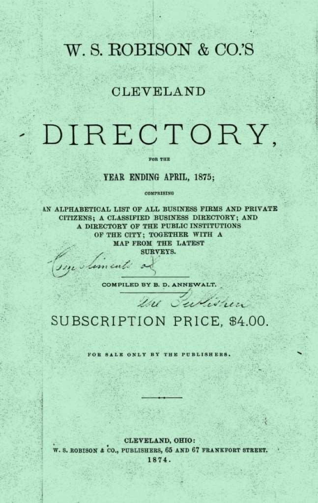
This is a foldout map from the 1835 book, History of the Town of Plymouth, by James Thacher,
which clearly shows where Edward Doty began his real estate holding in Plymouth, with land near Watson’s Hill.

Watson Hill is uniquely remembered because it is the vantage point from which the Native Person Samoset first observed the Pilgrims. “Stephen Hopkins, who had previously lived at Jamestown and, through interaction with the Powhatan tribe of Virginia, knew a little of the Algonquian language Samoset spoke”.(World History Encyclopedia) This resulted in Samoset staying in Hopkins’s home that evening, which is the same home that Edward Doty was also living. We speculate, that through his association with first Samoset, and then Squanto, that perhaps Doty favored Watson Hill as his home site. We cover much about the relationship between the Pilgrims and Native Peoples in the [same-named] chapter The Pilgrims — The Native Peoples. (2)

Whatever Happened to Edwards’s First Wife?

Plymouth Archives have Edward Doty records for everything from court cases, to land-dealing records, to the birth of his children… it’s actually a bit exhausting to wade through all of it. That may be, but as we wrote, there are many straightforward records of his real estate transactions in the Plymouth documents. He left much property to his children upon his death, which we will review in the later chapter, The Doty Line, A Narrative — Four.

Edward Doty had two wives, but there are no credible surviving records about who wife #1 actually was. There has been speculation that his first wife was in England, but if that were true, historians should be able to locate something? However, the fact that Edward Doty’s origins in England are also quite obscure, doesn’t help matters much, does it? He could have married someone who arrived on a later ship?

The issue with that is the timing —Edward Doty received land in 1623, but both he and Edward Leister are listed under Stephen Hopkins’s name. This leads us to believe that neither man was yet married, probably because their indentures to Hopkins were coming to an end. In the 1627 Division of Cattle, as with our other Pilgrim ancestor George Soule, if Doty had been married then, his wife would have been entitled to an additional share. Yet, no spouse is listed for him. (Could have had a very short marriage between 1623 and 1627? Perhaps.) About seven more years would pass before he would meet his wife #2. During this interval, many, many ships came to the New England Colonies during the Great Migration. They brought immigrants to the far north of Maine, all the way south to and beyond Jamestown, Virginia. Some of these ships did come through Plymouth.

If indeed Doty had a wife in the Plymouth Colony before he married wife #2 in 1635, then certainly Governor William Bradford would have recorded this in his manuscript, Of Plimoth Plantation. It is highly unlikely that under the meticulous and watchful eyes of Bradford, that Doty’s first marriage would have been unobserved, much less disregarded, but it could have happened. (3)

From the original document Of Plimoth Plantation, by William Bradford. Edward Doty is listed as having had a second wife. Note that it indicates 7 children — after this was initially written, they had 2 more children, for a total of 9 children in the family. (Image courtesy of the State Library of Massachusetts, Digital Collections).

Comment: The following section below is adapted from a post made at Fine Artist Made, (see footnotes).

Edward Doty Wasn’t The Only Person Who Could Get Upset
— The Incident At Ipswich, England

Back in England, by 1630, Britain had already been entrenched, for a number of years, in a period of political turmoil, social unrest and economic uncertainty. On top of that, the Church of England, in consort with the Crown, had launched a campaign of religious persecution against a growing Puritan reform movement, whose mission was to revitalize a church grown stale, tyrannical and corrupt. The Great Migration of Puritans to British North America had begun, and would continue fitfully until the pending English Civil War.

The situation worsened for the Puritans in 1633, with the appointment of William Laud, a fierce opponent to their cause, as the Archbishop of Canterbury. They would need to take their chances in the untested wilderness of the Massachusetts Bay Colony.

A romantic painting by Bernard Gribble (1872–1962), showing The Pilgrim Fathers Boarding the Mayflower for Their Voyage to America. Although the Mayflower was certainly not this grand and imposing, this painting does show what it was like for emigrants going to British North America to travel on merchant ships in that era. (Image courtesy of the Times Literary Supplement).

The process, technicalities and red tape involved with preparations for a voyage of this magnitude were likely frustrating and expensive. Passengers (Puritans and Others) had to acquire licenses and documents to pass the port — then locate a ship. Finding an appropriate vessel would have involved an intensive search followed by serious negotiations. They had to procure provisions for their passage, as well as for their first year in New England. All this by necessity must have been accomplished surreptitiously.

Early in February 1634, two vessels were moored in Ipswich Harbor on the estuary of the Orwell River. Their passenger lists consisted largely of single men, married couples, and families — as many children as adults; some as young as one year old. They were middle class artisans and farmers. The first ship, called the Francis* was commanded by Master John Cutter and carried 84 passengers. The other was the Elizabeth with 101 passengers and Master William Andrewes at her helm. These two captains were planning to make their passage in tandem for their mutual benefit and safety. Their ships, rigged for a lengthy uncertain voyage, suddenly had their passages blocked.
(*Please see the last paragraph at the end of this chapter).

What happened was this: there was immediate opposition to this “progressive” contingent by the conservative officials in the Church of England, (who felt no sympathy for the Puritan’s case). On February 4, the Archdeacon of Suffolk’s agent, Henry Dade, the Commissary of Suffolk, wrote a letter from his office in Ipswich, to the Church of England’s principal leader, the Archbishop of Canterbury, William Laud. Dade reported that two ships were about to sail from Ipswich Port with men and provisions for their abiding in New England, and that in each ship “are appointed to go about six score men.” He supposed they were debtors or persons discontented with the government of the Church of England.

In this 1874 engraving, English Puritans Escaping to America, was captioned “strength of faith and character mark the faces of those setting forth to the New World”. (Image courtesy of British Heritage Travel).

[Our observation: It seems Dade had worked himself up into quite a frothy state.] He told the Archbishop that his intelligence had informed him, that some 600 more were planning to shortly follow and described the “ill effects of suffering such swarms going out of England could cause; that trade would be overthrown and persons indebted would flee to New England to avoid bankruptcy and be treated as religious men for leaving the kingdom because they could not endure the ceremonies of the church.

He blamed the Puritan minister, Samuel Ward, for inciting desire among his flock to relocate to Massachusetts. Ward was stationed in the ancient church of St. Mary-le-Tower, the civic church of the Corporation of Ipswich. The records of the Privy Council show that a warrant for tying up the two Ipswich vessels was issued within the week. A few days later, on February 14, similar steps were taken for the detention of ten other ships lying in the Thames near London — all under similar charters for Massachusetts Bay Colony.

(Here is where we invoke long story short…) After much drama, these conditions were imposed on everyone for the voyages:

  • If anyone blasphemes or profanes the holy name of God, they shall be severely punished.
  • On the ship, everyone must attend when the “Booke of Common Prayer” (established in the Church of England) were said at both Morning and Evening Prayers.
  • All persons must have the ‘Certificate from the officers of the port’ where they departed, have taken both the oath of allegiance and supremacie (the belief that a particular group is superior to others, and should dominate them).
  • That upon their return to this Kingdom they certify to the Board, the names of all persons transported, together with their proceedings in the execution of the aforesaid articles.

Finally, in mid to late April 1634, once the powers that be had sufficiently flexed their muscles, the Francis and Elizabeth set sail. Plying the vast Atlantic without further incident or loss of life, they entered the clear unfettered waters of the Massachusetts Bay some five to ten weeks later.

From left to right: William Laud, the Archbishop of Canterbury, Center: A painting, Ipswich England harbor, Boat on Beach, Sunset, by John Moore of Ipswich, and Right: Samuel Ward, of the ancient church of St. Mary-le-Tower

Then by November, Samuel Ward (thanks to Dade’s efforts), was banned from preaching for life for encouraging immigration to New England. There were riots in the streets of Ipswich. The Corporation of Ipswich refused to replace Ward, paid his stipend for life and after his death in 1640, supported his widow and eldest son who could not work himself. In 1637, Ward’s compatriot, Timothy Dalton, after his own suspension, immigrated to New Hampshire.

In the end, the Henry Dade as the Commissary of Suffolk’s unyielding persecutor of the Puritans of Ipswich — this would prove to be undoing. Amidst charges of corruption, oppression and extortion brought by a friend of Ward’s, a humble Puritan cobbler, he was compelled to resign his posts. (The cobbler himself was faced with excommunication and sought asylum in New England).

As for Dade’s accomplice, William Laud, the Archbishop of Canterbury — in 1645, in the midst of the English Civil War, in part, for his crimes against the Puritans — he was beheaded.

The importance of relating this saga about strife and bureaucracy in England, with the ship Francis, is that this ship brought our 9x Great Grandmother Faith Clarke (along with her father Thurston Clarke), to the Plymouth Colony. The good news is, that very soon, we will meet the new Mrs. Doty. (4)

Following are the footnotes for the Primary Source Materials,
Notes, and Observations

(1) — one record

IPL, Learneo Services
What Is The Difference Between A Colonial Farmer And A Planter?
https://www.ipl.org/essay/What-Is-The-Difference-Between-A-Colonial-17E05078F5C70CC6
Note: For the text.

Mr. Hot Under The Collar?

(2) — seven records

Medium
The Art and Science of Swearing
by Robert Roy Britt
https://medium.com/wise-well/the-art-and-science-of-swearing-5fadb0b6c979
Note: For the insult cloud artwork.

10 Colonial Insults for Lollpools, Doxies and Prigs
by The New England Historical Society
https://newenglandhistoricalsociety.com/lollpoops-doxies-prigs-ten-colonial-insults/#google_vignette
Note: For the reference, you _______!

The Plymouth Colony Archive Project
EDWARD DOTEY (DOTEN, DOTTEN, DOTY, DOWTIE)
of Plymouth
http://www.histarch.illinois.edu/plymouth/DOTEYED.htm
Note: For the text.

Mayflower Ancestors
Edward Doty & Descendants
Edward Doty: 1599 – 1655
https://gardenmayflowerancestors.wordpress.com/
Note: For the text.

History of the Town of Plymouth,
from its first settlement in 1620, to the present time

by James Thacher, circa 1835
https://archive.org/details/historyoftownofp03thac/page/n11/mode/2up
Note: For the foldout map at the beginning of the book.

World History Encyclopedia
Samoset
https://www.worldhistory.org/Samoset/
Note: For the text.

Interview of Samoset With The Pilgrims, book engraving
by Artist unknown, circa 1853
File:Interview of Samoset with the Pilgrims.jpg
https://commons.wikimedia.org/wiki/File:Interview_of_Samoset_with_the_Pilgrims.jpg
Note: For the image of Interview of Samoset With The Pilgrims

Whatever Happened to Edwards’s First Wife?

(3) — two records

The Plymouth Colony Archive Project
EDWARD DOTEY (DOTEN, DOTTEN, DOTY, DOWTIE)
of Plymouth
http://www.histarch.illinois.edu/plymouth/DOTEYED.htm
Note: For the text.

State Library of Massachusetts Digital Collections
Of Plimoth Plantation: manuscript, 1630-1650
https://archives.lib.state.ma.us/items/db0e9f79-477c-4a4c-979b-359c2be1d4ad
Note 1: The notation for Edward Doty having a wife from a second marriage is located very close to the end of the book.
Note 2: There are no page numbers, but the page is possibly — Digital page:534/546, left column.
Note 3: The document is digitized and available as a .pdf download at the above link, file name: ocn137336369-Of-Plimoth-Plantation.pdf

Edward Doty Wasn’t The Only Person Who Could Get Upset
— The Incident At Ipswich, England

(4) — seven records

Fine Artist Made
Incident at Ipswich, Part 1
https://www.fineartistmade.com/blog/blog-detail.php?Incident-at-Ipswich-part-1-68
and
Incident at Ipswich, Part 2
https://www.fineartistmade.com/blog/blog-detail.php?Incident-at-Ipswich-part-2-70
by Patrick Mealey and Joyce Jackson
Note: For the text.Historic UK

Times Literary Supplement
The Pilgrim Fathers Boarding the Mayflower for their Voyage to America
by Bernard Gribble, (1872–1962)
https://www.the-tls.com/history/early-modern-history/mayflower-voyage-400
Note: For the ship painting.

British Heritage Travel
From East Anglia to A City Upon A Hill
https://britishheritage.com/from-east-anglia-to-a-city-upon-a-hill
Note: Primedia Archive, for the fleeing Puritans in a boat image.

The Life and Death of William Laud
https://www.historic-uk.com/HistoryUK/HistoryofEngland/The-Life-and-Death-Of-Wiliam-Laud/
Note: For the Laud portrait.

Boat on Beach, Sunset
by John Moore of Ipswich (1821–1902)
https://artuk.org/discover/artworks/boat-on-beach-sunset-12029
Note: For the Ipswich, England harbor scene.

The Digital Puritan
Samuel Ward
https://digitalpuritan.net/samuel-ward/
Note: For the Samuel Ward portrait.

The Doty Line, A Narrative — Two

This is Chapter Two of nine. This chapter covers the early dramatic events of the 162os: a foolish knife fight, how land was distributed, how cattle and other livestock were shared, and how The Colony started to find itself.

In the last chapter, we wrote about picturing our ancestors in our mind’s eye. One of the drawbacks about that way of pondering the Pilgrims is this — it is normal to picture them in a bucolic environment, with ordered streets, clean clothes, rosy cheeks. Hollywood has never really been very good at looking at how rough and tough things initially were for them.

When the Mayflower finally disappeared over the horizon, they were truly alone in the New World.

The Departure of the Mayflower for England in 1621 by N.C. Wyeth. This was part of a series of murals the artist created for the MetLife building in New York City in 1941.
(Image courtesy of the Brandywine Museum of Art).

Only 53 Passengers Remained

Consider the fact that the Mayflower was the home of the Pilgrims for a long time and that it was a very old merchant ship.

“During the winter, the passengers [had] remained on board Mayflower, suffering an outbreak of a contagious disease described as a mixture of scurvy, pneumonia, and tuberculosis. After it was over, only 53 passengers remained—just over half; half of the crew died as well. In the spring, they built huts ashore, and the passengers disembarked from Mayflower on March 31, 1621.”

Captain Christopher “Jones had originally planned to return to England as soon as the Pilgrims found a settlement site. But his crew members began to be ravaged by the same diseases that were felling the Pilgrims, and he realized that he had to remain in Plymouth Harbor ‘till he saw his men began to recover.’  Mayflower lay in New Plymouth harbor through the winter of 1620–21, then set sail for England on April 15, 1621. As with the Pilgrims, her sailors had been decimated by disease. Jones had lost his boatswain, his gunner, three quartermasters, the cook, and more than a dozen sailors. Mayflower made excellent time on her voyage back to England. The westerly winds that had buffeted her on the initial voyage pushed her along on the return trip home. She arrived in London on May 16, 1621, less than half the time that it had taken her to sail to America.” (Wikipedia)

Historian Caleb Johnson writes that, “Christopher Jones took the ship out on a trading voyage to Rochelle, France, in October 1621, returning with a cargo of Bay salt. [As the] master and quarter-owner of the Mayflower, [he] died and was buried at Rotherhithe, County. Surrey, England, on 5 March 1621/2. No further record of the Mayflower is found until May 1624, when it was appraised for the purposes of probate and was described as being in ‘ruinis’.  The ship was almost certainly sold off as scrap.” (Mayflower History.com)

With all of the many demands put upon the new shore-bound Plymouth community, our ancestor Edward Doty was about to steal the spotlight through a bit of infamy. (1)

Seeing Red + Flying Off The Handle = (We’re) Fit to Be Tied

Well, the two Edwards seemed to have had quite enough of each other and entered into a duel. It is reportedly the first duel fought in New England, which may be true, but how can you prove something like that? Who would want to?

Edward Doty and Edward Leister were both young men who were indentured servants in the home of the Stephen Hopkins family. Admittedly, the initial voyage of the Mayflower had been harrowing… they were both living as servants in a tiny, rather rough looking house, in far away new world colony… Mr. Hopkins ran a tavern (out of his home?) and just about everyone drank beer in those days because water could be contaminated… Was a young lady involved? Who knows? — but their rather intense dust-up has been featured by historians for over 400 years, which is a rather long time for a local fight to echo through history.

From the standpoint of their community, this fight took place slightly less than eight weeks after the Mayflower had departed for England. Everyone was probably exhausted after leaving the ship, continuing to care for the sick and dying, building huts to live in, and trying to source food in a new land. Who had the free time or energy to get caught up in a duel? Apparently, these two did.

Copy of Le Duel a l’Épée et au Poignard (The Duel with the Sword and Dagger),
from “Les Caprices” (Image courtesy of The Metropolitan Museum of Art).

William Bradford, the Governor of the Plymouth Colony at the time, recorded the details in his journal, but that original document was eventually lost. Transcriptions of what was recorded have survived and we found an account published in a Boston newspaper called The Liberator, on June 12, 1840. In an intriguing way, we noticed this newspaper account falls (more-or-less) at the halfway point between the 1620s and our present era.

Excerpted newspaper account from The Liberator newspaper, June 12, 1840, page 4.
(Image courtesy of Newspapers.com).

If history has a way a not-forgetting, then perhaps we all need to mind our manners in today’s world? It seems that Edward Doty had a history of being in court frequently in the Plymouth Colony being on both sides of things. Maybe he was a bit of a hot head? As elaborated upon by our quite far distant cousin Anna Kasper in her blog post, Anna’s Musings & Writings, 52 Ancestors in 52 Weeks, Week 7: “…Edward Doty did not always make good on that promise of ‘a better carriage.’ He did not like to pay his servants, he just let his cattle kind of wander around, he got into fights, and is found in the Plymouth Court records numerous times! To say that Edward was notably a contentious man would be correct.”

We are reminded of our ancestor David Du Four from a separate family line who we chronicled in The DeVoe Line, A Narrative — Two. (David did not seem to be a contentious man). We wrote this in the section subtitled:
For. Every. Little. Kerfuffle. With. Your. Neighbors.
“It seems that David Du Four had several showings in court because the records have survived. Here’s a little background on the times. In 1670s he was a “frequent flyer” at court, with several cases. In New Amsterdam, people from all walks of life could bring a case to court. They could defend the case themselves, or ask someone to speak for them.  It was not necessary for them to have a lawyer for every case. This is because…” there wasn’t a true court system existent. “To a degree, it seems like going to court was similar to being sent to the Principal’s Office. You had to go and plead your case.”

Then, whatever happened to Edward Leister? We don’t know very much. Governor William Bradford later recorded, “Lester, after he was at liberty, went to Virginia and there died”. American Ancestors has discerned a bit more, by evaluating some of the surviving colonial documents: “…in the 1623 division of land are two men with [the] first name [of] Edward but without surnames; these must be his two servants, Edward Doty and Edward Leister. But Leister is not in the 1627 division of cattle, so he must have left for Virginia between those two dates. He does not appear in the February 1623/4 list of those in Virginia living and dead, or in the February 1624/5 Virginia muster of inhabitants.”

Panoramic View of London in the early 1600s,
by Matthäus Merian der Ältere (Matthew Merian), 1638.

For Edward Doty, we do not know exactly when, nor where, he was born. He was recorded as being of London, but we don’t know if he had been born in another part of England and then had perhaps migrated to London. When he was a signer of the Mayflower Compact, there is speculation that he may have been slightly underage, but the Mayflower Society believe that he was probably at least 18 years of age. (It appears that there are a couple of other signers who were in similar circumstances). We do know however, that as an indentured servant to Stephen Hopkins, he was contracted to that obligation until the age of 25 years.

With that fact in mind, we can parse that he was likely born circa 1598. (2)

The Common Cause of Labor

“Working communally — also known as the “common course of labor” — was a key part of the business model planned for Plymouth Colony. In the original terms and conditions for funding and planting the colony, all the colonists agreed to work together for seven years at commercial fishing, trading, and farming “making such commodities as shall be most useful for the colony.” At the end of the seven years, the terms and conditions dictated that the colonists would receive a share of the common stock including land and livestock.

After three years, Plymouth Colony’s governor William Bradford ended communal work as related to farming, because it caused too much internal conflict and resulted in poor corn harvests. Without a good corn harvest to feed the colony and without regular supplies from England, the colony would not survive. It is interesting to note, however, that this injunction affected only grain and other field production. All other group work — hunting, fishing, trading and defense – continued as before and seemingly without tension.” (Plimoth Patuxet)

Edward continued to do his work for the Hopkins family as part of his commitment to the greater good. However, as one of the original settlers (the old-comers) within the Plymouth Colony, he was entitled a certain privileges which this status afforded him. One of these was the right to have land tenure.

The 1623 Division of Land in which Edward Doty received one acre. As described above, “These lye on the South side of the brook to the woodward opposite to the former”

It is likely that Edward was about 25 years old at this time. “In 1623 a parcel of land was allotted to each man to till for his family and to maintain those who were exempt from agricultural employment because of other duties. Each family was given one acre per family member. In abandoning the ‘common course and condition’ everyone worked harder and more willingly. The food problem was ended, and after the first abundant harvest under individual cultivation, the Pilgrims did not have to endure the meager rations of the first years. The plots assigned them permanently in 1624 became privately owned in 1627.” (Images of Old Hawaii)

“The people mentioned in the Division of Land came on the Mayflower (1620), the Fortune (1621), and the Anne (1623). A couple may have arrived on the Swan(1622) or the Little James (1623), but these were small ships carrying mostly cargo. The Division of Land is recorded in Volume XII of the ‘Records of the Colony of New Plymouth’ ”(TPCAP – The Plymouth Colony Archive Project)

At this time, one acre of land was distributed to each family member. As he was a single man, Edward Doty received one acre of land described communally as, “These lye on the South side of the brook to the woodward opposite to the former”. (Family Search) (3)

Animals Resting in a Pasture, by Paulus Potter, circa 1650.
(Image courtesy of Wikimedia Commons).

About The Division of Cattle

Like the distribution of land in 1623, in 1627, the Pilgrims divided their livestock (cattle, goats, etc.) into separate lots.

“The Pilgrims did not bring any large livestock animals with them on the Mayflower. In fact, the only animals known with certainty to have come on the Mayflower were two dogs, an English mastiff and an English spaniel, who are mentioned on a couple of occasions in the Pilgrims’ journals.

In 1624, [Governor William] Bradford reports that ‘Mr. Winslow came over, and brought a prety good supply, and the ship came on fishing, a thing fatall to this plantation. He brought 3. Heifers & a bull, the first begining of any catle of that kind in ye land’. Other cattle came, some nicknamed the Great Black Cow, the Lesser Black Cow, and the Great White-Backed Cow. By 1627, both the Lesser Black Cow and the Great White-backed Cow had calves.

The 1627 Division of Cattle. Edward Doty is listed as #11, as Edward Dolton. “The fourth lot fell to John Howland & his company Joyned to him his wife. To this lot fell one of the 4 heyfers Came in the Jacob Called ”

Onboard the Jacob in 1624 were four black heifers (a heifer is a young female cow that has not yet had a calf.) The four black heifers were nicknamed Least, Raghorn, Blind, and Smooth-Horned. There was also a Red Cow that belonged to the poor of the colony, which had a red female calf around 1625, and a male calf in 1627. By May 1627, there were 16 head of cattle and at least 22 goats living in Plymouth.” (Images of Old Hawaii)

It appears that Edward Doty, as part of the group of colonists (listed above as part of ‘John Howland & his company’), communally shared the ‘4 heyfers’ which had arrived on the ship Jacob in 1624. (4)

The Council for New England

We understand that Edward Doty was a man who didn’t die a poor man by the standards of his era. He was an early investor in the development of the Plymouth Colony and a land owner. The three passages excerpted below describe the business aspects he was involved with in those early decades.

“The Council for New England was a 17th-century English joint stock company to which James I of England awarded a royal charter, with the purpose of expanding his realm over parts of North America by establishing colonial settlements. The Council was established in November of 1620, and was disbanded (although with no apparent changes in land titles) in 1635. It provided for the establishment of the Plymouth Colony, the Province of New Hampshire, the Massachusetts Bay Colony, the New Haven Colony, and the Province of Maine”.

Left image: The Stuarts, King James I (reigned 1603 – 1625). Painting of James VI and I
Wearing the Jewel Called the Three Brothers in His Hat, circa 1605, (after) John de Critz.
Upper right: The Seal of The Council For New England, and
Lower right: (Shown at a small scale, the actual Peirce Patent from 1621.. It is cited as one of the most important documents in Anglo-American history.)

“In 1621, King James I authorized the Council for New England to plant and govern land in this area. This Council granted the Peirce Patent, confirming the Pilgrims’ settlement and governance of Plymouth. Peirce and his associates, the merchant adventurers, were allotted 100 acres for each settler the Company transported. The Pilgrims had a contract with the Company stating all land and profits would accrue to the Company for 7 years at which time the assets would be divided among the shareholders. Most of the Pilgrims held some stock. The Pilgrims negotiated a more favorable contract with the Company in 1626. In 1627, 53 Plymouth freemen, known as “The Purchasers,” agreed to buy out the Company over a period of years. In turn, 12 “Undertakers” (8 from Plymouth and 4 from London) agreed to pay off Plymouth’s debts in return for trade benefits”. (Pilgrim Hall Museum)

“In 1626, Edward Doty was one of twenty-seven Purchasers involved with the colony joint-stock company which afterwards was turned over to the control of senior colony members. That group [of investors] was called the “Undertakers”, and was made up initially of William Bradford, Myles Standish and Isaac Allerton, who were later joined by Edward Winslow, William Brewster, John Howland, John Alden, Thomas Prence, and four former Merchant Adventurers back in London. On the agreement, dated October 26, 1626, his surname appears as ‘Dotey’.” (Wikipedia) (5)

We continue our narrative about the Edward Doty in the next chapter, with his initial focus on acquiring stability through land ownership. (After all, a farmer who works the land, might want to own it too.) Then we look back a bit at the immigration unrest in Ipswich, England — which was certainly not a merry place at this time.

Following are the footnotes for the Primary Source Materials,
Notes, and Observations

Only 53 passengers Remained

(1) — three records

The Departure of the Mayflower for England in 1621
by N.C. Wyeth
https://collections.brandywine.org/objects/11394/the-departure-of-the-mayflower-for-england-in-1621?ctx=a8ad2d38-5e2e-466c-ae9e-f1f68e71df17&idx=8
Note: This was part of a series of murals the artist created for the MetLife building in New York City in 1941.

Mayflower
https://en.wikipedia.org/wiki/Mayflower
Note: For the text.

Caleb Johnson’s Mayflower History.com
The End of the Mayflower
https://mayflowerhistory.com/end-of-the-mayflower
Note: For the text.

Seeing Red + Flying Off The Handle = (We’re) Fit to Be Tied

(2) — seven records

The Met [The Metropolitan Museum of Art]
Copy of Le Duel a l’Épée et au Poignard (The Duel with the Sword and Dagger),
from Les Caprices
by Anonymous, (After Jacques Callot French, 17th century)
https://www.metmuseum.org/art/collection/search/417395
Note: For the illustration.

Edward Doty and Edward Leister duel 1621
https://www.newspapers.com/article/the-liberator-edward-doty-and-edward-lei/5952148/
Note: From Newspapers.com “The Liberator was a radical [their words] abolitionist newspaper published from 1831-65 in Boston, Massachusetts. A weekly four-page paper, it was the most influential abolitionist publication in the United States during the nineteenth century. At its peak, the Liberator was circulating 3,000 copies a week, primarily across the free North. It was funded and read largely by the free Black population in the North”.

HOW THE PILGRIM FATHERS SERVED DUELISTS.
The following account of the first duel fought in New England, and the second political offence committed in the Plymouth Colony, we take from a work entitled The New-England Chronology.’ The date of the event is June 8th, 1621.

The second offence is the first duel fought in New-England, upon a challenge to single combat, with sword and dagger, between Edward Doty and Edward Leister, servants of Mr. Hopkins. Both being wounded, the one in the hand, the other in the thigh, they are adjudged by the whole company to have their head and feet tied together, and so to lie for twenty-four hours, without meat or drink; which is begun to be inflicted. But within an hour, because of their great pains, at their own and their master’s humble request, upon promise of better carriage, they are released by the Governor.’
— Pa. Observer.

The DeVoe Line, A Narrative — Two
https://ourfamilynarratives.wordpress.com/wp-admin/post.php?post=13086&action=edit
Note: For the text in the section —
For. Every. Little. Kerfuffle. With. Your. Neighbors.

Anna’s Musings & Writings
52 Ancestors in 52 Weeks. Week 7: Landed. February Theme: Branching Out. My Contentious and Quarrelsome Mayflower Pilgrim Ancestor Edward Doty.
https://anna-kasper.com/2022/02/15/my-contentious-and-quarrelsome-mayflower-pilgrim-ancestor-edward-doty/
Note: For the text.
Hi cousin!

A contemporary reenactment of a farm laborer from the Plimouth Plantation Living Museum.

.American Ancestors 2020
Edward Leister
https://mayflower.americanancestors.org/edward-leister-biography#:~:text=Edward%20Leister%20came%20to%20Plymouth,%5BBradford%20442%2C%20445%5D.
Note: For the text.

Battlemaps.us
Panoramic View of London in the early 1600s,
by Matthäus Merian der Ältere (Matthew Merian), 1638
https://www.battlemaps.us/products/london-1600s-panoramic-view?srsltid=AfmBOoqFDoZLYTk2TCIRr2uUgV98KngVjw-QLKUO2raArsDdj_lOQJsq
Note: For the panoramic view of London.

The Mayflower Society
The Doty Family, Passenger Profile
https://themayflowersociety.org/passenger-profile/passenger-profiles/edward-doty/
Note: For the text.

The Common Cause of Labor

(3) — five records

Plimoth Patuxet Museums
As Precious As Silver
https://plimoth.org/yath/unit-3/as-precious-as-silver
Note: For the text.

Dividing the Land and Development of Towns
https://imagesofoldhawaii.com/wp-content/uploads/Dividing-the-Land-and-Development-of-Towns.pdf
Note: For the text.

Plymouth Colony 1623 Division of Land document
Massachusetts, Land Records, 1620-1986 > Plymouth > Deeds 1620-1651 vol 1
https://www.familysearch.org/ark:/61903/3:1:3QS7-89Z7-5Z3H?i=7&wc=MCBR-538%3A361612701%2C362501301&lang=en
Note 1: One acre of land for Edward Doty, as an unmarried man.
Note 2: This file is available at two locations. As indicated above, and also here:
https://www.familysearch.org/ark:/61903/3:1:3QS7-89Z7-5Z3H?i=7&wc=MCBR-538:361612701,362501301&lang=en
Book page: 4, Digital page: Image 8 of 239, Lower portion of page.
Note 3: He is the first Edward listed after Steven Hopkins’s name.

(TPCAP)
The Plymouth Colony Archive Project
Plymouth Colony Division of Land, 1623
http://www.histarch.illinois.edu/plymouth/landdiv.html
Note: For the text. Additional context, “In 1623, the Pilgrims divided up their land. The people mentioned in the Division of Land came on the Mayflower (1620), the Fortune (1621), and the Anne (1623). A couple may have arrived on the Swan(1622) or the Little James (1623), but these were small ships carrying mostly cargo. The Division of Land is recorded in Volume XII of the ‘Records of the Colony of New Plymouth’, and reprinted in the ‘Mayflower Descendant’, 1:227-230. Each family was given one acre per family member”.

About The Division of Cattle

(4) — four records

Animals Resting in the Pasture
by Paulus Potter, circa 1650
File:Paulus Potter – Animals Resting in the Pasture.jpg
https://commons.wikimedia.org/wiki/File:Paulus_Potter_-_Animals_Resting_in_the_Pasture.jpg
Note: For the painting image.

Plymouth Colony 1627 Division of Cattle document
Massachusetts, Land Records, 1620-1986 > Plymouth > Deeds 1620-1651 vol 1https://www.familysearch.org/ark:/61903/3:1:3QS7-99Z7-5ZZW?i=31&wc=MCBR-538%3A361612701%2C362501301&lang=en
Book page: 52, Digital page: Image 32 of 239, Middle of page.
Note: For the image. Edward Doty is listed in the Fourth Lot, as #11, named Edward Dolton.

The Plymouth Colony Archive Project
Plymouth Colony Division of Cattle, 1627
http://www.histarch.illinois.edu/plymouth/cattlediv.html
Note: Additional context, “1627. At a publique court held the 22th of May it was concluded by the whole Companie, that the cattle wch were the Companies, to wit, the Cowes & the Goates should be equal devided to all the posts of the same company & she kept until the expiration of ten years after the date above written & that every one should well and sufficiently paid for there own pt under penalty of forfeiting the same. That the old stock with half th increase should remain for common use to be divided at then of the said terms or otherwise as location fallers out, & the other half to be their own for ever. Upon wch agreement they were equally divided by Lotts she as the burthen of keeping the males then being should be borne for common use by those to whose lot the best Cowes should fall & so the Lotts fell as followers. thirteenepsonts being portioned to one lot.”

Division of Cattle
https://imagesofoldhawaii.com/wp-content/uploads/Division-of-Cattle.pdf
Note: For the text.

The Council for New England

(5) — six records

The Coat of Arms of King James VI and I

Council for New England
https://en.wikipedia.org/wiki/Council_for_New_England
Note: For the text.

Painting of James VI and I Wearing the Jewel Called the Three Brothers in His Hat, circa 1605
by (after) John de Critz 
File:Portrait of James I of England wearing the jewel called the Three Brothers in his hat.jpg
https://commons.wikimedia.org/wiki/File:Portrait_of_James_I_of_England_wearing_the_jewel_called_the_Three_Brothers_in_his_hat.jpg
Note: For the portrait of James I.

Digital Commonwealth
Seal of the Council for New England
https://www.digitalcommonwealth.org/search/commonwealth:h128nr41z
Note: For the seal artwork.

Plymouth Live
Important piece of American history is being brought to Plymouth
https://www.plymouthherald.co.uk/whats-on/whats-on-news/important-piece-american-history-being-2587196
Note: For the Peirce Patent document image.

Pilgrim Hall Museum
Beyond The Pilgrim Story
https://pilgrimhall.org/bradford_17th_century_documents.htm
Note: Excerpted text is from the section, Willliam Bradford: a 1626 “Undertaker”.
Note: For the text.

Edward Doty
https://en.wikipedia.org/wiki/Edward_Doty#CITEREFBanks2006
Note: For the text.

The Doty Line, A Narrative — One

This is Chapter One of nine. We hope that you have taken the time to read the opening chapters we wrote based on the lives of The Pilgrims. It will help to make these The Doty Line chapters more accessible.

As the authors of this family history genealogy blog, we are in the 12th generation of Doty descendants in America. Pilgrim Edward Doty and his wife Faith (Clarke) Doty Phillips are our 9x Great Grandparents. He was one of our two Mayflower ancestors, with the other being Pilgrim George Soule whose family line is profiled in The Soule Line’s seven chapters.

A map of London during the Tudor Period and prior to 1561,
by Georg Braun and Frans Hogenberg in Civitates Orbis Terrarum.
(Image courtesy of Wikipedia).

A Man “of London

Unfortunately, no one has been able to discern specifically the early origins for our 9x Great Grandfather Pilgrim Edward Doty. We wished to uncover more, but for now, until more credible evidence turns up, we must settle for the 20,000 foot view as to where he came from. One of these fine days, someone, somewhere, perhaps an observant researcher — will discover a clue that will reveal his true origins. For us, his name first comes up first in connection with the voyage of the Mayflower.

It’s 1620. He is sailing westward to the new colonies in North America, and for a few years, he is an indentured servant to the Stephen Hopkins family. This means that he was responsible for contributing to the success of the Hopkins family for a period of time, and until he had achieved the age of 25 years, he could not be released from this condition. Edward Leister, his fellow indentured traveler with the Hopkins family, was of the same status.

The original document Of Plimoth Plantation, by William Bradford, page 530. Edward Doty is listed as traveling with the Steven (Stephen) Hopkins family. (Image courtesy of the State Library of Massachusetts, Digital Collections).

He is then briefly mentioned in a pamphlet titled Mourt’s Relation, written by Thomas Winslow of the New Plymouth Colony, with contributions from William Bradford. This booklet eventually gained great fame.

From the website Voyaging Through History

The manuscript was carried out of New Plymouth by Robert Cushman, Chief Agent in London for the settlers, on board the Fortune in 1621. When Mourt’s Relation was sold in John Bellamy’s London bookshop in the 1620s its readers could have scarcely imagined this would become one of the most well-known texts in American history… Perhaps the most significant feature of Mourt’s Relation is its inclusion of ‘The Mayflower Compact’: the first governing document of Plymouth Colony. Signed on November 21, 1620 (prior to landing), the text gave a legal framework of government to the eventual settlement… Over time the Mayflower Compact has become revered as an antecedent to the American Constitution.

Something else we were able to see within Mourt’s Relation, is this text below. This is the only reference yet where we have found any indication for his origin before the Mayflower sailed.

In this pamphlet, Edward’s name is mentioned as being of London next to the name of the man he was indentured to, “Steeuen Hopkins”, (Stephen Hopkins). For more about what Indentured Servitude was, please see our chapters on The Pilgrims — specifically the chapter: The Pilgrims — A Mayflower Voyage.

A note about name spellings:
Historical sources vary much in how these names are spelled. Stephen Hopkins’s first name is written as Steven, Stephen, or Steeuen in original documents. [We are using Stephen for our text]. Edward Doty’s surname has several spellings in original documents, including: Doty, Dotte, Doten, Dotten, Dotey, Dowty, and Dolton. [Whew! We are using Doty for our text].

Most importantly, we know that Edward Doty was one the people who ‘signed’ The Mayflower Compact. However, the names of the signatories to the document were not published for many years out of the fear of reprisals from the British Monarchy. In any case, we know that Edward could not write his name:

“One is that no copy of the original [Mayflower Compact] document survives. Therefore, unfortunately we can’t see his signature. But considering he signed other legal documents, including his Will, with ‘his mark,’ he appears not to have learned how to write and we wouldn’t see much in the way of a signature anyway. Nevertheless, all accounts of the document give him credit for being among the 41 men who signed the pact.” (AFHB – A Family History Blog, see footnotes). (1)

As with many of our ancestors, their ability to read, write, and sign their name was not as important then as it is today. Clearly, someone drafted the text to Edward’s 1655 Will and wrote his name. He then endorsed this with ‘his marke’, a double flourish which we have circled.

Being thus arrived in a good harbor

Only one primary source account exists which describes the events while the Mayflower was at sea. It was written by Plymouth Colony Governor William Bradford in his History of Plymouth Plantation. It concludes with this dramatic passage:

Being thus arrived in a good harbor and brought safe to land, they fell upon their knees and blessed the God of heaven, who had brought them over the vast and furious ocean, and delivered them from all the perils and miseries thereof, again to set their feet on the firm and stable earth, their proper element. And no marvel if they were thus joyful, seeing wise Seneca was so affected with sailing a few miles on the coast of his own Italy; as he affirmed, that he had rather remain twenty years on his way by land, then pass by sea to any place in a short time; so tedious and dreadful was the same unto him.

When Edward Doty and Edward Leister arrived with the Hopkins family in Plymouth Harbor, there were no truly accurate maps of the area, but that was soon to change. The 1623 map below shows the location of the Plymouth Colony, along with other (new) local names. The nearby Native People populations are also indicated. (2)

This map from the book Three Visitors to Early Plymouth, captures the geography
of early New England, including most of the settlements that began in 1623.
(Image courtesy of the Internet Archive).

So, Who Was Stephen Hopkins?

He was a man of many accomplishments. Wikipedia sums it up best when they describe him: “Steven Hopkins (fl. 1579 – d. 1644) was an English adventurer to the Virginia Colony and Plymouth Colony. Most notably, he was a passenger on the Mayflower in 1620, one of 41 signatories of the Mayflower Compact, and an assistant to the governor of Plymouth Colony through 1636. He worked as a tanner and merchant and was recruited by the Company of Merchant Adventurers of London to provide the governance for the colony and to assist with the colony’s ventures.

He was also the only Mayflower  passenger with prior New World experience, having been shipwrecked [from the ship Sea Venture] in Bermuda in 1609 en route to Jamestown, Virginia. Hopkins left Jamestown in 1614 and returned to England. Hopkins traveled to New England in 1620 and died there in 1644.” (Wikipedia)

It is interesting to note that that he spent five years in Jamestown, Virginia after being shipwrecked. He was there for so long that his first wife Mary (who was living in England with their three children) died, leaving the children without a parent present. This could be one reason why he returned to England, where he married his second wife Elizabeth, who came with him on the Mayflower. For more information on the disastrous Jamestown Colony, please see our chapter, The Pilgrims — Colonial Pursuits.

The first page of Shakespeare’s The Tempest, printed in the First Folio of 1623.
(Image courtesy of Wikimedia Commons).

During his tenure in Bermuda (long story short), he was accused of treason and nearly beheaded. It is thought by scholars that the character of ‘Stephano’ in William Shakespeare’s The Tempest is based upon Stephen Hopkins’s experiences in Bermuda. (The play was first performed in November 1611). (3)

Living With The Hopkins Family in the Plimoth Plantation

The entire Hopkins family and their two indentured servants survived the first terrible winter, which is rather remarkable since so many other of their fellow travelers had passed away. What was it like for the indentured servants Edward Doty and Edward Leister to be living in the Stephen Hopkins home? Likely very crowded.

The image at the left shows the reproduction home of the Stephen Hopkins family located at the Plimoth Patuxet Museum historical site. The “elaborated” 1879 map at right show the location of that home within the context of William Bradford’s original sketch for New Plymouth. (See footnotes).

“The Mayflower Quarterly of December 2011, in an article on Plymouth-area taverns, has a paragraph on Stephen Hopkins, who kept an ‘ordinary’ (tavern) in Plymouth on the north side of Leyden Street from the earliest days of the colony.

The article defines a 17th-century ‘ordinary’ as a term for a tavern where set mealtimes and prices were offered. Terms such as ‘inn, alehouse and tavern’ were used interchangeably with ‘ordinary’ in early Plymouth records. Hopkins kept this tavern from the early colony days until his death in 1644. In the early 1600s he had also had an alehouse in Hampshire with his wife Mary and his mother-in-law Joan, which they maintained after he left for America in 1609.

Hopkins apparently had problems with the Court over his tavern. Plymouth records indicate that Hopkins let ‘men drink in his house upon the Lords day’, ‘for suffering servants and others to sit drinking in his house’ (contrary to Court orders), also to play games ‘& such like misdemeanors, is therefore fined fourty shillings.’ In addition, the Court had several charges against him ‘for selling wine, beere, strong waters, and nutmeggs at excessiue rates, is fined.’” (Wikipedia) (4)

Now that we have arrived in the new Plymouth Colony, the next chapters will narrate how the Doty Family grew, how they developed and changed, and what Life brought them during the subsequent generations.

Following are the footnotes for the Primary Source Materials,
Notes, and Observations

A Man “of London

(1) — six records

Tudor London
https://en.wikipedia.org/wiki/Tudor_London
Note: For the 1561 “Civitates Orbis Terrarum” map image.

State Library of Massachusetts Digital Collections
Of Plimoth Plantation: manuscript, 1630-1650
https://archives.lib.state.ma.us/items/db0e9f79-477c-4a4c-979b-359c2be1d4ad
The actual page 530 is here:
https://archives.lib.state.ma.us/server/api/core/bitstreams/4d69e338-cc1b-4eda-b2ff-57bfbbb5c6ed/content
Note 1: For the original document on which Edward Doty is listed as a passenger on the Mayflower.
Note 2: The document is digitized and available as a .pdf download at the above link, file name: ocn137336369-Of-Plimoth-Plantation.pdf
Digital page: 530/546. First page, right column at center, with the Steven (Stephen) Hopkins family.

Voyaging Through History, the Mayflower and Britain
Mourt’s Relation (1622)

https://voyagingthroughhistory.exeter.ac.uk/2020/08/25/mourts-relation-1622/
Note: For the text.

Mourt’s Relation or Journal of The Plantation at Plymouth
by William Bradford, 1590-1657; Edward Winslow, 1595-1655; 
(and Henry Martyn Dexter, 1821-1890)
https://archive.org/details/cu31924028815079/mode/2up
Digital pages: 100-102/242, Book pages: 43-45/176
Note: This edition is circa 1865.

(AFHB)
A Family History Blog
Signer of the Mayflower Compact
by Jamie
https://genealogy.thundermoon.us/blog/2020/09/26/signer-of-the-mayflower-compact/
Note 1: For the text, and the double flourish signature of Edward Doty.
Note 2: Jamie, the author of A Family History Blog, is another cousin. He is a descendant of Edward Doty’s son Isaac and his wife Elizabeth (England), as we are also. Hi cousin!

Being thus arrived in a good harbor

(2) — two records

Mayflower
by Rootsweb Author, kee46@msn.com
https://homepages.rootsweb.com/~ahopkins/cushman/mayflowe.htm
Note: For the text.

Three Visitors to Early Plymouth
by Sydney V. James, Samuel Eliot Morison, Isaack de Rasieres; John Pory; Emmanuel Altham
https://archive.org/details/plymtuxet005/plymtuxet005_epub/
Digital page: 2/133
Note: For the map image.

So, Who Was Stephen Hopkins?

(3) — three records

Stephen Hopkins (pilgrim)
https://en.wikipedia.org/wiki/Stephen_Hopkins_(pilgrim)
Note: For the data.

The Bermudian.com (magazine)
The Wreck of the Sea Venture: The Untold Story
by Gavin Shorto
https://www.thebermudian.com/history/history-history/the-wreck-oftheseaventure-the-untold-story/
Notes: For the antique map image of the island of Bermuda, and the wreck of the Sea Venture ship painting.

The Tempest
https://en.wikipedia.org/wiki/The_Tempest
Note: For the folio image.

Living With The Hopkins Family in the Plimoth Plantation

(4) — three records

Stephen Hopkins’ House, Plimoth Plantation
https://www.worldhistory.org/image/13127/stephen-hopkins-house-plimoth-plantation/
Note: For the replica house photograph,
stephen-hopkins-house-plimoth-plantation-13127.jpg

The Pilgrim Republic : an historical review of the colony of New Plymouth, with sketches of the rise of other New England settlements, the history of Congregationalism, and the creeds of the period
by John Abbot Goodwin, 1824-1884
https://archive.org/details/pilgrimrepublic01goodgoog/page/106/mode/2up
Book page: 106, Digital page: 159/722
Note: For the plan image of early Plymouth.

Stephen Hopkins (pilgrim)
https://en.wikipedia.org/wiki/Stephen_Hopkins_(pilgrim)
Note: As cited in the article (footnote 17) —
Suitably Provided and Accommodated: Plymouth Area Taverns
by Stephen C. O’Neill
The Mayflower Quarterly (Plymouth, MA: The General Society of Mayflower Descendants), December 2011, vol. 77, no. 4, pp. 335, 336

The Doty Line, A Narrative — Nine

This is Chapter Nine of nine. This the last chapter of our narrative about the Doty Line, hence, we are writing about the marriage and family of Orman Shaw and his wife Elizabeth. In the last chapter (Eight), the Doty name gave way to the Shaw surname, and in this chapter, the Shaw surname gives way to the DeVoe surname.

This chapter covers the years from when Orman and his wife Elizabeth were born, from the years after the American Revolution, up the time of the American Civil War. We came across this distinctive bit of history, and feel that because it is unique, that perhaps we should share it. We reminds us of how life was so different for these generations, as compared to how we live today.

So, let’s take a look at the very last soldiers of the American Revolution.

Image capture from the BBC video America’s Last Revolutionaries: Rare Photos of US patriots. (See footnotes).

The Last Six Men of the American Revolution

These men had lived their lives through a period when the United States as we have come to know it, first came into being. The BBC (isn’t that a bit ironic?) has created a celebrated video where we learn about these men who fought in the American Revolutionary War, and lived lifetimes that were so long — the end of their lives generally coincided with the end of those of our ancestors. To see the video (about 8 minutes in length), click on the link below:
https://www.bbc.com/reel/video/p0kh0k3v/america-s-last-revolutionaries-rare-photos-of-us-patriots (1)

A World That Seeks Balance

The young United States which Orman and Elizabeth Shaw were born into, was a world of variability. As such, they grew up in a young country that was trying to figure out how to govern itself, how to pay its debts from The War, how to establish a currency, how to unite the different states into a functioning Republic…

The PBS television program American Experience, aptly describes it this way in their program After The Revolution —
“The period following the Revolutionary War was one of instability and change. The end of monarchical rule, evolving governmental structures, religious fragmentation, challenges to the family system, economic flux, and massive population shifts all led to heightened uncertainty and insecurity. 

Although the states had united politically under the Articles of Confederation in 1777, they did not yet exist as a united nation. Each state retained individual sovereignty and operated under its own constitution. Congress struggled to hold the states together, and interests often clashed.”
The Articles of Confederation ended in 1789, and were then replaced with The Constitution.

Saratoga County New York, by Burr, 1866.
(Image courtesy of Maps Of The Past)

In other chapters we have described how local borders always seemed to be in flux — as described by Wikipedia, “When counties were established in the Province of New York in 1683, the present Saratoga County was part of Albany County. This was an enormous county, including the northern part of New York, as well as all of the present state of Vermont and, in theory, extending westward to the Pacific Ocean. This large county was progressively reduced in size by the separation of several counties until 1791, when Saratoga County and Rensselaer County were split off from Albany County”.

This family stayed local, living their 24 years first in Rensselaer County, and then moving one county westward to the community of Halfmoon in Saratoga County, where they put down deeper roots. The 1855 New York State Census tells us they relocated circa 1835. The Shaws were self sufficient farmers, likely making many of the things they needed, as their forebears had done across generations.

Orman Shaw’s Lot 53 property, where he had his farm. Shown on a map of the Town of Half Moon,
from the New Topographical Atlas of Saratoga County, New York, circa 1866

Even though this family had been born into an era of much change after the Revolutionary War, and there was much instability, things did evolve. The central government had become strong enough that a war with Great Britain had become inevitable for many reasons, but the basis of this new War was autonomy, and economics for the young United States. (2)

The War of 1812,
and Colonel William Knickerbocker’s 45th Regiment

“The tensions that caused the War of 1812 arose from the French revolutionary (1792–99) and Napoleonic Wars (1799–1815). During this nearly constant conflict between France and Britain, American interests were injured by each of the two countries’ endeavours to block the United States from trading with the other. American shipping initially prospered from trade with the French and Spanish empires, although the British countered the U.S. claim that ‘free ships make free goods’ with the belated enforcement of the so-called Rule of 1756 (trade not permitted in peacetime would not be allowed in wartime)”. (Encyclopædia Britannica)

Orman Shaw served in the War of 1812 as a Private, in Captain Samuel Strom’s Company. That group was part of the larger brigade and regiment — the Schaghticoke brigade of Colonel William Knickerbocker’s 45th Regiment, of the New York Militia. They participated in the Plattsburgh Campaign.

At Left: Soldier Dress & Uniform in the War of 1812. (Image courtesy of the Pritzker Military Museum & Library). At Right: Macdonough’s Victory on Lake Champlain and Defeat of the British Army at Plattsburg by General Macomb, September 11, 1814, by Engraverː Benjamin Tanner, after painting by Hugh Reinagle. (Image courtesy of the Lake Champlain Maritime Museum Collection via Wikipedia).

As described in an article titled, Bicentennial of the Battle of Plattsburgh, on the blog History of the Town of Schaghticoke —
“According to a 1936 article in the Albany “Evening News”, the call for the draft went out; the men assembled at Henry Vandercook’s Inn and put slips of paper with their names in a hat. Every fourth slip of paper drawn was opened, and the man whose name appeared [was] drafted for service. I do not know how accurate this account is, as much of the rest of the story was not, but in any case, the 2,200 men began to march north on September 13, first goal Granville. Three solid days of rain ensued, with the march halted at Speigletown.

The newspaper account stated [that] they reached Granville two weeks later. [However…] they reached Granville on September 18. Whatever the case, the battle had occurred on September 11. As soon as that word reached the Brigade at Granville, it was disbanded and the men [were] sent home”.

1857 Pension claim for his service in the War of 1812, for Orman Shaw.
Excerpted from the New York, War of 1812 Certificates and Applications of
Claim and Related Records, 1858-1869. (See footnotes).

So we do not know if Orman actually experienced any other battles, since it seems he was certainly soaked to the bone with the rain and fatigued from the long march to Plattsburgh.

An eventual benefit of that experience was that he was eventually paid (43 years later!). He did qualify for a pension for his war service. The 1857 record for this is shown above, indicating that even at this very late date, he was compensated for costs that initially came out of his own pocket. (Notice that, like many other people of his era, he signed his name with an X). The amount was $54.25, which in today’s time is equal to about $2014.00. His wife Elizabeth was the designated heir for any further pension benefits. (See footnotes). (3)

Just to be quite clear — this is not our 4x Great Grandfather Ormand Shaw’s family from long-ago New York State. Be that as it may, this is still a wonderful image — that of an unknown Ohio family, circa 1855, which we are using to ‘stand-in’ for Orman and Elizabeth’s family, [if only we had a daguerreotype of them!]. Image courtesy of Ohio Memory.

One interesting aspect of this time period, is that early forms of photography were starting to emerge as the world moved into the modern era. Some examples of this new photography are: heliography, calotypes, ambrotypes, tintypes, daguerreotypes, and albumen prints.

The Seven Shaws of Saratoga County

All birth and deaths took place in New York State, unless noted otherwise. Some county names did change over time — Albany County was reformed to be Rensselaer County, in 1791. So, before 1791 > Albany County, and after 1791 > Rensselaer County. Furthermore, when a county name changes, such as in a record for a marriage or a death, we have noted this.

We believe that in about 1811, Orman Shaw, married Elizabeth (last name unknown) in Rensselaer, New York. He was born on March 3, 1790 in Pittstown, Albany County* – died August 13, 1842, Halfmoon, Saratoga County.
*Albany County became Rensselaer County in 1791.

His wife Elizabeth, was born May 1795 (location unknown) — died April 2, 1876 in Saratoga County. She is buried in the Crescent Cemetary, Crescent, Saratoga County.

They had five children, who are listed below. The first four children were born in Rensselaer County; youngest daughter Emeline was born in Saratoga County.

  • Elida (Shaw) DeVoe. She was born April 10, 1812 in Rensselaer County – died February 17, 1896, in Easton, Washington County. She married Peter M. DeVoe on January 22, 1829. Please refer to the chapter, The DeVoe Line, A Narrative — Eight, for the history of their family. (Note: Elida’s name is sometimes spelled Alida, and she is also occasionally written about with the nick name ‘Olive’ on documents).
    We are descended from Elida and her husband Peter M. DeVoe.
Marriage records excerpted from the U.S., Dutch Reformed Church Records in Selected States, 1639-1989, New York > Bought > Bought, Book 6. (See footnotes).
  • Elizabeth (Shaw) DeVoe Smead. She was born February 12, 1814 in Rensselaer County – died March 29, 1901 in Stillwater, Saratoga County. She was married two times: first to Cornelius DeVoe on October 7, 1830, he died in 1844; second (after) 1844, to Elihu Smead, he died in 1895. It is interesting to note that Elizabeth and her older sister Elida both married men from the DeVoe family, at the Boght-Becker Dutch Reformed Church, Colonie, Albany County.
  • John W. Shaw. He was born in 1825 in Rensselaer County – died March 8, 1915 in Daytona Beach, Volusia County, Florida. He married Sarah E. (last name unknown). She was born in 1827.
  • Luzern Shaw. He was born in 1830, in Rensselaer County – died March 13, 1876, in Cohoes, Albany County. He married Julie Furman about 1855. She was born in April 1837, in either Dutchess or Green County – died December 6, 1838, in Halfmoon, Saratoga County.

    Luzern’s death is written about in the March 1876 edition of The Troy Daily Times under the section called: “Cohoes – Temperance Address — St. Patrick’s Day — Sudden Death: Luzern Shaw, an old resident of the first ward, died very suddenly last night. Heart disease is supposed to be the cause of his death.” They had three children, one of whom (Norman) died by suicide. (See footnotes).
  • Emeline (Shaw) Devine. She was born in 1838, in Saratoga County. She married Michael Devine, and died after 1868, likely in Malta, New York. (4)

Bringing The Farm to The Market

Sometimes we have the opportunity to understand more about the everyday lives of our ancestors when we come across documents which inform us about how they earned their livelihoods. Some pursed being merchants, one was a silversmith, several were painters, and many, many were farmers. For Orman Shaw, we have what are known as Agricultural Assessments from the Federal government in 1850 and 1860, as well as one from New York State in 1865. These reports help to paint a picture of what products he had brought to the market.

Sunday, a watercolor painting by Myles Birket Foster, of the English School.
This image demonstrates well the types of products which were produced on Orman Shaw’s farm in the 19th century: grain crops such as wheat farming, and raising livestock, in an area similar to the upper Hudson River Valley. (Image courtesy of Meisterdrucke).

From those documents, and selecting 1860 as an example report, we learned some interesting things. Instead of being a farmer who grew crops, (but not corn, which seems to be stuck in our mind’s eye…) — he grew Irish potatoes, buckwheat, and hay. He raised swine, which were market animals. There were dairy cows, so he had fresh milk with which he made and sold butter. He was selling the wool from his sheep, likely to the newly developing area woolen mills that were opening in nearby counties.

In 1850, he reported his farm as having 211 improved acres, and 8 unimproved acres. The value of the farm was about $1200. Ten years later in 1860, it was clear to us that he had sold much land because his acreage was reduced to 41 acres, but the cash value of his property had increased to over $12,000. It seems that since he was in his 60s by then, he must of felt that having money in the bank was a prudent choice. That makes sense since this is what had been going on in America of the 1850s—

“The Panic of 1857 was a significant economic crisis that began in August 1857, stemming from a combination of agricultural and financial instabilities. The aftermath of the Crimean War reduced European demand for American crops, particularly affecting land speculators in the U.S. Meanwhile, the financial infrastructure was already overextended, and the failure of the Ohio Life Insurance and Trust Company sparked widespread panic. Following this, a series of bank failures in New York led to a loss of public confidence in the banking system, exacerbated by the sinking of the Central America steamer, which carried crucial gold reserves”. (Ebsco)

Excerpts from pages 9 and 10 for Orman Shaw in the U.S., Selected Federal Census Non-Population Schedules for 1860.

The New York State assessment of 1865 actually sought out much more data than the previous Federal assessments in 1850 and 1860. (The amount of questions and the categories actually doubled). Since the survey was done in 1865, this period of time coincided with the end of the American Civil War. We evaluated the data in 1865, it looked remarkably like the data from 1860. The questions then became for us, How did the Civil War affect things for New York farmers by the last assessment of 1865, which occurred soon before Orman’s death? (Technically, the War ended 1865ish when there was a general cease of hostilities, see below).

“The conclusion of the American Civil War commenced with the articles of surrender agreement of the Army of Northern Virginia on April 9, at Appomattox Court House, by General Robert E. Lee and concluded with the surrender of the CSS Shenandoah on November 6, 1865, bringing the hostilities of the American Civil War to a close. Legally, the war did not end until a proclamation by President Andrew Johnson on August 20, 1866, when he declared “that the said insurrection is at an end and that peace, order, tranquillity, and civil authority now exist in and throughout the whole of the United States of America”. The Confederate government being in the final stages of collapse, the war ended by debellatio, with no definitive capitulation from the rapidly disintegrating Confederacy; rather, Lee’s surrender marked the effective end of Confederate military operations”. (Wikipedia)

Center image, Lee’s Surrender, Peace in Union by Thomas Nast.
The surrender of General Lee to General Grant at Appomattox Court House, Virginia, April 9, 1865.
(Image courtesy of http://www.granger.com via Wikipedia). The United States Flag and The Confederate States Flag images are courtesy of Google Images.

Unlike the American Revolutionary War and the War of 1812, no major battles for the Civil War were fought on the soil of New York State. Be that as it may, there were still riots and some fires south of Saratoga County in Manhattan. Perhaps this explains the relative equanimity that we perceive between the 1860 to 1865 surveys. If anything, farmers like Orman Shaw of Saratoga County were more appreciated. “New York boasted the nation’s most valuable farm land both before and after the Civil War. New York City was the nation’s biggest commercial, manufacturing and financial center during Reconstruction. [i.e. after the War] (PBS, American Experience)

Traveling On The Erie Canal, published in the 1825 edition of The Northern Traveler by Theodore Dwight. (Image courtesy of 40 x 4 x 28, see footnotes).

One thing to understand about this period, is that these years marked a transition between farming for one’s own subsistence, to one where many products could now be transported for sale to a larger market. Starting in the 1820s, New York State had built canals, such as the Erie Canal, and they were innovative for transporting goods to market. During the 1850s, new railroad lines were being built (practically everywhere it seems), and they were achieving even greater success with the timing and volume of goods moved. (NY State Canal Commission) (5)

Seen This Way, The Past Isn’t Finished

As we surmised from reviewing the various agricultural assessments, Orman Shaw seems to have been a sensible and thoughtful man. To that end, he thought about his own end long before it happened, creating his Will many years before it was actually needed. It is a very straightforward document, leaving much of his estate to his wife Elizabeth, but also providing for his children. (See footnotes).

First page of the 1868 Probate Notice, for the December 1858 Will of Orman Shaw.
Excerpted from the New York, U.S., Wills and Probate Records, 1659-1999,
Saratoga > Wills, Vol 021. (His complete Probate and Will is in the footnotes).

The Dotys > the Shaws > and the DeVoes had been making their homes in the New Amsterdam / New York area for many, many years. As an example, while the Dotys began in the Plymouth Colony, our ancestor David Du Four (DeVoe) was also living in Manhattan as a Walloon emigrant from the Southern Netherlands. For the generation that was to follow this one, this statement was prophetic. “Saratoga County was also a gateway for the westward migration of many settlers, as the Mohawk River provided a natural passageway through the Appalachian Mountains. Both the historic Champlain Canal, located on the Hudson River, and the Erie Canal, located on the Mohawk River, operated in this county.” (Town of Saratoga)

We are descended from two of the original Plymouth Pilgrim families, from the 1620 voyage
of the Mayflower. Both of these lines meet with our 2x Great Grandparents, through
the marriage of Peter A. DeVoe (for Edward Doty), and Mary Ann Warner (for George Soule).
Background image, Isolation: The Mayflower Becalmed on a Moonlit Night, by Montague Dawson.

This then brings us full circle to Generation 8 in America — to Elida (Shaw) DeVoe’s son, Peter A. DeVoe, who is our 2x Great Grandfather. He is the direct descendant of Mayflower passenger, Pilgrim Edward Doty. When he married our 2x Great Grandmother Mary Ann Warner, she was the direct descendant of Doty’s fellow Mayflower passenger, Pilgrim George Soule. Their union connected the Doty and Soule lineages from the Mayflower.

You can read about Elida (Shaw) DeVoe’s life with her family and the subsequent generations, starting in The DeVoe Line, A Narrative — Eight.

We look backward, in order to look forward.
Sometimes we ponder if the genealogy work that we enjoy doing, is similar in a way to the type of work which archeologists do. In a passage found in a recent fascinating book about Pompeii, written by the director of the Pompeii Archaeological Park, Gabriel Zuchtriegel, we felt that his words captured our similar point-of-view very well:

“We must realize that we’re the product of the past, the decisions people have taken, sometimes centuries ago, but also that the decisions we make about telling history
in a particular way constructs the present and the future. Seen this way, the past isn’t finished. We, who keep telling and discovering the past, are in the middle of it.”
— excerpted from
The Buried City, Unearthing the Real Pompeii
by Gabriel Zuchtriegel, and Jamie Bulloch (translator] (6)

Following are the footnotes for the Primary Source Materials,
Notes, and Observations

The Last Six Men of the American Revolution

(1) — two records

BBC
America’s Last Revolutionaries: Rare Photos of US Patriots
https://www.bbc.com/reel/video/p0kh0k3v/america-s-last-revolutionaries-rare-photos-of-us-patriots
Note: For the video link.

The original book upon which the video is based:
The Last Men of the Revolution : A Photograph of Each From Life,
Together With Views of Their Homes Printed in Colors: Accompanied by
Brief Biographical Sketches of The Men

by E. B. Hillard, circa 1864
https://archive.org/details/gri_33125012930976/page/n7/mode/2up
Note: For the data.

A World That Seeks Balance

(2) — four records

PBS
American Experience
After the Revolution
https://www.pbs.org/wgbh/americanexperience/features/midwife-after-revolution/#:~:text=The%20period%20following%20the%20Revolutionary,to%20heightened%20uncertainty%20and%20insecurity.
Note: For the text.

Saratoga County, New York
https://en.wikipedia.org/wiki/Saratoga_County,_New_York
Note: For the text.

Maps Of The Past
Historic County Map — Saratoga County New York
by Burr, 1866
https://mapsofthepast.com/products/historic-county-map-saratoga-county-new-york-burr-1866-23-x-26-38-vintage-wall-art?srsltid=AfmBOoriJTM18WF7QhJ6QUHVM9PG1DdHHVq2Ji6H_5h-tjaPtL8_cO9X
Note: For the map image.

New Topographical Atlas of Saratoga County, New York,
from Actual Surveys by S. N. & D. G.
by Beers and Assistants, Stone & Stewart Publishers, Philadelphia, 1866
Town of Half Moon
http://aleph0.clarku.edu/~djoyce/gen/saratoga/HalfMoon.html
Note: For the map image.

The War of 1812,
and Colonel William Knickerbocker’s 45th Regiment


(3) — eight records

Encyclopædia Britannica
War of 1812, United Kingdom-United States history
https://www.britannica.com/event/War-of-1812
Note: For the text.

Orman Shaw
in the New York, U.S., War of 1812
Payroll Abstracts for New York State Militia, 1812-1815
https://www.ancestry.com/search/collections/5370/records/40678?tid=&pid=&queryId=c54e6ca0-5bf6-48b1-b11e-3f621985e820&_phsrc=XgW11&_phstart=successSource
Digital page: 746/1026
Note: For the form and data.

Pritzker Military Museum & Library
Soldier Dress & Uniform in the War of 1812
https://www.pritzkermilitary.org/soldier-dress-uniform-war-1812
Note: For soldier and sailor uniforms for the War of 1812.

Battle of Plattsburgh
https://en.wikipedia.org/wiki/Battle_of_Plattsburgh
Note: For the naval battle image.

History of the Town of Schaghticoke
Bicentennial of the Battle of Plattsburgh
https://schaghticokehistory.wordpress.com/tag/war-of-1812/
Note: For the text.

Orman Shaw
in the New York, War of 1812
Certificates and Applications of Claim and Related Records, 1858-1869
https://www.ancestry.com/search/collections/61602/records/1892
Note: For the form and data.

Orman Shaw
in the U.S., War of 1812
Pension Application Files Index, 1812-1815
https://www.ancestry.com/search/collections/1133/records/12473?tid=&pid=&queryId=67ee574a-c0de-4bba-a7f3-604dc04b1412&_phsrc=XgW8&_phstart=successSource
Note: For the form and data.

CPI Inflation Calculator
https://www.in2013dollars.com/us/inflation/1857?amount=54.25
Note: For the data.

The Seven Shaws of Saratoga County

(4) — eighteen records

Ohio Memory
The Father of Commercial Photography
by Lily Birkhimer
https://ohiomemory.ohiohistory.org/archives/901
Note: For the image of the hand-tinted daguerreotype showing an unknown Ohio family in 1855.

Ormon Shaw
in the U.S., Find a Grave Index, 1600s-Current
https://www.ancestry.com/search/collections/60525/records/64818874?tid=&pid=&queryId=f3dee6ae-c8db-4089-a5d2-9496668ef966&_phsrc=XgW1&_phstart=successSource
and
Ormon Shaw

https://www.findagrave.com/memorial/92469264/ormon-shaw
Note: For the data.

Elizabeth Shaw
in the U.S., Find a Grave Index, 1600s-Current
https://www.ancestry.com/search/collections/60525/records/64818889?tid=13457304&pid=122242335478&ssrc=pt
and
Elizabeth Shaw
https://www.findagrave.com/memorial/92469282/elizabeth-shaw
Note: For the data.

Peter Devoe
in the U.S., Dutch Reformed Church Records in Selected States, 1639-1989

New York > Bought > Bought, Book 6
https://www.ancestry.com/discoveryui-content/view/216615:6961
Book page: 13, Digital page: 59/105, Entry 1.
Note: For the marriage dates of Elida Shaw and her sister, Elizabeth Shaw.

The New York Times
Suicide of a Boy — A Threat Carried Out
https://www.nytimes.com/1870/08/20/archives/suicide-of-a-boya-threat-carried-out.html
Note 1: 1870 Death notice for Norman Shaw, the son of Luzern Shaw and Julie (Furman) Shaw.
Note 2: The online link is for New York Times subscribers.

Research Note — We have included all Census information we were able to locate for this family, from 1810 through 1865.

O Shaw
in the 1810 United States Federal Census
New York > Rensselaer > Schaghticoke
https://www.ancestry.com/search/collections/7613/records/319074?tid=&pid=&queryId=1c086b73-fe18-43fd-973f-86393d43093a&_phsrc=XgW14&_phstart=successSource
Book page: 64, or 435 (handwritten), Digital page: 1/10, Upper portion, entry #19
Note: For the data.

1810 Census Records
https://www.archives.gov/research/census/1810
Note: For the data.

Ormand Shaw
in the 1820 United States Federal Census
New York > Rensselaer > Schaghticoke
https://www.ancestry.com/search/collections/7734/records/504125?tid=&pid=&queryId=5410cdcd-49a1-4779-b96f-4c5ad74bb3a9&_phsrc=XgW10&_phstart=successSource
Digital page: 7/9, Upper portion, entry #7 (below his father Daniel Shaw)
Note: For the data.

1820 Census Records
https://www.archives.gov/research/census/1820
Note: For the data.

Orean Shaw
in the 1840 United States Federal Census
New York > Saratoga > Half Moon
Book page: 4 or 5, Digital page: 13/34, Upper portion, entry #5
Note: For the data.

1840 Census Records
https://www.archives.gov/research/census/1840
Note: For the data.

Orman Shaw
in the 1850 United States Federal Census
New York > Saratoga > Halfmoon
https://www.ancestry.com/search/collections/8054/records/8325089?tid=&pid=&queryId=b5d111be-0778-4a9b-9b32-0d9a0f10ea2f&_phsrc=GES1&_phstart=successSource
Digital pages 28-29/67, Lines 41, 42, (on page 28), Lines 1, 2 (on page 29)
Note: For the data.

1850 Census Records
https://www.archives.gov/research/census/1850
Note: For the data.

Norman Shaw
in the New York, U.S., State Census, 1855
Saratoga > Halfmoon > E.d. 1
https://www.ancestry.com/search/collections/7181/records/1653051873
Digital page: 19/22
Note 1: This census lists a granddaughter named Elizabeth Shear living in the home, who we believe could be a daughter of Elizabeth (Shaw) Smead. (We are still researching this relationship. Observe the difference in the surname spelling). Additionally, in Orman Shaw’s 1858 Will there is a minor boy listed named Norman Shear, who is likely her brother.
Note 2: This census also indicates that they have been living in Halfmoon for 20 years. That means that they relocated there circa 1835. Thus, Emeline is their only child born there.

New York Genealogical & Biographical Society
1855 New York State Census
https://www.newyorkfamilyhistory.org/subject-guide/new-york-state-census-records-online
Note: “The 1855 New York state census is notable because it was the first to record the names of every individual in the household. It also asked about the relationship of each family member to the head of the household—something that was not asked in the federal census until 1880.”

Orman Shaw
in the New York, U.S., State Census, 1865
Saratoga > Halfmoon
https://www.ancestry.com/search/collections/7218/records/1039871?tid=&pid=&queryId=6799a95f-ba3d-474c-b989-2cb60c663a84&_phsrc=XgW18&_phstart=successSource
Book page: 37, Digital page: 19/62, Right page, line 14
Note: For the data.

New York Genealogical & Biographical Society
1865 New York State Census
https://www.newyorkfamilyhistory.org/subject-guide/new-york-state-census-records-online
Note: For the data.

Bringing The Farm to The Market

(5) — twelve records

Meisterdrucke
Sunday
Watercolor painting by Myles Birket Foster, circa 1861
https://www.meisterdrucke.uk/fine-art-prints/Myles-Birket-Foster/66821/Sunday.html
Note: For the pastoral artwork.

Orman Shaw
in the U.S., Selected Federal Census Non-Population Schedules, 1850-1880
— for 1850
New York > Agriculture > 1850 > Saratoga > Halfmoon
https://www.ancestry.com/search/collections/1276/records/4678711?tid=&pid=&queryId=7ec47de9-f45e-4860-bfae-001c1dda8dad&_phsrc=gDu9&_phstart=successSource
Digital page: 2/6, Line 39
and
https://www.ancestry.com/search/collections/1276/records/4678711?tid=&pid=&queryId=7ec47de9-f45e-4860-bfae-001c1dda8dad&_phsrc=gDu9&_phstart=successSource
Digital page: 3/6, Line 39
Note: For the data.

Orman Shaw
in the U.S., Selected Federal Census Non-Population Schedules, 1850-1880
— for 1860
New York > Agriculture > 1850 > Saratoga > Halfmoon
https://www.ancestry.com/search/collections/1276/records/4516098?tid=&pid=&queryId=fe821526-8e41-485d-96a7-9c17a3008267&_phsrc=gDu11&_phstart=successSource
Book page: 9, Digital page: 6/7, Line 16
and
https://www.ancestry.com/search/collections/1276/records/4516098?tid=&pid=&queryId=fe821526-8e41-485d-96a7-9c17a3008267&_phsrc=gDu11&_phstart=successSource
Book page 10, Digital page 7/7, Line 16
Note: For the data.

Ebsco
Panic of 1857
https://www.ebsco.com/research-starters/history/panic-1857
Note: For the text.

Arman Shaw
in the New York, U.S., State Census, 1865
(The file is mislabled. This is actually an Agricultural Assessment.)
– for 1865
Saratoga > Halfmoon
https://www.ancestry.com/search/collections/7218/records/2880127?tid=&pid=&queryId=45bdb53a-b9b7-4bfa-8ee3-f3d512ba51f2&_phsrc=gDu19&_phstart=successSource
Book page: 56-59, Digital page: 29-31/62, Line 7
Note: This is a multipage form with many more data points.

Conclusion of the American Civil War
https://en.wikipedia.org/wiki/Conclusion_of_the_American_Civil_War
Note: For the text.

Lee’s Surrender, Peace in Union by Thomas Nast
[www.granger.com via Wikipedia]
https://commons.wikimedia.org/wiki/File:General_Robert_E._Lee_surrenders_at_Appomattox_Court_House_1865.jpg
Note: For the painting.

PBS
American Experience
Reconstruction: The Second Civil War
State by State — New York, Union State
https://www.pbs.org/wgbh/americanexperience/features/reconstruction-states/
Note: For the text.

40 x 4 x 28
(Historical Landscapes of The Erie Canal)
Navigating The Noses
Traveling On The Erie Canal, circa 1825
by Henry Inman (painter) and Peter Maverick (engraver)
https://40x4x28.com/category/the-noses/
Note: For the image.

NY State Canal Commission
The Dream of The Erie Canal
https://www.canals.ny.gov/About/History
Note: For the data and the image.

Seen This Way, The Past Isn’t Finished

(6) — four records

First page of the December 1868 Probate Notice
for the December 1858 Will of Orman Shaw, page 495.
Second page of the December 1868 Probate Notice
for the December 1858 Will of Orman Shaw, page 496.
Third page of the December 1858 Will of Orman Shaw, page 497.

Orman Shaw
in the New York, U.S., Wills and Probate Records, 1659-1999
https://www.ancestry.com/search/collections/8800/records/9143519?tid=&pid=&queryId=dfe2db3c-1d4c-4bdb-b0b1-0c88cfc683fc&_phsrc=XgW6&_phstart=successSource
Book pages: 495-497, Digital pages: 271-272/401
Note: For the document [3 pages total] and data.

Town of Saratoga
County of Saratoga History
https://www.saratogacountyny.gov/departments/county-clerk/historian/county-history/
Note: For the text.

Isolation: The Mayflower becalmed on a moonlit night
by Montague Dawson, (British, 1890-1973)
https://www.mutualart.com/Artwork/Isolation–The-Mayflower-becalmed-on-a-m/FD8D6C1A6976C620
Note: For the image of the Mayflower painting.

The University of Chicago Press
The Buried City, Unearthing the Real Pompeii
by Gabriel Zuchtriegel, and translated by Jamie Bulloch
https://press.uchicago.edu/ucp/books/book/chicago/B/bo246710287.html
Note: For the pull quote excerpted from the text.

The Soule Line, A Narrative — Seven

This is Chapter Seven of seven. In this last narrative on the descendants of Pilgrim George Soule, we cover Generations Five and Six in America. Both of these generations carry the new family surname of Warner.

Preface

Our introduction to the Drinkwater name family goes back to the early 1970s, when first heard the name Mercy Drinkwater from our Grandmother Lulu Gore. Mercy was the 2x Great Grandmother to Lulu, and it was likely that Mercy’s first name evolved from an idea in Christian theology. The “seven lively virtues… are those opposite to the seven deadly sins. They are often enumerated as chastity, temperance, charity, diligence, kindness, patience, and humility.” (Wikipedia). We could see the name ‘Mercy’ falling right in line with that point-of-view. (1)

Just ask Homer Simpson which one has more fun.

However, we must admit a bit sheepishly that the ‘deadly sin’ part of our personalities cannot help but notice that when you say her name out loud, it sounds distinctly like you are either openly worrying about dehydration, or echoing the emergency response team from the Poison Control Center:
Mercy! Drink water!

So much… for lively virtue.

Woodbury, Connecticut Colony

Like our ancestors who founded the Plymouth Colony in Massachusetts, the settlers who founded Woodbury, Connecticut were also religious objectors. “The founders of Woodbury came from Stratford, Connecticut, in the early 1670s. Ancient Woodbury consisted of the present towns of Woodbury, Southbury, Roxbury, Bethlehem, most of Washington and parts of Middlebury and Oxford.

Two groups of settlers came from Stratford. The first, religious dissidents unhappy with the church in Stratford, was led by Woodbury’s first minister, the Reverend Zachariah Walker. The second, led by Deacon Samuel Sherman, had been given approval by the general court to purchase land from local Native Americans in order to establish a new settlement. Together, fifteen families (about fifty people), arrived in ancient Woodbury, known as ‘Pomperaug Plantation’, early in 1673”. (Wikipedia, Woodbury Connecticut)

“By the end of the eighteenth century Woodbury had developed as a thriving center of agricultural trade because of its proximity to the Housatonic River, which provided a major navigational route to the coast. A measure of Woodbury’s wealth was the large number of artisans and tradesmen such as millers, blacksmiths, wheelwrights and clothiers as well as tinsmiths, tanners, joiners and goldsmiths.” (The Old Woodbury Historical Society)

Plan of the Colony of Connecticut in North America, by Moses Park, 1766.
Mercy Drinkwater is from the area of the larger circle to the left; Eliphaz Warner, from the smaller circle to the right. (Image courtesy of the Boston Public Library).

One of the things about our Ancestral Grandmothers is the fact that not many records survive about these women. The eras that they lived in didn’t allow the creation of many meaningful records due to the customs of the time: things like civic records, inheritance laws, even Census data until about 1850… there just isn’t much there, or even that has survived. So it is with Mercy Drinkwater, especially as a young child.

We know when she was born, and that she was the youngest of 12 children from her father’s first wife. Her mother Elizabeth (Benedict) Drinkwater, died in 1749 when Mercy was about 15 months old. Her father William then remarried Susannah Washburn in 1751, when Mercy was about 3. Then in 1758, when Mercy was 10 years old, the records tell us that both William and her step-mother Susannah (Washburn) Drinkwater died.

So our primary question became, Who then raised Mercy for the next 10-11 years until she married? Was it her mother’s family the Benedicts? Or perhaps an older sister? How did she meet her husband, Eliphaz Warner? When exactly did they marry? We were not able to resolve these questions. We have looked everywhere and we don’t think that the marriage record has survived. We have to infer from what we know.

Mercy Drinkwater, born March 25, 1748, New Milford, Litchfield County, Connecticut Colony — died October 22, 1813, Sandgate, Bennington, Vermont. She was the daughter of William Drinkwater and Elizabeth Benedict.

Eliphaz Warner, born September 1, 1742, Middletown, Hartford* County, Connecticut Colony — died March 12, 1816, Sandgate, Bennington, Vermont. He was the son of Jabez Warner and Hannah Warner. He married Mercy Drinkwater by 1769, in an unknown location* in Connecticut; together they had seven children.

*We believe that the exact record for their marriage has been lost. This could be due to destruction caused by the church burning down, arson from conflicts with the Native Peoples, natural forces like a flood… Sometimes when the organizing government domain changes, records disappear through lack of oversight. Hartford County became Middlesex County in May 1785, being created from portions of Hartford County and New London County. Perhaps the record was lost then?

What we do know is this — it is highly probable is that they married in one of the three communities where their family members lived: Ridgefield, New Milford, or Woodbury. We just don’t know exactly where at this time. (2)

“This old map of Middlesex County, CT was commissioned in 1934 by the Connecticut League of Women Voters. S. Jerome Hoxie illustrated the map and it was printed by The Riverside Press in Mystic Connecticut.” (See footnotes).

Eliphaz and Mercy (Drinkwater) Warner Children

The first two children were born in Judea Parrish, Woodbury, Litchfield County, Connecticut Colony. “Before it became a separate town in 1779, and chose to name itself ‘Washington’, the area was known as ‘Judea’, and was part of Woodbury, Connecticut”. (Wikipedia, Judea Cemetery)

  • William S. Warner, born November 12, 1770 — died May 24, 1856, Sandgate, Bennington County, Vermont. He married first, (1798) Lucy Coan, in Woodbury, Litchfield County, Connecticut; they had 7 children. He married second, (circa 1816-17), Abigail Root; they had no children. He married third, (circa 1819) Prudence B. Nickerson, in Sandgate, Bennington, Vermont; they had 4 children.
    (We are descended from William and Prudence (Nickerson) Warner).
  • Dr. John Warner, born December 1772 — died September 4, 1839, Starkey, Yates County, New York. He married Mary DeWitt in October 1808.
  • Anna Warner, born 1773 in Middletown, Middlesex County, Connecticut Colony — died September 30, 1834, Sandgate, Bennington, Vermont. (Note: Anna may have been born in either Judea Parrish, Woodbury, Litchfield County, Connecticut, or Middletown, Middlesex County, Connecticut. The records conflict on this detail).

    By 1776 the family moved from Connecticut to Sandgate, Bennington County, The Vermont Republic (1771-1791), where the next four children were born .
  • Elizabeth Warner, born 1777 — died April 7, 1845, Salem, Washington County, New York. She married Joel Bassett, born Feb. 5, 1782 — died September 5, 1840, same location.
  • Hannah Warner, born 1783 — died October 13, 1818, Sandgate, Bennington County, Vermont.
  • Dr. James Warner, born 1785 — died February 21, 1813, Jericho, Chittenden County, Vermont.
  • Jabez Joseph Warner, born December 14, 1791 — died February 1, 1792 Sandgate, Bennington, County, Vermont.

A few years before they moved to the Vermont frontier, this document appears. It’s one of the few things with Mercy (Drinkwater) Warner’s name attached to it. Why was this document done in 1770, 12 years after her father William Drinkwater had died? We speculate that perhaps Mercy and her husband Eliphaz Warner wanted to make sure that any portion of his estate (she was due), had been delivered to her? (3)

Administration papers from the estate of William Drinkwater, circa 1770.
From the Connecticut, U.S., Wills and Probate Records, 1609-1999.

Colonel Seth Warner, a Distant Cousin

The Warner’s were a large family. And in those days, cousins married each other, which sometimes causes us to “fret and pull our hair out” when trying to figure out who is related to who… in this case our “cousinship” to Seth Warner is distant for us, but much closer to our Warner line during the 1760s and 1770s.

  • Seth Warner’s 2x Great-Grandfather, John Warner, Jr. was also the father of our 4x Great-Grandmother, Hannah (Warner) Warner.
  • She was married to her first cousin, Jabez Warner, our 4x Great-Grandfather.
  • Their son Eliphaz Warner, was our 3x Great Grandfather.

In 1754 Hannah and Jabez Warner moved to Woodbury, Litchfield, Connecticut Colony, a town next to Roxbury where lived Seth Warner and Ethan Allen, cousins via their Baker relatives. We can’t know how much they interacted some 150 years ago, but they were all of the same age and the adventuresome sort. At this time the state of Vermont did not exist yet. The area was called the New Hampshire Grants. It was a wild and unsettled area in the early 1760s. There were constant disputes between New York and New Hampshire as the Grants were being settled.

This print accompanied the narrative Seth Hubbell published in 1824
about his years spent struggling to establish a farm in the wilds of Vermont in 1789.
(Image courtesy of the Vermont Historical Society).

Dr. Benjamin Warner, Seth’s father, moved his family to this area in 1763. We know that they settled in what is now Bennington, Vermont. But there is some evidence that Seth held property in a small section called Sandgate, about 20 miles north of Bennington. At this time, families from Roxbury, Woodbury, and other parts of Connecticut began moving into the New Hampshire Grants. The Hurds, the Hurlburts, the Bakers and the Allens settled throughout the area and eventually, the Eliphaz Warners settled in Sandgate.

Under-appreciated by History?
Seth Warner is famous in Vermont history through his activities with Ethan Allen of the Green Mountain Boys just prior to and during the Revolutionary War. However, we wonder if perhaps he has been under-appreciated by American historians in general. We learned, from a fascinating online article by writer Gene Procknow at All Things Liberty —

“The legendary stories of Ethan Allen and Vermont’s Green Mountain Boys have long been part of American folklore. Their heroically described exploits are fabled in many fictional accounts and in children’s books. Allen’s name is synonymously linked with the Green Mountain Boys as if he was their sole leader.  However, while Allen receives the fame, there is a strong case that Seth Warner, a lesser-known member of the Green Mountain Boys, was the more impactful military leader during the American Revolution.

From left to right, the Colonel Seth Warner Monument in Bennington, Vermont.
Center: The flag of the Green Mountain Boys,
Right: Green Mountain Rangers, 1776 by Lt. Charles M. Lefferts. (See footnotes).

During the revolution, Seth Warner emerged as the leader of the Green Mountain Boys.  A day after Fort Ticonderoga fell [Allan’s victory], Warner led a contingent of the Green Mountain Boys in capturing British forces at Crown Point [Warner’s victory]. Both Warner and Ethan Allen traveled to Philadelphia to meet with the Continental Congress to obtain military pay for the Green Mountain Boys and to obtain permission to enlist a Green Mountain regiment in the Continental Army.  They returned with both. [The Green Mountain Boys were then referred to as the Green Mountain Rangers, and Warner’s Regiment].

In July 1777, he ably commanded undersized rear guard units at the battle of Hubbarton, Vermont and rallied his troops to cement a patriot victory at Bennington* in August.  British losses at these two battles weakened their invasion force, which aided the Continental Army victory at Saratoga in October.  After the 1777 campaign, Warner continued leading his regiment despite declining health until the unit was disbanded on January 1, 1781.
* See the text, The Battle of Bennington below.

Seth Warner was the elected and recognized commander of the Green Mountain Boys during their entire service with the Continental Army, with Ethan Allen playing the important political roles of firebrand, publicist, and spokesperson. Clearly, the American cause benefited from Seth Warner’s military leadership, while Ethan Allen’s political leadership was critical to the formation of Vermont as a distinct, independent sovereign entity”. (All Things Liberty) (4)

Being Early to Bennington, Republic of Vermont

Even though Vermont is recognized as the 14th state of the United States, it was born out of a complicated mess of issues as to who had the right to live in that rural territory, and who had the right to govern it. Among the interested parties were (quite naturally) the Native Peoples, the French Government and their settlers, and the British Government and their settlers. Like a tide that kept washing in and out, people came in and went out. After the French were defeated in the French and Indian War, the rights to this area were given by the Treaty of Paris (in 1763), to the British.

Be that as it may, the New York Colony, and the Province of Massachusetts Bay Colony, and the Province of New Hampshire continued to squabble over who had the land rights to the territory. Much of this was due to the fact that the population of the area increased dramatically in a short period of less than 30 years. “In the 28 years from 1763 to 1791, the non-Indian population of ‘New Hampshire Grants’ rose from 300 to 85,000.

Plan of Sandgate (map), by Benning Wentworth, circa 1761.
(Image courtesy of the Library of Congress).

New Hampshire’s [Colonial] governor, Benning Wentworth, [had] issued a series of 135 land grants between 1749 and 1764 called the New Hampshire Grants. Many of these were in a large valley on the west (or New York side) of the Green Mountains and only about forty miles from Albany. The town was laid out in 1749 and was settled after the war in 1761. The town was named Bennington for Wentworth. Ultimately, by 1754, Wentworth had granted lands for 15 towns. (Wikipedia, History of Vermont)

“The first settler in Sandgate was Reuben Thomas, who came from Woodbury, Connecticut. Congregational Church records show “1769, December 27th — Reuben Thomas Esqr. moved his family which was the first family into this town.” (Sandgate Vermont)

“In 1770, Ethan Allen—along with his brothers Ira and Levi, as well as Seth Warner—recruited an informal militia, the Green Mountain Boys, to protect the interests of the original New Hampshire settlers against the new migrants from New York. A significant standoff occurred at the Breakenridge farm in Bennington, when a sheriff from Albany arrived with a posse of 750 men to dispossess Breakenridge. The residents raised a body of about 300 armed men to resist. The Albany sheriff demanded Breakenridge, and was informed, ‘If you attempt it, you are a dead man.’ The sheriff returned to Albany.

In the summer of 1776, the first general convention of freemen of the New Hampshire Grants met in Dorset, Vermont, resolving ‘to take suitable measures to declare the New Hampshire Grants a free and independent district.’ On January 15, 1777, representatives of the New Hampshire Grants convened in Westminster and declared their land an independent republic, The Vermont Republic (from 1777 until 1791). Then in 1791, Vermont became a state.

Vermont, from actual survey, by Amos Doolittle and Mathew Carey, circa 1795. This map shows where the Warners were living in the small town of Sandgate, Vermont from 1776 onwards. (Image courtesy of the Library of Congress).

Observation: 1776 is the year when the Eliphaz Warner family moved from the Woodbury, Litchfield County, Connecticut area to Sandgate, Bennington, Vermont Republic. They moved right into the very thick of things.

On June 2, [1776] a second convention of 72 delegates met at Westminster, known as the ‘Westminster Convention’. At this meeting, the delegates adopted the name ‘Vermont’ on the suggestion of Dr. Thomas Young of Philadelphia, a supporter of the delegates who wrote a letter advising them on how to achieve statehood. [One month later…] On July 4, the Constitution of Vermont was drafted during a violent thunderstorm at the Windsor Tavern owned by Elijah West. It was adopted by the delegates on July 8 after four days of debate. This was the first written constitution in North America to provide for the abolition of slavery (for adults), suffrage [voting rights] for men who did not own land, and public schools.” (Wikipedia, History of Vermont) (5)

The first page of the original Constitution for Vermont, with a vintage postcard featuring the Old Constitution House, the former Windsor Tavern. (See footnotes).

Or This Night Molly Stark Sleeps a Widow!

“During the summer of 1777, the invading British army of General John Burgoyne slashed its way southward through the thick forest, from Quebec to the Hudson River, captured the strategic stronghold of Fort Ticonderoga, and drove the Continental Army into a desperate southward retreat. Raiding parties of British soldiers and native warriors freely attacked, pillaged and burned the frontier communities of the Champlain Valley and threatened all settlements to the south. The Vermont frontier collapsed in the face of the British invasion. The New Hampshire legislature, fearing an invasion from the west, mobilized the state’s militia under the command of General John Stark.

General Burgoyne received intelligence that large stores of horses, food and munitions were kept at Bennington, which was the largest community in the land grant area. He dispatched 2,600 troops, nearly a third of his army, to seize the colonial storehouse there, unaware that General Stark’s New Hampshire troops were then traversing the Green Mountains to join up at Bennington with the Vermont continental regiments commanded by Colonel Seth Warner, together with the local Vermont and western Massachusetts militia. 

The combined American forces, under Stark’s command, attacked the British column at Hoosick, New York, just across the border from Bennington. General Stark reportedly challenged his troops to fight to the death, telling them ‘There are your enemies, the redcoats and the Tories. They are ours, or this night Molly Stark sleeps a widow!’ ” (Wikipedia, History of Vermont) (6)

Battle of Bennington, 1777 by Alonzo Chappel.
(Image courtesy of The Bennington Museum).

The Battle of Bennington

“The town is known in particular for the Battle of Bennington, which took place during the Revolutionary War. Although the battle took place approximately 12 miles (19 km) to the west in what is now the state of New York, an ammunition storage building located in Bennington was an important strategic target. On August 16, 1777, Gen. John Stark’s 1,500-strong New Hampshire Militia defeated 800 German (Hessian) mercenaries, local Loyalists, Canadians and Indians under the command of German Lt. Col. Friedrich Baum. German reinforcements under the command of Lt. Col. Heinrich von Breymann looked set to reverse the outcome, but were prevented by the arrival of Seth Warner’s Green Mountain Boys, the Vermont militia founded by Ethan Allen”. (Wikipedia, Bennington Vermont)

This illustration depicts Ethan Allen [pointing at the map]
and the other leaders of the Green Mountain Boys, which included Seth Warner.
(Image courtesy of the Library of Congress).

The “all-day battle fought in intense summer heat, the army of Yankee farmers defeated the British, killing or capturing 900 soldiers. Burgoyne never recovered from this loss and eventually surrendered at Saratoga on October 17. (Wikipedia, History of Vermont)

During the War, Eliphaz Warner was called to serve in several instances. Shown below is one of the payroll records “for service done to guard the frontiers”. (7)

From the book, Rolls of the Soldiers in the Revolutionary War, 1775 to 1783,
by John E, Goodrich. “Payroll under Col. G. Warren’s Regiment under the command
of Capt. Gideon Ormsby”, pages: 76-77. (Image courtesy of the Library of Congress).
For other rosters, see the footnotes.

Time’s Arrow Points in One Direction

If anyone has spent any time glancing over census data, it quickly becomes clear that early censuses were simple, and later ones grew increasingly more complex. “Statistics show that as the Nation’s population grew and its demographics changed, so did the decennial* census evolve in order to measure that growth and change. As a result, no two censuses are exactly alike. To count a population of 3,329,326 in 1790, the census cost $44,377, utilized 1,650 enumerators, and culminated in one published volume totaling 56 pages. The 1990 Census counted a population of 248,709,873, cost $2.5 billion, and culminated in published census reports totaling 450,000 pages”.
*All of the following censuses are decennial, meaning they recur every ten years.

From the Vermont Historical Society, this painting titled
Derby View, 1939 by William Dean Fausett,
was painted to portray what colonial era Vermont would have looked like.

1790 —
“The census began on Monday, August 2, 1790, and was finished within 9 months, under the rules and directions established in an Act of Congress approved March 1, 1790. The 1790 population census was the First Decennial* Census of the United States”. (The National Archives)

The 1790 United States census for Sandgate, Vermont.

The 1790 census tells us that Eliphaz Warner had 8 people in his home, who were enumerated as follows (with our observations for people inserted):

  • 3 men of 16 years & upwards, including heads of families: sons William, John, and father Eliphaz — Head of Family
    • 1 boy under 16 years: son James
    • 4 women including heads of families: daughters Anna, Elizabeth, Hannah, and mother Mercy
Townscape of Bennington; Landscape View of Old Bennington, circa 1798, by Ralph Earl.
It is interesting to note how the landscape had changed from dense forest to open fields.
(Image courtesy of the Bennington Museum).

In 1798, Eliphaz and Mercy’s oldest son William Warner, married (1) Lucy Coan, daughter of Mulford and Elizabeth (Howd) Coan, in Woodbury, Litchfield, Connecticut. William returned to Woodbury for their marriage, and together she went with him to Sandgate, Vermont. They had seven children, who are interwoven throughout the following years of Census data shown below. (8)

For clarity, here is a list of their seven children:

  • Mary Warner, 1799 – 1859
  • William Warner, Jr., 1801-1890
  • Joseph Warner, 1803 -1890
  • Lucina Warner, 1805 – 1874
  • Gaylord Coan Warner, 1808 – 1886
  • Benjamin Stone Warner, 1810 – 1893
  • John Warner, 1812 – 1889

A New Century Begins

1800 —
“The census began on Monday, August 4, 1800, and was finished within 9 months, under the rules and directions established in an Act of Congress approved February 28, 1800. The 1800 population census was the Second Decennial Census of the United States”.

The 1800 United States census for Sandgate, Vermont.

For the Eliphaz Warner family, there were 5 people living there, as follows:

  • 1 boy 10 thru 15: son James
  • 1 man 45 and over: Eliphaz – Head of Family
  • 2 women 16 thru 25: daughters Hannah, Anna
  • 1 female 45 and over: mother Mercy

    This same 1800 census shows us that son William Warner is counted as a separate household. He is likely living nearby, if not next door. He had four people living in his home, enumerated as follows:
  • 2 men 26 thru 44: William – Head of Family, and an (unknown male)
  • 1 girl under 10: daughter Mary
  • 1 woman 45 and over: mother Lucy Coan (William’s first wife)

Observation: As we analyzed the censuses, it became clear that these two families lived next door to each other and that their lives were all intertwined. Eliphaz always had William living nearby, and after Eliphaz was no more, William usually had a sibling, or one of his own children nearby.

1810 —
“The census began on Monday, August 6, 1810, and was finished within 9 months, under the rules and directions established in an Act of Congress approved March 26, 1810. The 1810 population census was the Third Decennial Census of the United States”.

The 1810 United States census for Sandgate, Vermont. Note that Eliphaz’s name is positioned below his son William’s name.

This Census tells us that Eliphaz had 5 people in his home, who were enumerated as follows (with our observations of whom inserted):

  • 1 man 26 thru 44: son James (son John married, 1808 and lived in New York)
  • 1 man 45 and over: father Eliphaz – Head of Family
  • 2 women 26 thru 44: daughters Anna and Hannah (daughter Elizabeth married, 1808 and lived in New York)
  • 1 woman 45 and over: mother Mercy
Macdonough’s victory on Lake Champlain and defeat of the British Army at Plattsburg
by Genl. Macomb, Sept. 11 1814. Hand colored engraving by Benjamin Tanner, circa 1816.
(Image courtesy of Wikimedia Commons).

The 1810 Census is the last census that Eliphaz and Mercy appear in. From this point forward, all descriptions will only be about William Warner Sr.’s family. The 1810 Census further tells us that William Sr. had 9 people in his home, who were enumerated as follows (with our observations of whom inserted):

  • 4 boys under 10: sons William Jr., Joseph, Gaylord, and Benjamin
  • 1 man 26 thru 44: William Sr. – Head of Family
  • 2 girls under 10: daughters Lucina, and (unknown girl)
  • 1 girl: 10 thru 15: daughter Mary
  • 1 woman 26 thru 44: mother Lucy Coan

When the War of 1812 broke out in the young United States, Vermont was mostly removed from the battle sites of the war. The closest battle was The Battle of Plattsburg, which took place at the northern end of Lake Champlain, not very far away in New York State. “A relatively small force of approximately 5,000 Americans, including 2,200 Vermont militiamen, defeated a formidable force of roughly 11,000 British sailors on Sept. 11, 1814. This battle ended the British Invasion from Canada”. (Vermont National Guard Museum) We have not located any records that confirm that this branch of the Warner family actually participated in this war.

Besides, William Warner Sr. had his hands quite full. There was a house abundant of young children, his parents were elderly, and it seems that his wife Lucy had her troubles also — Several members of this family died during this decade; all of them in Vermont. Son Dr. James Warner died February 21, 1813 in Jericho, Chittenden County and is buried there. Mercy (Drinkwater) Warner soon followed. She died in October 22, 1813 in Sandgate, Bennington County and is buried in the Sandgate Center Cemetary. Eliphaz Warner died March 12, 1816 in Sandgate and is buried near his wife Mercy. Daughter Hannah Warner died October 13, 1818 in Sandgate and is buried near her parents. (9)

This brings us to…

The Decade of Three Wives

William Warner Sr.’s first wife, Lucy Coan, who had come to Vermont with him from Connecticut, died on October 2, 1815. She is buried at Sandgate Center Cemetery.

William was a widower with young children. He remarried after 1815 to his second wife (2) Abagail (Root) Warner. She was born about 1784 (based on the age of 34 years listed on her death record). Abagail has left very few records. She died soon after they were married, on June 13, 1818; there were no children.

At age 25, (3) Prudence B. Nickerson entered the family when she married William Warner in 1819; they had 4 children, James Ward, Lucy Mercy, Ira Nickerson, and Mary Ann. Like Abagail Root before her, there are very few records of her life prior to when she married William Sr. We know she was born in 1794 supposedly in Massachusetts, although some documents identify her birth in Vermont. We also note that there was a 24 year age gap when they married – William was 49 at the time.

Together, they are our 3x Great Grandparents — we are descended from William and Prudence B. (Nickerson) Warner and their daughter Mary Ann Warner.

The 1820 United States census for Sandgate, Vermont for William Warner and his unmarried sister Anna Warner.

1820 —
“The census began on Monday, August 7, 1820, and was finished within 6 months, under the rules and directions established in an Act of Congress approved March 14, 1820. The 1820 population census was the Fourth Decennial Census of the United States”. The census tells us that 10 people are living there. William Sr.’s sister Anna never married and is living next door, probably in her parents home. She is listed separately on this census. (10)

  • 2 boys under 10: sons Benjamin, John.
  • 1 boy 10 to 15: son Gaylord
  • 1 boy from 16 to 18: (unknown male)
  • 2 men 16 to 25: sons Joseph, William Jr.
  • 1 man 45 and upwards: William Sr. — Head of Family
  • 1 girl from 10 to 15: daughter Lucina
  • 1 girl/woman from 16 to 25: daughter Mary
  • 1 woman 26 to 45: (step-mother) Prudence.
Baaa-aaa-ah. Who knew? Where are the trees?
(Image courtesy of the Vermont Historical Society).

A World Awash in Merino Sheep

William Warner Sr. was a farmer, but we don’t know if he raised sheep. If he needed any, he wouldn’t have needed to go very far. From the Vermont History Explorer, “Vermont’s landscape looks very different today than it did nearly 200 years ago. Many places that are now covered with trees were open fields. In the 1830s and 1840s, those fields were full of Merino sheep. Almost 1.7 million sheep lived in Vermont in 1840. At the same time, fewer than 300,000 people lived in the state. There were nearly six times more sheep than people in Vermont! These sheep produced almost 3.7 million pounds of wool.”

The 1830 United States census for Sandgate, Vermont.

1830 —
“The census began on Tuesday, June 1, 1830, and was finished within 6 months, under the rules and directions established in an Act of Congress approved March 23, 1830. The 1830 population census was the Fifth Decennial Census of the United States”. The census tells us that 9 people are living in the Warner home. William Sr.’s sister Anna is still living next door and is listed separately on this census.

  • 1 boy under 5: son Ira (likely an infant)
  • 1 boy 6 to 10: son James Ward
  • 1 boy 15 to 20: sons, Benjamin or John
  • 1 man 20 to 29: son Gaylord
  • 1 man 50 to 59: William — Head of Family
  • 1 girl under 5: (unknown girl)
  • 2 girls 5 to 9: daughter Lucy Mercy, and (unknown girl)
  • 1 woman 30 to 39: mother Prudence

This is the first census that begins counting the children that were born after Prudence and William Sr. married circa 1819. Their children were born in Sandgate, Bennington, Vermont.

Son James Ward Warner was born September 26, 1820 — died October 25, 1908, in Kennewick, Benton, Washington. (For a fuller description of his descendants, See Descendant Appendix A in the footnotes for this section). Daughter Lucy Mercy Warner was born May 2, 1823 — died November 14, 1879, Bennington, Bennington, Vermont. (For a fuller description of her descendants, See Descendant Appendix B in the footnotes for this section). Son Ira Nickerson Warner was born May 20, 1830 — died March 6, 1877 in Aurora, DuPage, Illinois. (For a fuller description of his descendants, See Descendant Appendix C in the footnotes for this section).

The 1840 United States census for Sandgate, Vermont.

1840 —
“The census began on Monday, June 1, 1840, and was finished within five months, under the rules and directions established in an Act of Congress approved March 3, 1839. The 1840 population census was the Sixth Decennial Census of the United States”. The census tells us that 7 people are living there. William’s oldest daughter Mary (Warner) Meeker is living next door, and is listed separately on this census.

  • 1 boy 10 to 14: son Ira
  • 1 boy 15 to 19: son James
  • 1 man 60 to 69: William – Head of Family
  • 1 girl 5 to 9: daughter Mary Ann
  • 1 girl 15 to 19: daughter Lucy Mercy
  • 1 woman 40 to 49: mother Prudence
  • 1 woman 70 to 79: (unknown woman)
Taking the census — after a sketch by Thomas Worth.
As published in Harper’s Weekly magazine, 1870.
(Image courtesy of the Library of Congress).

In 1833, Prudence and William had their last child, a daughter, Mary Ann Warner. She was born on February 9, 1833 — died April 10, 1899 in South Russell, Geauga, Ohio. On February 2, 1856 she married Peter A. DeVoe; they had 2 children. They are our Great-Great-Grandparents — we are descended from Peter and Mary Ann. For the history of Peter and Mary Ann’s further lives together, please see: The DeVoe Line, A Narrative — Nine.

The 1850 United States census for Sandgate, Vermont.

1850 —
“The census began on Saturday, June 1, 1850, and was finished within 5 months, under the rules and directions established in an Act of Congress approved May 23, 1850. The 1850 population census was the Seventh Decennial Census of the United States”. The is the first Census where we see all members of the household listed.

Things seem to have quieted down a lot at the Warner home with just William and Prudence living there. In 1850, their daughter Mary Ann is living nearby in Sandgate, at her older sister Mary Meeker’s home, where her brother Ira is also residing. Mary Ann’s name is sometimes recorded as Ann, probably because (in this case) there were two people living there with the same name of Mary.

The 1850 United States census for Sandgate, Vermont.

William Warner Sr. died on May 24, 1856. He is buried at Sandgate Center Cemetery, at which a remarkable number of Warner family members are also interred. Near William are his wives Lucy, and Abagail, some of his siblings, and several of his children. For his estate papers, please see the footnotes. (11)

Sometimes Life Is A Circle

From the 1830s through this pre Civil War period, seven of William Sr.’s eleven children, relocated from Vermont to the Connecticut Western Reserve of Ohio. This emigration included his youngest daughter Mary Ann (Warner) DeVoe and her husband, Peter A. DeVoe. William’s surviving wife Prudence moved there by 1870 and is buried near their daughter.

As we learned more about Mary Ann Warner’s history — we found that by 1855, she had already been residing in the town of Wilton in Saratoga County, New York for three years. She is working as a weaver at the nearby Saratoga Victory Manufacturing Company, in Victory Village. An ironic thing about her occupation, is the fact that the wool she was likely using to manufacture products, had likely been produced right in her old backyard in Bennington, Vermont. Like Mary Ann Warner at her loom — we ourselves also gather the threads, of family stories, and weave them into the warp and weft of a meaningful family narrative.

We are descended from two of the original Plymouth Pilgrim families, from the 1620 voyage
of the Mayflower. Both of these lines meet with our 2x Great Grandparents, through
the marriage of Peter A. DeVoe (for Edward Doty), and Mary Ann Warner (for George Soule).
Background image, Isolation: The Mayflower Becalmed on a Moonlit Night, by Montague Dawson.

With Generation Seven in America, the Warner family surname gives way to the surname of DeVoe. Mary Ann’s husband, Peter A. DeVoe, is a direct descendant of another Mayflower passenger, Pilgrim Edward Doty. Not only does this line of descent circle back to the Mayflower, but the DeVoe line traces its origins back to the same region of Holland where Pilgrim George Soule began his journey.

You can read about the DeVoe family, who have their own amazing history starting with, The DeVoe Line, A Narrative — One, Holland & Huguenots, and the Doty family, starting with, The Doty Line, A Narrative — One. (12)

Following are the footnotes for the Primary Source Materials,
Notes, and Observations

Preface

(1) — one record

Seven virtues
https://en.wikipedia.org/wiki/Seven_virtues#:~:text=In%20Christian%20history%2C%20the%20seven,faith%2C%20hope%2C%20and%20charity.
Note: For the text.

Woodbury, Connecticut Colony

(2) — eleven records

Woodbury, Connecticut
https://en.wikipedia.org/wiki/Woodbury,_Connecticut
Note: For the text.

The Old Woodbury Historical Society
History of Woodbury
https://www.owhs.org/history.html
Note: For the text.

Boston Public Library
Norman B. Levanthal Map & Education Center Collection
Plan of the Colony of Connecticut in North America
by Moses Park, 1766
https://collections.leventhalmap.org/search/commonwealth:z603vt46p
Note: For the map image. “Moses Park, a surveyor from Preston, Connecticut, executed this map in 1766 with the assistance of Asa Spaulding of Norwalk and Samuel Mott of Preston.”

Mercy Drinkwater
in the Connecticut, U.S., Town Birth Records, pre-1870 (Barbour Collection)
New Milford Vital Records 1712-1860

https://www.ancestry.com/search/collections/1034/records/191129?tid=&pid=&queryId=65f6527a-b69f-4af3-8bf1-1576fb5d0bef&_phsrc=dRx1&_phstart=successSource
Book page: 76, Digital page: 74/232
Note: Listed as the 14th entry on the page.

Mercy Warner
in the U.S., Find a Grave Index, 1600s-Current
https://www.ancestry.com/search/collections/60525/records/91584565
and
Mercy Drinkwater Warner
https://www.findagrave.com/memorial/16704122/mercy-warner
Note: For the data.

Eliphaz Warner
The Descendants of Andrew Warner (book)
Fourth Generation
https://www.ancestry.com/imageviewer/collections/15319/images/dvm_GenMono000758-00056-0?usePUB=true&_phsrc=dRx5&pId=104&backlabel=Return&queryId=0095c2f420af5ec55c6e85937768fa6e&rcstate=dvm_GenMono000758-00056-0:227,1330,361,1362;361,1329,481,1353;352,1361,477,1388;332,1395,456,1420;336,1428,458,1453;324,1462,456,1491;359,1493,479,1523;320,1561,446,1588;466,1625,594,1653;502,1743,709,1774;191,1793,321,1821;429,1868,578,1897;890,104,1041,127;729,413,857,443;426,602,641,631;177,649,307,678;179,771,308,799;681,761,831,791;650,803,804,832;980,878,1128,909;947,999,1099,1034;365,1195,488,1219;348,1229,469,1254
Book page: 98, Digital page: 107/184

Eliphaz Warner
in the U.S., Find a Grave Index, 1600s-Current
https://www.ancestry.com/search/collections/60525/records/91584550?tid=&pid=&queryId=e60befba-7e73-4827-b3c5-efdd800afda8&_phsrc=PRY1&_phstart=successSource
and
Eliphaz Warner
https://www.findagrave.com/memorial/16704105/eliphaz-warner
Note: For the data.

Middletown, Connecticut
https://en.wikipedia.org/wiki/Middletown,_Connecticut
Note: For the data.

KNOWOL
Historical Map of Middlesex County, Connecticut
https://www.knowol.com/information/connecticut/middlesex-county-map/
Note: For the map image and caption.

The Eliphaz and Mercy Warner Children

(3) — eight records

Eliphaz Warner
The Descendants of Andrew Warner (book)
Fifth Generation
https://www.ancestry.com/imageviewer/collections/15319/images/dvm_GenMono000758-00084-0?usePUB=true&_phsrc=dRx4&pId=160&backlabel=Return&queryId=0095c2f420af5ec55c6e85937768fa6e&rcstate=dvm_GenMono000758-00084-0:268,488,490,523;500,489,714,516;183,529,337,564;336,529,493,563;903,649,1071,679;339,933,477,957;304,1033,420,1059;369,1066,492,1093;349,1398,468,1422;324,1431,444,1456;637,1560,835,1588;240,1603,419,1639;419,1602,573,1638;484,1763,633,1795;887,83,1037,105;314,159,435,183;378,193,499,216;379,226,495,250;349,292,473,316;328,358,449,382
Book page: 154, Digital page 163/184
Note: For his family records.

Judea Cemetery
https://en.wikipedia.org/wiki/Judea_Cemetery
Note: For the text.

William Drinkwater
in the Connecticut, U.S., Wills and Probate Records, 1609-1999
Woodbury District > Probate Packets, Downs, C-Edmond, M, 1720-1880
https://www.ancestry.com/imageviewer/collections/9049/images/007629576_00856?usePUB=true&_phsrc=VgH4&_phstart=successSource&usePUBJs=true&pId=2465233
Digital page: 856/1417
Note: Case 1384 — Administration papers from the estate of William Drinkwater, circa 1770.

Colonel Seth Warner, a Distant Cousin

(4) — five records

Journal of The American Revolution
Seth Warner or Ethan Allen: Who Led the Green Mountain Boys?
by Gene Procknow
https://allthingsliberty.com/2014/05/seth-warner-or-ethan-allen-who-led-the-green-mountain-boys/
Note: For the text.

VT Digger, News and Culture
Then Again: Plagued by Diversity, Wolcott’s First Settler Persevered
by Mark Bushnell
https://vtdigger.org/2018/09/09/plagued-adversity-wolcotts-first-settler-persevered/
Note: For the image.

The Historical Marker Database
Colonel Seth Warner
https://www.hmdb.org/m.asp?m=77023
Note: For the image, Photo 6 by Howard C. Ohlhous, October 24, 2008.

Flag of the Green Mountain Boys
https://en.wikipedia.org/wiki/Flag_of_the_Green_Mountain_Boys
Notes: Also known as the Stark Flag, this image is replica flag made by Amber Kincaid.

Uniforms of The American Revolution
Green Mountain Rangers, 1776
by Lt. Charles M. Lefferts, circa 1926
https://www.srcalifornia.com/uniforms/p24.htm
Note: For the image.

Being Early to Bennington (Vermont)

(5) — six records

History of Vermont
https://en.wikipedia.org/wiki/History_of_Vermont
Note: For the text.

Library of Congress
Plan of Sandgate (map)
by Benning Wentworth, circa 1809
https://www.loc.gov/resource/g3754s.ar087800/?r=-1.311,-0.37,3.622,1.808,0
Note: For the map image.

Sandgate Vermont
Early Settlers
https://www.sandgatevermont.com/settlers.php

Library of Congress
Vermont, from actual survey
by Amos Doolittle and Mathew Carey, circa 1795
https://www.loc.gov/resource/g3750.ct000093/?r=-0.878,-0.069,2.756,1.376,0
Note: For the map image.

Vermont History Explorer
The Vermont Constitution
https://vermonthistoryexplorer.org/the-vermont-constitution
Note: For the image of page one of the Vermont Constitution.

Hip Postcard
Vermont WINDSOR Old Constitution House, Built 1777 — DB
United States — Vermont — Other, Postcard

https://www.hippostcard.com/listing/vermont-windsor-old-constitution-house-built-1777-db/33113359
Note: For the vintage postcard image.

Or This Night Molly Stark Sleeps a Widow!

(6) — one record

History of Vermont
https://en.wikipedia.org/wiki/History_of_Vermont
Note: For the text.

The Battle of Bennington

(7) — eight records

Battle of Bennington, 1777 https://bennington.pastperfectonline.com/webobject/A4B796E5-ADE8-455B-8DF7-217237214000
by Alonzo Chappel.
Note: For the battle painting.

Bennington, Vermont
https://en.wikipedia.org/wiki/Bennington%2C_Vermont
Note: For the text.

Library of Congress
[Ethan Allen, 1738-1789, full-length portrait, standing,
before “the Green Mountain Boays in Council”, examining map]
digital file from b&w film copy neg.
https://www.loc.gov/resource/cph.3a47655/
Note: For the image.

History of Vermont
https://en.wikipedia.org/wiki/History_of_Vermont
Note: For the text.

Eliphaz Warner
The Descendants of Andrew Warner (book)
Fifth Generation
https://www.ancestry.com/imageviewer/collections/15319/images/dvm_GenMono000758-00084-0?usePUB=true&_phsrc=dRx4&pId=160&backlabel=Return&queryId=0095c2f420af5ec55c6e85937768fa6e&rcstate=dvm_GenMono000758-00084-0:268,488,490,523;500,489,714,516;183,529,337,564;336,529,493,563;903,649,1071,679;339,933,477,957;304,1033,420,1059;369,1066,492,1093;349,1398,468,1422;324,1431,444,1456;637,1560,835,1588;240,1603,419,1639;419,1602,573,1638;484,1763,633,1795;887,83,1037,105;314,159,435,183;378,193,499,216;379,226,495,250;349,292,473,316;328,358,449,382
Book page: 154, Digital page 163/184
Note: For his Revolutionary War service records.

Library of Congress
Rolls of the Soldiers in the Revolutionary War,
1775 to 1783

by John E, Goodrich, circa 1904
https://www.loc.gov/resource/gdcmassbookdig.rollsofsoldiersi01verm/?sp=7&r=-1.249,-0.065,3.497,1.718,0
Records from 3 sections as follows:
Shown with the Revolutionary War Subtitle Section.
— Col. G. Warren’s Regiment under command of Capt. Gideon Ormsby
Book pages: 76-77, Digital pages: 106-107/964

— Capt. Lemuel Bradley’s Company
Book page: 414, Digital pages: 444/964
— Capt. Richard Hurd’s Company in Col. Ira Allen’s Regiment
Book page: 457, Digital pages: 487/964

Time’s Arrow Points in One Direction

(8) — seven records

STEM Fellowship
The Arrow of Time
https://live.stemfellowship.org/the-arrow-of-time/
Note: For the data.

Vermont History
Vermont Historical Society Mounting a Major Exhibition:
For The Love of Vermont: The Lyman Orton Collection

Derby View
by William Dean Fausett, circa 1939
https://vermonthistory.org/lyman-orton-for-the-love-of-vermont-art-exhibition
Note: For the paining by William Dean Fausett.

Library of Congress
U.S. Census Connections: A Resource Guide
History of the U.S. Census
https://guides.loc.gov/census-connections/census-history
Note: For the text.

The National Archives
1790 Census Records
https://www.archives.gov/research/census/1790
Note: For the data.

Townscape of Bennington; Landscape View of Old Bennington, circa 1798
by Ralph Earl
https://commons.wikimedia.org/wiki/File:View_of_Bennington,_by_Ralph_Earl_(1798).jpg
Note: For the landscape image.

Eliphas Warner
in the 1790 United States Federal Census
Vermont > Bennington > Sandgate
https://www.ancestry.com/search/collections/5058/records/398650?tid=&pid=&queryId=98a8efe8-5fcc-4d84-9d21-54d2862efc2c&_phsrc=Qmi3&_phstart=successSource
Book page: 21, Digital page: 1 of 2
Note: For the data.

William Warner
in the North America, Family Histories, 1500-2000
https://www.ancestry.com/search/collections/61157/records/1807060
Note: For the data about his 1798 marriage to Lucy Coan.

A New Century Begins

(9) — twelve records

The National Archives
1800 Census Records
https://www.archives.gov/research/census/1800
Note: For the data.

Eliphaz Warner
in the 1800 United States Federal Census
Vermont > Bennington > Sandgate
https://www.ancestry.com/search/collections/7590/records/517748?tid=&pid=&queryId=4786d902-5d82-43a8-b238-b7cf626d86d1&_phsrc=Qmi4&_phstart=successSource

The National Archives
1810 Census Records
https://www.archives.gov/research/census/1810?_ga=2.101688962.2084972955.1741276218-755645739.1741276218
Note: For the data.

Macdonough’s Victory on Lake Champlain and Defeat of the British Army
at Plattsburg by Genl. Macomb, Sept. 11 1814.
Engraverː Benjamin Tanner, after painting by Hugh Reinagle, circa 1816
File:Macdonough’s victory on Lake Champlain and defeat of the British Army at Plattsburg by Genl. Macomb, Sept. 11 1814 (cropped).jpg
https://commons.wikimedia.org/wiki/File:Macdonough’s_victory_on_Lake_Champlain_and_defeat_of_the_British_Army_at_Plattsburg_by_Genl._Macomb,_Sept._11_1814_(cropped).jpg
Note: For the engraved war image.

1810 United States Federal Census
Vermont > Bennington > Sandgate
https://www.ancestry.com/search/collections/7613/records/613235?tid=&pid=&queryId=e72c38ad-6cba-40d7-8668-722546e89da1&_phsrc=LaX10&_phstart=successSource
Note: Digital page: 5/7
Note 1: For the data.
Note 2: We found this under the name of another community member: Stephen Scinter because it found not appear in searches using either Warner family name.

Vermont National Guard
Home > Museum >  > History > Wars > War Of 1812
Museum > > History > Wars > War Of 1812
https://vt.public.ng.mil/Museum/History/Wars/War-of-1812/#:~:text=A relatively small force of,the British Invasion from Canada.
Note: For the text.”>https://vt.public.ng.mil/Museum/History/Wars/War-of-1812/#:~:text=A relatively small force of,the British Invasion from Canada.
Note: For the text.

Dr. James Warner
https://www.findagrave.com/memorial/15098846/james-warner
Note: For her death record in 1813.

Hannah Warner
https://www.findagrave.com/memorial/16704110/hannah-warner
Note: For her death record in 1818.

Mercy Warner
in the U.S., Find a Grave Index, 1600s-Current
https://www.ancestry.com/search/collections/60525/records/91584565
and
Mercy Drinkwater Warner
https://www.findagrave.com/memorial/16704122/mercy-warner
Note: For the data.

Eliphaz Warner
in the U.S., Find a Grave Index, 1600s-Current
https://www.ancestry.com/search/collections/60525/records/91584550?tid=&pid=&queryId=e60befba-7e73-4827-b3c5-efdd800afda8&_phsrc=PRY1&_phstart=successSource
and
Eliphaz Warner
https://www.findagrave.com/memorial/16704105/eliphaz-warner
Note: For the data.

The Decade of Three Wives

(10) — ten records

Pinterest
Birds’ Nests (illustrations)
by Carl F. Gronemann
https://www.pinterest.com/pin/7951736837238337/
Notes: For the nest images.

Lucy Warner
in the U.S., Find a Grave Index, 1600s-Current
https://www.ancestry.com/search/collections/60525/records/91584559https://www.findagrave.com/memorial/16704116/lucy-warner
and
Lucy Coan Warner
https://www.findagrave.com/memorial/16704116/lucy-warner?_gl=1*qogcgg*_gcl_au*MTgzMjczMjIxLjE3NDE0NDY3MzA.*_ga*MTQ0MTY4ODk1OS4xNzQxNDQ2NzMw*_ga_4QT8FMEX30*MmMwNGE4ZTItNTkwOC00ZGIwLWFjMmItZWZiMjgxMTllMWVlLjIuMS4xNzQxNDU2ODEyLjU5LjAuMA..
Note: For the death data.

203 William Warner
The Descendants of Andrew Warner (book)
Sixth Generation
https://www.ancestry.com/imageviewer/collections/15319/images/dvm_GenMono000758-00134-0?usePUB=true&_phsrc=mYH3&pId=260&backlabel=Return&queryId=38e8346280d3fd1c8363358237de551d&rcstate=dvm_GenMono000758-00134-0%3A172%2C1481%2C285%2C1510%3B285%2C1481%2C417%2C1509%3B667%2C1482%2C770%2C1515%3B581%2C1522%2C679%2C1551%3B915%2C1683%2C1009%2C1716%3B714%2C413%2C802%2C442%3B338%2C1152%2C476%2C1180%3B727%2C1250%2C809%2C1274%3B548%2C1281%2C636%2C1314%3B791%2C1280%2C892%2C1314
Book page: 254, Digital page: 263/814
Note: For the Lucy Coan marriage data.

Abaigail Warner
in the Vermont, U.S., Vital Records, 1720-1908
https://www.ancestry.com/search/collections/4661/records/475913?tid=&pid=&queryId=4f4a50a5-af4e-4843-8b1b-e00c55e93578&_phsrc=mYH31&_phstart=successSource
and
Abigail Warner
in the U.S., Find a Grave Index, 1600s-Current
https://www.ancestry.com/search/collections/60525/records/91584543
and
https://www.findagrave.com/memorial/16704098/abigail-warner
Note: For the data.

Prudence Nickerson
in the North America, Family Histories, 1500-2000
W > Warner > The descendants of Andrew Warner
https://www.ancestry.com/search/collections/61157/records/1810112
Book page: 254, Digital page: 262/812
Note: For her marriage information.

The National Archives
1820 Census Records
https://www.archives.gov/research/census/1820?_ga=2.45009575.2084972955.1741276218-755645739.1741276218
Note: For the data.

William Warner
in the 1820 United States Federal Census
https://www.ancestry.com/search/collections/7734/records/166385?tid=&pid=&queryId=6f327c11-f22f-48ff-a316-60e1b9de1f93&_phsrc=unJ1&_phstart=successSource
Digital page: 1/6
Note: For the data.

A World Awash in Merino Sheep

(11) — twenty records, and three Descendant Appendices: A, B, C

Vermont History Explorer
Sheep in Vermont
https://vermonthistoryexplorer.org/sheep-in-vermont
Note: For the text.

The National Archives
1830 Census Records
https://www.archives.gov/research/census/1830?_ga=2.68161170.2084972955.1741276218-755645739.1741276218
Note: For the data.

Wm Warner
in the 1830 United States Federal Census
Vermont > Bennington > Sandgate
https://www.ancestry.com/search/collections/8058/records/781387?tid=&pid=&queryId=f25c311a-c9c4-4a64-bab4-cdb98f9bf760&_phsrc=unJ7&_phstart=successSource
Digital page: 1/12
Note: For the data.

Descendant Appendix A
Son James Ward Warner was married twice and had four children.

  • James Ward Warner was born September 26, 1820 — died October 25, 1908, in Kennewick, Benton, Washington. He married first Jane Mary Walton in 1845 in Manchester, Vermont. She died in 1854 in Wisconsin where they had moved. From this marriage, they had 3 children:
  • Sylvester C, 1842-1847 (possibly born before their marriage),
  • Helen Agnes, 1848-1931 and
  • James, born 1860 – date unknown
  • He married second, Anne Ross in 1856. She was born in 1826 in New York and died 1902 in Spokane, Washington. They had one son:
  • William Abner, 1860 – 1912. It appears William Abner moved west to Washington State where his parents died and are buried in Spokane. He died in Santa Monica, Los Angeles, California.

Descendant Appendix B
Daughter Lucy Mercy Warner married twice and had two children.

  • Lucy Mercy Warner was born May 2, 1823 — died November 14, 1879, Bennington, Bennington, Vermont. She married first in 1844 Henry G. Stewart, 1806 – 1848. They had 1 daughter:
  • Ellen 1845-1922. Ellen married Alexander Chapman in 1867, and they had two sons: George 1873 – unknown date, and John, 1878 – 1938.
  • After Henry Stewart’s death, Lucy married second Thomas Jefferson (TJ) Albro in 1859; they had 1 daughter:
  • Theresa, 1860 – 1921. Theresa married Frank Henry Crawford in 1884, and they had 3 children: Randall who lived for 11 months in 1885, Buel, 1887 – 1958, and Alida ‘Lida’ (Crawford) Beran, 1894 – 1945.

Descendant Appendix C
Son Ira Nickerson Warner married once and had five children.

  • Ira Nickerson Warner was born May 20, 1830 — died March 6, 1877 in Aurora, DuPage, Illinois. By 1858 he married Julia Barrett, 1833 – unknown date. They had 5 children:
  • Charles D., 1859 – 1864
  • George A., 1864 – unknown date
  • Frederick A. 1866 – 1935
  • Ida Rowena, 1869 – 1943
  • Lillian J., 1872 – 1899

James Ward Warner
https://www.familysearch.org/en/tree/person/details/L69H-5CC
Note: For the data.

Lucy Mercy Warner
https://www.familysearch.org/en/tree/person/details/LZ6N-QJX
Note: For the data.

Ira N Warner
Pension – United States, General Index to Pension Files, 1861-1934
https://www.familysearch.org/ark:/61903/1:1:QJD5-MLYG?lang=en
Notes: For the data. James Warner was the beneficiary of his brother Ira’s military pension?  We find this curious because he and Julia were married in 1860 at beginning of Civil War.

Ira Nickerson Warner
https://www.findagrave.com/memorial/39675687/ira-n-warner
Note 1: For the data. His death date on his tombstone is incorrect.
Note 2: Posted at the findagrave website:
“Civil War Soldier – Source The Beacon News Online, May 13, 2005.
Ira Nickerson Warner, born in Sandgate, VT 20 May 1830 was the son of William Warner and Prudence Nickerson. He enlisted 29 July 1862; mustered in 1 September 1862 as Private, Company E, 10th Vermont Infantry. He was wounded May 10, 1864 in the Battle of Spotsylvania Court House in Virginia, the second major engagement in Lt. Gen. Ulysses S. Grant’s Overland Campaign; 30,000 soldiers lost their lives during this battle that lasted 14 days. Source: U.S., Civil War Soldier Records and Profiles, 1861-1865. In 1865 he married Julia ___ and had a son Fred born in 1866. He died in 1877 of typhoid pneumonia in Aurora, Kane, IL.”

Library of Congress
Taking the census — after sketch by Thomas Worth, circa 1870.
https://www.loc.gov/item/93510014/
Note: For the illustration.

The National Archives
1840 Census Records
https://www.archives.gov/research/census/1840?_ga=2.46571940.2084972955.1741276218-755645739.1741276218
Note: For the data.

Wm Warner
in the 1840 United States Federal Census
Sandgate > Bennington > Vermont
https://www.ancestry.com/search/collections/8057/records/3433594?tid=&pid=&queryId=e99fa725-5ecf-4b6d-a915-76171699b658&_phsrc=unJ9&_phstart=successSource
Digital page: 9/15
Note: For the data.

The National Archives
1850 Census Records
https://www.archives.gov/research/census/1850?_ga=2.43385638.2084972955.1741276218-755645739.1741276218
Note: For the data.

William Warner
in the 1850 United States Federal Census
Sandgate > Bennington > Vermont
https://www.ancestry.com/search/collections/8054/records/1138454?tid=&pid=&queryId=586edbac-fa8d-451e-b15b-03df2333af9c&_phsrc=unJ11&_phstart=successSource
Digital page: 3/21
Note: For the data, entry lines 13 and 14.

Mary Hecker [Meeker]
in the 1850 United States Federal Census
Vermont > Bennington > Sandgate
https://www.ancestry.com/search/collections/8054/records/1138439?tid=&pid=&queryId=672895b9-401b-4f6a-963d-4078278551fd&_phsrc=nVv10&_phstart=successSource
Digital page: 2/21, entry lines 40 to 42.
Note: Her married surname is Meeker, but in this file it is incorrectly recorded as Hecker.

William Warner
in the U.S., Find a Grave Index, 1600s-Current
https://www.ancestry.com/search/collections/60525/records/91584571
and
William Warner
https://www.findagrave.com/memorial/16704128/william-warner
Note: For the data.

William Warner Sr 1770-1856
https://www.ancestry.com/mediaui-viewer/collection/1030/tree/85459977/person/44522992343/media/da5e28d8-21ce-479f-bba0-208da4f29196?queryId=41c505ab-9453-432d-bce5-448937b1d2c9&searchContextTreeId=&searchContextPersonId=&_phsrc=unJ4&_phstart=successSource
Note: For his photographic portrait. It is linked to this file: https://www.ancestry.com/family-tree/person/tree/85459977/person/44522992343/facts

William Warner
in the Vermont, U.S., Wills and Probate Records, 1749-1999
https://www.ancestry.com/search/collections/9084/records/1048224
Note 1: For the documents.
Note 2: There are 10 documents in this set of estate papers, organized as Will, administration papers, guardianship papers, and order papers.

Prudence B Warner
in the U.S., Find a Grave Index, 1600s-Current
https://www.ancestry.com/search/collections/60525/records/70522415?tid=&pid=&queryId=a898bdda-9ee5-4082-b05b-37c14c260542&_phsrc=Qok1&_phstart=successSource
and
Prudence B Nickerson Warner
https://www.findagrave.com/memorial/97254137/prudence-b-warner
Note: For the data.

Sometimes Life Is A Circle

(12) — two records

Warp and weft
https://en.wikipedia.org/wiki/Warp_and_weft
Note: For the data.

Isolation: The Mayflower becalmed on a moonlit night
by Montague Dawson, (British, 1890-1973)
https://www.mutualart.com/Artwork/Isolation–The-Mayflower-becalmed-on-a-m/FD8D6C1A6976C620
Note: For the image of the Mayflower painting.

The Soule Line, A Narrative — Six

This is Chapter Six of seven. The Drinkwater surname continues in this Generation Four in America, with the marriage to both the Benedict, and Washburn families.

We have been in the area of the Province of Massachusetts ever since George Soule set foot on Plymouth Rock. In this chapter we finally get out of town and make our way to some new places. Unlike the previous generation of the Drinkwater family, where it was difficult to understand why they moved around so much, this generation stayed anchored in one area of the Connecticut Colony. They also left many interesting records.

Carte De La Nouvelle Angleterre Nouvelle Yorck et Pensilvanie,
by Jacques Nicholas Bellin, circa 1757. (Image courtesy of Barry Lawrence Ruderman
Antique Maps, Inc).

Most of the life of our 5x Great Grandfather William Drinkwater had been lived in the half century previous to when this elegant looking map was made. The westward migration of this branch of the family, from the communities near Plymouth County, Massachusetts — all the way across to the western edge of Connecticut Colony — had them moving toward areas which were still thought of as the frontier.

With Rods Belaboured

“New-York, December 27th 1733 — We hear from Ridgefield, near the County of Westchester, that one William Drinkwater, late an inhabitant there, proving quarrelsome with his Neighbours and abusive to his Wife, the good Women of the Place took the Matter into Consideration and laid hold of an Opportunity to get him tied to a Cart, and there with Rods belaboured him on his Back, till, in striving to get away, he pulled one of his Arms out of joint, and then they unti’d him.

Mr. Drinkwater complained to sundrie Magistrates of this useage, but all he got by it was to be Laughed at. Whereupon he moved to New-Milford where we hear he proves a good Neighbour and a loveing Husband. A remarkable reformation arising from the Justice of the good Women!

—John Peter Zenger, The New-York Weekly Journal, Dec. 31, 1733”

Comment: Word must have travelled fast! As we all know, gossip can move like a whirlwind. — Ridgefield was a small town in the western side of Fairfield County, Connecticut. It is currently across the state line from Westchester County, New York. Everybody knows that marriages have ups and downs, but obviously they must have had a way of working things out —they had 12 children. (In those days it took time for stories to reach and get published in a newspaper. Please see the footnotes). (1)

Colonial Grist Mill, photograph by Paul Ward.

Having Been Put Through The Mill

From the book, Two Centuries Of New Milford, Connecticut: “William settled in New Milford about 1730 [likely circa 1732] where some of his family became Quakers… [and] on Apr 20, 1730, William bought land from Zachariah Ferris where he built a Gristmill. The mill was located on the East Aspetuck, near or at the site of the present paper mill. He sold the mill to Nathan Terrill in March 1735. William was a prominent, active citizen, but died in 1758, leaving a large family.”

Having a grist mill allows William to be in the know about goings on in the community. “Aside of the ingenuity, the grist mill was also a social hub, of such importance that it turns out our language still reflects its impact. For example, if a number of people were looking to have their grains milled, a line would form. Unlike today’s supermarkets, where you just quietly stand in line and perhaps spy on the shopping cart of the stranger in front of you, this would have been a situation in which people knew each other. Those lines would result in ‘milling about’ while they gossiped, which is still referred to as a ‘rumor mill.’

Meanwhile, inside the grist mill, the floor would have been covered with a hay like material, referred to as thresh. A piece of wood at the doorway would help keep the thresh in place, which you’d stand on when you crossed the ‘threshold’.” (Hidden New England)

William’s younger brother John was also living in the area in the mid-1730s. “John Drinkwater, came from Rhode Island, and bought of Wm. Drinkwater, 10 acres of ‘near Little Mount Tom, with a dwelling-house on it,’ March 30, 1735, and sold the same to John Sherwood, July 5, 1736, and removed from the town so far as known.” (History of the Towns of New Milford and Bridgewater, Connecticut, 1703-1882) (2)

Plan of the Colony of Connecticut in North America,
by Moses Park, 1766. (Image courtesy of the Boston Public Library).

There’s Many Trees In That Orchard!

Some of our ancestors stepped right up and took the Genesis 1:28 Biblical commandment to “be fruitful and multiply” quite seriously.

William Drinkwater, born about 1701 in Touisset (an area of) Swansea, Bristol, PMB — died circa 1758 in New Milford, Litchfield, Connecticut Colony, age 57. He married first Elizabeth Benedict, December 18, 1728 in New Milford, Connecticut Colony; they had 12 children. She was born January 17, 1704 in Ridgefield, Fairfield, Connecticut Colony — died July 2, 1749, in New Milford, Litchfield, Connecticut Colony, age 45.

Excerpted from History of the Towns of New Milford and Bridgewater, Connecticut, 1703-1882
by Samuel Orcutt, circa 1882. Note: Despite all of these children, the list is still missing daughter Sarah, born February 18, 1737. There were 16 children in total.

Also please note: We have corrected mistakes, updated spelling, birthdates, etc. from records of both Ridgefield, and New Milford, Connecticut — which varies from what is shown in the book image above. See footnotes).

On May 10, 1666 Fairfield County was established by an act of the Connecticut General Court along with Hartford County, New Haven County, and New London County; which were the first four Connecticut counties. On October 9, 1751 Litchfield County was created by an act of the Connecticut General Court from land belonging to Fairfield, New Haven, and Hartford counties.

William and Elizabeth’s children were born in both counties. Births for the first two, Thomas and John Drinkwater, are recorded in the town of Ridgefield, Fairfield County:

  • Thomas Drinkwater*, born November 3, 1729 —died November 3, 1755
  • John Drinkwater*, born July 3, 1731 —died September 8, 1755

    Births for Elizabeth (3) through Mercy (12) are recorded in the town of New Milford, Litchfield County:
  • Elizabeth Drinkwater, born April 2, 1733 — married John Beeman, May 1755
  • Hanah Drinkwater, born August 11, 1734
  • Mary Drinkwater, born February 5, 1735/6
  • Abigail Drinkwater, born March 15, 1736
  • Sarah Drinkwater, born February 18, 1738 — married Stephen Ferriss, August 27, 1771
  • Jerusha Drinkwater, born June 16, 1740 — married Gamaliel Hurlbut, February 19, 1758
  • William Drinkwater, Jr., born May 3, 1742
  • Samuel Drinkwater, born June 27, 1744 — married Olive Gray, July 27, 1769 
  • Ann Drinkwater, born June 11, 1746
  • Mercy Drinkwater, born March 25, 1748 — died October 22, 1813 in Sandgate, Bennington, Vermont. She married Eliphaz Warner, in 1769. (We are descended from Mercy and Eliphaz).

*Both died in the French and Indian War; see subtitle The French and Indian War below for more information

A New England Dame school in old colonial times, 1713 by Artist unknown.
(Image courtesy of Wikimedia Commons).

After the death of William Drinkwater’s wife Elizabeth (Benedict) Drinkwater, He married second Susanna Washburn, March 14, 1751; they had 4 children. The youngest four children were born in the town of New Milford, in Litchfield, County.

  • Ebenezer Drinkwater, born December 25, 1751
  • Joannah Drinkwater, July 26, 1753
  • Thomas Drinkwater, born January 13, 1756
  • Ann Drinkwater, born May 17 or 19, 1758.

William’s second wife Susanna died at a young age in in 1758. We don’t know what happened, but in that era it could have been something from a long list of troubles. For example, just a couple of years earlier in 1755-56, “Epidemics of smallpox and measles strike in Massachusetts, Rhode Island, Connecticut, New York, and Pennsylvania. The population, both of settlers and Native peoples, is already weakened by the measles epidemic when the smallpox outbreak occurs.” (3)

The beginnings of the town of New Milford and the church
are so intermingled that they are inseparable.
What occurred to the church occurred to the town . . . Towns were considered the basic structure for protection of individuals
and the central part of that structure came from a church and
the teachings of its minister. 

Ross Detwiler,
The Whole Story History Of The First Congregational Church

The Separatists’ Church of New Milford

We noted several times in our research of New Milford town records, that William Drinkwater was quite involved in both the civic affairs and goings-on with the local church. Considering that he had acquired a reputation for disreputable behavior when he was a younger man, this was quite a change of character. Here’s an example entry: “On Apr 11, 1731, the Separatist Church voted to take out part of the women’s seats in the Meetinghouse. Nathaniel Bostwick, Ebenezer Fisk and William Drinkwater were selected to do the work. William was among 35 members of the Separatist’s Church who became influential leaders. (History of the Towns of New Milford and Bridgewater…)

We wanted to understand more about his transformation, which led us to a larger understanding of what church life meant to our ancestors in colonial New England. No matter where you lived, it always began with the Meeting House. From an 1891 issue of The Atlantic magazine, writer Alice Morse Earle, wrote:

“When the Pilgrim Fathers landed at Plymouth, they at once assigned a Lord’s Day meeting-place for the Separatist church, — “a timber fort both strong and comely, with flat roof and battlements; ” and to this fort, every Sunday, the men and women walked reverently, three in a row, and in it they worshiped until they built for themselves a meeting-house in 1648.

As soon as each successive outlying settlement was located and established, the new community built a house for the purpose of assembling therein for the public worship of God; this house was called a meeting-house. Cotton Mather saith distinctly that he “found no just ground in Scripture to apply such a trope as church to a house for public assembly.” The church, in the Puritan’s way of thinking, worshiped in the meeting-house, and he was as bitterly opposed to calling this edifice a church as he was to calling the Sabbath Sunday. His favorite term for that day was the Lord’s Day.

The settlers were eager and glad to build their meeting-houses; for these houses of God were to them the visible sign of the establishment of that theocracy which they had left their fair homes and had come to New England to create and perpetuate. But lest some future settlements should be slow or indifferent about doing their duty promptly, it was enacted in 1675 that a meeting-house should be erected in every town in the colony; and if the people failed to do so at once, the magistrates were empowered to build it, and to charge the cost of its erection to the town. The number of members necessary to establish a separate church was very distinctly given in the Platform of Church Discipline : “ A church ought not to be of greater number than can ordinarilie meet convenientlie in one place, nor ordinarilie fewer than may conveniently carry on church-work.” Each church was quite independent in its work and government, and had absolute power to admit, expel, control, and censure its members.”

The First New Haven Meeting House, New Haven Colony, c. 1690, by Artist unknown, (1892).
(Image courtesy of Wikimedia Commons).

So we were a bit confused to read this: “The beginning of the influences which were largely the cause of the formation and existence of the Separatists’ Church, in New Milford, were started and propagated by the idea of compelling people to obey the regulations of a legal church, while still pretending that the gospel taught the spirit of freedom and kindness. This occurred in a town vote in 1745, upon the question of settling a minister, the Rev. Noah Wells. The proceedings were such on that occasion as to lead thirty-five influential men to pledge themselves against that action, and to induce two of the leaders to pledge themselves to prosecute the matter in the county court if the decision of the meeting should be carried out in the settlement of Mr. Wells. These leaders, Joseph Ruggles and William Drinkwater, afterwards became strong men in starting, sustaining, and upholding the Separate Church. They were men of decided ability, means, and public influence, although they did not long remain in the town.” (History of the Towns of New Milford and Bridgewater…)

There again. It had been stated two times: Separatists’ Church and the Separate Church — but what were they separating from? We knew that the Quakers had built their own Meeting House in town in 1741, so was this related to that, or was there some other schism going on?

What was going on requires some explanation about the Connecticut Colony in that era. “Other religions may have made inroads in 18th-century Connecticut, but Puritanism, now known as Congregationalism, remained the faith of the ruling elite, and the Congregational Church remained the established church of the colony. The majority of the population remained Congregationalist. Like their Puritan forebears, Congregationalists believed that governments existed for the benefit of the people, and that governors needed to rule according the will of God.” (Connecticut History.org)

Furthermore, “The original colonies along the Connecticut River and in New Haven were established by separatist Puritans who were connected with the Massachusetts and Plymouth colonies. They held Calvinist religious beliefs similar to the English Puritans, but they maintained that their congregations needed to be separated from the English state church. They had immigrated to New England during the Great Migration. In the middle of the 18th century, the government restricted voting rights with a property qualification and a church membership requirement. (Wikipedia, Connecticut Colony)

Colonial Church Design, Early American Church Spires Vintage Print Meeting Houses.
(Image courtesy of Pinterest, via Etsy).

So after learning all about the Congregationalist viewpoint of that era, this passage suddenly made sense: “KINDNESS, used as an element of power, instead of law, would have saved the Church and the world millions of men, treasure, and great honor, and would have elevated the human race far beyond anything as yet attained. While law is not to be discarded, yet it is proper to recognize the fact that it has been used, in a vast majority of cases, in the Church and out of it, as a matter of will, to gratify the anger and dictatorial feelings of men.” (History of the Towns of New Milford and Bridgewater…)

Summary: The gist of it is this — the State had made a law that crossed a line and determined who could be a member of a church. In other words, the beliefs that had brought the earlier generations of Puritans to America were being eroded, by the State sticking its nose into church matters. Connecting the ideas of voting rights and property ownership, to the right of personal religious worship as one saw fit — People did not like this development at all.

It was as if the State was dictating who had appropriate, approved spirituality, and who did not. (Just like back in the English State Church which they had all left behind). In the same manner that the Pilgrims had once been called Separatists — the Separatists’ Church in New Milford was then conceived. (4)

Four Sons, and the French and Indian War

The William Drinkwater family had four sons who served in The French and Indian War, even though much of the action for that conflict took place far away from where they lived in Connecticut. The two oldest sons, Thomas and John, both died in battles in 1755. The two younger sons, William Jr. and Samuel, served from 1759 until 1762 in various capacities.

Sons John and Thomas—
Both of these sons were serving at Fort Edward, located on a bend in the Hudson River, at Lake George in the Province of New York. (In the present day, this is Washington County, New York).

At 24 years old, John died at the Battle of Lake George, serving under Captain Banjamin Hinman. It  was “fought on 8 September 1755, in the north of the Province of New York, as part of a campaign by the British to expel the French from North America…The battle consisted of three separate phases and ended in victory for the British and their allies”.

Thomas, aged 25, is recorded as dying on November 3, 1755, also at Fort Edward under Captain Samuel Demmik. Based upon our research it seems he died either from wounds incurred in the earlier Battle of Lake George, or in skirmishes which occurred after that confrontation.

A Prospective Plan of the Battle Fought near Lake George on the 8th of September 1755,
by Thomas Johnston.
(Image courtesy of the Smithsonian American Art Museum).

Sons Willam Jr. and Samuel —
We observed in the Rolls of the Connecticut Men in The French and Indian War, that son William, who was born in 1742, was involved in the 1759 Campaign of Connecticut Forces, and served from April 1 through December 1, 1759 (for 6 months). “In the Tenth Company of the Second Regiment (Colonel Nathaniel Whiting’s) commanded by Captain Gideon Stoddard, the name of William Drinkwater appears. There are some [family] tales of Bill Drinkwater, of Stephen Terrell, and Thomas Drinkwater, but they are so indefinite that all which can be gleaned from them is that these men went as far as Quebec, and were in the battle on the Heights of Abraham, and, possibly, in some of the others.” (Two Centuries Of New Milford, Connecticut — 2 Centuries…)

“A View of the Taking of Quebec”, September 13, 1759. Published by Laurie and Whittle, 1759.
This engraving shows the three stages of the battle: the British disembarking,
scaling the cliff and the battle. (Image courtesy of the Library and Archives Canada).

“The Battle of the Plains of Abraham, also known as the Battle of Quebec (French: Bataille des Plaines d’Abraham, Première bataille de Québec), was a pivotal battle in the Seven Years’ War (referred to as the French and Indian War to describe the North American theatre). The battle, which began on 13 September 1759, was fought on a plateau by the British Army and Royal Navy against the French Army, just outside the walls of Quebec City… The battle involved fewer than 10,000 troops in total, but proved to be a deciding moment in the conflict between France and Britain over the fate of New France, influencing the later creation of Canada.” (Wikipedia)

From the same Connecticut Rolls book, we saw records that William and his younger brother Samuel (born 1744) were listed in the muster roll for the Connecticut Forces for the Campaign of 1761. They were in Captain Archibald McNeill’s Eleventh Company, recorded in June 1761.

Then, this book lists them again the next year as part of the muster roll of Captain Archibald McNeill’s Ninth Company, recorded June 1762.
William was enlisted from: March 27 until December 3, for slightly over eight months; Samuel,for a few days more, from: March 22 until December 3. (5)

The Death of General Montgomery in the Attack on Quebec, December 31, 1775, by John Trumbull,
circa 1786. (Image courtesy of Yale University Art Gallery).

Two Sons, and the Revolutionary War

Wiliam Drinkwater Jr. was apparently quite the Patriot. Not only did he serve in the French and Indian War, but he “was a private in the Continental Army. He was in Captain Starr’s Company when he was captured near Montreal Sept 25.” (2 Centuries…) This had to be in the months leading up to what is now called the Battle of Quebec. “Shortly after the American Revolutionary War broke out in April 1775, a small enterprising force led by Ethan Allen and Benedict Arnold captured the key [strategically important] Fort Ticonderoga on May 10. Arnold followed up the capture with a raid on Fort Saint-Jean not far from Montreal, alarming the British leadership there.

The Battle of Quebec (French: Bataille de Québec) was fought on December 31, 1775, between American Continental Army forces and the British defenders of Quebec City early in the American Revolutionary War. The battle was the first major defeat of the war for the Americans, and it came with heavy losses. General Richard Montgomery was killed, Benedict Arnold was wounded, and Daniel Morgan and more than 400 men were taken prisoner.” (Wikipedia)
Two Centuries Of New Milford, Connecticut continues, “William was captured and after being confined for a number of weeks in the Sugar House, prisoners were taken to the prison ship Dutton. Two hundred were transported to Milford and put ashore. Twenty were dead before the ship arrived and 20 more died soon after. All 40 are buried in a graveyard there.

Of the 12 men of New Milford, only four returned – Roger Blaisdell, David Buell, William Drinkwater and Lyman Noble. Through friends in Milford, they were able to secure a horse, and thus worked their way back to New Milford, reaching there about March 1777.” (6)
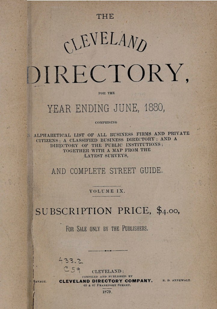
Burning of Fairfield, 1779, by Artist unknown.
(Image courtesy of the Connecticut Museum of History and Culture).

“Many of the residents who lost their homes were offered the choice of money or an equivalent value of land from the half-million acres owned by Connecticut in what is now part of Ohio. Many took the property in what came to be called ‘the Fire Lands’ and never returned.”
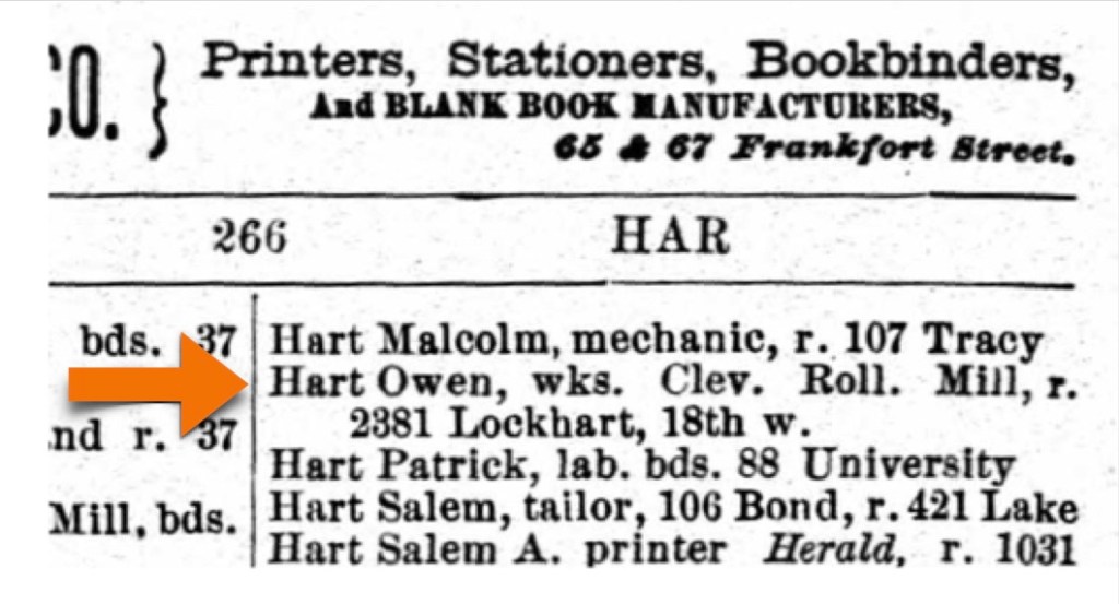
The Burning of the Towns of Danbury, and Fairfield

Yet, he continued to serve even after his ordeal. “Capt. Bostwick appeared as a leader in the Danbury alarm. [The burning of Danbury, Connecticut Continental Army military supply depots by the British forces]. With him were John Terrell and David Buell and Bill Drinkwater. The group from Capt. Bostwick’s company was camped four days in the Danbury alarm.

The following story regarding this little band is extant: The British had commenced their retreat from Danbury by way of Ridgefield and our men were following them up very earnestly, pressing close to a grenadier regiment which was the rear guard of the head force. John Terrell, William Noble, Bill Drinkwater and David Buell rushed together up one side of the famous Ridgefield Hill, while the grenadiers [a soldier armed with grenades] were still on the other side. Men who crossed the Delaware with Capt Bostwick of New Milford, Dec. 25, 1776, and were in the battles of Trenton and Princeton, included William.” (2 Centuries…)

Where was Samuel Drinkwater?
We were wondering why there was no apparent military records for Samuel Drinkwater during the Revolutionary War in Connecticut. The answer was unexpected, and it turns out that the records were in New York, not Connecticut. From WikiTree we learned, “Samuel Drinkwater, the 3rd generation of this surname found in early America and a descendant of Thomas Drinkwater, changed the family name to DeWaters after the Revolutionary War. He, and his wife’s family, were Loyalists. Loyalists were punished by the Patriots and some fled to England or Canada. Loyalists were not allowed to own land and some had their lands confiscated, and some were jailed.” (WikiTree)

We were able to confirm his Loyalist behavior based on the “Minutes of the Committee and of the First Commission for Detecting and Defeating Conspiracies in the State of New York” which documents every detail. (See the footnotes). When we thought about it, the French and Indian War he had served in earlier, was a war fought to protect British interests in America. Samuel eventually ended up in Michigan where his son Amos purchased land for him to live on.

Samuel’s behavior was in contrast to that of his brother William. Despite that, William Jr. still got into much trouble by being in the wrong place, at the wrong time, with the wrong people. The same “Minutes of the Committee…” book explains — it seems that he was with a group of people one evening, and a couple of them were disaffected people which means Loyalist. This was reported, and he got in trouble for it, but he went through the interrogation process, and voluntarily took the “Oath of Allegiance to this State” and was then released. That was in April 1777.

His has many records in the system, quite a few indicating that he was sick, excused, or on furlough. We suspect that he may have gotten ill while he was on the prison ship Dutton. One record notes him as deserting (with an evident question mark ?), in April of 1779, after a little more than two years of service. Other records indicate that he was discharged from service on January 1, 1780. We are not exactly sure what happened there — perhaps he had had quite enough, thank you. He may have ended up raising a family in Dartmouth, Massachusetts, but again, we just don’t know. (7)

William Drinkwater, Late of New Milford

When William Drinkwater Sr. died, as was customary at the time, his estate needed to be inventoried and his debts settled. William and both of his wives are buried in the Northville Cemetery, New Milford, Litchfield County, Connecticut.

Inventory documents from the Probate of William Drinkwater’s estate.

The next chapter is our final chapter in the Soule line. We begin in the Connecticut Colony with William Drainkwater’s daughter Mercy, who is the matriarch of Generation Five in America, with a new family line. (8)

Following are the footnotes for the Primary Source Materials,
Notes, and Observations

With Rods Belaboured

(1) — five records

Barry Lawrence Ruderman
Antique Maps, Inc.
Carte De La Nouvelle Angleterre Nouvelle Yorck et Pensilvanie
by Jacques Nicholas Bellin, circa 1757
https://www.raremaps.com/gallery/detail/97868/carte-de-la-nouvelle-angleterre-nouvelle-yorck-et-pensilvan-bellin
Note: For the map image.

We initially found this newspaper excerpt attached to this file:
William Drinkwater
https://www.findagrave.com/memorial/147201109/william-drinkwater
Note: For the newspaper story by John Peter Zenger, The New-York Weekly Journal, Dec. 31, 1733.

However, the original newspaper story was excerpted two more times in the next two centuries, once in Lippincott’s Magazine, circa 1876 and once more in the The Hudson Valley Review, circa 2016 (see footnotes below). The newspaper publisher, John Peter Zenger became an important historical figure in the cause for freedom of the press in the United States:
The New York Weekly Journal
https://en.wikipedia.org/wiki/The_New_York_Weekly_Journal
Note: For the reference.

Lippincott’s Magazine of Popular Literature And Science
February, 1876., Vol. XVII.
Our Monthly Gossip > Our Early Newspapers
https://www.gutenberg.org/files/13154/13154-h/13154-h.htm 
Note: This publication does not have page numbers; proceed to [pg 261].

The Hudson Valley Review, Spring 2016
Charivari on the Hudson:
Misrule, Disorder, and Festive Play, 1750-1900
by Thomas S. Wermuth
https://www.slideshare.net/slideshow/hrvr-2016/64294627#15
Book page: 46, Digital page: 57/137
Note: This version starts to stray from the original details.

Having Been Put Through The Mill

(2) — three records

PX Pixels
Colonial Grist Mill
by Paul Ward
https://pixels.com/featured/colonial-grist-mill-paul-ward.html
Note: For the mill image.

Two Centuries Of New Milford, Connecticut
An Account Of The Bi-Centennial Celebration Of The Founding Of The Town Held June 15, 16, 17 And 18, 1907, With A Number Of Historical Articles And Reminiscences

https://www.gutenberg.org/files/49048/49048-h/49048-h.htm
Notes: For the text.

Hidden New England
New England’s Grist Mills: Not Run-of-the-mill Historic Buildings
by Jay Bell
https://www.newenglandgoodlife.com/hidden-new-england/new-englands-grist-mills-not-run-of-the-mill-historic-buildings
Note: For the text.

There’s Many Trees In That Orchard!

(3) — fourteen records

Boston Public Library
Norman B. Levanthal Map & Education Center Collection
Plan of the Colony of Connecticut in North America
by Moses Park, 1766
https://collections.leventhalmap.org/search/commonwealth:z603vt46p
Note: For the map image. “Moses Park, a surveyor from Preston, Connecticut, executed this map in 1766 with the assistance of Asa Spaulding of Norwalk and Samuel Mott of Preston.”

William Drinkwater
in the U.S., Find a Grave Index, 1600s-Current
https://www.ancestry.com/search/collections/60525/records/122023930?tid=&pid=&queryId=4843a9fd-46f5-46ab-9c74-022e2410976d&_phsrc=qwN1&_phstart=successSource
and
William Drinkwater
https://www.findagrave.com/memorial/147201109/william-drinkwater
Note: For the data.

William Drinkwater
in the Connecticut, U.S., Town Marriage Records, pre-1870 (Barbour Collection)
New Milford Vital Records 1712-1860
https://www.ancestry.com/search/collections/1062/records/191143
Book page: 76, Digital page: 74/232
Note: For marriage 1.

Elizabeth Drinkwater
in the U.S., Find a Grave Index, 1600s-Current
https://www.ancestry.com/search/collections/60525/records/122024145
and
Elizabeth Benedict Drinkwater
https://www.findagrave.com/memorial/147201356/elizabeth-drinkwater
Note: For the text.

History of the Towns of New Milford and Bridgewater, Connecticut, 1703-1882
Genealogies (chapter)
by Samuel Orcutt, circa 1882
https://archive.org/details/ldpd_11727486_000/page/16/mode/2up
Book page: 692-693, Digital page: 724-725/943
Note: For the text.

Susanah Washburn
in the Connecticut, U.S., Town Marriage Records, pre-1870 (Barbour Collection) New Milford Vital Records 1712-1860
https://www.ancestry.com/search/collections/1062/records/186662?tid=&pid=&queryId=5d790e3c-e896-4e69-844c-f5687b26d2ed&_phsrc=Puk2&_phstart=successSource
Book page: 221, Digital page:219/232
Note: For marriage 2.

Susanna Drinkwater
in the U.S., Find a Grave Index, 1600s-Current
https://www.ancestry.com/search/collections/60525/records/122023247
and
Susanna Washburn Drinkwater
https://www.findagrave.com/memorial/147200354/susanna-drinkwater
Note: For the data.

To account for the births, deaths and marriages of the Drinkwater children from these two families, we created a chart based upon Family Search files, explaining below how to link to the actual files.

1729Thomas2795Birth
1755Thomas2976Death
1731John2961Birth
1755John2962Death
1733Elizabeth2951Birth
1755Elizabeth2953Marriage
1734Hanah2955Birth
1735/46Mary2963Birth
1736Abigail
1738Sarah2972Birth
1771Sarah2974Marriage
1740Jerusha2958Birth
1758Jerusha2959Marriage
1742William Jr.2983Birth
1744Samuel2969 / 2970Birth
1769Samuel2971Marriage
1746Ann
1748Mercy2965Birth
UnknownMercyOther file linkMarriage
1748MercyOther file linkDeath
1751Ebenezer2947 / 2949Birth
1753Johannah2960Birth
1756Thomas2977Birth
1758Ann2940Birth

A New England Dame school in old colonial times, 1713
by Artist unknown, Engraving. (Bettman Archive)
https://commons.wikimedia.org/wiki/File:Dame_School.jpeg
Note: For the image.

NIH > NLM, Native Voices
1755–56: Smallpox sweeps through northern British colonies
https://www.nlm.nih.gov/nativevoices/timeline/223.html
Note: For the text.

The Separatists’ Church of New Milford

(4) — eight records

Church History — The Whole Story History Of The First Congregational Church
New Milford, Connecticut

by Ross Detwiler, originally published November, 1983
revised 2001 and 2016
https://nmchurch.org/long-history/
Note: For the text.

History of the Towns of New Milford and Bridgewater, Connecticut, 1703-1882
Chapter VI. A Meeting-House and the North Purchase, 1716-1731
https://www.ancestry.com/imageviewer/collections/14676/images/dvm_LocHist003746-00063-0?usePUB=true&_phsrc=KMS3&pId=108&backlabel=Return&queryId=9c7228bee4240813c3a8238a9c32f67b&rcstate=dvm_LocHist003746-00038-1:285,940,575,978;1104,1012,1291,1051;1308,2571,1597,2610;1084,3234,1269,3273;1558,3365,1680,3408;103,940,286,978
Book page: 98 Digital page: 109/943
Note: For the text.

The Atlantic
The New England Meeting-House
by Alice Morse Earle
https://www.theatlantic.com/magazine/archive/1891/02/the-new-england-meeting-house/633979/
Note 1: This is not a typo. This is the February 1891 issue.
Note 2: For the text.

The First New Haven Meeting House, New Haven Colony, c. 1690
by Artist unknown, (1892)
File:The First New Haven Meeting House, New Haven Colony restored.jpg
https://commons.m.wikimedia.org/wiki/File:The_First_New_Haven_Meeting_House,_New_Haven_Colony_restored.jpg
Note: For the image.

Connecticut History.org
The Importance of Being Puritan: Church and State in Colonial Connecticut
https://connecticuthistory.org/the-importance-of-being-puritan-church-and-state-in-colonial-connecticut/
Note: For the text.

Wikipedia
Connecticut Colony
Religion
https://en.wikipedia.org/wiki/Connecticut_Colony
Note: For the text.History of the Towns of New Milford and Bridgewater, Connecticut, 1703-1882

Pinterest
Colonial Church Design
Early American Church Spires Vintage Print Meeting Houses | Etsy
https://www.pinterest.com/pin/331014641364220283/
Note: For the image.

History of the Towns of New Milford and Bridgewater, Connecticut, 1703-1882
Chapter XII, Church Of The Separates, 1753—1812
by Samuel Orcutt, circa 1882
https://archive.org/details/ldpd_11727486_000/page/16/mode/2up
Book page: 191 >, Digital page: 222 > (222/1014)
Note: For the text.

Four Sons, and the French and Indian War

(5) — six records

A Prospective Plan of the Battle Fought near Lake George on the 8th of September 1755, by Thomas Johnston
File:A Prospective Plan of the Battle Fought near Lake George on the 8th of September 1755-saam 1966.48.82.jpg
https://commons.wikimedia.org/wiki/File:A_Prospective_Plan_of_the_Battle_Fought_near_Lake_George_on_the_8th_of_September_1755-saam_1966.48.82.jpg
Note: For this image.

Collection of The Connecticut Historical Society, Volume X, circa 1905
Rolls of Connecticut Men in The French and Indian War, 1755-1762, Volume II, 175801762, Appendixes 1755-1764
File:Collections of the Connecticut historical society (IA collectionsofcon00conn).pdf
https://commons.wikimedia.org/wiki/File:Collections_of_the_Connecticut_historical_society_(IA_collectionsofcon00conn).pdf
Note: Pages 142, 280, and 338-339.

Bird’s-eye-view of New Milford, Connecticut, 1906, by Hughes & Bailey, circa 1906.
(Image courtesy of the Library of Congress).

(2 Centuries…)
Two Centuries Of New Milford, Connecticut
An Account Of The Bi-Centennial Celebration Of The Founding Of The Town Held June 15, 16, 17 And 18, 1907, With A Number Of Historical Articles And Reminiscences

https://www.gutenberg.org/files/49048/49048-h/49048-h.htm
Note 1: For the text.
Note 2: This book does not have page numbers. Refer to footnote number on the right-hand side of the page {33} and {34}.

The Canadian Encyclopedia
Battle of the Plains of Abraham
https://www.thecanadianencyclopedia.ca/en/article/battle-of-the-plains-of-abraham
Note: For the image, “A View of the Taking of Quebec, September 13, 1759”.

Battle of the Plains of Abraham
https://en.wikipedia.org/wiki/Battle_of_the_Plains_of_Abraham
Note: For the text.

Capt Archibald McNeill Jr.
https://www.findagrave.com/memorial/67585021/archibald-mcneill
Note: For his correct surname spelling.

Two Sons, and the Revolutionary War

(6) — three records

The Death of General Montgomery in the Attack on Quebec, December 31, 1775,
by John Trumbull, circa 1786.
https://en.wikipedia.org/wiki/File:The_Death_of_General_Montgomery_in_the_Attack_on_Quebec_December_31_1775.jpeg
Note: For this image.

(2 Centuries…)
Two Centuries Of New Milford, Connecticut
An Account Of The Bi-Centennial Celebration Of The Founding Of The Town Held June 15, 16, 17 And 18, 1907, With A Number Of Historical Articles And Reminiscences

https://www.gutenberg.org/files/49048/49048-h/49048-h.htm
Note 1: For the text.
Note 2: This book does not have page numbers. Refer to footnote number on the right-hand side of the page {39} and {40}.

British Merchant east indiaman ‘Dutton’ (1763)
https://threedecks.org/index.php?display_type=show_ship&id=29454
Note 1: The ship nationality is Great Britain, and it was operated by the East India Company until is was utilized to hold prisoners of war.
Note 2: Found in the comments — “Posted by Tom Hogan on Monday 14th of June 2021 12:45, This ship apparently held American prisoners at New York in 1776. In their pension applications, Pvt. Roswell Becket and Pvt. Enoch Greenwood, both taken at Fort Washington, reported being held for a time aboard the Dutton. The ship may have been in the Transport Service and was used as a prison after the large influx of captives from Fort Washington arrived in November 1776.”
Note: For the data about timeframe and country origin.

The Burning of the Towns of Danbury, and Fairfield

(7) — seven records

Connecticut History.org
The Burning of Danbury
https://connecticuthistory.org/the-burning-of-danbury/
Note: For reference.

Connecticut History.org
British Burn Fairfield – Today in History: July 7
Burning of Fairfield, 1779
by Artist unknown
https://connecticuthistory.org/british-burn-fairfield/
Note: For text and the woodcut illustration.

WikiTree
Drinkwater Name Study
Drinkwater Name Changed, Drinkwater > Dewalter
DeWaters
https://www.wikitree.com/wiki/Space:Drinkwater_Name_Study
Note 1: “Samuel (Drinkwater, the 3rd generation of this surname found in early America and a descendant of Thomas Drinkwater, changed the family name to DeWaters after the Revolutionary War. He, and his wife’s family, were Loyalists. Loyalists were punished by the Patriots and some fled to England or Canada. Loyalists were not allowed to own land and some had their lands confiscated, and some were jailed.”

Minutes of the Committee and of the First Commission for Detecting and Defeating Conspiracies in the State of New York, December 11, 1776-September 23, 1778, with collateral documents : to which is added Minutes of the Council of appointment, state of New York, April 2, 1778-May 3, 1779
by New York (State). Commissioners for Detecting and Defeating Conspiracies
https://archive.org/details/minutesofcommitt571newy/page/288/mode/2up

William Drinkwater
in the U.S., Compiled Revolutionary War Military Service Records, 1775-1783
Connecticut > Seventh Regiment > D
https://www.ancestry.com/search/collections/1309/records/440757?tid=&pid=&queryId=9a3bc703-5e28-4bb9-9d44-e4caaae3c054&_phsrc=Qwp1&_phstart=successSource
Digital page: 1409/1879
and
https://www.ancestry.com/search/collections/1309/records/440757?tid=&pid=&queryId=0e9420b9-85e2-45cf-8d6b-6f3652956042&_phsrc=Qwp5&_phstart=successSource
Digital page: 1452/1879
and
https://www.ancestry.com/search/collections/1309/records/440754?tid=&pid=&queryId=a04db6c4-0211-4b51-a0f3-d866cf058fdf&_phsrc=Qwp3&_phstart=successSource
Digital page: 1410/1879
Note: For the data.

William Drinkwater, Late of New Milford

(8) — one record

William Drinkwater
in the Connecticut, U.S., Wills and Probate Records, 1609-1999
Woodbury District > Probate Packets, Downs, C-Edmond, M, 1720-1880
https://www.ancestry.com/search/collections/9049/records/2465233?tid=&pid=&queryId=2aca2ddd-03e3-4f17-b65e-830efbf1bc7c&_phsrc=VgH4&_phstart=successSource
Digital page: 850-857/1417
Note: Case 1384

The Soule Line, A Narrative — Five

This is Chapter Five of seven, where we continue the historical development of the Soule line, as it enigmatically weaves its way slowly westward across the Province of Masssachsetts Bay.

Preface

Family surnames have evolved over time as generations change. Some of these changes happen through clerical records when family surnames were influenced by both profession, and whoever did the record keeping. Even understanding that, family surnames can also change through marriage. Let’s take a moment to review how our primary family surnames have shifted in just a few generations.

The Last Generation, in Europe — We began in chapter one with many name variations being encountered: Sol/Sols/Solis/Soltz/Soule, which connected through marriage with Lapis/Labis/Labus/Lapres/Laber.

Generation One, in America — In chapters two and three, Soule combined with:
Becket/Buckett, to standardize the Soule surname.

Generation Two, in America — (chapter four) The Haskell/Frowd family married with the Soule family, and the Soule name ended for our family. (The Stone and Hardy families also played important roles.)

Generation Three, in America — (Here: chapter five) The Haskell name ends for our family, and this generation is known by the name of Drinkwater.

This vintage crazy quilt, circa 1882, is captioned “The crazy quilt given to Mia in 2016
by Carolyn Crandall Bremner and family in honor of their grandparents…”
(Image courtesy of the Minneapolis Institute of Art).

Every Stone, Every Leaf, Every Clue

A crazy quilt is made from irregular patches of cloth embroidered and gathered together with little or no regard to pattern, but — each piece of cloth has a story, and when they combine, they create a new unique tale. This is how it was with this generation of Drinkwater ancestors: just a crazy quilt of names, locations, dates, and hints of missing history.

We have created a narrative that tells much of their story, and when we see a point where we are not sure exactly what happened, we qualify that part and tell you what we think happened and why.

We have diligently turned over every stone, every leaf, every clue, by pouring through many different resources all trying in vain to locate some concrete information about the early life and parentage of our 6x Great Grandfather, Thomas Drinkwater. Short of holding a séance, we don’t think that his life before he and Elizabeth Haskell met will truly be known, unless new information is discovered and released. (We would welcome that event). (1)

Genealogy research can be quite serious work.

The New England Colonies in the 1670s

This chapter begins with the world of Colonial New England being in a state of continual flux. The part of Massachusetts where they lived for much of their lives, is an area we are already familiar with — the Plymouth Colony going back to the 1620 arrival of the Mayflower. A little more than fifty years after George Soule arrived there, the entire region was engulfed in what is considered to be one of the deadliest conflicts in colonial history, King Phillip’s War. Many, many lives were lost and untold records were destroyed.

We don’t know exactly how, or when, Thomas Drinkwater and Elizabeth Haskell met, nor when they married. The lifetimes of Thomas Drinkwater and Elizabeth Haskell (in total), cover the 50 years from circa 1670 through 1715-20. We believe that they were married before 1699. The lives of their children cover almost the full breadth of the 18th century, from 1700 through 1790.

In the section below, Navigating Their Lives, we created a reconciled list of their children’s birthdates, marriage dates with spouses, and death dates. We needed to consult about 50-60 sources to verify details, so not all of them have footnotes. In doing that, we saw a great lack of conformity in record reporting, even with other modern researchers. We have tried to account for this by noting some important dates that affect interpretation of the surviving records. These items are noted just below this map.

New England Colonies in 1677.
(Map courtesy of the National Geographic Society).

1643 — The official establishment and charter of the Rhode Island and Providence Plantations. Note: We are using Rhode Island Colony for brevity.

1661 — Middleborough / Middleboro / Middlebury is the name of the place formerly called Nemasket. The official town spelling is Middleborough. Middleboro is a shortened form cited in many historical documents for many years, even after 1661. Middlebury is now an archaic form. (Middleborough is just east of Plymouth on the map above. See the John Seeler 1675 map in The Soule Line, A Narrative — Four, for more clarity).

In 1677, Massachusetts was made up of Plymouth Colony and Massachusetts Bay Colony plus the areas of New Hampshire, the Province of Maine, Martha’s Vineyard, and Nantucket. The Connecticut Colony and the Colony of Rhode Island and Providence Plantations, were originally settled by people from Massachusetts. Maine was not officially a state until 1820.

1685 — Plymouth County is established, in anticipation of the merger with the Massachusetts Bay Colony. (Prior to this date, it was simply Plymouth Colony).
and
1685 — Bristol County is also established due to this intended merger.

1691 — PMB explained — is an acronym for the Province of Massachusetts Bay, a royal colony. (The Plymouth Colony merged with the Massachusetts Bay Colony and other territories to form the Province of Massachusetts Bay, which included the counties of Barnstable, Bristol, and Plymouth). Note: We are using PMB (in bold) for this designation for brevity.

1788 — On February 6, 1788, Massachusetts officially becomes a State. (2)

Navigating Their Lives

We have no actual birth and death records for Thomas Drinkwater, so the dates for his lifetime are inferred. We believe he was could have been born circa 1670, possibly in Plymouth, Plymouth Colony, Massachusetts, or possibly in Newport, Rhode Island Colony. (Even though we lack concrete evidence for either location). He died between the dates of September 10, 1711, and certainly before June 21, 1715. (See footnotes).

A New and Accurate Map of the Colony of Massachusets Bay, In North America from a Late Survey,
circa 1780.
(Image courtesy of the Boston Public Library).

We have used colors to indicate on this map the different locations where the family lived and where the children were born.

  • Gray —
    Plymouth and Duxbury are the origin places for the previous generation, and Plymouth is a possible origin place for the father Thomas Drinkwater.
  • Yellow —
    The mother Elizabeth Haskell, was born in Middleborough, July 2, 1672, as were three of her children (see below).
  • Red —
    The location of Freetown turns up in records as a place they lived, but no children are recorded as having been born there.

The eight children of Elizabeth Haskell and Thomas Drinkwater are:

  • Blue —
    Warren (aka Walter) Drinkwater, born August 8, 1700 in Newport, Newport*, Rhode Island Colony — died May 5, 1734 in Falmouth, Cumberland**, Maine.
    Note: Did he change his name from Warren to Walter? No. (See our extensive footnotes).
  • Green —William Drinkwater, born about 1701 in Touisset (an area of) Swansea, Bristol, PMB — died 1758 in New Milford, Litchfield, Connecticut Colony. He married first Elizabeth Benedict, December 18, 1728 in New Milford, Connecticut Colony; they had 12 children. (We are descended from William and his wife Elizabeth.) He married second Susanna Washburn, March 14, 1751. They had 4 more children.
  • Yellow —
    George Drinkwater, born about 1702 in Middleborough, Plymouth, PMB — died November 21, 1737 in Yarmouth, Cumberland**, District of Maine. He married Elizabeth Parker.
  • Yellow —
    John Drinkwater, born March 19, 1703 in Middleborough, PMB — died after 1772 in New Milford, Litchfield, Connecticut Colony, United States. He married Elizabeth Staple, September 23, 1742 in Portsmouth, Newport, Rhode Island Colony.
  • Yellow —
    Elizabeth Drinkwater, born June 18, 1708 in Middleborough, Plymouth, PMB— died after June 18, 1729. She married John Dudly, May 2, 1717 in Dighton, Bristol, PMB.
  • Orange —
    Joseph Drinkwater, born November 10, 1709 in Taunton, Bristol, PMB — died April 18, 1784 in North Yarmouth, Cumberland, District of Maine. He married Jane Latham May 18, 1732 in the same location.
  • Yellow or Orange —
    Samuel Drinkwater, born April 25, 1711 in either Middleborough or Taunton, PMB — died between 1771 to March 6, 1789 in Dighton, Bristol, PMB. He married Dorrity Joselin, April 25, 1734 in same location where he died.
  • Teal —
    Patience Drinkwater, born December 10, 1713 in Swansea, Bristol, PMB —  died 1790 in Dartmouth, Bristol, Massachusetts State.

*became Newport County (in 1703), **became Cumberland County (in 1760)

Roger Williams Sheltered by the Narragansetts, by A. H. Wray, circa 1856. (Image courtesy of the New York Public Library).

Roger Williams (c. 1603 – March 1683) was an English-born New England Puritan minister, theologian, and author who founded Providence Plantations, which became the Colony of Rhode Island and Providence Plantations and later the State of Rhode Island. He was a staunch advocate for religious freedom, separation of church and state, and fair dealings with the Native Americans. (Wikipedia).

Our Analysis: All of the births and deaths of these Great Aunts and Uncles seem pretty straightforward, except for these facts: What this map shows is that their first child (Warren), was born in Newport, Rhode Island Colony, followed by the birth of (William) in Swansea, PMB. Both locations are far away from the towns of Plymouth, Duxbury, and Middleborough, Massachusetts.

The next three children who followed, were born in Middleborough, which is near Elizabeth’s parents who were still living (for a few more years). Other family members were presumably in the area — their availability would have been helpful to this young and growing family.

Next, for child number six (Joseph), we move away again from Middleborough, to Tauton/Dighton.

For child seven (Samuel), born in Middleborough or Taunton, (but likely in Taunton).

Lastly, there is child eight (Patience), born as her older brother William was, in Swansea, PMB. For much of this period, there seems to be much relocation up and down the Taunton Great River.

What does all this mean in the absence of records? We can infer that there were a few years where they seem stable and living in Middleborough. Why were they there? Her parents John and Patience Haskell were near the ends of their lives and it’s plausible that Elizabeth wanted to be near them. Most of the other locations look like they could possibly be maritime related, or at least related to owning property near water that could then transport crops to market. (3)

Newport Rhode Island in 1730, by J.P. Newell.
(Image courtesy of Posterazzi).

The Newport Mystery

Warren being born in Newport, Rhode Island Colony seemed especially odd because it just didn’t fit into any patterns we had seen before. The question became, why Newport? There are no records of the Drinkwater family name in the Plymouth area, until we encounter Thomas. Even though these locations don’t look that far apart on a map, in the 1670s, people just didn’t just pick up and move across land that was still considered to be a dangerous wilderness. When necessary, they probably traveled by water.

Had Thomas Drinkwater been a mariner? A captain of trading ships? More importantly, was there a family connection to that area? This is what we found:

Excerpted from pages 72-73 of the Rhode Island Court Records, Vol. II. Records of the Court of Trials of the Colony of Providence Plantation, 1662-1670. (Image courtesy of Ancestry.com).

A Thomas Drinkwatter (Note the two t’s in the surname spelling) was in Providence, Rhode Island Colony court in November 1668, for a case about illegally burning a fence. He was found not guilty. This event took place in November 1668 which was about two years before Thomas Drinkwater of Plymouth was born. That far back in time (over 350 years ago), there were very few Drinkwaters yet in New England.

We find it quite plausible that this person could be a relative — possibly a father, or an uncle? The fact that the case was in a Providence court was probably due to the fact that Providence was a more secure location inside of Narragansett Bay. That same Bay would have been the local superhighway for travel.

Summary: Our 6x Great Grandfather Thomas Drinkwater may have been from England, but it is more likely that his father, also named Thomas, was an immigrant from England. Our great grandfather was either born at the Rhode Island Providence Plantations, or he immigrated, as a very young child, with his family to America. He married our 6X Great Grandmother Elizabeth Haskell, probably in Middleborough, Massachusetts. They then set out for a life that took them from Newport, Rhode Island, to Plymouth County, Massachusetts, up and down the Great Taunton River. This crazy quilt of a life eventually fostered our 5x Great Grandfather William Drinkwater. (4)

To Finally Slip Away

We learned that Thomas Drinkwater died Intestate (without a Will). On the fifth line in the Drinkwater document below it indicates “Lately dyed Intestate.” This document, dated June 25, 1715, appoints his wife, Elizabeth Drinkwater, as the administrator of his inventory, listed as goods, chattels and credits*.  The list of inventory is also shown below. The document lists September 20 and December 20, 1715 as dates by which the inventory needs to be completed.

We often see June 25, 1715 as the death date for Thomas Drinkwater. This document tells us that he died sometime before that date.

*Goods and chattels generally refer to property that is not real estate… In common law , the term broadly included any moveable property or property rights that did not involve land and real estate, including rights such as leases.” (Cornell Law School)

From the Massachusetts, Plymouth County, Probate Records, 1633-1967.
The document date is June 25, 1715.
The inventory and administration papers of Thomas Drinkwater’s estate.

Notice on the above court document the signatures of Thomas Drinkwater’s sons William Hascall and Josiah Hascall. At first it appears as their signatures, but looking closely you can see the mark X indicating they could not write their names.

We have not located (nor has anyone else) an actual death record for Elizabeth (Haskell) Drinkwater, but nonetheless, we do not understand the 1715 date attached to her ‘findagrave.com’ website file. We believe that it is unlikely she actually died in 1715, because she is signing documents involved with the administration of her husband Thomas Drinkwater’s estate during that time. She had probably passed on by the early 1720s because several of her children are recorded as being involved in property transactions during that period.

We started this chapter by describing crazy quilts. Our Grandmother Lulu Gore used to sit in the church basement with her lady friends, everyone engaged in a group sewing activity. Working together, they carefully crafted quilts which were stretched tightly across wooden frames. It was always a shared experience — the quilting, the sewing, and the sharing of stories about the lives of their children. (5)

Following are the footnotes for the Primary Source Materials,
Notes, and Observations

Every Stone, Every Leaf, Every Clue

(1) — one record

Minneapolis Institute of Art
Mia’s newest crazy quilt recalls a grandmother’s love—and talent
by Leslie Ory Lewellen
https://new.artsmia.org/stories/mias-new-crazy-quilt-recalls-a-grandmothers-love-and-talent
Note: For the crazy quilt photo.

The New England Colonies in the 1670s

(2) — four records

The National Geographic Society
New England Colonies in 1677
https://education.nationalgeographic.org/resource/massachusetts-1677/
Note: For the map image.

Colony of Rhode Island and Providence Plantations
https://en.wikipedia.org/wiki/Colony_of_Rhode_Island_and_Providence_Plantations
Note: For location confirmation and dates.

Plymouth County, Massachsetts
About
https://www.plymouthcountyma.gov/about
Note: For the 1685 text.

National Park Service
Explorers and Settlers
Historical Background
https://www.nps.gov/parkhistory/online_books/explorers/intro25.htm#:~:text=In%201691%2C%20Massachusetts%20was%20granted,as%20formerly%2C%20but%20also%20Plymouth.
Note: For this text: “In 1691, Massachusetts was granted a new charter, as a royal colony, and to it was attached not only Maine, as formerly, but also Plymouth.”

Navigating Their Lives

(3) — nineteen records

The Arms of Drinkwater of Salford County, Lancashire.
Note: We have not been able to prove this familial connection, but we wanted to address this matter since it is out there causing mischief.

Thomas Drinkwater Death
in the U.S., Find a Grave Index, 1600s-Current
https://www.ancestry.com/search/collections/60525/records/73615725
and
Thomas Drinkwater
https://www.findagrave.com/memorial/124601468/thomas-drinkwater
Notes: For both entries, the June 25, 1715 date given for his death is not correct. He died sometime between the dates December 10, 1713— when his last child was born and before June 25, 1715 when his wife was in court being named his administrator because he died Intestate. It is most likely he died near the June 1715 date because the court would not have waited too long after his death to have his inventory completed and his debts paid.

On September 11, 1715 he quitclaimed a deed to John Hascall (brother-in-law) for land his wife inherited from her father, who had passed away.

Thomas Drinkwater
in the Mayflower Deeds and Probates, 1600-1850
https://www.ancestry.com/search/collections/3223/records/13888
Note: September 10, 1711 Quit claim deed record.

Thomas Drinkwater
in the Massachusetts, U.S., Wills and Probate Records, 1635-1991
https://www.ancestry.com/search/collections/9069/records/6848912
Plymouth > Probate Estate Files, No 6744-6790, Drew, William-Dunbar Jesse, Ca. 1686-1881
Digital pages: 104-108/1009 (5 pages Total)
Notes: Document file number is 6747. Probate date is January 21, 1715. It says that he lived in Midbury [Middleborough], Plymouth County.

Elizabeth Drinkwater
in the U.S., Find a Grave Index, 1600s-Current
https://www.ancestry.com/search/collections/60525/records/73615804
Note: For her death record.
and
Elizabeth Haskell Drinkwater
https://www.findagrave.com/memorial/124601558/elizabeth-drinkwater
Note: For her death record.

Boston Public Library
Norman B. Levanthal Map & Education Center Collection
A New and Accurate Map of the Colony of Massachusets Bay, In North America from a Late Survey
https://collections.leventhalmap.org/search/commonwealth:wd3765665
Note: Published in London in 1780.

Sources to create a compilation of the Thomas Drinkwater / Elizabeth Haskell children, were derived from these files—

Thomas Drinkwater
https://www.ancestry.com/family-tree/person/tree/21443362/person/1084690133/facts
Note: These files still required verification and clarity before we could use them.

The Strange Case of Warren and Walter Drinkwater of Freetown, MA – Ruth Wilder Sherman
https://www.ancestry.com/mediaui-viewer/collection/1030/tree/174263639/person/152378340108/media/9c6b8570-ea8b-4eaa-8775-3b092cd01479?galleryindex=1&sort=-created&filter=p

“Although Mayflower records state Warren was born at Middleboro, MA, Rhode Island vital records claim he was born at Newport. Mayflower records have omitted Walter from their list of Thomas’s children, saying ‘although the Drinkwater Family names the eldest son Walter, a diligent search has failed to find any reference to such a person.’ The 1991 addendum to this volume further explains that “Walter changed his name from Walter to Warren” which simply adds to the confusion. (He’s called Warren at birth).

Files however, show there was such a person with two references to Walter and one to Warren taken from Plymouth County deeds. Aug. 1, 1721, Walter Drinkwater of Freetown, (sold) two-ninths to James Rayment; Mar. 15, 1722, Walter Drinkwater of Freetown, to Stephen Easton and Sep 17, 1723, Warren Drinkwater of Freetown to Thomas Croade. The files contain references to all eight of Thomas Drinkwater’s children who deeded one-ninth of the share of their father’s estate, with the eldest deeding two-ninths. The eldest appears to be Walter with no mention of Warren. So, from the records cited, there is a Warren born in 1700, a Walter in 1721, a Walter in 1722 and a Warren in 1723. The only explanation appears to be that Warren changed his name to Walter, it was recorded incorrectly in the records, or they were two separate men. William Coddington, Town Clerk recorded Warren’s birth as May 29, 1723. There is no known marriage or children.

Comments: His father was not alive in 1723, and it is not likely that his mother was either — so the town clerk William Coddington must have been writing about some other Drinkwater family. In addition, May 23, 1723 is after the other property transactions were already concluded.

To support the Ruth Wilder Sherman viewpoint, we provide the following:
Rhode Island, U.S., Vital Extracts, 1636-1899
for Warren Drinkwater
Vol. 04: Newport County: Births, Marriages, Deaths
https://www.ancestry.com/search/collections/3897/records/51157
Book page: 94, Digital page: 218/691,
Note 1: The only Drinkwater reference on the page, it is found at the center, as entry 57
Note 2: It is a reference for a birth. The text reads, “57 DRINKWATER Warren, of Thomas and Elizabeth, Aug. 8, 1700.”
and
Mayflower Births and Deaths, Vol. 1 and 2
forWarren Drinkwater
Volume 2
https://www.ancestry.com/search/collections/3718/records/12189
Book page: 298, Digital page: 301/551
Note: File is just below.

We also discovered several references to Warren Drinkwater connected with three of his brothers and their life in North Yarmouth, Province of Maine.

The above excerpt is from:
Ancient North Yarmouth and Yarmouth, Maine, 1636-1936: a history
Chapter III. North Yarmouth — A plantation. 1690-1733
https://www.ancestry.com/imageviewer/collections/21850/images/dvm_LocHist007949-00051-1?usePUB=true&pId=94
Book page: 79, Digital page: 97/473

As Warren Drinkwater, he is cited in the three court records a couple of years before he passed on:

Drinkwater, Warren
in the Maine Court Records, 1696-1854
https://www.ancestry.com/search/collections/6888/records/41073?tid=&pid=&queryId=58b948a1-40a1-4b77-b90f-35852028f470&_phsrc=bgv5&_phstart=successSource
Note: Court case for debts, January 1732.
and
https://www.ancestry.com/search/collections/6888/records/41108?tid=&pid=&queryId=92ddc495-1aaf-4e32-ac54-58fc3f20ac86&_phsrc=bgv7&_phstart=successSource
Note: Court case for debts, April 1732.
and
https://www.ancestry.com/search/collections/6888/records/47593?tid=&pid=&queryId=3d6e8635-f754-4349-af35-e67ff42119c4&_phsrc=bgv9&_phstart=successSource
Note: Court case for debts, July 1732.

Conclusion: This ancestor was born named Warren Drinkwater. Walter is either his middle name (if he had one), a nick-name (if he had one), or it is a clerical error on past paperwork. OR WAS HE A TWIN?

Comment: Even though we are not descendants of the brother Joseph Drinkwater, we wanted to share this 1901 newspaper clipping we came across here: https://www.findagrave.com/memorial/249845059/joseph-drinkwater . Please note that there are several documents at this location, but some of them could be unverified, apocryphal information.

New York Public Library
Roger Williams Sheltered by the Narragansetts
by A. H. Wray, circa 1856
https://digitalcollections.nypl.org/items/8bfe7940-ba01-0132-96dc-58d385a7bbd0
Note: For this image.

Roger Williams
https://en.wikipedia.org/wiki/Roger_Williams
Note: For his short biographical text.

Posterazzi
Newport Rhode Island in 1730
by J.P. Newell
https://www.posterazzi.com/newport-rhode-island-in-1730-j-p-newell-poster-print-item-varsal900116360/
Note: For the harbor image.

The Newport Mystery

(4) — two records

Rhode Island Court Records, Vol. II. Records of the Court of Trials of the Colony of Providence Plantation, 1662-1670
https://www.ancestry.com/imageviewer/collections/17373/images/dvm_PrimSrc000293-00082-0?queryId=8d913042-3192-4727-84aa-18d70120de9b&usePUB=true&_phsrc=wcy1&_phstart=successSource&pId=99&rcstate=dvm_PrimSrc000293-00098-0:365,3358,655,3407;668,3348,900,3401;562,3423,790,3477;617,3569,819,3614;461,546,612,651;469,832,592,917;471,830,690,942;544,1039,769,1085;585,1182,752,1227;468,1396,586,1460;462,1891,499,1931;633,1956,883,2051;512,2028,751,2111;535,2244,680,2322;552,2452,705,2510;572,2663,724,2744
Book page: 72-73, Digital page: 160-161
Note 1: The Volume II title page is at this link: https://www.ancestry.com/imageviewer/collections/17373/images/dvm_PrimSrc000293-00046-0?usePUB=true&_phsrc=nIq5&pId=54
Note 2: In the original court record of the case is on page 253.
Note 3: In the manner in which the cases are transcribed, makes it appear that this case was tried in 1668, possibly in November.

To Finally Slip Away

(5) — three records

Cornell Law School
Legal Information Institute, Good and Chattels
https://www.law.cornell.edu/wex/goods_and_chattels
Note: For the legal definition.

Massachusetts, Plymouth County, Probate Records, 1633-1967
Probate records 1708-1717 and 1817-1861 vol 3-3P
https://www.familysearch.org/ark:/61903/3:1:3QS7-997D-ZXLV?lang=en&i=181
Book page: 341, Digital page: 182/710
Note: For the record of probate.

Thomas Drinkwater
in the Massachusetts, U.S., Wills and Probate Records, 1635-1991
https://www.ancestry.com/search/collections/9069/records/6848912
Plymouth > Probate Estate Files, No 6744-6790, Drew, William-Dunbar Jesse, Ca. 1686-1881
Digital pages: 104-108/1009 (5 pages Total)
Note 1: 2 documents presented within document file number is 6747.
Note 2: The probate date is January 21, 1715, and it says that he lived in Midbury [Middleborough], Plymouth County

The Soule Line, A Narrative — Four

This is Chapter Four of seven. In this Generation Two in America we learn a bit about the Stone, Haskell, and Hardy families who were early English immigrants to the Massachusetts Colony. Our 7x Great Grandparents John and Patience Haskell continue the history.

The Haskell Family Were Originally From Somerset, England

The Haskell family can be reliably traced back to William Haskell and Elinor Frowd of Charlton Parish, northern Wiltshire, England. This small Parish is near the Shire borders of Dorset, Somerset, and Wiltshire. Elinor and William had seven children, all baptized at this parish, including the oldest son Roger, who was Christened March 6, 1613/14. William Haskell died and is buried there, circa 1630.

From the Somerset, England, Church of England Baptisms, Marriages, and Burials, 1531-1812,
this reads “Roger Haskall the son of William Haskall was baptized the 6th day of March — 1613.
(Image courtesy of Ancestry.com).

The widow Elinor Haskell, then married John Stone “a fellow also with a son, whose wife had died. John Stone had a Certificate from the Minister at Hawkhurst, that stated, they were conformable to the Church of England”, so they immigrated to America [sailing on] the “Elizabeth of London” and tradition is that they sailed from Bristol, England to Salem, [Massachusetts Colony] and anchored in the North River off Massey’s Cove. 

Observations: If they were comformable with the Church of England, they may have been Puritans. “On March 19, 1628, the King [Charles I] granted a royal charter to the Massachusetts Bay Company, promoting the settlement of the territory ‘from sea to sea’ that had been granted to the Puritans, and to govern its colonies. The charter was the first foundation of government for the Massachusetts Bay Colony.” (See footnotes). Therefore, we wonder if those people who were allowed to immigrate to the Massachusetts Bay Colony were encouraged to be Puritans. The Plymouth Colony never received this same status from any King of England. This is one of the contributing factors as to why the Plymouth Colony was eventually absorbed into the Massachusetts Bay Colony in 1691.

“It was common in those early days of the settlement of the new world, that you would gain a deed to the property after having lived there one year. It was an incentive to have people come from England and etc. to move to the new world or the frontier. Often they would apply for additional lands as the years went by.

The Hardships + Sacrifice Masseys Cove Salem 1626 The First Winter. A mighty nation was born God leading these noble men and women.” by John Orne Johnson Frost, circa 1920-28.
(Image courtesy of Historic New England).

Salem and Beverly was separated by a river, and from the increased traffic, it became necessary to provide the means to cross the river and a ferry was provided. John Stone owned and operated the ferry from Massey’s Cove in Salem, later selling it to William Dixie. In a grant of 1637, John Stone and family received 10 acres and on January 1, 1638 an additional 30 acres with him being recorded as having seven in the household…

Roger worked as a farmer and also with John Hardy as a fisherman. The first few years of the Salem Colony, they followed the sea and made fishing their livelihood. It was while he was thus employed, that he became interested in the daughter of John Hardy and undoubtedly had many occasions to come into contact with her during those great fishing years. Roger Haskell and Elizabeth Hardy marry before 1644, when the father-in-law [John Hardy] interceded [with] 6 acres of Meadow Land for Roger. They lived with the Hardys for several years before moving to a house of their own. They had nine children; John, William, Mark, Elizabeth, Hannah, Roger, Josiah, Sarah, and Samuel — 6 boys and 3 girls. 

John Hardy became a well-to-do landowner, and in his Will which “was proved on January 30, 1652… he bequeathed all his land lying near the Basse River to Roger Haskell — my son-in-law (being all the land given him by the town of Salem). He gave Roger a steer and a cow which Roger was then taking care of, also an Ox which John’s wife Elizabeth was to pick from three in the William Flint herd.

Scene of colonial agriculture, Providence 1650, by Jean Blackburn.
(Image courtesy of Ag Learning Hub).

Roger served on a Jury 1655, 1662, and 1664, also was the Constable of the Basse River side for Salem for two years 1657 and 58. He was in the Court Record several times in connection with his job. Due to the land descriptions being somewhat clouded, Roger was in the courts many times clarifying descriptions. Old deeds and documents are most interesting and would often present a problem, as an instance, take this strange and unusual boundary, ‘running to a white oak with a birds nest in it’. Roger acquired considerable land holdings and was in court many times about boundaries.” (FamilySearch Library, 400 Years With Haskells — FSL400) (1)

Enter John Haskell

“John Haskell, [born about 1640, the husband of Patience Soule], was the first son of Roger Haskell, an emigrant from England, and Elizabeth Hardy whose father was in the fishing business. An interesting item was that John was sued for Breach of Promise in an Ipswitch, term of Court by John Proctor, in March of 1665 on behalf of his daughter Martha, which he won. 

It must have not deterred John though, because he married Patience Soule in January 1666.” (FSL400) Their marriage is recorded in the records for Middleborough, Plymouth, Massachusetts Colony.

Patience Sole in the Massachusetts, U.S., Town and Vital Records, 1620-1988.
(Image courtesy of Ancestry.com).

The map below has three arrows on it, for indications as to where these ancestors were born and raised. John Haskell is from Salem [Essex County], indicated by the uppermost white arrow. We already know that Patience Soule is from Duxbury, as shown by the lower white arrow. The bright green arrow indicates where the town of Middleborough, just east of Plymouth, is located. This is where they lived and raised their own family.

A mapp [sic] of New England, by John Seller, circa 1675.
A foundation in the early history of the mapping of New England, this map is the first printed version of William Read’s original survey of 1665.
(Image courtesy of the Norman B. Leventhal Map & Education Center Collection,
of the Boston Public Library).

1661 — Middleborough / Middleboro / Middlebury is the name of the place formerly called Nemasket. The official town spelling is Middleborough. Middleboro is a shortened form cited in many historical documents for many years, even after 1661. Middlebury is now an archaic form.

“As the town records were destroyed in the [King Phillip’s] war, it is impossible to give an exact list of men living in Middleborough… John [and Patience] lived in Middleborough before the year 1670, as the town records show birth of children between that time and the year 1684… [Nonetheless] it is hardly probable that the court at Plymouth would have incorporated a town unless there had been a larger number of inhabitants. We give below a list of forty-one who are known to have lived here, as the names are to be found in Plymouth records, in deeds, as office-holders and freemen, from records of births and deaths, as well as from reliable family note-books, and seven who were here according to generally accepted tradition.” – listed is John Haskall. (History of The Town of Middleboro, Massachusetts – HTM) (2)

The Haskell children in the Massachusetts, U.S., Town and Vital Records, 1620-1988. (Image courtesy of Ancestry.com).

The Haskell Family Children

John and Patience had eight children over a period of about 16 years. All of the children were likely born in Middleborough, Plymouth County [as such in 1685]. All deaths were in the Province of Massachusetts Bay [as such in 1691], unless otherwise noted.

In 1685, Plymouth County and Bristol County were established, in anticipation of pending merger with the Massachusetts Bay Colony. (Prior to this date, it was simply Plymouth Colony).

In 1691, The Plymouth Colony merged with the Massachusetts Bay Colony and other territories to form the Province of Massachusetts Bay, a royal colony. The included counties of Barnstable, Bristol, and Plymouth continued to exist). We use PMB for this designation for brevity.

  • John Haskell, Jr., born June 11, 1670 — died February 17, 1728 in Killingly, Connecticut. He married Mary Squire, March 2, 1700 in Middleborough; they had 12 children.
  • Elizabeth Haskell, born July 2, 1672 — died 1715 in Middleborough, Plymouth County. She married Thomas Drinkwater, circa 1695-99 in Middleborough; they had 8 children.
    We are descended from Elizabeth and Thomas.
  • William Haskell, born June 11, 1674 — died date unknown.
  • Patience Haskell, born February 1, 1679 — died February 14, 1706 in Middleborough, Plymouth County.
  • Bethiah Haskell, born January 15, 1681 — died after March 1739 in Rochester, Plymouth County. She married first Richard Westcott, May 10, 1715 in Dighton, Bristol County. She married second Thomas Childs, August 29, 1727 in Rochester, Plymouth County; she married third, William Sherman; one child.
  • Mary Haskell, born July 4, 1684 — died date unknown. She married Scotto Clarke, April 17, 1706 in Rochester, Plymouth County; they had 10 children.
  • Josiah Haskell, born June 18, 1686 — died in Freetown, Bristol County, before March 1775. He married first Sarah Kenedy/Canady, March 26, 1718 in Middleborough, Plymouth County; they had 6 children. He married second Sarah Brayley, March 27, 1729 in the same location; they had four more children.
  • Susannah Haskell, born January 15, 1691 — died in Freetown, Bristol County, between 1723 and 1731. She married  Thomas Paine, February 21, 1712 in Taunton; they had 5 children. (3)

Also Known As Middleboro John

He was one of twelve who were freemen before the year 1689, and was a large owner of real estate in the Twentysix Men’s Purchase, [and the Sixteen Shillings Purchase], with other purchases. [These purchased properties can be inferred from the map shown below on the left]. At one time he owned, with his brother-in-law, Francis Walker, a tract of land bounded by Raven Brook and the Indian Path, which included the pasture land and swamp later owned by Joshua Eddy, Esq. (HTM)

Two maps from the book, the History of The Town of Middleboro, Massachusetts
by Thomas Weston. The map on the left is a foldout map, that was not completely digitally archived. The map on the right is from 1853, and shows the same area with the town of Middleboro indicated. (See footnotes).

Some records refer to John Haskell as Middleboro John because he owned so much property there. “He not only was a farmer, but also [did] work in wood. He traded 30 wooden oars to Erasmus/Eramus James for one black horse, to be delivered January 15, 1676 at Bass River Ferry. [About the oars], 12 of them to be 26 feet long, 12 to be 24 feet long, and 6 to be 22 feet long. 

Even though he lived in Middleboro there was a great many dealings in the public record, several Beverly business transactions where his father lived, and also with his Uncle William. The family may have thought John wasn’t given a fair share in his father, Roger Haskell’s, Will, for they had him sue his mother and her [second] husband William Berry. Also a forty acre adjustment of land with Richard Dodge which necessitated an original deed of his father’s.” (FSL400)

It would seem that life was pretty good, but fate sometimes intrudes… “they had none of the luxuries, or what we consider to-day comforts, of life; there was also the extreme danger from hostile Indians before King Philip’s War, and the constant annoyance and depredations from wolves and bears, which attacked not only their crops, but sometimes the settlers themselves.’’ (HTM) (4)

The Middleborough Fort and King Phillip’s War

For those of us living today, it’s somewhat difficult to appreciate the utter wilderness that New England was in this period, despite the fact that many native Peoples had lived in the area for many years. This was a region that was in transition and accordingly, it would never be the same. Our ancestors, the Haskell / Soule family were living in a frontier community during this period.

“The proximity to Plymouth [to the East] had for some time kept the early settlers here informed of the danger feared by the authorities. In accordance with the requirements of the laws of the colony, Middleboro men had built a fort for their protection on the western bank of the Nemasket River, not far from the old Indian wading-place, on the land owned in later years by Colonel Peter H. Peirce. No description of this has come down to us. It was evidently something more than a garrison house, and was large enough to accommodate, for more than six weeks, the inhabitants of the town, who, with the men, women, and children, probably numbered seventy-five or more. It was enclosed with a wall strong enough to have deterred the many roving bands of hostile Indians from attempting to attack or to surround it.

During King Phillip’s War, Nipmuc Indians Attack the Settlement
of Brookfield, Massachusetts in August 1675, attributed to the English School.
(Image courtesy of Meisterdrucke, UK).

The war began on the 24th day of June, 1675, [near] the then frontier town of Swansea. The Sunday previous, the Indians had killed many of the cattle belonging to the settlers. Nine men were killed on the highway, and shortly after eight more. Gershom Cobb, a resident of Middleboro, was among the number… Encouraged by the success of their first encounter, they extended their operations to other parts of the colony, stealthily hiding in woods and swamps, behind fences and bushes, killing the whites as they came upon them, and burning their houses.

Shortly before this, many occurrences had served to confirm the fears of the Middleboro settlers. Some of the Indians were sullen and morose, manifesting unusual boldness and eagerness in procuring firearms and powder at almost any cost. This, in addition to ofificiousness [in a domineering manner] in many acts of friendliness with the evident design of covering some plot, did not deceive the settlers, who found their cows milked, and occasionally some animal missing. Most of the inhabitants, especially those living far from the center, thought it unsafe to remain about their farms and came to the garrison, some taking their provision and household furniture, others in such haste that they left everything, on hearing of the attack on Swansea. They were unable to gather any of their crops, and no aid could be sent from Plymouth, as all of the available forces in the colony had been despatched [sic] to towns where the danger was even greater than at Middleboro.

Illustration from “Firearms Of The Frontier Partisans — The Guns Of King Philip’s War.”
(See footnotes).

After the [Middleboro] mill was burned, many of the houses were destroyed by fire; among them the houses of John Tomson, William Nelson, Obadiah Eddy, John Morton, Henry Wood, George Dawson, Francis Coombs, and William Clark.

The inhabitants who had found refuge in the fort remained about six weeks; then it was deemed wise to go to Plymouth. With the small amount of provisions, arms, and ammunition, they would have been wholly unable to resist a siege or an attack from as large a band of warriors as had destroyed Swansea and other towns in the colony. After the abandonment of the fort, it was burned by the Indians. The inhabitants remained in Plymouth till after the close of the war, as did also the inhabitants of Dartmouth and Swansea.

In King Philip’s War, so far as [it] relates to Plymouth Colony, the decisive battle was the engagement at Scituate. If the Indians had not been defeated at that battle, it was their intention to go down along the coast, burn all of the houses, and destroy the inhabitants. Plymouth was not sufficiently fortified to have escaped the general massacre. The able-bodied men in the western part of the colony had joined the forces of Captain Church to meet the Indians, and their families had gone to Plymouth… The little fort at Middleboro was the only one on the west, and there was nothing to have prevented the Indians, had they passed Scituate, from continuing their march of destruction to Plymouth.” (History of The Town of Middleboro, Massachusetts – HTM) (5)

We wonder what Patient (Soule) Haskell really looked like, what her personality was like,
what her thoughts were like?
Artwork which portrays Pilgrim and Puritan women almost always features pious, demure, serious, even dour poses . These moods are choices for ‘ideas about personality’ made by later artists, who are mostly men. As a consequence, these artworks never cover the full range of emotions these women felt from their lived experiences. (For images, see footnotes).

An Outcry

None of us really have any true control on how history records us. The only story we have found about Patience Haskell is a civic matter that involves ‘an out cry’ and a meeting house. From Middleboro History (HTM) —

May 20, 1700.
“Being a town meeting it was voted by the inhabitants that 40 shillings shall be raised on the town to be expended on the raising of the meeting house for the refreshment of such as shall be at the raising. It is likewise agreed on and carried by the vote of the inhabitants of the town that the meeting house shall be raised on that piece of land that lies between the two roads, that is to say, on the Northerly side of the County Road that leads to Plymouth and on the Southeast side of the road that leads to Bridgewater.”

Much more than a year later… August 5, 1701.
At a town meeting of the inhabitants of Midleberry Aug. 5, 1701, the meeting house was exposed to seale at an outcry and Patiance Hascall, the wife of John Hascall, bid five pounds, 2 shillings money to be paid to the selectmen within 3 months and the meeting house to be removed some time between this and winter.” Was this an auction to raise money to build a new meeting house, or tear down the old one? It’s confusing. (HTM)

Or maybe Patience was confused because she was just getting on in years?
Our take on this: If you believe that she was a little bit antsy to get things going on building the new meeting house, you could say she was being Mrs. imPatience Haskall — or —perhaps she got caught up in the moment, because she just wanted to win (!) That was a lot of money to spend back then, even for a meeting house. (6)

Exactly Nine Months Between Them

Patience died March 15, 1705, aged about 58 years and John died exactly none months later on May 15, 1706, aged about sixty-six years. They are buried in the Miles Standish Burial Ground, Duxbury, Plymouth County, Massachusetts. Neither one left a Will; both dying intestate.

Patience (Soule) Haskell’s 1705/06 death record, and John Haskell’s 1706 death record, in the Massachusetts, U.S., Town and Vital Records, 1620-1988. (Image courtesy of Ancestry.com).

The next generation of this family line continues with the marriage and children of daughter Elizabeth Haskell to a new family line, that of Thomas Drinkwater. Due to the King Phillip’s War, many records from their time period were utterly destroyed, yet, we have been able to weave together a story about their life together. The next three generations are about the Drinkwater Family. (7)

Following are the footnotes for the Primary Source Materials,
Notes, and Observations

The Haskell Family Were Originally From Somerset, England

(1) — eight records

Roger Haskall in the 
Somerset, England, Church of England Baptisms, Marriages,
and Burials, 1531-1812

Charlton Musgrove > 1538-1764
https://www.ancestry.com/search/collections/60856/records/938903?tid=&pid=&queryId=f306b694-0713-4f69-baa7-a51945fa9b57&_phsrc=BnS35&_phstart=successSource
Digital page: 16/42. Right page, 6th entry from the top.
Note 1: For his Christening record.
Note 2: Note that church calendar years then ran from April to April in this period. Since his birthday was in March, he was actually born in March 1614, by today’s calendar.

John Stone
in the U.S., Find a Grave Index, 1600s-Current
https://www.ancestry.com/search/collections/60525/records/147265285?tid=&pid=&queryId=e9cc19b1-2d7f-4192-b44d-2ef32ecc451e&_phsrc=BnS32&_phstart=successSource
and
John Stone

https://www.findagrave.com/memorial/183486616/john-stone
Note: For the data.

(FSL400)
FamilySearch Library
400 Years With Haskells
by Ivan Youd Haskell
https://www.familysearch.org/library/books/records/item/559000-redirect#page=1&viewer=picture&o=info&n=0&q=
Note: Family Search Identifier #692782, for the text and chart.

Secretary of the Commonwealth of Massachusetts
William Francis Galvin
Historical Sketch of Massachusetts > Early European Contact
https://www.sec.state.ma.us/divisions/cis/historical/historical-sketch.htm#:~:text=On%20March%2019%2C%201628%2C%20the,for%20the%20Massachusetts%20Bay%20Colony.
Note: For this text: “On March 19, 1628, the King granted a royal charter to the Massachusetts Bay Company, promoting the settlement of the territory “from sea to sea” that had been granted to the Puritans, and to govern its colonies. The charter was the first foundation of government for the Massachusetts Bay Colony.”

Historic New England
“The Hardships + Sacrifice Masseys Cove Salem 1626 The First Winter. A mighty nation was born God leading these noble men and women. JOJ Frost Marblehead.”
by John Orne Johnson Frost, circa 1920-28
https://www.historicnewengland.org/explore/collections-access/gusn/179828
Note: For the landscape image.

John Hardy, in the 
New England, The Great Migration and The Great Migration Begins, 1620-1635
https://www.ancestry.com/search/collections/2496/records/2003?tid=&pid=&queryId=3ada0a72-b896-4161-ac7d-ea4862c0944a&_phsrc=Ixt2&_phstart=successSource
Note: For the data.

Ag Learning Hub
Agriculture During the Colonial Period in the Americas
https://aglearninghub.com/agriculture-during-the-colonial-period-in-the-americas/
Note: For the Providence agricultural image.

Enter John Haskell

(2) — four records

(FSL400)
FamilySearch Library
400 Years With Haskells
by Ivan Youd Haskell
https://www.familysearch.org/library/books/records/item/559000-redirect#page=1&viewer=picture&o=info&n=0&q=
Note: Family Search Identifier #692782, for the text and chart.

This chart with our Haskell ancestors is found on digital page: 392/434.

Patience Sole in the
Massachusetts, U.S., Town and Vital Records, 1620-1988
Middleborough > Town and Proprietors’ Records, with Births, Marriages, and Deaths
https://www.ancestry.com/search/collections/2495/records/58976985?tid=&pid=&queryId=74e44bb9-cd86-4ead-b121-00571c865af0&_phsrc=zBu4&_phstart=successSource
Book page: 3, Digital page: 3/136
Note: Her marriage record to John Haskell.

Norman B. Leventhal Map & Education Center Collection,
of the Boston Public Library
A mapp [sic] of New England,
by John Seller, circa 1675.
https://collections.leventhalmap.org/search/commonwealth:3f462s90h
Note: “A foundation in the early history of the mapping of New England, this map is the first printed version of William Reed’s original survey of 1665. The survey was commissioned by Massachusetts authorities to support the colonial boundaries as described in the first Massachusetts Charter of 1628”.

(HTM)
Library of Congress
History of The Town of Middleboro, Massachusetts
by Thomas Weston, 1834-1920
https://www.loc.gov/resource/gdcmassbookdig.historyoftownofm00wes/?c=160&sp=5&st=pdf
Note: For the text.

The Haskell Family Children

(3) — four records

Plymouth County, Massachsetts
About
https://www.plymouthcountyma.gov/about
Note: For the 1685 text.

National Park Service
Explorers and Settlers
Historical Background
https://www.nps.gov/parkhistory/online_books/explorers/intro25.htm#:~:text=In%201691%2C%20Massachusetts%20was%20granted,as%20formerly%2C%20but%20also%20Plymouth.
Note: For this text: “In 1691, Massachusetts was granted a new charter, as a royal colony, and to it was attached not only Maine, as formerly, but also Plymouth.”

John Haskall
in the Massachusetts, U.S., Town and Vital Records, 1620-1988
Middleborough > Births, Marriages and Death
https://www.ancestry.com/search/collections/2495/records/11903022
Book page: 143, Digital page: 67/2504. Right page, bottom entries.
Note: This document lists — John, Elizabeth, William, Patience, Bethiah, Mary, Josiah, (skip a space) and Susannah.

Patience (Soule) Haskell (abt. 1648 – 1706)
https://www.wikitree.com/wiki/Soule-82
Note: Although this file is quite good, we needed to research each individual child.

Also Known As Middleboro John

(4) — four records

(HTM)
Library of Congress
History of The Town of Middleboro, Massachusetts
by Thomas Weston, 1834-1920
https://www.loc.gov/resource/gdcmassbookdig.historyoftownofm00wes/?c=160&sp=5&st=pdf
Note 1: For the text.
Digital page for the maps vary, see specific notes below —
Note 2: For the partial foldout Map of Original Purchases From The Indians, Digital pages: 627-628/779.
Note 3: For the Map of Middleboro in 1853, Digital page: 17/779.

(FSL400)
FamilySearch Library
400 Years With Haskells
by Ivan Youd Haskell
https://www.familysearch.org/library/books/records/item/559000-redirect#page=1&viewer=picture&o=info&n=0&q=
Note: Family Search Identifier #692782, for the text.

Wooden sports kayak paddle isolated on white background.
https://www.shutterstock.com/image-photo/wooden-sports-kayak-paddle-isolated-on-1662186265
Note: For the image.

Library of Congress
History of The Town of Middleboro, Massachusetts
by Thomas Weston, 1834-1920
https://www.loc.gov/resource/gdcmassbookdig.historyoftownofm00wes/?c=160&sp=5&st=pdf
Note: For the text.

The Middleboro Fort and King Phillip’s War

(5) — three records

(HTM)
Library of Congress
History of The Town of Middleboro, Massachusetts
by Thomas Weston, 1834-1920
https://www.loc.gov/resource/gdcmassbookdig.historyoftownofm00wes/?c=160&sp=5&st=pdf
Note: For the text.

Meisterdrucke, UK
Nipmuc Indians Attack the Settlement of Brookfield, Massachusetts in August 1675
attributed to the English School
https://www.meisterdrucke.uk/fine-art-prints/School-English/1090351/Nipmuc-Indians-attack-the-settlement-of-Brookfield,-Massachusetts-in-August-1675-(coloured-engraving).html
Note: For the image.

Frontier Partisans
Firearms Of The Frontier Partisans — The Guns Of King Philip’s War
by Jim Cornelius
https://frontierpartisans.com/27781/firearms-of-the-frontier-partisans-the-guns-of-king-philips-war/
Note: For the illustration.

An Outcry!

(6) — three records

Library of Congress
A Fair Puritan
by E. Percy Moran
https://www.loc.gov/resource/cph.3g04290/
Note: For the portrait on the left.
and
Quahog.org
Rhode Island History Exhumed
Old Stone Bank History of Rhode Island: Anne Hutchinson
https://quahog.org/FactsFolklore/History/OSBHoRI/Anne_Hutchinson
Note: For the portrait on the right.

(HTM)
Library of Congress
History of The Town of Middleboro, Massachusetts
by Thomas Weston, 1834-1920
https://www.loc.gov/resource/gdcmassbookdig.historyoftownofm00wes/?c=160&sp=5&st=pdf
Note: For the text.

Exactly Nine Months Between Them

(7) — six records

Patience Hascol
in the Massachusetts, U.S., Town and Vital Records, 1620-1988
Middleborough > Town Records, with Births, Marriages, and Deaths
https://www.ancestry.com/search/collections/2495/records/11057713?tid=&pid=&queryId=cd915ce6-5e82-4813-b209-fa0ec3cae38a&_phsrc=zBu1&_phstart=successSource
Book page: 4, Digital page: 19/1022
Note: For her death record.
and
Patience Haskell
in the U.S., Find a Grave Index, 1600s-Current
https://www.ancestry.com/search/collections/60525/records/73615547
and here:
https://www.findagrave.com/memorial/124601265/patience-haskell
Note: For her death record.

John Hascol Sr
in the Massachusetts, U.S., Town and Vital Records, 1620-1988
Middleborough > Town Records, with Births, Marriages, and Deaths
https://www.ancestry.com/search/collections/2495/records/11057672?tid=&pid=&queryId=86becdb1-9936-40bb-b51b-9eb6b558d52e&_phsrc=LSY18&_phstart=successSource
Book page: 4, Digital page: 19/1022
Note: For his death record.
and
John Haskell
in the U.S., Find a Grave Index, 1600s-Current
https://www.ancestry.com/search/collections/60525/records/73615461
and here:
https://www.findagrave.com/memorial/124601170/john-haskell
Note: For his death record.

The Soule Line — A Narrative, Three

This is Chapter Three of seven. It’s important to understand that this era was filled with much conflict. The new British America in which the Soule family lived, was exceedingly different from their European experience.

In this chapter, we are starting to explore the life experiences of the Second Generation in America. Like all generations, the one that follows sometimes does things a bit differently than their parents did…

“In my extreme old age and weakness been tender…”

Mary (Becket/Buckett) Soule died circa December 1676. She is buried in the Miles Standish Burial Ground, Duxbury, Plymouth County, Massachusetts. We know her death date because — her son John Soule indicated this in his account of “the inventory of the goods of George Soule, circa 1679, that ‘since my mother died which was three yeer the Last December except some smale time my sister Patience Dressed his victualls’.” (Pilgrim Hall Museum)

George Soule died shortly before 22 January 1679, when inventory was taken of his estate. He is also buried at Myles Standish Burial Ground in Duxbury, Plymouth County, Massachusetts.

“George Soule [had] made his will on 11 August 1677 and mentions his eldest son John ‘my eldest son John Soule and his family hath in my extreme old age and weakness been tender and careful of me and very helpful to me. John was his executor and to whom was given nearly all of Soule’s estate.

But after he wrote his will, on 12 September 1677 George seemed to have second thoughts and made a codicil to the will to the effect that if John or any family member were to trouble his daughter Patience or her heirs, the Will would be void. And if such happened, Patience would then become the executor of his last Will and Testament with virtually all that he owned becoming hers. To put his youngest daughter to inherit his estate ahead of his eldest son would have been a major humiliation for John Soule. But John must have done well in his father’s eyes since after his father’s death, he did inherit the Duxbury estate. Twenty years later Patience and her husband sold the Middleboro estate they had received from her father.” (Wikipedia)

We observed that in the inventory list of his estate, there was this notation —“Item bookes” — which reinforces the observation that George Soule was a literate, educated man who read. Most people in the Plymouth Colony did not own books, unless it was a Bible. We wish we knew what the titles of these books were, but we will never know and can only dream of what their pages revealed to this 8x Great-Grandfather.

George Soule, with his long life, had outlived all of his associates who were involved in William Brewster’s Subterfuge, even King James I.

Upper image: George Soule Will which he drafted on August 11, 1677. Lower image: Codicil that he added on September 20, 1677.

Here is the codicil of September 12, 1677 —

If my son John Soule above-named or his heirs or assigns or any of them shall at any time disturb my daughter Patience or her heirs or assigns or any of them in peaceable possession or enjoyment of the lands I have given her at Nemasket alias Middleboro and recover the same from her or her heirs or assigns or any of them; that then my gift to my son John Soule shall be void; and that then my will is my daughter Patience shall have all my lands at Duxbury and she shall be my sole executrix of this my last will and testament and enter into my housing lands and meadows at Duxbury. (1)

Kids These Days!

We speculate that there isn’t a parent alive today (and also in the past for that matter), who hasn’t rolled their eyes and thought to themselves with a touch of exasperation, kids these days! George and Mary Soule were likely no exception.

Nathaniel
“Nathaniel may have caused the most colony trouble of any of his siblings. On 5 March 1667/8, he made an appearance in Plymouth court to ‘answer for his abusing of Mr. John Holmes, teacher of the church of Christ at Duxbury, by many false, scandalous and opprobrious speeches’. He was sentenced to make a public apology for his actions, find sureties* for future good behavior and to sit in the stocks, with the stock sentence remitted [because the man he offended asked for mercy to be shown]. His father George and brother John had to pay surety for Nathaniel’s good behavior with he being bound for monies and to pay a fine.
*The Cambridge Dictionary defines surety as “a person who accepts legal responsibility for another person’s debt or behaviour.”

Three years later, on 5 June 1671, he was fined for “telling several lies which tended greatly to the hurt of the Colony in reference to some particulars about the Indians.” And then on 1 March 1674/5 he was sentenced to be whipped for “lying with an Indian woman,” and had to pay a fine in the form of bushels of corn to the Indian woman towards the keeping of her child.”(Wikipedia)

“His crime would have been punished (by the lesser punishment of a fine) if he had committed it with an English woman, but there is other evidence to suggest that sex with Native Americans caused particular anxiety (hence the whipping), as it breached the racial boundaries of the Bible commonwealth itself.) (Whittock)

We wonder is perhaps maybe Nathaniel and Elizabeth could have coordinated their schedules
and just done their time together? Perhaps it would have been easier on George and Mary.
(Image courtesy of the New York Public Library).

Elizabeth
“Elizabeth, like her brother Nathaniel, also had her share of problems with the Plymouth Court. On 3 March 1662/3, the Court fined Elizabeth and Nathaniel Church for committing fornication. Elizabeth then in turn sued Nathaniel Church “for committing an act of fornication with her… and then denying to marry her.” The jury awarded her damages plus court costs.

On 2 July 1667 Elizabeth was sentenced to be whipped at the post “for committing fornication the second time.” And although the man with whom she committed the act was not named, Elizabeth did marry Francis Walker within the following year.” Whittock writes, “These activities do not imply promiscuity on Elizabeth’s part, since many in her society considered intention to marry as allowing licit intercourse. Consequently, about 20 percent of English brides at the time were pregnant at marriage.” (Two sources, see footnotes).

Observations: OK, it’s 400 years later and we’re a bit late to the party. Although we don’t excuse his behavior, perhaps Nathaniel Soule was just both a mouthy cad and a foolish, horny young man? It seems to us however, that Elizabeth was judged a bit unfairly, and likely because she was a woman. Nathaniel Church probably led her on… that seems quite plausible since the court awarded her a judgement. Can you imagine the utter audacity it took for her to sue him in court? And as far as the second case goes, it was likely that her partner was her future husband Francis. But, who knows? Why was this man not named, and why was Elizabeth the only one who was publicly punished?

Around the time when Nathaniel Soule was born, the New England area was engaged in a war with some of the native tribes, namely The Pequots. The various wars with the Native Peoples came and went as the populations within the region shifted. Many of these conflicts played out during the lifetimes of George and Mary Soule’s children—we are going to write about the two major conflicts which directly affected this family. (2)

The Pequot War

“The Pequot War was fought in 1636–37 by the Pequot people against a coalition of English settlers from the Massachusetts Bay, Connecticut, and Saybrook colonies and their Native American allies (including the Narragansett and Mohegan) that eliminated the Pequot as an impediment to English colonization of southern New England. It was an especially brutal war and the first sustained conflict between Native Americans and Europeans in northeastern North America.

Even though our ancestors were Pilgrims and not Puritans, an event like this would have had the same consequences — Puritans Barricading Their House Against Indians, by Albert Bobbett. (Image courtesy of Media Storehouse).

To best understand the Pequot War, one needs to consider the economic, political, and cultural changes brought about by the arrival of the Dutch on Long Island and in the Connecticut River valley at the beginning of the 17th century and of English traders and settlers in the early 1630s. The world into which they entered was dominated by the Pequot, who had subjugated dozens of other tribes throughout the area during the 1620s and early ’30s in an attempt to control the region’s fur and wampum trade. Through the use of diplomacy, coercion, intermarriage, and warfare, by 1635 the Pequot had exerted their economic, political, and military control over the whole of modern-day Connecticut and eastern Long Island and, in the process, established a confederacy of dozens of tribes in the region.

The struggle for control of the fur and wampum trade [decorative strings of beads] in the Connecticut River valley was at the root of the Pequot War. Before the arrival of the English in the early 1630s, the Dutch and Pequot controlled all the region’s trade, but the situation was precarious because of the resentment held by the subservient Native American tribes for their Pequot overlords.


Map of Colonial New England, 1620-40, by Ed Thomasten.
(Image courtesy of Deviantart.com).

The war lasted 11 months and involved thousands of combatants who fought several battles over an area encompassing thousands of square miles. In the first six months of the war, the Pequot, with no firearms, won every engagement against the English. Both sides showed a high degree of sophistication, planning, and ingenuity in adjusting to conditions and enemy countermeasures.

The turning point in the conflict came when the Connecticut colony declared war on the Pequot on May 1, 1637, following a Pequot attack on the English settlement at Wethersfield—the first time women and children were killed during the war. Capt. John Mason of Windsor was ordered to conduct an offensive war against the Pequot in retaliation for the Wethersfield raid.

The most-significant battles of the war then followed, including the Mistick Campaign of May 10–26, 1637 (Battle of Mistick Fort, present day Mystic), during which an expeditionary force of 77 Connecticut soldiers and as many as 250 Native American allies attacked and burned the fortified Pequot village at Mistick. Some 400 Pequot (including an estimated 175 women and children) were killed in less than an hour, half of whom burned to death. 

Engraving depicting The Attack on The Pequot Fort at Mystic, from John Underhill Newes from America, London, 1638. (Image courtesy of Wikipedia).

The Battles of Mistick Fort and the English Withdrawal were significant victories for the English, and they led to their complete victory over the Pequot six weeks later at the Swamp Fight in Fairfield, Connecticut—the last battle of the war.” (Encyclopædia Britannica) (3)

King Philip’s War

Our Soule ancestors were used to thinking about kings and queens of the European sort, but now they were going to meet a local king, who was new to their understanding. The following is excerpted from the Native Heritage Project article, King Philip’s War:

“King Philip’s War was sometimes called the First Indian War, Metacom’s War, or Metacom’s Rebellion and was an armed conflict between Native American inhabitants of present-day southern New England, English colonists and their Native American allies in 1675–76. The war is named after the main leader of the Native American side, Metacomet, known to the English as ‘King Philip’s War.” 

“Throughout the Northeast, the Native Americans had suffered severe population losses due to pandemics of smallpox, spotted fever, typhoid and measles, infectious diseases carried by European fishermen, starting in about 1618, two years before the first colony at Plymouth had been settled. Plymouth, Massachusetts, [which] was established in 1620 with significant early help from Native Americans, particularly… Metacomet’s father and chief of the Wampanoag tribe.”

“Prior to King Philip’s War, tensions fluctuated between different groups of Native Americans and the colonists, but relations were generally peaceful. As the colonists’ small population of a few thousand grew larger over time and the number of their towns increased, the Wampanoag, Nipmuck, Narragansett, Mohegan, Pequot, and other small tribes were each treated individually (many were traditional enemies of each other) by the English colonial officials of Rhode Island, Plymouth, Massachusetts Bay, Connecticut and the New Haven colony.”

The New England Colonies in 1677. (Image courtesy of the National Geographic Society).

Over time, “…the building of [Colonial] towns… progressively encroached on traditional Native American territories. As their population increased, the New Englanders continued to expand their settlements along the region’s coastal plain and up the Connecticut River valley. By 1675 they had even established a few small towns in the interior between Boston and the Connecticut River settlements. Tensions escalated and the war itself actually started almost accidentally, certainly not intentionally, but before long, it has spiraled into a full scale war between the 80,000 English settlers and the 10,000 or so Indians.”

Drawing depicting the capture of Mrs. Rolandson during the King Philip’s War between colonists and New England tribes, 1857, Harper’s Monthly. (Image courtesy Library of Congress).

From Wikipedia: “The war was the greatest calamity in seventeenth-century New England and is considered by many to be the deadliest war in Colonial American history. In the space of little more than a year, 12 of the region’s towns were destroyed and many more were damaged, the economy of Plymouth and Rhode Island Colonies was all but ruined and their population was decimated, losing one-tenth of all men available for military service. More than half of New England’s towns were attacked by Natives.”

King Philip’s War began the development of
an independent American identity.
The New England colonists faced their enemies without support
from any European government or military,
and this began to give them a group identity separate and distinct from Britain.

The Name of War: 
King Philip’s War and the Origins of American Identity
by Jill Lepore

Nine Men’s Misery

Benjamin Soule, the youngest son of George and Mary Soule, “fell with Captain Pierce 26 March 1676 during King Philip’s War.” (The Great Migration) We observed this notation about and researched a bit further, learning that —

“On March 26, 1676, during King Philip’s War, Captain Michael Pierce led approximately 60 Plymouth Colony militia and 20 Wampanoag warriors in pursuit of the Narragansett tribe, who had burned down several Rhode Island settlements and attacked Plymouth Colony. Pierce’s troops caught up with the Narragansett, Wampanoag, Nashaway, Nipmuck, and Podunk fighters, but were ambushed in what is now Central Falls, Rhode Island.

The Narragansett War is another term used to describe King Philip’s War.

Pierce’s troops fought the Narragansett warriors for several hours but were surrounded by the larger force. The battle was one of the biggest defeats of colonial troops during King Philip’s War; nearly all of the colonial militia were killed, including Captain Pierce and their Wampanoag allies (exact numbers vary by account). The Narragansett tribe lost only a handful of warriors.

Ten of the colonists were taken prisoner. Nine of these men were tortured to death by the Narragansett warriors at a site in Cumberland, Rhode Island, currently on the Cumberland Monastery and Library property, along with a tenth man who survived. The nine men were buried by English colonists who found the corpses and created a pile of stones [a cairn] to memorialize the men. This pile is believed to be the oldest war memorial in the United States, and a cairn of stones has continuously marked the site since 1676.” (Wikipedia)

The plaque on the memorial pictured at left reads: NINE MEN’S MISERY, On this spot where they were slain by the Indians were buried the nine soldiers captured in Pierce’s fight, March 26, 1676. (Images courtesy of Atlas Obscura and History Net).

To this day, it is unclear if Benjamin Soule is buried near the battle site, which is now known as the Pierce Park and Riverwalk, Central Falls, Providence County, Rhode Island. Or, if perhaps he was one of the soldiers who were tortured and are buried near the cairn mentioned above.

“In terms of population, King Philip’s War was the bloodiest conflict in American history. Fifty-two English towns were attacked, a dozen were destroyed, and more than 2,500 colonists died — perhaps 30% of the English population of New England.” (Westfield)

In the next chapter, we move continue with the specific history of Generation Two in America of the Soule descendants. We will be focusing on George and Mary’s daughter Patience (Soule) Haskell, our 7x Great Grandmother and her husband John. (5)

Following are the footnotes for the Primary Source Materials,
Notes, and Observations

(1) — seven records

“In my extreme old age and weakness been tender…”

Mary Soule
in the U.S., Find a Grave Index, 1600s-Current
https://www.ancestry.com/discoveryui-content/view/89809163:60525
and here:
Mary Beckett Soule
https://www.findagrave.com/memorial/26862296/mary-soule?_gl=1*1e3xq4g*_ga*MzEyNDMzMzU1LjE3NDAzMzEyOTI.*_ga_4QT8FMEX30*N2Q1YTE1YTQtN2EwYi00ZjFlLTkzYTAtNzIxYzI5ZWMxN2IzLjEuMC4xNzQwMzMxMjkyLjYwLjAuMA..*_gcl_au*NjE1ODQzOTgzLjE3NDAzMzEyOTI.

Pilgrim Hall Museum
The Last Will and Testament of George Soule
https://www.pilgrimhall.org/pdf/George_Soule_Will_Inventory.pdf
Note: For the text.

George Soule
in the U.S., Find a Grave Index, 1600s-Current
https://www.ancestry.com/discoveryui-content/view/2192512:60525
and here:
George Soule
https://www.findagrave.com/memorial/5728447/george-soule

George Soule (Mayflower passenger)
https://en.wikipedia.org/wiki/George_Soule_(Mayflower_passenger)
Note: For the text.

Caleb Johnson’s Mayflower History.com
George Soule
http://mayflowerhistory.com/soule/
Note: For the text regarding his George Soule’s Will codicil.

Kids These Days!

(2) — four records

George Soule (Mayflower passenger)
https://en.wikipedia.org/wiki/George_Soule_(Mayflower_passenger)
Note: For the text.

Cambridge Dictionary
Surety definition
https://dictionary.cambridge.org/dictionary/english/surety#google_vignette
Note: For the text.

Mayflower Lives Pilgrims in a New World and the Early American Experience
by Martyn Whittock
https://myuniuni.oss-cn-beijing.aliyuncs.com/files/sat/Mayflower Lives Pilgrims in a New World and the Early American Experience by Whittock, Martyn (z-lib.org).epub.pdf
Book pages: 242-244
Note 1: .pdf download file from the above link.
Note 2: Chapter 13, “The Rebels’ Story: the Billingtons, the Soules, and Other Challenges to Morality and Order”
Note 3: From the index: Soule, see: 14 The details of the Soules’ offenses and punishments can be found in C. H. Johnson, The Mayflower and Her Passengers, 207–208.

New York Public Library Digital Collections
Man and Woman in Stocks
https://digitalcollections.nypl.org/items/510d47e1-1d93-a3d9-e040-e00a18064a99
Note: For the illustration.

The Pequot War

(3) — four records

Encyclopædia Britannica
Pequot War, United States history [1636–1637]
by Kevin McBride
https://www.britannica.com/topic/Pequot-War
Note: For the text.

Deviantart.com
Colonial New England, 1620-40 (map)
by Ed Thomasten
https://www.deviantart.com/edthomasten/art/New-England-1620-40-245657170
Note: For the map image.

Media Storehouse
Felix Octavius Carr Collection
Puritans Barricading Their House Against Indians
by Albert Bobbett, circa 1877
https://www.mediastorehouse.com/heritage-images/puritans-barricading-house-indians-19044638.html
Note: For the image.

Engraving depicting The Attack on The Pequot Fort at Mystic
from John Underhill Newes from America, London, 1638
by Engraver unknown
File:Mystic Massacre in New England 1638 Photo Facsimile.png
https://commons.wikimedia.org/wiki/File:Mystic_Massacre_in_New_England_1638_Photo_Facsimile.png
Note: For the Pequot Fort image.

King Philip’s War

(4) — eight records

Native Heritage Project
King Philip’s War
https://nativeheritageproject.com/2012/09/02/king-philips-war/

King Philip’s War
https://en.wikipedia.org/wiki/King_Philip’s_War

World History Encyclopedia
Death of King Philip or Metacom
https://www.worldhistory.org/image/13670/death-of-king-philip-or-metacom/
Note: For the illustration.

Britannica.com
King Philip’s War
https://www.britannica.com/event/King-Philips-War
Note: For the illustration, Metacom (King Philip), Wampanoag sachem, meeting settlers, c. 1911

A group of Indians armed with bow-and-arrow, along with a fire in a carriage ablaze, burn a log-cabin in the woods during King Philip’s War, 1675-1676, hand-colored woodcut from the 19th century.
https://commons.wikimedia.org/wiki/File:KingPhilipsWarAttack.webp
Note: For the illustration.

National Geographic | Education
The New England Colonies in 1677
https://education.nationalgeographic.org/resource/massachusetts-1677/
Note: For the map image.

America’s Best History, Pre-Revolution Timeline – The 1600s
1675 Detail
https://americasbesthistory.com/abhtimeline1675m.html
Note: For the illustration depicting the capture of Mrs. Rolandson during the King Philip’s War between colonists and New England tribes, 1857, Harper’s Monthly.

The Name of War: King Philip’s War and the Origins of American Identity
by Jill Lepore
Vintage Books, 1999
Book pages: 5-7
Note: For the text.

Nine Men’s Misery

(5) — eight records

George Soule in the 
New England, The Great Migration and The Great Migration Begins, 1620-1635
https://www.ancestry.com/search/collections/2496/records/65782?tid=&pid=&queryId=41c48ad9-6fb5-45be-b3c3-255e8c9d21f4&_phsrc=GMi2&_phstart=successSource
Book pages: 1704-1708 , Digital pages: 393-397/795
Notes: Not all of this information is considered to be correct by today’s historians. Son Benjamin Soule’s death is mentioned on digital page 396/795.

Deviantart.com
The Narragansett War 1645 (map)
by Ed Thomasten
https://www.deviantart.com/edthomasten/art/The-Narragansett-War-1645-332325221
Notes: For the map image. Observe that the map has the incorrect year of 1645, which we have corrected.

Nine Men’s Misery
https://en.wikipedia.org/wiki/Nine_Men’s_Misery
Note: For the text.

Atlas Obscura
Nine Mens Misery
https://www.atlasobscura.com/places/nine-mens-misery
Note: For the image.

HMdb.org
The Historical Marker Database
Nine Men’s Misery
https://www.hmdb.org/m.asp?m=2924
Notes: For the text on the plaque. 

History Net
King Philip’s War And A Fight Neither Side Wanted
by Douglas L. Gifford
https://www.historynet.com/king-philips-war-and-a-fight-neither-side-wanted/
Note: For the battle illustration.

Benjamin Soule (Veteran)
1651 – 1676 – Pierce Park and Riverwalk
https://www.findagrave.com/memorial/278272111/benjamin-soule
Note: For the plaque image.

Westfield State College
Institute for Massachusetts Studies
Historical Journal of Massachusetts, Volume 37, Fall 2009
“Weltering in Their Own Blood”: Puritan Casualties in King Philip’s War
by Robert E. Cray, Jr.
https://www.westfield.ma.edu/historical-journal/wp-content/uploads/2018/06/Weltering-in-their-Own-Blood-Puritan-Casualties.pdf
Book pages: 106-123
Note: For the text.

The Soule Line — A Narrative, Two

This is Chapter Two of seven. During his lifetime in America, George Soule was known as both a farmer, and for animal husbandry (animals raised for products such as meat, milk, fibers for cloth, etc.). This was a typical profession of the time, if one was to survive in a far off colony, and pay off your debts to the English underwriters. (1)

For a Time, An Indentured Servant

As we learned in previous chapters, George was an indentured servant to the Edward Winslow family. This means that he responsible for contributing to the success of the Winslow family for a period of several years, and until he had achieved the age of 25 years, he could not be released from this condition. Elias Story his fellow travelers with the Winslow family on the Mayflower, was of the same status.

The original document Of Plimoth Plantation, by William Bradford, page 530. George Soule is listed as traveling with the Edward Winslow family. (Image courtesy of the State Library of Massachusetts, Digital Collections).

They arrived in Plymouth at the onset of a terrible winter and were woefully unprepared for their new environment. Within three months half of the people who had sailed, had died. Of the Winslow traveling group, Elias Story and Ellen More died first, and then Edward Winslow’s wife Elizabeth died. She was the last person to pass away in what colony Governor William Bradford called The Great Mortality.

The colony went through many struggles in the first year, but they received much help from the Native Peoples. This was especially true of the Wampanoag Confederacy who helped the settlers adapt and thrive in this new place. (2)

This map from the book Three Visitors to Early Plymouth, captures the geography
of early New England, including most of the settlements that began in 1623.
(Image courtesy of the Internet Archive).

The Common Cause of Labor

“Working communally — also known as the “common course of labor” — was a key part of the business model planned for Plymouth Colony. In the original terms and conditions for funding and planting the colony, all the colonists agreed to work together for seven years at commercial fishing, trading, and farming “making such commodities as shall be most useful for the colony.” At the end of the seven years, the terms and conditions dictated that the colonists would receive a share of the common stock including land and livestock.

After three years, Plymouth Colony’s governor William Bradford ended communal work as related to farming, because it caused too much internal conflict and resulted in poor corn harvests. Without a good corn harvest to feed the colony and without regular supplies from England, the colony would not survive. It is interesting to note, however, that this injunction affected only grain and other field production. All other group work — hunting, fishing, trading and defense – continued as before and seemingly without tension.” (Plimoth Patuxet)

George continued to do his work for the Winslow family as part of his commitment to the greater good. However, as one of the original settlers (the old-comers) within the Plymouth Colony, he was entitled a certain privileges which this status afforded him. One of these was the right to have land tenure.

The 1623 Division of Land in which George Soule received one acre. As described above, “these lye on the South side of the brooke to the baywards.”

“In 1623 a parcel of land was allotted to each man to till for his family and to maintain those who were exempt from agricultural employment because of other duties. Each family was given one acre per family member. In abandoning the “common course and condition” everyone worked harder and more willingly. The food problem was ended, and after the first abundant harvest under individual cultivation, the Pilgrims did not have to endure the meager rations of the first years. The plots assigned them permanently in 1624 became privately owned in 1627.” (Images of Old Hawaii)

“The people mentioned in the Division of Land came on the Mayflower (1620), the Fortune (1621), and the Anne (1623). A couple may have arrived on the Swan (1622) or the Little James (1623), but these were small ships carrying mostly cargo. The Division of Land is recorded in Volume XII of the ‘Records of the Colony of New Plymouth’ ” (The Plymouth Colony Archive Project – TPCAP)

At this time, one acre of land was distributed to each family member. George Soule received one acre of land “between the property of ‘Frances’ Cooke and ‘Mr. Isaak’ Allerton”, as he was a single man. (Wikipedia) (3)

Animals Resting in a Pasture, by Paulus Potter, circa 1650.
(Image courtesy of Wikimedia Commons).

About The Division of Cattle

Th next thing we learn about George is gained from what is known as The 1627 Division of Cattle. “In the 1627 Plymouth division of cattle George Sowle, Mary Sowle, and Zakariah Sowle were the eleventh, twelfth and thirteenth persons in the ninth company.” (American Ancestors) From this we learn that George has married a woman named Mary and that they have a son whom they have named Zachariah. In total, as a family they received 3 cows and 2 goats.

So, who is Mary and where did she come from? (4)

The 1627 Division of Cattle. Note in the lower left corner that George, his wife Mary, and their son Zachariah all received animals.

The Arrival of The Anne and The Little James

It turns out Mary had been in Plymouth since 1623. George’s wife Mary presumably landed at Plymouth on the ship The Anne, on July 10, 1623. She leaves very few historical records. “Mary has been identified by many writers as Mary Buckett of the 1623 land division on that basis that no other Mary was available in the limited Plymouth population of the earliest years).”

The 1623 Division of Land in which Mary Buckett received one acre. “These following lye on the other side of the towne towards the eele-river. Marie Buckett [sic] adioyning to Joseph Rogers.”

The “Anne and Little James [with about 90 new settlers] were the third and fourth ships financed by the London-based Company of Merchant Adventurers to travel together to North America in support of the Plymouth Colony, following Mayflower in 1620 and Fortune in 1621. Anne carried mostly passengers, while the much smaller Little James carried primarily cargo, albeit with a few passengers as well. Soon after arrival, the crew of Anne went to work loading whatever timber and beaver skins could be provided as cargo and sailed straight back across the Atlantic to home on September 10, 1623, carrying Edward Winslow on the first of several voyages back to England.” (Wikipedia, and the Mayflower Quarterly Magazine, Fall 2022)

It is interesting to note that Edward Winslow chose to return to England in 1623, after having left there fearing the wrath of King James I. It seems like Edward probably figured that he was no longer threatened. By this point in time King James “was often seriously ill during the last year of his life. He suffered increasingly from arthritis, gout, and kidney stones. He also lost his teeth and drank heavily. He died in Hertfordshire on March 27, 1625…” (Wikipedia)

Research has determined that Mary Buckett, was likely born “Mary Beckett of Watford, Hertfordshire, was baptized on 24 February 1605, the daughter of John and Ann (Alden) Beckett. It was hypothesized that Mary came on the ship Anne in the care of the Warrens, and that explains George and Mary Soule’s apparent association with the Warren family in the 1627 Division of Cattle. The Warren family was also from Hertfordshire.

Mary Beckett 1605 birth record from the Watford, Hertfordshire, England Parish register.
(See footnotes).

Her father John Becket died in 1619, and no further record “of this Mary Beckett was located in Watford or any of the surrounding parishes; combined with the death of her father in 1619 and non-remarriage of her mother (still a widow in 1622), this further suggests custody of her was transferred to another family and she left the area.” (Caleb Johnson, Soule Kindred in America)

If you know Mayflower Pilgrim names and were wondering…
Researchers have not been able to yet connect her mother’s family surname of Alden, to the John Alden family of Plymouth.

Observation: With grandparents from this far back in time, we are grateful to know what we do know. Their birth records are highly probable, but not specific. We do know when they arrived at the Plymouth Colony, and we do know when they likely passed on. For now, we shall focus next on their family. (5)

Since These Beginnings…

George and Mary had at least nine children over a period of about 24 years. The first three children were born at Plymouth:

  • Zachariah Soule, born by 1627 — died before December 11, 1663. He was married before 1663 to Margaret Ford, who was possibly the daughter of William Ford. “He died during the 1663 Canadian Expedition [fighting Mohawk Indians] and his estate went to his brother John.” There were no children.
  • John Soule, born March 8, 1631/32 — died before November 14, 1707 at Duxbury. Married first circa 1656 to Rebecca Simmons; they had nine children. Married circa 1678 second to Esther Delano Samson; they had three children.
  • Nathaniel Soule, born circa 1637 — died at Dartmouth before October 12, 1699. Married circa 1680 to Rosamund Thorn.

The following six children were born at Duxbury:

  • George Soule, born about circa 1639 — died before June 22, 1704. He married circa 1664 Deborah _____, who was possibly surnamed Thomas; they had eight children.
  • Susanna Soule, born circa 1642 — died date unknown. She married circa 1661 to Francis West.
  • Mary Soule, born circa 1643 — died at Plymouth after 1720. She married John Peterson by 1665; they had nine children.
  • Elizabeth Soule, born circa 1644 — died at Middleboro, date unknown. She married Francis Walker by 1668.
  • Patience Soule, born circa 1648 — died at Middleboro, March 11, 1705/06. Married circa 1666 John Haskell in Middleboro; they had eight children. (We are descended from Patience).
  • Benjamin Soule, born circa 1651 — died at Rhode Island, March 26, 1676, during King Phillip’s War. (6)

Duxbury / Ducksburrow / Duxbarrow

From Wikipedia, “Historic records indicate Soule became a freeman prior to 1632/33 (Johnson) or was on the 1633 list of freemen, [and that in 1633/34, he] “was taxed at the lowest rate which indicates that his estate was without much significance.” We read this to mean that he and Mary were doing fine, but that comfort and prosperity was still not yet achieved. At this point, they had a couple of children, a small amount of acreage for farming, some animals, and certainly, a vegetable garden. George and Mary Soule took their family and moved slightly north of the Plymouth Colony because this new area offered a chance at more prosperity. Nevertheless, George remained involved in the civic life of Plymouth.

These are sample records that record Plymouth Colony deeds for George Soule in 1637 and 1639. In his lifetime there, he was involved in 22 property transactions.

If you recall from The Common Cause of Labor above, the “financial backers in London, [had] required [for the settlers] live together in a tight community for seven years. At the end of that term in 1627, land along the coast was allotted to settlers for farming. Thus, the coastline from Plymouth to Marshfield, including Duxbury, likely named after Myles Standish’s ancestral home of Duxbury Hall in Chorley, was parceled out, and many settlers began moving away from Plymouth.

This map indicates the location of Soule property in the northernmost part of Duxbury at Powder Point. (Image graphics adapted from a contemporary Alden Kindred of America map).

From the mid-1630s forward, a series of small pieces of property were (mostly) granted to him, but there was also a sale completed by 1639. “The 1638 land records note that ‘one acre of land is granted to George Soule at the watering place…and also a parcel of Stony Marsh at Powder Point, containing two acres.’ The land at the ‘watering place’ in south Plymouth was sold the next year, possibly as he was living in Duxbury at that time and did not need his property in south Plymouth. In 1640 he was granted a meadow at Green’s Harbor—now Marshfield.” (Several sources, see footnotes).

Old Dartmouth purchase deed from November 29, 1652.

“The General Court voted 5 March 1639/40 to pay these ‘Purchasers or Old Comers’ for the surrender of their [original land] patent. George’s interests in Old Dartmouth originated in 1652/3, when Plymouth Colony assigned ‘over one hundred thousand acres’ along Buzzards Bay to significant old-comers (i.e., persons ‘who arrived at Plymouth before 1627’), among them George.

This large coastal area, organized as Old Dartmouth in 1664, comprises today the towns of ‘Dartmouth, New Bedford, Westport, Fairhaven, and Acushnet, Massachusetts, and a strip of Tiverton and Little Compton, Rhode Island.’ Assignments were made shortly after 29 Nov 1652, the date on which the indigenous leader Wesamequen and his son Wamsutta ‘sold’ the land to William Bradford, Myles Standish, Thomas Southworth, John Winslow, John Cooke ‘and their associates, the purchasers or old-comers.’

Interests were then assigned to thirty-six old-comers, 7 Mar 1652/3, including George, who received an undivided one thirty-fourth share of the lands.‘As [the assignees] all had their residences in other parts of the colony, it was not expected that they would remove to this territory. It was merely a dividend in land, which cost them nothing to buy and [for a time] nothing in taxes to hold.’ George never settled in Old Dartmouth, but his sons George and Nathaniel did.” (WikiTree)

Gosnold on Cuttyhunk, 1602 by Albert Bierstadt. From Wikipedia, “The first European settlement in the Old Dartmouth area was at present-day Cuttyhunk Island by the explorer Bartholomew Gosnold in 1602.”

By the end of his life, his land holdings included property in several towns, those being Bridgewater, Dartmouth, Duxbury, Marshfield, Nemaskett, (i.e. Middleborough), and Plymouth. He distributed much of this land among his children during the last twenty years of his life. (7)

Excerpted from the book, Sketches of Early Middleborough. (See footnotes).

George’s Role In The Civic Life of The Plymouth Colony

“On 27 September 27, 1642 he appeared before the General Court as one of two ‘Deputies’ or representatives from Duxbury, Plymouth Colony having established representative government in 1639 after finding it no longer practicable to have all the colonists participate as individuals. The representatives were limited to terms of one year and denied the right of succession so we find George Soule serving each alternate year for many years, concluding in June 1654.”

“First in 1642 and last in 1662, he was assigned to at least five grand and petty juries.” George also served on important committees: one for granting land, in 1640 and 1645, a committee on magistrates and deputies in 1650, and another on boundaries in 1658.

We thought that this was curious. “On 20 October 1646 Soule, with Anthony Thatcher, was chosen to be on a ‘committee to draw up an order concerning disorderly drinking (smoking) of tobacco.’ The law, as drawn up, provided strict limitations on where tobacco could be smoked and what fines could be levied against lawbreakers.” (George was ahead of his time!)

Raleigh’s First Pipe in England, an illustration included in the 1859 book, Tobacco, its History and Associations, by Frederick William Fairholt.

As a defender of the colony —
In the 1630s, southeastern New England was rocked by the conflict of the Pequot War. We will be writing about this in the next chapter, but we note it here because George volunteered for Pequot War on June 7, 1637 as one of 42 men under Lieutenant William Holmes and Reverend Thomas Prence as chaplain. Despite this, “when they were ready to march . . . they had word to stay; for the enemy was as good as vanquished and there would be no need.” His name appears on “the 1643 Able to Bear Arms List, with George and his son Zachariah (listed as ‘Georg’ and ‘Zachary’). They appear with those bearing arms from Duxbury (written as ‘Duxbarrow’).” When his estate was evaluated, a gun was listed in the inventory valued at 15 shillings. (Several sources, see footnotes).

In the next chapter, we will take a look at George’s estate, his Will, and the behavior of some of his and Mary’s children. New England was changing with many more people pouring into the area whose aims were different from those of the Pilgrims. The character of some of these new immigrants contributed to tense circumstances, which then lead to ongoing wars with the Native Peoples. (8)

Following are the footnotes for the Primary Source Materials,
Notes, and Observations

(1) — one record

Animal husbandry
https://en.wikipedia.org/wiki/Animal_husbandry
Note: For the data.

For a Time, An Indentured Servant

(2) — three records

State Library of Massachusetts Digital Collections
Of Plimoth Plantation: manuscript, 1630-1650
https://archives.lib.state.ma.us/items/db0e9f79-477c-4a4c-979b-359c2be1d4ad
The actual page 530 is here:
https://archives.lib.state.ma.us/server/api/core/bitstreams/4d69e338-cc1b-4eda-b2ff-57bfbbb5c6ed/content
Note 1: For the original document on which George Soule is listed as a passenger on the Mayflower.
Note 2: The document is digitized and available as a .pdf download at the above link, file name: ocn137336369-Of-Plimoth-Plantation.pdf
Digital page: 530/546. First page, left column at center, with the Edward Winslow family.

Three Visitors to Early Plymouth
by Sydney V. James, Samuel Eliot Morison, Isaack de Rasieres; John Pory; Emmanuel Altham
https://archive.org/details/plymtuxet005/plymtuxet005_epub/
Digital page: 2/133
Note: For the map image.

The Common Cause of Labor

(3) — six records

Plimoth Patuxet Museums
As Precious As Silver
https://plimoth.org/yath/unit-3/as-precious-as-silver
Note: For the text.

Dividing the Land and Development of Towns
https://imagesofoldhawaii.com/wp-content/uploads/Dividing-the-Land-and-Development-of-Towns.pdf
Note: For the text.

Plymouth Colony 1623 Division of Land document
Massachusetts, Land Records, 1620-1986 > Plymouth > Deeds 1620-1651 vol 1
https://www.familysearch.org/ark:/61903/3:1:3QS7-89Z7-5Z3H?i=7&wc=MCBR-538%3A361612701%2C362501301&lang=en
Note 1: One acre of land for George Soule, as an unmarried man.
Note 2: This file is available at two locations. As indicated above, and also here:
https://www.familysearch.org/ark:/61903/3:1:3QS7-89Z7-5Z3H?i=7&wc=MCBR-538:361612701,362501301&lang=en
Digital page: Image 8 of 239, Lower portion of page.

The Plymouth Colony Archive Project
Plymouth Colony Division of Land, 1623
http://www.histarch.illinois.edu/plymouth/landdiv.html
Note: For the text. Additionally, “In 1623, the Pilgrims divided up their land. The people mentioned in the Division of Land came on the Mayflower (1620), the Fortune (1621), and the Anne (1623). A couple may have arrived on the Swan(1622) or the Little James (1623), but these were small ships carrying mostly cargo. The Division of Land is recorded in Volume XII of the ‘Records of the Colony of New Plymouth’, and reprinted in the ‘Mayflower Descendant’, 1:227-230. Each family was given one acre per family member.”

George Soule (Mayflower passenger)
https://en.wikipedia.org/wiki/George_Soule_(Mayflower_passenger)
Note: For the text.

About The Division of Cattle

(4) — three records

Animals Resting in the Pasture
by Paulus Potter, circa 1650
File:Paulus Potter – Animals Resting in the Pasture.jpg
https://commons.wikimedia.org/wiki/File:Paulus_Potter_-_Animals_Resting_in_the_Pasture.jpg
Note: For the painting image.

American Ancestors 2020
George Soule
https://mayflower.americanancestors.org/george-soule-biography
Note: For the text.

Plymouth Colony 1627 Division of Cattle
Massachusetts, Land Records, 1620-1986 > Plymouth > Deeds 1620-1651 vol 1
https://www.familysearch.org/ark:/61903/3:1:3QS7-89Z7-5ZQL?i=33&wc=MCBR-538:361612701,362501301&lang=en
Book page: 56, Digital page: Image 34 of 239, Upper portion of page.
Note: For the image.

The Arrival of The Anne and The Little James

(5) — seven records

The Plymouth Colony Archive Project
Plymouth Colony Division of Land, 1623
http://www.histarch.illinois.edu/plymouth/landdiv.html
Note: For the text.

Plymouth Colony 1623 Division of Land document
Massachusetts, Land Records, 1620-1986 > Plymouth > Deeds 1620-1651 vol 1
https://www.familysearch.org/ark:/61903/3:1:3QS7-99Z7-5ZZ1?i=10&wc=MCBR-538%3A361612701%2C362501301&lang=en
Digital page: Image 11 of 239, Lower portion of page.
Note: One acre of land for Marie Buckett.

Mayflower Quarterly Magazine ( Vol 88 No 3) Fall 2022
by General Society of Mayflower Decendants
https://archive.org/details/mayflower-quarterly-magazine-vol-88-no-3-fall-2022/page/20/mode/2up
Book pages: 20-23, Digital pages: 22-24/28
Note: For the text.

Continuation of Research into the Origin of Mary Buckett,
early Plymouth colonist and wife of Mayflower passenger George Soule

By Caleb H. Johnson, With English research assistance from Simon Neal
Funded by the Soule Kindred in America, 2015
https://www.sherylaperry.com/histories/Caleb%20Johnson%202016%20Research%20Summary%20on%20Mary%20Bucket.pdf
Note: For the text.

James VI and I
https://en.wikipedia.org/wiki/James_VI_and_I
Note: Foe the text regarding the death of King James I.

Vital – England, Births and Christenings, 1538-1975
Mary Becket
https://www.familysearch.org/ark:/61903/1:1:J973-XY2?lang=en
The actual Watford Parish record is here:
https://www.familysearch.org/ark:/61903/3:1:33SQ-GRQK-16Z?i=72&lang=en
Film # 004946648
Digital page: 73/610, The entry is located on the right page, left column, in about the center.
Note: This document is very difficult to read.

Since These Beginnings…

(6) — seven records

Hip Postcard
Massachusetts, Plymouth – Children In Pilgrim Costume – [MA-786]
https://www.hippostcard.com/listing/massachusetts-plymouth-children-in-pilgrim-costume-ma-786/29106265
Note: For the image.

For their childrens’ birth, death, and marriage records, we combined data from these two sources:
The Mayflower Society
The Soule Family, Passenger Profile
https://themayflowersociety.org/passenger-profile/passenger-profiles/the-soule-family/
Note: Note that the birth information for George Soule Sr., on this file is now considered out of date due to Y-DNA data research.
and
American Ancestors 2020
George Soule
https://mayflower.americanancestors.org/george-soule-biography
Note: For the text regarding his childrens’ births, and deaths, and marriages.

Notes for the next two entries below:
There are strong arguments based upon the evidence, that Patience Soule’s likely birth year is actually 1648. (See WikiTree and the FamilySearch Library footnotes).

WikiTree
George Soule Sr (abt. 1601 – bef. 1680)
https://www.wikitree.com/wiki/Soule-33
Note: For the text about Patience Soule’s probable birth year.
“Birth — Arriving at an estimated birth year, is not an exact science. At some times in the past Patience, the daughter of George Soule and Mary Bucket, has been placed earlier in the birth order of George’s children, hence 1630 in Plymouth. An article on John Haskell her husband in the American Genealogist also says born 1639-1640, but if you take the statement that she died in 1706 after 40 years of marriage, that makes her married about 1666. If she were married at 18, she would have been born in 1648. The newer Mayflower Society publications have Patience listed as the next to last child, and born about 1648. Her last child was born 1691, making her aged 43 at this birth [a usual age for birth of last child–after a long series of children].”

FamilySearch Library
400 Years With Haskells
by Ivan Youd Haskell
https://www.familysearch.org/library/books/records/item/559000-redirect#page=1&viewer=picture&o=info&n=0&q=
Notes: Family Search Identifier #692782, for the text and chart.

This chart with our Haskell ancestors is found on digital page: 392/434.

Patience (Soule) Haskell (abt. 1648 – 1706)
https://www.wikitree.com/wiki/Soule-82
Note: Referenced for information about Patience Soule’s birth year.

Westernlady’s Weblog
Our Pilgrim Ancestor George Soule
https://westernlady.wordpress.com/2012/11/11/our-pilgrim-ancestor-george-soule/
Note: For the text regarding Zachariah Soule’s death on the 1663 Canadian Expedition.

Duxbury / Ducksburrow / Duxbarrow

(7) — nine records

George Soule (Mayflower passenger)
https://en.wikipedia.org/wiki/George_Soule_(Mayflower_passenger)
Note: For the text.

Records of the Colony of New Plymouth in New England
by New Plymouth Colony; Nathaniel Bradstreet Shurtleff, David Pulsifer
https://archive.org/details/recordsofcolonyo0102newp/page/n5/mode/2up
Book page: 3-4, Digital pages: 24-26/432
Note: ‘George Sowle’ listed as being a Freeman

Duxbury, Massachusetts
https://en.wikipedia.org/wiki/Duxbury,_Massachusetts
Note: For the text.

Plymouth Colony July 1639 Soule Duxbury property
Massachusetts, Land Records, 1620-1986 > Plymouth > Deeds 1620-1651 vol 1
https://www.familysearch.org/ark:/61903/3:1:3QS7-99Z7-5CYK?i=71&wc=MCBR-538:361612701,362501301&lang=en
Digital page: 72/239, Top of page.
Note: For the record of 22 property deeds during his lifetime.

WikiTree
George Soule Sr (abt. 1601 – bef. 1680)
https://www.wikitree.com/wiki/Soule-33
Note: For the text about the Old Dartmouth property and the deed image.

Old Dartmouth
https://en.wikipedia.org/w/index.php?title=Old_Dartmouth&oldid=1253342937
Note: For the 1652 deed image.

Gosnold at Cuttyhunk, 1602
by Albert Bierstadt
File:Gosnold at Cuttyhunk.jpg
https://commons.wikimedia.org/wiki/File:Gosnold_at_Cuttyhunk.jpg
Note: For the painting image.

The New England Historical and Genealogical Register
Sketches of the Early History of Middleborough (Specific chapter)
by Waters, Henry Fitz-Gilbert Watres), and the New England Historic Genealogical Society, 1848
https://archive.org/details/newenglandhistor001wate/page/334/mode/2up
Book page: 335, Digital page: 334/456
Note: For the excerpted book text.

Excerpt from Mayflower Deeds and Probates, 1600-1850.

Mayflower Deeds and Probates, 1600-1850
Mayflower Deeds and Probates
https://www.ancestry.com/search/collections/3223/records/13373
Book page: 406, Digital page: 418/671

George’s Role In The Civic Life of The Plymouth Colony

(8) — four records

George Soule (Mayflower passenger)
https://en.wikipedia.org/wiki/George_Soule_(Mayflower_passenger)
Note: For the text.

Raleigh’s First Pipe in England
by Artist unknown, circa 1859
File:Raleigh’s first pipe in England.jpeg
https://commons.wikimedia.org/wiki/File:Raleigh%27s_first_pipe_in_England.jpeg
Note: For the image, “An illustration included in Frederick William Fairholt’s Tobacco, its history and associations”.

American Ancestors 2020
George Soule
https://mayflower.americanancestors.org/george-soule-biography
Note: For the text.

Westernlady’s Weblog
Our Pilgrim Ancestor George Soule
https://westernlady.wordpress.com/2012/11/11/our-pilgrim-ancestor-george-soule/
Note: For the text.

The Soule Line — A Narrative, One

This is Chapter One of seven. We hope that you have taken the time to read the opening chapters we wrote based on the lives of The Pilgrims. It will help to make these The Soule Line chapters more accessible.

As the authors of this family history genealogy blog, we are in the 11th generation of Soule descendants in America. George and his wife Mary are our 8x Great Grandparents.

Introduction

The enigmatic Pilgrim George Soule was one of our two Mayflower ancestors. We use the word enigmatic to describe him because we didn’t know very much about him before he appears as a servant traveling with the family of Edward Winslow on that ship. His name appears on the Mayflower Compact as one of the signers. We also learned that he needed to be hidden for a time. Enigmatic and hidden… who doesn’t love to solve a mystery?

So, who was he and what were his origins? Much research has been done in the last decade to work toward a very plausible solution. First though, we should look at what he was not.

George Soule Was Probably Not an Englishman

Researchers at the Mayflower Society would be thrilled to find a birth record for this ancestor in England, but after decades of research, nothing credible has turned up. Additionally, cutting edge genetic research based on his possible Y-DNA chromosome male descendants in England — has also revealed nothing. As such, researchers decided to broaden their horizons and look at the life of the Pilgrims in Leiden, Holland during their years living there before they departed on the Mayflower.

It seems that this avenue of exploration may have yielded the clues his descendants have been looking for. Before we delve into that, we need to circle back for a concise review of the history from that era.

The Pilgrims were Separatists who chose to remove themselves from the Church of England and this act of defiance angered King James I, who was the head of the Church of England. He chose to persecute the Separatists, so in response, the Pilgrims escaped to Leiden, Holland. There they found a more compassionate environment for their point-of-view about religious matters.

View of Leiden From the Northeast, by Jan van Goyen, circa 1650.
(Image courtesy of Wikimedia Commons).

We must note however, that a very important aspect of their Leiden history, is the fact that William Brewster — as a member of the Pilgrim congregation and the future Governor of the Pilgrim Colony — was also a printer. King James I of England viewed Brewster’s printing work as criminal and subversive because it was critical of him and the Church of England. (For a more thorough explanation of this period, please see the chapter, The Pilgrims — Life in Leyden).

Our ancestor was very likely one of Brewster’s printing associates. Therefore, George Soule needed to be hidden for a time. Below is an excellent explanation of those events by the insightful researcher Louise Walsh Throop. We have gathered a very simple synopsis from three research papers she has published in the Mayflower Descendant and the Soule Kindred newsletter. Our synopsis is very basic, so we suggest that you consult her original work to appreciate the richness and clarity of her analysis. (See footnotes).

William Brewster’s Subterfuge

“Almost four hundred years after the event, the arrival of the
Mayflower off the shore of Cape Cod is still associated with a romantic
notion that its passengers were poor English farm folk, eager to take
the word of God to North America. Apparently the leaders were
also united in protecting William Brewster and his associates from the
wrath of King James I, and the romantic notion was part of a successful
deception.

…after May 1619 William Brewster was a fugitive who, if caught, would have been imprisoned or hanged. The printed work that incurred the wrath of King James I was published early in 1619. Entitled Perth Assembly, it was printed in
Holland by Brewster and smuggled into Scotland in a wine vat.” That this publication did not have the name of the printer, nor the location stated, made the printing press illegal under Dutch law.

Leiden Museum de Lakenhal
Perth Assembly, 1619
(Image courtesy of David Calderwood, Leiden University Libraries).
“A year before their departure for America, the Pilgrims published this pamphlet in Leiden. It was immediately banned in England since it criticised royal decisions that had been made during an assembly in Perth, Scotland in 1618. In this pamphlet, the Pilgrims express their dislike of the celebration of Christmas and Easter, the episcopal hierarchy and the practice of kneeling during Holy Communion.”

“Furthermore, when Brewster fled Holland, he brought with him
several of his associates in his printing venture in Leiden— probably to
protect them and prevent the King’s agents from eliciting information
about Brewster from them. To protect Brewster, names were changed
and documents altered—all part of a subterfuge.

The illegal printing of books critical of King James I and the
English Church was carefully planned. Two non-controversial books
were published in Latin in 1617 as a ‘front’ operation and perhaps
to gather the set type and gain income. William Brewster then faded
from view: he appeared in the Spring 1617 book trade catalog but
went underground and did not appear in the Autumn 1618 catalog.

Some of Brewster’s associates in this printing operation are
known—notably John Reynolds and Edward Winslow. [It was also with Winslow’s family that George Soule traveled as a servant on the Mayflower.] Brewster’s supporters and associates were also neighbors in Leiden—the city was teeming with printing associates ready to help.”

Illustration of Johannes Gutenberg’s First Printing Press, from 7 Ways the Printing Press Changed the World. (Image courtesy of History.com).

The Background History of Book Printing in Holland

When printing presses were becoming established, the interruptions which they caused in societies were problematic. The closest analogy we would have today, is when the internet came about and there was much fretting about the changes that were happening in society. In 16th century Holland, these interruptions were managed by regulation.

“Printing was regulated by local and/or regional authorities. Itinerant printers of the late 1500s traveled from town to town peddling pamphlets and broadsides produced on small hand-held presses. In 1608 Leiden banned foreigners from selling such printed matter by ‘calling out’ their wares. The basic printing laws in Holland were put forth in the edict of 1581, renewed and updated at various times from 1608 through 1651.

The salient point of these regulations was to require a printer to include information in his productions about his name, place, year, author, and translators. Anonymity and libel were illegal and fines for such behavior were heavy. Thus, by the printing regulations of the time, many of the books printed for Puritan and Separatist uses in Leiden and Amsterdam were illegal by reason of the omission of printer, author, or other essential data.

Illustration of a 15th century print shop, from 7 Ways the Printing Press Changed the World. (Image courtesy of History.com).

Around 1620 in Leiden, the book trade was in the middle of a transformation from a craft-based occupation peopled with printers, binders, type-founders and compositors to a commercially oriented industry peopled by booksellers, paper sellers, binders, typemakers, and printing firms.

The early printers in Leiden were actually small in number and appear to have known and worked or cooperated with each other. In any one year, there were probably no more than 20 printers working. The industry was growing, and after 1611 grew by 15 or more active workers in an average year. Leiden, with an estimated population in 1622 of 44,745, was home to a total of about 62 printers/booksellers in the period 1601-1625.”

A Friendly Neighbor, Johannes Sol

“A print shop in that period needed a minimum of three persons. William Brewster’s first assistant in this period was John Reynolds, who left after one year left when he married. [His second assistant was] Edward Winslow, who joined Brewster in Leiden late in 1617 after a four-year apprenticeship to stationer John Beal in London. Winslow, like Reynolds, married after assisting Brewster for about a year. Brewster also appears to have had assistance from the print shop of a friendly neighbor, Johannes Sol.

At Johannes Sol’s printshop, Johannes’s teenaged brother George Soule was available (no apprenticeship paperwork was needed). [Since we know George could read and sign his name, he probably also did proofreading.] The change of “Sol” to “Sowle” might have been part of Brewster’s subterfuge — to identify all Mayflower passengers as English.”

“On the recipe for a varnish used by El Greco” by Michel Faver-Félix. (Image courtesy of Conservar Património, no. 26, 2017, Associação Profissional de Conservadores Restauradores de Portugal).

It is likely that “Johannes Sol died suddenly during the winter of 1618/19. A Dutch printer… suffered an accidental, fiery death while boiling printing varnish in country house outside Leiden on a Sabbath day… the printer’s house was burned and he and his only daughter died in the fire.” His death left his younger brother George Sol, without a livelihood” and exposed him as an associate of William Brewster, who was a hunted man.”

Everyone in the Pilgrim community was worried about the long arm of King James I, and we wonder if perhaps the horrid death of Johannes Sol was something instigated by King James I? We will likely never know, but certainly, people were nervous. (1)

A Walloon Refugee Family

We have encountered many spelling alternatives when it comes to the surname for the Soule family. It seems that much of this variation is dependent upon who was doing the record-keeping and what culture they were from. Moreover, much spelling then could sometimes be phonetic. In addition, William Brewster seems to have altered the Sol spelling to Sowle/Soule as part of his great deception to make the name seem more English.

Several researchers have found records for this family that all seem to agree on the point that they were likely a Walloon refugee family. (For an understanding of what was occurring with the Walloons in Europe during this period, please see the chapter of another family line who was experiencing the same difficulties: The DeVoe Line, A Narrative — One, Holland & Huguenots. It is interesting to note that the Soule line connects through marriage to the DeVoe line in 6 generations).

 A Brief History of the Netherlands map, circa 1555, by Brian A. Smith, D.C. The orange circles indicate areas where our Jan Solis and Maecken Labus may have lived in the Walloon Provinces, before going to London, England for a few years.

From researcher Louise Walsh Throop, the “Father Jan Sols experienced in his lifetime the revolt of the Spanish Netherlands, led by William of Orange. In 1568 the 80 Years War between the Netherlands and Spain began. In the 1570s, Protestant refugees fled north to cities like Brussels and Antwerp or across the Channel to England. The assassination of William of Orange in 1584 was followed by the fall of Ghent, Bruges, Brussels, and Antwerp. Refugees fled north [about 1585] to the newly independent Dutch provinces of Holland and Zeeland, or across the  Channel to England. In the province of Holland are located the towns of Haarlem, Amsterdam and Leiden.” (2)

1820 illustration of the Dutch Reformed Church of Austin Friars, based upon illustration in A Topographical and Historical Description of London and Middlesex, by Edward Wedlake Brayley. (Image courtesy of Wikipedia).

The Dutch Reformed Church of Austin Friars

The “origins of George Soule this last variation of Sols/Soltz, i.e., ‘Solis,’ is a clerical variation on the Latinized version: Solius …the marriage record of Jan Solis of Brussels, to Maecken Labus, at the Dutch Reformed Church in Austin Friars, London, dated 30 August 1586,” and “…that “John Sols and his wife” were admitted into the congregation in 1585. Seven other children were born after they returned to Haarlem about 1590” (Soule Kindred newsletter, Summer 2019)

Entry for the marriage record of Jan Solis and Maecken Labus — August 30, 1586,
as published in The Marriage, Baptismal and Burial Registers, 1571-1874,
and Monumental Inscriptions of the Dutch Reformed Church, Austin Friars, London.
(Image courtesy of The Internet Archive).

“Jan and Mayken were Protestant refugees who were married at Austin Friars, London, England, 30 August 1586. They were the parents of seven known children baptized in Haarlem, Holland, between 1590 and 1599. The marriage record of Jan Sol in London, England, in 1586 gives his origin, misread in English as ‘Brussels’ whereas it was more likely referring to what is now Lille, France. ” (Wikitree)

Jan (or John in English) married Mayken/Maecken (Mary in English) in London in 1586 and may have lingered a year or two in or near London. Possibly a proposed tax on refugees provided the impetus for leaving London. The baptisms of seven children in Haarlem 1590-9 means that George Soule would have been born about 1601.” (Throop, 2011)

See the middle entry — August 30, 1586 marriage record for Jan Solis of Brussels,
to Maecken Labus at the Dutch Reformed Church, Austin Friars, London, England.
(Image courtesy of the Soule Kindred Newsletter, Summer 2019).

Indeed, they could have been from Brussels, or they could have been from Lille, France, or they could have been from both places. Due to the conflicts between Kingdoms at that time, the borders were always in flux and people were moving around much. (This same experience happened to our DeVoe family ancestors). What is most important is that they eventually ended up in Haarlem, Holland where they started their family.

Wikitree explains, “The Dutch Reformed Church records in Haarlem give the baptismal records for seven children of Jan Sols/Soltz, of Brussells, and his wife Mayken Labis/Labus/Lapres/Laber, including:

  • Geertrude, baptized February 25, 1590
  • Johannes, baptized October 6, 1591*
  • Sara, baptized September 5, 1593
  • Maria, baptized 28 March 28, 1596
  • Johanna, baptized March 19, 1597
  • Pieter, apparently twin with Susanna, baptized January 17, 1599
  • Susanna, apparently twin with Pieter, baptized January 17, 1599

*This oldest son is the printer Johannes Sol from Leiden.” So where is George Soule in this family group? He was presumably the youngest of the family. (3)

View of Haarlem with Bleaching Grounds, by Jacob van Ruisdael, circa 1665.
(Image courtesy of Wikipedia).

George Soule — Born About 1601

“It is not outside the realm of possibility for Johannes Sol to have a younger brother George, whose Dutch name would have been Joris (also Goris/Jurgem/Jurian/Jurn/Jury/Janz) Sol.” This places George’s birthdate somewhere in the range of November 1599 to November 1602. Therefore, researchers use the date of 1601 for his birthdate, and cite points of evidence for the familial relationship:

“Four of the 14 male servants on the Mayflower signed the Compact: John Howland, George Soule, Edward Doty, and Edward Leister. With regard to these men, we have help in calculating birth years: servants were not eligible to marry until their contract was up, which normally was when a man reached the age if 25 years. Thus, using George Soule’s projected marriage about 1626, his birth year was 1601 or earlier.”

“The naming of his children. “George married about 1626 in Plymouth Colony, and named two children for his presumed parents: Jan/John and Mayken/Mary (Labus/Labis) Sol. George [named a son after himself, and] also named a daughter Susannah, presumably for his sister Susanna, bap. in 1599.” Hence the names: John, Mary, George, Susannah. Mary could have been named for his mother, and/or his wife. (Both sections are Throop, 2009)

“A series of matching Y-DNA test results in 2017 supports the kinship of George Soule to Johannes Sol.” (Throop, 2009 and Wikipedia)

The Sails Fill As The Mayflower Leaves Plymouth, 1620, by Peter Goodhall.
(Image courtesy of American Art Collector).

In Summary, Before We Sail to America —

“The available evidence points to a Dutch birthplace for George Soule with his possible father Jan Sol(s) moving from Brussels in Brabant to Haarlem in the Dutch province of Holland at least 10 years before George’s birth. Being born about 1601, and literate, George was probably handy when presumed brother Johannes Sol needed a printer’s devil or general helper about 1616-1617 in Leiden. About the middle of 1618, George apparently became involved in the efforts of the so-called Pilgrim Press, which was suppressed in September 1619. His association with Brewster and Winslow appears to have led to his inclusion on the passenger list of the Mayflower, and, like Brewster and possibly also Winslow, or he may have been hiding from the Dutch and English authorities.”

Our ancestor, the young George Soule, was likely born in 1601 in Haarlem, Haarlem, Netherlands. “It very well could have been the chance of a lifetime for young George Soule to be part of a group leaving Leiden in the middle of 1620 for the relative freedom of North America.” (Soule, Terry, and Throop, 2000, and Throop 2009) (4)

Following are the footnotes for the Primary Source Materials,
Notes, and Observations

Note, that these four sections all use the same Louise Walsh Throop references:
George Soule Was Probably Not an Englishman
William Brewster’s Subterfuge
The Background History of Book Printing in Holland
A Friendly Neighbor, Johannes Sol

(1) — eight records

Library of Congress
History of The Town of Middleboro, Massachusetts
by Thomas Weston, 1834-1920
https://www.loc.gov/resource/gdcmassbookdig.historyoftownofm00wes/?c=160&sp=5&st=pdf
Book page: 590, Digital page: 644/788
Note: For George Soule & Son 1671 signature

Mayflower Descendant, Volume 66, No. 1: Winter 2018
William Brewster’s Subterfuge
by Louise Walsh Throop
Book pages: 14-22
Note: .pdf file available for purchase from American Ancestors at,
https://shop.americanancestors.org/products/mayflower-descendant-volume-66-no-1-winter-2018?srsltid=AfmBOopdq6ksBjHLwiaPfTnd4DImwKhDX3pjK_h2UsoTorf_pmESZ-C5&pass-through=true
Note: For the text.

This statement by Throop is published as a response at this link: https://www.wikitree.com/wiki/Soule-33

“…in which I describe how William Brewster got out of Leiden before being picked up by the authorities, who were being pressured by the English ambassador. Brewster seems to have taken some of his print crew with him, including George Sowle, an English spelling [as his original name was Dutch and probably Joris Sol]. The modern proof is in y-DNA matching with a Forrest family from southern Scotland, as it appears an orphaned nephew of George Soule was adopted into a Forrest family, probably by remarriage of a widowed mother. The orphaned son was the only surviving child of a printer in Leiden named Johannes Sol; Johannes left an estate so the widow would have been quickly remarried so the new husband could have control of the estate, and baby boy. Johannes’ apprentice left in 1619 for Scotland, apparently taking tell-tale type from Brewster’s presswork, and probably also the (missing) Brewster press. His name was Edward Rabin and he is celebrated for being the first printer in Aberdeen, Scotland [see wikipedia]. In one of his diatribes against Sabbath-breaking and drinking, etc., he mentions without any names his former master who died in a fire [while working on a Sabbath], and whose estate was then (in 1623) under the control of unrelated person(s). The Forrest/Soule y-DNA matches are found on the Soule project housed with FamilyTreeDNA. This whole scenario is described in the article already mentioned in Mayflower Descendant. Now if you know someone who can research in the Netherlands, please let me know! The Soule Kindred in America has been focusing on English research in the past 10 years, probably because they received a bequest for research in England! They have found nothing.”

Merriam Webster Dictionary
Enigmatic definition
https://www.merriam-webster.com/dictionary/enigmatic#:~:text=An%20enigmatic%20person%20is%20someone,tested%20one’s%20alertness%20and%20cleverness.
Note: For the data.

Leiden Museum de Lakenhal
Pilgrims to America — And The Limits of Freedom (Exhibition)
via Heritage Leiden, Stadsarchief 1574 – 1816
Perth Assembly, 1619
(Image courtesy of David Calderwood, Leiden University Libraries).
https://www.lakenhal.nl/en/story/images-and-credit-lines-pilgrims
Notes: “A year before their departure for America, the Pilgrims published this pamphlet in Leiden. It was immediately banned in England since it criticised royal decisions that had been made during an assembly in Perth, Scotland in 1618. In this pamphlet, the Pilgrims express their dislike of the celebration of Christmas and Easter, the episcopal hierarchy and the practice of kneeling during Holy Communion.”

History.com
7 Ways the Printing Press Changed the World
by Dave Roos
https://www.history.com/news/printing-press-renaissance
Notes: For two illustrations, Johannes Gutenberg’s First Printing Press, and a 15th century print shop.

Further Searching for the Origins of Mayflower Passenger
George Soule: Printer’s Devil in Leiden?

by Louise Walsh Throop, M.B.A.
https://web.archive.org/web/20190403203131/https://soulekindred.org/resources/Documents/Newsletters/PDF-Newsletters/Vol.-43-No.-4-Autumn-2009.pdf
Note: For the text.

Conservar Património, no. 26, 2017
Associação Profissional de Conservadores Restauradores de Portugal
“On the recipe for a varnish used by El Greco”
by Michel Faver-Félix
https://www.redalyc.org/jatsRepo/5136/513654156004/html/index.html
Note: For the botanical images.

A Walloon Refugee Family

(2) — three records

The Most Remarkable Lives of Jan Jansen and his son Anthony
A Brief History of the Netherlands (map)
by Brian A. Smith, D.C.
https://ia801604.us.archive.org/32/items/2013JanAndAnthonyJansenPublic/2013 Jan and Anthony Jansen public.pdf
Book page: 3/145
Note: For the map.

Further Searching for the Origins of Mayflower Passenger
George Soule: Printer’s Devil in Leiden?

by Louise Walsh Throop, M.B.A.
https://web.archive.org/web/20190403203131/https://soulekindred.org/resources/Documents/Newsletters/PDF-Newsletters/Vol.-43-No.-4-Autumn-2009.pdf
Note: For the text.

Soule Kindred Newsletter
Fall 2011, Vol. XXXXV, No. 4
Continuing the Search for the Origins of George Soule and
Some Incidental Findings in the Search for His Descendants
by Louise Walsh Throop, M.B.A.
https://soulekindred.org/George-Soule-Research
Note: For the text.

The Dutch Reformed Church of Austin Friars

(3) — five records

London Remembers
First Dutch Church, Austin Friars
https://www.londonremembers.com/subjects/first-dutch-church-austin-friars
Note 1: For the 1820 illustration of the church, based upon A Topographical and Historical Description of London and Middlesex, by Edward Wedlake Brayley.
Note 2: From Wikipedia, “In the night of 15–16 October 1940, just a decade before the Dutch Church celebrated its 400th anniversary, the medieval building was completely destroyed by German bombs. The church’s collection of rare books including Dutch Bibles, atlases and encyclopedias had been moved out of London for safe-keeping one day before the bombing raid that destroyed the building.” Via https://en.wikipedia.org/wiki/Dutch_Church,_Austin_Friars

Soule Kindred Newsletter
Fall 2011, Vol. XXXXV, No. 4
Continuing the Search for the Origins of George Soule and
Some Incidental Findings in the Search for His Descendants
by Louise Walsh Throop, M.B.A.
https://soulekindred.org/George-Soule-Research
Note: For the text.

Soule Kindred Newsletter
Summer 2019, Vol. LIII, No. 2
Soule Sleuths Make Headway in theSearch for George
by Marcy Kelly
https://soulekindred.org/Newsletters-2010s
Note: For the text, and the (personal photograph) image of the marriage record for Jan Solis and Maecken Labus, found in parish registers of Austin Friars.

The Marriage, Baptismal and Burial Registers, 1571-1874, and Monumental Inscriptions of the Dutch Reformed Church, Austin Friars, London; with a short account of the strangers and their churches
by London. Dutch Reformed Church, Austin Friars; William John Charles Moens, 1833-1904 editor
https://archive.org/details/marriagebaptisma00lond/page/134/mode/2up
Book page: 135, Digital page: 190/295
Note: For the text.

WikiTree
George Soule Sr (abt. 1601 – bef. 1680)
https://www.wikitree.com/wiki/Soule-33
Note: For the text.

Note, that these two sections all use the same Louise Walsh Throop reference:
George Soule — Born About 1601
In Summary, Before We Sail to America —

(4) — five records

American Art Collector
The Sails Fill As The Mayflower Leaves Plymouth, 1620
by Peter Goodhall
https://www.americanartcollector.com/shows/1584/peter-goodhall
Note: For the painting image.

Further Searching for the Origins of Mayflower Passenger
George Soule: Printer’s Devil in Leiden?

by Louise Walsh Throop, M.B.A.
https://web.archive.org/web/20190403203131/https://soulekindred.org/resources/Documents/Newsletters/PDF-Newsletters/Vol.-43-No.-4-Autumn-2009.pdf
Note: For the text.

George Soule
Family Search family tree that indicates a 1601 birth
in Haarlem, Haarlem, Netherlands
https://www.familysearch.org/ark:/61903/2:2:QDJH-P1T
Note 1: This circa 2000 reference is cited for this family tree.
Mayflower Families In Progress –
George Soule of the Mayflower and his descendants in the Fifth and Sixth Generations (Families 1-229) ([Plymouth, Massachusetts]: G
by John E. Soule, Col. USA, Ret., M.C.E., Milton E. Terry, Ph.D., and Louise Walsh Throop, M.B.A.,
Note 2: This publication is also available here —
George Soule of the Mayflower and his descendants in the Fifth and Sixth Generations, at: https://archive.org/details/georgesouleofmay2000soul/page/2/mode/2up
Note: For the data.

George Soule (Mayflower passenger)
https://en.wikipedia.org/wiki/George_Soule_(Mayflower_passenger)#cite_note-soulekindred.org-9
Note: For the text.

The Pilgrims — A Thanksgiving

This is Chapter Seven of seven. It is the last of our opening chapters on The Pilgrims. So far we have covered topics such as — how they thought differently than we do today, British colonization, their experiences in Holland, the Mayflower, Plimoth Plantation, and the Native Peoples they encountered. Finally, we get to the part that most of us know, the Thanksgiving celebration. Like a great meal, pass the plate please, because there’s always more to share.

The Thanksgiving holiday is a national ritual that has moved like a resonant wave through American culture for more than 150 years. Iconic images such as those by painter Norman Rockwell have impressed generations, including our own family.

Freedom From Want, by Norman Rockwell, from the Saturday Evening Post magazine,
March 6, 1943. (Image courtesy of the Saturday Evening Port archives).

Freedom From Want

“One of Norman Rockwell’s most well known and adored paintings, ‘Freedom from Want’ was never actually on the cover of the magazine. It appeared as an inside illustration, along with the three other images that represented President Franklin D. Roosevelt’s Four Freedoms: Freedom of Speech, Freedom of Worship, and Freedom from Fear. Hundreds of variations of this image have been created, including ones for our magazine featuring The Muppets and The Waltons.” (The Saturday Evening Post)

These examples pay tribute to the themes represented in Norman Rockwell’s painting, Freedom From Want. (There are many, many versions of this iconic artwork). From left to right, the Peanuts Gang, the Legos, and the Muppets all gather to celebrate. (See footnotes).

The Pilgrims arrived at Cape Cod Bay over 400 years ago. That has been a lot of time for some mythology about the first Thanksgiving to have developed — an event at which two of our ancestors were present. Some myths and rituals are good, because they bring all of us together. We think it will be interesting to look at and write a bit about, both this mythology and the actual history.

Myths are the body of legends and stories that belong to our different societies.  Occasions such as wedding ceremonies, funerals, baptisms, Bar Mitzvah, church services, college graduations, Super Bowl, and Heineken Cup (Rugby) are all examples of the various types of rituals that take place during our normal lives.

It is these myths and rituals that give our societies some meaning and contribute to stability. Indeed, one could say that stability requires its myths and rituals. 

Writer Brian Leggett,
writing on Joseph Campbell’s book, The Power of Myth

“For American culture, the story of the Pilgrims, including their “first Thanksgiving” feast with the local Native Americans, has become the ruling creation narrative, celebrated each November along with turkey, pumpkin pie, and football games. The Pilgrims and Plymouth Rock have eclipsed the earlier 1607 English settlement at Jamestown, Virginia, as the place where America was born.” (National Endowment For The Humanities – NEFTH) (1)

What Happened In That First Winter

Before we can get to the first Thanksgiving celebration we need to pass through the devastating winter which the Saints and Strangers experienced. When they disembarked, it was already a troublesome experience. “With passengers and crew weakened by the voyage and weeks exploring Cape Cod, the Mayflower anchored in Plymouth harbor in late December 1620. The weather worsened, and exposure and infections [began to] take their toll. (PBS)

Immediate decisions were made as to where to begin with the development of structures for shelter. This required felling trees and making their own lumber. — “First to be built was a Common House which would have several huts around it.  Then there would be living quarters built for the settlers.  There would be a total of 19 lots. Because of the hardships that the settlers had to endure in the coming months, the Common House had to be used as living quarters and a hospital. Just as the construction of the Common House began, a storm came along which featured snow that changed to rain. During the next three weeks, there were a number of storms that moved through while producing rain, snow, and sleet. Many settlers lived on the Mayflower and left the ship [only] to work until March when more dwellings were constructed in earnest.” (NY NJ PA Weather – NYNJPA)

The First Winter of the Pilgrims in Massachusetts, 1620. Colored engraving, circa 19th century. (Image courtesy of The Granger Collection).

“Many of the colonists [had fallen] ill. They were probably suffering from scurvy and pneumonia caused by a lack of shelter in the cold, wet weather. Although the Pilgrims were not starving, their sea-diet was very high in salt, which weakened their bodies on the long journey and during that first winter. As many as two or three people died each day during their first two months on land. Only 52 people survived the first year in Plymouth. When the Mayflower left Plymouth on April 5, 1621, she was sailed back to England by only half of her crew.” (Plimoth Pautexet)

By the spring of 1621, about half of the Mayflower’s passengers and crew had died. We obtained these charts from the Pilgrim Hall Museum, and they are perfect for explaining quite clearly what a difference one year made in their lives.

William Bradford kept a registry recording those who had passed. The Plymouth Colony Archive Project shares his entry below. On March 24, 1621 (only three months after they arrived), he wrote —

Elizabeth Winslow: March “Dies Elizabeth, the wife of Master Edward. This month, Thirteen of our number die.”

“And in three months past, die Half our Company. The greatest part in the depth of winter, wanting houses and other comforts; being infected with the scurvy and other diseases which their long voyage and unaccommodate condition bring upon them. So as there die sometimes two or three a day. Of one hundred persons, scarce 50 remain. The living scarce able to bury the dead; the well not sufficient to tend the sick: there being in their time of greatest distress but six or seven who spare no pains to help them. Two of the seven were Master Brewster, their reverend Elder, and Master Standish the Captain.

The like disease fell also among the sailors; so as almost Half their company also die, before they sail.”

(See footnotes — Deetz and Mayflower Society)

“Of the eighteen women who began the journey, only five (Susanna White, Eleanor Billington, Elizabeth Hopkins, Katherine Carver, and Mary Brewster) were alive by the spring of 1621. Of these 5 women, Katherine Carver, wife of Plimoth’s first governor John Carver, would not live to see the year’s end. William Bradford writes that John Carver died in April 1621, and Katherine “his wife, being a weak woman, died within five or six weeks after him.”

“About a year after the arrival of the Mayflower, [around the time of the first Thanksgiving] the ship Fortune reached Plimoth bringing more settlers in November 1621.  Amongst its passengers there were only two women, meaning this small contingent of  adult women were often spread quite thin between the colony’s domestic duties.” (Mayflower Society) (2)

To Celebrate With A Harvest Feast

The Thanksgiving holiday has not existed for 400+ years as many people likely assume. In fact, for a long period of time it was a forgotten event. One of the first places it was mentioned is a small book we referred to in the chapter, The Pilgrims — A Mayflower Voyage.

In fact, “as autumn came, the Pilgrims gathered to in a ‘special manner rejoice together after we had gathered the fruit of our labors,’ wrote one of their number, Edward Winslow.” This same event was held again in 1623, but after that, there are no further records of it. (NEFTH)

Images left to right: Front cover for Mourt’s Relation, circa 1622. Photograph of the original 17th century volume (book) Of Plimoth Plantation. 1945 front cover for George F. Willison book, Saints and Strangers. (See footnotes).

Writer Joshua J. Mark in the World History Encyclopedia, helps us to understand the context of this period in the early 1620s: “The story of the First Thanksgiving comes from only two sources initially: Bradford and Winslow’s ‘Mourt’s Relation’, which gives a detailed account. The book seems to have been an initial success before going out of print and was only brought back to public notice in 1841.

By the fall of 1621, with Squanto’s [and Samoset’s] help, the colonists were able to bring in a good crop and had been shown the best hunting grounds and fishing streams. The colonists decided to celebrate with a harvest feast which has since been defined as the First Thanksgiving.

“Visit of Samoset to the Colony.” Illustration from the 1876 textbook,
A Popular History of the United States, by William Cullen Bryant, circa 1876.

The narrative of the event is usually given along the lines provided by the scholar George F. Willison in his 1945 ‘Saints and Strangers: Being the Lives of the Pilgrim Fathers & Their Families, with Their Friends and Foes’, which is loosely based on Bradford’s and Winslow’s earlier account:

As the day of the harvest festival approached, four men were sent out to shoot waterfowl, returning with enough to supply the company for a week. Massasoit was invited to attend and shortly arrived – with ninety ravenous braves! The strain on the larder was somewhat eased when some of these went out and bagged five deer. Captain Standish staged a military review, there were games of skill and chance, and for three days the Pilgrims and their guests gorged themselves on venison, roast duck, roast goose, clams and other shellfish, succulent eels, white bread, corn bread, leeks and watercress and other “sallet herbes”, with wild plums and dried berries as dessert – all washed down with wine, made of the wild grape, both white and red, which the Pilgrims praised as “very sweete and strong”. At this first Thanksgiving feast in New England, the company may have enjoyed, though there is no mention of it in the record, some of the long-legged “Turkies” whose speed of foot in the woods constantly amazed the Pilgrims.

Gift of Meat from Native Americans to Plymouth Colonists.
Hand-colored woodcut of a 19th-century illustration.
(Illustration courtesy of North Wind Picture Archives).

Bradford’s Of Plymouth Plantation, which references the event in more general terms. (It was brought back into print in 1856). Bradford writes:

They began now [fall of 1621) to gather in the small harvest they had, and to prepare their houses for the winter, being well recovered and in health and strength and plentifully provisioned; for while some had been thus employed in affairs away from home, others were occupied in fishing for cod, bass, and other fish, of which they caught a good quantity, every family having their portion. All summer there was no want. And now, as winter approached, wild fowl began to arrive [and] they got abundance of wild turkeys besides venison. (Book II. ch. 2)

Harvest time had now come, and then instead of famine, God gave them plenty, and the face of things was changed, to the rejoicing of the hearts of many for which they blessed God. And the effect of their particular planting was well seen, for all had, one way or another, pretty well to bring the year about, and some of the abler sort and more industrious had to spare, and sell to others, in fact, no general want or famine has been amongst them since, to this day. (Book II. ch. 4) (3)

The First Thanksgiving In 1621, by Jean Leon Gerome Ferris. Another Ferris painting that, although somewhat romantic and popular, is wrong in most details.

What Was Really On The Menu?

Writer Joshua J. Mark continues: “Bradford mentions turkeys, which most likely were served as part of the feast, but no menu such as provided by Willison appears in the primary documents and, although cranberries probably grew in the nearby wetlands, nothing suggests they were harvested. Further, since the settlement had no ovens, butter, or wheat for crusts, there were no pies, pumpkin or otherwise. The most glaring misrepresentation of the First Thanksgiving story, however, which routinely adheres to the above passage from Willison, is that the Native Americans of the Wampanoag were invited to the feast; neither of the primary documents suggests this in any way.”

In addressing this quandary, Epicurious interviewed Kathleen Curtin the food historian at Plimoth Plantation (Plimoth Patuxet), who shares that “Most of today’s classic Thanksgiving dishes weren’t served in 1621,” says Curtin. “These traditional holiday dishes became part of the menu after 1700. When you’re trying to figure out just what was served, you need to do some educated guesswork. Ironically, it’s far easier to discern what wasn’t on the menu during those three days of feasting than what was!”

First Thanksgiving, by Artist unknown. (Image courtesy of Fine Art Storehouse).

She elaborates further, “Potatoes—white or sweet—would not have been featured on the 1621 table, and neither would sweet corn. Bread-based stuffing was also not made, though the Pilgrims may have used herbs or nuts to stuff birds. Instead, the table was loaded with native fruits like plums, melons, grapes, and cranberries, plus local vegetables such as leeks, wild onions, beans, Jerusalem artichokes, and squash. (English crops such as turnips, cabbage, parsnips, onions, carrots, parsley, sage, rosemary, and thyme might have also been on hand.) And for the starring dishes, there were undoubtedly native birds and game… Fish and shellfish were also likely [served].

“While modern Thanksgiving meals involve a lot of planning and work, at least we have efficient ovens and kitchen utensils to make our lives easier. Curtin says the Pilgrims probably roasted and boiled their food. ‘Pieces of venison and whole wildfowl were placed on spits and roasted before glowing coals, while other cooking took place in the household hearth,’ she notes, and speculates that large brass pots for cooking corn, meat pottages (stews), or simple boiled vegetables were in constant use.” (4)

“To make victuals both more plentiful and comfortable”

“The Pilgrims had to sell their butter in 1620 to pay expensive port fees caused by delays with the Speedwell. Little did they know that they would not taste cows’ milk, butter, or cheese for another four years. On September 8, 1623, Gov. William Bradford and Dep. Governor Isaac Allerton wrote to the Merchant Adventures in London imploring them to send goats and cattle in order ‘to make victuals both more plentiful and comfortable’ and stating that “the Colony will never be in good estate till they have some.

The London investors agreed, and finally sent over one bull and three heifers in 1623 on the Anne and five more cows on the Jacob in 1624. From that time forward, the food shortages came to an end. Why would the addition of cattle make such a difference?

Young Herdsmen with Cows, by Aelbert Cuyp, circa 1655-60.
(Image courtesy of the Metropolitan Museum of Art).

“As the Pilgrims knew, the addition of milk, cheese and butter was so important to the diet of English colonists that it was called ‘white meat.’ The concentrated calories, proteins, calcium and fats were life sustaining, and particularly important for growing children. Most of the Pilgrims came from yeoman farming backgrounds and knew how to effectively use dairy cows. Dairying was ‘women’s work’ and it was hard and labor-intensive. The Colony women would have worked from dawn to dusk taking care of their cattle.

By 1627, the colonists had sufficient cattle to actually divide them by family group among the 156 colonists. The 1627 Division of Cattle into 13 family groups acts as an invaluable census for all those living in Plymouth during that year. The growth in cattle also caused a demand for farms, which led to the settlement of Kingston, Duxbury, Marshfield, and other towns throughout the colony.” (Mayflower Society Newsletter) (5)

Adopted — A Day of For Thanksgiving

Due to the advocacy of one woman, and a President who listened to her, we eventually gained a national holiday in November.

“Sarah Josepha Hale (1788-1879), the writer and editor of the popular periodical Godey’s Lady’s Book, campaigned for the national observance of Thanksgiving Day beginning in 1846. She wrote to each sitting president advocating the adoption of the holiday, but it was only acted upon in 1863 by President Abraham Lincoln (served 1861-1865) during the American Civil War as a means of encouraging national unity.

Sidebar: Sarah Joseph Hale was quite intriguing as she was an early advocate for equal educational opportunities for women. She was the author of the nursery rhyme “Mary Had a Little Lamb” and retired in 1877 at the age of 89. That same year, Thomas Edison spoke the opening lines of Mary’s Lamb as the first speech ever recorded on his newly invented phonograph. Here is a 17 second audio clip (just below his photo), where Edison recalls the original event. Unfortunately, the original recording was too fragile and has not survived.

Inventor Thomas Alva Edison with his early phonograph, circa 1877. (Public domain)
Left image: A typical cover of Godey’s Lady’s Book, circa 1867. Note Hale’s name as editor on the front cover. Right image: Sarah Josepha Hale, 1831 by James Lambdin.

Americans already celebrated the holiday at different times in different places, but Hale wanted a specific national day of giving thanks to God for the blessings received during the past year. The Civil War context made such a day even more necessary, as both sides occasionally proclaimed days of thanksgiving to recognize and potentially foster divine support for their respective causes.” (World History Encyclopedia, WHE)

“Lincoln proved receptive to Hale’s ideas and officially declared the last Thursday in November ‘as a day of Thanksgiving and Praise to our beneficent Father who dwelleth in the Heavens.’ He added (in an October 3, 1863, proclamation written by Secretary of State William H. Seward) that Americans should ‘with humble penitence for our national perverseness and disobedience, commend to His tender care all those who have become widows, orphans, mourners or sufferers in the lamentable civil strife in which we are unavoidably engaged, and fervently implore the interposition of the Almighty Hand to heal the wounds of the nation and to restore it as soon as may be consistent with the Divine purposes to the full enjoyment of peace, harmony, tranquility and Union.’” (Lincoln Presidential Library)

A public notice about one of several Thanksgiving proclamations Lincoln issued
during the Civil War, circa 1863. (Image courtesy of the Lincoln Presidential Library).

“The modern celebration of the holiday was formalized across the United States only as recently as 1963 under President John F. Kennedy (served 1961-1963), although it had been observed regionally for 100 years prior.” (WHE)
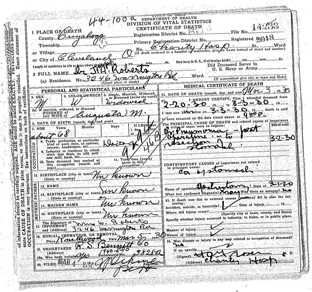
Finally, author Kathleen Donegan writes in Seasons of Misery: Catastrophe and Colonial Settlement in Early America, about the Pilgrims and the Native Peoples at the first celebration in 1621 —

“We love the story of Thanksgiving because it’s about alliance and abundance,” Donegan says… ‘But part of the reason that they were grateful was that they had been in such misery; that they had lost so many people — on both sides. So, in some way, that day of thanksgiving is also coming out of mourning; it’s also coming out of grief. It’s a very interesting narrative for a superpower nation. There is something sacred about humble beginnings. A country that has grown so rapidly, so violently, so prodigiously, needs a story of small, humble beginnings.’” (6)

Finally, Thanksgiving Dinner is Just Not Complete Without Pumpkin Pie!

Every year without fail we gathered together for our annual Thanksgiving dinner. Sometimes we would have twenty people gathered around the table at our home. It would always start out very well mannered and civilized, and then evolve into loosened belts, catching up on goings-on, mountains of dishes, and people yelling at the inevitable football games playing on the afternoon television.

Top photo: Around 1990, it looks like everyone decided to go to a restaurant and let someone else do the cooking. (Mom probably appreciated that). From left to right, John Bond, Daniel Bond, Jo Ann (Bond) White, and Marguerite Bond (who is casting glances at George Soule and Edward Doty). Middle right image, Susan Bond helping with a post dinner clean up. Bottom image, an example of our traditional family pumpkin pie, [with an overly crispy crust: ‘A’ for effort; ‘C+’ for execution].

Our mother was a good cook. Later in her life, we convinced her to write out some of her recipes and now we’re glad we did, except for the fact that she had very difficult handwriting to read. (Her excuse was always that when she was younger, she learned shorthand at secretarial school and it had ruined her handwriting. We would not disagree). In any case, for those of you who are interested — her actual recipe as she wrote it out, is transcribed in the footnotes. (7) By the way, the picture of the pie is not Mom’s, it’s from an experiment in pie making by two of her children!

Following are the footnotes for the Primary Source Materials, 
Notes, and Observations


Freedom From Want

(1) — four records

The Saturday Evening Post
Thanksgiving
https://www.saturdayeveningpost.com/collections/thanksgiving/
Note: For the text, and Norman Rockwell’s painting, Freedom From Want, 1943.

If It’s Hip, It’s Here
The 37 Best Parodies of Rockwell’s Freedom From Want (aka Thanksgiving Dinner)
https://www.ifitshipitshere.com/37-best-parodies-rockwells-freedom-want-aka-thanksgiving-dinner/
Notes: Freedom From Want — Peanuts version by Charles Schultz, Lego Version by Greg 50 on Flickr, Muppets version by Jim Henson

IESE Business School, University of Navarra
The Power of Myth, by Joseph Campbell
Review of this book by Brian Liggett
https://blog.iese.edu/leggett/2012/02/27/the-power-of-myth-by-joseph-campbell/
Note: For the text.

(NEFTA)
The National Endowment For The Humanities
Who Were the Pilgrims Who Celebrated the First Thanksgiving?
by Craig Lambert
https://www.neh.gov/humanities/2015/novemberdecember/feature/who-were-the-pilgrims-who-celebrated-the-first-thanksgiving
Note: For the text.

What Happened In That First Winter

(2) — seven records

The First Winter of the Pilgrims in Massachusetts, 1620. Colored engraving, circa 19th century. (Image courtesy of The Granger Collection).
Note: As found here, Exploration and the Early Settlers from Of Plymouth Plantation, on page 106:
https://www.muhlsdk12.org/site/handlers/filedownload.ashx?moduleinstanceid=4199&dataid=8729&FileName=Of%20Plymouth%20Plantation.pdf
Note: For the winter artwork.

PBS Learning Media
The First Winter | The Pilgrims
https://www.pbslearningmedia.org/resource/americanexperience27p-soc-firstwinter/the-first-winter-the-pilgrims/
Note: For the text.

(NYNJPA)
The Pilgrims Barely Survived Their First Winter At Plymouth
https://nynjpaweather.com/public/2023/11/17/the-pilgrims-barely-survived-their-first-winter-at-plymouth/
Note: For the text.

Plimoth Pautexet Museums
Who Were The Pilgrims?
Arrival at Plymouth
https://plimoth.org/for-students/homework-help/who-were-the-pilgrims
Note: For the text.

Pilgrim Hall Museum
Charts About The Mayflower Passengers
https://www.pilgrimhall.org/ce_our_collection.htm
Note: We adapted these graphics for this chapter.

The Plymouth Colony Archive Project
Mayflower Passenger Deaths, 1620-1621
Patricia Scott Deetz and James Deetz

http://www.histarch.illinois.edu/plymouth/maydeaths.html
Note: For the text.

The Mayflower Society
Women of The Mayflower
https://themayflowersociety.org/history/women-of-the-mayflower/
Note: For the text.

To Celebrate With A Harvest Feast

(3) — seven records

(NEFTH)
The National Endowment For The Humanities
Who Were the Pilgrims Who Celebrated the First Thanksgiving?https://www.neh.gov/humanities/2015/novemberdecember/feature/who-were-the-pilgrims-who-celebrated-the-first-thanksgiving
Note: For the text.

(VTHMB)
Voyaging Through History, the Mayflower and Britain
Mourt’s Relation (1622)
https://voyagingthroughhistory.exeter.ac.uk/2020/08/25/mourts-relation-1622/
Note: For the cover image.

State Library of Massachusetts
Bradford’s “Of Plimoth Plantation”
https://www.mass.gov/info-details/bradfords-manuscript-of-plimoth-plantation
Note: For the photograph of the original 17th century volume (book) Of Plimoth Plantation.

Saints and Strangers: Being the Lives of the Pilgrim Fathers & Their Families
by George F. Willison
https://archive.org/details/dli.ernet.13804/page/509/mode/2up
Note: For the cover image.

(WHE)
World History Encyclopedia
Thanksgiving Day: A Brief History
by Joshua J. Mark
https://www.worldhistory.org/article/1646/thanksgiving-day-a-brief-history/
Note: For the text.

“Visit of Samoset to the Colony”
Illustration from the 1876 textbook, A Popular History of the United States 
by William Cullen Bryant, circa 1876
https://commons.wikimedia.org/wiki/File:A_popular_history_of_the_United_States_-_from_the_first_discovery_of_the_western_hemisphere_by_the_Northmen,_to_the_end_of_the_first_century_of_the_union_of_the_states;_preceded_by_a_sketch_of_the_(14597125217).jpg
Book page: 400, Digital page: 472/682
Note: For the Samoset illustration.

North Wind Picture Archives
Gift of Meat from Native Americans to Plymouth Colonists
https://www.northwindprints.com/american-history/gift-meat-native-americans-plymouth-colonists-5877641.html
Note: Fir the hand-colored woodcut of a 19th-century illustration.

What Was Really On The Menu?

(4) — three records

Fine Art America
The First Thanksgiving In 1621
by Jean Leon Gerome Ferris
https://fineartamerica.com/featured/the-first-thanksgiving-in-1621-by-ferris-artist-jean-leon-gerome-ferris.html
Note: For the painting.

The Real Story of The First Thanksgiving
by Joanne Camas
https://www.epicurious.com/holidays-events/the-real-story-of-the-first-thanksgiving-menu-recipes-article
Note: For the text and historical insights.

Fine Art Storehouse
First Thanksgiving
https://www.fineartstorehouse.com/photographers/frederic-lewis/first-thanksgiving-11428168.html
Note: A depiction of early settlers of the Plymouth Colony sharing a harvest Thanksgiving meal with members of the local Wampanoag tribe at the Plymouth Plantation, Plymouth, Massachusetts, 1621.

“To make victuals both more plentiful and comfortable”

(5) — two records

Mayflower Society Newsletter, July 2024
by Lisa H. Pennington, Governor General
Note 1: For the text cited in the article — 2024: The 400th Anniversary of the “Great Black Cow” (Access to this actual article is only available through a membership with the Mayflower Society).
Note 2: We have transcribed the relevant newsletter text below:

The Metropolitan Museum of Art
Young Herdsmen with Cows
by Aelbert Cuyp, circa 1655-1660
https://www.metmuseum.org/art/collection/search/436064
Note: For the painting image.

Adopted — A Day of For Thanksgiving

(6) — eight records

(WHE)
World History Encyclopedia
Thanksgiving Day: A Brief History
by Joshua J. Mark
https://www.worldhistory.org/article/1646/thanksgiving-day-a-brief-history/
Note: For the text.

Godey’s Lady’s Book
https://en.wikipedia.org/wiki/Godey’s_Lady’s_Book
Note: For the cover image.

Sarah Josepha Hale
https://en.wikipedia.org/wiki/Sarah_Josepha_Hale
Note: For the text, and her portrait.

The audio file housed at —
The Internet Archive
Mary had a little lamb
by Thomas Edison
https://archive.org/details/EDIS-SCD-02
Note: For the audio clip reference only.

The Public Domain Review
Edison reading Mary Had a Little Lamb (1927)
https://publicdomainreview.org/collection/edison-reading-mary-had-a-little-lamb-1927/
Note: For the photograph of Thomas Edison, and the MP3 download link at the articles end for the actual audio file used in this chapter.

Abraham Lincoln Presidential Library and Museum
Lincoln and Thanksgiving
https://presidentlincoln.illinois.gov/Blog/Posts/169/Abraham-Lincoln/2022/11/Lincoln-and-Thanksgiving/blog-post/
Note: For the text and 1863 proclamation image.

(NEFTA)
The National Endowment For The Humanities
Who Were the Pilgrims Who Celebrated the First Thanksgiving?
by Craig Lambert
https://www.neh.gov/humanities/2015/novemberdecember/feature/who-were-the-pilgrims-who-celebrated-the-first-thanksgiving
Note: For the text.

Finally, Thanksgiving Dinner is Just Not Complete Without Pumpkin Pie!

(7) — one record

All records are family photographs, or ephemera. Below is a transcription of Marguerite’s Pumpkin Pie recipe exactly as she wrote it out —

The Pilgrims — The Native Peoples

This is Chapter Six of seven. Long before our ancestors had arrived in the New Plymouth, the native peoples who already lived there had more than a century of experience with the Europeans.

In the first chapter, The Pilgrims — Saints & Strangers, we briefly learned about some of the historical consequences of the Columbian Exchange. We were then choosing to apply a light touch to that history, but here in this chapter, we need to delve more deeply.

(The English Exporer) Bartholemew Gosnold trading with the Wampanoag at Martha’s Vineyard,
circa 1597. (Image courtesy of The Newberry Library).

The Americas and The Great Dying

“The first manifestation of the Columbian Exchange may have been the spread of syphilis from the native people of the Caribbean Sea to Europe. The history of syphilis has been well-studied, but the origin of the disease remains a subject of debate.

There are two primary hypotheses: one proposes that syphilis was carried to Europe from the Americas by the crew of Christopher Columbus in the early 1490s, while the other proposes that syphilis previously existed in Europe but went unrecognized. The first written descriptions of syphilis in the Old World came in 1493. The first large outbreak of syphilis in Europe occurred in 1494–1495 among the army of Charles VIII during its invasion of Naples. Many of the crew members who had served with Columbus had joined this army. After the victory, Charles’s largely mercenary army returned to their respective homes, spreading “the Great Pox” across Europe, which killed up to five million people.” (Wikipedia)

This chart looks a bit heavy on the left side, doesn’t it?
Data gathered was from Wikipedia, and The National Library of Medicine, United Kingdom.
(See footnotes).

The Columbian Exchange of diseases towards the New World was far deadlier. The peoples of the Americas had previously had no exposure to Old World diseases and little or no immunity to them. An epidemic of swine influenza beginning in 1493 killed many of the Taino people inhabiting Caribbean islands. The pre-contact population of the island of Hispaniola was probably at least 500,000, but by 1526, fewer than 500 were still alive. Spanish exploitation was part of the cause of the near-extinction of the native people. (Wikipedia)

In 1518, smallpox was first recorded in the Americas and became the deadliest imported Old World disease. Forty percent of the 200,000 people living in the Aztec capital of Tenochtitlan, later Mexico City, are estimated to have died of smallpox in 1520 during the war of the Aztecs with conquistador Hernán Cortés. Epidemics, possibly of smallpox, spread from Central America, devastated the population of the Inca Empire a few years before the arrival of the Spanish. The ravages of Old World diseases and Spanish exploitation reduced the Mexican population from an estimated 20 million to barely more than a million in the 16th century. (Wikipedia)

Known as the Port St. Louis map, by Samuel de Champlain, circa 1605. This image shows the Patuxet settlement (the future Plymouth Colony site), before the plague of 1617. Note the depictions of shelters and abundant cornfields. It was included in the book, Les Voyages du Sievr de Champlain Xaintongeois, 1613. (Image courtesy of the Library of Congress).

“There is disagreement regarding the number of Native Peoples before the first Europeans set foot in North America, but approximately five to eighteen million is currently the best estimate, and a much larger population of over 100 million including throughout the Americas and West Indies is probable. The arrival of Europeans… resulted in a catastrophic ‘demographic collapse’ of up to 95% of the indigenous population. By the beginning of the 20th Century, the number of Native Americans in this country had been reduced to about 237,000 people through disease, war, and relocation.” (See footnotes, Ipswich) (1)

Passage excerpted from: Indian Narratives: Containing a Correct and Interesting History
of the Indian Wars, From the Landing of Our Pilgrim Fathers, 1620. It was published in 1854,
by Henry Trumbull, Susannah Willard, and Zadock Steele. (See footnotes).

Closer to Home in New England

“The Wampanoag Tribe, also known as the People of the First Light, has inhabited present-day Massachusetts and Eastern Rhode Island for more than 12,000 years. In the 1600s, there were as many as 40,000 people in the 67 villages that made up the Wampanoag People, who firstly lived as a nomadic hunting and gathering culture. By about 1000 AD, archaeologists have found the first signs of agriculture, in particular the corn crop, which became an important staple, as did beans and squash.” (Mayflower 400)

Dr. Ian Saxine of Bridgewater State University, when interviewed near the time of the Mayflower’s 400th anniversary stated, “There is evidence that the inhabitants of the Outer Cape had interacted with European sailors from Portugal, England and France for at least 200 years. They traded, and at times, fought.” (GBH News) This area is shown on the right portion of the map below.


Map of Wampanoag Country in the 1600s.
Wampanoag territory in the 1600s was made up of about 67 villages, and this map shows some of them. The larger print shows the Wampanoag name, and the smaller print gives the modern name. (Map courtesy of Plimoth Patuxet Museums).

“Entire villages were lost and only a fraction of the Wampanoag Nation survived. This meant they were not only threatened by the effects of colonisation but vulnerable to rival tribes and struggled to fend off the neighbouring Narragansett, who had been less affected by this plague.

In the winter of 1616-17 an expedition dispatched by Sir Ferdinando Gorges found a region devastated by war and disease, the remaining people so “sore afflicted with the plague, for that the country was in a manner left void of inhabitants”. Two years later another Englishman found “ancient plantations” now completely empty with few inhabitants – and those that had survived were suffering.

In the years before the Mayflower arrived, the effects of colonization had already taken root.” (Mayflower 400)

Front cover and interior page from, Historical, Poetical and Pictorial American scenes:
Principally Moral and Religious: Being a Selection of Interesting Incidents in American History

to Which is Added a Historical Sketch of Each of the United States,
by John W. Barber and Elizabeth G. Barber, 1850. (Images courtesy of the Hathi Trust).

When the sickness came, the reduction of the population may have been incremental, episodic, and continuous, but in the end, it was relentless.
For the tribe with whom our family (mostly) interacted with, “the extraordinary impact of the Great Dying meant the Wampanoag had to reorganize its structure and the Sachems [the North American Indian chiefs] had to join together and build new unions.” (Mayflower 400)

“When we look back on the Aborigines, as the sole proprietors
of our soil, on the places which once knew them,
but are now to know them no more forever,
feelings of sympathy and sadness come over our souls.

In the light of history,
a tribe of men immortal as ourselves… have irrevocably
disappeared from the scenes and concerns of earth.

Joseph Felt writing in his 1834 book,
“History of Ipswich, Essex and Hamilton”

If you recall when we wrote in The Pilgrims — Saints & Strangers, we drew attention to the fact that people then had no concept of germ theory. The very healthy nature of the Native Peoples “proved their undoing, for they had built up no resistance, genetically or through childhood diseases, to the microbes that Europeans and Africans would bring to them. They did not cause the plague and were as baffled as to its origin as the stricken Indian villagers.

These epidemics probably constituted the most important geopolitical event of the early seventeenth century. Their net result was that the English, for their first fifty years in New England, would face no real Indian challenge.” (Lies My Teacher Told Me – LMTTM)

Drawing of a Wampanoag hut. (Image courtesy of the Leiden American Pilgrim Museum).

Nature loves to exploit a new environmental niche, and viruses that complicate our lives are unintentionally skilled at exploiting new opportunities. We all know this, with the most recent example being the global SARS-CoV-2 (COVID-19).

It was into this world of empty landscapes that the Plimoth Plantation began. (2)

First Encounters With The Pilgrims

From the standpoint of the Native People, when the Pilgrims first arrived, their memories of some of their own having been taken prisoner and sold into slavery, led some to act aggressively. “The First Encounter… was not so much an attack on the English settlers as the Wampanoags defending themselves and their culture. Pilgrim records say the Nauset [a neighboring tribe of the Wampanoags] attacked once the Pilgrims had pulled their small boat ashore after spending the day exploring along the coast and were camped out near the beach. Although the Pilgrims and Nauset engaged in a brief firefight, there is no record of any deaths or injuries.

Saxine [of Bridgewater State University] said both sides felt they had won what was the first violent engagement between the Native Americans and the European settlers who would later colonize Plymouth. The Mayflower party felt that they had won because the Nauset fighters pulled back after this firefight,” Saxine said. “The Nauset probably felt they had won because the English people sailed away and left them alone.” (GBH News) (3)

The Pilgrims arrive at Plymouth, Massachusetts on board the Mayflower,
November 1620
(painting), by W.J. Aylward. (Image courtesy of Historynet.com)

These People Were Different.

“The story of the Pilgrims… has been told primarily from the English colonists’ point of view. How the Native Americans felt about the colonists’ arrival in the New World has been mostly absent from the story.” (GBH News)

“Four hundred years ago, this newly organised People [after the Great Dying] watched as yet another ship arrived from the east. These people were different. The Wampanoag watched as women and children walked from the ship, using the waters to wash themselves. Never before had they seen Europeans engage in such an act. They watched cautiously as the men of this new ship explored their lands, finding what remained of Patuxet and building homes. They watched them take corn and beans, probably winter provisions, stored for the harsh conditions that were to come. The Wampanoag People did not react.

Given the horrific nature of the past years, the Wampanoag People were understandably wary of this new group. Months would pass before contact. But in this time, they would have recognised the opportunity for a new alliance to help them survive.” (Mayflower 400) (3)

Discovering Indian Cornand Graves

In the book, 1491: New Revelations of the Americas Before Columbus, author Charles C. Mann, states to National Geographic —

“When the pilgrims arrived in Cape Cod, they were incredibly unprepared. “They were under the persistent belief that because New England is south of the Netherlands and southern England, it would therefore be warmer,” says Mann. “Then they showed up six weeks before winter [actually less than six weeks] with practically no food.” In a desperate state, the pilgrims robbed corn from Native Americans graves and storehouses soon after they arrived; but because of their overall lack of preparation, half of them still died within their first year.

If the pilgrims had arrived in Cape Cod three years earlier, they might not have found those abandoned graves and storehouses… in fact, they might not have had space to land. Europeans who sailed to New England in the early to mid-1610s found flourishing communities along the coast, and little room for themselves to settle. But by 1620, when the Mayflower arrived, the area looked abandoned.

“Having their guns and hearing nobody, they entered the houses and found the people were gone. The sailors took some things but didn’t dare stay. . . . We had meant to have left some beads and other things in the houses as a sign of peace and to show we meant to trade with them. But we didn’t do it because we left in such haste. But as soon as we can meet with the Indians, we will pay them well for what we took.”

“We marched to the place we called Cornhill, where we had found the corn before. At another place we had seen before, we dug and found some more corn, two or three baskets full, and a bag of beans… In all we had about ten bushels, which will be enough for seed. It was with God’s help that we found this corn, for how else could we have done it, without meeting some Indians who might trouble us.”

“A couple of years before, there’d been an epidemic that wiped out most of the coastal population of New England, and Plymouth was on top of a village that had been deserted by disease,” says Mann. “The pilgrims didn’t know it, but they were moving into a cemetery,” he adds.

“The next morning, we found a place like a grave. We decided to dig it up. We found first a mat, and under that a fine bow. . . . We also found bowls, trays, dishes, and things like that. We took several of the prettiest things to carry away with us, and covered the body up again.”

“The newcomers did eventually pay the Wampanoags for the corn they had dug up and taken. Plymouth, unlike many other colonies, usually paid Indians for the land it took. In some instances Europeans settled in Indian towns because Natives had invited them, as protection against another tribe, or a nearby competing European power.” (National Geographic, and LMTTM)
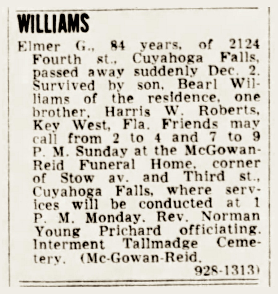
Massasoit Meeting English Settlers, from Lives of Famous Indian Chiefs by Norman B. Wood, 1906. (Image courtesy of Encyclopædia Britannica).

“…just as the Pilgrims don’t represent all English colonists, the Wampanoags, who feasted with them, don’t represent all Native Americans. The Pilgrims’ relations with the Narragansetts, or the Pequots, were completely different.” (National Endowment For The Humanities – NEFTH) (5)
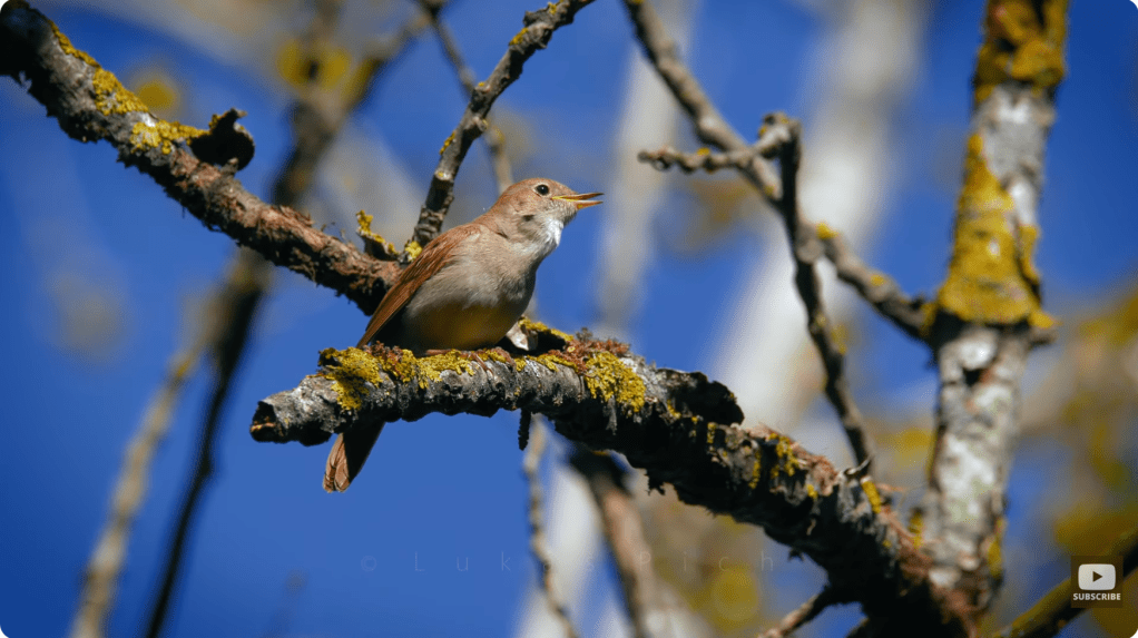
The Wampanoag Confederacy of Massasoit Sachem

The history that has come down to us today, records four individuals who made important differences in the lives of the Pilgrims, and helped them to succeed with their new colony endeavors.

Massasoit was the Sachem, or leader of the Wampanoag confederacy. Massasoit Sachem means the Great Sachem. Although Massasoit was only his title, English colonists mistook it as his name and it stuck. Massasoit needed the Pilgrims just as much as they needed him. [His] people had been seriously weakened by a series of epidemics and were vulnerable to attacks by the Narragansetts, and he formed an alliance with the colonists at Plymouth Colony for defense against them. It was through his assistance that the Plymouth Colony avoided starvation during the early years.

At the time of the Pilgrims’ arrival in Plymouth, the realm of the Wampanoag, also known as the Pokanokets, included parts of Rhode Island and much of southeastern Massachusetts. Massasoit lived in Sowams, a village at Pokanoket in Warren, Rhode Island. He held the allegiance of lesser Pokanoket Sachems [chiefs]. 

Massasoit forged critical political and personal ties with colonial leaders William Bradford, Edward Winslow, Stephen Hopkins, John Carver, and Myles Standish, ties which grew out of a peace treaty negotiated on March 22, 1621. The alliance ensured that the Pokanokets remained neutral during the Pequot War in 1636. According to English sources, Massasoit prevented the failure of Plymouth Colony and the starvation that the Pilgrims faced during its earliest years.

Massasoit Sachem images, from left to right: Pilgrim Edward Winslow comforting Massasoit. Center: A Map of New-England (Woodcut), attributed to John Foster 1677. Note: The crown, indicates the royal seat of Massassoit Sachem of the Wampanoags, and is drawn between the two branches of the Sowams River. Plimoth is nearby to the southeast. Right: 1902 postcard photo showing Profile Rock, …it was thought to be that of the Wampanoag Chief Massasoit Sachem. (See footnotes).

Massasoit was humane and honest, kept his word, and endeavored to imbue his people with a love for peace. He kept the Pilgrims advised of any warlike designs toward them by other tribes. It is unclear when Massasoit died. Some accounts claim that it was as early as 1660; others contend that he died as late as 1662. He was anywhere from 80 to 90 at the time.” (Wikipedia)
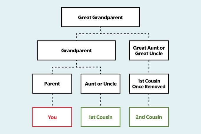
“In Winslow’s second published book, ‘Good Newes from New England (1624),’ he recounted at length nursing the Wampanoag leader Massasoit as he lay dying, even to the point of spoon-feeding him chicken broth.” (See footnotes, The Conversation) (6)

Samoset arriving at Plymouth Colony in 1621. (See footnotes).

Samoset, the Abenaki Native American

This is how we first learn of Samoset, “Yet, in March, a lone Indian warrior named Samoset appeared and greeted the settlers, improbably, in English. Soon, the Pilgrims formed an alliance with the Wampanoags and their chief, Massasoit. Only a few years before, the tribe had lost 50 to 90 percent of its population to an epidemic borne by European coastal fisherman. Devastated by death, both groups were vulnerable to attack or domination by Indian tribes. They needed each other.” (NEFTH) 

He “was the Abenaki Native American who first approached the English settlers of Plymouth Colony in friendship, introducing them to [the] natives Squanto and Massasoit who would help save and sustain the colony.

He was a Sagamore (Chief) of the Eastern Abenaki, who was either visiting Massasoit or had been taken prisoner by him sometime before the Mayflower landed off the coast of modern-day Massachusetts in November 1620. Massasoit chose him to make first contact with the pilgrims in March of 1621, and he has been recognized since as instrumental in bringing the Native Americans of the Wampanoag Confederacy and English colonists of Plymouth together in a compact which would remain unbroken for the next 50 years.”

All that is known of Samoset comes from these works except for a passing mention by the explorer Captain Christopher Levett who met Samoset in 1624 at present-day Portland, Maine, and considered it an honor based on Samoset’s role in helping to sustain Plymouth Colony in 1621. Samoset was highly regarded by other English and European colonists following his appearance in Mourt’s Relation, published in 1622. (World History Encyclopedia) (7)

Tisquantum. or Squanto, the Guide and Interpreter
by Charles de Wolf Brownell, circa 1864. (See footnotes).

Tisquantum, Who is Also Known as Squanto

“A Native American called Tisquantum was born in 1580. He became known as Squanto and little is known of his early life. Some believe he was captured as a young man on the coast of what is now Maine by Captain George Weymouth in 1605. Weymouth was an Englishmen commissioned to explore the American coastline and thought his financial backers might like to see Native American people.

“What do most books leave out about Squanto? First, how he learned English. Squanto spent nine years [in England, with three years being in the employ of Ferdinando Gorges]. At length, Gorges helped Squanto arrange passage back to Massachusetts. Some historians doubt that Squanto was among the five Indians stolen in 1605. All sources agree, however, that in 1614 an English slave raider, Thomas Hunt, lured 24 Native Americans on board his ship under the premise of trade. Their number included Tisquantum. Hunt locked them up below deck, sailed for Spain and sold these people into the European slavery in Málaga, Spain. Squanto escaped from slavery, escaped from Spain, and made his way back to England.

Malaga, Spain, circa 1572, 40 years before Tisquantum was delivered there in slavery.
(Image courtesy of Universitätsbibliothek Heidelberg).

After trying to get home via Newfoundland, in 1619 he talked Thomas Dermer into taking him along on his next trip to Cape Cod as an interpreter. He searched for his homeland but tragically, he arrived as the Great Dying reached its horrific climax. His tribe had all been wiped out two years before.. His home village, Patuxet, was lost. — No wonder Squanto threw in his lot with the Pilgrims.” (LMTTM and Mayflower 400)

“Squanto’s travels acquainted him with more of the world than any Pilgrim encountered. He had crossed the Atlantic perhaps six times, twice as an English captive, and had lived in Maine, Newfoundland, Spain, and England, as well as Massachusetts.”
Excerpted from Lies My Teacher Told Me, by James W. Loewen, page 88.

“As translator, ambassador, and technical advisor, Squanto was essential to the survival of Plymouth in its first two years. Like other Europeans in America, the Pilgrims had no idea what to eat or how to raise or find food until American Indians showed them. [Massasoit was, as the Great Sachem of the Wampanoag Confederacy, the one who sent Tisquantum (Squanto) to live among the Pilgrim colonists.]

William Bradford called Squanto “a special instrument sent of God for their good beyond their expectation. He directed them how to set their corn, where to take fish, and to procure other commodities, and was also their pilot to bring them to unknown places for their profit.” Squanto was not the Pilgrims’ only aide: in the summer of 1621 Massasoit sent another Indian, Hobomok, to live among the Pilgrims for several years as guide and ambassador.” (LMTTM)

Importantly, we learned that he “… facilitated understandings between the colony and its native neighbors and established trade relations with a number of villages.” (Wikipedia)

Pilgrim Fathers and Squanto, the Friendly Indian,
after an Illustration by C. W. Jefferys, 1926. (See footnotes).

“With spring, under the careful guidance of a Wampanoag friend, Tisquantum, the settlers planted corn, squash, and beans, with herring for fertilizer. They began building more houses, fishing for cod and bass, and trading with the Native Americans. By October, they had erected seven crude houses and four common buildings.” (NEFTH) (8)

Hobomok, A ‘Pneise’ of the Pokanoket

Almost nothing is known about Hobomok before he began living with the English settlers who arrived aboard the Mayflower. His name was variously spelled in 17th century documents and today is generally simplified as Hobomok, or Hobbamock. He was known as a Pneise, which means he was an elite warrior of the Algonquin people of Eastern Massachusetts. Also, he was a member of the Pokanoket tribe… whom Sachem Massasoit had authority over. William Bradford described him as “a proper lustie man, and a man of accounte for his vallour and parts amongst thed Indeans.”

“Hobomak is known to us primarily for his rivalry with Squanto, who lived with the settlers before him. He was greatly trusted by Myles Standish, the colony’s military commander, and he joined with Standish in a military raid against the Massachuset” [a neighboring tribe].

The March of Miles Standish, postcard image published by Armstrong & Co.
(Image courtesy of the Library of Congress, see footnotes).

Both Bradford and Winslow first record Hobomok’s actions in connection with a crisis in which Squanto was thought to have been kidnapped and possibly murdered. Long story short is that there were ongoing rival factions for control among the various Native nations, and therefore there was an attempt to have Massasoit driven “from his country.” Hobomak aided Miles Standish “to raid Nemasket at night to round up Corbitant and any accomplices.” This was a messy confrontation, but Squanto was released, and Massasoit remained as Sachem.

However, “The affair left the colony feeling exposed. They decided to protect the settlement by taking down tall trees, dragging them from the forest and sinking them in deep holes closely bound to prevent arrows from passing through. [This was the building of a stockade.] Moreover, Standish divided the men into four squadrons and drilled them on how to respond to an emergency, including instructions on how to remain armed and alert to a native attack even during a fire in the town.” (Adapted from Wikipedia)

An artist’s conception of the Plymouth Colony by 1630. (See footnotes).

“Hobomok helped Plymouth set-up fur trading posts at the mouth of the Penobscot and Kennebec rivers in Maine; in Aputucxet, Massachusetts, and in Windsor, Connecticut.” If you recall, the underwriters in London who had financed the voyage of the Mayflower still need to be reimbursed by the Pilgrims. The income generated by the sale and shipment of these fur skins back to the Europeans, helped to alleviate those debts. (LMTTM) (9)

Very Faithful in Their Covenant of Peace

When have written previously that it appeared that the demeanor of the Pilgrims had shifted during their years in Leyden, Holland. Perhaps after all of their harrowing experiences since they left there, some of them were becoming less strident in their views? We observed that instead of viewing the Native Peoples in America as Others — as they themselves had been treated in England — an appreciation and tolerance toward those who are different from them, had begun to take hold.

Left image: Portrait of Plymouth Colony Governor Edward Winslow, Attributed to the school of Robert Walker, circa 1651. Right image: Hand-colored woodcut of Edward Winslow visiting Chief Massasoit. (See footnotes).

“At the same time, Pilgrims did not actively seek the conversion of Native Americans. According to scholars like [Nathaniel] Philbrick, English author Rebecca Fraser and [Mark] Peterson, the Pilgrims appreciated and respected the intellect and common humanity of Native Americans.

An early example of Pilgrim respect for the humanity of Native Americans came from the pen of Edward Winslow. Winslow was one of the chief Pilgrim founders of Plymouth. In 1622, just two years after the Pilgrims’ arrival, he published in the mother country the first book about life in New England, “Mourt’s Relation.”

While opining that Native Americans “are a people without any religion or knowledge of God,” he nevertheless praised them for being “very trusty, quick of apprehension, ripe witted, just.” Winslow added that “we have found the Indians very faithful in their covenant of peace with us; very loving. … we often go to them, and they come to us; some of us have been fifty miles by land in the country with them.” (See footnotes, The Conversation) (10)

Following are the footnotes for the Primary Source Materials, 
Notes, and Observations

The Americas and The Great Dying

(1) — eight records

The Newberry Library
(The English Exporer) Bartholomew Gosnold trading with
Wampanoag Indians at Martha’s Vineyard, Massachusetts
by Theodor de Bay, circa 1597
https://collections.carli.illinois.edu/digital/collection/nby_eeayer/id/3563
Note: For the image.

Post-Columbian Transfer of Diseases chart, sources —
Columbian Exchange
https://en.wikipedia.org/wiki/Columbian_exchange
Note: For the text and the image of, Sixteenth-century Aztec drawings
of victims of smallpox, from the Florentine Codex.
and
New Hypothesis for Cause of Epidemic among Native Americans,
New England, 1616–1619
by John S. Marr and John T. Cathey
https://pmc.ncbi.nlm.nih.gov/articles/PMC2957993/
Note: For the data, “…leptospirosis complicated by Weil syndrome, a rare but severe bacterial infection, spread by non-native black rats that arrived on the settlers’ ships.”
and
Smithsonian Magazine
Alfred W. Crosby on the Columbian Exchange
by Megan Gambino
https://www.smithsonianmag.com/history/alfred-w-crosby-on-the-columbian-exchange-98116477/?no-ist
Note: For the bottom image.

Library of Congress
Les voyages dv sievr de Champlain Xaintongeois,
capitaine ordinaire pour le Roy, en la marine. Divisez en devx livres.
ou, Iovrnal tres-fidele des observations faites és descouuertures
de la Nouuelle France
by Samuel de Champlain, circa 1605
https://www.loc.gov/item/22006274/
Book page: 80, Digital page: 112/436
Note: For book frontipiece and credits.
and
Plimoth Patuxet Museums
Port St. Louis (map)
https://plimoth.org/yath/unit-1/port-st-louis
Note: For the text and map.

(Ipswich)
Historic Ipswich
The Great Dying 1616-1619, “By God’s visitation, a Wonderful Plague.”
https://historicipswich.net/2023/11/17/the-great-dying/

Indian Narratives: Containing a Correct and Interesting History of the Indian Wars,
From the Landing of Our Pilgrim Fathers, 1620,
circa 1854
by Henry Trumbull, Susannah Willard, and Zadock Steele
https://archive.org/details/indiannarrative00steegoog/page/n10/mode/2up
Book page: 76, Digital page: 87/295
Note: For the text.

Closer to Home in New England

(2) — seven records

Mayflower 400
Native America and the Mayflower: 400 years of Wampanoag History
https://www.mayflower400uk.org/education/native-america-and-the-mayflower-400-years-of-wampanoag-history/
Note: For the text.

GBH News
Reframing The Story Of The First Encounter Between
Native Americans And The Pilgrims
by Bob Seay
https://www.wgbh.org/news/local/2019-11-28/reframing-the-story-of-the-first-encounter-between-native-americans-and-the-pilgrims
Note: For the text.

Plimoth Patuxet Museums
Map of Wampanoag Country in the 1600s
https://plimoth.org/yath/unit-1/map-of-wampanoag-country-in-the-1600s
Note: For the map image.

Hathi Trust
Historical, Poetical and Pictorial American scenes:
Principally Moral and Religious: Being a Selection of Interesting Incidents in American History to Which is Added a Historical Sketch of Each of the United States
, 1850
by John W. Barber and Elizabeth G. Barber
https://babel.hathitrust.org/cgi/pt?id=uiuo.ark:/13960/t00057646&seq=199
Book page: 183, Digital page: 199/254
Note: For the text and the image.

History of Ipswich, Essex and Hamilton
by Joseph Barlow Felt, 1834
https://archive.org/details/historyofipswich00felt/page/2/mode/2up
Book page: 2, Digital page: 24/404
Note: For the text (pull-quote).

(LAPM)
Leiden American Pilgrim Museum
https://leidenamericanpilgrimmuseum.org/en
Note: For the illustration of the Wampanoag hut.

(LMTTM)
Lies My Teacher Told Me
by James W. Loewen
https://www.google.pt/books/edition/Lies_My_Teacher_Told_Me/5m23RrMeLt4C?hl=en&gbpv=1&pg=PA1&printsec=frontcover
Book pages: 70-92
Note: Chapter 3: “The Truth About The First Thanksgiving”

First Encounters With The Pilgrims

(3) — two records

GBH News
Reframing The Story Of The First Encounter Between Native Americans And The Pilgrims
by Bob Seay
https://www.wgbh.org/news/local/2019-11-28/reframing-the-story-of-the-first-encounter-between-native-americans-and-the-pilgrims
Note: For the text.

The Pilgrims arrive at Plymouth, Massachusetts on board the Mayflower,
November 1620
(painting)
by W.J. Aylward
https://www.historynet.com/how-collectivism-nearly-sunk-colonies/landing-of-the-pilgrims/
Note: For the painting image.

These People Were Different.

(4) — two records

GBH News
Reframing The Story Of The First Encounter Between Native Americans And The Pilgrims
by Bob Seay
https://www.wgbh.org/news/local/2019-11-28/reframing-the-story-of-the-first-encounter-between-native-americans-and-the-pilgrims
Note: For the text.

Mayflower 400
Native America and the Mayflower: 400 years of Wampanoag History
https://www.mayflower400uk.org/education/native-america-and-the-mayflower-400-years-of-wampanoag-history/
Note: For the text.

Discovering Indian Cornand Graves

(5) — five records

National Geographic
A few things you (probably) don’t know about Thanksgiving
by Becky Little
https://www.nationalgeographic.com/history/article/151121-first-thanksgiving-pilgrims-native-americans-wampanoag-saints-and-strangers
Note: For the text.

Interesting Events in the History of The United States: being a selection of
the most important and interesting events which have transpired…

by John Warner Barber, 1798-1885
https://archive.org/details/intereventshistus00barbrich/page/n5/mode/2up
Note: For text and the illustration, Discovering Indian Corn.

(LMTTM)
Lies My Teacher Told Me
by James W. Loewen
https://www.google.pt/books/edition/Lies_My_Teacher_Told_Me/5m23RrMeLt4C?hl=en&gbpv=1&pg=PA1&printsec=frontcover
Book pages: 70-92
Note 1: Chapter 3 for text, The Truth About The First Thanksgiving
Note 2: The travel map for Squanto was adapted from graphics on page 88.

Encyclopædia Britannica
Wampanoag People
Massasoit Meeting English Settlers
from ‘Lives of Famous Indian Chiefs’ by Norman B. Wood, 1906
https://www.britannica.com/topic/Wampanoag#/media/1/635211/179338
Note: For the image.

(NEFTH)
The National Endowment For The Humanities
Who Were the Pilgrims Who Celebrated the First Thanksgiving?
by Craig Lambert
https://www.neh.gov/humanities/2015/novemberdecember/feature/who-were-the-pilgrims-who-celebrated-the-first-thanksgiving
Note: For the text.

The Wampanoag Confederacy of Massasoit Sachem

(6) — seven records

Primary Source Learning:
The Wampanoag, the Plimoth Colonists & the First Thanksgiving
https://primarysourcenexus.org/2021/11/primary-source-learning-wampanoag-plimoth-colonists-first-thanksgiving/
Note: For the image of Massasoit And His Warriors

Massasoit
https://en.m.wikipedia.org/wiki/Massasoit
Note: For the text.

The Conversation
The First Pilgrims and the Puritans Differed in Their Views on Religion,

Respect for Native Americans
by Michael Carrafiello
https://theconversation.com/how-the-first-pilgrims-and-the-puritans-differed-in-their-views-on-religion-and-respect-for-native-americans-240974
Note: For the text.

Images for the Massasoit collage —
Hathi Trust
Historical, Poetical and Pictorial American scenes:
Principally Moral and Religious: Being a Selection of Interesting Incidents in American History to Which is Added a Historical Sketch of Each of the United States, 1850
by John W. Barber and Elizabeth G. Barber
https://babel.hathitrust.org/cgi/pt?id=uiuo.ark:/13960/t00057646&seq=32
Book page: 16, Digital page: 32/254
Note: For the image of Massasoit.
and
The Massachusetts Historical Society
A Map of New-England (Woodcut)
Attributed to John Foster, 1677
https://www.masshist.org/database/68
Note 1: Originally published in William Hubbard’s Narrative of the Troubles with the Indians. Note 2: The Crown, indicates the royal seat of Massassoit, the Sachem of the Wampanoags, and is drawn between the two branches of the Sowams River.
and

File:Profile Rock (Assonet).jpg
https://commons.wikimedia.org/wiki/File:Profile_Rock_(Assonet).jpg
Note 1: Image, 1902 postcard photo showing Profile Rock; scanned from a private collection.
Note 2: …it was thought to be that of the Wampanoag Chief Massasoit Sachem, from: https://www.atlasobscura.com/places/profile-rock

Samoset, the Abenaki Native American

(7) — two records

Samoset
Samoset arriving at Plymouth Colony in 1621
by Artist unknown
https://kids.britannica.com/kids/article/Samoset/601202

World History Encyclopedia
Samoset
https://www.worldhistory.org/Samoset/
Note: For the text. 

Tisquantum, Who is Also Known as Squanto

(8) — seven records

Antique Print Club
Tisquantum. or Squanto, the Guide and Interpreter
by Charles de Wolf Brownell, circa 1864
https://www.antiqueprintclub.com/Products/Antique-Prints/Historic-Views-People/Americas-Canada/Tisquantum-or-Squanto,-the-guide-and-interpreter-c.aspx
Note 1: For the antique image of Tisquantum. or Squanto.
Note 2: “Rare wood engraving with contemporary hand color, from Charles de Wolf Brownell’s ‘The Indian Races of North and South America: comprising an account of the principal aboriginal races; a description of their national customs, mythology, and religious ceremonies; the history of their most powerful tribes, and of their most celebrated chiefs and warriors…’,
published in Hartford, Connecticut in 1864 by Hurlbut, Scranton & Co.”

Artwork of Málaga in 1572 —
40 years before Tisquantum was delivered there in slavery
Extracted from:
https://en.wikipedia.org/wiki/Squanto
Notes: Georg Braun; Frans Hogenberg: Civitates Orbis Terrarum, Band 1, 1572 (Ausgabe Beschreibung vnd Contrafactur der vornembster Stät der Welt, Köln 1582; [VD16-B7188) Universitätsbibliothek Heidelberg

(LMTTM)
Lies My Teacher Told Me
by James W. Loewen
https://www.google.pt/books/edition/Lies_My_Teacher_Told_Me/5m23RrMeLt4C?hl=en&gbpv=1&pg=PA1&printsec=frontcover
Book pages: 70-92
Note 1: Chapter 3: “The Truth About The First Thanksgiving”
Note 2: For the map from page 88, which we adapted for this chapter.

Mayflower 400
Native America and the Mayflower: 400 years of Wampanoag History
https://www.mayflower400uk.org/education/native-america-and-the-mayflower-400-years-of-wampanoag-history/
Note: For the text.

(NEFTH)
The National Endowment For The Humanities
Who Were the Pilgrims Who Celebrated the First Thanksgiving?
by Craig Lambert
https://www.neh.gov/humanities/2015/novemberdecember/feature/who-were-the-pilgrims-who-celebrated-the-first-thanksgiving
Note: For the text.

Pilgrim Fathers and Squanto, the Friendly Indian
after an Illustration by C. W. Jefferys, 1926
https://www.art.com/products/p53691947530-sa-i8600719/pilgrim-fathers-and-squanto-the-friendly-indian-after-an-illustration-by-c-w-jefferys-1926.htm
Note: For the illustration.

Hobbamock
https://en.wikipedia.org/wiki/Hobbamock#Hobomok_comes_to_live_with_English
Note: For the text about Squanto.

Hobomok, A Pneise of the Pokanoket

(9) — three records

Hobbamock
https://en.wikipedia.org/wiki/Hobbamock#Hobomok_comes_to_live_with_English
Note: For the text.

(LMTTM)
Lies My Teacher Told Me
by James W. Loewen
https://www.google.pt/books/edition/Lies_My_Teacher_Told_Me/5m23RrMeLt4C?hl=en&gbpv=1&pg=PA1&printsec=frontcover
Book pages: 70-92
Note: Chapter 3: “The Truth About The First Thanksgiving”

The Conversation
The First Pilgrims and the Puritans Differed in Their Views on Religion, Respect for Native Americans

by Michael Carrafiello
https://theconversation.com/how-the-first-pilgrims-and-the-puritans-differed-in-their-views-on-religion-and-respect-for-native-americans-240974
Note: For the text.

Very Faithful in Their Covenant of Peace

(10) — three records

Hand-colored woodcut of Edward Winslow visiting Chief Massasoit.
https://www.bostonglobe.com/ideas/2017/11/19/after-first-thanksgiving-things-went-downhill/vvDRodh9iKU7IB2Wegjt8J/story.html
Note: For the image.

The British Empire
Plymouth Colony in 1630
https://www.britishempire.co.uk/maproom/massachusetts/massachusetts3.htm
Note: For the image.

Portrait of Plymouth Colony Governor Edward Winslow
Attributed to the school of Robert Walker, circa 1651
File:Edward Winslow.jpg
https://commons.wikimedia.org/wiki/File:Edward_Winslow.jpg
Note: For the portrait of Edward Winslow.

The Pilgrims — Plimoth Plantation

This is Chapter Five of seven. In this chapter we are going to share some of the knowledge we’ve gained about what it was like to live in the new ‘Plimouth’ Plantation, but first an interesting history that is quite literally, about a rock.

But now, God knows, Anything Goes!

Times have changed / And we’ve often rewound the clock / Since the Puritans got the shock / When they landed on Plymouth Rock
If today / Any shock they should try to stem / ’Stead of landing on Plymouth Rock / Plymouth Rock would land on them!

In 1934, Cole Porter wrote the classic Broadway musical Anything Goes!, and it was quite an enormous hit with the Depression Era audiences. In fact, some of those catchy songs are still popular to this day. However, he got the introductory details in the lyrics just a little off in the title song.

The Puritans didn’t land at Plymouth Rock. Our ancestors the Pilgrims did — or did they?

Stereoscopic card image, circa 1925. (Image courtesy of the Library of Congress).

When you first lay eyes on Plymoth Rock, you can’t help but think, Is that all there is? (Cue singer Peggy Lee). It’s actually just pretty much a boulder. Even when you take a hopeful photograph wishing that through the magic of your camera, it will be… somehow more photogenic. It still ends up looking underwhelming — just like a rock from somebody’s yard down the street.

There are historical reasons for this. (1)

The Real Story of Behind Plymouth Rock

“There’s the inconvenient truth that no historical evidence exists to confirm Plymouth Rock as the Pilgrims’ steppingstone to the New World. Leaving aside the fact that the Pilgrims first made landfall on the tip of Cape Cod in November 1620 before sailing to safer harbors in Plymouth the following month, William Bradford and his fellow Mayflower passengers made no written references to setting foot on a rock as they disembarked to start their settlement on a new continent.

It wasn’t until 1741—121 years after the arrival of the Mayflower—that a 10-ton boulder in Plymouth Harbor was identified as the precise spot where Pilgrim feet first trod. The claim was made by 94-year-old Thomas Faunce, a church elder who said his father, who arrived in Plymouth in 1623, and several of the original Mayflower passengers assured him the stone was the specific landing spot. When the elderly Faunce heard that a wharf was to be built over the rock, he wanted a final glimpse. He was conveyed by chair 3 miles from his house to the harbor, where he reportedly gave Plymouth Rock a tearful goodbye. Whether Faunce’s assertion was accurate oral history or the figment of a doddering old mind, we don’t know.

By the 1770s, just a few years after Faunce made his declaration, Plymouth Rock had already become a tangible monument to freedom. As a revolutionary fever swept through Plymouth in 1774, some of the town’s most zealous patriots sought to enlist Plymouth Rock in the cause. With 20 teams of oxen at the ready, the colonists attempted to move the boulder from the harbor to a liberty pole in front of the town’s meetinghouse. As they tried to load the rock onto a carriage, however, it accidentally broke in two. The bottom portion of Plymouth Rock was left embedded on the shoreline, while the top half was moved to the town square.

On July 4, 1834, Plymouth Rock was on the move again, this time a few blocks north to the front lawn of the Pilgrim Hall Museum. And once again, the boulder had a rough ride. While passing the courthouse, the rock fell from a cart and broke in two on the ground. The small iron fence encircling Plymouth Rock did little to discourage the stream of souvenir seekers from wielding their hammers and chisels to get a piece of the rock. (Even today, chips off the old block are strewn across the country in places such as the Smithsonian Institution and the Plymouth Church in Brooklyn.)

The long history of the Plymouth Rock in images.
Clockwise from the top left: The painting Memorial Housing the Plymouth Rock, (which was built circa 1920), the wharf which was built over the Rock, circa 1860s, a lithographic print of passengers arriving, Plymouth Rock in front of Pilgrim Hall, circa 1834, (note the painted numerals) and from the Historical Marker Database, the Plymouth Rock Marker. (See footnotes).

Finally, in 1880, at the same time that an America torn asunder by the Civil War was stitching itself back together, the top of Plymouth Rock was returned to the harbor and reunited with its base. The date ‘1620’ was carved on the stone’s surface, replacing painted numerals.

In conjunction with the 300th anniversary of the Pilgrims’ arrival, Plymouth’s Rock’s current home, which resembles a Roman temple, was constructed. The boulder now rests on a sandy bed 5 feet below street level, encased in an enclosure like a zoo animal. Given all the whittling and the accidents, Plymouth Rock is estimated to be only a third or half of its original size, and only a third of the stone is visible, with the rest buried under the sand. A prominent cement scar is a reminder of the boulder’s tumultuous journeys around town.” (History.com) (2)

The Landing of the Pilgrims by Henry Bacon, 1877. (Image courtesy of Wikipedia).
Comment: Was Plymouth Rock ever really this big? Or was the painter Henry Bacon just inspired?

English Clothing in the 1620s: Not What You Think

“Many people think the Pilgrims always wore black clothes. This may be because in many images of the time, people are shown wearing black clothes. This is because in the 1620s, the best clothes were often black, and people usually had their portraits painted while wearing their best clothes. It was not easy to dye cloth a solid, long-lasting black. It took a great deal of skill. People kept clothes made of such beautiful, expensive cloth for special occasions. Everyday clothes were made of many colors. Brown, brick red, yellow and blue were common. Other clothes were made of cloth that was not dyed. These clothes were gray or white, the natural color of the cloth.” (Plimoth Pautuxet)

Let’s just clarify something here at the get go —
The Pilgrims were not Puritans, even though they are sometimes labeled as such
by writers and artists from the past. (They just dressed similarly).

A Puritan Woman, About 1640 and A Puritan Man, About 1640.
These cards are from WD & HO Wills, a British tobacco company founded in 1786.
(The series is from 1929, English Period Costumes).
Note: The man’s clothing would likely have been more colorful, despite the fact that many Victorian era illustrators have frequently portrayed the Pilgrims as wearing black.

“Men wore a short jacket called a doublet, which was attached to breeches (which are knee-length pants), to form a suit. Usually they were made of wool cloth or linen canvas. A felt hat often completed the outfit. At the time when the Pilgrims first arrived in Massachusetts, colors were fashionable, and the colonists wore various hues. The wardrobe of colonist William Brewster, for example, included a pair of green trousers and a violet-colored coat.

Women colonists wore elaborate multi-layered outfits: a corset, multiple petticoats, stockings, a dress over those items, and a waistcoat or apron. They also wore linen caps called coifs over their hair, and felt hats as well.” (WordPress, George Soule History) (3)

The Everyday Life of The Settlers

Historian Carla Pestana shares her thoughts on their everyday lives with this story, and reflects on how the world they lived in, was quickly changing:

“One thing I got fascinated with was the everyday reality of the settlers’ lives. In the book, I tell the story of a man named Thomas Hallowell who gets called before the grand jury in Plymouth in 1638 because he’s wearing red stockings. The reason why his neighbors call him on this, is that they know he doesn’t own red stockings and has no honest way to acquire them. So they think it needs to be looked into. When he’s called into court, he immediately confesses, yes, I was up in the very new town of Boston. I saw these stockings laying over a windowsill, drying, and I pocketed them, and brought them back to Plymouth, and put them on, and wore them in front of my neighbors, who knew I didn’t have them.

“It’s just so tempting..”.

That story tells you so much. The neighbors knew exactly what clothes he had, because clothes were really scarce and valuable. The materials to make clothing were not locally available, at first, and so it all has to be imported, which means that it’s expensive. Mostly they have to make do with what they have.

There were lots of references in letters, accounts, and even in the court records about people and their clothing, and about having to provide a suit of clothes to somebody, or having some shoes finally arrive on a ship, and what they’re able to do because the shoes have arrived. You’d think, shoes arrived, no big deal, but the shoes don’t just make themselves!

Cloth is coming in, and it’s being traded with Native hunters, and it’s being used by local people to make clothes. They try to get sheep, so they can have wool and start making woolen cloth. All of this trade is connecting them to other places, where sheep are available, or skills are available, or the cloth is coming from, or the shoes are coming from. That little story about this man’s stockings really tells us so much.

Changes were happening in the wider world, of which they were part. English people are in Virginia and Bermuda. The English are going in and out of the Caribbean all the time, and thinking about setting up settlements down there. Fisherman operating off the Grand Banks and in the northern fisheries are always stumbling into Plymouth. Then shortly after Plymouth, the New Amsterdam [Manhattan Island] colony was founded so English have these not-too-distant European neighbors from the Netherlands. French fishing boats are constantly in the region, so there’s all kinds of activity, and people coming and going.

Woodcut engraving of 17th Century New England Cod-fishing.
(Image courtesy of Granger Art On Demand).

Almost immediately after Plymouth is founded, other peoples from England say, ‘Well, we can go there, too. We don’t need to be part of Plymouth, but we can go to that region, and actually mooch off of Plymouth for a while for food and supplies, and then go set up a trading post somewhere else.’ ” (Smithsonian) (4)

New England’s Great Migration Had Started

The eventual success of the Plimoth Plantation caught the attention of many investors and immigrants back home in England. The inset detail (below) is excerpted from the famous 1676 Map of New York and New England by John Speed of London. (And no, that dark spec next to the ‘New Plymouth’ name is not the Plymouth Rock before it went on all of its adventures).

As part of The Great Migration, a map like this, with all of the various harbors already named, helped familiarize people with this strange new world they had been hearing about.“It depicts the territories acquired by the British with the capture of New Amsterdam in 1664, which changed European influence in the colonies from the Dutch to the English. It is the first appearance of the name Boston, and the first map to use the term New York for both Manhattan and the colony.”

Inset detail showing the town of New Plymouth,
from A Map of New England and New York, by John Speed, circa 1676.
(Image courtesy of Raremaps.com).

“The Great Migration Study Project uses 1620 — the date of the arrival of the Mayflower — as its starting point. The peak years lasted just over ten years — from 1629 to 1640, years when the Puritan crisis in England reached its height.

Motivated primarily by religious concerns, most Great Migration colonists traveled to Massachusetts in family groups. In fact, the proportion of Great Migration immigrants who traveled in family groups is the highest in American immigrant history. Consequently, New England retained a normal, multi-generational structure with relatively equal numbers of men and women. At the time they left England, many husbands and wives were in their thirties and had three or more children, with more yet to be born.

Great Migration colonists shared other distinctive characteristics. New Englanders had a high level of literacy, perhaps nearly twice that of England as a whole. New Englanders were highly skilled; more than half of the settlers had been artisans or craftsmen. Only about seventeen percent came as servants, mostly as members of a household.” (American Ancestors) (5)

Contemporary pushpin map of Plymouth, Massachusetts.
(Image courtesy of Dreamstime).

Let’s Put A Pin In That (Place) Name!

We have come across some name variations about the place where the Pilgrims established their colony, which seem to cause a bit of confusion. We believe that these names depend upon the era in which the history was written, so we have sorted them out a bit.

Plymouth
This is the location of the eventual (future) town on Cape Cod Bay where the Pilgrims established their settlement.

Plimoth Plantation, or Plymouth Plantation
This is name with which Governor William Bradford described their settlement in his journal Of Plimoth Plantation. This old-fashioned spelling was soon supplanted with the more modern spelling: Plymouth Plantation.

Plimoth Colony, or Plymouth Colony
Whether the Name is spelled as Plimoth, or Plymouth depends upon your source material, (and your computer’s fussy spell-check programming). They are the same place, just not the same spelling.

New Plimoth, or New Plymouth
Again, the same place. Some people have assumed that the Pilgrims named Plymouth after the English port city they knew. Actually, John Smith had already named the area New Plimouth on his 1616 map. See the chapter, The Pilgrims — A Mayflower Voyage.

Contemporary photograph of the Plimoth Patuxet historical site.
(Image courtesy of Wikipedia).

Plimoth Patuxet
This is the name of the museum and present day historical (replica village) site near the town of Plymouth. It is viewed as a more accurate representation of the cultures that co-existed at that time. “For the 12,000 years that the Wampanoag lived in and around what is now Plymouth, they called the land Patuxet, meaning ‘place of running water’ in the Wampanoag language. This land that is both Patuxet and Plymouth speaks to the emergence of an Indigenous-English hybrid society that existed here — in conflict and in collaboration – in the 17th century.” (See footnotes, The Enterprise) (6)

William Bradford’s 1620 Sketch of Plymouth

For our two Pilgrim ancestors — George Soule and Edward Doty — we have only been able to discern where the Soule family home was specifically located. We started with William Bradford’s 1620 Sketch of Plymouth, upon which he noted the two primary roads: one labeled the Streete, and the other the High Way. On this sketch, he also indicated where some homes were built, or intended to be built, since it was Winter time.

The second map is from the 19th century. If you look closely, you can see that First Street (the Streete), had a name change to Leyden Street. This happened in 1823, when it was renamed in honor of Leiden, Holland.

Four different plat drawings showing the original housing sites for various Pilgrim families. Top row, left: William Bradford’s original drawing, “The meersteads & garden plots of which came first layed out 1620, is the only known map of the original town layout.” Top row right: 19th century, origin unknown. Bottom row, left: This drawing was originally published in “The Arkansas Gazette (Little Rock, Arkansas), November 21, 1966. Bottom row, right: Origin unknown. (See footnotes).

The third sketch is from the 20th century and is an aerial view of the Plymouth Plantation* for a November 1966 newspaper article in the Arkansas Gazette (Little Rock, Arkansas). The George Soule home is tucked into the upper corner.
*Now known as the Plimoth Patuxet Museum, it opened in 1947.

Lastly, the image shown below at the lower right, appears as if it is from the mid-20th century. Note how several more homesites are accounted for, which earlier documents had not yet indicted. This brings us to any interesting point — it was a big challenge to work out exactly where the Soule house was, because all of these maps / had different authors / in different eras / with different purposes. Even the modern aerial photograph below does not account for a couple of new home additions to the Plimoth Patuxet site. (7)

The George and Mary Soule house as shown situated within Plimoth Patuxet Museum site. (Background image borrowed from Axiom Images, Aerial Stock Photos).

Leyden Street

In the last few years, archeologists have determined that the original location of Plimoth Plantation was likely Leyden Street in the present town of Plymouth, Massachusetts.

From the article See Plymouth, “The Pilgrims began laying out the street before Christmas in 1620 after disembarking from the Mayflower. The original settlers built their houses along the street from the shore up to the base of Burial Hill where the original fort/gun platform building was located, and now is the site of a cemetery and First Church of Plymouth.

Leyden Street is a street in Plymouth, Massachusetts that was created in 1620 by the Pilgrims, and claims to be the oldest continuously inhabited street in the Thirteen Colonies of British America. It was originally named First Street, …named Leyden Street in 1823.” (See Plymouth) (8)

Left image: Leyden Street in the 1800s from a period stereographic photo. Right image: This is a contemporary tourist map which shows the locations of the original Plimouth Colony, where the streets William Bradford sketched are still in use. The arrow indicates the distance to the Plimoth Patuxet Museum site — about 3.2 miles, or 5 kilometers.

If you recall from previous chapters, we learned that the British nobility were interested in developing these American colonies so that they could extract resources and bring those resources back to Europe to make money — and — the Pilgrims also had a responsibility to pay off their debts to the underwriters, who had financed their Mayflower voyage.

This transactional relationship required our ancestors to learn and develop new skills to prosper in this, their new home. They owe much of this success to the help of The Native Peoples.

Following are the footnotes for the Primary Source Materials, 
Notes, and Observations


But now, God knows, Anything Goes!

(1) — three records

Anything Goes! (lyrics)
by Cole Porter
https://www.allmusicals.com/lyrics/anythinggoes/anythinggoes.htm

Ella Fitzgerald – Anything Goes (Verve Records 1956)
We believe that the best version of this song, is this one.
Click on the link to listen:
https://www.youtube.com/watch?v=8NTO2n35Xo0

Library of Congress
Plymouth Rock, Plymouth, Mass. digital file from original
https://www.loc.gov/resource/stereo.1s13324/
Note: For the stereo scope image, circa 1925.

Plymouth Rock

(2) — eight records

History.com
The Real Story Behind Plymouth Rock
by Christopher Klein
https://www.history.com/news/the-real-story-behind-plymouth-rock
Note: For much of the text. Thanks Chris!

Colonial Quills
Saving Plymouth Rock
Massacusetts, Landing at Plymouth 1620

https://colonialquills.blogspot.com/2014/12/saving-plymouth-rock.html
Note: For the boat landing artwork.

The long history of Plymouth Rock in images,
with the five references which follow—
Memorial Housing the Plymouth Rock, Plymouth, Massachusetts
by E. Mote
https://artuk.org/discover/artworks/memorial-housing-the-plymouth-rock-plymouth-massachusetts-147875
Note: For the Roman temple-like image which houses the Plymouth Rock.

Library of Congress
Where the pilgrims landed, Plymouth Rock and Cole’s Hill, Plymouth, Mass., U.S.A.
https://www.loc.gov/item/2018649923/
Note: For the wharf image.

Library of Congress
Plymouth Rock, in front of Pilgrim Hall, ‘1834’ b&w film copy neg.
https://www.loc.gov/resource/cph.3b43231/
Note: For the painted 1620 numerals image.

Mediastorehouse.com
Mayflower passengers landing at Plymouth Rock, 1620
https://www.mediastorehouse.com/north-wind-picture-archives/american-history/mayflower-passengers-landing-plymouth-rock-1620-5877623.html
Note: For the disembarking passengers image.

The Historical Marker Database
1. Plymouth Rock Marker
https://www.hmdb.org/m.asp?m=2896
Note: For the photograph.

The Landing of the Pilgrims
by Henry Bacon, circa 1877
File:The Landing of the Pilgrims (1877) by Henry A. Bacon.jpg
https://commons.wikimedia.org/wiki/File:The_Landing_of_the_Pilgrims_(1877)_by_Henry_A._Bacon.jpg
Note: For the painting image.

English Clothing in the 1620s: Not What You Think

(3) — five records

Plimoth Patuxet Museums
What to Wear?
English Clothing in the 1620s: Not What You Think
https://plimoth.org/for-students/homework-help/what-to-wear
Note: For the text.

George Soule History
Colony Lifestyle: Clothing
https://georgesoulehistory.wordpress.com/tag/mayflower/
Note 1: For the adapted text.
Note 2: Furthermore, it appear that this text above was adapted (or vice-versa), from:
What Did the Pilgrims Wear?
by Rebecca Beatrice Brooks
https://historyofmassachusetts.org/what-did-pilgrims-wear/

A Puritan Woman, About 1640 and A Puritan Man, About 1640.
These cards are from WD & HO Wills, a British tobacco company founded in 1786. (The series is from 1929, English Period Costumes).
Notes: Sources vary. For some of the text, see: https://tommies-militaria-and-collectables.myshopify.com/collections/wd-ho-wills-cigarette-cards For the card images; Google searches, such as: https://www.breakoutcards1.co.uk/a-puritan-woman-about-1640-24-english-period-costumes-1929-wills-card

The Everyday Life of The Settlers

(4) — three records

Smithsonian Magazine
Why the Myths of Plymouth Dominate the American Imagination
by Karin Wulf
https://www.smithsonianmag.com/history/why-myths-plymouth-dominate-american-imagination-180976396/
Note: For the text.

Interview of Samoset With The Pilgrims, book engraving
by Artist unknown, circa 1853
File:Interview of Samoset with the Pilgrims.jpg
https://commons.wikimedia.org/wiki/File:Interview_of_Samoset_with_the_Pilgrims.jpg
Note: For the image of Interview of Samoset With The Pilgrims

Granger Art On Demand
Woodcut engraving of 17th Century New England Cod-fishing
https://grangerartondemand.com/featured/cod-fishing-17th-century-granger.html
Note: For the illustration. Woodcut engraving, American, 1876.

New England’s Great Migration Had Started

(5) — three records

A Map of New England and New York
by John Speed, circa 1676
https://www.raremaps.com/gallery/detail/33805/a-map-of-new-england-and-new-york-speed
Note: For the map image.

Alexandre Antique Prints, Maps & Books
John Speed
A Map of New England and New York.
https://www.alexandremaps.com/pages/books/M8290/john-speed/a-map-of-new-england-and-new-york
Note: For the history of the John Speed map.“It depicts the territories acquired by the British with the capture of New Amsterdam in 1664, which changed European influence in the colonies from the Dutch to the English.. It is the first appearance of name Boston, and the first map to use the term New York for both Manhattan and the colony.”
Note: For the text.

American Ancestors
New England’s Great Migration
by Lynn Fetlock
https://www.americanancestors.org/new-englands-great-migration
Note: For the text.

Let’s Put A Pin In That (Place) Name!

(6) — four records

Dreamstime
A map of Plymouth, Massachusetts marked with a push pin
https://www.dreamstime.com/map-plymouth-massachusetts-marked-push-pin-image138326844
Note: For the map image.

Of Plymouth Plantation
https://en.wikipedia.org/wiki/Of_Plymouth_Plantation#:~:text=Of%20Plymouth%20Plantation%20is%20a,the%20colony%20which%20they%20founded.
Note: For the text.

The Enterprise
Why was Plimoth Plantation changed to Plimoth Patuxet Museums?
https://eu.enterprisenews.com/story/news/history/2024/03/21/why-was-plimoth-plantation-changed-to-plimoth-patuxet-museums/72710390007/
Note: For the text.

File: Plimoth Plantation 2002.JPG
https://commons.wikimedia.org/wiki/File:Plimoth_Plantation_2002.JPG
Note: For contemporary photograph of the Plimoth Patuxet site.

William Bradford’s 1620 Sketch of Plymouth

(7) — six records

The Plymouth Colony Archive Project
Bradford’s 1620 Sketch of Plymouth
http://www.histarch.illinois.edu/plymouth/1620map.html
Note: For the map image.

Stagge-Parker Histories
George Soule 1600-1679
https://stagge-parker.blogspot.com/2009/05/george-soule.html
Note: For the map image.

File:Map of early Plymouth MA home lots.png
https://commons.wikimedia.org/wiki/File:Map_of_early_Plymouth_MA_home_lots.png#mw-jump-to-license
Note: For the map image.

Genealogy Bank
April 2022 Newsletter
Mayflower Descendants: Who’s Who, Part 14
by Melissa Davenport Berry
https://www.genealogybank.com/newsletter-archives/202204/mayflower-descendants-who’s-who-part-14
Note 1: For the map image.
Note 2: This map was originally published in “The Arkansas Gazette (Little Rock, Arkansas), 21 November 1966, page 25.” Original file name: arkansas-gazette-newspaper-1121-1966-plymouth-map.jpg

File:Plimoth Plantation farm house.jpg
https://commons.wikimedia.org/wiki/File:Plimoth_Plantation_farm_house.jpg
Note: 2009 photo of a Pilgrim House, (George Soule and Mary Soule’s) from Plimoth Plantation in Plymouth, Massachusetts, USA.
Note: For the Soule house image.

Axiom Images, Aerial Stock Photos
https://www.axiomimages.com/aerial-stock-photos/view/AX143_108.0000260
Note: Borrowed as the background image of the Plimoth Patuxet site > The Plimoth Plantation museum in Plymouth, Massachusetts Aerial Stock Photo AX143_107.0000194

Leyden Street

(8) — four records

Phys.org
Researchers find evidence of original 1620 Plymouth settlement
https://phys.org/news/2016-11-evidence-plymouth-settlement.html
Note: For the text.

Leyden Street
https://en.wikipedia.org/wiki/Leyden_Street
Note: For the stereographic photo and caption.

See Plymouth Massachusetts
Learn the True Story of the Pilgrims Along the Mayflower Trail —
Leyden Street
https://seeplymouth.com/news/learn-the-true-story-of-the-pilgrims-along-the-mayflower-trail/#:~:text=Leyden%20Street&text=After%20disembarking%20from%20the%20Mayflower,Thanksgiving%20was%20likely%20held%20nearby.
Note: For the text.

(Contemporary) Waterfront Visitors Center Map
https://seeplymouth.com/travel-guides/
Then use this link: https://seeplymouth.com/wp-content/uploads/2024/07/DP-001-24_2024_Map.pdf
Note: To document the location of the Plimoth Patuxet site in relation to contemporary downtown Plymouth, Massachusetts.

The Pilgrims — A Mayflower Voyage

This is Chapter Four of seven. Finally, after many troubles, both Pilgrim Soule and Pilgrim Doty board the Mayflower and sail with the Saints and Strangers to the New World. As we learned in the chapter The Pilgrims — Colonial Pursuits, several European nations in the 15th and 16th centuries were seeking to exploit the resources available in the New World. They just needed good maps to guide them on their various quests.

Samuel de Champlain, Explorer and Cartographer

One of the most famous early explorers and cartographers was the Frenchman, Samuel de Champlain (1574 — 1635). “He made between 21 and 29 trips across the Atlantic Ocean, [creating] the first accurate coastal map during his explorations [as he] founded various colonial settlements.

Born into a family of sailors, Champlain began exploring North America in 1603, under the guidance of his uncle, François Gravé Du Pont. From 1604 to 1607, he participated in the exploration and creation of the first permanent European settlement north of Florida. Champlain was the first European to describe the Great Lakes, and published maps of his journeys and accounts of what he learned from the natives and the French living among the Natives.” (Wikipedia) (1)

Known as the Port St. Louis map, by Samuel de Champlain, circa 1605. This image shows the Patuxet settlement (the future Plymouth Colony site), before the plague of 1617. Note the depictions of shelters and abundant cornfields. It was included in the book, Les Voyages du Sievr de Champlain Xaintongeois, 1613. (Image courtesy of the Library of Congress).

Reliable Maps Were Difficult To Come By

“On March 3, 1614, Captain John Smith set sail for Monhegan Island, a rocky outcrop ten miles off the coast of Maine. The spot was popular for fishing, and the funders of Smith’s voyage expected fresh whale on his return. When Smith and the crew of his two whaling ships landed in what was then called Northern Virginia that April, however, they found rorqual and finback whales to be painfully difficult to catch. To make the trip worthwhile, most of the men fished and traded furs, while Smith and eight other shipmates explored the shore.

Smith quickly discerned that the half-dozen maps of the region he had in his possession were useless, saying that they ‘so unlike each to other; and most so differing from any true proportion, or resemblance of the Countrey [sic], as they did mee [sic] no more good, then so much waste paper, though they cost me more.’

With a humble set of surveying tools—a crude compass, astrolabe, sextant, a lead line to measure depth, a quill pen and paper—they gathered notes for their very own map of what Smith named ‘New England.’ The official map was published alongside Smith’s book, A Description of New England, in 1616.” (Smithsonian)

Captain John Smith’s map of New England, published in 1616. (Image courtesy of Smithsonian).

Many writers feel that the Pilgrims almost certainly had access to the map of New England published by Captain John Smith in 1616. An interesting fact: Some people have assumed that the Pilgrims named Plymouth after the English port city they knew in England. Actually, John Smith had already named the area New Plimouth on his 1616 map. “John Smith had studied the region… he even offered to guide the Pilgrim leaders. They rejected his services as too expensive and carried his guidebook along instead.” (Lies My Teacher Told Me – LMTTM)

An 19th century depiction of the Pilgrim Fathers leaving Delfshaven on their voyage to America. (Image courtesy of History Extra).

Observation: Recalling that two of the concerns which the Pilgrims had when they chose to leave Leyden, Holland, were these: Losing their English culture, and losing their religious viewpoint (their worldviews), to Dutch influence, to Dutch language, and to that culture. Did these ideas in any way influence the possibility that New Amsterdam needed to be avoided? It turns out that this observation is true — “The [Pilgrim] congregation obtained a land patent from the Plymouth Company in June 1619. They had declined the opportunity to settle south of Cape Cod in New Amsterdam because of their desire to avoid the Dutch influence.” (Wikipedia) (2)

But What Destination Exactly Were The Pilgrims Supposed To Sail To?

“In 1620, Virginia extended far beyond its current boundaries and the Mayflower was originally meant to land at its ‘northern parts,’ specifically the Hudson River. When the Mayflower attempted to sail around Cape Cod to reach the Hudson, contrary winds and dangerous shoals forced the ship to turn around and instead anchor in modern day Provincetown Harbor.” (The Mayflower Society)

Was something fishy going on?
“The textbooks say the Pilgrims intended to go to Virginia, where there existed a British settlement already. But “the little party on the Mayflower”, explains American History, “never reached Virginia. On November 9, they sighted land on Cape Cod.” How did the Pilgrims wind up in Massachusetts when they set out for Virginia? “Violent storms blew their ship off course,” according to some textbooks; others blame an “error in navigation.” Both explanations may be wrong. Some historians believe the Dutch bribed the captain of the Mayflower to sail north so the Pilgrims would not settle near New Amsterdam. Others hold that the Pilgrims went to Cape Cod on purpose.

Bear in mind that the Pilgrims numbered only about 35 of the 102 settlers aboard the Mayflower; the rest were ordinary folk seeking their fortunes in the new Virginia colony. Author George Willison [of Saints and Strangers book fame] has argued that the Pilgrim leaders, wanting to be far from Anglican control, never planned to settle in Virginia. According to Willison, they intended a hijacking.” (LMTTM)

The Virginia Company of Plymouth managed the northern section (in yellow), which was much larger than what is shown here. The Virginia Company of London was responsible for the southern section shown in blue. The yellow rectangle designates overlapped responsibility. Competition between the two branches with overlapping territory was intended to motivate efficient settlement.

We have some observations about “something fishy” going on —
Observation 1: Despite what history textbooks say about bad weather hampering their voyage, the Pilgrims still spent about six weeks exploring the coastline along what eventually became the Massachusetts Colony. Even back then, that is a long time to sail up and down the coast line. Suspicious? Perhaps, but the evidence is soft.

Observation 2: Virginia was quite a vast area at that time. Perhaps some writers get confused about what was actually designated as Virginia. The northern area where the Pilgrims settled, was still technically Virginia territory; it was just the very, very outer reaches of Virginia in 1620. Boundaries then were still in flux in North America. As such, this caused many disputes among both nations and their colonizers.

The Pilgrims Patent was in question because of this, and it was a fundamental reason why the Mayflower Compact was crafted. The definition of what was constituted as Virginia and as English territory, settled out in the decades after the Pilgrims landed, and was fully resolved as England gained more control of the area.

Observation 3: Despite their charter, they actually settled quite north of the Hudson River. The Dutch were slowly building strong militarized influence near the Hudson River. Since the Pilgrims had just left Leyden, they wanted to steer completely clear of anything Dutch, their culture, their language, their influences, etc.

Observation 4: Jamestown was further south, in the area that was shared by another charter, so why not go there? At this time, Jamestown was still a tough, difficult colony. If the Pilgrims thought Leyden was wrong for their families, then tales of the many struggles in Jamestown (cannibalism!), probably made going there out of the question. And, it was also a place named after someone who for years had worked actively against their safety and beliefs. So that was not a real possibility either.

What choices did they actually have? Perhaps they intended a hijacking, but it is also plausible that they just couldn’t sail south. (3)

The Mayflower — A Merchant Ship

“The Mayflower was [newly] built shortly before its purchase in 1608. Experts estimate that the length of the deck was between 80 and 90 feet and that the ship was 24 feet at its widest ” (Family Search)

“The Mayflower is first recorded in 1609, at which time it was a merchant ship travelling to Baltic ports, most notably Norway. It was at that time owned by Christopher Nichols, Richard Child, Thomas Short, and Christopher Jones II. The ship was about 180 tons, and rested in Harwich. In its early years it was employed in the transportation of tar, lumber, and fish; and possibly did some Greenland whaling. Later on in its life, it became employed in Mediterranean wine and spice trading.

In 1620, Thomas Weston assisted by John Carver and Robert Cushman, hired the Mayflower and the Speedwell to undertake the voyage to plant a colony in Northern Virginia. Christopher Jones was the captain of the Mayflower when it took the Pilgrims to New England in 1620.” (Rootsweb)

 Mayflower II on Her Sailing Trials in the Waters Off Brixham, South Devon, April 1957
by Montague Dawson. (Image courtesy of Bonhams).

“The Mayflower set sail for home on April 5, 1621, arriving back May 6, 1621. The ship made a few more trading runs, to Spain, Ireland, and lastly to France. However, Captain Christopher Jones died shortly thereafter, and was buried March 5, 1621 or 1622, in Rotherhithe, Surrey, England. The ship lay dormant for about two years, at which point it was appraised for probate.

This probate inventory is the last record of the Mayflower. The ship was not in very good condition, being called “in ruinis” in a 1624 High Court of Admiralty record (HCA 3/30, folio 227) written in Latin. Ships in that condition were more valuable as wood (which was in shortage in England at the time), so the Mayflower was most likely broken apart and sold as scrap.” (Rootsweb)

“After 1624, the Mayflower disappeared from maritime records. Several places in England claim to have a piece of the original ship, but there is no historical proof to support these claims.” (Orange County Register – OCR) (4)

Embarkation of the Pilgrims by Robert Walter Wier, 1857. (Image courtesy of Wikipedia).

Saints, and Strangers, and Pilgrims, and Debts…

At the time, the definition “of who was a Pilgrim was much narrower than it is today. On board the 1620 voyage of the Mayflower to the New World were 102 passengers and 30 crew.” Not Everyone on the Mayflower was a Pilgrim.

The Saints
Of the passengers, 40 or so comprised a band of English seekers of religious independence [religious Separatists, also sometimes called Brownists], These religious people – whose journey to the New World began in Leiden, Holland – referred to themselves as Saints, and to the others – who boarded in Southampton, England — as Strangers.

The Strangers
These passengers are identified as people who were sympathetic to the cause of the Saints, but not necessarily people who shared their exact, specific viewpoint on faith. Some of them were Adventurers, who had contracted with the merchant Thomas Weston (1584-1647), for a ship to take them to the New World. Weston had enlisted some of the Strangers to assist the Separatists in establishing a colony and turning a profit for the investors who financed the expedition.

The Pilgrims
Later in time, William Bradford [the Colony Governor, who once referred to] the so-called Saints as Pilgrims, from an Old Testament reference, and the name eventually stuck. During the bicentennial celebration in 1820 of the founding of Plymouth, the term Pilgrim was broadened to include all of the Mayflower passengers. “The English term ‘pilgrim’ originally comes from the Latin word peregrinus (per, through + ager, field, country, land), which means a foreigner, a stranger, someone on a journey, or a temporary resident”. (University of York)

From the Virginia Historical Society, An example of an Indentured servant agreement
from July 31, 1627. (Image courtesy of Bridgeman Images).

The Indentured Servants
Indentured servitude is a form of labor in which a person is contracted to work without salary for a specific number of years. Between one-half and two-thirds of European immigrants to the American Colonies between the 1630s and the American Revolution came under indentures. The contract [is called an] ‘indenture’, [and] may be entered voluntarily for a prepaid lump sum, as payment for some good or service (e.g. travel), purported eventual compensation, or debt repayment.

Historically, in an apprenticeship, an apprentice worked with no pay for a master tradesman to learn a trade. This was often for a fixed length of time, usually seven years or less. Apprenticeship was not the same as indentureship”.

The Pilgrims started out deeply in debt —
“Seeking the right to worship as they wished, the Pilgrims had signed a contract with the Virginia Company to settle on land near the Hudson River, which was then part of northern Virginia.” (History.com / Mayflower Compact))

“To pay for the journey to America, the Pilgrims took a loan for 1,700 pounds. This was an astronomical sum of money, considering the average day’s wage back then was 10 pence. To repay the loan, the Pilgrims signed a legal contract called an indenture, which obligated them to work for seven years, six days a week, harvesting furs and cod. However, more than half the Pilgrims died from the bitter cold the first winter.” (OCR)

The Pilgrims were finally able to erase their debt to the Merchant Adventurers by 1648. (NY NJ PA Weather – NYNJPA) (5)

However, before we sail, here are some statistics about those who were on board. Of the 132 people on board —

The Julian Calendar Versus The Gregorian Calendar

An important understanding about calendars —
We have come across this important bit of information which we would like to share — When original sources are cited by some writers, it’s important to verify if they are citing dates that make sense with the calendar that is in use today. At the historical time of this journey, two calendars were in use. (Many writers do not realize this error).

“Simply put, the Mayflower passengers used a different calendar than we do now. According to their old-style
Julian calendar,
the Mayflower departed England on September 6, 1620.
However, the actual anniversary of their departure,
according to the Gregorian calendar we use today,
was September 16, 1620.”

Tamura Jones, for
Vita Brevis, Mayflower Myths 2020


“When the Pilgrims lived in Leiden, [known as the Low Countries] the Dutch were using the Gregorian calendar, while the English were still using the Julian calendar.” The difference is about ten days.

“The Julian calendar is named after Julius Caesar, who introduced it as a reform of the Roman calendar. The Gregorian calendar is named after Pope Gregorius XIII, who introduced it as a reform of the Julian calendar. Henry VIII had thumbed his nose at the Pope by creating the Anglican Church, with the English head of state as the head of the Anglican Church. The English monarch was not going to jump at some papal decision. Great Britain and the many English colonies kept using the Julian calendar till 1751.” (Vita Brevis)

Note: In the following section, we have corrected the calendar dates to correspond to the Gregorian calendar we use today. (6)

This map and two others below are from the Oklahoma Society of Mayflower Descendants. (See footnotes).

The Speedwell and The Mayflower

“The Pilgrim’s arduous journey to the New World technically began on August 1, 1620, when a large group of colonists boarded a ship called the Speedwell in the Dutch port city of Delfshaven. From there, they sailed to Southampton, UK, where they met the rest of the passengers as well as a second ship, the Mayflower. The two ships disembarked from Southampton on August 15 with hopes of speedy crossing to northern Virginia.”

The Mayflower and Speedwell in Dartmouth Harbor 
By Leslie Wilcox, circa 1971.

Between August 22 and September 14. through the ports at both Dartmouth and Plymouth, “The Mayflower and Speedwell [had] twice set sail from England and returned because the Speedwell leaked. After the second return, the Speedwell was deemed unseaworthy, although no specific leak was found*. A significant reorganization of the voyage followed. The frustrated and exhausted Pilgrims docked at Plymouth and made the difficult decision to ditch the Speedwell. Some of the Pilgrims also called it quits in Plymouth, but the rest of the passengers and cargo from the Speedwell were transferred to the already overcrowded Mayflower.
*Later it was found to be deliberately sabotaged by the crew who didn’t want to make the long voyage across the ocean on that ship. (NYNJPA)

On September 16, 1620, 102 passengers and 30 crew members crowded on board the Mayflower and set sail again, a month behind schedule. (Some of the passengers had already been living on the ship for one month by this time). They were leaving behind some of the passengers and vital supplies and would be crossing the Atlantic Ocean at the height of the storm season.

The Mayflower was a modest merchant ship built to carry crew and cargo. It had no passenger cabins, beds, dining rooms, or toilets. It also had very little ventilation. The passengers stayed on the gun deck, which measured about five feet tall (152.4 centimeters), preventing anyone taller than that from standing upright. At that time, all ships were cargo ships; the concept of passenger ships would not emerge for another two hundred years.

On November 21, the ship sighted American land, and the passengers rejoiced. However, as they approached the upper end of Cape Cod, they realized they were north of the area where King James had authorized them to settle. (This is the day when they signed The Mayflower Compact). After deliberating with the shipmaster, the Mayflower changed direction to sail south along the coast to its intended destination.

​Within a day, joy turned to terror as treacherous shallow waters and crashing waves threatened to splinter the ship. They could not continue south. Harsh winter weather was upon them, food and drink supplies were nearly gone, and passengers and crew were ill and dying. Having no choice, they reversed their course and sailed back to Cape Cod to look for a place to settle.

The Mayflower anchored at Provincetown. The long voyage was eventful. A baby was born, [They named him Oceanus Hopkins], a young passenger died [William Butten], a main mast cracked and fell during a storm, casting doubt on the ship’s fate until its repair; and a male passenger [John Howland]* fell overboard, requiring a dramatic rescue. In addition, the seas were often stormy, and the relentlessly cold and wet passengers suffered from seasickness, scurvy, dehydration, and hunger.

*Comment: “Howland not only made it to America and worked off his indenture, but married a pretty young woman in the new colony named Elizabeth Tilley. They produced ten children, who begat 88 grandchildren, from whom an estimated two million Americans descended over the next four centuries. These included Ralph Waldo Emerson, Joseph Smith, Franklin Delano Roosevelt, Humphrey Bogart, Chevy Chase, and both Presidents Bush.” (National Endowment For The Humanities – NEFTH) (7)

Man overboard!
John and Elizabeth (Tilley) Howland should be proud of these four grandchildren,
if not many more of their two million (and counting) descendants.
From left to right: Ralph Waldo Emerson, poet and essayist; Franklin Delano Roosevelt,
32nd President of the United States; Humphrey Bogart, Hollywood legend;
and George H.W. Bush, 41st President of the United States.

What Was The Mayflower Compact?

When Pilgrims and other settlers set out on the ship for America in 1620, they intended to lay anchor in northern Virginia. But after treacherous shoals and storms drove their ship off course, the settlers landed in Massachusetts instead, near Cape Cod, outside of Virginia’s jurisdiction.

“English colonies at the time required “patents” – documents granted by the King or authorized companies which gave permission to settle at a particular place.  Since the Mayflower passengers had obtained a patent for Virginia, when they instead landed in New England this patent was no longer valid.” (The Mayflower Society)

Comment: See Observation 2 (from above) under the section, But What Destination Exactly Were The Pilgrims Supposed To Sail To?

The Mayflower at Sea, by John Clark Ridpath. (Image courtesy of Wikimedia Commons).

Tensions arose on board the ship, and discord began before the colonists even left the ship. The strangers argued the Virginia Company contract was void. They felt since the Mayflower had landed outside of Virginia Company territory, they were no longer bound to the company’s charter. The defiant strangers refused to recognize any rules since there was no official government over them. Pilgrim leader William Bradford later wrote, ‘several strangers made discontented and mutinous speeches.’ (BBC)

[The strategy of the Pilgrim leaders was to] to quell the rebellion before it took hold. After all, establishing a New World colony would be difficult enough without dissent in the ranks. The Pilgrims knew they needed as many productive, law-abiding souls as possible to make the colony successful. With that in mind, they set out to create a temporary set of laws for ruling themselves as per the majority agreement.

On November 11, 1620 [November 21 on our Gregorian Calendar], 41 adult male colonists signed the Mayflower Compact, although it wasn’t called that at the time.

Signing The Mayflower Compact 1620, painting by Jean Leon Gerome Ferris, circa 1899.
(Image courtesy of Wikimedia Commons).

The Mayflower Compact created laws for Mayflower Pilgrims and non-Pilgrims alike for the good of their new colony. It was a short document which established that:

  • The colonists would live in accordance with the Christian faith.
  • The colonists would remain loyal subjects to King James, despite their need for self-governance.
  • The colonists would create and enact “laws, ordinances, acts, constitutions and offices…” for the good of the colony, and abide by those laws. 
  • The colonists would create one society and work together to further it.”
    (History.com)

“The influence of the Mayflower Compact has far outlasted and outgrown the Pilgrims’ original intent. Legally, it was superseded when the Pilgrims obtained a patent from the Council of New England for their settlement at Plimoth in 1621. However, the Compact had already gained symbolic importance in the Pilgrims’ lifetimes, as it was considered important enough to be read at government meetings in Plimoth Colony for many years.” (The Mayflower Society)

The text of the Mayflower Compact was published as early as 1622, (see Mourt’s Relation below). However, the names of the signatories of that document were not published for many years due to fears of political retaliation against them. Both of our ancestors, Pilgrim George Soule and Pilgrim Edward Doty, were signers. (8)

Front cover for Mourt’s Relation —“Erroneously attributed to fellow settler George Morton, scholars now believe the work to be written by Edward Winslow with contributions from William Bradford. Their names are not quoted as authors to avoid the association of the new settlement with fugitive Brownist separatists – a fact that could spell trouble for the fledgling colony.” ((VTHMB)

Mourt’s Relation

“The earliest text detailing the settlement of New Plymouth is known as Mourt’s Relation or ‘A Relation or Journal of the Beginning and Proceedings of the English Plantation Settled at Plimoth in New England’ (1622). The manuscript was carried out of New Plymouth by Robert Cushman, Chief Agent in London for the settlers, on board the Fortune in 1621. When Mourt’s Relation was sold in John Bellamy’s London bookshop in the 1620s, its readers could have scarcely imagined this would become one of the most well-known texts in American history.

Perhaps the most significant feature of Mourt’s Relation is its inclusion of ‘The Mayflower Compact’: the first governing document of Plymouth Colony. Signed on November 21, 1620 (prior to landing), the text gave a legal framework of government to the eventual settlement.” (Voyaging Through History, the Mayflower and Britain – VTHMB) (9)

An image of the original handwritten page of Governor William Bradford’s history Of Plimoth Plantation. In the footnotes, we have added an exact, line-by-line transcription with the original spelling and punctuation. (The words of the text have not been modernized). 

Being thus arrived in a good harbor

There is only one primary source account existing which describes the events while the Mayflower was at sea. It was written by Plymouth Colony Governor William Bradford in his History of Plymouth Plantation. It concludes with this dramatic passage:

Being thus arrived in a good harbor and brought safe to land, they fell upon their knees and blessed the God of heaven, who had brought them over the vast and furious ocean, and delivered them from all the perils and miseries thereof, again to set their feet on the firm and stable earth, their proper element. And no marvel if they were thus joyful, seeing wise Seneca was so affected with sailing a few miles on the coast of his own Italy; as he affirmed, that he had rather remain twenty years on his way by land, then pass by sea to any place in a short time; so tedious and dreadful was the same unto him. (10)

Top image: Frontispiece for the History of Plymouth Plantation by William Bradford
(this edition), circa 1890. Background image: The first page of his original document,
Of Plimoth Plantation. (See footnotes).

What Was It Like to Live on the Mayflower Gun Deck?

Writer Jeff Goertzen describes it pretty gruesomely — “You’re crammed in a room, shoulder to shoulder with 100 other passengers. [The distance from the floor to the ceiling was only five feet (152.4 centimeters) — so anyone taller than that, was constantly bent over].*

It’s dark. It smells. It’s wet and very cold. There’s no privacy. No bathrooms. Your meals are pitiful — salted meat and a hard, dry biscuit. [hardtack biscuits] You, and people around you are sick, because the room is rocking side to side. There’s no fresh water and no change of clean clothes. In essence, you‘re trapped because land is thousands of miles away. These conditions seem inhumane, but this was the Mayflower, the Pilgrims’ only means of transportation to a better life in the New Land.

*Observation: (Looking at you artist Jean Leon Gerome Ferris, circa 1899). Many artists like you have painted scenes inside of the Mayflower (gun deck) showing fabulous amounts of head space, lots of light, healthy, noble looking voyagers, etc. We surmise that this made the paintings more palatable to your patrons, rather than realistic looking scenes of seasick people slightly hunched over in the dark?

Of the passengers, most of the men had been farmers and were used to working long, hard hours. But on the ship, they spent most of their time reading or playing board games. The men also met to talk about the journey and plans for their new home. The women: On the ship, women cared for the children, prepared the meals, and sewed clothes. Women were expected to obey their husbands, so they never questioned their decision to go to the New World. Of the children, there were 41 minors on board the Mayflower. Only ten were girls. The older girls helped care for the younger children and there was no place for them to play.” (OCR)

Amazing, isn’t it? We wonder which sizes they eventually had at the first Thanksgiving celebration. (Image modified from Quora clip art).

From Quora: “The Puritans [actually the Pilgrims] brought more beer than water on the Mayflower. They carried 42 tons [tun or tonne] of beer (in contrast to only 14 tons of water) and 10,000 gallons of wine. The beverage of choice for many extended voyages was beer. The casks of fresh water tended to go “off” during long storage. Even on land, water was questionable as a potable drink — sometimes even dangerous. Young children were often given beer to drink as their daily beverage. The brews weren’t necessarily crafted with an eye toward imbibing alcohol; they were actually carried to avoid the water on board the ship.”

Observation: So understandably, beer was the beverage of choice. Thus, as in other earlier historical periods — before there was reliable, clean, fresh water available for people to drink — everyone drank fermented beverages. The microorganisms of the beer-making process rendered the beverage safe, and even the children drank beer. However, we have pondered just how much they could have drunk on a voyage like this — not too much we gather, because the ship was always heaving too and fro.

The Mayflower was originally a merchant ship that transported goods across the English Channel. It’s “castle-like” structures fore and aft (front and back) of the ship were designed to protect the crew from the elements. This made it very difficult to sail against the North Atlantic westerly winds, which is why it took more than two months to complete the journey.

  1. Poop house: Despite this name, this was the living quarters for the Captain, and the higher ranking crew.
  2. Cabin: The general sleeping quarters for the Mayflower’s crew. The 20-30 crewmembers took shifts working the ship and sleeping in this small space.
  3. Steerage Room: Where the pilot steered the Mayflower with a special stick called a whip-staff, which moved the tiller, which then moved the rudder.
  4. Upper Deck: Where the seamen worked and attended to the ship.
  5. Forecastle: Where meals were cooked and the crew’s food supplies were kept.
  6. Capstan: A large apparatus used to lift and lower cargo.
  7. Gun Deck: Where the cannons were located — the ship carried 12 cannons to defend itself against pirates. Also, on merchant ships it was used to hold additional cargo, meaning this is where the ship’s passengers lived day in and day out. Note that there were no windows. All of the 102 passengers on the Mayflower’s journey to the new world lived in this cramped 58 foot x 24 foot space, [which equals 17.6 meters x 7.3 meters]. There was very little privacy and only the occasional opportunity to venture to the top deck to enjoy the sunshine and fresh air.
  8. Cargo Hold: This is where the Pilgrims stored their cargo, which consisted of biscuits, salt, dried beef, salted pork, oats, peas, beer, wheat, clothing, canvas sheets filled with straw bedding, pots and pans, utensils, and tools for building and farming. (OCR) (11)
The Mayflower II from Britannica.

The Pilgrims have finally made it to America, but it is late and Winter was arriving — but truthfully, it had already started! In the next chapter, we are going to write about their initial arrival and life at the Plimoth Plantation.

Following are the footnotes for the Primary Source Materials, 
Notes, and Observations

Samuel de Champlain, Explorer and Cartographer

(1) — three records

Samuel de Champlain
https://en.wikipedia.org/wiki/Samuel_de_Champlain
Note: For the text.

Library of Congress
Les voyages dv sievr de Champlain Xaintongeois,
capitaine ordinaire pour le Roy, en la marine. Divisez en devx livres.
ou, Iovrnal tres-fidele des observations faites és descouuertures
de la Nouuelle France
by Samuel de Champlain, circa 1605
https://www.loc.gov/item/22006274/
Book page: 80, Digital page: 112/436
Note: For the book frontipiece and credits.
and
Plimoth Patuxet Museums
Port St. Louis (map)
https://plimoth.org/yath/unit-1/port-st-louis
Note: For the text and map.

Reliable Maps Were Difficult To Come By

(2) — three records

Smithsonian Magazine
John Smith Coined the Term New England on This 1616 Map
by Megan Gambino
https://www.smithsonianmag.com/history/john-smith-coined-the-term-new-england-on-this-1616-map-180953383/
Note: For the text and the map image.

(LMTTM)
Lies My Teacher Told Me
by James W. Loewen
https://www.google.pt/books/edition/Lies_My_Teacher_Told_Me/5m23RrMeLt4C?hl=en&gbpv=1&pg=PA1&printsec=frontcover
Book pages: 70-92
Note: For Chapter 3: “The Truth About The First Thanksgiving”

History Extra
(The official website for BBC History Magazine)
Your Guide to the Pilgrim Fathers, plus 6 interesting facts
https://www.historyextra.com/period/stuart/pilgrim-fathers-facts-history-mayflower-who-why-leave-religion-new-world/
Note: For the 19th century image of the Pilgrims leaving Delft.

But What Destination Exactly Were The Pilgrims Supposed To Sail To?

(3) — four records

The Mayflower Society
The Mayflower Compact
https://themayflowersociety.org/history/the-mayflower-compact/
Note: For the text.

(LMTTM)
Lies My Teacher Told Me
by James W. Loewen
https://www.google.pt/books/edition/Lies_My_Teacher_Told_Me/5m23RrMeLt4C?hl=en&gbpv=1&pg=PA1&printsec=frontcover
Book pages: 70-92
Note: For Chapter 3: “The Truth About The First Thanksgiving”

Plymouth Colony
https://en.wikipedia.org/wiki/Plymouth_Colony
Note: For the text.

Virginia Company
https://en.m.wikipedia.org/wiki/Virginia_Company
Note: For the text and map.

The Mayflower — A Merchant Ship

(4) — five records

Take a Virtual Tour of the Mayflower
b
y Jessica Grimaud
https://www.familysearch.org/en/blog/virtual-tour-mayflower-ship
Note: For some dimensions of the Mayflower in 1608.

Mayflower
by Rootsweb Author, kee46@msn.com  
https://homepages.rootsweb.com/~ahopkins/cushman/mayflowe.htm
Note: For the text.

Mayflower II on Her Sailing Trials in the Waters
Off Brixham, South Devon, April 1957
by Montague Dawson, (British, 1890-1973)
https://www.bonhams.com/auction/23272/lot/54/montague-dawson-british-1890-1973-mayflower-ii-on-her-sailing-trials-in-the-waters-off-brixham-south-devon-april-1957-together-with-ramseys-book-montague-dawson-rsma-frsa-the-greatest-sea-painter-in-the-world/
Note: For the ship image.

Embarkation of the Pilgrims
by Robert Walter Wier, 1857
https://upload.wikimedia.org/wikipedia/commons/9/94/Robert_Walter_Weir_-_Embarkation_of_the_Pilgrims_-_Google_Art_Project.jpg
Note: For the painting image.

Orange County Register
How 102 Pilgrims Crammed Inside the Mayflower
a Year Before Their First Thanksgiving
by Jeff Goertzen
https://www.ocregister.com/2017/11/20/ahead-of-thanksgiving-day-2017-a-look-back-inside-the-mayflower/amp/
Note: For the text.

Saints, and Strangers, and Adventurers, and Debts…

(5) — six records

The University of York
Pilgrims and Pilgrimage
https://www.york.ac.uk/projects/pilgrimage/intro.html
Note: For text regarding the definition of Pilgrim.

Indentured servant agreement between Richard Lowther and Edward Lyurd, 31st July 1627 (ink on paper)
https://www.bridgemanimages.com/en/american-school/indentured-servant-agreement-between-richard-lowther-and-edward-lyurd-31st-july-1627-ink-on-paper/ink-on-paper/asset/443693
Note: Example document, subtitled as “From the Virginia Historical Society, An example of an Indentured servant agreement from July 31, 1627.”

Indentured Servitude
https://en.wikipedia.org/wiki/Indentured_servitude
Note: For the text.

History.com
Mayflower Compact
https://www.history.com/topics/colonial-america/mayflower-compact
Note: For the text.

Orange County Register
How 102 Pilgrims Crammed Inside the Mayflower
a Year Before Their First Thanksgiving
by Jeff Goertzen
https://www.ocregister.com/2017/11/20/ahead-of-thanksgiving-day-2017-a-look-back-inside-the-mayflower/amp/
Note: For the text.

(NYNJPA)
The Pilgrims Barely Survived Their First Winter At Plymouth
https://nynjpaweather.com/public/2023/11/17/the-pilgrims-barely-survived-their-first-winter-at-plymouth/
Note: For the text.

The Julian Calendar Versus The Gregorian Calendar

(6) — two records

Vita Brevis
Mayflower Myths 2020
by Tamura Jones
https://vitabrevis.americanancestors.org/2020/07/mayflower-myths-2020
Note 1: This reference gives a very precise timeline for the Pilgrims journey from Holland to North America.
Note 2: For information about the differences between the Julian calendar and the Gregorian calendar.

Family Search Blog
When Did the Mayflower Land in America? The Answer Might Surprise You!
b
y  Jessica Grimaud
https://www.familysearch.org/en/blog/when-did-mayflower-land-depart

The Speedwell and The Mayflower

(7) — nine records

Massachusetts Society of Mayflower Descendants
The Mayflower and Speedwell in Dartmouth Harbor 
by Leslie Wilcox, circa 1971
https://www.facebook.com/MassMayflowerDesc/photos/a.397753117000504/408962462546236/?type=3
Note: For this rare painting showing the two ships together.

Descriptions of the voyage are combined from these four sources:
(OCR)
Orange County Register
How 102 Pilgrims Crammed Inside the Mayflower
a Year Before Their First Thanksgiving
by Jeff Goertzen
https://www.ocregister.com/2017/11/20/ahead-of-thanksgiving-day-2017-a-look-back-inside-the-mayflower/amp/
Note: For some captions.
and
The Oklahoma Society of Mayflower Descendants
The Voyage
https://www.okmayflower.com/voyage
and
https://www.okmayflower.com/maps-1
Note 1: For the three maps, and the voyage information.
Note 2: We have corrected the dates from this online article to match the Gregorian calendar as per the Vita Brevis footnote above.
and
History.com
The Pilgrims’ Miserable Journey Aboard the Mayflower
by Dave Roos
https://www.history.com/news/mayflower-journey-pilgrims-america
Note: For the text.
and
(Rootsveb)
Mayflower
by Rootsweb Author, kee46@msn.com  
https://homepages.rootsweb.com/~ahopkins/cushman/mayflowe.htm
Note: For the text.

AP News
Meet John Howland, A Lucky Pilgrim — and Maybe Your Ancestor
by Mark Pratt
https://apnews.com/general-news-0d370c58d0034038b6a16c3f57c22af4
Note: Show off!

(NYNJPA)
The Pilgrims Barely Survived Their First Winter At Plymouth
https://nynjpaweather.com/public/2023/11/17/the-pilgrims-barely-survived-their-first-winter-at-plymouth/
Note: For the text.

(NEFTH)
The National Endowment For The Humanities
Who Were the Pilgrims Who Celebrated the First Thanksgiving?
by Craig Lambert
https://www.neh.gov/humanities/2015/novemberdecember/feature/who-were-the-pilgrims-who-celebrated-the-first-thanksgiving
Note: For the text.

What Was The Mayflower Compact?

(8) — four records

BBC
What is the Mayflower and why is it celebrated 400 years later?
https://www.bbc.co.uk/newsround/54152197
Note: For the text.

The Mayflower Society
The Mayflower Compact
https://themayflowersociety.org/history/the-mayflower-compact/
Note: For the text.

File:The Mayflower at sea.jpg
by John Clark Ridpath
https://commons.wikimedia.org/wiki/File:The_Mayflower_at_sea.jpg
Note: From the 1893 textbook, United States; a history: the most complete and most popular history of the United States of America from the aboriginal times to the present day…

File:The Mayflower Compact 1620 cph.3g07155.jpg
Signing The Mayflower Compact 1620
by Jean Leon Gerome Ferris, circa 1899
https://commons.wikimedia.org/wiki/File:The_Mayflower_Compact_1620_cph.3g07155.jpg
Note: For the painting image.

Mourt’s Relation

(9) — two records

(VTHMB)
Voyaging Through History, the Mayflower and Britain
Mourt’s Relation (1622)
https://voyagingthroughhistory.exeter.ac.uk/2020/08/25/mourts-relation-1622/

Caleb Johnson’s Mayflower History.com
The Mayflower Compact
http://mayflowerhistory.com/mayflower-compact
Note: We have included an exact, line-by-line transcription with the original spelling and punctuation. (The words of the text have not been modernized ).

In ye name of God Amen· We whose names are vnderwriten, 
the loyall subjects of our dread soueraigne Lord King James 
by ye grace of God, of great Britaine, franc, & Ireland king, 
defender of ye faith, &c

Haueing vndertaken, for ye glorie of God, and aduancemente 
of ye christian ^faith and honour of our king & countrie, a voyage to 
plant ye first colonie in ye Northerne parts of Virginia· doe 
by these presents solemnly & mutualy in ye presence of God, and 
one of another, couenant, & combine our selues togeather into a 
ciuill body politick; for ye our better ordering, & preseruation & fur=
therance of ye ends aforesaid; and by vertue hearof, to enacte, 
constitute, and frame shuch just & equall lawes, ordinances, 
Acts, constitutions, & offices, from time to time, as shall be thought 
most meete & conuenient for ye generall good of ye colonie:  vnto 
which we promise all due submission and obedience.  In witnes 
wherof we haue herevnder subscribed our names at Cap=
Codd ye ·11· of Nouember, in ye year of ye raigne of our soueraigne 
Lord king James of England, france, & Ireland ye eighteenth 
and of Scotland ye fiftie fourth. Ano: Dom ·1620·| 

Being thus arrived in a good harbor

(10) — three records

Mayflower
by Rootsweb Author, kee46@msn.com
https://homepages.rootsweb.com/~ahopkins/cushman/mayflowe.htm
Note: For the text.

Library of Congress
History of Plymouth Plantation, circa 1890
by William Bradford, 1590-1657
https://www.loc.gov/resource/gdcmassbookdig.historyofplymout00bra/?st=gallery&c=16
Note: For the cover image.
and
First page of “Of Plimoth Plantation” from a circa 1900 publication.
by William Brewster
File:Of Plimoth Plantation First 1900.jpg
https://commons.wikimedia.org/wiki/File:Of_Plimoth_Plantation_First_1900.jpg
Note: For the background image.

What Was It Like to Live on the Mayflower Gun Deck?

(11) — four records

Take a Virtual Tour of the Mayflower
b
y Jessica Grimaud
https://www.familysearch.org/en/blog/virtual-tour-mayflower-ship
Note: For some captions describing various rooms on the 1620 Mayflower.

(OCR)
The Orange County Register
How 102 Pilgrims Crammed Inside the Mayflower
a Year Before Their First Thanksgiving
by Jeff Goertzen
https://www.ocregister.com/2017/11/20/ahead-of-thanksgiving-day-2017-a-look-back-inside-the-mayflower/amp/
Note: For the ship cut away image, and some captions.

Quora
Did settlers really land at Plymouth Rock because they were out of beer?
by James M. Volo
(MA in Military History and Wars , American Military University)
https://www.quora.com/Did-settlers-really-land-at-Plymouth-Rock-because-they-were-out-of-beer
Note: For the text and the image of the barrels chart.

Mayflower ship
https://www.britannica.com/topic/Mayflower-ship
Note: For the Mayflower II ship image.