This is Chapter Five of nine. When our ancestor Edward Doty Sr. died in 1655, his son Isaac was only about seven years old. As he had grown up in a large family with eight other siblings. Some of these brothers and sisters stayed local and then had big families of their own… so, we speculate that he may have gotten just a bit tired of seeing so many Doty relatives everywhere he looked?
This suggests that he then sought out some new horizons. Author Ethan Allan Doty wrote, “At the death of his father he was just six years of age, and probably continued to live with his mother until about the time of her marriage to John Phillips, in 1667. It is somewhat doubtful where he spent the next five years of his life, but it is probable that it was in Sandwich. Mass.. where his brother Joseph was also, early in life, a resident. But it is possible that he may have visited in this period Oyster Bay on Long Island where he subsequently lived”. (Doty-Doten Family in America, DDFA) (1)
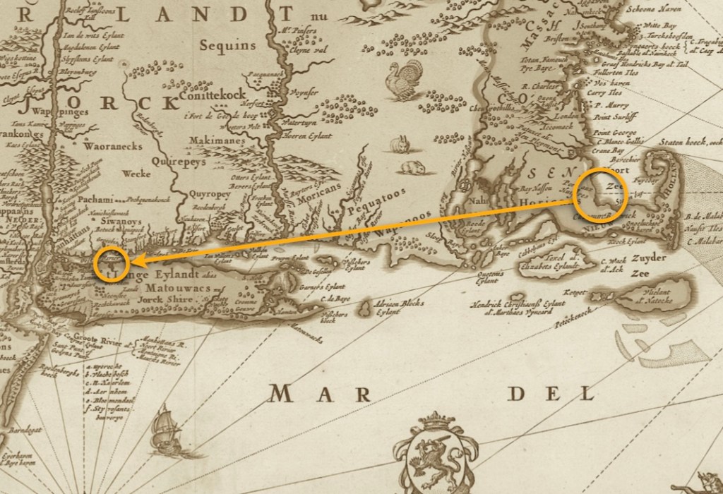
Drawn in 1685 by Nicolaes Visscher, it shows the distance that Isaac Doty traveled from the Plymouth Colony area which was undertake control of England — to the area of Oyster Bay, Long Island, New Amsterdam, which was under the control of the Dutch.
(Map image courtesy of Wikimedia Commons).

(Map image courtesy of the Norman B. Levanthal Map & Education Center Collection).
Breaking New Ground
For reasons which we continue to ponder, Isaac Doty, broke away from the Plymouth Colony and relocated much further west, settling at Oyster Bay, Long Island. At the time, this area was the border between the English settlements in the New York Colony, and the Dutch settlement of New Amsterdam. We will write in detail about both the historical details and Isaac’s family history later on in this chapter. First, we would like to set the stage about what was happening in Long Island before he moved there.
The name “ ’t Lange Eylandt alias Matouwacs” appears in Dutch maps from the 1650s, with ’t Lange Eylandt translating to Long Island from Old Dutch. The English referred to Long Island as Nassau Island, after the House of Nassau of the Dutch Prince William of Nassau, Prince of Orange (who later also ruled as King William III of England). It is unclear when the name Nassau Island was discontinued. Another indigenous name from colonial time, Paumanok, comes from the Native American name for Long Island and means “the island that pays tribute”. (Wikipedia)
Writer John E. Hammond from The Oyster Bay Historical Society, [as quoted throughout,] tells us in The Early Settlement of Oyster Bay — “The original settlers of the area [and the group which Isaac Doty had the most contact with, were the Matinecocks. In their language, their name meant] “at the hilly ground”. They were part of the thirteen tribes who made up the Matouwack Confederacy, (see map below).
“They were a part of the Algonquin language and cultural group but had no written language. When the first Europeans arrived in the early 1600s the total population of the 13 chieftaincies on Long Island was estimated at about 6,500.” Like many of our other family lines who were in New England in this era, they witnessed that the Europeans “had a great impact on the” Native Peoples; “many were decimated by diseases which they had no resistance to”. (2)
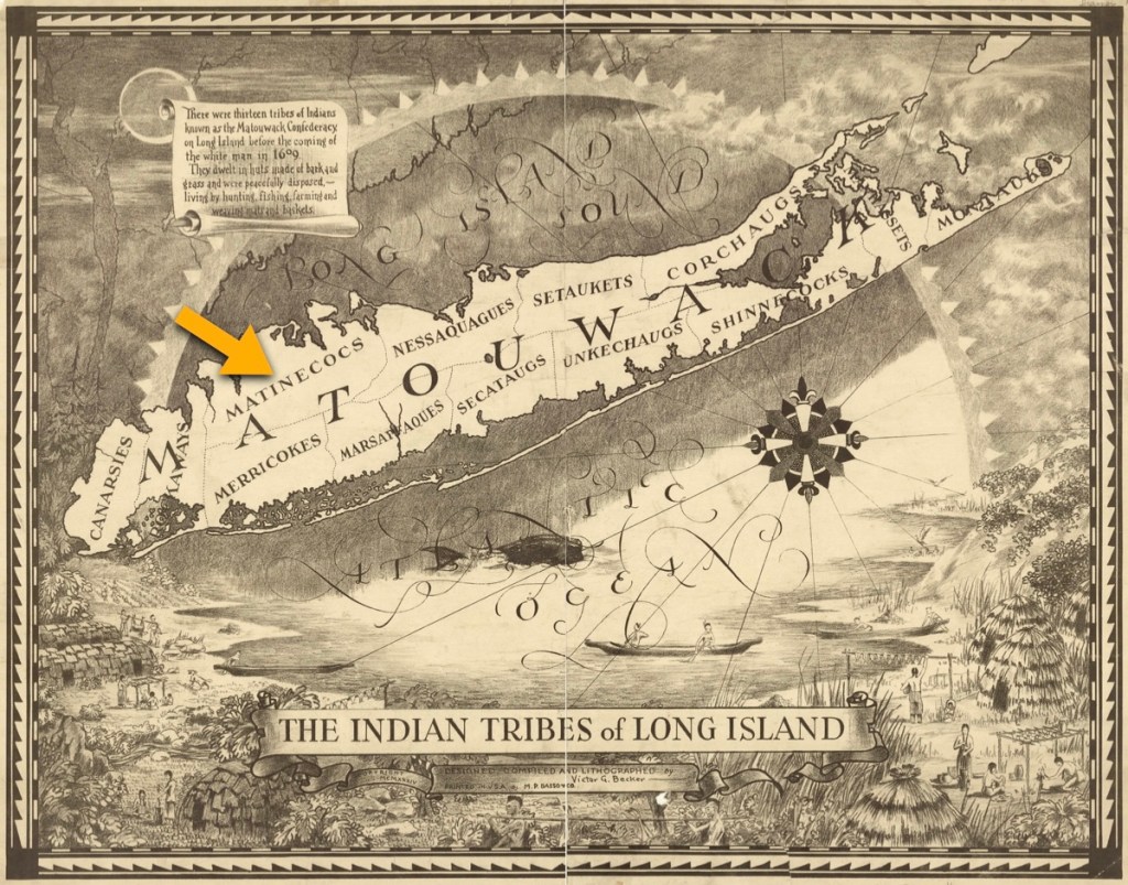
(Image courtesy of the Brooklyn Public Library).
The Matinecock People
As with other tribal groups in the area, “their leaders were called sachems and were shown great respect by the other members of the community”. Furthermore, “…the sachems sought the opinions of the other members of the community while sitting in council, and the sachem’s decision on any subject was always final”. When the Dutch and English settlers began buying up the land, many of the native sachems “thought this was just another form of tribute; many did not believe that they were actually selling off the rights to their land”.
The effect on the population from the diminishing ravages of disease cannot be underestimated. “By the year 1685, the last piece of land was bought by the European settlers”. By 1709, there were no Native Peoples left on the island “except small remnants of a few scattered communities. The remaining Matinecocks moved to join with the Shinnecocks and Montaucks… Those that chose to stay on their ancestral land settled within small hamlets near sites of their earlier villages and sought work on English plantations”. (Hammond)

The decades before Isaac Doty’s arrival in the Oyster Point area saw the Matinecocks facing profound challenges, including conflicts like Kieft’s War and the Battle of Madnan’s Neck, which further impacted their population and landholdings. (Wikipedia, see footnotes). (3)
The Dutch Held New Amsterdam
In this period, Manhattan Island was called New Amsterdam* because it was under the control of the Dutch, who desired to control more land territory. Very close to the mouth of the Hudson River, there was also Long Island, where the Dutch controlled the western one-third, and the eastern two-thirds of Long Island was controlled by the English.
(*and sometimes it was also called, the New Netherlands)
The point where there was tension between the two empires, was more-or-less right through the area of Oyster Bay.

Again, as explained by writer Hammond, the Dutch and the British had different perspectives about what constituted the exact boundaries of Oyster Bay. This caused much confusion about who had the right to govern the area… The Dutch perspective was that only Part A below was Oyster Bay. (They referred to Part B as Martin Gerritsen’s Bay). The English perspective was that Oyster Bay was both Part A and Part B, as shown below.

The Dutch had difficulty in populating the territory after they claimed the New Netherlands and freely accepted English settlers within their territory. [This was] allowed, provided the English settlers swore an oath to the Dutch Directors and paid their tithes; one tenth of all their crops were taken by the Dutch as taxes.
The settlement at Oyster Bay was by a group of traders from Plymouth who neither swore any oath to the Dutch nor had any political connection with the Hartford or New Haven colonies. The Oyster Bay settlement was under no government and was therefore the center of a long dispute between the Dutch at New Amsterdam and the English in New England.” (4)
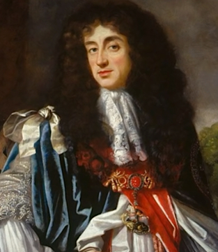

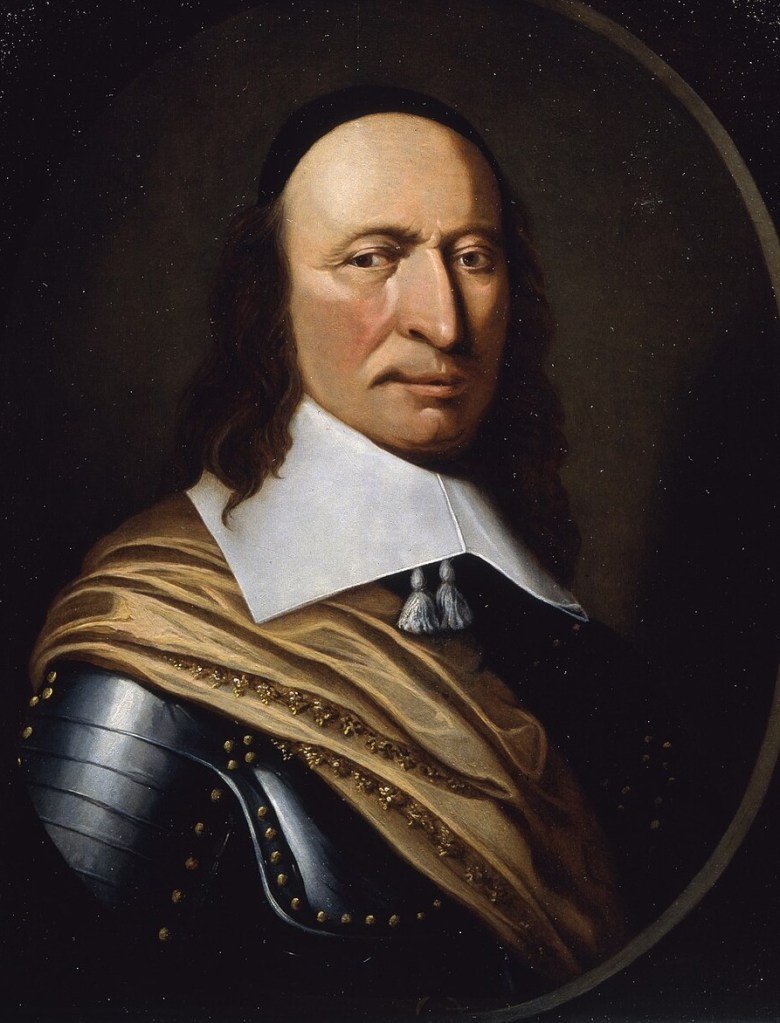
The Stuarts: King Charles II (reigned 1660 – 1685). The Houses of Stuart and Orange: James, first as the Duke of York, then King James II (reigned 1685 – 1688). Peter Stuyvesant, Director-General of New Netherland, (1647 – 1664).
The 1660s Brought Change and a Charter
Continuing with Hammond, “In 1660 King Charles II was restored to the throne in England. Believing that all of the English villages on the western end of Long Island were now theirs, the General Court of Hartford ordered on October 23, 1662, that all English towns on Long Island send representatives to the General Assembly at Hartford. This was the first time that the settlement at Oyster Bay came under the protection of any government other than themselves.
…on March 22, 1664, King Charles II gave the entire territory to his brother James, Duke of York [the future King James II] and Oyster Bay then became part of the North Riding of Yorkshire. In August 1664, Peter Stuyvesant was forced to relinquish all control over New Amsterdam. The Duke’s Laws were issued in 1665, and in 1667 the settlement at Oyster Bay received its charter from the new colony and thereby formally began the political entity we know today as the Township of Oyster Bay.”
[From 1664 until 1776, what was once called the New York Colony became known as the Province of New York]. (5)
(Image courtesy of the Empire State Plaza & New York State Capitol).
Isaac Doty Acquires a Home and Land
The records for very old property deeds in the Oyster Bay Area are not that great, and many original documents are simple gone. We think that this may have had something to do with the fact that “Oyster Bay settlement was under no government” until the later 1670s, and even then, it took some time to get everything settled. There are however, a few bright spots where we have located either a mention of property he was involved with, or property he owned.
First, we need a little background about his life in Plymouth. When his father Edward Doty Sr., died, he left extensive land holdings which were divided up between his many children. One of those areas was property in Yarmouth, Barnstable County, on Cape Cod, near Plymouth County where Isaac had grown up. The map below show the town of Sandwich just south of Plymouth and not far from Yarmouth, which was to the east.
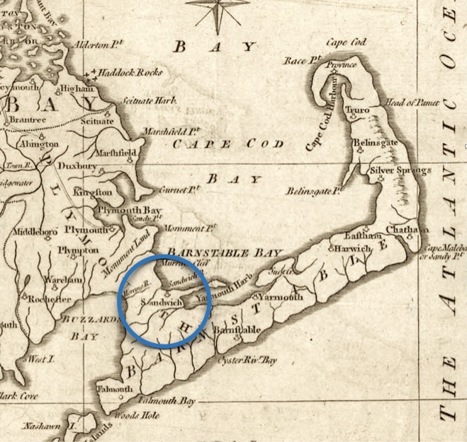
From the book The Doty-Doten Family in America (DDFA), written by his descendant Ethan Allan Doty, we learned that the settlement of Oyster Bay began thus, “The first purchase, as above said, was made in 1651 and by emigrants from Sandwich, the principal of whom were Peter and Anthony Wright, two brothers, who, with their father, had come from Lynn, Mass., to Sandwich, shortly before. The larger part of the emigrants for the next twenty or thirty years came from Sandwich and it is probable that Isaac Doty, having spent a portion of his minority there, was attracted by the reports of returning visitors to his new home on Long Island”. It was here that Isaac likely met the Wright family, of which, Anthony Wright was to have much influence on his life.
“The first purchase… was made in 1651 and by emigrants from Sandwich, the principal of whom were Peter and Anthony Wright, two brothers, who, with their father, had come from Lynn, Mass., to Sandwich, shortly before. The larger part of the emigrants for the next twenty or thirty years came from Sandwich… and that it is probable that Isaac Doty, having spent a portion of his minority there [in Plymouth and Sandwich], was attracted by the reports of returning visitors to [then relocate to]his new home on Long Island”.
He was received with favor. A piece of land for a house lot was at once granted, January 6 [or 23], 1673, and he proceeded to build a house upon it. It is probable that he was married by this time, as the house lot was seldom granted by the town to a young single man.

Its Founding and Growth From 1653 to 1700, by Van S. Merle-Smith, Jr.
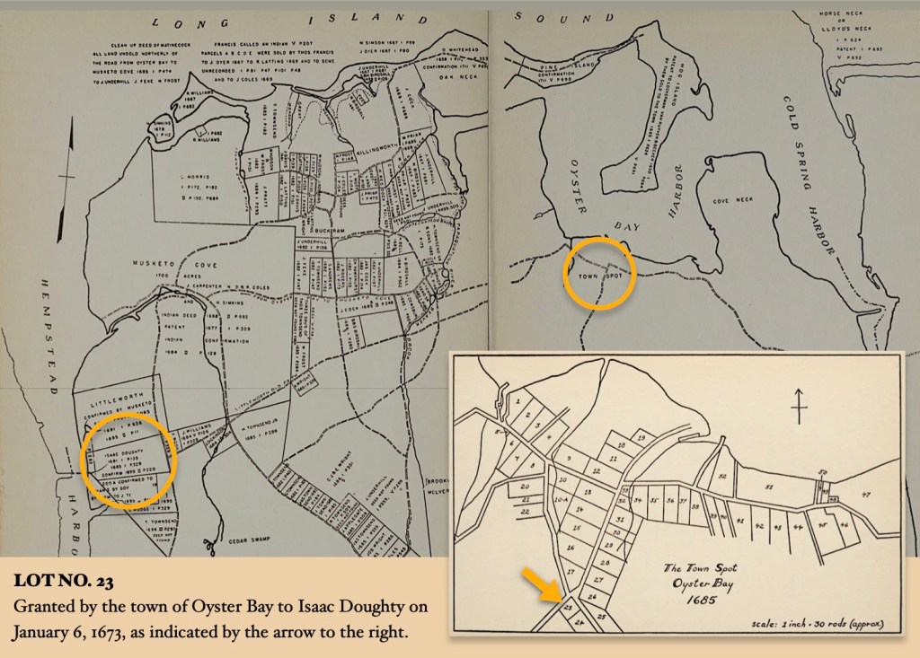
[Lot 23] — This plot was situated upon what is known in the present village as South street, at the head of that street and the corner of Pine Hollow road. He continued to live there several years, while he added constantly to his possessions through the neighboring country.”
All of the following records are from the The Doty-Doten Family in America book, unless noted otherwise:
1675
“On the town records it appears, under date of 26th June, 1675, Anthony Wright by a deed of gift to James Townsend and Isaac Douty, all of Oyster Bay, conveys a certain piece of meadow land at Monensscussott Beach in Sandwich in Plymouth Colony, said lot having been granted to said Anthony Wright by the town of Sandwich in return for certain services rendered the town. And Anthony Wright’s will, made 20th of 3d month. 1678, bequeaths to ‘James Townsend five shillings; to his wife, Elizabeth Townsend, two shillings six pence; and to Isaack Dotye, one cow.’
It is a matter of speculation why Isaac Doty should have received these repeated favors from Anthony Wright; for besides the direct gifts he probably owed his favorable reception in the town and the grants of land there by the town meeting to the influence of this same Anthony Wright. It can hardly have been by reason of any connection by marriage, for Anthony Wright was not married, or at least had no issue. He died September 9, 1680, and aside from the above bequests left his whole estate to Alice, the widow of his brother, Peter Wright.
1676 through 1678
In 1676, his name appears in deeds; May 21, 1677. A list of the freeholders, among whom, entitled to one share of the town, was Isaac Doutty; [in] 1678, he bought one share at Unkaway Neck. [This strange name is an obsolete name for a section of land in the southern part of Oyster Bay].
The 1680s
July 5, 1681. He buys of the Indians a plot where he lives on the east side of Hempstead Harbor; October 16, 1682. Isaac Doughty and William N. Crooker hire for seven years the farm at Littleworth of Robert Godfree. Littleworth was in the western part of the town on the eastern side of Hempstead Harbor; it is now known as Glenwood [Glen Cove] and is in the town of North Hempstead; Up to this time the Indians had continued to hold a considerable part of their old possessions, but in 1685 Isaac Doughty, with a number of others, united and purchased from the chief of the Matinecocks [The Sachem] the balance of their lands in this vicinity.

In 1688, his wife, Elizabeth, joins with him in executing a deed, which she signs with her mark; but the absence of her name in other deeds, both before and after, has no significance, as it was not customary at this time for the wife to sign deeds with the husband. Throughout this period Isaac Doty was frequently appointed to ‘lay out lots,’ to settle boundary lines and to act as commissioner for various purposes, which show him to have been held in high respect by his neighbors, and his judgment to have been greatly esteemed.
In 1703, he is mentioned as one of the proprietors of Littleworth, and in 1704, in a deed, calls his residence at Oyster Bay, New York. (6)
In consideration of filial duty and affection…
Isaac Doty, Sr. was born on February 8, 1648 in the Plymouth, Massachusetts Colony – died about 1728 in Oyster Bay, Long Island, New York Colony. He married Elizabeth Wood* about 1672, in the same location. Elizabeth was born in Portsmouth, Rhode Island and Providence Plantations — died about 1722 in Oyster Bay, Long Island, New York Colony.
*The John Wood Family
There is much information circulating online that records Elizabeth’s family surname as England, rather than as Wood. (However, the name England is an error. This mistake stems from a misreading of a 1684 Will of a man named Hugh Parsons. Please see the footnotes for a detailed explanation).
Together Isaac and Elizaeth had six children (all boys), who were born, lived and died in Oyster Bay, Long Island, the Province of New York. The land and civic records cited are from the The Doty-Doten Family in America (DDFA) book —
- Isaac Doty, Jr. was born about 1673 – died after 1718
He married Elizabeth Jackson and they lived in Oyster Bay. On March 29th, 1697, his father “By a deed of gift he conveys to his son, Isaac, Jr., a farm”. - Joseph Doty (Sr.?) was born about 1680 – died July 7, 1716. He married Sarah (last name unknown). On “June 9th, 1704. In consideration of filial duty and affection he conveys a farm to his son Joseph, and the same day another to his son Jacob.”
We are descended from Joseph and Sarah.
(Image courtesy of the Long Island Museum).
- Jacob Doty was born June 19, 1683 – died after 1750. He married Penelope Albertson on September 2, 1713 in Oyster Bay. She was born in 1694 — death date unknown. (See June 9th, 1704 land record above).
- Solomon Doty was born about 1691 – died about 1761. He married Rachel Seaman about 1722.
- James Doty was born about 1693 – died about 1773. He married Catherine Latting about 1730. She was born about 1710 – died about 1781. In a notation for his brother Samuel Doty, it is shown that he had a farm near his brothers.
- Samuel Doty was born about 1695 – died about 1741. He married Charity Mudge, and records indicate that this family were members of the Society of Friends [the Quakers]. On “March 5th, 1723. In consideration of his fatherly love for his son, Samuel, he conveys to him a farm, adjoining those of his brothers, Jacob, Joseph, Isaac and James”.

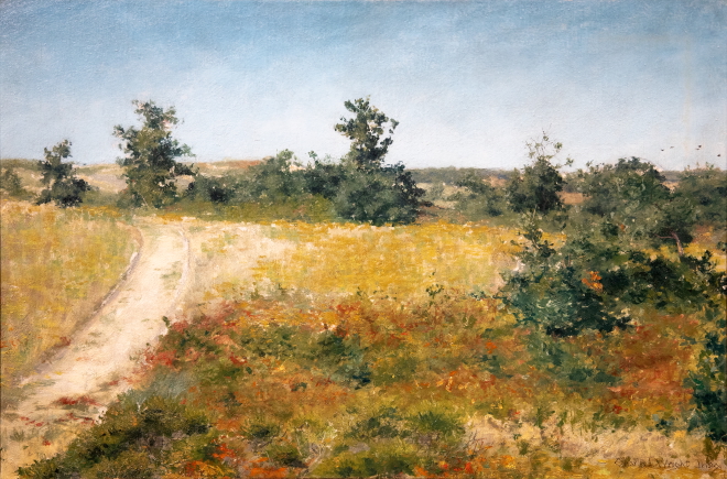
Paradise Woods, Southold, Long Island, by Whitney M. Hubbard.
(Image courtesy of the Long Island Museum).
Outside of records which account for property he left his sons, there are also a couple of civic records. Isaac Doty Sr., “was a member of the Episcopal Church of Oyster Bay and at the meetings held 12th January, 1703, and 14th January, 1707, was appointed vestryman; the first time his name is written Isaac Doughty; the second time it is Isaac Doty, Sr., his son Isaac being now also a householder”. According to idiom.com, A vestryman is a person who “is a member of the vestry, a committee of parishioners responsible for the financial and administrative affairs of a church. As a vestryman, he contributed to the decision-making process regarding church maintenance and community events”.
“September 29th, 1727. He acknowledged in person deeds made by him, 1702-3. [and] January 7th, 1728. He appeared before a magistrate to identify some old landmarks or boundary lines, testifying that he was then about seventy nine years of age. This is the last reference to him upon the records of the town, but he probably died shortly after, and must have been buried in the Episcopal Cemetery at Oyster Bay, though no stone now marks his resting place”.
In his summation about Isaac Doty Sr., author Ethan Allan Doty wrote, “It may be readily seen from the documents already quoted that Isaac Doty was of an exceptionally strong character. He possessed in a marked degree that element of industry and thrift which characterized, to greater or less extent, every one of the children of Edward Doty. With an energy that was commendable, he pushed out to a new territory, constantly extended his lines, and lived to see a prosperous settlement and each one of his sons provided with a farm well cleared and tilled, which his foresight had made possible, and which his fatherly affection had secured.
Upright in all his dealings, his word was respected by his neighbors, who were glad to refer their disputes to his arbitration. He was an active member and supporter of the established church of his town, and encouraged the attendance of his family. His posterity have generally maintained these characteristics, and there have been no more solid and highly esteemed men in the localities where they have lived than his immediate descendants on Long Island and in the western part of Dutchess County. N.Y.”. (7)
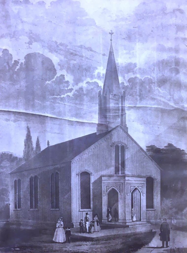
The Christ Church (Episcopal) of Oyster Bay
We looked into the available history for the Episcopal Church of Oyster Bay and found some interesting information about its founding. “From a genealogical record in Thompson’s History of Long Island it appears that a great-grandson of the Rev. John ‘was a leading man in the Episcopal ’ and did much toward the erection of a place of worship for that denomination on or near the site of the present Oyster Bay academy, which land is still known as the church lot. This Mr. Youngs was born in 1716, and his exertions must have been directed toward the completion of the church.
The question of the actual date of the erection of the first church is now definitively settled by a letter from the Rev. Mr. Thomas to the Society for the Propagation of the Gospel in Foreign Parts, in which he speaks of a church having been erected in Oyster Bay. The date of the letter is April 22nd 1707”.
The church was built and thrived for many years, however, life did eventually intervene… Soldiers on both sides of the Revolutionary War took shelter there, and took wooden planks and stones from the church structure to supply their firewood and to build fortifications. “The church finally blew down, and the materials were sold at auction in 1804. The last vestige of the church having disappeared, and there being in all probability no Episcopalian in the parish, the church ground was taken for the location of an academy. One or more of the persons having charge of this new institution set out trees in the yard, took up tombstones and leveled graves, which at one time were numerous in all parts of the yard”. (History of Queens County, New York)
This means that if Isaac Doty Sr. and his wife Elizabeth were indeed buried there, then their graves ended up under ‘an academy’. Subsequent history indicates that the academy eventually evolved into another place of worship. In total, it is likely that through both rebuilding and remodeling, at least five church structures have likely stood on the site.

For an interesting historical viewpoint from more current times, the present (Episcopal) Christ Church in Oyster Bay (on that same site) has this distinction that, “The most famous parishioner of Christ Church was President Theodore Roosevelt, whose funeral took place here on January 8, 1919”. It turns out that we actually have connections to the Roosevelt Family Line, see: The Doty Line, A Narrative — Seven. (8)
As we continue the generations of the Doty family, we move into the next two generations which follow — both ancestors are named with the same name. The first is Joseph Doty, Sr., followed by his son Joseph Doty, Jr., being the one who sought out new areas to live in the Hudson River Valley.
Following are the footnotes for the Primary Source Materials,
Notes, and Observations
(1) — one record
(DDFA)
Doty-Doten Family in America
Descendants of Edward Doty, an Emigrant by the Mayflower, 1620
by Ethan Allan Doty, 1897
https://archive.org/details/dotydotenfamilyi00doty/page/496/mode/2up
Book pages: 496-500 Digital pages: 496-500 /1048
Note: For the text.
Breaking New Ground
(2) — five records
Map of New Netherland and New England, and also parts of Virginia,
which is also known as the
Novi Belgii Novæque Angliæ nec non partis Virginiæ tabula
by Nicolaes Visscher, 1685
https://en.wikipedia.org/wiki/New_Netherland#/media/File:Map-Novi_Belgii_Novæque_Angliæ_(Amsterdam,_1685).jpg
Note: For the map image.
Boston Public Library
Norman B. Levanthal Map & Education Center Collection
A Map of the Most Inhabited Part of New England
by Braddock Mead (alias John Green)
https://commons.wikimedia.org/wiki/File:A_map_of_the_most_inhabited_part_of_New_England_(2674889207).jpg
Note: “This large, detailed map of New England was compiled by Braddock Mead (alias John Green), and first published by Thomas Jefferys in 1755. Green was an Irish translator, geographer, and editor, as well as one of the most talented British map-makers at mid-century. The map was re-published at the outset of the American Revolution, as it remained the most accurate and detailed survey of New England.”
Long Island
https://en.wikipedia.org/wiki/Long_Island
Note: For the text.
(Hammond)
The Oyster Bay Historical Society
The Early Settlement of Oyster Bay
by John E. Hammond
https://www.oysterbayhistorical.org/history-of-oyster-bay.html
Note: Their .pdf download of the town’s history is from:
The Freeholder, Spring 2003, Volume 7, no. 4. 3-9, 18-19.
https://www.oysterbayhistorical.org/uploads/4/9/5/1/4951065/__the_early_settlement_of_oyster_bay.pdf
Note: For the text.
The Matinecock People
(3) — four records
Brooklyn Public Library
Center for Brooklyn History Map Collections
The Indian Tribes of Long Island
(Designed, compiled and lithographed) by Victor G. Becker, 1934
https://mapcollections.brooklynhistory.org/map/the-indian-tribes-of-long-island-designed-compiled-and-lithographed-by-victor-g-becker/
Note: For the map image.
(Hammond)
The Oyster Bay Historical Society
The Early Settlement of Oyster Bay
by John E. Hammond
https://www.oysterbayhistorical.org/history-of-oyster-bay.html
Note: Their .pdf download of the town’s history is from:
The Freeholder, Spring 2003, Volume 7, no. 4. 3-9, 18-19.
https://www.oysterbayhistorical.org/uploads/4/9/5/1/4951065/__the_early_settlement_of_oyster_bay.pdf
Note: For the text.
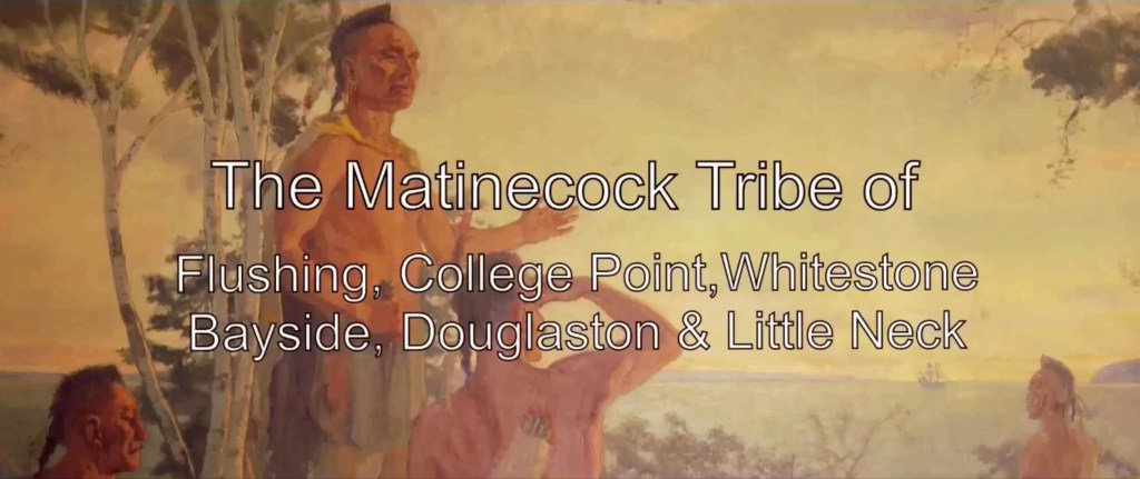
Lost Matinecock Tribe of Flushing, College Point, Whitestone, Bayside, Douglaston, Little Neck, NY
by Thomas Byrne
Note: To watch this short video, please click this link:
https://www.youtube.com/watch?v=zX7LFjs_9TM
Kieft’s War
https://en.wikipedia.org/wiki/Kieft%27s_War
Note: For reference only.
The Dutch Held New Amsterdam
(4) — five records
Brooklyn Public Library
Center for Brooklyn History Map Collections
Map of Long Island [Long Iland sirvaide]
by Robert Ryder, circa 1675
https://mapcollections.brooklynhistory.org/map/long-iland-sirvaide-by-robartt-sic-ryder/
Note 1: From the Blathwayt Atlas in the John Carter Brown Library, 1949
Note 2: Also available at this link —
https://hdl.huntington.org/digital/collection/p15150coll4/id/2688/
Historical Nautical Charts of New York
Harbor Charts of Long Island – Page 2
Chart 367 – Oyster Bay 1916
https://www.old-maps.com/NY/ny_Nautical_Historical_LI_Harbors_2.htm
Note: This map better documents the land and harbors of Oyster Bay, New York.
(Hammond)
The Oyster Bay Historical Society
The Early Settlement of Oyster Bay
by John E. Hammond
https://www.oysterbayhistorical.org/history-of-oyster-bay.html
Note: Their .pdf download of the town’s history is from:
The Freeholder, Spring 2003, Volume 7, no. 4. 3-9, 18-19.
https://www.oysterbayhistorical.org/uploads/4/9/5/1/4951065/__the_early_settlement_of_oyster_bay.pdf
Note: For the text.
The 1660s Brought Change and a Charter
(5) — nine records
Charles II of England: History, Family, Reign & Achievements
https://simple.wikiquote.org/wiki/Charles_II_of_England
Note: For his portrait.
List of English Monarchs
Houses of Stuart and Orange
https://en.wikipedia.org/wiki/List_of_English_monarchs
Note: For the portrait of James II.
Peter Stuyvesant,
Director-General of New Netherland, (1647 – 1664)
https://en.m.wikipedia.org/wiki/File:Petrus_(Peter_Pieter)_Stuyvesant_portrait_c1660.jpg
Note: For his portrait.
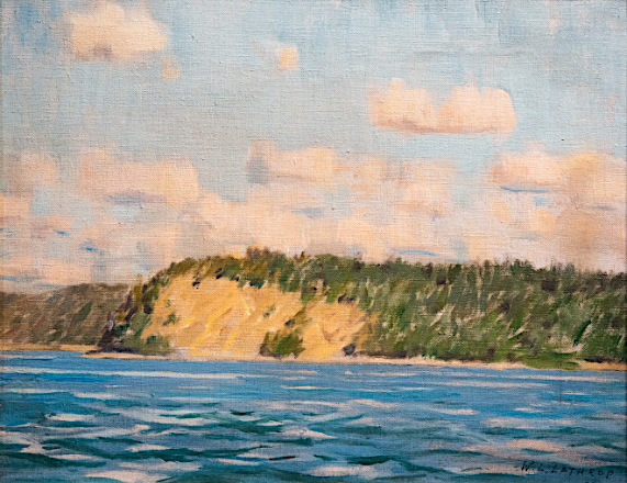
The Empire State Plaza & New York State Capitol
Oyster Bay
by William Langson Lathrop, 1933, via the Heckscher Museum
https://empirestateplaza.ny.gov/hall-new-york/long-island
Note: For the painting.
Isaac Doty Acquires a Home and Land
(6) — six records
(DDFA)
Doty-Doten Family in America
Descendants of Edward Doty, an Emigrant by the Mayflower, 1620
by Ethan Allan Doty, 1897
https://archive.org/details/dotydotenfamilyi00doty/page/496/mode/2up
Book pages: 496-500 Digital pages: 496-500 /1048
Note: For the text.
The Village of Oyster Bay,
Its Founding and Growth From 1653 to 1700
by Van S. Merle-Smith, Jr.
https://archive.org/details/villageofoysterb00merl/page/n5/mode/2up
Book page 62, Digital page: 62/136
Note 1: Small inset township map of home lots, titled The Town Spot Oyster Bay 1685.
Book page 73, Digital page: 72/136
Note 2: Description for Lot. 23 where Isaac Doty had his homesite. Also shown at left is property that he purchased circa 1682-1685.
Note 3: The background map was created from the book endsheets.
Book pages: front and back end sheets
Book page 90, Digital page: 118/136
Note 4: Isaac Doty’s surviving real estate records from 1677 through at least 1702.
(Hammond)
The Oyster Bay Historical Society
The Early Settlement of Oyster Bay
by John E. Hammond
https://www.oysterbayhistorical.org/history-of-oyster-bay.html
Note: Their .pdf download of the town’s history is from:
The Freeholder, Spring 2003, Volume 7, no. 4. 3-9, 18-19.
https://www.oysterbayhistorical.org/uploads/4/9/5/1/4951065/__the_early_settlement_of_oyster_bay.pdf
Note: For the text.
Documentary History of the State of New-York
Volume Two
by Edmund Bailey O’Callaghan
https://archive.org/details/documentaryhisto00ocal_0/page/n327/mode/2up
Book page: 306-307, Digital page: 328/766
Note 1: For the record of “A List Of The Estates Of Ye Inhabitants Of Oyster Baye For A Contry Rate, This 29Te Of Sept 1683.”
Note 2: See —Isack dotty…………..066, Left column, 19th entry
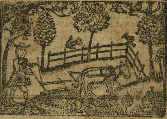
Who Built America?, Volume 1, Chapter 3
Family Labor and the Growth of the Northern Colonies, 1640-1760
Farmer At The Plough, from John Tobler’s Almanack, 1761
published by Christopher Sower, the Library Company of Philadelphia.
https://www.whobuiltamerica.org/book/wba/part-i-colonization-and-revolution-1492-1815/family-labor-and-the-growth-of-the-northern-colonies-1640-1760/
Note: For the image
In consideration of filial duty and affection…
(7) — eleven records
(DDFA)
Doty-Doten Family in America
Descendants of Edward Doty, an Emigrant by the Mayflower, 1620
by Ethan Allan Doty, 1897
https://archive.org/details/dotydotenfamilyi00doty/page/496/mode/2up
Book pages: 496-504 Digital pages: 496-504 /1048
Note: For the text.
John Wood of Rhode Island and
His Early Descendants on the Mainland
by Bertha W. Clark
https://www.ancestry.com/imageviewer/collections/28334/images/dvm_GenMono007787-00001-0?usePUB=true&_phsrc=YEO2&pId=2000000000
Book pages: 11-11~1/2) and 15-16, Digital pages: 23-24/171 and 28-29/171).
Note: For the data.
Elizabeth (Wood) Doty And Susanna (Wood) (England) Carpenter
Of Rhode Island And Long Island:
Daughters Of John Wood, Not William England
by Henry B. Hoff
Excerpted from:
The Mayflower Descendant: A Magazine of Pilgrim Genealogy and History
Volume: 54, Page 27, Winter 2005
https://www.americanancestors.org/DB407/i/14019/27/259013230
The same article is also found here:
Elizabeth Wood Doty
unknown – unknown – Burial Details Unknown
https://www.findagrave.com/memorial/57325018/elizabeth-doty
Note: For the text.
From The Mayflower Descendant article by Henry B. Hoff:
“In the sketch of William England of Portsmouth, R.I., Austin’s Genealogical Dictionary of Rhode Island informs us that England’s widow Elizabeth married second Hugh Parsons whose 1684 will “to wife Elizabeth’s two daughters living on Long Island, viz.: Susannah Carpenter and Elizabeth Doty, certain legacies,” Subsequent works, such as the 1897 Doty genealogy and the 1901 Carpenter genealogy, explained the sole rationale for identifying Hugh Parsons’ stepdaughters as children of William England; namely, the marriage of Ephrain: Carpenter and Susanna England in Oyster Bay, Long Island on 3 December 1677. From this record Austin and others had assumed that this was Susanna’s first marriage and so her maiden name (and that of her sister Elizabeth) was England — and thus Hugh Parsons’ wife Elizabeth was the widow of William England.
However, since 1966 the correct identification of Susanna and Elizabeth has been available at the New England Historic Genealogical Society in Boston, Mass., and several other libraries from a typescript by Bertha W. Clark, “John Wood of Rhode Island and His Early Descendants on the Mainland.” On pages 10 through 16, Miss Clark, an accomplished genealogist, showed that Hugh Parsons married Elizabeth, the widow of John Wood of Portsmouth, and that her daughter Susanna Wood married first Josiah England and second Ephraim Carpenter. Miss Clark cited the 1655 settlement of John Wood’s estate.
The Empire State Plaza & New York State Capitol
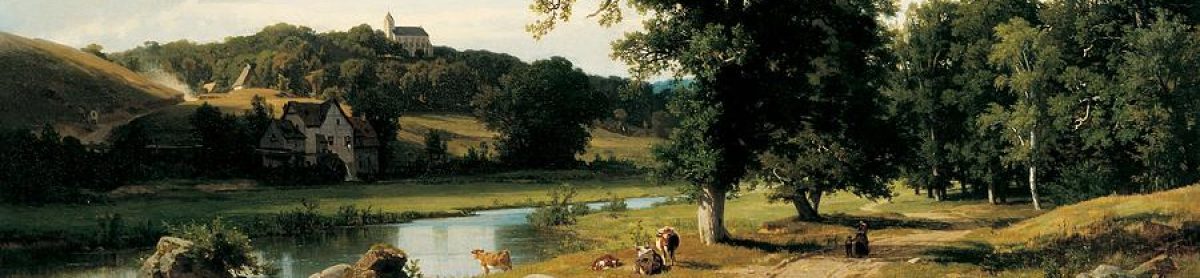
Road to the Beach, Shinnecock Hills,
by Charles L. Wright II, 1891, via the Long Island Museum).
https://empirestateplaza.ny.gov/hall-new-york/long-island
Note: Named after the Shinnecock Nation, these sprawling hills in Suffolk County are the highest point on Long Island’s East End, and the only place on the island where one can see both shorelines. Charles L. Wright II (1876-1966) was born in Long Island and lived there until the age of 15 when he left to study art in Paris. Following his studies, Wright gained notoriety for his landscape paintings, especially of the area surrounding Shinnecock Hills, and for his movie poster art for RKO studios.
The Empire State Plaza & New York State Capitol
Paradise Woods, Southold, Long Island
by Whitney M. Hubbard, via the Long Island Museum
https://empirestateplaza.ny.gov/hall-new-york/long-island
Note: Whitney M. Hubbard (1875-1965) was educated at the Art Students League in New York. He led a secluded life in Greenport, Long Island for seventy years, producing a body of marine and landscape paintings. When he died in 1965, Hubbard’s paintings were not highly valued, but have since gained recognition for their exceptional quality and authentic impressions of Long Island.
Idiom.com English Dictionary
Vestryman Role
https://getidiom.com/dictionary/english/vestryman-role
Note: For the text.
The Christ Church (Episcopal) of Oyster Bay
(8) — three records
Historic Structures
Christ Church, Oyster Bay New York
https://www.historic-structures.com/ny/oyster_bay/christ-church-oyster-bay/
Note: For the 1750 church image.

History of Queens County, New York
with Illustrations, Portraits, & Sketches
Town Village and City Histories: Oyster Bay
https://archive.org/details/historyofqueensc00unse/page/n535/mode/2up?view=theater
Book pages: 500-502, Digital pages: 536-538/617
Note: For the text and the image of the 1878 building of Christ Church, Oyster Bay.

26th President of the United States
Christ Church Oyster Bay
History of Christ Church Oyster Bay
https://christchurchoysterbay.org/who-we-are/history
Note: For the text about President Theodore Roosevelt.

.jpg)
.jpg)
_Stuyvesant_portrait_c1660.jpg)