This is Chapter Eight of nine, being the next-to-last chapter of our narrative about the Doty Line. This chapter will introduce a new family line, the Shaw family, whose surname replaces the Doty surname in this part of our family history.
Setting The Stage
For the first part, the entire history takes place in a relatively small area of the upper Hudson River, at its confluence with the Mohawk River. As you can see in the map below, the town of Cohoes (Falls) is circled in orange. The area circled in yellow covers the district of Schaghticoke, and the towns of Lansingburgh, and Pittstown. Note the town of Troy shown just below Lansingburgh.
Detail from A Map of the State of New York, by Simeon De Witt, circa 1804. (Image courtesy of the Norman B. Leventhal Map & Education Center at the Boston Public Library).
In their era, borders, place names, and populations were always in flux, so we try to feature images which are as accurate as possible to the timeframe. As powerful as maps are for location orientation, we do sometimes come upon an image which helps readers to be grounded in a particular place. One such image is shown below, Troy from Mount Ida(No. 11 of The Hudson River Portfolio).
Troy from Mount Ida(No. 11 of The Hudson River Portfolio) Various artists/makers, circa 1821–22. (Image courtesy of the Metropolitan Museum of Art). This view shows the Hudson River at the border of Lansingburgh.
Look within this artwork and observe that the rain clouds have just cleared away, the late afternoon sunlight is just starting to shine through, it’s very quiet, except for the birds who are starting to call to one another. Two people are making their way along the river road. Maybe we can hear the murmur of their voices?
Imagine that you are standing at this most southern viewpoint in the new town of Lansingburgh, looking toward the south, down the Hudson River. Before you lies the small village of Troy.* In front of you are three islands, located where the Hudson meets the Mohawk. One island is named Van Schaick — which is likely named after one of Lydia Doty’s ancestors who were very early to this area. Behind you, with the breeze to your back, lie the towns of Lansingburgh, Pittstown, and Schaghticoke, where the future of this family unfolds.
Finally, to the right of the three major islands, lies the small town of Cohoes, where the our exploration truly begins.
Excerpted image of Lansingburgh, New York in 1847, as Point-of-Interest #153 from Wade & Croome’s Panorama of the Hudson River from New York to Waterford, by Wade, Disturnell, and Croome.
The image above is an open panoramic view from the 1840s, found within a unique souvenir book. It is built in an accordion style, with views that stretch out for 38 continuous hand-colored panels. It features aerial and panoramic views along both shores of the Hudson River, from New York City, on Manhattan Island, up to the Mohawk river junction at the town of Waterford (across the river from the town of Lansingburgh).
Our Comment: This souvenir book literally mirrors the historical movement of our family as it journeys from New Amsterdam / Manhattan, to Lansingburgh.
*We learned about the eventual ascendance of Troy as a metropolitan city; with it eventually overtaking and eclipsing all the other communities in the area in terms of prominence. From Wikipedia, “Through much of the 19th and into the early 20th centuries, Troy was one of the most prosperous cities in the United States. Prior to its rise as an industrial center, it was the transshipment point for meat and vegetables from Vermont and New York, which were sent by the Hudson River to New York City. The trade was vastly increased after the construction of the Erie Canal, with its eastern terminus directly across the Hudson River from Troy at Cohoes in 1825”. (1)
This oak tree, which eventually became known as the Witenagemot Oak Peace Tree, was planted to commemorate a treaty. It stood until 1949 when a flood toppled it. (Image courtesy of the Knickerbocker Historical Society).
A Tree of Welfare
This family eventually lived in several adjacent communities on both sides of the upper Hudson River. This area had earlier been populated first by Native Peoples, who then gave way to the Dutch, and then the British.
“In 1675, Governor Andros, governor of the colony of New York, planted a tree of Welfare near the junction of the Hoosic River and Tomhannock Creek, an area already known as Schaghticoke, “the place where the waters mingle.” This tree symbolized the friendship between the English and the Dutch, and the Schaghticoke Indians. The Native Inhabitants were Mohican refugees from New England welcomed to Schaghticoke [through a treaty] because they agreed to help protect the English from the French and the Iroquois. They stayed until 1754.
Prior to the proclamation of colonial independence, Schaghticoke was part of the colony of New York with most of its citizens governed by the city of Albany, which owned the land they rented.” (Wikipedia)
Daniel Shaw, like many of our other ancestors, was a farmer for most of his life. (This was confirmed through his Will). (2)
Getting To Know Daniel Shaw
Our research on Daniel Shaw and his birth family is ongoing. At first glance, we thought he may be related to a man named John Shaw who arrived in Plymouth Colony, in 1623 and was very involved in the settling of that place. However, a direct link between the family lines has not yet been found. We learned that another family of Shaws settled in Connecticut, so, as we publish this section of our family blog, we are researching that possible connection. (Updates will be added as we resolve the Shaw family line history).
Therefore, this grandfather is a bit enigmatic — due to the fact that not much information about his life before meeting Lydia Doty seems to have surfaced. He was barely mentioned in the Doty-Doten Family in America book by Ethan Allan Doty, (DDFA).
Despite that, in the rather comprehensively titled book, the History of the Seventeen Towns of Rensselaer County, From the Colonization of the Manor of Rensselaerwyck to the Present Time, we first observe Daniel Shaw’s name and the (likely) name of his future father-in-law, Joseph Doty. The context was what was then known as a patriotic pledge, made when American Colonists knew that a war with Great Britain was imminent.
It was a long, patriotic pledge, made on May 22, 1775. The opening paragraph reads: “A general association agreed to and subscribed by the freemen, freeholders and Inhabitants of the town of Lansingburgh and patent of Stone Arabia: Persuaded that the Violation of the rights and liberties of America depends, under God, on the firm opinion of its Inhabitants in a vigorous prosecution of the measures necessary for Its safety,— convinced of the necessity of preventing the anarchy and confusion which attend a dissolution of the power of government, we, the freemen, freeholders and inhabitants of the town of Lansingbugh and patent of Stone Arabia, being greatly alarmed at the avowed design of the British ministry to raise a revenue In America, and shocked by the bloody scenes now enacting In Massachusetts bay government, in the most solemn manner…”
Excerpted text from the History of the Seventeen Towns of Rensselaer County, From the Colonization of the Manor of Rensselaerwyck to the Present Time, page 34. In the left column we see Daniel Shaw as one of the signatories to a Patriotic Pledge, given in Lansingburgh on May 22, 1775. Despite the misspelling of the surname, in the right column we see the name of his future father- in-law, Joseph Doty. (See footnotes).
This tells us that he was living in the Lansingburgh area as early as May 1775.
The Albany County area and the local communities were the scenes of many fierce battles during the Revolutionary War. We learned that Daniel had served in the Albany Militia’s Fourteenth Regiment. It appears that years later, in March 1789, he was paid in certificates. The currency of the new United States was not regularized yet and many States still printed their own money. Certificates were issued by the government, which could be used with merchants to pay for goods. (See footnotes).
New York Revolutionary War Tax ListsBy County — Albany, showing page 4, October 1779, Land and Property Tax Lists – Schachtakoke. See Daniel Shaw of Cohoes indicated by the arrow, along with three siblings of Lydia Doty listed — her brothers Peter, Ormond, and Jacob Doty.
The United States was very new in this era and it was unclear to whom and how property taxes were to be paid. This was still not finalized until many years after The War had ended. We did find tax records from the year 1779. As explained by, the Empire State Society of the Sons of the American Revolution, “Subcommittee on Revolutionary Taxes and have been found to support the War and/or address a request of the Continental Congress. The lists therefore provide evidence of Revolutionary service for those whose names are found on the lists…” In a very young United States, paying the taxes to a government that was not very organized and still evolving… this was seen as a hallmark of patriotic behavior. (3)
Excerpted and collaged content from the U.S., Revolutionary War Rolls, 1775-1783 for Daniel Shaw New York > Willett´s Regiment of Levies, 1781-1783.
The Colonial Militias of New York
The 14th Albany County Regiment of Militia was a regiment of the New York Militia, and was part of the 2nd Brigade alongside the regiments of Tryon County. (Renamed as Montgomery County in 1784). Militiamen for Albany County were recruited into the 2nd New York Regiment.
Generally speaking, the “Albany County militia was the colonial militia of Albany County, New York. Drawn from the general male population, by law all male inhabitants from 15 to 55 had to be enrolled in militia companies, the later known by the name of their commanders. By the 1700s, the militia of the Province of New York was organized by county and officers were appointed by the royal government. By the early phases of the American Revolutionary War the county’s militia had grown into seventeen regiments.” We learned that Lydia Doty’s brothers Peter, Ormond, and Jacob Doty, were also part of this regiment.
As they were allied with the 2nd New York Regiment, this “regiment would see action in the Invasion of Canada (1775), the Battle of Valcour Island (1776), the Battles of Saratoga (1777), the Battle of Monmouth (1778), the Sullivan Expedition (1779), and the Battle of Yorktown (1781). The regiment would be furloughed, June 2, 1783, at Newburgh, New York.” (Fandom AR Wiki, and Wikipedia) We have another family line living in this exact same area during that time, who also participated in the Battles of Saratoga. Either family or both, may have also participated in The Battle of Klock’s Field, and The Battle of Oriskany. (See The Devoe Line, A Narrative — Five).
Observation 1: It is important to note that these men certainly did not participate in all of these battles. (We know this because they were paying property taxes in March and October 1779). We can credibly believe that The Battles of Saratoga in 1777, is an event which they fought in, because it took place right in their back yard. Other than that, they may have been called up periodically for campaigns.
Observation 2: Daniel Shaw’s friendship with (and awareness of) the Doty brothers, could have led to his meeting their sister, Lydia Doty. (4)
Wedding scene from Ramsay’s The Gentle Shepherd, Act V. Printed for G. Reid and Co., 1798. (Image courtesy of The Lewis Walpole Library at Yale University).
The Doty Surname Gives Way to Shaw
For this section, unless noted otherwise, all events took place in Albany County, New York State. Of note: Albany County was reformed to be Rensselaer County, in 1791. So, before 1791 > Albany County, and after 1791 > Rensselaer County. Furthermore, when a county name changes, such as in a record for a marriage or a death, we have noted this.
We believe that in about 1783, Daniel Shaw, married Lydia Doty (likely) in Lansingburgh. He was born about 1760 in (unknown location) – died August 13, 1842, in Lansingburgh, Rensselaer, New York. Lydia Doty was born in December 1769 in Lansingburgh, (then Albany County), New York – died November 2, 1830, in Schaghticoke, Rensselaer, New York.
Daniel was about 9 to 10 years older than Lydia, and she was only about 14 to 15 when she married him. Even though we do not know the exact death date for Lydia’s mother Giesje ‘Lucretia’ Doty, we believe that Lydia was very young when her mother died. During this time, the American Revolution was raging all around her. (We speculate that she may have been cared for by an older sister, but we do not have evidence for this. Even though we have seen similar circumstances in other family lines). The truth is, we do not know who actually cared for her, or her younger sister Nancy.
Together Daniel and Lydia had 10 children, who are listed below. In the 1790 Census, the family is shown as living in Pittstown, Albany County. Therefore, we believe that the first five children: Lucretia, Daniel Jr., Nancy, William, and Orman, were born there.
Taken on August 2, 1790, The 1790 population census was the First Census of the United States. (The National Archives).
Lucretia (Shaw) Preston. She was born about 1784 – died after 1865 in Verona, Oneida County. She married James Preston, date unknown.
Daniel Shaw, Jr. He was born about 1786 – died January 17, 1857 in Greenwich, Washington County.
Nancy (Shaw) Stover. She was born April 11, 1788 – died March 21, 1872 in Somers, Kenosha County, Wisconsin. She married Joseph Stover. We noted that of all these siblings, she was the only one to relocate outside of New York State.
William Shaw. He was born September 11, 1789 – died May 16, 1876 in Ulster County, New York. He married two times, with both marriages being in New York. First, to Hannah Burhans on July 25, 1812 in New York; second, to Eliza Bonestell on February 7, 1856 in Kingston, Ulster County. Please see the footnotes for an obituary about William’s life.
Orman Shaw. He was born on March 3, 1790 – died November 24, 1867 in Halfmoon, Saratoga County. About 1811, he married Elizabeth (last name unknown). We are descended from Orman and his wife Elizabeth.
The next five children: Henry, Soloman, John, Elizabeth, and Hiram, were likely born in the Schaghticoke District, (now) Renssaelar County. This was located just slightly to the west, right next to Pittstown. It could also be that the family may have already been living in Lansingburgh. It was technically a separate municipality from the Schaghticoke District. (Who knows exactly after more than 2oo years of various record keepers?)
Taken on August 4, 1800, the 1800 population census was the Second Census of the United States. (The National Archives).
Henry Shaw. He was born 1796 — died (date unknown). He is noted as being the 1842 executor for his father Daniel Shaw’s Will.
Solomon Shaw. He was born 1797 — died 1863.
John Shaw. He was born 1799 — died August 1859 in Cohoes. He married Mary Elizabeth Hutchins about 1827.
Elizabeth (Shaw) Baninger. She was born 1802 — death date unknown. She married (first name unknown) Baninger.
Hiram Shaw. He was born 1804 — died May 25, 1857, Waterford, Saratoga County. He married Jane A. Patten about 1823. (He died a tragic death, please see the footnotes). (5)
Perhaps He Was A Prudent Man?
Lydia Doty died in November 1830, and consequently her husband Daniel was maybe feeling a little bit blue in the years afterward— or maybe not. Perhaps he was just prudent? We observed that he executed his Will on September 22, 1834, but continued to live on for almost eight more years, dying on August 13, 1842.
The Will of Daniel Shaw, dated September 22, 1834.
When we looked at the Will contents, we read that he left his son Henry “the whole of my real estate, the crops on the ground and all the grain, hay fodder on the premises at the time of my death and also one mare and one colt and all the farming utensils”. (It seems Henry never married, so perhaps he was living with his father in his older age?) For his other children (excepting for Henry who was provided for), he asked that his estate “be equally divided among them”.
One of the most intriguing aspects of the Will is that after he indicated what he was providing to his son Henry, and before he mentions his other children, he specifically requests provision for a servant girl (we added commas to make the text understandable) —
To Misa, a Mulatto girl in my family, I give and bequeath one bedstead, one bed and straw-bed, two blankets, two sheets, two pillows, and one bolster, which I have usually had for my personal use, and one cow, which she may select from my cows, as a compensation for her services…
We checked the 1840 census to see if Daniel owned any slaves.* He did not. However, that census did indicate that there were three “Free Colored Persons” residing in the home, as follows:
Two males, one under 10, and one between 10-24 years old
One female, between 24-36 years old
*Slavery was fully abolished in New York following a gradual emancipation act passed in 1799 that freed children born after that date. An act on March 31, 1817, set the timeline for final emancipation, and the last enslaved people in the state gained freedom on July 4, 1827. (See footnotes).
We speculate that the Free Colored Person on the census (female) was Misa, and we wonder if the two males could have been her sons? By 1840, Daniel Shaw had been living in his Lansingburgh home for many years. When we looked at the ages for the other residents in the home, none of them aligned perfectly with the very scant knowledge we have about his children… Conceivably, he could have had a family boarding there. It makes sense that in his older age, and being a widower, he needed people around him. (6)
Crossing The Bridge
In the era we live in today, with the general ease of transportation, getting around is something we don’t pay much heed to. (Unless of course, we get stuck driving in traffic, or worse, we get a bit anxious because our luggage is taking much too long to show up at the carousel at the airport!) For our ancestors, getting around town took some real effort. Just imagine what it was like to cross the Hudson or Mohawk Rivers back then? It’s no wonder people got excited when a new bridge was built!
Page 108 from The Hudson, From the Wilderness to the Sea, by Benson John Lossing, 1866. The Union Bridge was built between 1800-1810.
From a Wikipedia article on the History of Lansingburgh, “The structure which spans the Hudson River between Lansingburgh and Waterford, Saratoga county, known as the Union Bridge, is distinguished as being the oldest wooden bridge in the United States. It stands intact today as strong apparently as in the early days of the century. When the bridge was constructed it was deemed a marvel of engineering skill. How the public looked upon the structure at that time is manifested by the elaborate character of the exercises which attended its opening.
The day was a holiday in Lansingburgh. A ‘very numerous procession’ was formed at noon at Johnson & Judson’s hotel and marched to the bridge, and thence across to Waterford, ‘under the discharge of seventeen cannon’, where a dinner had been provided at Van Schoonhoven’s hotel at the expense of the stockholders of the bridge. Among the prominent persons in attendance were the governor, the secretary of state, the comptroller, ‘and a large number of respectable gentlemen from Albany and the adjacent villages’, who ‘partook in much harmony and conviviality’. The structure is 800 feet (240 m) long and thirty feet wide…”
In the next chapter, we will literally cross over this Union Bridge with our 4x Great Grandfather Orman Shaw, and learn about a union of another kind — that with his future wife Elizabeth. They will come to reside in the community of Halfmoon, Saratoga County. (7)
Following are the footnotes for the Primary Source Materials, Notes, and Observations
Wade & Croome’s Panorama of the Hudson River from New York to Waterford [electronic resource] by William Wade, John Disturnell, and William Croome, circa 1847 https://archive.org/details/ldpd_11290386_000/page/n1/mode/2up Note: For the cover image, and the panoramic Point-of-Interest view #153 of Lansingburgh, New York
History of the Seventeen Towns of Rensselaer County, From the Colonization of the Manor of Rensselaerwyck to the Present Time by Arthur James Weise, circa 1880 https://archive.org/details/cu31924064123015/page/n5/mode/2up?view=theater Book page: 34, Digital page: 40/168, Left and right columns at bottom. Note: For the names Daniel Shaw and Joseph “Dody” as observed within the text.
Empire State Society of the Sons of the American Revolution New York Revolutionary War Tax Lists by County — Albany October 1779 Land and Property Tax Lists — Schachtakoke https://www.ess-sar.org/pages/nystax_counties/nys_taxlists_county_albany_schachtakoke_october-1779.html Document page: 4, Digital page: 5 Note 1: Entry 16 lists Danl Shaw of Cohoes. Note 2: Three siblings of Lydia Doty are listed: Peter, Orman, and Jacob Doty.
The Colonial Militias of New York
(4) — seven records
U.S., Revolutionary War Rolls, 1775-1783 for Daniel Shaw New York > Willett’s Regiment of Levies, 1781-1783 (Folder 173) — Various Organizations (Folder 181) Digital page: 226/644 https://www.ancestry.com/search/collections/4282/records/1725089 Note 1:“An account of certificates” with Daniel Shaw being listed 25th from the bottom. Indications read “Investigation shows that a large number of the names on this records as of Col. Peter Yates’ Reg’t. NY” Note 2: Further notations on digital page 228/644 indicate that payments were paid on 3 March 1789 in Lansingburgh by John VanRensselaer.
Documents Relative to the Colonial History of the State of New York by Various Authors, circa 1853 (is enclosed within) New York In The Revolution, Volume One by The Board of Regents and Berthold Fernow, circa 1887 https://archive.org/details/documentsrelativ15alba/page/n9/mode/2up Note 1: On book page 469 —Daniel Shaw, private, and Peter Doty, private, are listed on the Roster of the State Troops as being members of Yate’s Regiment. Note 2: On book page 361 —Jacob Doty, private, and Orman Doty, private, are listed on the Roster of the State Troops as being members of Van Rensselaer’s Regiment.
William Shaw obituary from an uncredited Kingston, New York newspaper.
William Shaw https://www.findagrave.com/memorial/106338154/william-shaw Note: For the obituary profile from an uncredited Kingston, New York newspaper. There are errors in the profile, such as his birthplace.He was not born in Dutchess County.
[Record of the Will of Daniel Shaw] New York, Probate Records, 1629-1971 > Rensselaer > Wills 1842-1843 vol 33 https://www.familysearch.org/ark:/61903/3:1:33SQ-GY4J-6ST?lang=en&i=167 Book pages: 279-285, Digital pages (images): 168-171/277 Note: The first six pages are notices to all the siblings of the probate. The actual Will begins on book page 285, or image 171.
This is Chapter Five of nine. When our ancestor Edward Doty Sr. died in 1655, his son Isaac was only about seven years old. As he had grown up in a large family with eight other siblings. Some of these brothers and sisters stayed local and then had big families of their own… so, we speculate that he may have gotten just a bit tired of seeing so many Doty relatives everywhere he looked?
This suggests that he then sought out some new horizons. Author Ethan Allan Doty wrote, “At the death of his father he was just six years of age, and probably continued to live with his mother until about the time of her marriage to John Phillips, in 1667. It is somewhat doubtful where he spent the next five years of his life, but it is probable that it was in Sandwich. Mass.. where his brother Joseph was also, early in life, a resident. But it is possible that he may have visited in this period Oyster Bay on Long Island where he subsequently lived”. (Doty-Doten Family in America, DDFA) (1)
Map of New Netherland and New England, and also parts of Virginia, also known as the Novi Belgii Novæque Angliæ nec non partis Virginiæ tabula. Although this map is not considered to be very accurate for its geography, but it is correct for the time period in which Isaac Doty lived.
Drawn in 1685 by Nicolaes Visscher, it shows the distance that Isaac Doty traveled from the Plymouth Colony area which was undertake control of England — to the area of Oyster Bay, Long Island, New Amsterdam, which was under the control of the Dutch. (Map image courtesy of Wikimedia Commons).Created a mere 70 years later than the map above, A Map of the Most Inhabited Part of New England, by Braddock Mead (alias John Green) — this clearly shows how much cartography [map making] skills had improved in those years. (Map image courtesy of the Norman B. Levanthal Map & Education Center Collection).
Breaking New Ground
For reasons which we continue to ponder, Isaac Doty, broke away from the Plymouth Colony and relocated much further west, settling at Oyster Bay, Long Island. At the time, this area was the border between the English settlements in the New York Colony, and the Dutch settlement of New Amsterdam. We will write in detail about both the historical details and Isaac’s family history later on in this chapter. First, we would like to set the stage about what was happening in Long Island before he moved there.
The name “’t Lange Eylandt alias Matouwacs” appears in Dutch maps from the 1650s, with ’t Lange Eylandt translating to Long Island from Old Dutch. The English referred to Long Island as Nassau Island, after the House of Nassau of the Dutch Prince William of Nassau, Prince of Orange (who later also ruled as King William III of England). It is unclear when the name Nassau Island was discontinued. Another indigenous name from colonial time, Paumanok, comes from the Native American name for Long Island and means “the island that pays tribute”. (Wikipedia)
Writer John E. Hammond from The Oyster Bay Historical Society, [as quoted throughout,] tells us in The Early Settlement of Oyster Bay — “The original settlers of the area [and the group which Isaac Doty had the most contact with, were the Matinecocks. In their language, their name meant] “at the hilly ground”. They were part of the thirteen tribes who made up the Matouwack Confederacy, (see map below).
“They were a part of the Algonquin language and cultural group but had no written language. When the first Europeans arrived in the early 1600s the total population of the 13 chieftaincies on Long Island was estimated at about 6,500.” Like many of our other family lines who were in New England in this era, they witnessed that the Europeans “had a great impact on the” Native Peoples; “many were decimated by diseases which they had no resistance to”. (2)
Shows areas of Long Island held by the various Native People tribes that made up the Matouwack Confederacy as of 1609. Isaac Doty interacted with the Matinecocs. (Image courtesy of the Brooklyn Public Library).
The Matinecock People
As with other tribal groups in the area, “their leaders were called sachems and were shown great respect by the other members of the community”. Furthermore, “…the sachems sought the opinions of the other members of the community while sitting in council, and the sachem’s decision on any subject was always final”. When the Dutch and English settlers began buying up the land, many of the native sachems “thought this was just another form of tribute; many did not believe that they were actually selling off the rights to their land”.
The effect on the population from the diminishing ravages of disease cannot be underestimated. “By the year 1685, the last piece of land was bought by the European settlers”. By 1709, there were no Native Peoples left on the island “except small remnants of a few scattered communities. The remaining Matinecocks moved to join with the Shinnecocks and Montaucks… Those that chose to stay on their ancestral land settled within small hamlets near sites of their earlier villages and sought work on English plantations”. (Hammond)
An unknown artist’s representation of the Matinecock People (note the colonial era ship in the distance). This is a screen grab of a video about the Matinecocks which we have linked in the footnotes.
The decades before Isaac Doty’s arrival in the Oyster Point area saw the Matinecocks facing profound challenges, including conflicts like Kieft’s War and the Battle of Madnan’s Neck, which further impacted their population and landholdings. (Wikipedia, see footnotes). (3)
The Dutch Held New Amsterdam
In this period, Manhattan Island was called New Amsterdam* because it was under the control of the Dutch, who desired to control more land territory. Very close to the mouth of the Hudson River, there was also Long Island, where the Dutch controlled the western one-third, and the eastern two-thirds of Long Island was controlled by the English. (*and sometimes it was also called, the New Netherlands)
The point where there was tension between the two empires, was more-or-less right through the area of Oyster Bay.
Left image: Map of Long Island [Long Iland sirvaide], by Robert Ryder, circa 1675. (Image courtesy of The Brooklyn Library). Right image: A contemporary map of Oyster Bay to better understand the true landscape and harbors. (image courtesy of Historical Nautical Charts of New York).
Again, as explained by writer Hammond, the Dutch and the British had different perspectives about what constituted the exact boundaries of Oyster Bay. This caused much confusion about who had the right to govern the area… The Dutch perspective was that only Part A below was Oyster Bay. (They referred to Part B as Martin Gerritsen’s Bay). The English perspective was that Oyster Bay was both Part A and Part B, as shown below.
The Dutch had difficulty in populating the territory after they claimed the New Netherlands and freely accepted English settlers within their territory. [This was] allowed, provided the English settlers swore an oath to the Dutch Directors and paid their tithes; one tenth of all their crops were taken by the Dutch as taxes.
The settlement at Oyster Bay was by a group of traders from Plymouth who neither swore any oath to the Dutch nor had any political connection with the Hartford or New Haven colonies. The Oyster Bay settlement was under no government and was therefore the center of a long dispute between the Dutch at New Amsterdam and the English in New England.” (4)
The Stuarts: King Charles II (reigned 1660 – 1685). The Houses of Stuart and Orange: James, first as the Duke of York, then King James II (reigned 1685 – 1688). Peter Stuyvesant, Director-General of New Netherland, (1647 – 1664).
The 1660s Brought Change and a Charter
Continuing with Hammond, “In 1660 King Charles II was restored to the throne in England. Believing that all of the English villages on the western end of Long Island were now theirs, the General Court of Hartford ordered on October 23, 1662, that all English towns on Long Island send representatives to the General Assembly at Hartford. This was the first time that the settlement at Oyster Bay came under the protection of any government other than themselves.
…on March 22, 1664, King Charles II gave the entire territory to his brother James, Duke of York [the future King James II] and Oyster Bay then became part of the North Riding of Yorkshire. In August 1664, Peter Stuyvesant was forced to relinquish all control over New Amsterdam. The Duke’s Laws were issued in 1665, and in 1667 the settlement at Oyster Bay received its charter from the new colony and thereby formally began the political entity we know today as the Township of Oyster Bay.”
[From 1664 until 1776, what was once called the New York Colony became known as the Province of New York]. (5)
Oyster Bay, by William Langson Lathrop, 1933, via the Heckscher Museum. (Image courtesy of the Empire State Plaza & New York State Capitol).
Isaac Doty Acquires a Home and Land
The records for very old property deeds in the Oyster Bay Area are not that great, and many original documents are simple gone. We think that this may have had something to do with the fact that “Oyster Bay settlement was under no government” until the later 1670s, and even then, it took some time to get everything settled. There are however, a few bright spots where we have located either a mention of property he was involved with, or property he owned.
First, we need a little background about his life in Plymouth. When his father Edward Doty Sr., died, he left extensive land holdings which were divided up between his many children. One of those areas was property in Yarmouth, Barnstable County, on Cape Cod, near Plymouth County where Isaac had grown up. The map below show the town of Sandwich just south of Plymouth and not far from Yarmouth, which was to the east.
From the book The Doty-Doten Family in America (DDFA), written by his descendant Ethan Allan Doty, we learned that the settlement of Oyster Bay began thus, “The first purchase, as above said, was made in 1651 and by emigrants from Sandwich, the principal of whom were Peter and Anthony Wright, two brothers, who, with their father, had come from Lynn, Mass., to Sandwich, shortly before. The larger part of the emigrants for the next twenty or thirty years came from Sandwich and it is probable that Isaac Doty, having spent a portion of his minority there, was attracted by the reports of returning visitors to his new home on Long Island”. It was here that Isaac likely met the Wright family, of which, Anthony Wright was to have much influence on his life.
“The first purchase… was made in 1651 and by emigrants from Sandwich, the principal of whom were Peter and Anthony Wright, two brothers, who, with their father, had come from Lynn, Mass., to Sandwich, shortly before. The larger part of the emigrants for the next twenty or thirty years came from Sandwich… and that it is probable that Isaac Doty, having spent a portion of his minority there [in Plymouth and Sandwich], was attracted by the reports of returning visitors to [then relocate to]his new home on Long Island”.
He was received with favor. A piece of land for a house lot was at once granted, January 6 [or 23], 1673, and he proceeded to build a house upon it. It is probable that he was married by this time, as the house lot was seldom granted by the town to a young single man.
Oyster Bay property records from the description found in the book, The Village of Oyster Bay, Its Founding and Growth From 1653 to 1700, by Van S. Merle-Smith, Jr.This set of two maps indicates at least some of the property that Isaac Doty owned in Oyster Bay, Long Island, New York Colony. At left, the circle indicates property that he purchased circa 1682-1685. At right, Lot 23 in the township settlement. (Images derived from The Village of Oyster Bay,Its Founding and Growth From 1653 to 1700, by Van S. Merle-Smith, Jr.).
[Lot 23] — This plot was situated upon what is known in the present village as South street, at the head of that street and the corner of Pine Hollow road. He continued to live there several years, while he added constantly to his possessions through the neighboring country.”
All of the following records are from the The Doty-Doten Family in America book, unless noted otherwise:
1675 “On the town records it appears, under date of 26th June, 1675, Anthony Wright by a deed of gift to James Townsend and Isaac Douty, all of Oyster Bay, conveys a certain piece of meadow land at Monensscussott Beach in Sandwich in Plymouth Colony, said lot having been granted to said Anthony Wright by the town of Sandwich in return for certain services rendered the town. And Anthony Wright’s will, made 20th of 3d month. 1678, bequeaths to ‘James Townsend five shillings; to his wife, Elizabeth Townsend, two shillings six pence; and to Isaack Dotye, one cow.’
It is a matter of speculation why Isaac Doty should have received these repeated favors from Anthony Wright; for besides the direct gifts he probably owed his favorable reception in the town and the grants of land there by the town meeting to the influence of this same Anthony Wright. It can hardly have been by reason of any connection by marriage, for Anthony Wright was not married, or at least had no issue. He died September 9, 1680, and aside from the above bequests left his whole estate to Alice, the widow of his brother, Peter Wright.
Page 90 from The Village of Oyster Bay.
1676 through 1678 In 1676, his name appears in deeds; May 21, 1677. A list of the freeholders, among whom, entitled to one share of the town, was Isaac Doutty; [in] 1678, he bought one share at Unkaway Neck. [This strange name is an obsolete name for a section of land in the southern part of Oyster Bay].
The 1680s July 5, 1681. He buys of the Indians a plot where he lives on the east side of Hempstead Harbor; October 16, 1682. Isaac Doughty and William N. Crooker hire for seven years the farm at Littleworth of Robert Godfree. Littleworth was in the western part of the town on the eastern side of Hempstead Harbor; it is now known as Glenwood [Glen Cove] and is in the town of North Hempstead; Up to this time the Indians had continued to hold a considerable part of their old possessions, but in 1685 Isaac Doughty, with a number of others, united and purchased from the chief of the Matinecocks [The Sachem] the balance of their lands in this vicinity.
“A List Of The Estates Of Ye Inhabitants Of Oyster Baye For A Contry Rate, This 29Te Of Sept 1683.” From Documentary History of the State of New-York, Volume Two by Edmund Bailey O’Callaghan). Image courtesy of the Internet Archive).
In 1688, his wife, Elizabeth, joins with him in executing a deed, which she signs with her mark; but the absence of her name in other deeds, both before and after, has no significance, as it was not customary at this time for the wife to sign deeds with the husband. Throughout this period Isaac Doty was frequently appointed to ‘lay out lots,’ to settle boundary lines and to act as commissioner for various purposes, which show him to have been held in high respect by his neighbors, and his judgment to have been greatly esteemed.
In 1703, he is mentioned as one of the proprietors of Littleworth, and in 1704, in a deed, calls his residence at Oyster Bay, New York. (6)
Farmer At The Plough, from John Tobler’s Almanack, 1761, published by Christopher Sower, the Library Company of Philadelphia. (Image courtesy of Who Built America?)
In consideration of filial duty and affection…
Isaac Doty, Sr. was born on February 8, 1648 in the Plymouth, Massachusetts Colony – died about 1728 in Oyster Bay, Long Island, New York Colony. He married Elizabeth Wood* about 1672, in the same location. Elizabeth was born in Portsmouth, Rhode Island and Providence Plantations — died about 1722 in Oyster Bay, Long Island, New York Colony.
*The John Wood Family There is much information circulating online that records Elizabeth’s family surname as England, rather than as Wood. (However, the name England is an error. This mistake stems from a misreading of a 1684 Will of a man named Hugh Parsons. Please see the footnotes for a detailed explanation).
Together Isaac and Elizaeth had six children (all boys), who were born, lived and died in Oyster Bay, Long Island, the Province of New York. The land and civic records cited are from the The Doty-Doten Family in America (DDFA) book —
Isaac Doty, Jr. was born about 1673 – died after 1718 He married Elizabeth Jackson and they lived in Oyster Bay. On March 29th, 1697, his father “By a deed of gift he conveys to his son, Isaac, Jr., a farm”.
Joseph Doty (Sr.?) was born about 1680 – died July 7, 1716. He married Sarah (last name unknown). On “June 9th, 1704. In consideration of filial duty and affection he conveys a farm to his son Joseph, and the same day another to his son Jacob.” We are descended from Joseph and Sarah.
Road to the Beach, Shinnecock Hills, by Charles L. Wright II, 1891 (Image courtesy of the Long Island Museum).
Jacob Doty was born June 19, 1683 – died after 1750. He married Penelope Albertson on September 2, 1713 in Oyster Bay. She was born in 1694 — death date unknown. (See June 9th, 1704 land record above).
Solomon Doty was born about 1691 – died about 1761. He married Rachel Seaman about 1722.
James Doty was born about 1693 – died about 1773. He married Catherine Latting about 1730. She was born about 1710 – died about 1781. In a notation for his brother Samuel Doty, it is shown that he had a farm near his brothers.
Samuel Doty was born about 1695 – died about 1741. He married Charity Mudge, and records indicate that this family were members of the Society of Friends [the Quakers]. On “March 5th, 1723. In consideration of his fatherly love for his son, Samuel, he conveys to him a farm, adjoining those of his brothers, Jacob, Joseph, Isaac and James”.
It is likely that the properties Isaac Doty Sr. gifted to his sons were located in the western section of Oyster Bay, near Hempstead Harbor. The views then would have been similar to this — Paradise Woods, Southold, Long Island, by Whitney M. Hubbard. (Image courtesy of the Long Island Museum).
Outside of records which account for property he left his sons, there are also a couple of civic records. Isaac Doty Sr., “was a member of the Episcopal Church of Oyster Bay and at the meetings held 12th January, 1703, and 14th January, 1707, was appointed vestryman; the first time his name is written Isaac Doughty; the second time it is Isaac Doty, Sr., his son Isaac being now also a householder”. According to idiom.com, A vestryman is a person who “is a member of the vestry, a committee of parishioners responsible for the financial and administrative affairs of a church. As a vestryman, he contributed to the decision-making process regarding church maintenance and community events”.
“September 29th, 1727. He acknowledged in person deeds made by him, 1702-3. [and] January 7th, 1728. He appeared before a magistrate to identify some old landmarks or boundary lines, testifying that he was then about seventy nine years of age. This is the last reference to him upon the records of the town, but he probably died shortly after, and must have been buried in the Episcopal Cemetery at Oyster Bay, though no stone now marks his resting place”.
In his summation about Isaac Doty Sr., author Ethan Allan Doty wrote, “It may be readily seen from the documents already quoted that Isaac Doty was of an exceptionally strong character. He possessed in a marked degree that element of industry and thrift which characterized, to greater or less extent, every one of the children of Edward Doty. With an energy that was commendable, he pushed out to a new territory, constantly extended his lines, and lived to see a prosperous settlement and each one of his sons provided with a farm well cleared and tilled, which his foresight had made possible, and which his fatherly affection had secured.
Upright in all his dealings, his word was respected by his neighbors, who were glad to refer their disputes to his arbitration. He was an active member and supporter of the established church of his town, and encouraged the attendance of his family. His posterity have generally maintained these characteristics, and there have been no more solid and highly esteemed men in the localities where they have lived than his immediate descendants on Long Island and in the western part of Dutchess County. N.Y.”. (7)
A rare image of Christ Church in Oyster Bay, Long Island, New York Colony in 1750. Image courtesy of Historic Structures, see footnotes).
The Christ Church (Episcopal) of Oyster Bay
We looked into the available history for the Episcopal Church of Oyster Bay and found some interesting information about its founding. “From a genealogical record in Thompson’s History of Long Island it appears that a great-grandson of the Rev. John ‘was a leading man in the Episcopal ’ and did much toward the erection of a place of worship for that denomination on or near the site of the present Oyster Bay academy, which land is still known as the church lot. This Mr. Youngs was born in 1716, and his exertions must have been directed toward the completion of the church.
The question of the actual date of the erection of the first church is now definitively settled by a letter from the Rev. Mr. Thomas to the Society for the Propagation of the Gospel in Foreign Parts, in which he speaks of a church having been erected in Oyster Bay. The date of the letter is April 22nd 1707”.
The church was built and thrived for many years, however, life did eventually intervene… Soldiers on both sides of the Revolutionary War took shelter there, and took wooden planks and stones from the church structure to supply their firewood and to build fortifications. “The church finally blew down, and the materials were sold at auction in 1804. The last vestige of the church having disappeared, and there being in all probability no Episcopalian in the parish, the church ground was taken for the location of an academy. One or more of the persons having charge of this new institution set out trees in the yard, took up tombstones and leveled graves, which at one time were numerous in all parts of the yard”. (History of Queens County, New York)
This means that if Isaac Doty Sr. and his wife Elizabeth were indeed buried there, then their graves ended up under ‘an academy’. Subsequent history indicates that the academy eventually evolved into another place of worship. In total, it is likely that through both rebuilding and remodeling, at least five church structures have likely stood on the site.
For an interesting historical viewpoint from more current times, the present (Episcopal) Christ Church in Oyster Bay (on that same site) has this distinction that, “The most famous parishioner of Christ Church was President Theodore Roosevelt, whose funeral took place here on January 8, 1919”. It turns out that we actually have connections to the Roosevelt Family Line, see: The Doty Line, A Narrative — Seven. (8)
As we continue the generations of the Doty family, we move into the next two generations which follow — both ancestors are named with the same name. The first is Joseph Doty, Sr., followed by his son Joseph Doty, Jr., being the one who sought out new areas to live in the Hudson River Valley.
Following are the footnotes for the Primary Source Materials, Notes, and Observations
Boston Public Library Norman B. Levanthal Map & Education Center Collection A Map of the Most Inhabited Part of New England by Braddock Mead (alias John Green) https://commons.wikimedia.org/wiki/File:A_map_of_the_most_inhabited_part_of_New_England_(2674889207).jpg Note: “This large, detailed map of New England was compiled by Braddock Mead (alias John Green), and first published by Thomas Jefferys in 1755. Green was an Irish translator, geographer, and editor, as well as one of the most talented British map-makers at mid-century. The map was re-published at the outset of the American Revolution, as it remained the most accurate and detailed survey of New England.”
Lost Matinecock Tribe of Flushing, College Point, Whitestone, Bayside, Douglaston, Little Neck, NY by Thomas Byrne Note: To watch this short video, please click this link: https://www.youtube.com/watch?v=zX7LFjs_9TM
The Village of Oyster Bay, Its Founding and Growth From 1653 to 1700 by Van S. Merle-Smith, Jr. https://archive.org/details/villageofoysterb00merl/page/n5/mode/2up Book page 62, Digital page: 62/136 Note 1: Small inset township map of home lots, titled The Town Spot Oyster Bay 1685. Book page 73, Digital page: 72/136 Note 2: Description for Lot. 23 where Isaac Doty had his homesite. Also shown at left is property that he purchased circa 1682-1685. Note 3: The background map was created from the book endsheets. Book pages: front and back end sheets Book page 90, Digital page: 118/136 Note 4: Isaac Doty’s surviving real estate records from 1677 through at least 1702.
Documentary History of the State of New-York Volume Two by Edmund Bailey O’Callaghan https://archive.org/details/documentaryhisto00ocal_0/page/n327/mode/2up Book page: 306-307, Digital page: 328/766 Note 1: For the record of “A List Of The Estates Of Ye Inhabitants Of Oyster Baye For A Contry Rate, This 29Te Of Sept 1683.” Note 2: See —Isack dotty…………..066, Left column, 19th entry
Elizabeth (Wood) Doty And Susanna (Wood) (England) Carpenter Of Rhode Island And Long Island: Daughters Of John Wood, Not William England by Henry B. Hoff Excerpted from: The Mayflower Descendant: A Magazine of Pilgrim Genealogy and History Volume: 54, Page 27, Winter 2005 https://www.americanancestors.org/DB407/i/14019/27/259013230 The same article is also found here: Elizabeth Wood Doty unknown – unknown – Burial Details Unknown https://www.findagrave.com/memorial/57325018/elizabeth-doty Note: For the text.
From The Mayflower Descendant article by Henry B. Hoff:
“In the sketch of William England of Portsmouth, R.I., Austin’s Genealogical Dictionary of Rhode Island informs us that England’s widow Elizabeth married second Hugh Parsons whose 1684 will “to wife Elizabeth’s two daughters living on Long Island, viz.: Susannah Carpenter and Elizabeth Doty, certain legacies,” Subsequent works, such as the 1897 Doty genealogy and the 1901 Carpenter genealogy, explained the sole rationale for identifying Hugh Parsons’ stepdaughters as children of William England; namely, the marriage of Ephrain: Carpenter and Susanna England in Oyster Bay, Long Island on 3 December 1677. From this record Austin and others had assumed that this was Susanna’s first marriage and so her maiden name (and that of her sister Elizabeth) was England — and thus Hugh Parsons’ wife Elizabeth was the widow of William England.
However, since 1966 the correct identification of Susanna and Elizabeth has been available at the New England Historic Genealogical Society in Boston, Mass., and several other libraries from a typescript by Bertha W. Clark, “John Wood of Rhode Island and His Early Descendants on the Mainland.” On pages 10 through 16, Miss Clark, an accomplished genealogist, showed that Hugh Parsons married Elizabeth, the widow of John Wood of Portsmouth, and that her daughter Susanna Wood married first Josiah England and second Ephraim Carpenter. Miss Clark cited the 1655 settlement of John Wood’s estate.
The Empire State Plaza & New York State Capitol Road to the Beach, Shinnecock Hills, by Charles L. Wright II, 1891, via the Long Island Museum). https://empirestateplaza.ny.gov/hall-new-york/long-island Note: Named after the Shinnecock Nation, these sprawling hills in Suffolk County are the highest point on Long Island’s East End, and the only place on the island where one can see both shorelines. Charles L. Wright II (1876-1966) was born in Long Island and lived there until the age of 15 when he left to study art in Paris. Following his studies, Wright gained notoriety for his landscape paintings, especially of the area surrounding Shinnecock Hills, and for his movie poster art for RKO studios.
The Empire State Plaza & New York State Capitol Paradise Woods, Southold, Long Island by Whitney M. Hubbard, via the Long Island Museum https://empirestateplaza.ny.gov/hall-new-york/long-island Note: Whitney M. Hubbard (1875-1965) was educated at the Art Students League in New York. He led a secluded life in Greenport, Long Island for seventy years, producing a body of marine and landscape paintings. When he died in 1965, Hubbard’s paintings were not highly valued, but have since gained recognition for their exceptional quality and authentic impressions of Long Island.
History of Queens County, New York with Illustrations, Portraits, & Sketches Town Village and City Histories: Oyster Bay https://archive.org/details/historyofqueensc00unse/page/n535/mode/2up?view=theater Book pages: 500-502, Digital pages: 536-538/617 Note: For the text and the image of the 1878 building of Christ Church, Oyster Bay.
Theodore Roosevelt, 1858 — 1919. 26th President of the United States
This is Chapter Four of nine. After more than a dozen years in the Plymouth Colony, Edward Doty’s life is about to take an affection new direction with his kindred. In this chapter, we are writing about his wife Faith, their children, and the end of this Mayflower Pilgrim’s journey with us.
The Freemen of 1633
In 1633, the Records of the Colony of New Plymouth in New England, list ‘Edward Dowty’ as being a Freeman. This meant that in the Plymouth Colony, being a Freeman gave him a specific legal and political status that granted certain rights and responsibilities. Freemen were considered part of the community and had the right to participate in the colony’s governance by voting and holding office. They were also expected to uphold the laws and contribute to the colony’s success. (1)
This anecdote has been transmitted from father to son…
Edward Doty’s land dealings are where he created much of his prosperity. As we learned in Chapter Two, his real estate holdings commenced with the 1623 Division of Land. Even earlier than this, however, it appears that as a young man, he was a bit eager and impatient to be a landholder — as this story from Thacher’s History of the Town of Plymouth relates:
History of the Town of Plymouth, by James Thacher, page 330. (See footnotes).
Wikipedia also tells us that “… later [he was] granted an additional twenty acres. Records of the 1630s and 1640s show numerous land transactions by him apparently making him quite prosperous. Per the record of December 4, 1637, one such land transaction involved land being granted to him and Tristram Clarke, ‘his father in law.’ It is known that he did own land in central Plymouth where the Mayflower Society House now stands.” Also, “he periodically received land grants from court as with other residents, and received other property rights and benefits from being classed as a ‘first comer’ ”. (Wikipedia) (2)
Arrival of Winthrops Company in Boston Harbor 1630 by William Formby Halsall, 1880 (Image courtesy of Merchant’s House Museum).
The Arrival of The Francis
After the Francis left Ipswich, England in late April 1634, it arrived in Plymouth Harbor likely in late May, or early June 1634.
“The years 1630 to 1640 are known as the Great Migration. The largely Puritan immigrants from England settled in New England, north of the settlement at Plymouth Bay, in a stretch of land known as the Massachusetts Bay Colony. The major centers of the new colony were the eastern coastal Massachusetts towns of Boston and Salem. During the Great Migration, an estimated two hundred ships reportedly carrying approximately 20,000 people arrived in Massachusetts.” (Ebsco) The ship Francis anchored in Plymouth Harbor, but it may have also visited the Massachusetts Bay Colony to the north of Plymouth.
It turns out that in 1634, Edward was soon share his life in the Plymouth Colony with the Clarkes (also spelled Clearke) family, of which his wife #2 was a member. In a ship reference list simply titled, Pilgrim Ship Lists Early 1600’s (see footnotes), the ship Francis’s passenger list includes:
Clearke Thurston, aged 44, and
Clearke Ffaythe, aged 15, (listed as a Ward of J Pease)
We know that Thurston Clearke, is actually Thurston Clarke Sr., the Clark family patriarch. Ffaythe Clearke, is his daughter Faith Clarke. (Why she was traveling as a ward of J. Pease is unknown). He is listed as Pease John, aged 27, “From Baddow, Magna, Essex, bound for Salem, Edgartown”.
Writer Ethan Allan Doty, writes about Faith and her family, in Doty-Doten Family in America,“Faith Clarke was born 1610, and was at this time but sixteen years of age, was the daughter of Thurston Clarke and Faith [same named], his wife. They came to Plymouth from Ipswich, Suffolk, England, in 1634 in the Francis, he being at that time forty-four years of age. His name is sometimes written Tristram Clarke.
Besides their daughter Faith they had two sons, Thurston, Jr., and Henry. They probably had no issue. [Meaning the brothers] Under date of 1st April, 1690, we find: ‘The selectmen of Duxborough having reported that two of their inhabitants, Henry Clarke and Thirston Clarke, by reason of their age indiscretion & weakness of understanding are incapable of their own support notwithstanding that they have an estate sufficient, and John Dotey of Plymouth their nephew having promised to take prudent care of them Is allowed to recoup himself from their estate,’ under certain conditions mentioned. (Doty-Doten Family in America, DDFA)
Excerpted illustration from Foxe’s Book of Martyrs, published in 1570.
The reason for their emigration was likely religious. The Clarke family, being from Ipswich, England, would have been very aware of the persecution of Protestants in their town’s history. Wikipedia states, “In the time of Queen Mary [ruled 1553 – 1558] the Ipswich Martyrs were burnt at the stake on the Cornhill for their Protestant beliefs… From 1611 to 1634 Ipswich was a major centre for emigration to New England. This was encouraged by the Town Lecturer, Samuel Ward”.
Who was George Clarke? Not everyone who lived in the Plymouth Colony who had the surname Clarke was related to the Thurston Clarke family. “Since several of Doty’s court cases involved Thurston Clarke and George Clarke, it would appear that some of his legal situations, including fights, were the result of in-law domestic problems. (Wikipedia) However, Ethan Allen Doty’s history of this family, states that George Clarke was not related to the Thurston Clarke family. (Doty-Doten Family in America, DDFA)
On January 6, 1635 Edward Doty and Faith Clarke were married. The actual Court Record reads, “6th Jany 1634-5. Edward Doten and Fayth Clarke wore married.”
Faith Clarke was born at Ipswich, England about 1619. When they married, Edward* was about 36 years old and Faith was about 16 years old. They had at least nine children over a period of about 16 years, all born at Plymouth, Massachusetts Colony. *Going forward, after the birth of his oldest son, we will now refer to him as Edward Sr. (3)
With Six Boys, and Three Girls
Back in this era children were born at home, and very few records were kept that have survived. For nearly all of the Doty children, their birth dates are educated guesses.
Edward Doty Jr., born about 1637 – died about December 20, 1675. He was married February 25, 1662 to Sarah Faunce in the same location. They had eleven children, with their last child Benjamin likely being born a few months after his father had already passed on.
“It is related that in a storm on the 8th Feb., 1689-90. Edward Dotey, with his son John and Elkanah Watson, another resident of Plymouth, were drowned in Plymouth harbor, or, perhaps more properly, by the wreck of their vessel in attempting to enter the harbor… On the 18th March following, Sarah Dotey relict widdow of Edward Dotey late of Plimouth deceased,” made oath to an inventory of the estate, to which her brother-in-law, ‘John Doten’, and son-in-law, James Warren, were witnesses. The widow continued to live in Plymouth until 1693, whereon the 26th April of that year she married John Buck, of Scituate, Mass… It is probable that at her second marriage Mrs. Buck removed to Scituate, where her death occurred 27th June, 1695.”
Illustration from the Handbook of Old Burial Hill, Plymouth, Massachusetts, page 6. (Image courtesy of the Library of Congress).
John Doty, born about 1639-40 — May 8, 1701. He married first Elizabeth Cooke in Plymouth in 1667; she died in 1692. They had nine children. [Her mother was a daughter of Mayflower passenger Stephen Hopkins and her father was a son of Mayflower passenger Francis Cooke. (Wikipedia)]
He married second Sarah (Rickard) Jones in 1695, also in Plymouth; they had three children. From his two marriages, John Doty had twelve children. It seems John Doty became the caretaker for his extended family. The following two passages are examples:
“1690, April 1. The selectmen of Duxborough having reported that two of their inhabitants Henry Clarke and Thisten Clarke, [his maternal uncles] by reason of their age, indiscretion and weakness of understanding are incapable of their own support notwithstanding they have an estate sufficient, and John Dotey of Plymouth their nephew having promised to take prudent care of them, is allowed to recoup himself from their estate, under certain provisions…”
“In 1695, after the death of his brother Edward’s widow, [(Sarah (Faunce) Doty]he and Elmer Faunee were appointed guardians for her minor children.”
Thomas Doty, born about 1641 — died about 1679. He was married to Mary Churchill about 1638; they had two children both born in Plymouth. From Wikipedia, “On January 17, 1671 Mary Churchill confessed she had gotten pregnant by Thomas, son of Edward Doty, with whom she had ‘carnall coppulation’ three times – first time on July 15, second time on August 8 and the third was about ‘senight’ after. A sergeant went to Mary Churchill’s house, found Doty there and took him into custody. Doty was warned ‘take heed lest evil come of such carriages’. Mary Churchill was fined and at the time of his court hearing Doty fled the colony, but the two finally married about the time of the birth of their first child.”
Puritans Going To Church, Mezzotint after George Henry Boughton, circa 1884.
Samuel Doty, born about 1643 — died November 15, 1715. He was most likely the first of the Doty siblings to leave Plymouth Colony, moving to New Jersey. He married to Jeane Harmon about 1678 in Piscataway, Middlesex, New Jersey; they had thirteen children. “He was the ancestor of the very large and influential branch of the Doty family, who, from the State of New Jersey, have gone forth as pioneers to the West and the South.”Comment: With thirteen children (!), no wonder they were a ‘large and influential branch’ of the family.
Desire (Doty) Sherman/ Holmes/ Standish, born about 1645 — died January 1731. She was married three times, and outlived all three of her husbands. All of her marriages took place in Marshfield, Massachusetts. With her three husbands she had twelve children. She married first William Sherman on December 25, 1667; he died in 1679. She married second Israel Holmes on November 24, 1681; he died in 1684. She married third Alexander Standish in 1686; he died in 1702. Observation: in 1667, her mother Faith (Clarke) Doty was remarried to John Phillips and they relocated to the town of Marshfield, just north of Plymouth. It seems that Desire likely lived near her mother.
“She was a remarkable woman, as is evident from her history. Born on the High Cliff at Plymouth, losing her father at the age of ten years, her early married life especially unfortunate by reason of the insanity of her first* and the early death of her second husband, she not only successfully raised the young children left to her care, but her troubles had borne so lightly upon her that she attracted the attention of and married the well-to-do farmer of Duxbury [Alexander Standish, son of Miles Standish]. She lived to see her children well married and prosperous, and before her death her pathway was smoothed by hosts of grandchildren at Marshfield and Duxbury, who must have found delight in listening to the tales of one who had had such a long and varied experience.”
*Observation: Please see the footnotes for two passages which describe some of the likely circumstances which contributed to William Sherman’s being described as having died from insanity.
A 1930 postcard image of the Governor Winslow House in Marshfield, Massachusetts. It was built in 1699, and is still standing today. Desire (Doty) Standish lived until 1731, so this building would have been something that she knew. (Image courtesy of Picture Rock Treasures).
Elizabeth (Doty) Rouse, born about 1647 — died April 7, 1741 in Marshfield, Massachusetts. She married John Rouse on January 13, 1675 in Plymouth; they had three children. She married second William Carver on January 28, 1718.
Isaac Doty, born February 8, 1648 — died (after) January 7, 1728 in Oyster Bay, Queens County (existent as Nassau in 1899), New York. He married Elizabeth Wood about 1672 in the same county, and they had six children. They are profiled in the next chapter. We are descended from Isaac and Elizabeth.
Joseph Doty, born April 30, 1651 — died about 1732 in Rochester, Plymouth County (existent 1685). He was married three times and outlived all three of his wives. He married first Elizabeth Warren about 1674 in Plymouth; they had two children. He married second Deborah Hatch about 1680 in Sandwich, (Barnstable County, existent 1685); they had seven children. He married Sarah Edwards on March 9, 1712 in Rochester, Plymouth County. From his three marriages, John Doty had nine children.
“He was thus, at the death of his father, but four years of age. He doubtless lived with his mother at Plymouth up to about the time of her marriage to John Phillips in 1667, and must have enjoyed considerable advantage in having the aid and counsel of his brothers, Edward and John, both of whom were now well established householders and prosperous and examplary citizens. The Colony records show that in 1672, he was living at Plymouth, and it is probable that he did not remove with his mother and sisters to Marshfield… Sepecan, or Scippican, was the early name for Rochester, Mass., which was also known as Mattapoiset. He became one of the original purchasers of Rochester, but apparently did not take up his residence there till about 1683”.
The town which became Rochester, was earlier known as Sepecan, or Scippican, and also as Mattapoisett. It is located in the southwestern corner of Plymouth County. (Map image courtesy of the Mattapoisett Museum).
Mary (Doty) Hatch, born about 1653 in Plymouth — died (before) June 13, 1728. She married Samuel Hatch July 10, 1677 in Scituate, Plymouth Colony.(4)
Know All Men To Whom It May Concern
Pilgrim Edward Doty Sr. died on August 23, 1655 at Plymouth after having been ill. As per the Doty-Doten Family in America (DDFA) book, “His Will is dated there three months earlier, and as it states him then sick it is probable that his sickness continued altogether many months”. Also note that whoever wrote the document, created yet another spelling of his surname — now written as Dotten.
May the 20th 1655
In the Name of God Amen
Know all men to whom It may concerne that I Edward Dotten senir: of the Towne of New Plymouth in New England being sicke and yett by the mercye of God in prfect memory and upon matture Consideration Doe by this my last will and Testament leave and bequeath my purchase land lying att Coaksett unto my sons; my son Edward I give a Double portion and to the rest of my sonnes equall alike if they live to the age of one and twenty if they Die before then to bee prted among the rest onely to my wife I leave a third During her life and then after to returne to my sonnes, And unto my loveing wife I give and bequeath my house and lands and meddows within the precincts of New Plymouth together with all Chattles and moveables that are my proper goods onely Debts and engagements to bee paied; As for my Share of land att Punckquetest if it come to anything I give it unto my son Edward; This being my last will and Testament; I Edward Dotten Doe owne it for my Act and Deed before these my loveing ffrinds whoe are Witnesses; and Doe sett my hand to the same; the Day and yeare abovewritten
Witness John howland Edward Dotten James hurst his Marke John Cooke William hoskins
Ther being many names besides Coaksett I mean all my purchase land According to the Deed
Att the generall court held the fift of March 1655; faith the wife of Edward Dotten Decased Did give up and make over all her right and enterest she had in the land of Edward Dotten Att Coaksett or places adjacent unto her Children this shee Did in the prsence of the said Court; held att Plymouth yt Day and yeare above expressed;
The above written Will and Testament of Edward Dotten Deceased was exhibited to the Court held att Plymouth the fift of March 1655 on the oathes of Mr John howland James hurst John Cooke and William Hoskins
Edward Sr. was interred at the Burial Hill cemetery… “Behind Plymouth’s town square, a steep hill abruptly rising to the height of 165 feet marks the site where the Pilgrims originally erected a stockade and meeting house. In the 1630s, however, the site began to be used as the town’s cemetery. Several of the Mayflower passengers were interred there, including Governor William Bradford, Church Elder William Brewster, and Mary Allerton, the last surviving passenger.” (TripSavvy)
Contemporary photograph of Burial Hill cemetery in Plymouth, Massachusetts. (Photo by Ken Weidemann / Getty Images, via the TripSavvy article).
[A few years] “after Doty’s death, Faith [Doty] married John Philips on March 14, 1667 as his 2nd wife. She moved to Marshfield and died there December 21, 1675. She was buried at Winslow Cemetery in Marshfield.” (Wikipedia) (5)
The Prosperity of An Early Investor
Upon Edward Doty Sr. death, he left a considerable amount of real estate through his wheeling & dealing / negotiating / bargaining / deal making / horse-trading / and investing. These properties were then distributed amongst his heirs. The place names for several of these locations have changed over the centuries, but we have been able to investigate historical documents and records to discern the locations as diagrammed on the two maps below. Note that several of the properties are situated further away from the Plymouth Colony.
The first map shows the property known by the names of Heigh Cliffe, or High Cliff, or Skeart Hill, described as “six acres of meadow there” and “a locality still known by that name, being the extreme north of town, bordering on Kingston.” (DDFA) It has been described by researchers that he likely maintained this location as his residence throughout his life, after relocating there from the initial Watson Hill site. The inventory of his estate identifies “three score acres of upland with the meadow adjoining it” [which is 60+ acres]. So it seems that indeed, he came to own more land at High Cliff than just the first six acres with which he started.
Manuscript map of Plymouth harbor, circa 1795. Note the inset detail written as Doten’s Cliff. (Image courtesy of Massachusetts Historical Society).
As we had learned in the The Doty Line, A Narrative — Two chapter, “In 1626, Edward Doty was one of twenty-seven Purchasers involved with the colony joint-stock company which afterwards was turned over to the control of senior colony members. That group [of investors] was called the “Undertakers”, and was made up initially of William Bradford, Myles Standish and Isaac Allerton, who were later joined by Edward Winslow, William Brewster, John Howland, John Alden, Thomas Prence, and four former Merchant Adventurers back in London. On the agreement, dated October 26, 1626, his surname appears as ‘Dotey’”. (Wikipedia)
Through an analysis of real estate place names, his Will, and the inventory of his estate, we have learned that Edward Doty eventually owned properties in the locations listed below on the following map.
This map of Massachusetts by John Hinton, 1781 , documents the locations where Pilgrim Edward Doty Sr. had held property more than a century earlier. (Map courtesy of the Library Congress).
New Plymouth This area includes the lands known as High Cliff, and…
Clarke’s Island Even though as a young man he was eager to set foot on this island in Plymouth Bay and was held back by other explorers on the Mayflower, ironically, he did eventually own the island.
The Dartmouth Tract Doty had been an early investor in properties that fell to the southwest area of Plymouth. This area was eventually formalized by treaty as The Dartmouth Tract (or Old Dartmouth) in 1652, but he had been acquiring lands in that area for some years prior to that event. This area held several properties, including…
Coaksett (also known as Cohasset), and Mount’s Hill These areas are mentioned in his Will, and are part of what became the town of Dartmouth. Of note, Mount’s Hill is where the University of Massachusetts Dartmouth is located.
Lakenham This area was originally part of part of the hamlet of Plympton (see map above), and eventually became known first as Carver, and then North Carver.
Punckquesett (spelled as Punckquetest in his Will) This area eventually became Tiverton, until 1676, when the border between colonies of Massachusetts Colony and Rhode Island Colony were adjusted.
Yarmouth He was described as a large purchaser at Yarmouth, located on Cape Cod. (6)
Item: a ‘candlesticke’
The inventory of Edward Doty Sr.’s estate in November 1655, contains an entry for “6 pewter dishes and a candlesticke”, which could be the item below. (Look closely — it is hanging on a larger display pedestal). It doesn’t really look like a ‘candlesticke’ to our modern eyes, but we are writing with a description of how someone else saw it nearly 400 years ago. In any case, the Pilgrim House Museum contains this item. It is rather remarkable that it has survived through time to our era.
We wonder about the times when either Edward Sr. or Faith once lit this simple candleholder — initially, it was probably the only source of light in their home, except of course, for the fire in their hearth. How many simple things do any of us hold in our hands today, of which one of our future descendants could write about in another 4oo years?
As it is sometimes said, just as one candle can light another without diminishing — that the flame will continue on from generation-to-generation. Of the many children this family brought forth, we are descended from their son Isaac Doty and his wife Elizabeth Wood. We will be writing about their lives in the next chapter. (7)
Following are the footnotes for the Primary Source Materials, Notes, and Observations
The Freemen of 1633
(1) — one record
Records of the Colony of New Plymouth in New England by New Plymouth Colony; Nathaniel Bradstreet Shurtleff, David Pulsifer https://archive.org/details/recordsofcolonyo0102newp/page/n5/mode/2up Book page: 3, Digital pages: 24/432 Note: ‘Edward Dowty’ listed as being a Freeman
This anecdote has been transmitted from father to son…
(DDFA) Doty-Doten Family in America Descendants of Edward Doty, an Emigrant by the Mayflower, 1620 by Ethan Allan Doty, 1897 https://archive.org/details/dotydotenfamilyi00doty/page/26/mode/2up Book pages: 27-28, Digital pages: 32-34 /1048 Note: For the text about Faith Clarke’s family, her parents and her brothers, and this quote below — “Thurston Clarke, the elder died at Duxbury, Mass., 1661. His widow died about 1663, as appears by an entry in the records 1st June, 1663. ‘The Court have ordered concerning the disposing of the estate of Faith Clarke widdow, deceased, that her daughter Faith Dotey widdow shall have a quarte pte,’ etc.”
The Armory A Large Volume of Foxe’s Book of Martyrs 1570, by An Impartial Hand. Detailing the Burning at the Stake of the Protestant Martyrs Under Queen ‘Bloody’ Mary the 1st’s Rule, Published 1741, Formerly Part of the Richard Hoare Collection. https://www.thelanesarmoury.co.uk/shop.php?code=19180 Note:For the excerpted illustration from Foxe’s Book of Martyrs.
(DDFA) Doty-Doten Family in America Descendants of Edward Doty, an Emigrant by the Mayflower, 1620 by Ethan Allan Doty, 1897 https://archive.org/details/dotydotenfamilyi00doty/page/16/mode/2up Book pages: 17, Digital pages: 16/1048 Note: For the comment about George Clarke not being related to the Thurston Clarke family.
(DDFA) Doty-Doten Family in America Descendants of Edward Doty, an Emigrant by the Mayflower, 1620 by Ethan Allan Doty, 1897 https://archive.org/details/dotydotenfamilyi00doty/page/n5/mode/2up Book pages: 6- 29, Digital pages: 12-34/1048 Note: For various texts as noted below:
*Indicates specific passages from the Doty-Doten book:
Re: William Sherman and ‘insanity’ The following two passages describe some of the likely circumstances which contributed to William Sherman’s being described as having died from insanity. It is possible that perhaps he had a form of what we refer to today as post-traumatic stress disorder (PTSD). https://archive.org/details/dotydotenfamilyi00doty/page/490/mode/2up. (Please note the word choices are those of the original author).
“Desire Doty and her husband, William Sherman, lived at Marshfield. He was an extensive farmer there and an active man, and when the great Indian War, known as King Philip’s War, broke out in 1675, he, with most of the other able bodied men of the town, shouldered his musket and went to the front. The war proved in many respects a very severe one. The border settlements, which had now begun to be established at favorable points in the interior, as far as Springfield, were attacked, captured, burned and the settlers massacred. It taxed the utmost resources of the colony to cope with it, and it was not until some six hundred lives had been lost, twelve or thirteen towns had been destroyed and the colony had expended the immense sum of $500,000 that King Philip, the Indian chief, was tracked to his lair at Narragansett in the latter part of 1676 and killed”.
A group of Indians armed with bow-and-arrow, along with a fire in a carriage ablaze, burn a log-cabin in the woods during King Philip’s War, 1675-1676, hand-colored woodcut from the 19th century. https://commons.wikimedia.org/wiki/File:KingPhilipsWarAttack.webp
“In atrocities by the Indians on the defenseless settlers and on prisoners, this war was unquestionably a most harrowing experience for the colonists and William Sherman, by reason of the exposures and hardships, and witnessing the cruelties of that campaign, was subject after his return to periods of insanity during the balance of his life. In consideration of his affliction the colony, in 1675, granted him relief. And it has been noted before that, in 1677, after the death of Mrs. Faith Phillips, that thirty shillings of her estate by the consent of her sons, was to be divided in equal proportions between her daughters, Desire Sherman, Elizabeth Rouse and Mary Doten, unless the two younger sisters shall see reason, in respect of the low condition of the eldest, to consider her in that respect.”
Postcard MA Governor Winslow House Marshfield from Picture Rock Treasures https://www.ebay.com/itm/235827821669 Note: for the 1930 postcard image of the Governor Winslow House in Marshfield, Massachusetts
*Joseph Doty, and (w1) Elizabeth Warren, (w2) Deborah Hatch, w3) Sarah Edwards https://archive.org/details/dotydotenfamilyi00doty/page/626/mode/2up “He was thus, at the death of his father… occupation than that of farmer.” Book page: 626, Digital page: 626/1048 Note: For the text.
(DDFA) Doty-Doten Family in America Descendants of Edward Doty, an Emigrant by the Mayflower, 1620 by Ethan Allan Doty, 1897 https://archive.org/details/dotydotenfamilyi00doty/page/18/mode/2up Book pages: 18-24, Digital pages: 18-26/1048 Note: For the descriptions of his lands at High Cliff, and other properties
This is Chapter Three of nine. Edward Doty was a farmer, but he is sometimes also written of as being a yeoman (which is the same as a farmer), or sometimes as a plantor. (With the ‘or’ suffix spelling, plantor is likely an antique mis-spelling).
He was never a ‘Capital P’ Planter — which is something different, being a more elevated class of (usually tropical) plantation owners.
“What is the difference between a colonial farmer & a Planter? The difference between a colonial farmer and a Planter is a farmer worked in small, family-run farms. Farmers also cleared land, dug ditches, built fences and farm buildings, plowed, and did other heavy labor. Planters were wealthy, educated men who oversaw the operations on their large farms, or plantations.” (IPL, Learneo Services) (1)
Mr. Hot Under The Collar?
You Prigger! No I’m not , you’re a Prancer!! You’re a Doxie! Is that so?! Gilt! Rum Dubber!! You’re a Palliard and always will be! Your family are Clapperdogeons! [Faux Gasp] You Filching Cove! You should talk, you’re a Filching Mort! You’re a Lubber and so are all your Lollpooping friends! Rook! Rook! Rook!
…And so it goes, on and on in every era… These are just a few of the Colonial Era insults that used to be bandied about by some of our forebears. The Offended might have occasionally whispered under their breath that The Offender was A Gentlleman of Three Outs. (See footnotes).
We mentioned in the last chapter that Edward Doty had a history of being in court frequently in the Plymouth Colony being on both sides of things. As an example of a typical case, here is an excerpt from The Plymouth Colony Archive Project, from the Records of the General Court 1 April 1633, Records of Plymouth Colony 1:12 — “William Bennet accuses Dowty ‘of New Plymouth’ of slander by calling him a rogue. 😡The foreman of the jury, Josuah Pratt found Dowty guilty and fined him 50 shillings, plus 20 for ‘the King’ and gave him eight month to make payment”.
An intriguing entry from 1643, (about Wolf Traps, yikes!) notes the following, “At a Townes meeting holden the xth ffebruary 1643 It is agreed That wolfe traps be made according to the order of the Court in manner following, That one be made at Playne Dealing — by Mr Combe, Mr Lee ffrancis Billington Georg Clark John Shawe and Edward Dotey”.
Near Watson Hill “…in 1624, Edward received his share of land allotment [for a home lot] and in 1627, in an allotment given to “heads of families and young men of prudence…” Edward was, also, given a share, even though he was unmarried, which shows him to have gained the confidence of the governor.” (Mayflower Ancestors)
This is a foldout map from the 1835 book, History of the Town of Plymouth, by James Thacher, which clearly shows where Edward Doty began his real estate holding in Plymouth, with land near Watson’s Hill.
Watson Hill is uniquely remembered because it is the vantage point from which the Native Person Samoset first observed the Pilgrims. “Stephen Hopkins, who had previously lived at Jamestown and, through interaction with the Powhatan tribe of Virginia, knew a little of the Algonquian language Samoset spoke”.(World History Encyclopedia) This resulted in Samoset staying in Hopkins’s home that evening, which is the same home that Edward Doty was also living. We speculate, that through his association with first Samoset, and then Squanto, that perhaps Doty favored Watson Hill as his home site. We cover much about the relationship between the Pilgrims and Native Peoples in the [same-named] chapter The Pilgrims — The Native Peoples. (2)
Whatever Happened to Edwards’s First Wife?
Plymouth Archives have Edward Doty records for everything from court cases, to land-dealing records, to the birth of his children… it’s actually a bit exhausting to wade through all of it. That may be, but as we wrote, there are many straightforward records of his real estate transactions in the Plymouth documents. He left much property to his children upon his death, which we will review in the later chapter, The Doty Line, A Narrative — Four.
Edward Doty had two wives, but there are no credible surviving records about who wife #1 actually was. There has been speculation that his first wife was in England, but if that were true, historians should be able to locate something? However, the fact that Edward Doty’s origins in England are also quite obscure, doesn’t help matters much, does it? He could have married someone who arrived on a later ship?
The issue with that is the timing —Edward Doty received land in 1623, but both he and Edward Leister are listed under Stephen Hopkins’s name. This leads us to believe that neither man was yet married, probably because their indentures to Hopkins were coming to an end. In the 1627 Division of Cattle, as with our other Pilgrim ancestor George Soule, if Doty had been married then, his wife would have been entitled to an additional share. Yet, no spouse is listed for him. (Could have had a very short marriage between 1623 and 1627? Perhaps.) About seven more years would pass before he would meet his wife #2. During this interval, many, many ships came to the New England Colonies during the Great Migration. They brought immigrants to the far north of Maine, all the way south to and beyond Jamestown, Virginia. Some of these ships did come through Plymouth.
If indeed Doty had a wife in the Plymouth Colony before he married wife #2 in 1635, then certainly Governor William Bradford would have recorded this in his manuscript, Of Plimoth Plantation. It is highly unlikely that under the meticulous and watchful eyes of Bradford, that Doty’s first marriage would have been unobserved, much less disregarded, but it could have happened. (3)
From the original document Of Plimoth Plantation, by William Bradford. Edward Doty is listed as having had a second wife. Note that it indicates 7 children — after this was initially written, they had 2 more children, for a total of 9 children in the family. (Image courtesy of the State Library of Massachusetts, Digital Collections).
Comment: The following section below is adapted from a post made at Fine Artist Made, (see footnotes).
Edward Doty Wasn’t The Only Person Who Could Get Upset — The Incident At Ipswich, England
Back in England, by 1630, Britain had already been entrenched, for a number of years, in a period of political turmoil, social unrest and economic uncertainty. On top of that, the Church of England, in consort with the Crown, had launched a campaign of religious persecution against a growing Puritan reform movement, whose mission was to revitalize a church grown stale, tyrannical and corrupt. The Great Migration of Puritans to British North America had begun, and would continue fitfully until the pending English Civil War.
The situation worsened for the Puritans in 1633, with the appointment of William Laud, a fierce opponent to their cause, as the Archbishop of Canterbury. They would need to take their chances in the untested wilderness of the Massachusetts Bay Colony.
A romantic painting by Bernard Gribble (1872–1962), showing The Pilgrim Fathers Boarding the Mayflower for Their Voyage to America. Although the Mayflower was certainly not this grand and imposing, this painting does show what it was like for emigrants going to British North America to travel on merchant ships in that era. (Image courtesy of the Times Literary Supplement).
The process, technicalities and red tape involved with preparations for a voyage of this magnitude were likely frustrating and expensive. Passengers (Puritans and Others) had to acquire licenses and documents to pass the port — then locate a ship. Finding an appropriate vessel would have involved an intensive search followed by serious negotiations. They had to procure provisions for their passage, as well as for their first year in New England. All this by necessity must have been accomplished surreptitiously.
Early in February 1634, two vessels were moored in Ipswich Harbor on the estuary of the Orwell River. Their passenger lists consisted largely of single men, married couples, and families — as many children as adults; some as young as one year old. They were middle class artisans and farmers. The first ship, called the Francis* was commanded by Master John Cutter and carried 84 passengers. The other was the Elizabeth with 101 passengers and Master William Andrewes at her helm. These two captains were planning to make their passage in tandem for their mutual benefit and safety. Their ships, rigged for a lengthy uncertain voyage, suddenly had their passages blocked. (*Please see the last paragraph at the end of this chapter).
What happened was this: there was immediate opposition to this “progressive” contingent by the conservative officials in the Church of England, (who felt no sympathy for the Puritan’s case). On February 4, the Archdeacon of Suffolk’s agent, Henry Dade, the Commissary of Suffolk, wrote a letter from his office in Ipswich, to the Church of England’s principal leader, the Archbishop of Canterbury, William Laud. Dade reported that two ships were about to sail from Ipswich Port with men and provisions for their abiding in New England, and that in each ship “are appointed to go about six score men.” He supposed they were debtors or persons discontented with the government of the Church of England.
In this 1874 engraving, English Puritans Escaping to America, was captioned “strength of faith and character mark the faces of those setting forth to the New World”. (Image courtesy of British Heritage Travel).
[Our observation: It seems Dade had worked himself up into quite a frothy state.] He told the Archbishop that his intelligence had informed him, that some 600 more were planning to shortly follow and described the “ill effects of suffering such swarms going out of England could cause; that trade would be overthrown and persons indebted would flee to New England to avoid bankruptcy and be treated as religious men for leaving the kingdom because they could not endure the ceremonies of the church.”
He blamed the Puritan minister, Samuel Ward, for inciting desire among his flock to relocate to Massachusetts. Ward was stationed in the ancient church of St. Mary-le-Tower, the civic church of the Corporation of Ipswich. The records of the Privy Council show that a warrant for tying up the two Ipswich vessels was issued within the week. A few days later, on February 14, similar steps were taken for the detention of ten other ships lying in the Thames near London — all under similar charters for Massachusetts Bay Colony.
(Here is where we invoke long story short…) After much drama, these conditions were imposed on everyone for the voyages:
If anyone blasphemes or profanes the holy name of God, they shall be severely punished.
On the ship, everyone must attend when the “Booke of Common Prayer” (established in the Church of England) were said at both Morning and Evening Prayers.
All persons must have the ‘Certificate from the officers of the port’ where they departed, have taken both the oath of allegiance and supremacie (the belief that a particular group is superior to others, and should dominate them).
That upon their return to this Kingdom they certify to the Board, the names of all persons transported, together with their proceedings in the execution of the aforesaid articles.
Finally, in mid to late April 1634, once the powers that be had sufficiently flexed their muscles, the Francis and Elizabeth set sail. Plying the vast Atlantic without further incident or loss of life, they entered the clear unfettered waters of the Massachusetts Bay some five to ten weeks later.
From left to right: William Laud, the Archbishop of Canterbury, Center: A painting, Ipswich England harbor, Boat on Beach, Sunset, by John Moore of Ipswich, and Right: Samuel Ward, of the ancient church of St. Mary-le-Tower
Then by November, Samuel Ward (thanks to Dade’s efforts), was banned from preaching for life for encouraging immigration to New England. There were riots in the streets of Ipswich. The Corporation of Ipswich refused to replace Ward, paid his stipend for life and after his death in 1640, supported his widow and eldest son who could not work himself. In 1637, Ward’s compatriot, Timothy Dalton, after his own suspension, immigrated to New Hampshire.
In the end, the Henry Dade as the Commissary of Suffolk’s unyielding persecutor of the Puritans of Ipswich — this would prove to be undoing. Amidst charges of corruption, oppression and extortion brought by a friend of Ward’s, a humble Puritan cobbler, he was compelled to resign his posts. (The cobbler himself was faced with excommunication and sought asylum in New England).
As for Dade’s accomplice, William Laud, the Archbishop of Canterbury — in 1645, in the midst of the English Civil War, in part, for his crimes against the Puritans — he was beheaded.
The importance of relating this saga about strife and bureaucracy in England, with the ship Francis, is that this ship brought our 9x Great Grandmother Faith Clarke (along with her father Thurston Clarke), to the Plymouth Colony. The good news is, that very soon, we will meet the new Mrs. Doty. (4)
Following are the footnotes for the Primary Source Materials, Notes, and Observations
State Library of Massachusetts Digital Collections Of Plimoth Plantation: manuscript, 1630-1650 https://archives.lib.state.ma.us/items/db0e9f79-477c-4a4c-979b-359c2be1d4ad Note 1: The notation for Edward Doty having a wife from a second marriage is located very close to the end of the book. Note 2: There are no page numbers, but the page is possibly — Digital page:534/546, left column. Note 3: The document is digitized and available as a .pdf download at the above link, file name: ocn137336369-Of-Plimoth-Plantation.pdf
Edward Doty Wasn’t The Only Person Who Could Get Upset — The Incident At Ipswich, England
This is Chapter Two of nine. This chapter covers the early dramatic events of the 162os: a foolish knife fight, how land was distributed, how cattle and other livestock were shared, and how The Colony started to find itself.
In the last chapter, we wrote about picturing our ancestors in our mind’s eye. One of the drawbacks about that way of pondering the Pilgrims is this — it is normal to picture them in a bucolic environment, with ordered streets, clean clothes, rosy cheeks. Hollywood has never really been very good at looking at how rough and tough things initially were for them.
When the Mayflower finally disappeared over the horizon, they were truly alone in the New World.
The Departure of the Mayflower for England in 1621 by N.C. Wyeth. This was part of a series of murals the artist created for the MetLife building in New York City in 1941. (Image courtesy of the Brandywine Museum of Art).
Only 53 Passengers Remained
Consider the fact that the Mayflower was the home of the Pilgrims for a long time and that it was a very old merchant ship.
“During the winter, the passengers [had] remained on board Mayflower, suffering an outbreak of a contagious disease described as a mixture of scurvy, pneumonia, and tuberculosis. After it was over, only 53 passengers remained—just over half; half of the crew died as well. In the spring, they built huts ashore, and the passengers disembarked from Mayflower on March 31, 1621.”
Captain Christopher “Jones had originally planned to return to England as soon as the Pilgrims found a settlement site. But his crew members began to be ravaged by the same diseases that were felling the Pilgrims, and he realized that he had to remain in Plymouth Harbor ‘till he saw his men began to recover.’ Mayflower lay in New Plymouth harbor through the winter of 1620–21, then set sail for England on April 15, 1621. As with the Pilgrims, her sailors had been decimated by disease. Jones had lost his boatswain, his gunner, three quartermasters, the cook, and more than a dozen sailors. Mayflower made excellent time on her voyage back to England. The westerly winds that had buffeted her on the initial voyage pushed her along on the return trip home. She arrived in London on May 16, 1621, less than half the time that it had taken her to sail to America.” (Wikipedia)
Historian Caleb Johnson writes that, “Christopher Jones took the ship out on a trading voyage to Rochelle, France, in October 1621, returning with a cargo of Bay salt. [As the] master and quarter-owner of the Mayflower, [he] died and was buried at Rotherhithe, County. Surrey, England, on 5 March 1621/2. No further record of the Mayflower is found until May 1624, when it was appraised for the purposes of probate and was described as being in ‘ruinis’. The ship was almost certainly sold off as scrap.” (Mayflower History.com)
With all of the many demands put upon the new shore-bound Plymouth community, our ancestor Edward Doty was about to steal the spotlight through a bit of infamy. (1)
Seeing Red + Flying Off The Handle = (We’re) Fit to Be Tied
Well, the two Edwards seemed to have had quite enough of each other and entered into a duel. It is reportedly the first duel fought in New England, which may be true, but how can you prove something like that? Who would want to?
Edward Doty and Edward Leister were both young men who were indentured servants in the home of the Stephen Hopkins family. Admittedly, the initial voyage of the Mayflower had been harrowing… they were both living as servants in a tiny, rather rough looking house, in far away new world colony… Mr. Hopkins ran a tavern (out of his home?) and just about everyone drank beer in those days because water could be contaminated… Was a young lady involved? Who knows? — but their rather intense dust-up has been featured by historians for over 400 years, which is a rather long time for a local fight to echo through history.
From the standpoint of their community, this fight took place slightly less than eight weeks after the Mayflower had departed for England. Everyone was probably exhausted after leaving the ship, continuing to care for the sick and dying, building huts to live in, and trying to source food in a new land. Who had the free time or energy to get caught up in a duel? Apparently, these two did.
Copy of Le Duel a l’Épée et au Poignard (The Duel with the Sword and Dagger), from “Les Caprices” (Image courtesy of The Metropolitan Museum of Art).
William Bradford, the Governor of the Plymouth Colony at the time, recorded the details in his journal, but that original document was eventually lost. Transcriptions of what was recorded have survived and we found an account published in a Boston newspaper called The Liberator, on June 12, 1840. In an intriguing way, we noticed this newspaper account falls (more-or-less) at the halfway point between the 1620s and our present era.
Excerpted newspaper account from The Liberator newspaper, June 12, 1840, page 4. (Image courtesy of Newspapers.com).
If history has a way a not-forgetting, then perhaps we all need to mind our manners in today’s world? It seems that Edward Doty had a history of being in court frequently in the Plymouth Colony being on both sides of things. Maybe he was a bit of a hot head? As elaborated upon by our quite far distant cousin Anna Kasper in her blog post, Anna’s Musings & Writings, 52 Ancestors in 52 Weeks, Week 7: “…Edward Doty did not always make good on that promise of ‘a better carriage.’ He did not like to pay his servants, he just let his cattle kind of wander around, he got into fights, and is found in the Plymouth Court records numerous times! To say that Edward was notably a contentious man would be correct.”
We are reminded of our ancestor David Du Four from a separate family line who we chronicled in The DeVoe Line, A Narrative — Two. (David did not seem to be a contentious man). We wrote this in the section subtitled: For. Every. Little. Kerfuffle. With. Your. Neighbors. “It seems that David Du Four had several showings in court because the records have survived. Here’s a little background on the times. In 1670s he was a “frequent flyer” at court, with several cases. In New Amsterdam, people from all walks of life could bring a case to court. They could defend the case themselves, or ask someone to speak for them. It was not necessary for them to have a lawyer for every case. This is because…” there wasn’t a true court system existent. “To a degree, it seems like going to court was similar to being sent to the Principal’s Office. You had to go and plead your case.”
Then, whatever happened to Edward Leister? We don’t know very much. Governor William Bradford later recorded, “Lester, after he was at liberty, went to Virginia and there died”. American Ancestors has discerned a bit more, by evaluating some of the surviving colonial documents: “…in the 1623 division of land are two men with [the] first name [of] Edward but without surnames; these must be his two servants, Edward Doty and Edward Leister. But Leister is not in the 1627 division of cattle, so he must have left for Virginia between those two dates. He does not appear in the February 1623/4 list of those in Virginia living and dead, or in the February 1624/5 Virginia muster of inhabitants.”
Panoramic View of London in the early 1600s, by Matthäus Merian der Ältere (Matthew Merian), 1638.
For Edward Doty, we do not know exactly when, nor where, he was born. He was recorded as being of London, but we don’t know if he had been born in another part of England and then had perhaps migrated to London. When he was a signer of the Mayflower Compact, there is speculation that he may have been slightly underage, but the Mayflower Society believe that he was probably at least 18 years of age. (It appears that there are a couple of other signers who were in similar circumstances). We do know however, that as an indentured servant to Stephen Hopkins, he was contracted to that obligation until the age of 25 years.
With that fact in mind, we can parse that he was likely born circa 1598. (2)
The Common Cause of Labor
“Working communally — also known as the “common course of labor” — was a key part of the business model planned for Plymouth Colony. In the original terms and conditions for funding and planting the colony, all the colonists agreed to work together for seven years at commercial fishing, trading, and farming “making such commodities as shall be most useful for the colony.” At the end of the seven years, the terms and conditions dictated that the colonists would receive a share of the common stock including land and livestock.
After three years, Plymouth Colony’s governor William Bradford ended communal work as related to farming, because it caused too much internal conflict and resulted in poor corn harvests. Without a good corn harvest to feed the colony and without regular supplies from England, the colony would not survive. It is interesting to note, however, that this injunction affected only grain and other field production. All other group work — hunting, fishing, trading and defense – continued as before and seemingly without tension.” (Plimoth Patuxet)
Edward continued to do his work for the Hopkins family as part of his commitment to the greater good. However, as one of the original settlers (the old-comers) within the Plymouth Colony, he was entitled a certain privileges which this status afforded him. One of these was the right to have land tenure.
The 1623 Division of Land in which Edward Doty received one acre. As described above, “These lye on the South side of the brook to the woodward opposite to the former”
It is likely that Edward was about 25 years old at this time. “In 1623 a parcel of land was allotted to each man to till for his family and to maintain those who were exempt from agricultural employment because of other duties. Each family was given one acre per family member. In abandoning the ‘common course and condition’ everyone worked harder and more willingly. The food problem was ended, and after the first abundant harvest under individual cultivation, the Pilgrims did not have to endure the meager rations of the first years. The plots assigned them permanently in 1624 became privately owned in 1627.” (Images of Old Hawaii)
“The people mentioned in the Division of Land came on the Mayflower (1620), the Fortune (1621), and the Anne (1623). A couple may have arrived on the Swan(1622) or the Little James (1623), but these were small ships carrying mostly cargo. The Division of Land is recorded in Volume XII of the ‘Records of the Colony of New Plymouth’ ”(TPCAP – The Plymouth Colony Archive Project)
At this time, one acre of land was distributed to each family member. As he was a single man, Edward Doty received one acre of land described communally as, “These lye on the South side of the brook to the woodward opposite to the former”. (Family Search) (3)
Animals Resting in a Pasture, by Paulus Potter, circa 1650. (Image courtesy of Wikimedia Commons).
About The Division of Cattle
Like the distribution of land in 1623, in 1627, the Pilgrims divided their livestock (cattle, goats, etc.) into separate lots.
“The Pilgrims did not bring any large livestock animals with them on the Mayflower. In fact, the only animals known with certainty to have come on the Mayflower were two dogs, an English mastiff and an English spaniel, who are mentioned on a couple of occasions in the Pilgrims’ journals.
In 1624, [Governor William] Bradford reports that ‘Mr. Winslow came over, and brought a prety good supply, and the ship came on fishing, a thing fatall to this plantation. He brought 3. Heifers & a bull, the first begining of any catle of that kind in ye land’. Other cattle came, some nicknamed the Great Black Cow, the Lesser Black Cow, and the Great White-Backed Cow. By 1627, both the Lesser Black Cow and the Great White-backed Cow had calves.
The 1627 Division of Cattle. Edward Doty is listed as #11, as Edward Dolton. “The fourth lot fell to John Howland & his company Joyned to him his wife. To this lot fell one of the 4 heyfers Came in the Jacob Called ”
Onboard the Jacob in 1624 were four black heifers (a heifer is a young female cow that has not yet had a calf.) The four black heifers were nicknamed Least, Raghorn, Blind, and Smooth-Horned. There was also a Red Cow that belonged to the poor of the colony, which had a red female calf around 1625, and a male calf in 1627.By May 1627, there were 16 head of cattle and at least 22 goats living in Plymouth.” (Images of Old Hawaii)
It appears that Edward Doty, as part of the group of colonists (listed above as part of ‘John Howland & his company’), communally shared the ‘4 heyfers’ which had arrived on the ship Jacob in 1624. (4)
The Council for New England
We understand that Edward Doty was a man who didn’t die a poor man by the standards of his era. He was an early investor in the development of the Plymouth Colony and a land owner. The three passages excerpted below describe the business aspects he was involved with in those early decades.
“The Council for New England was a 17th-century English joint stock company to which James I of England awarded a royal charter, with the purpose of expanding his realm over parts of North America by establishing colonial settlements.The Council was established in November of 1620, and was disbanded (although with no apparent changes in land titles) in 1635. It provided for the establishment of the Plymouth Colony, the Province of New Hampshire, the Massachusetts Bay Colony, the New Haven Colony, and the Province of Maine”.
Left image: The Stuarts, King James I (reigned 1603 – 1625). Painting of James VI and I Wearing the Jewel Called the Three Brothers in His Hat, circa 1605, (after) John de Critz. Upper right: The Seal of The Council For New England, and Lower right: (Shown at a small scale, the actual Peirce Patent from 1621.. It is cited as one of the most important documents in Anglo-American history.)
“In 1621, King James I authorized the Council for New England to plant and govern land in this area. This Council granted the Peirce Patent, confirming the Pilgrims’ settlement and governance of Plymouth. Peirce and his associates, the merchant adventurers, were allotted 100 acres for each settler the Company transported. The Pilgrims had a contract with the Company stating all land and profits would accrue to the Company for 7 years at which time the assets would be divided among the shareholders. Most of the Pilgrims held some stock. The Pilgrims negotiated a more favorable contract with the Company in 1626. In 1627, 53 Plymouth freemen, known as “The Purchasers,” agreed to buy out the Company over a period of years. In turn, 12 “Undertakers” (8 from Plymouth and 4 from London) agreed to pay off Plymouth’s debts in return for trade benefits”. (Pilgrim Hall Museum)
“In 1626, Edward Doty was one of twenty-seven Purchasers involved with the colony joint-stock company which afterwards was turned over to the control of senior colony members. That group [of investors] was called the “Undertakers”, and was made up initially of William Bradford, Myles Standish and Isaac Allerton, who were later joined by Edward Winslow, William Brewster, John Howland, John Alden, Thomas Prence, and four former Merchant Adventurers back in London. On the agreement, dated October 26, 1626, his surname appears as ‘Dotey’.” (Wikipedia) (5)
We continue our narrative about the Edward Doty in the next chapter, with his initial focus on acquiring stability through land ownership. (After all, a farmer who works the land, might want to own it too.) Then we look back a bit at the immigration unrest in Ipswich, England — which was certainly not a merry place at this time.
Following are the footnotes for the Primary Source Materials, Notes, and Observations
Seeing Red + Flying Off The Handle = (We’re) Fit to Be Tied
(2) — seven records
The Met [The Metropolitan Museum of Art] Copy of Le Duel a l’Épée et au Poignard (The Duel with the Sword and Dagger), from Les Caprices by Anonymous, (After Jacques Callot French, 17th century) https://www.metmuseum.org/art/collection/search/417395 Note: For the illustration.
Edward Doty and Edward Leister duel 1621 https://www.newspapers.com/article/the-liberator-edward-doty-and-edward-lei/5952148/ Note: From Newspapers.com “The Liberator was a radical [their words] abolitionist newspaper published from 1831-65 in Boston, Massachusetts. A weekly four-page paper, it was the most influential abolitionist publication in the United States during the nineteenth century. At its peak, the Liberator was circulating 3,000 copies a week, primarily across the free North. It was funded and read largely by the free Black population in the North”.
HOW THE PILGRIM FATHERS SERVED DUELISTS. The following account of the first duel fought in New England, and the second political offence committed in the Plymouth Colony, we take from a work entitled The New-England Chronology.’ The date of the event is June 8th, 1621.
The second offence is the first duel fought in New-England, upon a challenge to single combat, with sword and dagger, between Edward Doty and Edward Leister, servants of Mr. Hopkins. Both being wounded, the one in the hand, the other in the thigh, they are adjudged by the whole company to have their head and feet tied together, and so to lie for twenty-four hours, without meat or drink; which is begun to be inflicted. But within an hour, because of their great pains, at their own and their master’s humble request, upon promise of better carriage, they are released by the Governor.’ — Pa. Observer.
(TPCAP) The Plymouth Colony Archive Project Plymouth Colony Division of Land, 1623 http://www.histarch.illinois.edu/plymouth/landdiv.html Note: For the text. Additional context, “In 1623, the Pilgrims divided up their land. The people mentioned in the Division of Land came on the Mayflower (1620), the Fortune (1621), and the Anne (1623). A couple may have arrived on the Swan(1622) or the Little James (1623), but these were small ships carrying mostly cargo. The Division of Land is recorded in Volume XII of the ‘Records of the Colony of New Plymouth’, and reprinted in the ‘Mayflower Descendant’, 1:227-230. Each family was given one acre per family member”.
The Plymouth Colony Archive Project Plymouth Colony Division of Cattle, 1627 http://www.histarch.illinois.edu/plymouth/cattlediv.html Note: Additional context, “1627. At a publique court held the 22th of May it was concluded by the whole Companie, that the cattle wch were the Companies, to wit, the Cowes & the Goates should be equal devided to all the posts of the same company & she kept until the expiration of ten years after the date above written & that every one should well and sufficiently paid for there own pt under penalty of forfeiting the same.That the old stock with half th increase should remain for common use to be divided at then of the said terms or otherwise as location fallers out, & the other half to be their own for ever. Upon wch agreement they were equally divided by Lotts she as the burthen of keeping the males then being should be borne for common use by those to whose lot the best Cowes should fall & so the Lotts fell as followers. thirteenepsonts being portioned to one lot.”
This is Chapter One of nine. We hope that you have taken the time to read the opening chapters we wrote based on the lives of The Pilgrims. It will help to make these The Doty Line chapters more accessible.
As the authors of this family history genealogy blog, we are in the 12th generation of Doty descendants in America. Pilgrim Edward Doty and his wife Faith (Clarke) Doty Phillips are our 9x Great Grandparents. He was one of our two Mayflower ancestors, with the other being Pilgrim George Soule whose family line is profiled in The Soule Line’s seven chapters.
A map of London during the Tudor Period and prior to 1561, by Georg Braun and Frans Hogenberg in Civitates Orbis Terrarum. (Image courtesy of Wikipedia).
A Man “of London”
Unfortunately, no one has been able to discern specifically the early origins for our 9x Great Grandfather Pilgrim Edward Doty. We wished to uncover more, but for now, until more credible evidence turns up, we must settle for the 20,000 foot view as to where he came from. One of these fine days, someone, somewhere, perhaps an observant researcher — will discover a clue that will reveal his true origins. For us, his name first comes up first in connection with the voyage of the Mayflower.
It’s 1620. He is sailing westward to the new colonies in North America, and for a few years, he is an indentured servant to the Stephen Hopkins family. This means that he was responsible for contributing to the success of the Hopkins family for a period of time, and until he had achieved the age of 25 years, he could not be released from this condition. Edward Leister, his fellow indentured traveler with the Hopkins family, was of the same status.
The original document Of Plimoth Plantation, by William Bradford, page 530. Edward Doty is listed as traveling with the Steven (Stephen) Hopkins family. (Image courtesy of the State Library of Massachusetts, Digital Collections).
He is then briefly mentioned in a pamphlet titled Mourt’s Relation, written by Thomas Winslow of the New Plymouth Colony, with contributions from William Bradford. This booklet eventually gained great fame.
From the website Voyaging Through History —
The manuscript was carried out of New Plymouth by Robert Cushman, Chief Agent in London for the settlers, on board the Fortune in 1621. When Mourt’s Relation was sold in John Bellamy’s London bookshop in the 1620s its readers could have scarcely imagined this would become one of the most well-known texts in American history… Perhaps the most significant feature of Mourt’s Relation is its inclusion of ‘The Mayflower Compact’: the first governing document of Plymouth Colony. Signed on November 21, 1620 (prior to landing), the text gave a legal framework of government to the eventual settlement… Over time the Mayflower Compact has become revered as an antecedent to the American Constitution.
Something else we were able to see within Mourt’s Relation, is this text below. This is the only reference yet where we have found any indication for his origin before the Mayflower sailed.
In this pamphlet, Edward’s name is mentioned as being of London next to the name of the man he was indentured to, “Steeuen Hopkins”, (Stephen Hopkins). For more about what Indentured Servitude was, please see our chapters on The Pilgrims — specifically the chapter: The Pilgrims — A Mayflower Voyage.
A note about name spellings: Historical sources vary much in how these names are spelled. Stephen Hopkins’s first name is written as Steven, Stephen, or Steeuen in original documents. [We are using Stephen for our text]. Edward Doty’s surname has several spellings in original documents, including: Doty, Dotte, Doten, Dotten, Dotey, Dowty, and Dolton. [Whew! We are using Doty for our text].
Most importantly, we know that Edward Doty was one the people who ‘signed’ The Mayflower Compact. However, the names of the signatories to the document were not published for many years out of the fear of reprisals from the British Monarchy. In any case, we know that Edward could not write his name:
“One is that no copy of the original [Mayflower Compact] document survives. Therefore, unfortunately we can’t see his signature. But considering he signed other legal documents, including his Will, with ‘his mark,’ he appears not to have learned how to write and we wouldn’t see much in the way of a signature anyway. Nevertheless, all accounts of the document give him credit for being among the 41 men who signed the pact.” (AFHB – A Family History Blog, see footnotes). (1)
As with many of our ancestors, their ability to read, write, and sign their name was not as important then as it is today. Clearly, someone drafted the text to Edward’s 1655 Will and wrote his name. He then endorsed this with ‘his marke’, a double flourish which we have circled.
Being thus arrived in a good harbor…
Only one primary source account exists which describes the events while the Mayflower was at sea. It was written by Plymouth Colony Governor William Bradford in his History of Plymouth Plantation. It concludes with this dramatic passage:
Being thus arrived in a good harbor and brought safe to land, they fell upon their knees and blessed the God of heaven, who had brought them over the vast and furious ocean, and delivered them from all the perils and miseries thereof, again to set their feet on the firm and stable earth, their proper element. And no marvel if they were thus joyful, seeing wise Seneca was so affected with sailing a few miles on the coast of his own Italy; as he affirmed, that he had rather remain twenty years on his way by land, then pass by sea to any place in a short time; so tedious and dreadful was the same unto him.
When Edward Doty and Edward Leister arrived with the Hopkins family in Plymouth Harbor, there were no truly accurate maps of the area, but that was soon to change. The 1623 map below shows the location of the Plymouth Colony, along with other (new) local names. The nearby Native People populations are also indicated. (2)
This map from the book Three Visitors to Early Plymouth, captures the geography of early New England, including most of the settlements that began in 1623. (Image courtesy of the Internet Archive).
So, Who Was Stephen Hopkins?
He was a man of many accomplishments. Wikipedia sums it up best when they describe him: “Steven Hopkins (fl. 1579 – d. 1644) was an English adventurer to the Virginia Colony and Plymouth Colony. Most notably, he was a passenger on the Mayflower in 1620, one of 41 signatories of the Mayflower Compact, and an assistant to the governor of Plymouth Colony through 1636. He worked as a tanner and merchant and was recruited by the Company of Merchant Adventurers of London to provide the governance for the colony and to assist with the colony’s ventures.
He was also the only Mayflower passenger with prior New World experience, having been shipwrecked [from the ship Sea Venture] in Bermuda in 1609 en route to Jamestown, Virginia. Hopkins left Jamestown in 1614 and returned to England. Hopkins traveled to New England in 1620 and died there in 1644.” (Wikipedia)
It is interesting to note that that he spent five years in Jamestown, Virginia after being shipwrecked. He was there for so long that his first wife Mary (who was living in England with their three children) died, leaving the children without a parent present. This could be one reason why he returned to England, where he married his second wife Elizabeth, who came with him on the Mayflower. For more information on the disastrous Jamestown Colony, please see our chapter, The Pilgrims — Colonial Pursuits.
The first page of Shakespeare’s The Tempest, printed in the First Folio of 1623. (Image courtesy of Wikimedia Commons).
During his tenure in Bermuda (long story short), he was accused of treason and nearly beheaded. It is thought by scholars that the character of ‘Stephano’ in William Shakespeare’s The Tempest is based upon Stephen Hopkins’s experiences in Bermuda. (The play was first performed in November 1611). (3)
Living With The Hopkins Family in the Plimoth Plantation
The entire Hopkins family and their two indentured servants survived the first terrible winter, which is rather remarkable since so many other of their fellow travelers had passed away. What was it like for the indentured servants Edward Doty and Edward Leister to be living in the Stephen Hopkins home? Likely very crowded.
The image at the left shows the reproduction home of the Stephen Hopkins family located at the Plimoth Patuxet Museum historical site. The “elaborated” 1879 map at right show the location of that home within the context of William Bradford’s original sketch for New Plymouth. (See footnotes).
“The Mayflower Quarterly of December 2011, in an article on Plymouth-area taverns, has a paragraph on Stephen Hopkins, who kept an ‘ordinary’ (tavern) in Plymouth on the north side of Leyden Street from the earliest days of the colony.
The article defines a 17th-century ‘ordinary’ as a term for a tavern where set mealtimes and prices were offered. Terms such as ‘inn, alehouse and tavern’ were used interchangeably with ‘ordinary’ in early Plymouth records. Hopkins kept this tavern from the early colony days until his death in 1644. In the early 1600s he had also had an alehouse in Hampshire with his wife Mary and his mother-in-law Joan, which they maintained after he left for America in 1609.
Hopkins apparently had problems with the Court over his tavern. Plymouth records indicate that Hopkins let ‘men drink in his house upon the Lords day’, ‘for suffering servants and others to sit drinking in his house’ (contrary to Court orders), also to play games ‘& such like misdemeanors, is therefore fined fourty shillings.’ In addition, the Court had several charges against him ‘for selling wine, beere, strong waters, and nutmeggs at excessiue rates, is fined.’” (Wikipedia) (4)
Now that we have arrived in the new Plymouth Colony, the next chapters will narrate how the Doty Family grew, how they developed and changed, and what Life brought them during the subsequent generations.
Following are the footnotes for the Primary Source Materials, Notes, and Observations
Mourt’s Relation or Journal of The Plantation at Plymouth by William Bradford, 1590-1657; Edward Winslow, 1595-1655; (and Henry Martyn Dexter, 1821-1890) https://archive.org/details/cu31924028815079/mode/2up Digital pages: 100-102/242, Book pages: 43-45/176 Note: This edition is circa 1865.
(AFHB) A Family History Blog Signer of the Mayflower Compact by Jamie https://genealogy.thundermoon.us/blog/2020/09/26/signer-of-the-mayflower-compact/ Note 1: For the text, and the double flourish signature of Edward Doty. Note 2: Jamie, the author of A Family History Blog, is another cousin. He is a descendant of Edward Doty’s son Isaac and his wife Elizabeth (England), as we are also. Hi cousin!
The Pilgrim Republic : an historical review of the colony of New Plymouth, with sketches of the rise of other New England settlements, the history of Congregationalism, and the creeds of the period by John Abbot Goodwin, 1824-1884 https://archive.org/details/pilgrimrepublic01goodgoog/page/106/mode/2up Book page: 106, Digital page: 159/722 Note: For the plan image of early Plymouth.
Stephen Hopkins (pilgrim) https://en.wikipedia.org/wiki/Stephen_Hopkins_(pilgrim) Note: As cited in the article (footnote 17) — Suitably Provided and Accommodated: Plymouth Area Taverns by Stephen C. O’Neill The Mayflower Quarterly (Plymouth, MA: The General Society of Mayflower Descendants), December 2011, vol. 77, no. 4, pp. 335, 336
This is Chapter Nine of nine. This the last chapter of our narrative about the Doty Line, hence, we are writing about the marriage and family of Orman Shaw and his wife Elizabeth. In the last chapter (Eight), the Doty name gave way to the Shaw surname, and in this chapter, the Shaw surname gives way to the DeVoe surname.
This chapter covers the years from when Orman and his wife Elizabeth were born, from the years after the American Revolution, up the time of the American Civil War. We came across this distinctive bit of history, and feel that because it is unique, that perhaps we should share it. We reminds us of how life was so different for these generations, as compared to how we live today.
So, let’s take a look at the very last soldiers of the American Revolution.
Image capture from the BBC video America’s Last Revolutionaries: Rare Photos of US patriots. (See footnotes).
The Last Six Men of the American Revolution
These men had lived their lives through a period when the United States as we have come to know it, first came into being. The BBC (isn’t that a bit ironic?) has created a celebrated video where we learn about these men who fought in the American Revolutionary War, and lived lifetimes that were so long — the end of their lives generally coincided with the end of those of our ancestors. To see the video (about 8 minutes in length), click on the link below: https://www.bbc.com/reel/video/p0kh0k3v/america-s-last-revolutionaries-rare-photos-of-us-patriots (1)
A World That Seeks Balance
The young United States which Orman and Elizabeth Shaw were born into, was a world of variability. As such, they grew up in a young country that was trying to figure out how to govern itself, how to pay its debts from The War, how to establish a currency, how to unite the different states into a functioning Republic…
The PBS television program American Experience, aptly describes it this way in their program After The Revolution — “The period following the Revolutionary War was one of instability and change. The end of monarchical rule, evolving governmental structures, religious fragmentation, challenges to the family system, economic flux, and massive population shifts all led to heightened uncertainty and insecurity. Although the states had united politically under the Articles of Confederation in 1777, they did not yet exist as a united nation. Each state retained individual sovereignty and operated under its own constitution. Congress struggled to hold the states together, and interests often clashed.” The Articles of Confederation ended in 1789, and were then replaced with The Constitution.
Saratoga County New York, by Burr, 1866. (Image courtesy of Maps Of The Past)
In other chapters we have described how local borders always seemed to be in flux — as described by Wikipedia, “When counties were established in the Province of New York in 1683, the present Saratoga County was part of Albany County. This was an enormous county, including the northern part of New York, as well as all of the present state of Vermont and, in theory, extending westward to the Pacific Ocean. This large county was progressively reduced in size by the separation of several counties until 1791, when Saratoga County and Rensselaer County were split off from Albany County”.
This family stayed local, living their 24 years first in Rensselaer County, and then moving one county westward to the community of Halfmoon in Saratoga County, where they put down deeper roots. The 1855 New York State Census tells us they relocated circa 1835. The Shaws were self sufficient farmers, likely making many of the things they needed, as their forebears had done across generations.
Orman Shaw’s Lot 53 property, where he had his farm. Shown on a map of the Town of Half Moon, from the New Topographical Atlas of Saratoga County, New York, circa 1866
Even though this family had been born into an era of much change after the Revolutionary War, and there was much instability, things did evolve. The central government had become strong enough that a war with Great Britain had become inevitable for many reasons, but the basis of this new War was autonomy, and economics for the young United States. (2)
The War of 1812, and Colonel William Knickerbocker’s 45th Regiment
“The tensions that caused the War of 1812 arose from the French revolutionary (1792–99) and Napoleonic Wars (1799–1815). During this nearly constant conflict between France and Britain, American interests were injured by each of the two countries’ endeavours to block the United States from trading with the other.American shipping initially prospered from trade with the French and Spanish empires, although the British countered the U.S. claim that ‘free ships make free goods’ with the belated enforcement of the so-called Rule of 1756 (trade not permitted in peacetime would not be allowed in wartime)”. (Encyclopædia Britannica)
Orman Shaw served in the War of 1812 as a Private, in Captain Samuel Strom’s Company. That group was part of the larger brigade and regiment — the Schaghticoke brigade of Colonel William Knickerbocker’s 45th Regiment, of the New York Militia. They participated in the Plattsburgh Campaign.
At Left: Soldier Dress & Uniform in the War of 1812. (Image courtesy of the Pritzker Military Museum & Library). At Right: Macdonough’s Victory on Lake Champlain and Defeat of the British Army at Plattsburg by General Macomb, September 11, 1814, by Engraverː Benjamin Tanner, after painting by Hugh Reinagle. (Image courtesy of the Lake Champlain Maritime Museum Collection via Wikipedia).
As described in an article titled, Bicentennial of the Battle of Plattsburgh, on the blog History of the Town of Schaghticoke — “According to a 1936 article in the Albany “Evening News”, the call for the draft went out; the men assembled at Henry Vandercook’s Inn and put slips of paper with their names in a hat. Every fourth slip of paper drawn was opened, and the man whose name appeared [was] drafted for service. I do not know how accurate this account is, as much of the rest of the story was not, but in any case, the 2,200 men began to march north on September 13, first goal Granville. Three solid days of rain ensued, with the march halted at Speigletown.
The newspaper account stated [that] they reached Granville two weeks later. [However…] they reached Granville on September 18. Whatever the case, the battle had occurred on September 11. As soon as that word reached the Brigade at Granville, it was disbanded and the men [were] sent home”.
1857 Pension claim for his service in the War of 1812, for Orman Shaw. Excerpted from the New York, War of 1812 Certificates and Applications of Claim and Related Records, 1858-1869. (See footnotes).
So we do not know if Orman actually experienced any other battles, since it seems he was certainly soaked to the bone with the rain and fatigued from the long march to Plattsburgh.
An eventual benefit of that experience was that he was eventually paid (43 years later!). He did qualify for a pension for his war service. The 1857 record for this is shown above, indicating that even at this very late date, he was compensated for costs that initially came out of his own pocket. (Notice that, like many other people of his era, he signed his name with an X). The amount was $54.25, which in today’s time is equal to about $2014.00. His wife Elizabeth was the designated heir for any further pension benefits. (See footnotes). (3)
Just to be quite clear — this is not our 4x Great Grandfather Ormand Shaw’s family from long-ago New York State. Be that as it may, this is still a wonderful image — that of an unknown Ohio family, circa 1855, which we are using to ‘stand-in’ for Orman and Elizabeth’s family, [if only we had a daguerreotype of them!]. Image courtesy of Ohio Memory.
One interesting aspect of this time period, is that early forms of photography were starting to emerge as the world moved into the modern era. Some examples of this new photography are: heliography, calotypes, ambrotypes, tintypes, daguerreotypes, and albumen prints.
The Seven Shaws of Saratoga County
All birth and deaths took place in New York State, unless noted otherwise. Some county names did change over time — Albany County was reformed to be Rensselaer County, in 1791. So, before 1791 > Albany County, and after 1791 > Rensselaer County. Furthermore, when a county name changes, such as in a record for a marriage or a death, we have noted this.
We believe that in about 1811, Orman Shaw, married Elizabeth (last name unknown) in Rensselaer, New York. He was born on March 3, 1790 in Pittstown, Albany County* – died August 13, 1842, Halfmoon, Saratoga County. *Albany County became Rensselaer County in 1791.
His wife Elizabeth, was born May 1795 (location unknown) — died April 2, 1876 in Saratoga County. She is buried in the Crescent Cemetary, Crescent, Saratoga County.
They had five children, who are listed below. The first four children were born in Rensselaer County; youngest daughter Emeline was born in Saratoga County.
Elida (Shaw) DeVoe. She was born April 10, 1812 in Rensselaer County – died February 17, 1896, in Easton, Washington County. She married Peter M. DeVoe on January 22, 1829. Please refer to the chapter, The DeVoe Line, A Narrative — Eight, for the history of their family. (Note: Elida’s name is sometimes spelled Alida, and she is also occasionally written about with the nick name ‘Olive’ on documents). We are descended from Elida and her husband Peter M. DeVoe.
Marriage records excerpted from the U.S., Dutch Reformed Church Records in Selected States, 1639-1989, New York > Bought > Bought, Book 6. (See footnotes).
Elizabeth (Shaw) DeVoe Smead. She was born February 12, 1814 in Rensselaer County – died March 29, 1901 in Stillwater, Saratoga County. She was married two times: first to Cornelius DeVoe on October 7, 1830, he died in 1844; second (after) 1844, to Elihu Smead, he died in 1895. It is interesting to note that Elizabeth and her older sister Elida both married men from the DeVoe family, at the Boght-Becker Dutch Reformed Church, Colonie, Albany County.
John W. Shaw. He was born in 1825 in Rensselaer County – died March 8, 1915 in Daytona Beach, Volusia County, Florida. He married Sarah E. (last name unknown). She was born in 1827.
Luzern Shaw. He was born in 1830, in Rensselaer County – died March 13, 1876, in Cohoes, Albany County. He married Julie Furman about 1855. She was born in April 1837, in either Dutchess or Green County – died December 6, 1838, in Halfmoon, Saratoga County.
Luzern’s death is written about in the March 1876 edition of The Troy Daily Times under the section called: “Cohoes – Temperance Address — St. Patrick’s Day — Sudden Death: Luzern Shaw, an old resident of the first ward, died very suddenly last night. Heart disease is supposed to be the cause of his death.” They had three children, one of whom (Norman) died by suicide. (See footnotes).
Emeline (Shaw) Devine. She was born in 1838, in Saratoga County. She married Michael Devine, and died after 1868, likely in Malta, New York. (4)
Bringing The Farm to The Market
Sometimes we have the opportunity to understand more about the everyday lives of our ancestors when we come across documents which inform us about how they earned their livelihoods. Some pursed being merchants, one was a silversmith, several were painters, and many, many were farmers. For Orman Shaw, we have what are known as Agricultural Assessments from the Federal government in 1850 and 1860, as well as one from New York State in 1865. These reports help to paint a picture of what products he had brought to the market.
Sunday, a watercolor painting by Myles Birket Foster, of the English School. This image demonstrates well the types of products which were produced on Orman Shaw’s farm in the 19th century: grain crops such as wheat farming, and raising livestock, in an area similar to the upper Hudson River Valley. (Image courtesy of Meisterdrucke).
From those documents, and selecting 1860 as an example report, we learned some interesting things. Instead of being a farmer who grew crops, (but not corn, which seems to be stuck in our mind’s eye…) — he grew Irish potatoes, buckwheat, and hay. He raised swine, which were market animals. There were dairy cows, so he had fresh milk with which he made and sold butter. He was selling the wool from his sheep, likely to the newly developing area woolen mills that were opening in nearby counties.
In 1850, he reported his farm as having 211 improved acres, and 8 unimproved acres. The value of the farm was about $1200. Ten years later in 1860, it was clear to us that he had sold much land because his acreage was reduced to 41 acres, but the cash value of his property had increased to over $12,000. It seems that since he was in his 60s by then, he must of felt that having money in the bank was a prudent choice. That makes sense since this is what had been going on in America of the 1850s—
“The Panic of 1857 was a significant economic crisis that began in August 1857, stemming from a combination of agricultural and financial instabilities. The aftermath of the Crimean War reduced European demand for American crops, particularly affecting land speculators in the U.S. Meanwhile, the financial infrastructure was already overextended, and the failure of the Ohio Life Insurance and Trust Company sparked widespread panic. Following this, a series of bank failures in New York led to a loss of public confidence in the banking system, exacerbated by the sinking of the Central America steamer, which carried crucial gold reserves”. (Ebsco)
Excerpts from pages 9 and 10 for Orman Shaw in the U.S., Selected Federal Census Non-Population Schedules for 1860.
The New York State assessment of 1865 actually sought out much more data than the previous Federal assessments in 1850 and 1860. (The amount of questions and the categories actually doubled). Since the survey was done in 1865, this period of time coincided with the end of the American Civil War. We evaluated the data in 1865, it looked remarkably like the data from 1860. The questions then became for us, How did the Civil War affect things for New York farmers by the last assessment of 1865, which occurred soon before Orman’s death? (Technically, the War ended 1865ish when there was a general cease of hostilities, see below).
“The conclusion of the American Civil War commenced with the articles of surrender agreement of the Army of Northern Virginia on April 9, at Appomattox Court House, by General Robert E. Lee and concluded with the surrender of the CSS Shenandoah on November 6, 1865, bringing the hostilities of the American Civil War to a close. Legally, the war did not end until a proclamation by President Andrew Johnson on August 20, 1866, when he declared “that the said insurrection is at an end and that peace, order, tranquillity, and civil authority now exist in and throughout the whole of the United States of America”. The Confederate government being in the final stages of collapse, the war ended by debellatio, with no definitive capitulation from the rapidly disintegrating Confederacy; rather, Lee’s surrender marked the effective end of Confederate military operations”. (Wikipedia)
Center image, Lee’s Surrender, Peace in Union by Thomas Nast. The surrender of General Lee to General Grant at Appomattox Court House, Virginia, April 9, 1865. (Image courtesy of http://www.granger.com via Wikipedia). The United States Flag and The Confederate States Flag images are courtesy of Google Images.
Unlike the American Revolutionary War and the War of 1812, no major battles for the Civil War were fought on the soil of New York State. Be that as it may, there were still riots and some fires south of Saratoga County in Manhattan. Perhaps this explains the relative equanimity that we perceive between the 1860 to 1865 surveys. If anything, farmers like Orman Shaw of Saratoga County were more appreciated. “New York boasted the nation’s most valuable farm land both before and after the Civil War. New York City was the nation’s biggest commercial, manufacturing and financial center during Reconstruction. [i.e. after the War]” (PBS, American Experience)
Traveling On The Erie Canal, published in the 1825 edition of The Northern Traveler by Theodore Dwight. (Image courtesy of 40 x 4 x 28, see footnotes).
One thing to understand about this period, is that these years marked a transition between farming for one’s own subsistence, to one where many products could now be transported for sale to a larger market. Starting in the 1820s, New York State had built canals, such as the Erie Canal, and they were innovative for transporting goods to market. During the 1850s, new railroad lines were being built (practically everywhere it seems), and they were achieving even greater success with the timing and volume of goods moved. (NY State Canal Commission) (5)
Seen This Way,The Past Isn’t Finished…
As we surmised from reviewing the various agricultural assessments, Orman Shaw seems to have been a sensible and thoughtful man. To that end, he thought about his own end long before it happened, creating his Will many years before it was actually needed. It is a very straightforward document, leaving much of his estate to his wife Elizabeth, but also providing for his children. (See footnotes).
First page of the 1868 Probate Notice, for the December 1858 Will of Orman Shaw. Excerpted from the New York, U.S., Wills and Probate Records, 1659-1999, Saratoga > Wills, Vol 021. (His complete Probate and Will is in the footnotes).
The Dotys > the Shaws > and the DeVoes had been making their homes in the New Amsterdam / New York area for many, many years. As an example, while the Dotys began in the Plymouth Colony, our ancestor David Du Four (DeVoe) was also living in Manhattan as a Walloon emigrant from the Southern Netherlands. For the generation that was to follow this one, this statement was prophetic. “Saratoga County was also a gateway for the westward migration of many settlers, as the Mohawk River provided a natural passageway through the Appalachian Mountains. Both the historic Champlain Canal, located on the Hudson River, and the Erie Canal, located on the Mohawk River, operated in this county.” (Town of Saratoga)
We are descended from two of the original Plymouth Pilgrim families, from the 1620 voyage of the Mayflower. Both of these lines meet with our 2x Great Grandparents, through the marriage of Peter A. DeVoe (for Edward Doty), and Mary Ann Warner (for George Soule). Background image, Isolation: The Mayflower Becalmed on a Moonlit Night, by Montague Dawson.
This then brings us full circle to Generation 8 in America — to Elida (Shaw) DeVoe’s son, Peter A. DeVoe, who is our 2x Great Grandfather. He is the direct descendant of Mayflower passenger, Pilgrim Edward Doty. When he married our 2x Great Grandmother Mary Ann Warner, she was the direct descendant of Doty’s fellow Mayflower passenger, Pilgrim George Soule. Their union connected the Doty and Soule lineages from the Mayflower.
You can read about Elida (Shaw) DeVoe’s life with her family and the subsequent generations, starting in The DeVoe Line, A Narrative — Eight.
We look backward, in order to look forward. Sometimes we ponder if the genealogy work that we enjoy doing, is similar in a way to the type of work which archeologists do. In a passage found in a recent fascinating book about Pompeii, written by the director of the Pompeii Archaeological Park, Gabriel Zuchtriegel, we felt that his words captured our similar point-of-view very well:
“We must realize that we’re the product of the past, the decisions people have taken, sometimes centuries ago, but also that the decisions we make about telling history in a particular way constructs the present and the future. Seen this way, the past isn’t finished. We, who keep telling and discovering the past, are in the middle of it.” — excerpted from The Buried City, Unearthing the Real Pompeii by Gabriel Zuchtriegel, and Jamie Bulloch (translator] (6)
Following are the footnotes for the Primary Source Materials, Notes, and Observations
The original book upon which the video is based: The Last Men of the Revolution : A Photograph of Each From Life, Together With Views of Their Homes Printed in Colors: Accompanied by Brief Biographical Sketches of The Men by E. B. Hillard, circa 1864 https://archive.org/details/gri_33125012930976/page/n7/mode/2up Note: For the data.
New Topographical Atlas of Saratoga County, New York, from Actual Surveys by S. N. & D. G. by Beers and Assistants, Stone & Stewart Publishers, Philadelphia, 1866 Town of Half Moon http://aleph0.clarku.edu/~djoyce/gen/saratoga/HalfMoon.html Note: For the map image.
The War of 1812, and Colonel William Knickerbocker’s 45th Regiment
Ohio Memory The Father of Commercial Photography by Lily Birkhimer https://ohiomemory.ohiohistory.org/archives/901 Note: For the image of the hand-tinted daguerreotype showing an unknown Ohio family in 1855.
Peter Devoe in the U.S., Dutch Reformed Church Records in Selected States, 1639-1989 New York > Bought > Bought, Book 6 https://www.ancestry.com/discoveryui-content/view/216615:6961 Book page: 13, Digital page: 59/105, Entry 1. Note: For the marriage dates of Elida Shaw and her sister, Elizabeth Shaw.
Orean Shaw in the 1840 United States Federal Census New York > Saratoga > Half Moon Book page: 4 or 5, Digital page: 13/34, Upper portion, entry #5 Note: For the data.
Norman Shaw in the New York, U.S., State Census, 1855 Saratoga > Halfmoon > E.d. 1 https://www.ancestry.com/search/collections/7181/records/1653051873 Digital page: 19/22 Note 1: This census lists a granddaughter named Elizabeth Shear living in the home, who we believe could be a daughter of Elizabeth (Shaw) Smead. (We are still researching this relationship. Observe the difference in the surname spelling). Additionally, in Orman Shaw’s 1858 Will there is a minor boy listed named Norman Shear, who is likely her brother. Note 2: This census also indicates that they have been living in Halfmoon for 20 years. That means that they relocated there circa 1835. Thus, Emeline is their only child born there.
New York Genealogical & Biographical Society 1855 New York State Census https://www.newyorkfamilyhistory.org/subject-guide/new-york-state-census-records-online Note:“The 1855 New York state census is notable because it was the first to record the names of every individual in the household. It also asked about the relationship of each family member to the head of the household—something that was not asked in the federal census until 1880.”
40 x 4 x 28 (Historical Landscapes of The Erie Canal) Navigating The Noses Traveling On The Erie Canal, circa 1825 by Henry Inman (painter) and Peter Maverick (engraver) https://40x4x28.com/category/the-noses/ Note: For the image.
First page of the December 1868 Probate Notice for the December 1858 Will of Orman Shaw, page 495.Second page of the December 1868 Probate Notice for the December 1858 Will of Orman Shaw, page 496.Third page of the December 1858 Will of Orman Shaw, page 497.
This is Chapter Seven of seven. In this last narrative on the descendants of Pilgrim George Soule, we cover Generations Five and Six in America. Both of these generations carry the new family surname of Warner.
Preface
Our introduction to the Drinkwater name family goes back to the early 1970s, when first heard the name Mercy Drinkwater from our Grandmother Lulu Gore. Mercy was the 2x Great Grandmother to Lulu, and it was likely that Mercy’s first name evolved from an idea in Christian theology. The “seven lively virtues… are those opposite to the seven deadly sins. They are often enumerated as chastity, temperance, charity, diligence, kindness, patience, and humility.” (Wikipedia). We could see the name ‘Mercy’ falling right in line with that point-of-view. (1)
Just ask Homer Simpson which one has more fun.
However, we must admit a bit sheepishly that the ‘deadly sin’ part of our personalities cannot help but notice that when you say her name out loud, it sounds distinctly like you are either openly worrying about dehydration, or echoing the emergency response team from the Poison Control Center: Mercy! Drink water!
So much… for lively virtue.
Woodbury, Connecticut Colony
Like our ancestors who founded the Plymouth Colony in Massachusetts, the settlers who founded Woodbury, Connecticut were also religious objectors. “The founders of Woodbury came from Stratford, Connecticut, in the early 1670s. Ancient Woodbury consisted of the present towns of Woodbury, Southbury, Roxbury, Bethlehem, most of Washington and parts of Middlebury and Oxford.
Two groups of settlers came from Stratford. The first, religious dissidents unhappy with the church in Stratford, was led by Woodbury’s first minister, the Reverend Zachariah Walker. The second, led by Deacon Samuel Sherman, had been given approval by the general court to purchase land from local Native Americans in order to establish a new settlement. Together, fifteen families (about fifty people), arrived in ancient Woodbury, known as ‘Pomperaug Plantation’, early in 1673”. (Wikipedia, Woodbury Connecticut)
“By the end of the eighteenth century Woodbury had developed as a thriving center of agricultural trade because of its proximity to the Housatonic River, which provided a major navigational route to the coast. A measure of Woodbury’s wealth was the large number of artisans and tradesmen such as millers, blacksmiths, wheelwrights and clothiers as well as tinsmiths, tanners, joiners and goldsmiths.” (The Old Woodbury Historical Society)
Plan of the Colony of Connecticut in North America, by Moses Park, 1766. Mercy Drinkwater is from the area of the larger circle to the left; Eliphaz Warner, from the smaller circle to the right. (Image courtesy of the Boston Public Library).
One of the things about our Ancestral Grandmothers is the fact that not many records survive about these women. The eras that they lived in didn’t allow the creation of many meaningful records due to the customs of the time: things like civic records, inheritance laws, even Census data until about 1850… there just isn’t much there, or even that has survived. So it is with Mercy Drinkwater, especially as a young child.
We know when she was born, and that she was the youngest of 12 children from her father’s first wife. Her mother Elizabeth (Benedict) Drinkwater, died in 1749 when Mercy was about 15 months old. Her father William then remarried Susannah Washburn in 1751, when Mercy was about 3. Then in 1758, when Mercy was 10 years old, the records tell us that both William and her step-mother Susannah (Washburn) Drinkwater died.
So our primary question became, Who then raised Mercy for the next 10-11 years until she married? Was it her mother’s family the Benedicts? Or perhaps an older sister? How did she meet her husband, Eliphaz Warner? When exactly did they marry? We were not able to resolve these questions. We have looked everywhere and we don’t think that the marriage record has survived. We have to infer from what we know.
Mercy Drinkwater, born March 25, 1748, New Milford, Litchfield County, Connecticut Colony — died October 22, 1813, Sandgate, Bennington, Vermont. She was the daughter of William Drinkwater and Elizabeth Benedict.
Eliphaz Warner, born September 1, 1742, Middletown, Hartford* County, Connecticut Colony — died March 12, 1816, Sandgate, Bennington, Vermont. He was the son of Jabez Warner and Hannah Warner. He married Mercy Drinkwater by 1769, in an unknown location* in Connecticut; together they had seven children.
*We believe that the exact record for their marriage has been lost. This could be due to destruction caused by the church burning down, arson from conflicts with the Native Peoples, natural forces like a flood… Sometimes when the organizing government domain changes, records disappear through lack of oversight. Hartford County became Middlesex County in May 1785, being created from portions of Hartford County and New London County. Perhaps the record was lost then?
What we do know is this — it is highly probable is that they married in one of the three communities where their family members lived: Ridgefield, New Milford, or Woodbury. We just don’t know exactly where at this time. (2)
“This old map of Middlesex County, CT was commissioned in 1934 by the Connecticut League of Women Voters. S. Jerome Hoxie illustrated the map and it was printed by The Riverside Press in Mystic Connecticut.” (See footnotes).
Eliphaz and Mercy (Drinkwater) Warner Children
The first two children were born in Judea Parrish, Woodbury, Litchfield County, Connecticut Colony. “Before it became a separate town in 1779, and chose to name itself ‘Washington’, the area was known as ‘Judea’, and was part of Woodbury, Connecticut”. (Wikipedia, Judea Cemetery)
William S. Warner, born November 12, 1770 — died May 24, 1856, Sandgate, Bennington County, Vermont. He married first, (1798) Lucy Coan, in Woodbury, Litchfield County, Connecticut; they had 7 children. He married second, (circa 1816-17), Abigail Root; they had no children. He married third, (circa 1819) Prudence B. Nickerson, in Sandgate, Bennington, Vermont; they had 4 children. (We are descended from William and Prudence (Nickerson) Warner).
Dr. John Warner, born December 1772 — died September 4, 1839, Starkey, Yates County, New York. He married Mary DeWitt in October 1808.
Anna Warner, born 1773 in Middletown, Middlesex County, Connecticut Colony — died September 30, 1834, Sandgate, Bennington, Vermont. (Note: Anna may have been born in either Judea Parrish, Woodbury, Litchfield County, Connecticut, or Middletown, Middlesex County, Connecticut. The records conflict on this detail).
By 1776 the family moved from Connecticut to Sandgate, Bennington County, The Vermont Republic (1771-1791), where the next four children were born .
Elizabeth Warner, born 1777 — died April 7, 1845, Salem, Washington County, New York. She married Joel Bassett, born Feb. 5, 1782 — died September 5, 1840, same location.
Hannah Warner, born 1783 — died October 13, 1818, Sandgate, Bennington County, Vermont.
Dr. James Warner, born 1785 — died February 21, 1813, Jericho, Chittenden County, Vermont.
Jabez Joseph Warner, born December 14, 1791 — died February 1, 1792 Sandgate, Bennington, County, Vermont.
A few years before they moved to the Vermont frontier, this document appears. It’s one of the few things with Mercy (Drinkwater) Warner’s name attached to it. Why was this document done in 1770, 12 years after her father William Drinkwater had died? We speculate that perhaps Mercy and her husband Eliphaz Warner wanted to make sure that any portion of his estate (she was due), had been delivered to her? (3)
Administration papers from the estate of William Drinkwater, circa 1770. From the Connecticut, U.S., Wills and Probate Records, 1609-1999.
ColonelSeth Warner, a Distant Cousin
The Warner’s were a large family. And in those days, cousins married each other, which sometimes causes us to “fret and pull our hair out” when trying to figure out who is related to who… in this case our “cousinship” to Seth Warner is distant for us, but much closer to our Warner line during the 1760s and 1770s.
Seth Warner’s 2x Great-Grandfather, John Warner, Jr. was also the father of our 4x Great-Grandmother, Hannah (Warner) Warner.
She was married to her first cousin, Jabez Warner, our 4x Great-Grandfather.
Their son Eliphaz Warner, was our 3x Great Grandfather.
In 1754 Hannah and Jabez Warner moved to Woodbury, Litchfield, Connecticut Colony, a town next to Roxbury where lived Seth Warner and Ethan Allen, cousins via their Baker relatives. We can’t know how much they interacted some 150 years ago, but they were all of the same age and the adventuresome sort. At this time the state of Vermont did not exist yet. The area was called the New Hampshire Grants. It was a wild and unsettled area in the early 1760s. There were constant disputes between New York and New Hampshire as the Grants were being settled.
This print accompanied the narrative Seth Hubbell published in 1824 about his years spent struggling to establish a farm in the wilds of Vermont in 1789. (Image courtesy of the Vermont Historical Society).
Dr. Benjamin Warner, Seth’s father, moved his family to this area in 1763. We know that they settled in what is now Bennington, Vermont. But there is some evidence that Seth held property in a small section called Sandgate, about 20 miles north of Bennington. At this time, families from Roxbury, Woodbury, and other parts of Connecticut began moving into the New Hampshire Grants. The Hurds, the Hurlburts, the Bakers and the Allens settled throughout the area and eventually, the Eliphaz Warners settled in Sandgate.
Under-appreciated by History? Seth Warner is famous in Vermont history through his activities with Ethan Allen of the Green Mountain Boys just prior to and during the Revolutionary War. However, we wonder if perhaps he has been under-appreciated by American historians in general. We learned, from a fascinating online article by writer Gene Procknow at All Things Liberty —
“The legendary stories of Ethan Allen and Vermont’s Green Mountain Boys have long been part of American folklore. Their heroically described exploits are fabled in many fictional accounts and in children’s books. Allen’s name is synonymously linked with the Green Mountain Boys as if he was their sole leader. However, while Allen receives the fame, there is a strong case that Seth Warner, a lesser-known member of the Green Mountain Boys, was the more impactful military leader during the American Revolution.
From left to right, the Colonel Seth Warner Monument in Bennington, Vermont. Center: The flag of the Green Mountain Boys, Right: Green Mountain Rangers, 1776 by Lt. Charles M. Lefferts. (See footnotes).
During the revolution, Seth Warner emerged as the leader of the Green Mountain Boys. A day after Fort Ticonderoga fell [Allan’s victory], Warner led a contingent of the Green Mountain Boys in capturing British forces at Crown Point [Warner’s victory]. Both Warner and Ethan Allen traveled to Philadelphia to meet with the Continental Congress to obtain military pay for the Green Mountain Boys and to obtain permission to enlist a Green Mountain regiment in the Continental Army. They returned with both. [The Green Mountain Boys were then referred to as the Green Mountain Rangers, and Warner’s Regiment].
In July 1777, he ably commanded undersized rear guard units at the battle of Hubbarton, Vermont and rallied his troops to cement a patriot victory at Bennington* in August. British losses at these two battles weakened their invasion force, which aided the Continental Army victory at Saratoga in October. After the 1777 campaign, Warner continued leading his regiment despite declining health until the unit was disbanded on January 1, 1781. * See the text, The Battle of Bennington below.
Seth Warner was the elected and recognized commander of the Green Mountain Boys during their entire service with the Continental Army, with Ethan Allen playing the important political roles of firebrand, publicist, and spokesperson. Clearly, the American cause benefited from Seth Warner’s military leadership, while Ethan Allen’s political leadership was critical to the formation of Vermont as a distinct, independent sovereign entity”. (All Things Liberty) (4)
Being Early to Bennington, Republic of Vermont
Even though Vermont is recognized as the 14th state of the United States, it was born out of a complicated mess of issues as to who had the right to live in that rural territory, and who had the right to govern it. Among the interested parties were (quite naturally) the Native Peoples, the French Government and their settlers, and the British Government and their settlers. Like a tide that kept washing in and out, people came in and went out. After the French were defeated in the French and Indian War, the rights to this area were given by the Treaty of Paris (in 1763), to the British.
Be that as it may, the New York Colony, and the Province of Massachusetts Bay Colony, and the Province of New Hampshire continued to squabble over who had the land rights to the territory. Much of this was due to the fact that the population of the area increased dramatically in a short period of less than 30 years. “In the 28 years from 1763 to 1791, the non-Indian population of ‘New Hampshire Grants’ rose from 300 to 85,000.
Plan of Sandgate (map), by Benning Wentworth, circa 1761. (Image courtesy of the Library of Congress).
New Hampshire’s [Colonial] governor, Benning Wentworth, [had] issued a series of 135 land grants between 1749 and 1764 called the New Hampshire Grants. Many of these were in a large valley on the west (or New York side) of the Green Mountains and only about forty miles from Albany. The town was laid out in 1749 and was settled after the war in 1761. The town was named Bennington for Wentworth. Ultimately, by 1754, Wentworth had granted lands for 15 towns. (Wikipedia, History of Vermont)
“The first settler in Sandgate was Reuben Thomas, who came from Woodbury, Connecticut. Congregational Church records show “1769, December 27th — Reuben Thomas Esqr. moved his family which was the first family into this town.” (Sandgate Vermont)
“In 1770, Ethan Allen—along with his brothers Ira and Levi, as well as Seth Warner—recruited an informal militia, the Green Mountain Boys, to protect the interests of the original New Hampshire settlers against the new migrants from New York. A significant standoff occurred at the Breakenridge farm in Bennington, when a sheriff from Albany arrived with a posse of 750 men to dispossess Breakenridge. The residents raised a body of about 300 armed men to resist. The Albany sheriff demanded Breakenridge, and was informed, ‘If you attempt it, you are a dead man.’ The sheriff returned to Albany.
In the summer of 1776, the first general convention of freemen of the New Hampshire Grants met in Dorset, Vermont, resolving ‘to take suitable measures to declare the New Hampshire Grants a free and independent district.’ On January 15, 1777, representatives of the New Hampshire Grants convened in Westminster and declared their land an independent republic, The Vermont Republic (from 1777 until 1791). Then in 1791, Vermont became a state.
Vermont, from actual survey, by Amos Doolittle and Mathew Carey, circa 1795. This map shows where the Warners were living in the small town of Sandgate, Vermont from 1776 onwards. (Image courtesy of the Library of Congress).
Observation: 1776 is the year when the Eliphaz Warner family moved from the Woodbury, Litchfield County, Connecticut area to Sandgate, Bennington, Vermont Republic. They moved right into the very thick of things.
On June 2, [1776] a second convention of 72 delegates met at Westminster, known as the ‘Westminster Convention’. At this meeting, the delegates adopted the name ‘Vermont’ on the suggestion of Dr. Thomas Young of Philadelphia, a supporter of the delegates who wrote a letter advising them on how to achieve statehood. [One month later…] On July 4, the Constitution of Vermont was drafted during a violent thunderstorm at the Windsor Tavern owned by Elijah West. It was adopted by the delegates on July 8 after four days of debate. This was the first written constitution in North America to provide for the abolition of slavery (for adults), suffrage [voting rights] for men who did not own land, and public schools.” (Wikipedia, History of Vermont) (5)
The first page of the original Constitution for Vermont, with a vintage postcard featuring the Old Constitution House, the former Windsor Tavern. (See footnotes).
Or This Night Molly Stark Sleeps a Widow!
“During the summer of 1777, the invading British army of General John Burgoyne slashed its way southward through the thick forest, from Quebec to the Hudson River, captured the strategic stronghold of Fort Ticonderoga, and drove the Continental Army into a desperate southward retreat. Raiding parties of British soldiers and native warriors freely attacked, pillaged and burned the frontier communities of the Champlain Valley and threatened all settlements to the south. The Vermont frontier collapsed in the face of the British invasion. The New Hampshire legislature, fearing an invasion from the west, mobilized the state’s militia under the command of General John Stark.
General Burgoyne received intelligence that large stores of horses, food and munitions were kept at Bennington, which was the largest community in the land grant area. He dispatched 2,600 troops, nearly a third of his army, to seize the colonial storehouse there, unaware that General Stark’s New Hampshire troops were then traversing the Green Mountains to join up at Bennington with the Vermont continental regiments commanded by Colonel Seth Warner, together with the local Vermont and western Massachusetts militia.
The combined American forces, under Stark’s command, attacked the British column at Hoosick, New York, just across the border from Bennington. General Stark reportedly challenged his troops to fight to the death, telling them ‘There are your enemies, the redcoats and the Tories. They are ours, or this night Molly Stark sleeps a widow!’ ” (Wikipedia, History of Vermont) (6)
Battle of Bennington, 1777 by Alonzo Chappel. (Image courtesy of The Bennington Museum).
The Battle of Bennington
“The town is known in particular for the Battle of Bennington, which took place during the Revolutionary War. Although the battle took place approximately 12 miles (19 km) to the west in what is now the state of New York, an ammunition storage building located in Bennington was an important strategic target. On August 16, 1777, Gen. John Stark’s 1,500-strong New Hampshire Militia defeated 800 German (Hessian) mercenaries, local Loyalists, Canadians and Indians under the command of German Lt. Col. Friedrich Baum. German reinforcements under the command of Lt. Col. Heinrich von Breymann looked set to reverse the outcome, but were prevented by the arrival of Seth Warner’s Green Mountain Boys, the Vermont militia founded by Ethan Allen”. (Wikipedia, Bennington Vermont)
This illustration depicts Ethan Allen [pointing at the map] and the other leaders of the Green Mountain Boys, which included Seth Warner. (Image courtesy of the Library of Congress).
The “all-day battle fought in intense summer heat, the army of Yankee farmers defeated the British, killing or capturing 900 soldiers. Burgoyne never recovered from this loss and eventually surrendered at Saratoga on October 17. (Wikipedia, History of Vermont)
During the War, Eliphaz Warner was called to serve in several instances. Shown below is one of the payroll records “for service done to guard the frontiers”. (7)
From the book, Rolls of the Soldiers in the Revolutionary War, 1775 to 1783, by John E, Goodrich. “Payroll under Col. G. Warren’s Regiment under the command of Capt. Gideon Ormsby”, pages: 76-77. (Image courtesy of the Library of Congress). For other rosters, see the footnotes.
Time’s Arrow Points in One Direction
If anyone has spent any time glancing over census data, it quickly becomes clear that early censuses were simple, and later ones grew increasingly more complex. “Statistics show that as the Nation’s population grew and its demographics changed, so did the decennial* census evolve in order to measure that growth and change. As a result, no two censuses are exactly alike. To count a population of 3,329,326 in 1790, the census cost $44,377, utilized 1,650 enumerators, and culminated in one published volume totaling 56 pages. The 1990 Census counted a population of 248,709,873, cost $2.5 billion, and culminated in published census reports totaling 450,000 pages”. *All of the following censuses are decennial, meaning they recur every ten years.
From the Vermont Historical Society, this painting titled Derby View, 1939 by William Dean Fausett, was painted to portray what colonial era Vermont would have looked like.
1790 — “The census began on Monday, August 2, 1790, and was finished within 9 months, under the rules and directions established in an Act of Congress approved March 1, 1790. The 1790 population census was the First Decennial* Census of the United States”. (The National Archives)
The 1790 United States census for Sandgate, Vermont.
The 1790 census tells us that Eliphaz Warner had 8 people in his home, who were enumerated as follows (with our observations for people inserted):
3 men of 16 years & upwards, including heads of families: sons William, John, and father Eliphaz — Head of Family
1 boy under 16 years: son James
4 women including heads of families: daughters Anna, Elizabeth, Hannah, and mother Mercy
Townscape of Bennington; Landscape View of Old Bennington, circa 1798, by Ralph Earl. It is interesting to note how the landscape had changed from dense forest to open fields. (Image courtesy of the Bennington Museum).
In 1798, Eliphaz and Mercy’s oldest son William Warner, married (1) Lucy Coan, daughter of Mulford and Elizabeth (Howd) Coan, in Woodbury, Litchfield, Connecticut. William returned to Woodbury for their marriage, and together she went with him to Sandgate, Vermont. They had seven children, who are interwoven throughout the following years of Census data shown below. (8)
For clarity, here is a list of their seven children:
Mary Warner, 1799 – 1859
William Warner, Jr., 1801-1890
Joseph Warner, 1803 -1890
Lucina Warner, 1805 – 1874
Gaylord Coan Warner, 1808 – 1886
Benjamin Stone Warner, 1810 – 1893
John Warner, 1812 – 1889
A New Century Begins
1800 — “The census began on Monday, August 4, 1800, and was finished within 9 months, under the rules and directions established in an Act of Congress approved February 28, 1800. The 1800 population census was the Second Decennial Census of the United States”.
The 1800 United States census for Sandgate, Vermont.
For the Eliphaz Warner family, there were 5 people living there, as follows:
1 boy 10 thru 15: son James
1 man 45 and over: Eliphaz – Head of Family
2 women 16 thru 25: daughters Hannah, Anna
1 female 45 and over: mother Mercy
This same 1800 census shows us that son William Warner is counted as a separate household. He is likely living nearby, if not next door. He had four people living in his home, enumerated as follows:
2 men 26 thru 44: William – Head of Family, and an (unknown male)
1 girl under 10: daughter Mary
1 woman 45 and over: mother Lucy Coan (William’s first wife)
Observation: As we analyzed the censuses, it became clear that these two families lived next door to each other and that their lives were all intertwined. Eliphaz always had William living nearby, and after Eliphaz was no more, William usually had a sibling, or one of his own children nearby.
1810 — “The census began on Monday, August 6, 1810, and was finished within 9 months, under the rules and directions established in an Act of Congress approved March 26, 1810. The 1810 population census was the Third Decennial Census of the United States”.
The 1810 United States census for Sandgate, Vermont. Note that Eliphaz’s name is positioned below his son William’s name.
This Census tells us that Eliphaz had 5 people in his home, who were enumerated as follows (with our observations of whom inserted):
1 man 26 thru 44: son James (son John married, 1808 and lived in New York)
1 man 45 and over: father Eliphaz – Head of Family
2 women 26 thru 44: daughters Anna and Hannah (daughter Elizabeth married, 1808 and lived in New York)
1 woman 45 and over: mother Mercy
Macdonough’s victory on Lake Champlain and defeat of the British Army at Plattsburg by Genl. Macomb, Sept. 11 1814. Hand colored engraving by Benjamin Tanner, circa 1816. (Image courtesy of Wikimedia Commons).
The 1810 Census is the last census that Eliphaz and Mercy appear in. From this point forward, all descriptions will only be about William Warner Sr.’s family. The 1810 Census further tells us that William Sr. had 9 people in his home, who were enumerated as follows (with our observations of whom inserted):
4 boys under 10: sons William Jr., Joseph, Gaylord, and Benjamin
1 man 26 thru 44: William Sr. – Head of Family
2 girls under 10: daughters Lucina, and (unknown girl)
1 girl: 10 thru 15: daughter Mary
1 woman 26 thru 44: mother Lucy Coan
When the War of 1812 broke out in the young United States, Vermont was mostly removed from the battle sites of the war. The closest battle was The Battle of Plattsburg, which took place at the northern end of Lake Champlain, not very far away in New York State. “A relatively small force of approximately 5,000 Americans, including 2,200 Vermont militiamen, defeated a formidable force of roughly 11,000 British sailors on Sept. 11, 1814. This battle ended the British Invasion from Canada”. (Vermont National Guard Museum) We have not located any records that confirm that this branch of the Warner family actually participated in this war.
Besides, William Warner Sr. had his hands quite full. There was a house abundant of young children, his parents were elderly, and it seems that his wife Lucy had her troubles also — Several members of this family died during this decade; all of them in Vermont. Son Dr. James Warner died February 21, 1813 in Jericho, Chittenden County and is buried there. Mercy (Drinkwater) Warner soon followed. She died in October 22, 1813 in Sandgate, Bennington County and is buried in the Sandgate Center Cemetary. Eliphaz Warner died March 12, 1816 in Sandgate and is buried near his wife Mercy. Daughter Hannah Warner died October 13, 1818 in Sandgate and is buried near her parents. (9)
This brings us to…
The Decade of Three Wives
William Warner Sr.’s first wife, Lucy Coan, who had come to Vermont with him from Connecticut, died on October 2, 1815. She is buried at Sandgate Center Cemetery.
William was a widower with young children. He remarried after 1815 to his second wife (2) Abagail (Root) Warner. She was born about 1784 (based on the age of 34 years listed on her death record). Abagail has left very few records. She died soon after they were married, on June 13, 1818; there were no children.
At age 25, (3) Prudence B. Nickerson entered the family when she married William Warner in 1819; they had 4 children, James Ward, Lucy Mercy, Ira Nickerson, and Mary Ann. Like Abagail Root before her, there are very few records of her life prior to when she married William Sr. We know she was born in 1794 supposedly in Massachusetts, although some documents identify her birth in Vermont. We also note that there was a 24 year age gap when they married – William was 49 at the time.
Together, they are our 3x Great Grandparents — we are descended from William and Prudence B. (Nickerson) Warnerand their daughter Mary Ann Warner.
The 1820 United States census for Sandgate, Vermont for William Warner and his unmarried sister Anna Warner.
1820 — “The census began on Monday, August 7, 1820, and was finished within 6 months, under the rules and directions established in an Act of Congress approved March 14, 1820. The 1820 population census was the Fourth Decennial Census of the United States”. The census tells us that 10 people are living there. William Sr.’s sister Anna never married and is living next door, probably in her parents home. She is listed separately on this census. (10)
2 boys under 10: sons Benjamin, John.
1 boy 10 to 15: son Gaylord
1 boy from 16 to 18: (unknown male)
2 men 16 to 25: sons Joseph, William Jr.
1 man 45 and upwards: William Sr. — Head of Family
1 girl from 10 to 15: daughter Lucina
1 girl/woman from 16 to 25: daughter Mary
1 woman 26 to 45: (step-mother) Prudence.
Baaa-aaa-ah. Who knew? Where are the trees? (Image courtesy of the Vermont Historical Society).
A World Awash in Merino Sheep
William Warner Sr. was a farmer, but we don’t know if he raised sheep. If he needed any, he wouldn’t have needed to go very far. From the Vermont History Explorer, “Vermont’s landscape looks very different today than it did nearly 200 years ago. Many places that are now covered with trees were open fields. In the 1830s and 1840s, those fields were full of Merino sheep. Almost 1.7 million sheep lived in Vermont in 1840. At the same time, fewer than 300,000 people lived in the state. There were nearly six times more sheep than people in Vermont! These sheep produced almost 3.7 million pounds of wool.”
The 1830 United States census for Sandgate, Vermont.
1830 — “The census began on Tuesday, June 1, 1830, and was finished within 6 months, under the rules and directions established in an Act of Congress approved March 23, 1830. The 1830 population census was the Fifth Decennial Census of the United States”. The census tells us that 9 people are living in the Warner home. William Sr.’s sister Anna is still living next door and is listed separately on this census.
1 boy under 5: son Ira (likely an infant)
1 boy 6 to 10: son James Ward
1 boy 15 to 20: sons, Benjamin or John
1 man 20 to 29: son Gaylord
1 man 50 to 59: William — Head of Family
1 girl under 5: (unknown girl)
2 girls 5 to 9: daughter Lucy Mercy, and (unknown girl)
1 woman 30 to 39: mother Prudence
This is the first census that begins counting the children that were born after Prudence and William Sr. married circa 1819. Their children were born in Sandgate, Bennington, Vermont.
Son James Ward Warner was born September 26, 1820 — died October 25, 1908, in Kennewick, Benton, Washington. (For a fuller description of his descendants, See Descendant Appendix A in the footnotes for this section). Daughter Lucy Mercy Warner was born May 2, 1823 — died November 14, 1879, Bennington, Bennington, Vermont. (For a fuller description of her descendants, See Descendant Appendix B in the footnotes for this section). Son Ira Nickerson Warner was born May 20, 1830 — died March 6, 1877 in Aurora, DuPage, Illinois. (For a fuller description of his descendants, See Descendant Appendix C in the footnotes for this section).
The 1840 United States census for Sandgate, Vermont.
1840 — “The census began on Monday, June 1, 1840, and was finished within five months, under the rules and directions established in an Act of Congress approved March 3, 1839. The 1840 population census was the Sixth Decennial Census of the United States”. The census tells us that 7 people are living there. William’s oldest daughter Mary (Warner) Meeker is living next door, and is listed separately on this census.
1 boy 10 to 14: son Ira
1 boy 15 to 19: son James
1 man 60 to 69: William – Head of Family
1 girl 5 to 9: daughter Mary Ann
1 girl 15 to 19: daughter Lucy Mercy
1 woman 40 to 49: mother Prudence
1 woman 70 to 79: (unknown woman)
Taking the census— after a sketch by Thomas Worth. As published in Harper’s Weekly magazine, 1870. (Image courtesy of the Library of Congress).
In 1833, Prudence and William had their last child, a daughter, Mary Ann Warner. She was born on February 9, 1833 — died April 10, 1899 in South Russell, Geauga, Ohio. On February 2, 1856 she married Peter A. DeVoe; they had 2 children. They are our Great-Great-Grandparents — we are descended from Peter and Mary Ann. For the history of Peter and Mary Ann’s further lives together, please see: The DeVoe Line, A Narrative — Nine.
The 1850 United States census for Sandgate, Vermont.
1850 — “The census began on Saturday, June 1, 1850, and was finished within 5 months, under the rules and directions established in an Act of Congress approved May 23, 1850. The 1850 population census was the Seventh Decennial Census of the United States”. The is the first Census where we see all members of the household listed.
Things seem to have quieted down a lot at the Warner home with just William and Prudence living there. In 1850, their daughter Mary Ann is living nearby in Sandgate, at her older sister Mary Meeker’s home, where her brother Ira is also residing. Mary Ann’s name is sometimes recorded as Ann, probably because (in this case) there were two people living there with the same name of Mary.
The 1850 United States census for Sandgate, Vermont.
William Warner Sr. died on May 24, 1856. He is buried at Sandgate Center Cemetery, at which a remarkable number of Warner family members are also interred. Near William are his wives Lucy, and Abagail, some of his siblings, and several of his children. For his estate papers, please see the footnotes. (11)
Sometimes Life Is A Circle
From the 1830s through this pre Civil War period, seven of William Sr.’s eleven children, relocated from Vermont to the Connecticut Western Reserve of Ohio. This emigration included his youngest daughter Mary Ann (Warner) DeVoe and her husband, Peter A. DeVoe. William’s surviving wife Prudence moved there by 1870 and is buried near their daughter.
As we learned more about Mary Ann Warner’s history — we found that by 1855, she had already been residing in the town of Wilton in Saratoga County, New York for three years. She is working as a weaver at the nearby Saratoga Victory Manufacturing Company, in Victory Village. An ironic thing about her occupation, is the fact that the wool she was likely using to manufacture products, had likely been produced right in her old backyard in Bennington, Vermont. Like Mary Ann Warner at her loom — we ourselves also gather the threads, of family stories, and weave them into the warp and weft of a meaningful family narrative.
We are descended from two of the original Plymouth Pilgrim families, from the 1620 voyage of the Mayflower. Both of these lines meet with our 2x Great Grandparents, through the marriage of Peter A. DeVoe (for Edward Doty), and Mary Ann Warner (for George Soule). Background image, Isolation: The Mayflower Becalmed on a Moonlit Night, by Montague Dawson.
With Generation Seven in America, the Warner family surname gives way to the surname of DeVoe. Mary Ann’s husband, Peter A. DeVoe, is a direct descendant of another Mayflower passenger, Pilgrim Edward Doty. Not only does this line of descent circle back to the Mayflower, but the DeVoe line traces its origins back to the same region of Holland where Pilgrim George Soule began his journey.
You can read about the DeVoe family, who have their own amazing history starting with, The DeVoe Line, A Narrative — One, Holland & Huguenots, and the Doty family, starting with, The Doty Line, A Narrative — One. (12)
Following are the footnotes for the Primary Source Materials, Notes, and Observations
Boston Public Library Norman B. Levanthal Map & Education Center Collection Plan of the Colony of Connecticut in North America by Moses Park, 1766 https://collections.leventhalmap.org/search/commonwealth:z603vt46p Note: For the map image. “Moses Park, a surveyor from Preston, Connecticut, executed this map in 1766 with the assistance of Asa Spaulding of Norwalk and Samuel Mott of Preston.”
The Historical Marker Database Colonel Seth Warner https://www.hmdb.org/m.asp?m=77023 Note: For the image, Photo 6 by Howard C. Ohlhous, October 24, 2008.
Library of Congress [Ethan Allen, 1738-1789, full-length portrait, standing, before “the Green Mountain Boays in Council”, examining map] digital file from b&w film copy neg. https://www.loc.gov/resource/cph.3a47655/ Note: For the image.
Library of Congress Rolls of the Soldiers in the Revolutionary War, 1775 to 1783 by John E, Goodrich, circa 1904 https://www.loc.gov/resource/gdcmassbookdig.rollsofsoldiersi01verm/?sp=7&r=-1.249,-0.065,3.497,1.718,0 Records from 3 sections as follows: Shown with the Revolutionary War Subtitle Section. — Col. G. Warren’s Regiment under command of Capt. Gideon Ormsby Book pages: 76-77, Digital pages: 106-107/964
— Capt. Lemuel Bradley’s Company Book page: 414, Digital pages: 444/964— Capt. Richard Hurd’s Company in Col. Ira Allen’s Regiment Book page: 457, Digital pages: 487/964
Descendant Appendix A Son James Ward Warner was married twice and had four children.
James Ward Warner was born September 26, 1820 — died October 25, 1908, in Kennewick, Benton, Washington. He married first Jane Mary Walton in 1845 in Manchester, Vermont. She died in 1854 in Wisconsin where they had moved. From this marriage, they had 3 children:
Sylvester C, 1842-1847 (possibly born before their marriage),
Helen Agnes, 1848-1931 and
James, born 1860 – date unknown
He married second, Anne Ross in 1856. She was born in 1826 in New York and died 1902 in Spokane, Washington. They had one son:
William Abner, 1860 – 1912. It appears William Abner moved west to Washington State where his parents died and are buried in Spokane. He died in Santa Monica, Los Angeles, California.
Descendant Appendix B Daughter Lucy Mercy Warner married twice and had two children.
Lucy Mercy Warner was born May 2, 1823 — died November 14, 1879, Bennington, Bennington, Vermont. She married first in 1844 Henry G. Stewart, 1806 – 1848. They had 1 daughter:
Ellen 1845-1922. Ellen married Alexander Chapman in 1867, and they had two sons: George 1873 – unknown date, and John, 1878 – 1938.
After Henry Stewart’s death, Lucy married second Thomas Jefferson (TJ) Albro in 1859; they had 1 daughter:
Theresa, 1860 – 1921. Theresa married Frank Henry Crawford in 1884, and they had 3 children: Randall who lived for 11 months in 1885, Buel, 1887 – 1958, and Alida ‘Lida’ (Crawford) Beran, 1894 – 1945.
Descendant Appendix C Son Ira Nickerson Warner married once and had five children.
Ira Nickerson Warner was born May 20, 1830 — died March 6, 1877 in Aurora, DuPage, Illinois. By 1858 he married Julia Barrett, 1833 – unknown date. They had 5 children:
Ira N Warner Pension – United States, General Index to Pension Files, 1861-1934 https://www.familysearch.org/ark:/61903/1:1:QJD5-MLYG?lang=en Notes: For the data. James Warner was the beneficiary of his brother Ira’s military pension? We find this curious because he and Julia were married in 1860 at beginning of Civil War.
Ira Nickerson Warner https://www.findagrave.com/memorial/39675687/ira-n-warner Note 1: For the data. His death date on his tombstone is incorrect. Note 2: Posted at the findagrave website: “Civil War Soldier – Source The Beacon News Online, May 13, 2005. Ira Nickerson Warner, born in Sandgate, VT 20 May 1830 was the son of William Warner and Prudence Nickerson. He enlisted 29 July 1862; mustered in 1 September 1862 as Private, Company E, 10th Vermont Infantry. He was wounded May 10, 1864 in the Battle of Spotsylvania Court House in Virginia, the second major engagement in Lt. Gen. Ulysses S. Grant’s Overland Campaign; 30,000 soldiers lost their lives during this battle that lasted 14 days. Source: U.S., Civil War Soldier Records and Profiles, 1861-1865. In 1865 he married Julia ___ and had a son Fred born in 1866. He died in 1877 of typhoid pneumonia in Aurora, Kane, IL.”
Library of Congress Taking the census — after sketch by Thomas Worth, circa 1870. https://www.loc.gov/item/93510014/ Note: For the illustration.
William Warner in the Vermont, U.S., Wills and Probate Records, 1749-1999 https://www.ancestry.com/search/collections/9084/records/1048224 Note 1: For the documents. Note 2: There are 10 documents in this set of estate papers, organized as Will, administration papers, guardianship papers, and order papers.
This is Chapter Six of seven. The Drinkwater surname continues in this Generation Four in America, with the marriage to both the Benedict, and Washburn families.
We have been in the area of the Province of Massachusetts ever since George Soule set foot on Plymouth Rock. In this chapter we finally get out of town and make our way to some new places. Unlike the previous generation of the Drinkwater family, where it was difficult to understand why they moved around so much, this generation stayed anchored in one area of the Connecticut Colony. They also left many interesting records.
Carte De La Nouvelle Angleterre Nouvelle Yorck et Pensilvanie, by Jacques Nicholas Bellin, circa 1757. (Image courtesy of Barry Lawrence Ruderman Antique Maps, Inc).
Most of the life of our 5x Great Grandfather William Drinkwater had been lived in the half century previous to when this elegant looking map was made. The westward migration of this branch of the family, from the communities near Plymouth County, Massachusetts — all the way across to the western edge of Connecticut Colony — had them moving toward areas which were still thought of as the frontier.
With Rods Belaboured…
“New-York, December 27th 1733 — We hear from Ridgefield, near the County of Westchester, that one William Drinkwater, late an inhabitant there, proving quarrelsome with his Neighbours and abusive to his Wife, the good Women of the Place took the Matter into Consideration and laid hold of an Opportunity to get him tied to a Cart, and there with Rods belaboured him on his Back, till, in striving to get away, he pulled one of his Arms out of joint, and then they unti’d him.
Mr. Drinkwater complained to sundrie Magistrates of this useage, but all he got by it was to be Laughed at. Whereupon he moved to New-Milford where we hear he proves a good Neighbour and a loveing Husband. A remarkable reformation arising from the Justice of the good Women!
—John Peter Zenger, The New-York Weekly Journal, Dec. 31, 1733”
Comment: Word must have travelled fast! As we all know, gossip can move like a whirlwind. — Ridgefield was a small town in the western side of Fairfield County, Connecticut. It is currently across the state line from Westchester County, New York. Everybody knows that marriages have ups and downs, but obviously they must have had a way of working things out —they had 12 children. (In those days it took time for stories to reach and get published in a newspaper. Please see the footnotes). (1)
Colonial Grist Mill, photograph by Paul Ward.
Having Been Put Through The Mill
From the book, Two Centuries Of New Milford, Connecticut: “William settled in New Milford about 1730 [likely circa 1732] where some of his family became Quakers… [and] on Apr 20, 1730, William bought land from Zachariah Ferris where he built a Gristmill. The mill was located on the East Aspetuck, near or at the site of the present paper mill. He sold the mill to Nathan Terrill in March 1735. William was a prominent, active citizen, but died in 1758, leaving a large family.”
Having a grist mill allows William to be in the know about goings on in the community. “Aside of the ingenuity, the grist mill was also a social hub, of such importance that it turns out our language still reflects its impact. For example, if a number of people were looking to have their grains milled, a line would form. Unlike today’s supermarkets, where you just quietly stand in line and perhaps spy on the shopping cart of the stranger in front of you, this would have been a situation in which people knew each other. Those lines would result in ‘milling about’ while they gossiped, which is still referred to as a ‘rumor mill.’
Meanwhile, inside the grist mill, the floor would have been covered with a hay like material, referred to as thresh. A piece of wood at the doorway would help keep the thresh in place, which you’d stand on when you crossed the ‘threshold’.” (Hidden New England)
William’s younger brother John was also living in the area in the mid-1730s. “John Drinkwater, came from Rhode Island, and bought of Wm. Drinkwater, 10 acres of ‘near Little Mount Tom, with a dwelling-house on it,’ March 30, 1735, and sold the same to John Sherwood, July 5, 1736, and removed from the town so far as known.” (History of the Towns of New Milford and Bridgewater, Connecticut, 1703-1882) (2)
Plan of the Colony of Connecticut in North America, by Moses Park, 1766. (Image courtesy of the Boston Public Library).
There’s Many Trees In That Orchard!
Some of our ancestors stepped right up and took the Genesis 1:28 Biblical commandment to “be fruitful and multiply” quite seriously.
William Drinkwater, born about 1701 in Touisset (an area of) Swansea, Bristol, PMB — died circa 1758 in New Milford, Litchfield, Connecticut Colony, age 57. He married first Elizabeth Benedict, December 18, 1728 in New Milford, Connecticut Colony; they had 12 children. She was born January 17, 1704 in Ridgefield, Fairfield, Connecticut Colony — died July 2, 1749, in New Milford, Litchfield, Connecticut Colony, age 45.
Excerpted from History of the Towns of New Milford and Bridgewater, Connecticut, 1703-1882 by Samuel Orcutt, circa 1882. Note: Despite all of these children, the list is still missing daughter Sarah, born February 18, 1737. There were 16 children in total.
Also please note: We have corrected mistakes, updated spelling, birthdates, etc. from records of both Ridgefield, and New Milford, Connecticut — which varies from what is shown in the book image above. See footnotes).
On May 10, 1666 Fairfield County was established by an act of the Connecticut General Court along with Hartford County, New Haven County, and New London County; which were the first four Connecticut counties. On October 9, 1751 Litchfield County was created by an act of the Connecticut General Court from land belonging to Fairfield, New Haven, and Hartford counties.
William and Elizabeth’s children were born in both counties. Births for the first two, Thomas and John Drinkwater, are recorded in the town of Ridgefield, Fairfield County:
Thomas Drinkwater*, born November 3, 1729 —died November 3, 1755
John Drinkwater*, born July 3, 1731 —died September 8, 1755
Births for Elizabeth (3) through Mercy (12) are recorded in the town of New Milford, Litchfield County:
Elizabeth Drinkwater, born April 2, 1733 — married John Beeman, May 1755
Hanah Drinkwater, born August 11, 1734
Mary Drinkwater, born February 5, 1735/6
Abigail Drinkwater, born March 15, 1736
Sarah Drinkwater, born February 18, 1738 — married Stephen Ferriss, August 27, 1771
Jerusha Drinkwater, born June 16, 1740 — married Gamaliel Hurlbut, February 19, 1758
William Drinkwater, Jr., born May 3, 1742
Samuel Drinkwater, born June 27, 1744 — married Olive Gray, July 27, 1769
Ann Drinkwater, born June 11, 1746
Mercy Drinkwater, born March 25, 1748 — died October 22, 1813 in Sandgate, Bennington, Vermont. She married Eliphaz Warner, in 1769. (We are descended from Mercy and Eliphaz).
*Both died in the French and Indian War; see subtitle The French and Indian War below for more information
A New England Dame school in old colonial times, 1713 by Artist unknown. (Image courtesy of Wikimedia Commons).
After the death of William Drinkwater’s wife Elizabeth (Benedict) Drinkwater, He married second Susanna Washburn, March 14, 1751; they had 4 children. The youngest four children were born in the town of New Milford, in Litchfield, County.
Ebenezer Drinkwater, born December 25, 1751
Joannah Drinkwater, July 26, 1753
Thomas Drinkwater, born January 13, 1756
Ann Drinkwater, born May 17 or 19, 1758.
William’s second wife Susanna died at a young age in in 1758. We don’t know what happened, but in that era it could have been something from a long list of troubles. For example, just a couple of years earlier in 1755-56, “Epidemics of smallpox and measles strike in Massachusetts, Rhode Island, Connecticut, New York, and Pennsylvania. The population, both of settlers and Native peoples, is already weakened by the measles epidemic when the smallpox outbreak occurs.” (3)
The beginnings of the town of New Milford and the church are so intermingled that they are inseparable. What occurred to the church occurred to the town . . . Towns were considered the basic structure for protection of individuals and the central part of that structure came from a church and the teachings of its minister.
Ross Detwiler, The Whole Story History Of The First Congregational Church
The Separatists’ Church of New Milford
We noted several times in our research of New Milford town records, that William Drinkwater was quite involved in both the civic affairs and goings-on with the local church. Considering that he had acquired a reputation for disreputable behavior when he was a younger man, this was quite a change of character. Here’s an example entry: “On Apr 11, 1731, the Separatist Church voted to take out part of the women’s seats in the Meetinghouse. Nathaniel Bostwick, Ebenezer Fisk and William Drinkwater were selected to do the work. William was among 35 members of the Separatist’s Church who became influential leaders.” (History of the Towns of New Milford and Bridgewater…)
We wanted to understand more about his transformation, which led us to a larger understanding of what church life meant to our ancestors in colonial New England. No matter where you lived, it always began with the Meeting House. From an 1891 issue of The Atlantic magazine, writer Alice Morse Earle, wrote:
“When the Pilgrim Fathers landed at Plymouth, they at once assigned a Lord’s Day meeting-place for the Separatist church, — “a timber fort both strong and comely, with flat roof and battlements; ” and to this fort, every Sunday, the men and women walked reverently, three in a row, and in it they worshiped until they built for themselves a meeting-house in 1648.
As soon as each successive outlying settlement was located and established, the new community built a house for the purpose of assembling therein for the public worship of God; this house was called a meeting-house. Cotton Mather saith distinctly that he “found no just ground in Scripture to apply such a trope as church to a house for public assembly.” The church, in the Puritan’s way of thinking, worshiped in the meeting-house, and he was as bitterly opposed to calling this edifice a church as he was to calling the Sabbath Sunday. His favorite term for that day was the Lord’s Day.
The settlers were eager and glad to build their meeting-houses; for these houses of God were to them the visible sign of the establishment of that theocracy which they had left their fair homes and had come to New England to create and perpetuate. But lest some future settlements should be slow or indifferent about doing their duty promptly, it was enacted in 1675 that a meeting-house should be erected in every town in the colony; and if the people failed to do so at once, the magistrates were empowered to build it, and to charge the cost of its erection to the town. The number of members necessary to establish a separate church was very distinctly given in the Platform of Church Discipline : “ A church ought not to be of greater number than can ordinarilie meet convenientlie in one place, nor ordinarilie fewer than may conveniently carry on church-work.” Each church was quite independent in its work and government, and had absolute power to admit, expel, control, and censure its members.”
The First New Haven Meeting House, New Haven Colony, c. 1690, by Artist unknown, (1892). (Image courtesy of Wikimedia Commons).
So we were a bit confused to read this: “The beginning of the influences which were largely the cause of the formation and existence of the Separatists’ Church, in New Milford, were started and propagated by the idea of compelling people to obey the regulations of a legal church, while still pretending that the gospel taught the spirit of freedom and kindness. This occurred in a town vote in 1745, upon the question of settling a minister, the Rev. Noah Wells. The proceedings were such on that occasion as to lead thirty-five influential men to pledge themselves against that action, and to induce two of the leaders to pledge themselves to prosecute the matter in the county court if the decision of the meeting should be carried out in the settlement of Mr. Wells. These leaders, Joseph Ruggles and William Drinkwater, afterwards became strong men in starting, sustaining, and upholding the Separate Church. They were men of decided ability, means, and public influence, although they did not long remain in the town.” (History of the Towns of New Milford and Bridgewater…)
There again. It had been stated two times: Separatists’ Church and the Separate Church — but what were they separating from? We knew that the Quakers had built their own Meeting House in town in 1741, so was this related to that, or was there some other schism going on?
What was going on requires some explanation about the Connecticut Colony in that era. “Other religions may have made inroads in 18th-century Connecticut, but Puritanism, now known as Congregationalism, remained the faith of the ruling elite, and the Congregational Church remained the established church of the colony. The majority of the population remained Congregationalist. Like their Puritan forebears, Congregationalists believed that governments existed for the benefit of the people, and that governors needed to rule according the will of God.” (Connecticut History.org)
Furthermore, “The original colonies along the Connecticut River and in New Haven were established by separatist Puritans who were connected with the Massachusetts and Plymouth colonies. They held Calvinist religious beliefs similar to the English Puritans, but they maintained that their congregations needed to be separated from the English state church. They had immigrated to New England during the Great Migration. In the middle of the 18th century, the government restricted voting rights with a property qualification and a church membership requirement. (Wikipedia, Connecticut Colony)
Colonial Church Design, Early American Church Spires Vintage Print Meeting Houses. (Image courtesy of Pinterest, via Etsy).
So after learning all about the Congregationalist viewpoint of that era, this passage suddenly made sense: “KINDNESS, used as an element of power, instead of law, would have saved the Church and the world millions of men, treasure, and great honor, and would have elevated the human race far beyond anything as yet attained. While law is not tobe discarded, yet it is proper to recognize the fact that it has been used, in avast majority of cases, in the Church and out of it, as a matter of will, togratify the anger and dictatorial feelings of men.” (History of the Towns of New Milford and Bridgewater…)
Summary: The gist of it is this — the State had made a law that crossed a line and determined who could be a member of a church. In other words, the beliefs that had brought the earlier generations of Puritans to America were being eroded, by the State sticking its nose into church matters. Connecting the ideas of voting rights and property ownership, to the right of personal religious worship as one saw fit — People did not like this development at all.
It was as if the State was dictating who had appropriate, approved spirituality, and who did not. (Just like back in the English State Church which they had all left behind). In the same manner that the Pilgrims had once been called Separatists — the Separatists’ Church in New Milford was then conceived. (4)
Four Sons, and the French and Indian War
The William Drinkwater family had four sons who served in The French and Indian War, even though much of the action for that conflict took place far away from where they lived in Connecticut. The two oldest sons, Thomas and John, both died in battles in 1755. The two younger sons, William Jr. and Samuel, served from 1759 until 1762 in various capacities.
Sons John and Thomas— Both of these sons were serving at Fort Edward, located on a bend in the Hudson River, at Lake George in the Province of New York. (In the present day, this is Washington County, New York).
At 24 years old, John died at the Battle of Lake George, serving under Captain Banjamin Hinman. It was “fought on 8 September 1755, in the north of the Province of New York, as part of a campaign by the British to expel the French from North America…The battle consisted of three separate phases and ended in victory for the British and their allies”.
Thomas, aged 25, is recorded as dying on November 3, 1755, also at Fort Edward under Captain Samuel Demmik. Based upon our research it seems he died either from wounds incurred in the earlier Battle of Lake George, or in skirmishes which occurred after that confrontation.
A Prospective Plan of the Battle Fought near Lake George on the 8th of September 1755, by Thomas Johnston. (Image courtesy of the Smithsonian American Art Museum).
Sons Willam Jr. and Samuel — We observed in the Rolls of the Connecticut Men in The French and Indian War, that son William, who was born in 1742, was involved in the 1759 Campaign of Connecticut Forces, and served from April 1 through December 1, 1759 (for 6 months). “In the Tenth Company of the Second Regiment (Colonel Nathaniel Whiting’s) commanded by Captain Gideon Stoddard, the name of William Drinkwater appears. There are some [family] tales of Bill Drinkwater, of Stephen Terrell, and Thomas Drinkwater, but they are so indefinite that all which can be gleaned from them is that these men went as far as Quebec, and were in the battle on the Heights of Abraham, and, possibly, in some of the others.” (Two Centuries Of New Milford, Connecticut — 2 Centuries…)
“A View of the Taking of Quebec”, September 13, 1759. Published by Laurie and Whittle, 1759. This engraving shows the three stages of the battle: the British disembarking, scaling the cliff and the battle. (Image courtesy of the Library and Archives Canada).
“The Battle of the Plains of Abraham, also known as the Battle of Quebec(French: Bataille des Plaines d’Abraham, Première bataille de Québec), was a pivotal battle in the Seven Years’ War (referred to as the French and Indian War to describe the North American theatre). The battle, which began on 13 September 1759, was fought on a plateau by the British Army and Royal Navy against the French Army, just outside the walls of Quebec City… The battle involved fewer than 10,000 troops in total, but proved to be a deciding moment in the conflict between France and Britain over the fate of New France, influencing the later creation of Canada.” (Wikipedia)
From the same Connecticut Rolls book, we saw records that William and his younger brother Samuel (born 1744) were listed in the muster roll for the Connecticut Forces for the Campaign of 1761. They were in Captain Archibald McNeill’s Eleventh Company, recorded in June 1761.
Then, this book lists them again the next year as part of the muster roll of Captain Archibald McNeill’s Ninth Company, recorded June 1762. William was enlisted from: March 27 until December 3, for slightly over eight months; Samuel,for a few days more, from: March 22 until December 3. (5)
The Death of General Montgomery in the Attack on Quebec, December 31, 1775, by John Trumbull, circa 1786. (Image courtesy of Yale University Art Gallery).
Two Sons, and the Revolutionary War
Wiliam Drinkwater Jr. was apparently quite the Patriot. Not only did he serve in the French and Indian War, but he “was a private in the Continental Army. He was in Captain Starr’s Company when he was captured near Montreal Sept 25.” (2 Centuries…) This had to be in the months leading up to what is now called the Battle of Quebec. “Shortly after the American Revolutionary War broke out in April 1775, a small enterprising force led by Ethan Allen and Benedict Arnoldcaptured the key [strategically important] Fort Ticonderoga on May 10. Arnold followed up the capture with a raid on Fort Saint-Jean not far from Montreal, alarming the British leadership there.
The Battle of Quebec (French: Bataille de Québec) was fought on December 31, 1775, between American Continental Army forces and the British defenders of Quebec City early in the American Revolutionary War. The battle was the first major defeat of the war for the Americans, and it came with heavy losses. General Richard Montgomery was killed, Benedict Arnold was wounded, and Daniel Morgan and more than 400 men were taken prisoner.” (Wikipedia)
Two Centuries Of New Milford, Connecticut continues, “William was captured and after being confined for a number of weeks in the Sugar House, prisoners were taken to the prison ship Dutton. Two hundred were transported to Milford and put ashore. Twenty were dead before the ship arrived and 20 more died soon after. All 40 are buried in a graveyard there.
Of the 12 men of New Milford, only four returned – Roger Blaisdell, David Buell, William Drinkwater and Lyman Noble. Through friends in Milford, they were able to secure a horse, and thus worked their way back to New Milford, reaching there about March 1777.” (6)
Burning of Fairfield, 1779, by Artist unknown. (Image courtesy of the Connecticut Museum of History and Culture).
“Many of the residents who lost their homes were offered the choice of money or an equivalent value of land from the half-million acres owned by Connecticut in what is now part of Ohio. Many took the property in what came to be called ‘the Fire Lands’ and never returned.”
The Burning of the Towns of Danbury, and Fairfield
Yet, he continued to serve even after his ordeal. “Capt. Bostwick appeared as a leader in the Danbury alarm. [The burning of Danbury, Connecticut Continental Army military supply depots by the British forces]. With him were John Terrell and David Buell and Bill Drinkwater. The group from Capt. Bostwick’s company was camped four days in the Danbury alarm.
The following story regarding this little band is extant: The British had commenced their retreat from Danbury by way of Ridgefield and our men were following them up very earnestly, pressing close to a grenadier regiment which was the rear guard of the head force. John Terrell, William Noble, Bill Drinkwater and David Buell rushed together up one side of the famous Ridgefield Hill, while the grenadiers [a soldier armed with grenades] were still on the other side. Men who crossed the Delaware with Capt Bostwick of New Milford, Dec. 25, 1776, and were in the battles of Trenton and Princeton, included William.” (2 Centuries…)
Where was Samuel Drinkwater? We were wondering why there was no apparent military records for Samuel Drinkwater during the Revolutionary War in Connecticut. The answer was unexpected, and it turns out that the records were in New York, not Connecticut. From WikiTree we learned, “Samuel Drinkwater, the 3rd generation of this surname found in early America and a descendant of Thomas Drinkwater, changed the family name to DeWaters after the Revolutionary War. He, and his wife’s family, were Loyalists. Loyalists were punished by the Patriots and some fled to England or Canada. Loyalists were not allowed to own land and some had their lands confiscated, and some were jailed.” (WikiTree)
We were able to confirm his Loyalist behavior based on the “Minutes of the Committee and of the First Commission for Detecting and Defeating Conspiracies in the State of New York” which documents every detail. (See the footnotes). When we thought about it, the French and Indian War he had served in earlier, was a war fought to protect British interests in America. Samuel eventually ended up in Michigan where his son Amos purchased land for him to live on.
Samuel’s behavior was in contrast to that of his brother William. Despite that, William Jr. still got into much trouble by being in the wrong place, at the wrong time, with the wrong people. The same “Minutes of the Committee…” book explains — it seems that he was with a group of people one evening, and a couple of them were disaffected people which means Loyalist. This was reported, and he got in trouble for it, but he went through the interrogation process, and voluntarily took the “Oath of Allegiance to this State” and was then released. That was in April 1777.
His has many records in the system, quite a few indicating that he was sick, excused, or on furlough. We suspect that he may have gotten ill while he was on the prison ship Dutton. One record notes him as deserting (with an evident question mark ?), in April of 1779, after a little more than two years of service. Other records indicate that he was discharged from service on January 1, 1780. We are not exactly sure what happened there — perhaps he had had quite enough, thank you. He may have ended up raising a family in Dartmouth, Massachusetts, but again, we just don’t know. (7)
William Drinkwater, Late of New Milford
When William Drinkwater Sr. died, as was customary at the time, his estate needed to be inventoried and his debts settled. William and both of his wives are buried in the Northville Cemetery, New Milford, Litchfield County, Connecticut.
Inventory documents from the Probate of William Drinkwater’s estate.
The next chapter is our final chapter in the Soule line. We begin in the Connecticut Colony with William Drainkwater’s daughter Mercy, who is the matriarch of Generation Five in America, with a new family line. (8)
Following are the footnotes for the Primary Source Materials, Notes, and Observations
However, the original newspaper story was excerpted two more times in the next two centuries, once in Lippincott’s Magazine, circa 1876 and once more in the The Hudson Valley Review, circa 2016 (see footnotes below). The newspaper publisher, John Peter Zenger became an important historical figure in the cause for freedom of the press in the United States: The New York Weekly Journal https://en.wikipedia.org/wiki/The_New_York_Weekly_Journal Note: For the reference.
Lippincott’s Magazine of Popular Literature And Science February, 1876., Vol. XVII. Our Monthly Gossip > Our Early Newspapers https://www.gutenberg.org/files/13154/13154-h/13154-h.htm Note: This publication does not have page numbers; proceed to [pg 261].
The Hudson Valley Review, Spring 2016 Charivari on the Hudson: Misrule, Disorder, and Festive Play, 1750-1900 by Thomas S. Wermuth https://www.slideshare.net/slideshow/hrvr-2016/64294627#15 Book page: 46, Digital page: 57/137 Note: This version starts to stray from the original details.
Two Centuries Of New Milford, Connecticut An Account Of The Bi-Centennial Celebration Of The Founding Of The Town Held June 15, 16, 17 And 18, 1907, With A Number Of Historical Articles And Reminiscences https://www.gutenberg.org/files/49048/49048-h/49048-h.htm Notes: For the text.
Boston Public Library Norman B. Levanthal Map & Education Center Collection Plan of the Colony of Connecticut in North America by Moses Park, 1766 https://collections.leventhalmap.org/search/commonwealth:z603vt46p Note: For the map image. “Moses Park, a surveyor from Preston, Connecticut, executed this map in 1766 with the assistance of Asa Spaulding of Norwalk and Samuel Mott of Preston.”
William Drinkwater in the Connecticut, U.S., Town Marriage Records, pre-1870 (Barbour Collection) New Milford Vital Records 1712-1860 https://www.ancestry.com/search/collections/1062/records/191143 Book page: 76, Digital page: 74/232 Note: For marriage 1.
History of the Towns of New Milford and Bridgewater, Connecticut, 1703-1882 Genealogies (chapter) by Samuel Orcutt, circa 1882 https://archive.org/details/ldpd_11727486_000/page/16/mode/2up Book page: 692-693, Digital page: 724-725/943 Note: For the text.
To account for the births, deaths and marriages of the Drinkwater children from these two families, we created a chart based upon Family Search files, explaining below how to link to the actual files.
Family Search, Birth — Connecticut, Births and Christenings, 1649-1906, Film # 007833261
Enter file link number in upper left corner box: ___ of 7181. Here is an example: The oldest son Thomas Drinkwater, born in 1758. Type in file number 2795 (of 7181) and you will see his actual birth record. This numerical entry leads to this —
A blue bus the appears around your file. Click on this blue box and the file pops up.
Church History — The Whole Story History Of The First Congregational Church New Milford, Connecticut by Ross Detwiler, originally published November, 1983 revised 2001 and 2016 https://nmchurch.org/long-history/ Note: For the text.
History of the Towns of New Milford and Bridgewater, Connecticut, 1703-1882 Chapter XII, Church Of The Separates, 1753—1812 by Samuel Orcutt, circa 1882 https://archive.org/details/ldpd_11727486_000/page/16/mode/2up Book page: 191 >, Digital page: 222 > (222/1014) Note: For the text.
Bird’s-eye-view of New Milford, Connecticut, 1906, by Hughes & Bailey, circa 1906. (Image courtesy of the Library of Congress).
(2 Centuries…) Two Centuries Of New Milford, Connecticut An Account Of The Bi-Centennial Celebration Of The Founding Of The Town Held June 15, 16, 17 And 18, 1907, With A Number Of Historical Articles And Reminiscences https://www.gutenberg.org/files/49048/49048-h/49048-h.htm Note 1: For the text. Note 2: This book does not have page numbers. Refer to footnote number on the right-hand side of the page {33} and {34}.
(2 Centuries…) Two Centuries Of New Milford, Connecticut An Account Of The Bi-Centennial Celebration Of The Founding Of The Town Held June 15, 16, 17 And 18, 1907, With A Number Of Historical Articles And Reminiscences https://www.gutenberg.org/files/49048/49048-h/49048-h.htm Note 1: For the text. Note 2: This book does not have page numbers. Refer to footnote number on the right-hand side of the page {39} and {40}.
British Merchant east indiaman ‘Dutton’ (1763) https://threedecks.org/index.php?display_type=show_ship&id=29454 Note 1: The ship nationality is Great Britain, and it was operated by the East India Company until is was utilized to hold prisoners of war. Note 2: Found in the comments — “Posted by Tom Hogan on Monday 14th of June 2021 12:45, This ship apparently held American prisoners at New York in 1776. In their pension applications, Pvt. Roswell Becket and Pvt. Enoch Greenwood, both taken at Fort Washington, reported being held for a time aboard the Dutton. The ship may have been in the Transport Service and was used as a prison after the large influx of captives from Fort Washington arrived in November 1776.” Note: For the data about timeframe and country origin.
The Burning of the Towns of Danbury, and Fairfield
Connecticut History.org British Burn Fairfield – Today in History: July 7 Burning of Fairfield, 1779 by Artist unknown https://connecticuthistory.org/british-burn-fairfield/ Note: For text and the woodcut illustration.
WikiTree Drinkwater Name Study Drinkwater Name Changed, Drinkwater > Dewalter DeWaters https://www.wikitree.com/wiki/Space:Drinkwater_Name_Study Note 1: “Samuel (Drinkwater, the 3rd generation of this surname found in early America and a descendant of Thomas Drinkwater, changed the family name to DeWaters after the Revolutionary War. He, and his wife’s family, were Loyalists. Loyalists were punished by the Patriots and some fled to England or Canada. Loyalists were not allowed to own land and some had their lands confiscated, and some were jailed.”
Minutes of the Committee and of the First Commission for Detecting and Defeating Conspiracies in the State of New York, December 11, 1776-September 23, 1778, with collateral documents : to which is added Minutes of the Council of appointment, state of New York, April 2, 1778-May 3, 1779 by New York (State). Commissioners for Detecting and Defeating Conspiracies https://archive.org/details/minutesofcommitt571newy/page/288/mode/2up
This is Chapter Five of seven, where we continue the historical development of the Soule line, as it enigmatically weaves its way slowly westward across the Province of Masssachsetts Bay.
Preface
Family surnames have evolved over time as generations change. Some of these changes happen through clerical records when family surnames were influenced by both profession, and whoever did the record keeping. Even understanding that, family surnames can also change through marriage. Let’s take a moment to review how our primary family surnames have shifted in just a few generations.
The Last Generation, in Europe — We began in chapter one with many name variations being encountered: Sol/Sols/Solis/Soltz/Soule, which connected through marriage with Lapis/Labis/Labus/Lapres/Laber.
Generation One, in America — In chapters two and three, Soule combined with: Becket/Buckett, to standardize the Soule surname.
Generation Two, in America — (chapter four) The Haskell/Frowd family married with the Soule family, and the Soule name ended for our family. (The Stone and Hardy families also played important roles.)
Generation Three, in America — (Here: chapter five) The Haskell name ends for our family, and this generation is known by the name of Drinkwater.
This vintage crazy quilt, circa 1882, is captioned “The crazy quilt given to Mia in 2016 by Carolyn Crandall Bremner and family in honor of their grandparents…” (Image courtesy of the Minneapolis Institute of Art).
Every Stone, Every Leaf, Every Clue
A crazy quilt is made from irregular patches of cloth embroidered and gathered together with little or no regard to pattern, but — each piece of cloth has a story, and when they combine, they create a new unique tale. This is how it was with this generation of Drinkwater ancestors: just a crazy quilt of names, locations, dates, and hints of missing history.
We have created a narrative that tells much of their story, and when we see a point where we are not sure exactly what happened, we qualify that part and tell you what we think happened and why.
We have diligently turned over every stone, every leaf, every clue, by pouring through many different resources all trying in vain to locate some concrete information about the early life and parentage of our 6x Great Grandfather, Thomas Drinkwater. Short of holding a séance, we don’t think that his life before he and Elizabeth Haskell met will truly be known, unless new information is discovered and released. (We would welcome that event). (1)
Genealogy research can be quite serious work.
The New England Colonies in the 1670s
This chapter begins with the world of Colonial New England being in a state of continual flux. The part of Massachusetts where they lived for much of their lives, is an area we are already familiar with — the Plymouth Colony going back to the 1620 arrival of the Mayflower. A little more than fifty years after George Soule arrived there, the entire region was engulfed in what is considered to be one of the deadliest conflicts in colonial history, King Phillip’s War. Many, many lives were lost and untold records were destroyed.
We don’t know exactly how, or when, Thomas Drinkwater and Elizabeth Haskell met, nor when they married. The lifetimes of Thomas Drinkwater and Elizabeth Haskell (in total), cover the 50 years from circa 1670 through 1715-20. We believe that they were married before 1699. The lives of their children cover almost the full breadth of the 18th century, from 1700 through 1790.
In the section below, Navigating Their Lives, we created a reconciled list of their children’s birthdates, marriage dates with spouses, and death dates. We needed to consult about 50-60 sources to verify details, so not all of them have footnotes. In doing that, we saw a great lack of conformity in record reporting, even with other modern researchers. We have tried to account for this by noting some important dates that affect interpretation of the surviving records. These items are noted just below this map.
New England Colonies in 1677. (Map courtesy of the National Geographic Society).
1643 — The official establishment and charter of the Rhode Island and Providence Plantations. Note: We are using Rhode Island Colony for brevity.
1661 — Middleborough / Middleboro / Middlebury is the name of the place formerly called Nemasket. The official town spelling is Middleborough. Middleboro is a shortened form cited in many historical documents for many years, even after 1661. Middlebury is now an archaic form. (Middleborough is just east of Plymouth on the map above. See the John Seeler 1675 map in The Soule Line, A Narrative — Four, for more clarity).
In 1677, Massachusetts was made up of Plymouth Colony and Massachusetts Bay Colony plus the areas of New Hampshire, the Province of Maine, Martha’s Vineyard, and Nantucket. The Connecticut Colony and the Colony of Rhode Island and Providence Plantations, were originally settled by people from Massachusetts. Maine was not officially a state until 1820.
1685 — Plymouth County is established, in anticipation of the merger with the Massachusetts Bay Colony. (Prior to this date, it was simply Plymouth Colony). and 1685 — Bristol County is also established due to this intended merger.
1691 — PMB explained — is an acronym for the Province of Massachusetts Bay, a royal colony. (The Plymouth Colony merged with the Massachusetts Bay Colony and other territories to form the Province of Massachusetts Bay, which included the counties of Barnstable, Bristol, and Plymouth). Note: We are using PMB (in bold) for this designation for brevity.
1788 — On February 6, 1788, Massachusetts officially becomes a State. (2)
Navigating Their Lives
We have no actual birth and death records for Thomas Drinkwater, so the dates for his lifetime are inferred. We believe he was could have been born circa 1670, possibly in Plymouth, Plymouth Colony, Massachusetts, or possibly in Newport, Rhode Island Colony. (Even though we lack concrete evidence for either location). He died between the dates of September 10, 1711, and certainly before June 21, 1715. (See footnotes).
A New and Accurate Map of the Colony of Massachusets Bay, In North America from a Late Survey, circa 1780. (Image courtesy of the Boston Public Library).
We have used colors to indicate on this map the different locations where the family lived and where the children were born.
Gray — Plymouth and Duxbury are the origin places for the previous generation, and Plymouth is a possible origin place for the father Thomas Drinkwater.
Yellow — The mother Elizabeth Haskell, was born in Middleborough, July 2, 1672, as were three of her children (see below).
Red — The location of Freetown turns up in records as a place they lived, but no children are recorded as having been born there.
The eight children of Elizabeth Haskell and Thomas Drinkwater are:
Blue — Warren (aka Walter) Drinkwater, born August 8, 1700 in Newport, Newport*, Rhode Island Colony — died May 5, 1734 in Falmouth, Cumberland**, Maine. Note:Did he change his name from Warren to Walter? No. (See our extensive footnotes).
Green —William Drinkwater, born about 1701 in Touisset (an area of) Swansea, Bristol, PMB — died 1758 in New Milford, Litchfield, Connecticut Colony. He married first Elizabeth Benedict, December 18, 1728 in New Milford, Connecticut Colony; they had 12 children. (We are descended from William and his wife Elizabeth.) He married second Susanna Washburn, March 14, 1751. They had 4 more children.
Yellow — George Drinkwater, born about 1702 in Middleborough, Plymouth, PMB — died November 21, 1737 in Yarmouth, Cumberland**, District of Maine. He married Elizabeth Parker.
Yellow — John Drinkwater, born March 19, 1703 in Middleborough, PMB — died after 1772 in New Milford, Litchfield, Connecticut Colony, United States. He married Elizabeth Staple, September 23, 1742 in Portsmouth, Newport, Rhode Island Colony.
Yellow — Elizabeth Drinkwater, born June 18, 1708 in Middleborough, Plymouth, PMB— died after June 18, 1729. She married John Dudly, May 2, 1717 in Dighton, Bristol, PMB.
Orange — Joseph Drinkwater, born November 10, 1709 in Taunton, Bristol, PMB — died April 18, 1784 in North Yarmouth, Cumberland, District of Maine. He married Jane Latham May 18, 1732 in the same location.
Yellow or Orange — Samuel Drinkwater, born April 25, 1711 in either Middleborough or Taunton, PMB — died between 1771 to March 6, 1789 in Dighton, Bristol, PMB. He married Dorrity Joselin, April 25, 1734 in same location where he died.
Teal — Patience Drinkwater, born December 10, 1713 in Swansea, Bristol, PMB — died 1790 in Dartmouth, Bristol, Massachusetts State.
*became Newport County (in 1703), **became Cumberland County (in 1760)
Roger Williams Sheltered by the Narragansetts, by A. H. Wray, circa 1856. (Image courtesy of the New York Public Library).
Roger Williams (c. 1603 – March 1683) was an English-born New England Puritan minister, theologian, and author who founded Providence Plantations, which became the Colony of Rhode Island and Providence Plantations and later the State of Rhode Island. He was a staunch advocate for religious freedom, separation of church and state, and fair dealings with the Native Americans. (Wikipedia).
Our Analysis: All of the births and deaths of these Great Aunts and Uncles seem pretty straightforward, except for these facts: What this map shows is that their first child (Warren), was born in Newport, Rhode Island Colony, followed by the birth of (William) in Swansea, PMB. Both locations are far away from the towns of Plymouth, Duxbury, and Middleborough, Massachusetts.
The next three children who followed, were born in Middleborough, which is near Elizabeth’s parents who were still living (for a few more years). Other family members were presumably in the area — their availability would have been helpful to this young and growing family.
Next, for child number six (Joseph), we move away again from Middleborough, to Tauton/Dighton.
For child seven (Samuel), born in Middleborough or Taunton, (but likely in Taunton).
Lastly, there is child eight (Patience), born as her older brother William was, in Swansea, PMB. For much of this period, there seems to be much relocation up and down the Taunton Great River.
What does all this mean in the absence of records? We can infer that there were a few years where they seem stable and living in Middleborough. Why were they there? Her parents John and Patience Haskell were near the ends of their lives and it’s plausible that Elizabeth wanted to be near them. Most of the other locations look like they could possibly be maritime related, or at least related to owning property near water that could then transport crops to market. (3)
Newport Rhode Island in 1730, by J.P. Newell. (Image courtesy of Posterazzi).
The Newport Mystery
Warren being born in Newport, Rhode Island Colony seemed especially odd because it just didn’t fit into any patterns we had seen before. The question became, why Newport? There are no records of the Drinkwater family name in the Plymouth area, until we encounter Thomas. Even though these locations don’t look that far apart on a map, in the 1670s, people just didn’t just pick up and move across land that was still considered to be a dangerous wilderness. When necessary, they probably traveled by water.
Had Thomas Drinkwater been a mariner? A captain of trading ships? More importantly, was there a family connection to that area? This is what we found:
Excerpted from pages 72-73 of the Rhode Island Court Records, Vol. II. Records of the Court of Trials of the Colony of Providence Plantation, 1662-1670. (Image courtesy of Ancestry.com).
A Thomas Drinkwatter (Note the two t’s in the surname spelling) was in Providence, Rhode Island Colony court in November 1668, for a case about illegally burning a fence. He was found not guilty. This event took place in November 1668 which was about two years before Thomas Drinkwater of Plymouth was born. That far back in time (over 350 years ago), there were very few Drinkwaters yet in New England.
We find it quite plausible that this person could be a relative — possibly a father, or an uncle? The fact that the case was in a Providence court was probably due to the fact that Providence was a more secure location inside of Narragansett Bay. That same Bay would have been the local superhighway for travel.
Summary: Our 6x Great Grandfather Thomas Drinkwater may have been from England, but it is more likely that his father, also named Thomas, was an immigrant from England. Our great grandfather was either born at the Rhode Island Providence Plantations, or he immigrated, as a very young child, with his family to America. He married our 6X Great Grandmother Elizabeth Haskell, probably in Middleborough, Massachusetts. They then set out for a life that took them from Newport, Rhode Island, to Plymouth County, Massachusetts, up and down the Great Taunton River. This crazy quilt of a life eventually fostered our 5x Great Grandfather William Drinkwater. (4)
To Finally Slip Away
We learned that Thomas Drinkwater died Intestate (without a Will). On the fifth line in the Drinkwater document below it indicates “Lately dyed Intestate.” This document, dated June 25, 1715, appoints his wife, Elizabeth Drinkwater, as the administrator of his inventory, listed as goods, chattels and credits*. The list of inventory is also shown below. The document lists September 20 and December 20, 1715 as dates by which the inventory needs to be completed.
We often see June 25, 1715 as the death date for Thomas Drinkwater. This document tells us that he died sometime before that date.
*Goods and chattels generally refer to property that is not real estate… In common law , the term broadly included any moveable property or property rights that did not involve land and real estate, including rights such as leases.” (Cornell Law School)
From the Massachusetts, Plymouth County, Probate Records, 1633-1967. The document date is June 25, 1715.The inventory and administration papers of Thomas Drinkwater’s estate.
Notice on the above court document the signatures of Thomas Drinkwater’s sons William Hascall and Josiah Hascall. At first it appears as their signatures, but looking closely you can see the mark X indicating they could not write their names.
We have not located (nor has anyone else) an actual death record for Elizabeth (Haskell) Drinkwater, but nonetheless, we do not understand the 1715 date attached to her ‘findagrave.com’ website file. We believe that it is unlikely she actually died in 1715, because she is signing documents involved with the administration of her husband Thomas Drinkwater’s estate during that time. She had probably passed on by the early 1720s because several of her children are recorded as being involved in property transactions during that period.
We started this chapter by describing crazy quilts. Our Grandmother Lulu Gore used to sit in the church basement with her lady friends, everyone engaged in a group sewing activity. Working together, they carefully crafted quilts which were stretched tightly across wooden frames. It was always a shared experience — the quilting, the sewing, and the sharing of stories about the lives of their children. (5)
Following are the footnotes for the Primary Source Materials, Notes, and Observations
The Arms of Drinkwater of Salford County, Lancashire. Note: We have not been able to prove this familial connection, but we wanted to address this matter since it is out there causing mischief.
Thomas DrinkwaterDeath in the U.S., Find a Grave Index, 1600s-Current https://www.ancestry.com/search/collections/60525/records/73615725 and Thomas Drinkwater https://www.findagrave.com/memorial/124601468/thomas-drinkwater Notes: For both entries, the June 25, 1715 date given for his death is not correct. He died sometime between the dates December 10, 1713— when his last child was born and before June 25, 1715 when his wife was in court being named his administrator because he died Intestate. It is most likely he died near the June 1715 date because the court would not have waited too long after his death to have his inventory completed and his debts paid.
On September 11, 1715 he quitclaimed a deed to John Hascall (brother-in-law) for land his wife inherited from her father, who had passed away.
Thomas Drinkwater in the Massachusetts, U.S., Wills and Probate Records, 1635-1991 https://www.ancestry.com/search/collections/9069/records/6848912 Plymouth > Probate Estate Files, No 6744-6790, Drew, William-Dunbar Jesse, Ca. 1686-1881 Digital pages: 104-108/1009 (5 pages Total) Notes: Document file number is 6747. Probate date is January 21, 1715. It says that he lived in Midbury [Middleborough], Plymouth County.
Boston Public Library Norman B. Levanthal Map & Education Center Collection A New and Accurate Map of the Colony of Massachusets Bay, In North America from a Late Survey https://collections.leventhalmap.org/search/commonwealth:wd3765665 Note: Published in London in 1780.
Sources to create a compilation of the Thomas Drinkwater / Elizabeth Haskell children, were derived from these files—
“Although Mayflower records state Warren was born at Middleboro, MA, Rhode Island vital records claim he was born at Newport. Mayflower records have omitted Walter from their list of Thomas’s children, saying ‘although the Drinkwater Family names the eldest son Walter, a diligent search has failed to find any reference to such a person.’ The 1991 addendum to this volume further explains that “Walter changed his name from Walter to Warren” which simply adds to the confusion. (He’s called Warren at birth).
Files however, show there was such a person with two references to Walter and one to Warren taken from Plymouth County deeds. Aug. 1, 1721, Walter Drinkwater of Freetown, (sold) two-ninths to James Rayment; Mar. 15, 1722, Walter Drinkwater of Freetown, to Stephen Easton and Sep 17, 1723, Warren Drinkwater of Freetown to Thomas Croade. The files contain references to all eight of Thomas Drinkwater’s children who deeded one-ninth of the share of their father’s estate, with the eldest deeding two-ninths. The eldest appears to be Walter with no mention of Warren. So, from the records cited, there is a Warren born in 1700, a Walter in 1721, a Walter in 1722 and a Warren in 1723. The only explanation appears to be that Warren changed his name to Walter, it was recorded incorrectly in the records, or they were two separate men. William Coddington, Town Clerk recorded Warren’s birth as May 29, 1723. There is no known marriage or children.
Comments: His father was not alive in 1723, and it is not likely that his mother was either — so the town clerk William Coddington must have been writing about some other Drinkwater family. In addition, May 23, 1723 is after the other property transactions were already concluded.
To support the Ruth Wilder Sherman viewpoint, we provide the following: Rhode Island, U.S., Vital Extracts, 1636-1899 for Warren Drinkwater Vol. 04: Newport County: Births, Marriages, Deaths https://www.ancestry.com/search/collections/3897/records/51157 Book page: 94, Digital page: 218/691, Note 1: The only Drinkwater reference on the page, it is found at the center, as entry 57 Note 2: It is a reference for a birth. The text reads, “57 DRINKWATER Warren, of Thomas and Elizabeth, Aug. 8, 1700.” and Mayflower Births and Deaths, Vol. 1 and 2 forWarren Drinkwater Volume 2 https://www.ancestry.com/search/collections/3718/records/12189 Book page: 298, Digital page: 301/551 Note: File is just below.
We also discovered several references to Warren Drinkwater connected with three of his brothers and their life in North Yarmouth, Province of Maine.
Conclusion: This ancestor was born named Warren Drinkwater. Walter is either his middle name (if he had one), a nick-name (if he had one), or it is a clerical error on past paperwork. OR WAS HE A TWIN?
Comment: Even though we are not descendants of the brother Joseph Drinkwater, we wanted to share this 1901 newspaper clipping we came across here: https://www.findagrave.com/memorial/249845059/joseph-drinkwater . Please note that there are several documents at this location, but some of them could be unverified, apocryphal information.
Thomas Drinkwater in the Massachusetts, U.S., Wills and Probate Records, 1635-1991 https://www.ancestry.com/search/collections/9069/records/6848912 Plymouth > Probate Estate Files, No 6744-6790, Drew, William-Dunbar Jesse, Ca. 1686-1881 Digital pages: 104-108/1009 (5 pages Total) Note 1: 2 documents presented within document file number is 6747. Note 2: The probate date is January 21, 1715, and it says that he lived in Midbury [Middleborough], Plymouth County
This is Chapter Four ofseven. In this Generation Two in America we learn a bit about the Stone, Haskell, and Hardy families who were early English immigrants to the Massachusetts Colony. Our 7x Great Grandparents John and Patience Haskell continue the history.
The Haskell Family Were Originally From Somerset, England
The Haskell family can be reliably traced back to William Haskell and Elinor Frowd of Charlton Parish, northern Wiltshire, England. This small Parish is near the Shire borders of Dorset, Somerset, and Wiltshire. Elinor and William had seven children, all baptized at this parish, including the oldest son Roger, who was Christened March 6, 1613/14. William Haskell died and is buried there, circa 1630.
From the Somerset, England, Church of England Baptisms, Marriages, and Burials, 1531-1812, this reads “Roger Haskall the son of William Haskall was baptized the 6th day of March — 1613. (Image courtesy of Ancestry.com).
The widow Elinor Haskell, then married John Stone “a fellow also with a son, whose wife had died. John Stone had a Certificate from the Minister at Hawkhurst, that stated, they were conformable to the Church of England”, so they immigrated to America [sailing on] the “Elizabeth of London” and tradition is that they sailed from Bristol, England to Salem, [Massachusetts Colony] and anchored in the North River off Massey’s Cove.
Observations: If they were comformable with the Church of England, they may have been Puritans. “On March 19, 1628, the King [Charles I] granted a royal charter to the Massachusetts Bay Company, promoting the settlement of the territory ‘from sea to sea’ that had been granted to the Puritans, and to govern its colonies. The charter was the first foundation of government for the Massachusetts Bay Colony.” (See footnotes). Therefore, we wonder if those people who were allowed to immigrate to the Massachusetts Bay Colony were encouraged to be Puritans. The Plymouth Colony never received this same status from any King of England. This is one of the contributing factors as to why the Plymouth Colony was eventually absorbed into the Massachusetts Bay Colony in 1691.
“It was common in those early days of the settlement of the new world, that you would gain a deed to the property after having lived there one year. It was an incentive to have people come from England and etc. to move to the new world or the frontier. Often they would apply for additional lands as the years went by.
“The Hardships + Sacrifice Masseys Cove Salem 1626 The First Winter. A mighty nation was born God leading these noble men and women.” by John Orne Johnson Frost, circa 1920-28. (Image courtesy of Historic New England).
Salem and Beverly was separated by a river, and from the increased traffic, it became necessary to provide the means to cross the river and a ferry was provided. John Stone owned and operated the ferry from Massey’s Cove in Salem, later selling it to William Dixie. In a grant of 1637, John Stone and family received 10 acres and on January 1, 1638 an additional 30 acres with him being recorded as having seven in the household…
Roger worked as a farmer and also with John Hardy as a fisherman. The first few years of the Salem Colony, they followed the sea and made fishing their livelihood. It was while he was thus employed, that he became interested in the daughter of John Hardy and undoubtedly had many occasions to come into contact with her during those great fishing years. Roger Haskell and Elizabeth Hardy marry before 1644, when the father-in-law [John Hardy] interceded [with] 6 acres of Meadow Land for Roger. They lived with the Hardys for several years before moving to a house of their own. They had nine children; John, William, Mark, Elizabeth, Hannah, Roger, Josiah, Sarah, and Samuel — 6 boys and 3 girls.
John Hardy became a well-to-do landowner, and in his Will which “was proved on January 30, 1652… he bequeathed all his land lying near the Basse River to Roger Haskell — my son-in-law (being all the land given him by the town of Salem). He gave Roger a steer and a cow which Roger was then taking care of, also an Ox which John’s wife Elizabeth was to pick from three in the William Flint herd.
Scene of colonial agriculture, Providence 1650, by Jean Blackburn. (Image courtesy of Ag Learning Hub).
Roger served on a Jury 1655, 1662, and 1664, also was the Constable of the Basse River side for Salem for two years 1657 and 58. He was in the Court Record several times in connection with his job. Due to the land descriptions being somewhat clouded, Roger was in the courts many times clarifying descriptions. Old deeds and documents are most interesting and would often present a problem, as an instance, take this strange and unusual boundary, ‘running to a white oak with a birds nest in it’. Roger acquired considerable land holdings and was in court many times about boundaries.” (FamilySearch Library, 400 Years With Haskells — FSL400) (1)
Enter John Haskell
“John Haskell, [born about 1640, the husband of Patience Soule], was the first son of Roger Haskell, an emigrant from England, and Elizabeth Hardy whose father was in the fishing business. An interesting item was that John was sued for Breach of Promise in an Ipswitch, term of Court by John Proctor, in March of 1665 on behalf of his daughter Martha, which he won.
It must have not deterred John though, because he married Patience Soule in January 1666.” (FSL400) Their marriage is recorded in the records for Middleborough, Plymouth, Massachusetts Colony.
Patience Sole in the Massachusetts, U.S., Town and Vital Records, 1620-1988. (Image courtesy of Ancestry.com).
The map below has three arrows on it, for indications as to where these ancestors were born and raised. John Haskell is from Salem [Essex County], indicated by the uppermost white arrow. We already know that Patience Soule is from Duxbury, as shown by the lower white arrow. The bright green arrow indicates where the town of Middleborough, just east of Plymouth, is located. This is where they lived and raised their own family.
A mapp [sic] of New England, by John Seller, circa 1675. A foundation in the early history of the mapping of New England, this map is the first printed version of William Read’s original survey of 1665. (Image courtesy of the Norman B. Leventhal Map & Education Center Collection, of the Boston Public Library).
1661 — Middleborough / Middleboro / Middlebury is the name of the place formerly called Nemasket. The official town spelling is Middleborough. Middleboro is a shortened form cited in many historical documents for many years, even after 1661. Middlebury is now an archaic form.
“As the town records were destroyed in the [King Phillip’s] war, it is impossible to give an exact list of men living in Middleborough… John [and Patience] lived in Middleborough before the year 1670, as the town records show birth of children between that time and the year 1684… [Nonetheless] it is hardly probable that the court at Plymouth would have incorporated a town unless there had been a larger number of inhabitants. We give below a list of forty-one who are known to have lived here, as the names are to be found in Plymouth records, in deeds, as office-holders and freemen, from records of births and deaths, as well as from reliable family note-books, and seven who were here according to generally accepted tradition.” – listed is John Haskall. (History of The Town of Middleboro, Massachusetts – HTM) (2)
The Haskell children in the Massachusetts, U.S., Town and Vital Records, 1620-1988. (Image courtesy of Ancestry.com).
The Haskell Family Children
John and Patience had eight children over a period of about 16 years. All of the children were likely born in Middleborough, Plymouth County [as such in 1685]. All deaths were in the Province of Massachusetts Bay [as such in 1691], unless otherwise noted.
In 1685, Plymouth County and Bristol County were established, in anticipation of pending merger with the Massachusetts Bay Colony. (Prior to this date, it was simply Plymouth Colony).
In 1691, The Plymouth Colony merged with the Massachusetts Bay Colony and other territories to form the Province of Massachusetts Bay, a royal colony. The included counties of Barnstable, Bristol, and Plymouth continued to exist). We use PMB for this designation for brevity.
John Haskell, Jr., born June 11, 1670 — died February 17, 1728 in Killingly, Connecticut. He married Mary Squire, March 2, 1700 in Middleborough; they had 12 children.
Elizabeth Haskell, born July 2, 1672 — died 1715 in Middleborough, Plymouth County. She married Thomas Drinkwater, circa 1695-99 in Middleborough; they had 8 children. We are descended from Elizabeth and Thomas.
William Haskell, born June 11, 1674 — died date unknown.
Patience Haskell, born February 1, 1679 — died February 14, 1706 in Middleborough, Plymouth County.
Bethiah Haskell, born January 15, 1681 — died after March 1739 in Rochester, Plymouth County. She married first Richard Westcott, May 10, 1715 in Dighton, Bristol County. She married second Thomas Childs, August 29, 1727 in Rochester, Plymouth County; she married third, William Sherman; one child.
Mary Haskell, born July 4, 1684 — died date unknown. She married Scotto Clarke, April 17, 1706 in Rochester, Plymouth County; they had 10 children.
Josiah Haskell, born June 18, 1686 — died in Freetown, Bristol County, before March 1775. He married first Sarah Kenedy/Canady, March 26, 1718 in Middleborough, Plymouth County; they had 6 children. He married second Sarah Brayley, March 27, 1729 in the same location; they had four more children.
Susannah Haskell, born January 15, 1691 — died in Freetown, Bristol County, between 1723 and 1731. She married Thomas Paine, February 21, 1712 in Taunton; they had 5 children. (3)
Also Known As Middleboro John
He was one of twelve who were freemen before the year 1689, and was a large owner of real estate in the Twentysix Men’s Purchase, [and the Sixteen Shillings Purchase], with other purchases. [These purchased properties can be inferred from the map shown below on the left]. At one time he owned, with his brother-in-law, Francis Walker, a tract of land bounded by Raven Brook and the Indian Path, which included the pasture land and swamp later owned by Joshua Eddy, Esq. (HTM)
Two maps from the book, the History of The Town of Middleboro, Massachusetts by Thomas Weston. The map on the left is a foldout map, that was not completely digitally archived. The map on the right is from 1853, and shows the same area with the town of Middleboro indicated. (See footnotes).
Some records refer to John Haskell as Middleboro John because he owned so much property there. “He not only was a farmer, but also [did] work in wood. He traded 30 wooden oars to Erasmus/Eramus James for one black horse, to be delivered January 15, 1676 at Bass River Ferry. [About the oars], 12 of them to be 26 feet long, 12 to be 24 feet long, and 6 to be 22 feet long.
Even though he lived in Middleboro there was a great many dealings in the public record, several Beverly business transactions where his father lived, and also with his Uncle William. The family may have thought John wasn’t given a fair share in his father, Roger Haskell’s, Will, for they had him sue his mother and her [second] husband William Berry. Also a forty acre adjustment of land with Richard Dodge which necessitated an original deed of his father’s.” (FSL400)
It would seem that life was pretty good, but fate sometimes intrudes… “they had none of the luxuries, or what we consider to-day comforts, of life; there was also the extreme danger from hostile Indians before King Philip’s War, and the constant annoyance and depredations from wolves and bears, which attacked not only their crops, but sometimes the settlers themselves.’’ (HTM) (4)
The Middleborough Fort and King Phillip’s War
For those of us living today, it’s somewhat difficult to appreciate the utter wilderness that New England was in this period, despite the fact that many native Peoples had lived in the area for many years. This was a region that was in transition and accordingly, it would never be the same. Our ancestors, the Haskell / Soule family were living in a frontier community during this period.
“The proximity to Plymouth [to the East] had for some time kept the early settlers here informed of the danger feared by the authorities. In accordance with the requirements of the laws of the colony, Middleboro men had built a fort for their protection on the western bank of the Nemasket River, not far from the old Indian wading-place, on the land owned in later years by Colonel Peter H. Peirce. No description of this has come down to us. It was evidently something more than a garrison house, and was large enough to accommodate, for more than six weeks, the inhabitants of the town, who, with the men, women, and children, probably numbered seventy-five or more. It was enclosed with a wall strong enough to have deterred the many roving bands of hostile Indians from attempting to attack or to surround it.
During King Phillip’s War, Nipmuc Indians Attack the Settlement of Brookfield, Massachusetts in August 1675, attributed to the English School. (Image courtesy of Meisterdrucke, UK).
The war began on the 24th day of June, 1675, [near] the then frontier town of Swansea. The Sunday previous, the Indians had killed many of the cattle belonging to the settlers. Nine men were killed on the highway, and shortly after eight more. Gershom Cobb, a resident of Middleboro, was among the number… Encouraged by the success of their first encounter, they extended their operations to other parts of the colony, stealthily hiding in woods and swamps, behind fences and bushes, killing the whites as they came upon them, and burning their houses.
Shortly before this, many occurrences had served to confirm the fears of the Middleboro settlers. Some of the Indians were sullen and morose, manifesting unusual boldness and eagerness in procuring firearms and powder at almost any cost. This, in addition to ofificiousness [in a domineering manner] in many acts of friendliness with the evident design of covering some plot, did not deceive the settlers, who found their cows milked, and occasionally some animal missing. Most of the inhabitants, especially those living far from the center, thought it unsafe to remain about their farms and came to the garrison, some taking their provision and household furniture, others in such haste that they left everything, on hearing of the attack on Swansea. They were unable to gather any of their crops, and no aid could be sent from Plymouth, as all of the available forces in the colony had been despatched [sic] to towns where the danger was even greater than at Middleboro.
Illustration from “Firearms Of The Frontier Partisans — The Guns Of King Philip’s War.” (See footnotes).
After the [Middleboro] mill was burned, many of the houses were destroyed by fire; among them the houses of John Tomson, William Nelson, Obadiah Eddy, John Morton, Henry Wood, George Dawson, Francis Coombs, and William Clark.
The inhabitants who had found refuge in the fort remained about six weeks; then it was deemed wise to go to Plymouth. With the small amount of provisions, arms, and ammunition, they would have been wholly unable to resist a siege or an attack from as large a band of warriors as had destroyed Swansea and other towns in the colony. After the abandonment of the fort, it was burned by the Indians. The inhabitants remained in Plymouth till after the close of the war, as did also the inhabitants of Dartmouth and Swansea.
In King Philip’s War, so far as [it] relates to Plymouth Colony, the decisive battle was the engagement at Scituate. If the Indians had not been defeated at that battle, it was their intention to go down along the coast, burn all of the houses, and destroy the inhabitants. Plymouth was not sufficiently fortified to have escaped the general massacre. The able-bodied men in the western part of the colony had joined the forces of Captain Church to meet the Indians, and their families had gone to Plymouth… The little fort at Middleboro was the only one on the west, and there was nothing to have prevented the Indians, had they passed Scituate, from continuing their march of destruction to Plymouth.” (History of The Town of Middleboro, Massachusetts – HTM) (5)
We wonder what Patient (Soule) Haskell really looked like, what her personality was like, what her thoughts were like? Artwork which portrays Pilgrim and Puritan women almost always features pious, demure, serious, even dour poses . These moods are choices for ‘ideas about personality’ made by later artists, who are mostly men. As a consequence, these artworks never cover the full range of emotions these women felt from their lived experiences. (For images, see footnotes).
An Outcry
None of us really have any true control on how history records us. The only story we have found about Patience Haskell is a civic matter that involves ‘an out cry’ and a meeting house. From Middleboro History (HTM) —
May 20, 1700. “Being a town meeting it was voted by the inhabitants that 40 shillings shall be raised on the town to be expended on the raising of the meeting house for the refreshment of such as shall be at the raising. It is likewise agreed on and carried by the vote of the inhabitants of the town that the meeting house shall be raised on that piece of land that lies between the two roads, that is to say, on the Northerly side of the County Road that leads to Plymouth and on the Southeast side of the road that leads to Bridgewater.”
Much more than a year later… August 5, 1701. At a town meeting of the inhabitants of Midleberry Aug. 5, 1701, the meeting house was exposed to seale at an outcry and Patiance Hascall, the wife of John Hascall, bid five pounds, 2 shillings money to be paid to the selectmen within 3 months and the meeting house to be removed some time between this and winter.” Was this an auction to raise money to build a new meeting house, or tear down the old one? It’s confusing. (HTM)
Or maybe Patience was confused because she was just getting on in years? Our take on this: If you believe that she was a little bit antsy to get things going on building the new meeting house, you could say she was being Mrs. imPatience Haskall — or —perhaps she got caught up in the moment, becauseshe just wanted to win (!) That was a lot of money to spend back then, even for a meeting house. (6)
Exactly Nine Months Between Them
Patience died March 15, 1705, aged about 58 years and John died exactly none months later on May 15, 1706, aged about sixty-six years. They are buried in the Miles Standish Burial Ground, Duxbury, Plymouth County, Massachusetts. Neither one left a Will; both dying intestate.
Patience (Soule) Haskell’s 1705/06 death record, and John Haskell’s 1706 death record, in the Massachusetts, U.S., Town and Vital Records, 1620-1988. (Image courtesy of Ancestry.com).
The next generation of this family line continues with the marriage and children of daughter Elizabeth Haskell to a new family line, that of Thomas Drinkwater. Due to the King Phillip’s War, many records from their time period were utterly destroyed, yet, we have been able to weave together a story about their life together. The next three generations are about the Drinkwater Family. (7)
Following are the footnotes for the Primary Source Materials, Notes, and Observations
The Haskell Family Were Originally From Somerset, England
Historic New England “The Hardships + Sacrifice Masseys Cove Salem 1626 The First Winter. A mighty nation was born God leading these noble men and women. JOJ Frost Marblehead.” by John Orne Johnson Frost, circa 1920-28 https://www.historicnewengland.org/explore/collections-access/gusn/179828 Note: For the landscape image.
Norman B. Leventhal Map & Education Center Collection, of the Boston Public Library A mapp [sic] of New England, by John Seller, circa 1675. https://collections.leventhalmap.org/search/commonwealth:3f462s90h Note: “A foundation in the early history of the mapping of New England, this map is the first printed version of William Reed’s original survey of 1665. The survey was commissioned by Massachusetts authorities to support the colonial boundaries as described in the first Massachusetts Charter of 1628”.
John Haskall in the Massachusetts, U.S., Town and Vital Records, 1620-1988 Middleborough > Births, Marriages and Death https://www.ancestry.com/search/collections/2495/records/11903022 Book page: 143, Digital page: 67/2504. Right page, bottom entries. Note: This document lists — John, Elizabeth, William, Patience, Bethiah, Mary, Josiah, (skip a space) and Susannah.
Patience (Soule) Haskell (abt. 1648 – 1706) https://www.wikitree.com/wiki/Soule-82 Note: Although this file is quite good, we needed to research each individual child.
Also Known As Middleboro John
(4) — four records
(HTM) Library of Congress History of The Town of Middleboro, Massachusetts by Thomas Weston, 1834-1920 https://www.loc.gov/resource/gdcmassbookdig.historyoftownofm00wes/?c=160&sp=5&st=pdf Note 1: For the text. Digital page for the maps vary, see specific notes below — Note 2: For the partial foldout Map of Original Purchases From The Indians, Digital pages: 627-628/779. Note 3: For the Map of Middleboro in 1853, Digital page: 17/779.
This is Chapter Three of seven. It’s important to understand that this era was filled with much conflict. The new British America in which the Soule family lived, was exceedingly different from their European experience.
In this chapter, we are starting to explore the life experiences of the Second Generation in America. Like all generations, the one that follows sometimes does things a bit differently than their parents did…
“In my extreme old age and weakness been tender…”
Mary (Becket/Buckett) Soule died circa December 1676. She is buried in the Miles Standish Burial Ground, Duxbury, Plymouth County, Massachusetts. We know her death date because — her son John Soule indicated this in his account of “the inventory of the goods of George Soule, circa 1679, that ‘since my mother died which was three yeer the Last December except some smale time my sister Patience Dressed his victualls’.” (Pilgrim Hall Museum)
George Soule died shortly before 22 January 1679, when inventory was taken of his estate. He is also buried at Myles Standish Burial Ground in Duxbury, Plymouth County, Massachusetts.
“George Soule [had] made his will on 11 August 1677 and mentions his eldest son John ‘my eldest son John Soule and his family hath in my extreme old age and weakness been tender and careful of me and very helpful to me’. John was his executor and to whom was given nearly all of Soule’s estate.
But after he wrote his will, on 12 September 1677 George seemed to have second thoughts and made a codicil to the will to the effect that if John or any family member were to trouble his daughter Patience or her heirs, the Will would be void. And if such happened, Patience would then become the executor of his last Will and Testament with virtually all that he owned becoming hers. To put his youngest daughter to inherit his estate ahead of his eldest son would have been a major humiliation for John Soule. But John must have done well in his father’s eyes since after his father’s death, he did inherit the Duxbury estate. Twenty years later Patience and her husband sold the Middleboro estate they had received from her father.” (Wikipedia)
We observed that in the inventory list of his estate, there was this notation —“Item bookes” — which reinforces the observation that George Soule was a literate, educated man who read. Most people in the Plymouth Colony did not own books, unless it was a Bible. We wish we knew what the titles of these books were, but we will never know and can only dream of what their pages revealed to this 8x Great-Grandfather.
George Soule, with his long life, had outlived all of his associates who were involved in William Brewster’s Subterfuge, even King James I.
Upper image: George Soule Will which he drafted on August 11, 1677. Lower image: Codicil that he added on September 20, 1677.
Here is the codicil of September 12, 1677 —
If my son John Soule above-named or his heirs or assigns or any of them shall at any time disturb my daughter Patience or her heirs or assigns or any of them in peaceable possession or enjoyment of the lands I have given her at Nemasket alias Middleboro and recover the same from her or her heirs or assigns or any of them; that then my gift to my son John Soule shall be void; and that then my will is my daughter Patience shall have all my lands at Duxbury and she shall be my sole executrix of this my last will and testament and enter into my housing lands and meadows at Duxbury. (1)
Kids These Days!
We speculate that there isn’t a parent alive today (and also in the past for that matter), who hasn’t rolled their eyes and thought to themselves with a touch of exasperation, kids these days! George and Mary Soule were likely no exception.
Nathaniel “Nathaniel may have caused the most colony trouble of any of his siblings. On 5 March 1667/8, he made an appearance in Plymouth court to ‘answer for his abusing of Mr. John Holmes, teacher of the church of Christ at Duxbury, by many false, scandalous and opprobrious speeches’. He was sentenced to make a public apology for his actions, find sureties* for future good behavior and to sit in the stocks, with the stock sentence remitted [because the man he offended asked for mercy to be shown]. His father George and brother John had to pay surety for Nathaniel’s good behavior with he being bound for monies and to pay a fine. *The Cambridge Dictionary defines surety as “a person who accepts legal responsibility for another person’s debt or behaviour.”
Three years later, on 5 June 1671, he was fined for “telling several lies which tended greatly to the hurt of the Colony in reference to some particulars about the Indians.” And then on 1 March 1674/5 he was sentenced to be whipped for “lying with an Indian woman,” and had to pay a fine in the form of bushels of corn to the Indian woman towards the keeping of her child.”(Wikipedia)
“His crime would have been punished (by the lesser punishment of a fine) if he had committed it with an English woman, but there is other evidence to suggest that sex with Native Americans caused particular anxiety (hence the whipping), as it breached the racial boundaries of the Bible commonwealth itself.) (Whittock)
We wonder is perhaps maybe Nathaniel and Elizabeth could have coordinated their schedules and just done their time together? Perhaps it would have been easier on George and Mary. (Image courtesy of the New York Public Library).
Elizabeth “Elizabeth, like her brother Nathaniel, also had her share of problems with the Plymouth Court. On 3 March 1662/3, the Court fined Elizabeth and Nathaniel Church for committing fornication. Elizabeth then in turn sued Nathaniel Church “for committing an act of fornication with her… and then denying to marry her.” The jury awarded her damages plus court costs.
On 2 July 1667 Elizabeth was sentenced to be whipped at the post “for committing fornication the second time.” And although the man with whom she committed the act was not named, Elizabeth did marry Francis Walker within the following year.” Whittock writes, “These activities do not imply promiscuity on Elizabeth’s part, since many in her society considered intention to marry as allowing licit intercourse. Consequently, about 20 percent of English brides at the time were pregnant at marriage.” (Two sources, see footnotes).
Observations: OK, it’s 400 years later and we’re a bit late to the party. Although we don’t excuse his behavior, perhaps Nathaniel Soule was just both a mouthy cad and a foolish, horny young man? It seems to us however, that Elizabeth was judged a bit unfairly, and likely because she was a woman. Nathaniel Church probably led her on… that seems quite plausible since the court awarded her a judgement. Can you imagine the utter audacity it took for her to sue him in court? And as far as the second case goes, it was likely that her partner was her future husband Francis. But, who knows? Why was this man not named, and why was Elizabeth the only one who was publicly punished?
Around the time when Nathaniel Soule was born, the New England area was engaged in a war with some of the native tribes, namely The Pequots. The various wars with the Native Peoples came and went as the populations within the region shifted. Many of these conflicts played out during the lifetimes of George and Mary Soule’s children—we are going to write about the two major conflicts which directly affected this family. (2)
The Pequot War
“The Pequot War was fought in 1636–37 by the Pequot people against a coalition of English settlers from the Massachusetts Bay, Connecticut, and Saybrook colonies and their Native American allies (including the Narragansett and Mohegan) that eliminated the Pequot as an impediment to English colonization of southern New England. It was an especially brutal war and the first sustained conflict between Native Americans and Europeans in northeastern North America.
Even though our ancestors were Pilgrims and not Puritans, an event like this would have had the same consequences — Puritans Barricading Their House Against Indians, by Albert Bobbett. (Image courtesy of Media Storehouse).
To best understand the Pequot War, one needs to consider the economic, political, and cultural changes brought about by the arrival of the Dutch on Long Island and in the Connecticut River valley at the beginning of the 17th century and of English traders and settlers in the early 1630s. The world into which they entered was dominated by the Pequot, who had subjugated dozens of other tribes throughout the area during the 1620s and early ’30s in an attempt to control the region’s fur and wampum trade. Through the use of diplomacy, coercion, intermarriage, and warfare, by 1635 the Pequot had exerted their economic, political, and military control over the whole of modern-day Connecticut and eastern Long Island and, in the process, established a confederacy of dozens of tribes in the region.
The struggle for control of the fur and wampum trade [decorative strings of beads] in the Connecticut River valley was at the root of the Pequot War. Before the arrival of the English in the early 1630s, the Dutch and Pequot controlled all the region’s trade, but the situation was precarious because of the resentment held by the subservient Native American tribes for their Pequot overlords.
Map of Colonial New England, 1620-40, by Ed Thomasten. (Image courtesy of Deviantart.com).
The war lasted 11 months and involved thousands of combatants who fought several battles over an area encompassing thousands of square miles. In the first six months of the war, the Pequot, with no firearms, won every engagement against the English. Both sides showed a high degree of sophistication, planning, and ingenuity in adjusting to conditions and enemy countermeasures.
The turning point in the conflict came when the Connecticut colony declared war on the Pequot on May 1, 1637, following a Pequot attack on the English settlement at Wethersfield—the first time women and children were killed during the war. Capt. John Mason of Windsor was ordered to conduct an offensive war against the Pequot in retaliation for the Wethersfield raid.
The most-significant battles of the war then followed, including the Mistick Campaign of May 10–26, 1637 (Battle of Mistick Fort, present day Mystic), during which an expeditionary force of 77 Connecticut soldiers and as many as 250 Native American allies attacked and burned the fortified Pequot village at Mistick. Some 400 Pequot (including an estimated 175 women and children) were killed in less than an hour, half of whom burned to death.
Engraving depicting The Attack on The Pequot Fort at Mystic, from John Underhill Newes from America, London, 1638. (Image courtesy of Wikipedia).
The Battles of Mistick Fort and the English Withdrawal were significant victories for the English, and they led to their complete victory over the Pequot six weeks later at the Swamp Fight in Fairfield, Connecticut—the last battle of the war.” (Encyclopædia Britannica) (3)
King Philip’s War
Our Soule ancestors were used to thinking about kings and queens of the European sort, but now they were going to meet a local king, who was new to their understanding. The following is excerpted from the Native Heritage Project article, King Philip’s War:
“King Philip’s War was sometimes called the First Indian War, Metacom’s War, or Metacom’s Rebellion and was an armed conflict between Native American inhabitants of present-day southern New England, English colonists and their Native American allies in 1675–76. The war is named after the main leader of the Native American side, Metacomet, known to the English as ‘King Philip’s War.”
“Throughout the Northeast, the Native Americans had suffered severe population losses due to pandemics of smallpox, spotted fever, typhoid and measles, infectious diseases carried by European fishermen, starting in about 1618, two years before the first colony at Plymouth had been settled. Plymouth, Massachusetts, [which] was established in 1620 with significant early help from Native Americans, particularly… Metacomet’s father and chief of the Wampanoag tribe.”
“Prior to King Philip’s War, tensions fluctuated between different groups of Native Americans and the colonists, but relations were generally peaceful. As the colonists’ small population of a few thousand grew larger over time and the number of their towns increased, the Wampanoag, Nipmuck, Narragansett, Mohegan, Pequot, and other small tribes were each treated individually (many were traditional enemies of each other) by the English colonial officials of Rhode Island, Plymouth, Massachusetts Bay, Connecticut and the New Haven colony.”
The New England Colonies in 1677. (Image courtesy of the National Geographic Society).
Over time, “…the building of [Colonial] towns… progressively encroached on traditional Native American territories. As their population increased, the New Englanders continued to expand their settlements along the region’s coastal plain and up the Connecticut River valley. By 1675 they had even established a few small towns in the interior between Boston and the Connecticut River settlements. Tensions escalated and the war itself actually started almost accidentally, certainly not intentionally, but before long, it has spiraled into a full scale war between the 80,000 English settlers and the 10,000 or so Indians.”
Drawing depicting the capture of Mrs. Rolandson during the King Philip’s War between colonists and New England tribes, 1857, Harper’s Monthly. (Image courtesy Library of Congress).
From Wikipedia: “The war was the greatest calamity in seventeenth-century New England and is considered by many to be the deadliest war in Colonial American history. In the space of little more than a year, 12 of the region’s towns were destroyed and many more were damaged, the economy of Plymouth and Rhode Island Colonies was all but ruined and their population was decimated, losing one-tenth of all men available for military service. More than half of New England’s towns were attacked by Natives.”
King Philip’s War began the development of an independent American identity. The New England colonists faced their enemies without support from any European government or military, and this began to give them a group identity separate and distinct from Britain.
The Name of War: King Philip’s War and the Origins of American Identity by Jill Lepore
Nine Men’s Misery
Benjamin Soule, the youngest son of George and Mary Soule, “fell with Captain Pierce 26 March 1676 during King Philip’s War.” (The Great Migration) We observed this notation about and researched a bit further, learning that —
“On March 26, 1676, during King Philip’s War, Captain Michael Pierce led approximately 60 Plymouth Colony militia and 20 Wampanoag warriors in pursuit of the Narragansett tribe, who had burned down several Rhode Island settlements and attacked Plymouth Colony. Pierce’s troops caught up with the Narragansett, Wampanoag, Nashaway, Nipmuck, and Podunk fighters, but were ambushed in what is now Central Falls, Rhode Island.
The Narragansett War is another term used to describe King Philip’s War.
Pierce’s troops fought the Narragansett warriors for several hours but were surrounded by the larger force. The battle was one of the biggest defeats of colonial troops during King Philip’s War; nearly all of the colonial militia were killed, including Captain Pierce and their Wampanoag allies (exact numbers vary by account). The Narragansett tribe lost only a handful of warriors.
Ten of the colonists were taken prisoner. Nine of these men were tortured to death by the Narragansett warriors at a site in Cumberland, Rhode Island, currently on the Cumberland Monastery and Library property, along with a tenth man who survived. The nine men were buried by English colonists who found the corpses and created a pile of stones [a cairn] to memorialize the men. This pile is believed to be the oldest war memorial in the United States, and a cairn of stones has continuously marked the site since 1676.” (Wikipedia)
The plaque on the memorial pictured at left reads: NINE MEN’S MISERY, On this spot where they were slain by the Indians were buried the nine soldiers captured in Pierce’s fight, March 26, 1676. (Images courtesy of Atlas Obscura and History Net).
To this day, it is unclear if Benjamin Soule is buried near the battle site, which is now known as the Pierce Park and Riverwalk, Central Falls, Providence County, Rhode Island. Or, if perhaps he was one of the soldiers who were tortured and are buried near the cairn mentioned above.
“In terms of population, King Philip’s War was the bloodiest conflict in American history. Fifty-two English towns were attacked, a dozen were destroyed, and more than 2,500 colonists died — perhaps 30% of the English population of New England.” (Westfield)
In the next chapter, we move continue with the specific history of Generation Two in America of the Soule descendants. We will be focusing on George and Mary’s daughter Patience (Soule) Haskell, our 7x Great Grandmother and her husband John. (5)
Following are the footnotes for the Primary Source Materials, Notes, and Observations
A group of Indians armed with bow-and-arrow, along with a fire in a carriage ablaze, burn a log-cabin in the woods during King Philip’s War, 1675-1676, hand-colored woodcut from the 19th century. https://commons.wikimedia.org/wiki/File:KingPhilipsWarAttack.webp Note: For the illustration.
America’s Best History, Pre-Revolution Timeline – The 1600s 1675 Detail https://americasbesthistory.com/abhtimeline1675m.html Note: For the illustration depicting the capture of Mrs. Rolandson during the King Philip’s War between colonists and New England tribes, 1857, Harper’s Monthly.
The Name of War: King Philip’s War and the Origins of American Identity by Jill Lepore Vintage Books, 1999 Book pages: 5-7 Note: For the text.
This is Chapter Two of seven. During his lifetime in America, George Soule was known as both a farmer, and for animal husbandry (animals raised for products such as meat, milk, fibers for cloth, etc.). This was a typical profession of the time, if one was to survive in a far off colony, and pay off your debts to the English underwriters. (1)
For a Time, An Indentured Servant
As we learned in previous chapters, George was an indentured servant to the Edward Winslow family. This means that he responsible for contributing to the success of the Winslow family for a period of several years, and until he had achieved the age of 25 years, he could not be released from this condition. Elias Story his fellow travelers with the Winslow family on the Mayflower, was of the same status.
The original document Of Plimoth Plantation, by William Bradford, page 530. George Soule is listed as traveling with the Edward Winslow family. (Image courtesy of the State Library of Massachusetts, Digital Collections).
They arrived in Plymouth at the onset of a terrible winter and were woefully unprepared for their new environment. Within three months half of the people who had sailed, had died. Of the Winslow traveling group, Elias Story and Ellen More died first, and then Edward Winslow’s wife Elizabeth died. She was the last person to pass away in what colony Governor William Bradford called The Great Mortality.
The colony went through many struggles in the first year, but they received much help from the Native Peoples. This was especially true of the Wampanoag Confederacy who helped the settlers adapt and thrive in this new place. (2)
This map from the book Three Visitors to Early Plymouth, captures the geography of early New England, including most of the settlements that began in 1623. (Image courtesy of the Internet Archive).
The Common Cause of Labor
“Working communally — also known as the “common course of labor” — was a key part of the business model planned for Plymouth Colony. In the original terms and conditions for funding and planting the colony, all the colonists agreed to work together for seven years at commercial fishing, trading, and farming “making such commodities as shall be most useful for the colony.” At the end of the seven years, the terms and conditions dictated that the colonists would receive a share of the common stock including land and livestock.
After three years, Plymouth Colony’s governor William Bradford ended communal work as related to farming, because it caused too much internal conflict and resulted in poor corn harvests. Without a good corn harvest to feed the colony and without regular supplies from England, the colony would not survive. It is interesting to note, however, that this injunction affected only grain and other field production. All other group work — hunting, fishing, trading and defense – continued as before and seemingly without tension.” (Plimoth Patuxet)
George continued to do his work for the Winslow family as part of his commitment to the greater good. However, as one of the original settlers (the old-comers) within the Plymouth Colony, he was entitled a certain privileges which this status afforded him. One of these was the right to have land tenure.
The 1623 Division of Land in which George Soule received one acre. As described above, “these lye on the South side of the brooke to the baywards.”
“In 1623 a parcel of land was allotted to each man to till for his family and to maintain those who were exempt from agricultural employment because of other duties. Each family was given one acre per family member. In abandoning the “common course and condition” everyone worked harder and more willingly. The food problem was ended, and after the first abundant harvest under individual cultivation, the Pilgrims did not have to endure the meager rations of the first years. The plots assigned them permanently in 1624 became privately owned in 1627.” (Images of Old Hawaii)
“The people mentioned in the Division of Land came on the Mayflower (1620), the Fortune (1621), and the Anne (1623). A couple may have arrived on the Swan (1622) or the Little James (1623), but these were small ships carrying mostly cargo. The Division of Land is recorded in Volume XII of the ‘Records of the Colony of New Plymouth’ ” (The Plymouth Colony Archive Project – TPCAP)
At this time, one acre of land was distributed to each family member. George Soule received one acre of land “between the property of ‘Frances’ Cooke and ‘Mr. Isaak’ Allerton”, as he was a single man. (Wikipedia) (3)
Animals Resting in a Pasture, by Paulus Potter, circa 1650. (Image courtesy of Wikimedia Commons).
About The Division of Cattle
Th next thing we learn about George is gained from what is known as The 1627 Division of Cattle. “In the 1627 Plymouth division of cattle George Sowle, Mary Sowle, and Zakariah Sowle were the eleventh, twelfth and thirteenth persons in the ninth company.” (American Ancestors) From this we learn that George has married a woman named Mary and that they have a son whom they have named Zachariah. In total, as a family they received 3 cows and 2 goats.
So, who is Mary and where did she come from? (4)
The 1627 Division of Cattle. Note in the lower left corner that George, his wife Mary, and their son Zachariah all received animals.
The Arrival of The Anne and The Little James
It turns out Mary had been in Plymouth since 1623. George’s wife Mary presumably landed at Plymouth on the ship The Anne, on July 10, 1623. She leaves very few historical records. “Mary has been identified by many writers as Mary Buckett of the 1623 land division on that basis that no other Mary was available in the limited Plymouth population of the earliest years).”
The 1623 Division of Land in which Mary Buckett received one acre. “These following lye on the other side of the towne towards the eele-river. Marie Buckett [sic] adioyning to Joseph Rogers.”
The “Anne and Little James [with about 90 new settlers] were the third and fourth ships financed by the London-based Company of Merchant Adventurers to travel together to North America in support of the Plymouth Colony, following Mayflower in 1620 and Fortune in 1621. Anne carried mostly passengers, while the much smaller Little James carried primarily cargo, albeit with a few passengers as well. Soon after arrival, the crew of Anne went to work loading whatever timber and beaver skins could be provided as cargo and sailed straight back across the Atlantic to home on September 10, 1623, carrying Edward Winslow on the first of several voyages back to England.” (Wikipedia, and the Mayflower Quarterly Magazine, Fall 2022)
It is interesting to note that Edward Winslow chose to return to England in 1623, after having left there fearing the wrath of King James I. It seems like Edward probably figured that he was no longer threatened. By this point in time King James “was often seriously ill during the last year of his life. He suffered increasingly from arthritis, gout, and kidney stones. He also lost his teeth and drank heavily. He died in Hertfordshire on March 27, 1625…” (Wikipedia)
Research has determined that Mary Buckett, was likely born “Mary Beckett of Watford, Hertfordshire, was baptized on 24 February 1605, the daughter of John and Ann (Alden) Beckett. It was hypothesized that Mary came on the ship Anne in the care of the Warrens, and that explains George and Mary Soule’s apparent association with the Warren family in the 1627 Division of Cattle. The Warren family was also from Hertfordshire.
Mary Beckett 1605 birth record from the Watford, Hertfordshire, England Parish register. (See footnotes).
Her father John Becket died in 1619, and no further record “of this Mary Beckett was located in Watford or any of the surrounding parishes; combined with the death of her father in 1619 and non-remarriage of her mother (still a widow in 1622), this further suggests custody of her was transferred to another family and she left the area.” (Caleb Johnson, Soule Kindred in America)
If you know Mayflower Pilgrim names and were wondering… Researchers have not been able to yet connect her mother’s family surname of Alden, to the John Alden family of Plymouth.
Observation: With grandparents from this far back in time, we are grateful to know what we do know. Their birth records are highly probable, but not specific. We do know when they arrived at the Plymouth Colony, and we do know when they likely passed on. For now, we shall focus next on their family. (5)
Since These Beginnings…
George and Mary had at least nine children over a period of about 24 years. The first three children were born at Plymouth:
Zachariah Soule, born by 1627 — died before December 11, 1663. He was married before 1663 to Margaret Ford, who was possibly the daughter of William Ford. “He died during the 1663 Canadian Expedition [fighting Mohawk Indians] and his estate went to his brother John.” There were no children.
John Soule, born March 8, 1631/32 — died before November 14, 1707 at Duxbury. Married first circa 1656 to Rebecca Simmons; they had nine children. Married circa 1678 second to Esther Delano Samson; they had three children.
Nathaniel Soule, born circa 1637 — died at Dartmouth before October 12, 1699. Married circa 1680 to Rosamund Thorn.
The following six children were born at Duxbury:
George Soule, born about circa 1639 — died before June 22, 1704. He married circa 1664 Deborah _____, who was possibly surnamed Thomas; they had eight children.
Susanna Soule, born circa 1642 — died date unknown. She married circa 1661 to Francis West.
Mary Soule, born circa 1643 — died at Plymouth after 1720. She married John Peterson by 1665; they had nine children.
Elizabeth Soule, born circa 1644 — died at Middleboro, date unknown. She married Francis Walker by 1668.
Patience Soule, born circa 1648 — died at Middleboro, March 11, 1705/06. Married circa 1666 John Haskell in Middleboro; they had eight children. (We are descended from Patience).
Benjamin Soule, born circa 1651 — died at Rhode Island, March 26, 1676, during King Phillip’s War. (6)
Duxbury / Ducksburrow / Duxbarrow
From Wikipedia, “Historic records indicate Soule became a freeman prior to 1632/33 (Johnson) or was on the 1633 list of freemen, [and that in 1633/34, he] “was taxed at the lowest rate which indicates that his estate was without much significance.” We read this to mean that he and Mary were doing fine, but that comfort and prosperity was still not yet achieved. At this point, they had a couple of children, a small amount of acreage for farming, some animals, and certainly, a vegetable garden. George and Mary Soule took their family and moved slightly north of the Plymouth Colony because this new area offered a chance at more prosperity. Nevertheless, George remained involved in the civic life of Plymouth.
These are sample records that record Plymouth Colony deeds for George Soule in 1637 and 1639. In his lifetime there, he was involved in 22 property transactions.
If you recall from The Common Cause of Labor above, the “financial backers in London, [had] required [for the settlers] live together in a tight community for seven years. At the end of that term in 1627, land along the coast was allotted to settlers for farming. Thus, the coastline from Plymouth to Marshfield, including Duxbury, likely named after Myles Standish’s ancestral home of Duxbury Hall in Chorley, was parceled out, and many settlers began moving away from Plymouth.
This map indicates the location of Soule property in the northernmost part of Duxbury at Powder Point. (Image graphics adapted from a contemporary Alden Kindred of America map).
From the mid-1630s forward, a series of small pieces of property were (mostly) granted to him, but there was also a sale completed by 1639. “The 1638 land records note that ‘one acre of land is granted to George Soule at the watering place…and also a parcel of Stony Marsh at Powder Point, containing two acres.’ The land at the ‘watering place’ in south Plymouth was sold the next year, possibly as he was living in Duxbury at that time and did not need his property in south Plymouth. In 1640 he was granted a meadow at Green’s Harbor—now Marshfield.” (Several sources, see footnotes).
Old Dartmouth purchase deed from November 29, 1652.
“The General Court voted 5 March 1639/40 to pay these ‘Purchasers or Old Comers’ for the surrender of their [original land] patent. George’s interests in Old Dartmouth originated in 1652/3, when Plymouth Colony assigned ‘over one hundred thousand acres’ along Buzzards Bay to significant old-comers (i.e., persons ‘who arrived at Plymouth before 1627’), among them George.
This large coastal area, organized as Old Dartmouth in 1664, comprises today the towns of ‘Dartmouth, New Bedford, Westport, Fairhaven, and Acushnet, Massachusetts, and a strip of Tiverton and Little Compton, Rhode Island.’ Assignments were made shortly after 29 Nov 1652, the date on which the indigenous leader Wesamequen and his son Wamsutta ‘sold’ the land to William Bradford, Myles Standish, Thomas Southworth, John Winslow, John Cooke ‘and their associates, the purchasers or old-comers.’
Interests were then assigned to thirty-six old-comers, 7 Mar 1652/3, including George, who received an undivided one thirty-fourth share of the lands.‘As [the assignees] all had their residences in other parts of the colony, it was not expected that they would remove to this territory. It was merely a dividend in land, which cost them nothing to buy and [for a time] nothing in taxes to hold.’ George never settled in Old Dartmouth, but his sons George and Nathaniel did.” (WikiTree)
Gosnold on Cuttyhunk, 1602 by Albert Bierstadt. From Wikipedia, “The first European settlement in the Old Dartmouth area was at present-day Cuttyhunk Island by the explorer Bartholomew Gosnold in 1602.”
By the end of his life, his land holdings included property in several towns, those being Bridgewater, Dartmouth, Duxbury, Marshfield, Nemaskett, (i.e. Middleborough), and Plymouth. He distributed much of this land among his children during the last twenty years of his life. (7)
Excerpted from the book, Sketches of Early Middleborough. (See footnotes).
George’s Role In The Civic Life of The Plymouth Colony
“On 27 September 27, 1642 he appeared before the General Court as one of two ‘Deputies’ or representatives from Duxbury, Plymouth Colony having established representative government in 1639 after finding it no longer practicable to have all the colonists participate as individuals. The representatives were limited to terms of one year and denied the right of succession so we find George Soule serving each alternate year for many years, concluding in June 1654.”
“First in 1642 and last in 1662, he was assigned to at least five grand and petty juries.” George also served on important committees: one for granting land, in 1640 and 1645, a committee on magistrates and deputies in 1650, and another on boundaries in 1658.
We thought that this was curious. “On 20 October 1646 Soule, with Anthony Thatcher, was chosen to be on a ‘committee to draw up an order concerning disorderly drinking (smoking) of tobacco.’ The law, as drawn up, provided strict limitations on where tobacco could be smoked and what fines could be levied against lawbreakers.” (George was ahead of his time!)
Raleigh’s First Pipe in England, an illustration included in the 1859 book, Tobacco, its History and Associations, by Frederick William Fairholt.
As a defender of the colony — In the 1630s, southeastern New England was rocked by the conflict of the Pequot War. We will be writing about this in the next chapter, but we note it here because George volunteered for Pequot War on June 7, 1637 as one of 42 men under Lieutenant William Holmes and Reverend Thomas Prence as chaplain. Despite this, “when they were ready to march . . . they had word to stay; for the enemy was as good as vanquished and there would be no need.” His name appears on “the 1643 Able to Bear Arms List, with George and his son Zachariah (listed as ‘Georg’ and ‘Zachary’). They appear with those bearing arms from Duxbury (written as ‘Duxbarrow’).” When his estate was evaluated, a gun was listed in the inventory valued at 15 shillings. (Several sources, see footnotes).
In the next chapter, we will take a look at George’s estate, his Will, and the behavior of some of his and Mary’s children. New England was changing with many more people pouring into the area whose aims were different from those of the Pilgrims. The character of some of these new immigrants contributed to tense circumstances, which then lead to ongoing wars with the Native Peoples. (8)
Following are the footnotes for the Primary Source Materials, Notes, and Observations
The Plymouth Colony Archive Project Plymouth Colony Division of Land, 1623 http://www.histarch.illinois.edu/plymouth/landdiv.html Note: For the text. Additionally, “In 1623, the Pilgrims divided up their land. The people mentioned in the Division of Land came on the Mayflower (1620), the Fortune (1621), and the Anne (1623). A couple may have arrived on the Swan(1622) or the Little James (1623), but these were small ships carrying mostly cargo. The Division of Land is recorded in Volume XII of the ‘Records of the Colony of New Plymouth’, and reprinted in the ‘Mayflower Descendant’, 1:227-230. Each family was given one acre per family member.”
Notes for the next two entries below: There are strong arguments based upon the evidence, that Patience Soule’s likely birth year is actually 1648. (See WikiTree and the FamilySearch Library footnotes).
WikiTree George Soule Sr (abt. 1601 – bef. 1680) https://www.wikitree.com/wiki/Soule-33 Note: For the text about Patience Soule’s probable birth year. “Birth — Arriving at an estimated birth year, is not an exact science. At some times in the past Patience, the daughter of George Soule and Mary Bucket, has been placed earlier in the birth order of George’s children, hence 1630 in Plymouth. An article on John Haskell her husband in the American Genealogist also says born 1639-1640, but if you take the statement that she died in 1706 after 40 years of marriage, that makes her married about 1666. If she were married at 18, she would have been born in 1648. The newer Mayflower Society publications have Patience listed as the next to last child, and born about 1648. Her last child was born 1691, making her aged 43 at this birth [a usual age for birth of last child–after a long series of children].”
Records of the Colony of New Plymouth in New England by New Plymouth Colony; Nathaniel Bradstreet Shurtleff, David Pulsifer https://archive.org/details/recordsofcolonyo0102newp/page/n5/mode/2up Book page: 3-4, Digital pages: 24-26/432 Note: ‘George Sowle’ listed as being a Freeman
WikiTree George Soule Sr (abt. 1601 – bef. 1680) https://www.wikitree.com/wiki/Soule-33 Note: For the text about the Old Dartmouth property and the deed image.
The New England Historical and Genealogical Register Sketches of the Early History of Middleborough (Specific chapter) by Waters, Henry Fitz-Gilbert Watres), and the New England Historic Genealogical Society, 1848 https://archive.org/details/newenglandhistor001wate/page/334/mode/2up Book page: 335, Digital page: 334/456 Note: For the excerpted book text.
Excerpt from Mayflower Deeds and Probates, 1600-1850.
This is Chapter One of seven. We hope that you have taken the time to read the opening chapters we wrote based on the lives of The Pilgrims. It will help to make these The Soule Line chapters more accessible.
As the authors of this family history genealogy blog, we are in the 11th generation of Soule descendants in America. George and his wife Mary are our 8x Great Grandparents.
Introduction
The enigmatic Pilgrim George Soule was one of our two Mayflower ancestors. We use the word enigmatic to describe him because we didn’t know very much about him before he appears as a servant traveling with the family of Edward Winslow on that ship. His name appears on the Mayflower Compact as one of the signers. We also learned that he needed to be hidden for a time. Enigmatic and hidden… who doesn’t love to solve a mystery?
So, who was he and what were his origins? Much research has been done in the last decade to work toward a very plausible solution. First though, we should look at what he was not.
George Soule Was Probably Not an Englishman
Researchers at the Mayflower Society would be thrilled to find a birth record for this ancestor in England, but after decades of research, nothing credible has turned up. Additionally, cutting edge genetic research based on his possible Y-DNA chromosome male descendants in England — has also revealed nothing. As such, researchers decided to broaden their horizons and look at the life of the Pilgrims in Leiden, Holland during their years living there before they departed on the Mayflower.
It seems that this avenue of exploration may have yielded the clues his descendants have been looking for. Before we delve into that, we need to circle back for a concise review of the history from that era.
The Pilgrims were Separatists who chose to remove themselves from the Church of England and this act of defiance angered King James I, who was the head of the Church of England. He chose to persecute the Separatists, so in response, the Pilgrims escaped to Leiden, Holland. There they found a more compassionate environment for their point-of-view about religious matters.
View of Leiden From the Northeast, by Jan van Goyen, circa 1650. (Image courtesy of Wikimedia Commons).
We must note however, that a very important aspect of their Leiden history, is the fact that William Brewster — as a member of the Pilgrim congregation and the future Governor of the Pilgrim Colony — was also a printer. King James I of England viewed Brewster’s printing work as criminal and subversive because it was critical of him and the Church of England. (For a more thorough explanation of this period, please see the chapter, The Pilgrims — Life in Leyden).
Our ancestor was very likely one of Brewster’s printing associates. Therefore, George Soule needed to be hidden for a time. Below is an excellent explanation of those events by the insightful researcher Louise Walsh Throop. We have gathered a very simple synopsis from three research papers she has published in the Mayflower Descendant and the Soule Kindred newsletter. Our synopsis is very basic, so we suggest that you consult her original work to appreciate the richness and clarity of her analysis. (See footnotes).
William Brewster’s Subterfuge
“Almost four hundred years after the event, the arrival of the Mayflower off the shore of Cape Cod is still associated with a romantic notion that its passengers were poor English farm folk, eager to take the word of God to North America. Apparently the leaders were also united in protecting William Brewster and his associates from the wrath of King James I, and the romantic notion was part of a successful deception.
…after May 1619 William Brewster was a fugitive who, if caught, would have been imprisoned or hanged. The printed work that incurred the wrath of King James I was published early in 1619. Entitled Perth Assembly, it was printed in Holland by Brewster and smuggled into Scotland in a wine vat.” That this publication did not have the name of the printer, nor the location stated, made the printing press illegal under Dutch law.
Leiden Museum de Lakenhal Perth Assembly, 1619 (Image courtesy of David Calderwood, Leiden University Libraries). “A year before their departure for America, the Pilgrims published this pamphlet in Leiden. It was immediately banned in England since it criticised royal decisions that had been made during an assembly in Perth, Scotland in 1618. In this pamphlet, the Pilgrims express their dislike of the celebration of Christmas and Easter, the episcopal hierarchy and the practice of kneeling during Holy Communion.”
“Furthermore, when Brewster fled Holland, he brought with him several of his associates in his printing venture in Leiden— probably to protect them and prevent the King’s agents from eliciting information about Brewster from them. To protect Brewster, names were changed and documents altered—all part of a subterfuge.
The illegal printing of books critical of King James I and the English Church was carefully planned. Two non-controversial books were published in Latin in 1617 as a ‘front’ operation and perhaps to gather the set type and gain income. William Brewster then faded from view: he appeared in the Spring 1617 book trade catalog but went underground and did not appear in the Autumn 1618 catalog.
Some of Brewster’s associates in this printing operation are known—notably John Reynolds and Edward Winslow. [It was also with Winslow’s family that George Soule traveled as a servant on the Mayflower.] Brewster’s supporters and associates were also neighbors in Leiden—the city was teeming with printing associates ready to help.”
Illustration of Johannes Gutenberg’s First Printing Press, from 7 Ways the Printing Press Changed the World. (Image courtesy of History.com).
The Background History of Book Printing in Holland
When printing presses were becoming established, the interruptions which they caused in societies were problematic. The closest analogy we would have today, is when the internet came about and there was much fretting about the changes that were happening in society. In 16th century Holland, these interruptions were managed by regulation.
“Printing was regulated by local and/or regional authorities. Itinerant printers of the late 1500s traveled from town to town peddling pamphlets and broadsides produced on small hand-held presses. In 1608 Leiden banned foreigners from selling such printed matter by ‘calling out’ their wares. The basic printing laws in Holland were put forth in the edict of 1581, renewed and updated at various times from 1608 through 1651.
The salient point of these regulations was to require a printer to include information in his productions about his name, place, year, author, and translators. Anonymity and libel were illegal and fines for such behavior were heavy. Thus, by the printing regulations of the time, many of the books printed for Puritan and Separatist uses in Leiden and Amsterdam were illegal by reason of the omission of printer, author, or other essential data.
Illustration of a 15th century print shop, from 7 Ways the Printing Press Changed the World. (Image courtesy of History.com).
Around 1620 in Leiden, the book trade was in the middle of a transformation from a craft-based occupation peopled with printers, binders, type-founders and compositors to a commercially oriented industry peopled by booksellers, paper sellers, binders, typemakers, and printing firms.
The early printers in Leiden were actually small in number and appear to have known and worked or cooperated with each other. In any one year, there were probably no more than 20 printers working. The industry was growing, and after 1611 grew by 15 or more active workers in an average year. Leiden, with an estimated population in 1622 of 44,745, was home to a total of about 62 printers/booksellers in the period 1601-1625.”
A Friendly Neighbor, Johannes Sol
“A print shop in that period needed a minimum of three persons. William Brewster’s first assistant in this period was John Reynolds, who left after one year left when he married. [His second assistant was] Edward Winslow, who joined Brewster in Leiden late in 1617 after a four-year apprenticeship to stationer John Beal in London. Winslow, like Reynolds, married after assisting Brewster for about a year. Brewster also appears to have had assistance from the print shop of a friendly neighbor, Johannes Sol.
At Johannes Sol’s printshop, Johannes’s teenaged brother George Soule was available (no apprenticeship paperwork was needed). [Since we know George could read and sign his name, he probably also did proofreading.] The change of “Sol” to “Sowle” might have been part of Brewster’s subterfuge — to identify all Mayflower passengers as English.”
“On the recipe for a varnish used by El Greco” by Michel Faver-Félix. (Image courtesy of Conservar Património, no. 26, 2017, Associação Profissional de Conservadores Restauradores de Portugal).
It is likely that “Johannes Sol died suddenly during the winter of 1618/19. A Dutch printer… suffered an accidental, fiery death while boiling printing varnish in country house outside Leiden on a Sabbath day… the printer’s house was burned and he and his only daughter died in the fire.” His death left his younger brother George Sol, without a livelihood” and exposed him as an associate of William Brewster, who was a hunted man.”
Everyone in the Pilgrim community was worried about the long arm of King James I, and we wonder if perhaps the horrid death of Johannes Sol was something instigated by King James I? We will likely never know, but certainly, people were nervous. (1)
A Walloon Refugee Family
We have encountered many spelling alternatives when it comes to the surname for the Soule family. It seems that much of this variation is dependent upon who was doing the record-keeping and what culture they were from. Moreover, much spelling then could sometimes be phonetic. In addition, William Brewster seems to have altered the Sol spelling to Sowle/Soule as part of his great deception to make the name seem more English.
Several researchers have found records for this family that all seem to agree on the point that they were likely a Walloon refugee family. (For an understanding of what was occurring with the Walloons in Europe during this period, please see the chapter of another family line who was experiencing the same difficulties: The DeVoe Line, A Narrative — One, Holland & Huguenots. It is interesting to note that the Soule line connects through marriage to the DeVoe line in 6 generations).
A Brief History of the Netherlands map, circa 1555, by Brian A. Smith, D.C. The orange circles indicate areas where our Jan Solis and Maecken Labus may have lived in the Walloon Provinces, before going to London, England for a few years.
From researcher Louise Walsh Throop, the “Father Jan Sols experienced in his lifetime the revolt of the Spanish Netherlands, led by William of Orange. In 1568 the 80 Years War between the Netherlands and Spain began. In the 1570s, Protestant refugees fled north to cities like Brussels and Antwerp or across the Channel to England. The assassination of William of Orange in 1584 was followed by the fall of Ghent, Bruges, Brussels, and Antwerp. Refugees fled north [about 1585] to the newly independent Dutch provinces of Holland and Zeeland, or across the Channel to England. In the province of Holland are located the towns of Haarlem, Amsterdam and Leiden.” (2)
1820 illustration of the Dutch Reformed Church of Austin Friars, based upon illustration in A Topographical and Historical Description of London and Middlesex, by Edward Wedlake Brayley. (Image courtesy of Wikipedia).
The Dutch Reformed Church of Austin Friars
The “origins of George Soule this last variation of Sols/Soltz, i.e., ‘Solis,’ is a clerical variation on the Latinized version: Solius …the marriage record of Jan Solis of Brussels, to Maecken Labus, at the Dutch Reformed Church in Austin Friars, London, dated 30 August 1586,” and “…that “John Sols and his wife” were admitted into the congregation in 1585. Seven other children were born after they returned to Haarlem about 1590” (Soule Kindred newsletter, Summer 2019)
Entry for the marriage record of Jan Solis and Maecken Labus — August 30, 1586, as published in The Marriage, Baptismal and Burial Registers, 1571-1874, and Monumental Inscriptions of the Dutch Reformed Church, Austin Friars, London. (Image courtesy of The Internet Archive).
“Jan and Mayken were Protestant refugees who were married at Austin Friars, London, England, 30 August 1586. They were the parents of seven known children baptized in Haarlem, Holland, between 1590 and 1599. The marriage record of Jan Sol in London, England, in 1586 gives his origin, misread in English as ‘Brussels’ whereas it was more likely referring to what is now Lille, France. ” (Wikitree)
Jan (or John in English) married Mayken/Maecken (Mary in English) in London in 1586 and may have lingered a year or two in or near London. Possibly a proposed tax on refugees provided the impetus for leaving London. The baptisms of seven children in Haarlem 1590-9 means that George Soule would have been born about 1601.” (Throop, 2011)
See the middle entry — August 30, 1586 marriage record for Jan Solis of Brussels, to Maecken Labus at the Dutch Reformed Church, Austin Friars, London, England. (Image courtesy of the Soule Kindred Newsletter, Summer 2019).
Indeed, they could have been from Brussels, or they could have been from Lille, France, or they could have been from both places. Due to the conflicts between Kingdoms at that time, the borders were always in flux and people were moving around much. (This same experience happened to our DeVoe family ancestors). What is most important is that they eventually ended up in Haarlem, Holland where they started their family.
Wikitree explains, “The Dutch Reformed Church records in Haarlem give the baptismal records for seven children of Jan Sols/Soltz, of Brussells, and his wife Mayken Labis/Labus/Lapres/Laber, including:
Geertrude, baptized February 25, 1590
Johannes, baptized October 6, 1591*
Sara, baptized September 5, 1593
Maria, baptized 28 March 28, 1596
Johanna, baptized March 19, 1597
Pieter, apparently twin with Susanna, baptized January 17, 1599
Susanna, apparently twin with Pieter, baptized January 17, 1599
*This oldest son is the printer Johannes Sol from Leiden.” So where is George Soule in this family group? He was presumably the youngest of the family. (3)
View of Haarlem with Bleaching Grounds, by Jacob van Ruisdael, circa 1665. (Image courtesy of Wikipedia).
George Soule — Born About 1601
“It is not outside the realm of possibility for Johannes Sol to have a younger brother George, whose Dutch name would have been Joris (also Goris/Jurgem/Jurian/Jurn/Jury/Janz) Sol.” This places George’s birthdate somewhere in the range of November 1599 to November 1602. Therefore, researchers use the date of 1601 for his birthdate, and cite points of evidence for the familial relationship:
“Four of the 14 male servants on the Mayflower signed the Compact: John Howland, George Soule, Edward Doty, and Edward Leister. With regard to these men, we have help in calculating birth years: servants were not eligible to marry until their contract was up, which normally was when a man reached the age if 25 years. Thus, using George Soule’s projected marriage about 1626, his birth year was 1601 or earlier.”
“The naming of his children. “George married about 1626 in Plymouth Colony, and named two children for his presumed parents: Jan/John and Mayken/Mary (Labus/Labis) Sol. George [named a son after himself, and] also named a daughter Susannah, presumably for his sister Susanna, bap. in 1599.” Hence the names: John, Mary, George, Susannah. Mary could have been named for his mother, and/or his wife. (Both sections are Throop, 2009)
“A series of matching Y-DNA test results in 2017 supports the kinship of George Soule to Johannes Sol.” (Throop, 2009 and Wikipedia)
The Sails Fill As The Mayflower Leaves Plymouth, 1620, by Peter Goodhall. (Image courtesy of American Art Collector).
In Summary, Before We Sail to America —
“The available evidence points to a Dutch birthplace for George Soule with his possible father Jan Sol(s) moving from Brussels in Brabant to Haarlem in the Dutch province of Holland at least 10 years before George’s birth. Being born about 1601, and literate, George was probably handy when presumed brother Johannes Sol needed a printer’s devil or general helper about 1616-1617 in Leiden. About the middle of 1618, George apparently became involved in the efforts of the so-called Pilgrim Press, which was suppressed in September 1619. His association with Brewster and Winslow appears to have led to his inclusion on the passenger list of the Mayflower, and, like Brewster and possibly also Winslow, or he may have been hiding from the Dutch and English authorities.”
Our ancestor, the young George Soule, was likely born in 1601 in Haarlem, Haarlem, Netherlands. “It very well could have been the chance of a lifetime for young George Soule to be part of a group leaving Leiden in the middle of 1620 for the relative freedom of North America.” (Soule, Terry, and Throop, 2000, and Throop 2009) (4)
Following are the footnotes for the Primary Source Materials, Notes, and Observations
Note, that these four sections all use the same Louise Walsh Throop references: George Soule Was Probably Not an Englishman William Brewster’s Subterfuge The Background History of Book Printing in Holland A Friendly Neighbor, Johannes Sol
“…in which I describe how William Brewster got out of Leiden before being picked up by the authorities, who were being pressured by the English ambassador. Brewster seems to have taken some of his print crew with him, including George Sowle, an English spelling [as his original name was Dutch and probably Joris Sol]. The modern proof is in y-DNA matching with a Forrest family from southern Scotland, as it appears an orphaned nephew of George Soule was adopted into a Forrest family, probably by remarriage of a widowed mother. The orphaned son was the only surviving child of a printer in Leiden named Johannes Sol; Johannes left an estate so the widow would have been quickly remarried so the new husband could have control of the estate, and baby boy. Johannes’ apprentice left in 1619 for Scotland, apparently taking tell-tale type from Brewster’s presswork, and probably also the (missing) Brewster press. His name was Edward Rabin and he is celebrated for being the first printer in Aberdeen, Scotland [see wikipedia]. In one of his diatribes against Sabbath-breaking and drinking, etc., he mentions without any names his former master who died in a fire [while working on a Sabbath], and whose estate was then (in 1623) under the control of unrelated person(s). The Forrest/Soule y-DNA matches are found on the Soule project housed with FamilyTreeDNA. This whole scenario is described in the article already mentioned in Mayflower Descendant. Now if you know someone who can research in the Netherlands, please let me know! The Soule Kindred in America has been focusing on English research in the past 10 years, probably because they received a bequest for research in England! They have found nothing.”
Leiden Museum de Lakenhal Pilgrims to America — And The Limits of Freedom (Exhibition) via Heritage Leiden, Stadsarchief 1574 – 1816 Perth Assembly, 1619 (Image courtesy of David Calderwood, Leiden University Libraries). https://www.lakenhal.nl/en/story/images-and-credit-lines-pilgrims Notes:“A year before their departure for America, the Pilgrims published this pamphlet in Leiden. It was immediately banned in England since it criticised royal decisions that had been made during an assembly in Perth, Scotland in 1618. In this pamphlet, the Pilgrims express their dislike of the celebration of Christmas and Easter, the episcopal hierarchy and the practice of kneeling during Holy Communion.”
History.com 7 Ways the Printing Press Changed the World by Dave Roos https://www.history.com/news/printing-press-renaissance Notes: For two illustrations, Johannes Gutenberg’s First Printing Press, and a 15th century print shop.
Conservar Património, no. 26, 2017 Associação Profissional de Conservadores Restauradores de Portugal “On the recipe for a varnish used by El Greco” by Michel Faver-Félix https://www.redalyc.org/jatsRepo/5136/513654156004/html/index.html Note: For the botanical images.
Soule Kindred Newsletter Fall 2011, Vol. XXXXV, No. 4 Continuing the Search for theOrigins of George Soule and Some Incidental Findings in the Search for His Descendants by Louise Walsh Throop, M.B.A. https://soulekindred.org/George-Soule-Research Note: For the text.
The Dutch Reformed Church of Austin Friars
(3) — five records
London Remembers First Dutch Church, Austin Friars https://www.londonremembers.com/subjects/first-dutch-church-austin-friars Note 1: For the 1820 illustration of the church, based upon A Topographical and Historical Description of London and Middlesex, by Edward Wedlake Brayley. Note 2: From Wikipedia, “In the night of 15–16 October 1940, just a decade before the Dutch Church celebrated its 400th anniversary, the medieval building was completely destroyed by German bombs. The church’s collection of rare books including Dutch Bibles, atlases and encyclopedias had been moved out of London for safe-keeping one day before the bombing raid that destroyed the building.” Via https://en.wikipedia.org/wiki/Dutch_Church,_Austin_Friars
Soule Kindred Newsletter Fall 2011, Vol. XXXXV, No. 4 Continuing the Search for theOrigins of George Soule and Some Incidental Findings in the Search for His Descendants by Louise Walsh Throop, M.B.A. https://soulekindred.org/George-Soule-Research Note: For the text.
Soule Kindred Newsletter Summer 2019, Vol. LIII, No. 2 Soule Sleuths Make Headway in theSearch for George by Marcy Kelly https://soulekindred.org/Newsletters-2010s Note: For the text, and the (personal photograph) image of the marriage record for Jan Solis and Maecken Labus, found in parish registers of Austin Friars.
The Marriage, Baptismal and Burial Registers, 1571-1874, and Monumental Inscriptions of the Dutch Reformed Church, Austin Friars, London; with a short account of the strangers and their churches by London. Dutch Reformed Church, Austin Friars; William John Charles Moens, 1833-1904 editor https://archive.org/details/marriagebaptisma00lond/page/134/mode/2up Book page: 135, Digital page: 190/295 Note: For the text.
George Soule Family Search family tree that indicates a 1601 birth in Haarlem, Haarlem, Netherlands https://www.familysearch.org/ark:/61903/2:2:QDJH-P1T Note 1: This circa 2000 reference is cited for this family tree. Mayflower Families In Progress – George Soule of the Mayflower and his descendants in the Fifth and Sixth Generations (Families 1-229) ([Plymouth, Massachusetts]: G by John E. Soule, Col. USA, Ret., M.C.E., Milton E. Terry, Ph.D., and Louise Walsh Throop, M.B.A., Note 2: This publication is also available here — George Soule of the Mayflower and his descendants in the Fifth and Sixth Generations, at: https://archive.org/details/georgesouleofmay2000soul/page/2/mode/2up Note: For the data.
This is Chapter Seven of seven. It is the last of our opening chapters on The Pilgrims. So far we have covered topics such as — how they thought differently than we do today, British colonization, their experiences in Holland, the Mayflower, Plimoth Plantation, and the Native Peoples they encountered. Finally, we get to the part that most of us know, the Thanksgiving celebration. Like a great meal, pass the plate please, because there’s always more to share.
The Thanksgiving holiday is a national ritual that has moved like a resonant wave through American culture for more than 150 years. Iconic images such as those by painter Norman Rockwell have impressed generations, including our own family.
Freedom From Want, by Norman Rockwell, from the Saturday Evening Post magazine, March 6, 1943. (Image courtesy of the Saturday Evening Port archives).
Freedom From Want
“One of Norman Rockwell’s most well known and adored paintings, ‘Freedom from Want’ was never actually on the cover of the magazine. It appeared as an inside illustration, along with the three other images that represented President Franklin D. Roosevelt’s Four Freedoms: Freedom of Speech, Freedom of Worship, and Freedom from Fear. Hundreds of variations of this image have been created, including ones for our magazine featuring The Muppets and The Waltons.” (The Saturday Evening Post)
These examples pay tribute to the themes represented in Norman Rockwell’s painting, Freedom From Want. (There are many, many versions of this iconic artwork). From left to right, the Peanuts Gang, the Legos, and the Muppets all gather to celebrate. (See footnotes).
The Pilgrims arrived at Cape Cod Bay over 400 years ago. That has been a lot of time for some mythology about the first Thanksgiving to have developed — an event at which two of our ancestors were present. Some myths and rituals are good, because they bring all of us together. We think it will be interesting to look at and write a bit about, both this mythology and the actual history.
Myths are the body of legends and stories that belong to our different societies. Occasions such as wedding ceremonies, funerals, baptisms, Bar Mitzvah, church services, college graduations, Super Bowl, and Heineken Cup (Rugby) are all examples of the various types of rituals that take place during our normal lives.
It is these myths and rituals that give our societies some meaning and contribute to stability. Indeed, one could say that stability requires its myths and rituals.
Writer Brian Leggett, writing on Joseph Campbell’s book, The Power of Myth
“For American culture, the story of the Pilgrims, including their “first Thanksgiving” feast with the local Native Americans, has become the ruling creation narrative, celebrated each November along with turkey, pumpkin pie, and football games. The Pilgrims and Plymouth Rock have eclipsed the earlier 1607 English settlement at Jamestown, Virginia, as the place where America was born.” (National Endowment For The Humanities – NEFTH) (1)
What Happened In That First Winter
Before we can get to the first Thanksgiving celebration we need to pass through the devastating winter which the Saints and Strangers experienced. When they disembarked, it was already a troublesome experience. “With passengers and crew weakened by the voyage and weeks exploring Cape Cod, the Mayflower anchored in Plymouth harbor in late December 1620. The weather worsened, and exposure and infections [began to] take their toll. (PBS)
Immediate decisions were made as to where to begin with the development of structures for shelter. This required felling trees and making their own lumber. — “First to be built was a Common House which would have several huts around it. Then there would be living quarters built for the settlers. There would be a total of 19 lots. Because of the hardships that the settlers had to endure in the coming months, the Common House had to be used as living quarters and a hospital. Just as the construction of the Common House began, a storm came along which featured snow that changed to rain. During the next three weeks, there were a number of storms that moved through while producing rain, snow, and sleet. Many settlers lived on the Mayflower and left the ship [only] to work until March when more dwellings were constructed in earnest.” (NY NJ PA Weather – NYNJPA)
The First Winter of the Pilgrims in Massachusetts, 1620. Colored engraving, circa 19th century. (Image courtesy of The Granger Collection).
“Many of the colonists [had fallen] ill. They were probably suffering from scurvy and pneumonia caused by a lack of shelter in the cold, wet weather. Although the Pilgrims were not starving, their sea-diet was very high in salt, which weakened their bodies on the long journey and during that first winter. As many as two or three people died each day during their first two months on land. Only 52 people survived the first year in Plymouth. When the Mayflower left Plymouth on April 5, 1621, she was sailed back to England by only half of her crew.” (Plimoth Pautexet)
By the spring of 1621, about half of the Mayflower’s passengers and crew had died. We obtained these charts from the Pilgrim Hall Museum, and they are perfect for explaining quite clearly what a difference one year made in their lives.
William Bradford kept a registry recording those who had passed. The Plymouth Colony Archive Project shares his entry below. On March 24, 1621 (only three months after they arrived), he wrote —
Elizabeth Winslow: March “Dies Elizabeth, the wife of Master Edward. This month, Thirteen of our number die.”
“And in three months past, die Half our Company. The greatest part in the depth of winter, wanting houses and other comforts; being infected with the scurvy and other diseases which their long voyage and unaccommodate condition bring upon them. So as there die sometimes two or three a day. Of one hundred persons, scarce 50 remain. The living scarce able to bury the dead; the well not sufficient to tend the sick: there being in their time of greatest distress but six or seven who spare no pains to help them. Two of the seven were Master Brewster, their reverend Elder, and Master Standish the Captain.
The like disease fell also among the sailors; so as almost Half their company also die, before they sail.”
(See footnotes — Deetz and Mayflower Society)
“Of the eighteen women who began the journey, only five (Susanna White, Eleanor Billington, Elizabeth Hopkins, Katherine Carver, and Mary Brewster) were alive by the spring of 1621. Of these 5 women, Katherine Carver, wife of Plimoth’s first governor John Carver, would not live to see the year’s end. William Bradford writes that John Carver died in April 1621, and Katherine “his wife, being a weak woman, died within five or six weeks after him.”
“About a year after the arrival of the Mayflower, [around the time of the first Thanksgiving] the ship Fortune reached Plimoth bringing more settlers in November 1621. Amongst its passengers there were only two women, meaning this small contingent of adult women were often spread quite thin between the colony’s domestic duties.” (Mayflower Society) (2)
To Celebrate With A Harvest Feast
The Thanksgiving holiday has not existed for 400+ years as many people likely assume. In fact, for a long period of time it was a forgotten event. One of the first places it was mentioned is a small book we referred to in the chapter, The Pilgrims — A Mayflower Voyage.
In fact, “as autumn came, the Pilgrims gathered to in a ‘special manner rejoice together after we had gathered the fruit of our labors,’ wrote one of their number, Edward Winslow.” This same event was held again in 1623, but after that, there are no further records of it. (NEFTH)
Images left to right: Front cover for Mourt’s Relation, circa 1622. Photograph of the original 17th century volume (book) Of Plimoth Plantation. 1945 front cover for George F. Willison book, Saints and Strangers. (See footnotes).
Writer Joshua J. Mark in the World History Encyclopedia, helps us to understand the context of this period in the early 1620s: “The story of the First Thanksgiving comes from only two sources initially: Bradford and Winslow’s ‘Mourt’s Relation’, which gives a detailed account. The book seems to have been an initial success before going out of print and was only brought back to public notice in 1841.
By the fall of 1621, with Squanto’s [and Samoset’s] help, the colonists were able to bring in a good crop and had been shown the best hunting grounds and fishing streams. The colonists decided to celebrate with a harvest feast which has since been defined as the First Thanksgiving.
“Visit of Samoset to the Colony.” Illustration from the 1876 textbook, A Popular History of the United States, by William Cullen Bryant, circa 1876.
The narrative of the event is usually given along the lines provided by the scholar George F. Willison in his 1945 ‘Saints and Strangers: Being the Lives of the Pilgrim Fathers & Their Families, with Their Friends and Foes’, which is loosely based on Bradford’s and Winslow’s earlier account:
As the day of the harvest festival approached, four men were sent out to shoot waterfowl, returning with enough to supply the company for a week. Massasoit was invited to attend and shortly arrived – with ninety ravenous braves! The strain on the larder was somewhat eased when some of these went out and bagged five deer. Captain Standish staged a military review, there were games of skill and chance, and for three days the Pilgrims and their guests gorged themselves on venison, roast duck, roast goose, clams and other shellfish, succulent eels, white bread, corn bread, leeks and watercress and other “sallet herbes”, with wild plums and dried berries as dessert – all washed down with wine, made of the wild grape, both white and red, which the Pilgrims praised as “very sweete and strong”. At this first Thanksgiving feast in New England, the company may have enjoyed, though there is no mention of it in the record, some of the long-legged “Turkies” whose speed of foot in the woods constantly amazed the Pilgrims.
Gift of Meat from Native Americans to Plymouth Colonists. Hand-colored woodcut of a 19th-century illustration. (Illustration courtesy of North Wind Picture Archives).
Bradford’s Of Plymouth Plantation, which references the event in more general terms. (It was brought back into print in 1856). Bradford writes:
They began now [fall of 1621) to gather in the small harvest they had, and to prepare their houses for the winter, being well recovered and in health and strength and plentifully provisioned; for while some had been thus employed in affairs away from home, others were occupied in fishing for cod, bass, and other fish, of which they caught a good quantity, every family having their portion. All summer there was no want. And now, as winter approached, wild fowl began to arrive [and] they got abundance of wild turkeys besides venison. (Book II. ch. 2)
Harvest time had now come, and then instead of famine, God gave them plenty, and the face of things was changed, to the rejoicing of the hearts of many for which they blessed God. And the effect of their particular planting was well seen, for all had, one way or another, pretty well to bring the year about, and some of the abler sort and more industrious had to spare, and sell to others, in fact, no general want or famine has been amongst them since, to this day. (Book II. ch. 4) (3)
The First Thanksgiving In 1621, by Jean Leon Gerome Ferris. Another Ferris painting that, although somewhat romantic and popular, is wrong in most details.
What Was Really On The Menu?
Writer Joshua J. Mark continues: “Bradford mentions turkeys, which most likely were served as part of the feast, but no menu such as provided by Willison appears in the primary documents and, although cranberries probably grew in the nearby wetlands, nothing suggests they were harvested. Further, since the settlement had no ovens, butter, or wheat for crusts, there were no pies, pumpkin or otherwise. The most glaring misrepresentation of the First Thanksgiving story, however, which routinely adheres to the above passage from Willison, is that the Native Americans of the Wampanoag were invited to the feast; neither of the primary documents suggests this in any way.”
In addressing this quandary, Epicurious interviewed Kathleen Curtin the food historian at Plimoth Plantation (Plimoth Patuxet), who shares that “Most of today’s classic Thanksgiving dishes weren’t served in 1621,” says Curtin. “These traditional holiday dishes became part of the menu after 1700. When you’re trying to figure out just what was served, you need to do some educated guesswork. Ironically, it’s far easier to discern what wasn’t on the menu during those three days of feasting than what was!”
First Thanksgiving, by Artist unknown. (Image courtesy of Fine Art Storehouse).
She elaborates further, “Potatoes—white or sweet—would not have been featured on the 1621 table, and neither would sweet corn. Bread-based stuffing was also not made, though the Pilgrims may have used herbs or nuts to stuff birds. Instead, the table was loaded with native fruits like plums, melons, grapes, and cranberries, plus local vegetables such as leeks, wild onions, beans, Jerusalem artichokes, and squash. (English crops such as turnips, cabbage, parsnips, onions, carrots, parsley, sage, rosemary, and thyme might have also been on hand.) And for the starring dishes, there were undoubtedly native birds and game… Fish and shellfish were also likely [served].
“While modern Thanksgiving meals involve a lot of planning and work, at least we have efficient ovens and kitchen utensils to make our lives easier. Curtin says the Pilgrims probably roasted and boiled their food. ‘Pieces of venison and whole wildfowl were placed on spits and roasted before glowing coals, while other cooking took place in the household hearth,’ she notes, and speculates that large brass pots for cooking corn, meat pottages (stews), or simple boiled vegetables were in constant use.” (4)
“To make victuals both more plentiful and comfortable”
“The Pilgrims had to sell their butter in 1620 to pay expensive port fees caused by delays with the Speedwell. Little did they know that they would not taste cows’ milk, butter, or cheese for another four years. On September 8, 1623, Gov. William Bradford and Dep. Governor Isaac Allerton wrote to the Merchant Adventures in London imploring them to send goats and cattle in order ‘to make victuals both more plentiful and comfortable’ and stating that “the Colony will never be in good estate till they have some.
The London investors agreed, and finally sent over one bull and three heifers in 1623 on the Anne and five more cows on the Jacob in 1624. From that time forward, the food shortages came to an end. Why would the addition of cattle make such a difference?
Young Herdsmen with Cows, by Aelbert Cuyp, circa 1655-60. (Image courtesy of the Metropolitan Museum of Art).
“As the Pilgrims knew, the addition of milk, cheese and butter was so important to the diet of English colonists that it was called ‘white meat.’ The concentrated calories, proteins, calcium and fats were life sustaining, and particularly important for growing children. Most of the Pilgrims came from yeoman farming backgrounds and knew how to effectively use dairy cows. Dairying was ‘women’s work’ and it was hard and labor-intensive. The Colony women would have worked from dawn to dusk taking care of their cattle.
By 1627, the colonists had sufficient cattle to actually divide them by family group among the 156 colonists. The 1627 Division of Cattle into 13 family groups acts as an invaluable census for all those living in Plymouth during that year. The growth in cattle also caused a demand for farms, which led to the settlement of Kingston, Duxbury, Marshfield, and other towns throughout the colony.” (Mayflower Society Newsletter) (5)
Adopted — A Day of For Thanksgiving
Due to the advocacy of one woman, and a President who listened to her, we eventually gained a national holiday in November.
“Sarah Josepha Hale (1788-1879), the writer and editor of the popular periodical Godey’s Lady’s Book, campaigned for the national observance of Thanksgiving Day beginning in 1846. She wrote to each sitting president advocating the adoption of the holiday, but it was only acted upon in 1863 by President Abraham Lincoln (served 1861-1865) during the American Civil War as a means of encouraging national unity.
Sidebar: Sarah Joseph Hale was quite intriguing as she was an early advocate for equal educational opportunities for women. She was the author of the nursery rhyme “Mary Had a Little Lamb” and retired in 1877 at the age of 89. That same year, Thomas Edison spoke the opening lines of Mary’s Lamb as the first speech ever recorded on his newly invented phonograph. Here is a 17 second audio clip (just below his photo), where Edison recalls the original event. Unfortunately, the original recording was too fragile and has not survived.
Inventor Thomas Alva Edison with his early phonograph, circa 1877. (Public domain)Left image: A typical cover of Godey’s Lady’s Book, circa 1867. Note Hale’s name as editor on the front cover. Right image: Sarah Josepha Hale, 1831 by James Lambdin.
Americans already celebrated the holiday at different times in different places, but Hale wanted a specific national day of giving thanks to God for the blessings received during the past year. The Civil War context made such a day even more necessary, as both sides occasionally proclaimed days of thanksgiving to recognize and potentially foster divine support for their respective causes.” (World History Encyclopedia, WHE)
“Lincoln proved receptive to Hale’s ideas and officially declared the last Thursday in November ‘as a day of Thanksgiving and Praise to our beneficent Father who dwelleth in the Heavens.’ He added (in an October 3, 1863, proclamation written by Secretary of State William H. Seward) that Americans should ‘with humble penitence for our national perverseness and disobedience, commend to His tender care all those who have become widows, orphans, mourners or sufferers in the lamentable civil strife in which we are unavoidably engaged, and fervently implore the interposition of the Almighty Hand to heal the wounds of the nation and to restore it as soon as may be consistent with the Divine purposes to the full enjoyment of peace, harmony, tranquility and Union.’” (Lincoln Presidential Library)
A public notice about one of several Thanksgiving proclamations Lincoln issued during the Civil War, circa 1863. (Image courtesy of the Lincoln Presidential Library).
“The modern celebration of the holiday was formalized across the United States only as recently as 1963 under President John F. Kennedy (served 1961-1963), although it had been observed regionally for 100 years prior.” (WHE)
Finally, author Kathleen Donegan writes in Seasons of Misery: Catastrophe and Colonial Settlement in Early America, about the Pilgrims and the Native Peoples at the first celebration in 1621 —
“We love the story of Thanksgiving because it’s about alliance and abundance,” Donegan says… ‘But part of the reason that they were grateful was that they had been in such misery; that they had lost so many people — on both sides. So, in some way, that day of thanksgiving is also coming out of mourning; it’s also coming out of grief. It’s a very interesting narrative for a superpower nation. There is something sacred about humble beginnings. A country that has grown so rapidly, so violently, so prodigiously, needs a story of small, humble beginnings.’” (6)
Finally, Thanksgiving Dinner is Just Not Complete Without Pumpkin Pie!
Every year without fail we gathered together for our annual Thanksgiving dinner. Sometimes we would have twenty people gathered around the table at our home. It would always start out very well mannered and civilized, and then evolve into loosened belts, catching up on goings-on, mountains of dishes, and people yelling at the inevitable football games playing on the afternoon television.
Top photo: Around 1990, it looks like everyone decided to go to a restaurant and let someone else do the cooking. (Mom probably appreciated that). From left to right, John Bond, Daniel Bond, Jo Ann (Bond) White, and Marguerite Bond (who is casting glances at George Soule and Edward Doty). Middle right image, Susan Bond helping with a post dinner clean up. Bottom image, an example of our traditional family pumpkin pie, [with an overly crispy crust: ‘A’ for effort; ‘C+’ for execution].
Our mother was a good cook. Later in her life, we convinced her to write out some of her recipes and now we’re glad we did, except for the fact that she had very difficult handwriting to read. (Her excuse was always that when she was younger, she learned shorthand at secretarial school and it had ruined her handwriting. We would not disagree). In any case, for those of you who are interested — her actual recipe as she wrote it out, is transcribed in the footnotes. (7) By the way, the picture of the pie is not Mom’s, it’s from an experiment in pie making by two of her children!
Following are the footnotes for the Primary Source Materials, Notes, and Observations
“To make victuals both more plentiful and comfortable”
(5) — two records
Mayflower Society Newsletter, July 2024 by Lisa H. Pennington, Governor General Note 1: For the text cited in the article — 2024: The 400th Anniversary of the “Great Black Cow” (Access to this actual article is only available through a membership with the Mayflower Society). Note 2: We have transcribed the relevant newsletter text below:
The audio file housed at — The Internet Archive Mary had a little lamb by Thomas Edison https://archive.org/details/EDIS-SCD-02 Note: For the audio clip reference only.
This is Chapter Six of seven. Long before our ancestors had arrived in the New Plymouth, the native peoples who already lived there had more than a century of experience with the Europeans.
In the first chapter, The Pilgrims — Saints & Strangers, we briefly learned about some of the historical consequences of the Columbian Exchange. We were then choosing to apply a light touch to that history, but here in this chapter, we need to delve more deeply.
(The English Exporer) Bartholemew Gosnold trading with the Wampanoag at Martha’s Vineyard, circa 1597. (Image courtesy of The Newberry Library).
The Americas and The Great Dying
“The first manifestation of the Columbian Exchange may have been the spread of syphilis from the native people of the Caribbean Sea to Europe. The history of syphilis has been well-studied, but the origin of the disease remains a subject of debate.
There are two primary hypotheses: one proposes that syphilis was carried to Europe from the Americas by the crew of Christopher Columbus in the early 1490s, while the other proposes that syphilis previously existed in Europe but went unrecognized. The first written descriptions of syphilis in the Old World came in 1493. The first large outbreak of syphilis in Europe occurred in 1494–1495 among the army of Charles VIII during its invasion of Naples. Many of the crew members who had served with Columbus had joined this army. After the victory, Charles’s largely mercenary army returned to their respective homes, spreading “the Great Pox” across Europe, which killed up to five million people.” (Wikipedia)
This chart looks a bit heavy on the left side, doesn’t it? Data gathered was from Wikipedia, and The National Library of Medicine, United Kingdom. (See footnotes).
The Columbian Exchange of diseases towards the New World was far deadlier. The peoples of the Americas had previously had no exposure to Old World diseases and little or no immunity to them. An epidemic of swine influenza beginning in 1493 killed many of the Taino people inhabiting Caribbean islands. The pre-contact population of the island of Hispaniola was probably at least 500,000, but by 1526, fewer than 500 were still alive. Spanish exploitation was part of the cause of the near-extinction of the native people. (Wikipedia)
In 1518, smallpox was first recorded in the Americas and became the deadliest imported Old World disease. Forty percent of the 200,000 people living in the Aztec capital of Tenochtitlan, later Mexico City, are estimated to have died of smallpox in 1520 during the war of the Aztecs with conquistador Hernán Cortés. Epidemics, possibly of smallpox, spread from Central America, devastated the population of the Inca Empire a few years before the arrival of the Spanish. The ravages of Old World diseases and Spanish exploitation reduced the Mexican population from an estimated 20 million to barely more than a million in the 16th century. (Wikipedia)
Known as the Port St. Louis map, by Samuel de Champlain, circa 1605. This image shows the Patuxet settlement (the future Plymouth Colony site), before the plague of 1617. Note the depictions of shelters and abundant cornfields. It was included in the book, Les Voyages du Sievr de Champlain Xaintongeois, 1613. (Image courtesy of the Library of Congress).
“There is disagreement regarding the number of Native Peoples before the first Europeans set foot in North America, but approximately five to eighteen million is currently the best estimate, and a much larger population of over 100 million including throughout the Americas and West Indies is probable. The arrival of Europeans… resulted in a catastrophic ‘demographic collapse’ of up to 95% of the indigenous population. By the beginning of the 20th Century, the number of Native Americans in this country had been reduced to about 237,000 people through disease, war, and relocation.” (See footnotes, Ipswich) (1)
Passage excerpted from: Indian Narratives: Containing a Correct and Interesting History of the Indian Wars, From the Landing of Our Pilgrim Fathers, 1620. It was published in 1854, by Henry Trumbull, Susannah Willard, and Zadock Steele. (See footnotes).
Closer to Home in New England
“The Wampanoag Tribe, also known as the People of the First Light, has inhabited present-day Massachusetts and Eastern Rhode Island for more than 12,000 years. In the 1600s, there were as many as 40,000 people in the 67 villages that made up the Wampanoag People, who firstly lived as a nomadic hunting and gathering culture. By about 1000 AD, archaeologists have found the first signs of agriculture, in particular the corn crop, which became an important staple, as did beans and squash.” (Mayflower 400)
Dr. Ian Saxine of Bridgewater State University, when interviewed near the time of the Mayflower’s 400th anniversary stated, “There is evidence that the inhabitants of the Outer Cape had interacted with European sailors from Portugal, England and France for at least 200 years. They traded, and at times, fought.” (GBH News) This area is shown on the right portion of the map below.
Map of Wampanoag Country in the 1600s. Wampanoag territory in the 1600s was made up of about 67 villages, and this map shows some of them. The larger print shows the Wampanoag name, and the smaller print gives the modern name. (Map courtesy of Plimoth Patuxet Museums).
“Entire villages were lost and only a fraction of the Wampanoag Nation survived. This meant they were not only threatened by the effects of colonisation but vulnerable to rival tribes and struggled to fend off the neighbouring Narragansett, who had been less affected by this plague.
In the winter of 1616-17 an expedition dispatched by Sir Ferdinando Gorges found a region devastated by war and disease, the remaining people so “sore afflicted with the plague, for that the country was in a manner left void of inhabitants”. Two years later another Englishman found “ancient plantations” now completely empty with few inhabitants – and those that had survived were suffering.
In the years before the Mayflower arrived, the effects of colonization had already taken root.” (Mayflower 400)
Front cover and interior page from, Historical, Poetical and Pictorial American scenes: Principally Moral and Religious: Being a Selection of Interesting Incidents in American History to Which is Added a Historical Sketch of Each of the United States, by John W. Barber and Elizabeth G. Barber, 1850. (Images courtesy of the Hathi Trust).
When the sickness came, the reduction of the population may have been incremental, episodic, and continuous, but in the end, it was relentless. For the tribe with whom our family (mostly) interacted with, “the extraordinary impact of the Great Dying meant the Wampanoag had to reorganize its structure and the Sachems [the North American Indian chiefs] had to join together and build new unions.” (Mayflower 400)
“When we look back on the Aborigines, as the sole proprietors of our soil, on the places which once knew them, but are now to know them no more forever, feelings of sympathy and sadness come over our souls.
In the light of history, a tribe of men immortal as ourselves… have irrevocably disappeared from the scenes and concerns of earth.
Joseph Felt writing in his 1834 book, “History of Ipswich, Essex and Hamilton”
If you recall when we wrote in The Pilgrims — Saints & Strangers, we drew attention to the fact that people then had no concept of germ theory. The very healthy nature of the Native Peoples “proved their undoing, for they had built up no resistance, genetically or through childhood diseases, to the microbes that Europeans and Africans would bring to them. They did not cause the plague and were as baffled as to its origin as the stricken Indian villagers.
These epidemics probably constituted the most important geopolitical event of the early seventeenth century. Their net result was that the English, for their first fifty years in New England, would face no real Indian challenge.” (Lies My Teacher Told Me – LMTTM)
Drawing of a Wampanoag hut. (Image courtesy of the Leiden American Pilgrim Museum).
Nature loves to exploit a new environmental niche, and viruses that complicate our lives are unintentionally skilled at exploiting new opportunities. We all know this, with the most recent example being the global SARS-CoV-2 (COVID-19).
It was into this world of empty landscapes that the Plimoth Plantation began. (2)
First Encounters With The Pilgrims
From the standpoint of the Native People, when the Pilgrims first arrived, their memories of some of their own having been taken prisoner and sold into slavery, led some to act aggressively. “The First Encounter… was not so much an attack on the English settlers as the Wampanoags defending themselves and their culture. Pilgrim records say the Nauset [a neighboring tribe of the Wampanoags] attacked once the Pilgrims had pulled their small boat ashore after spending the day exploring along the coast and were camped out near the beach. Although the Pilgrims and Nauset engaged in a brief firefight, there is no record of any deaths or injuries.
Saxine [of Bridgewater State University] said both sides felt they had won what was the first violent engagement between the Native Americans and the European settlers who would later colonize Plymouth. The Mayflower party felt that they had won because the Nauset fighters pulled back after this firefight,” Saxine said. “The Nauset probably felt they had won because the English people sailed away and left them alone.” (GBH News) (3)
The Pilgrims arrive at Plymouth, Massachusetts on board the Mayflower, November 1620 (painting), by W.J. Aylward. (Image courtesy of Historynet.com)
These People Were Different.
“The story of the Pilgrims… has been told primarily from the English colonists’ point of view. How the Native Americans felt about the colonists’ arrival in the New World has been mostly absent from the story.” (GBH News)
“Four hundred years ago, this newly organised People [after the Great Dying] watched as yet another ship arrived from the east. These people were different. The Wampanoag watched as women and children walked from the ship, using the waters to wash themselves. Never before had they seen Europeans engage in such an act. They watched cautiously as the men of this new ship explored their lands, finding what remained of Patuxet and building homes. They watched them take corn and beans, probably winter provisions, stored for the harsh conditions that were to come. The Wampanoag People did not react.
Given the horrific nature of the past years, the Wampanoag People were understandably wary of this new group. Months would pass before contact. But in this time, they would have recognised the opportunity for a new alliance to help them survive.” (Mayflower 400) (3)
Discovering Indian Corn… and Graves
In the book, 1491: New Revelations of the Americas Before Columbus, author Charles C. Mann, states to National Geographic —
“When the pilgrims arrived in Cape Cod, they were incredibly unprepared. “They were under the persistent belief that because New England is south of the Netherlands and southern England, it would therefore be warmer,” says Mann. “Then they showed up six weeks before winter [actually less than six weeks] with practically no food.” In a desperate state, the pilgrims robbed corn from Native Americans graves and storehouses soon after they arrived; but because of their overall lack of preparation, half of them still died within their first year.
If the pilgrims had arrived in Cape Cod three years earlier, they might not have found those abandoned graves and storehouses… in fact, they might not have had space to land. Europeans who sailed to New England in the early to mid-1610s found flourishing communities along the coast, and little room for themselves to settle. But by 1620, when the Mayflower arrived, the area looked abandoned.
“Having their guns and hearing nobody, they entered the houses and found the people were gone. The sailors took some things but didn’t dare stay. . . . We had meant to have left some beads and other things in the houses as a sign of peace and to show we meant to trade with them. But we didn’t do it because we left in such haste. But as soon as we can meet with the Indians, we will pay them well for what we took.”
“We marched to the place we called Cornhill, where we had found the corn before. At another place we had seen before, we dug and found some more corn, two or three baskets full, and a bag of beans… In all we had about ten bushels, which will be enough for seed. It was with God’s help that we found this corn, for how else could we have done it, without meeting some Indians who might trouble us.”
“A couple of years before, there’d been an epidemic that wiped out most of the coastal population of New England, and Plymouth was on top of a village that had been deserted by disease,” says Mann. “The pilgrims didn’t know it, but they were moving into a cemetery,” he adds.
“The next morning, we found a place like a grave. We decided to dig it up. We found first a mat, and under that a fine bow. . . . We also found bowls, trays, dishes, and things like that. We took several of the prettiest things to carry away with us, and covered the body up again.”
“The newcomers did eventually pay the Wampanoags for the corn they had dug up and taken. Plymouth, unlike many other colonies, usually paid Indians for the land it took. In some instances Europeans settled in Indian towns because Natives had invited them, as protection against another tribe, or a nearby competing European power.” (National Geographic, and LMTTM)
Massasoit Meeting English Settlers, from Lives of Famous Indian Chiefs by Norman B. Wood, 1906. (Image courtesy of Encyclopædia Britannica).
“…just as the Pilgrims don’t represent all English colonists, the Wampanoags, who feasted with them, don’t represent all Native Americans. The Pilgrims’ relations with the Narragansetts, or the Pequots, were completely different.” (National Endowment For The Humanities – NEFTH) (5)
The Wampanoag Confederacy of Massasoit Sachem
The history that has come down to us today, records four individuals who made important differences in the lives of the Pilgrims, and helped them to succeed with their new colony endeavors.
Massasoit was the Sachem, or leader of the Wampanoag confederacy. MassasoitSachem means the Great Sachem. Although Massasoit was only his title, English colonists mistook it as his name and it stuck. Massasoit needed the Pilgrims just as much as they needed him. [His] people had been seriously weakened by a series of epidemics and were vulnerable to attacks by the Narragansetts, and he formed an alliance with the colonists at Plymouth Colony for defense against them. It was through his assistance that the Plymouth Colony avoided starvation during the early years.
At the time of the Pilgrims’ arrival in Plymouth, the realm of the Wampanoag, also known as the Pokanokets, included parts of Rhode Island and much of southeastern Massachusetts. Massasoit lived in Sowams, a village at Pokanoket in Warren, Rhode Island. He held the allegiance of lesser Pokanoket Sachems [chiefs].
Massasoit forged critical political and personal ties with colonial leaders William Bradford, Edward Winslow, Stephen Hopkins, John Carver, and Myles Standish, ties which grew out of a peace treaty negotiated on March 22, 1621. The alliance ensured that the Pokanokets remained neutral during the Pequot War in 1636. According to English sources, Massasoit prevented the failure of Plymouth Colony and the starvation that the Pilgrims faced during its earliest years.
Massasoit Sachem images, from left to right: Pilgrim Edward Winslow comforting Massasoit. Center: A Map of New-England (Woodcut), attributed to John Foster 1677. Note: The crown, indicates the royal seat of Massassoit Sachem of the Wampanoags, and is drawn between the two branches of the Sowams River. Plimoth is nearby to the southeast. Right: 1902 postcard photo showing Profile Rock, …it was thought to be that of the Wampanoag Chief Massasoit Sachem. (See footnotes).
Massasoit was humane and honest, kept his word, and endeavored to imbue his people with a love for peace. He kept the Pilgrims advised of any warlike designs toward them by other tribes. It is unclear when Massasoit died. Some accounts claim that it was as early as 1660; others contend that he died as late as 1662. He was anywhere from 80 to 90 at the time.” (Wikipedia)
“In Winslow’s second published book, ‘Good Newes from New England (1624),’ he recounted at length nursing the Wampanoag leader Massasoit as he lay dying, even to the point of spoon-feeding him chicken broth.” (See footnotes, The Conversation) (6)
Samoset arriving at Plymouth Colony in 1621. (See footnotes).
Samoset, the Abenaki Native American
This is how we first learn of Samoset, “Yet, in March, a lone Indian warrior named Samoset appeared and greeted the settlers, improbably, in English. Soon, the Pilgrims formed an alliance with the Wampanoags and their chief, Massasoit. Only a few years before, the tribe had lost 50 to 90 percent of its population to an epidemic borne by European coastal fisherman. Devastated by death, both groups were vulnerable to attack or domination by Indian tribes. They needed each other.” (NEFTH)
He “was the Abenaki Native American who first approached the English settlers of Plymouth Colony in friendship, introducing them to [the] natives Squanto and Massasoit who would help save and sustain the colony.
He was a Sagamore (Chief) of the Eastern Abenaki, who was either visiting Massasoit or had been taken prisoner by him sometime before the Mayflower landed off the coast of modern-day Massachusetts in November 1620. Massasoit chose him to make first contact with the pilgrims in March of 1621, and he has been recognized since as instrumental in bringing the Native Americans of the Wampanoag Confederacy and English colonists of Plymouth together in a compact which would remain unbroken for the next 50 years.”
All that is known of Samoset comes from these works except for a passing mention by the explorer Captain Christopher Levett who met Samoset in 1624 at present-day Portland, Maine, and considered it an honor based on Samoset’s role in helping to sustain Plymouth Colony in 1621. Samoset was highly regarded by other English and European colonists following his appearance in Mourt’s Relation, published in 1622. (World History Encyclopedia) (7)
Tisquantum. or Squanto, the Guide and Interpreter by Charles de Wolf Brownell, circa 1864. (See footnotes).
Tisquantum, Who is Also Known as Squanto
“A Native American called Tisquantum was born in 1580. He became known as Squanto and little is known of his early life. Some believe he was captured as a young man on the coast of what is now Maine by Captain George Weymouth in 1605. Weymouth was an Englishmen commissioned to explore the American coastline and thought his financial backers might like to see Native American people.
“What do most books leave out about Squanto? First, how he learned English. Squanto spent nine years [in England, with three years being in the employ of Ferdinando Gorges]. At length, Gorges helped Squanto arrange passage back to Massachusetts. Some historians doubt that Squanto was among the five Indians stolen in 1605. All sources agree, however, that in 1614 an English slave raider, Thomas Hunt, lured 24 Native Americans on board his ship under the premise of trade. Their number included Tisquantum. Hunt locked them up below deck, sailed for Spain and sold these people into the European slavery in Málaga, Spain. Squanto escaped from slavery, escaped from Spain, and made his way back to England.
Malaga, Spain, circa 1572, 40 years before Tisquantum was delivered there in slavery. (Image courtesy of Universitätsbibliothek Heidelberg).
After trying to get home via Newfoundland, in 1619 he talked Thomas Dermer into taking him along on his next trip to Cape Cod as an interpreter. He searched for his homeland but tragically, he arrived as the Great Dying reached its horrific climax. His tribe had all been wiped out two years before.. His home village, Patuxet, was lost. — No wonder Squanto threw in his lot with the Pilgrims.” (LMTTM and Mayflower 400)
“Squanto’s travels acquainted him with more of the world than any Pilgrim encountered. He had crossed the Atlantic perhaps six times, twice as an English captive, and had lived in Maine, Newfoundland, Spain, and England, as well as Massachusetts.” Excerpted from Lies My Teacher Told Me, by James W. Loewen, page 88.
“As translator, ambassador, and technical advisor, Squanto was essential to the survival of Plymouth in its first two years. Like other Europeans in America, the Pilgrims had no idea what to eat or how to raise or find food until American Indians showed them. [Massasoit was, as the Great Sachem of the Wampanoag Confederacy, the one who sent Tisquantum (Squanto) to live among the Pilgrim colonists.]
William Bradford called Squanto “a special instrument sent of God for their good beyond their expectation. He directed them how to set their corn, where to take fish, and to procure other commodities, and was also their pilot to bring them to unknown places for their profit.” Squanto was not the Pilgrims’ only aide: in the summer of 1621 Massasoit sent another Indian, Hobomok, to live among the Pilgrims for several years as guide and ambassador.” (LMTTM)
Importantly, we learned that he “… facilitated understandings between the colony and its native neighbors and established trade relations with a number of villages.” (Wikipedia)
Pilgrim Fathers and Squanto, the Friendly Indian, after an Illustration by C. W. Jefferys, 1926. (See footnotes).
“With spring, under the careful guidance of a Wampanoag friend, Tisquantum, the settlers planted corn, squash, and beans, with herring for fertilizer. They began building more houses, fishing for cod and bass, and trading with the Native Americans. By October, they had erected seven crude houses and four common buildings.” (NEFTH) (8)
Hobomok, A ‘Pneise’ of the Pokanoket
Almost nothing is known about Hobomok before he began living with the English settlers who arrived aboard the Mayflower. His name was variously spelled in 17th century documents and today is generally simplified as Hobomok, or Hobbamock. He was known as a Pneise, which means he was an elite warrior of the Algonquin people of Eastern Massachusetts. Also, he was a member of the Pokanoket tribe… whom Sachem Massasoit had authority over. William Bradford described him as “a proper lustie man, and a man of accounte for his vallour and parts amongst thed Indeans.”
“Hobomak is known to us primarily for his rivalry with Squanto, who lived with the settlers before him. He was greatly trusted by Myles Standish, the colony’s military commander, and he joined with Standish in a military raid against the Massachuset” [a neighboring tribe].
The March of Miles Standish, postcard image published by Armstrong & Co. (Image courtesy of the Library of Congress, see footnotes).
Both Bradford and Winslow first record Hobomok’s actions in connection with a crisis in which Squanto was thought to have been kidnapped and possibly murdered. Long story short is that there were ongoing rival factions for control among the various Native nations, and therefore there was an attempt to have Massasoit driven “from his country.” Hobomak aided Miles Standish “to raid Nemasket at night to round up Corbitant and any accomplices.” This was a messy confrontation, but Squanto was released, and Massasoit remained as Sachem.
However, “The affair left the colony feeling exposed. They decided to protect the settlement by taking down tall trees, dragging them from the forest and sinking them in deep holes closely bound to prevent arrows from passing through. [This was the building of a stockade.] Moreover, Standish divided the men into four squadrons and drilled them on how to respond to an emergency, including instructions on how to remain armed and alert to a native attack even during a fire in the town.” (Adapted from Wikipedia)
An artist’s conception of the Plymouth Colony by 1630. (See footnotes).
“Hobomok helped Plymouth set-up fur trading posts at the mouth of the Penobscot and Kennebec rivers in Maine; in Aputucxet, Massachusetts, and in Windsor, Connecticut.” If you recall, the underwriters in London who had financed the voyage of the Mayflower still need to be reimbursed by the Pilgrims. The income generated by the sale and shipment of these fur skins back to the Europeans, helped to alleviate those debts. (LMTTM) (9)
Very Faithful in Their Covenant of Peace
When have written previously that it appeared that the demeanor of the Pilgrims had shifted during their years in Leyden, Holland. Perhaps after all of their harrowing experiences since they left there, some of them were becoming less strident in their views? We observed that instead of viewing the Native Peoples in America as Others — as they themselves had been treated in England — an appreciation and tolerance toward those who are different from them, had begun to take hold.
Left image: Portrait of Plymouth Colony Governor Edward Winslow, Attributed to the school of Robert Walker, circa 1651. Right image: Hand-colored woodcut of Edward Winslow visiting Chief Massasoit. (See footnotes).
“At the same time, Pilgrims did not actively seek the conversion of Native Americans. According to scholars like [Nathaniel] Philbrick, English author Rebecca Fraser and [Mark] Peterson, the Pilgrims appreciated and respected the intellect and common humanity of Native Americans.
An early example of Pilgrim respect for the humanity of Native Americans came from the pen of Edward Winslow. Winslow was one of the chief Pilgrim founders of Plymouth. In 1622, just two years after the Pilgrims’ arrival, he published in the mother country the first book about life in New England, “Mourt’s Relation.”
While opining that Native Americans “are a people without any religion or knowledge of God,” he nevertheless praised them for being “very trusty, quick of apprehension, ripe witted, just.” Winslow added that “we have found the Indians very faithful in their covenant of peace with us; very loving. … we often go to them, and they come to us; some of us have been fifty miles by land in the country with them.” (See footnotes, The Conversation) (10)
Following are the footnotes for the Primary Source Materials, Notes, and Observations
Post-Columbian Transfer of Diseases chart, sources — Columbian Exchange https://en.wikipedia.org/wiki/Columbian_exchange Note: For the text and the image of, Sixteenth-century Aztec drawings of victims of smallpox, from the Florentine Codex. and New Hypothesis for Cause of Epidemic among Native Americans, New England, 1616–1619 by John S. Marr and John T. Cathey https://pmc.ncbi.nlm.nih.gov/articles/PMC2957993/ Note: For the data, “…leptospirosis complicated by Weil syndrome, a rare but severe bacterial infection, spread by non-native black rats that arrived on the settlers’ ships.” and Smithsonian Magazine Alfred W. Crosby on the Columbian Exchange by Megan Gambino https://www.smithsonianmag.com/history/alfred-w-crosby-on-the-columbian-exchange-98116477/?no-ist Note: For the bottom image.
Library of Congress Les voyages dv sievr de Champlain Xaintongeois, capitaine ordinaire pour le Roy, en la marine. Divisez en devx livres. ou, Iovrnal tres-fidele des observations faites és descouuertures de la Nouuelle France by Samuel de Champlain, circa 1605 https://www.loc.gov/item/22006274/ Book page: 80, Digital page: 112/436 Note: For book frontipiece and credits. and Plimoth Patuxet Museums Port St. Louis (map) https://plimoth.org/yath/unit-1/port-st-louis Note: For the text and map.
Indian Narratives: Containing a Correct and Interesting History of the Indian Wars, From the Landing of Our Pilgrim Fathers, 1620, circa 1854 by Henry Trumbull, Susannah Willard, and Zadock Steele https://archive.org/details/indiannarrative00steegoog/page/n10/mode/2up Book page: 76, Digital page: 87/295 Note: For the text.
Hathi Trust Historical, Poetical and Pictorial American scenes: Principally Moral and Religious: Being a Selection of Interesting Incidents in American History to Which is Added a Historical Sketch of Each of the United States, 1850 by John W. Barber and Elizabeth G. Barber https://babel.hathitrust.org/cgi/pt?id=uiuo.ark:/13960/t00057646&seq=199 Book page: 183, Digital page: 199/254 Note: For the text and the image.
Interesting Events in the History of The United States: being a selection of the most important and interesting events which have transpired… by John Warner Barber, 1798-1885 https://archive.org/details/intereventshistus00barbrich/page/n5/mode/2up Note: For text and the illustration, Discovering Indian Corn.
Images for the Massasoit collage — Hathi Trust Historical, Poetical and Pictorial American scenes: Principally Moral and Religious: Being a Selection of Interesting Incidents in American History to Which is Added a Historical Sketch of Each of the United States, 1850 by John W. Barber and Elizabeth G. Barber https://babel.hathitrust.org/cgi/pt?id=uiuo.ark:/13960/t00057646&seq=32 Book page: 16, Digital page: 32/254 Note: For the image of Massasoit. and The Massachusetts Historical Society A Map of New-England (Woodcut) Attributed to John Foster, 1677 https://www.masshist.org/database/68 Note 1: Originally published in William Hubbard’s Narrative of the Troubles with the Indians. Note 2: The Crown, indicates the royal seat of Massassoit, the Sachem of the Wampanoags, and is drawn between the two branches of the Sowams River. and File:Profile Rock (Assonet).jpg https://commons.wikimedia.org/wiki/File:Profile_Rock_(Assonet).jpg Note 1: Image, 1902 postcard photo showing Profile Rock; scanned from a private collection. Note 2: …it was thought to be that of the Wampanoag Chief Massasoit Sachem, from: https://www.atlasobscura.com/places/profile-rock
Antique Print Club Tisquantum. or Squanto, the Guide and Interpreter by Charles de Wolf Brownell, circa 1864 https://www.antiqueprintclub.com/Products/Antique-Prints/Historic-Views-People/Americas-Canada/Tisquantum-or-Squanto,-the-guide-and-interpreter-c.aspx Note 1: For the antique image of Tisquantum. or Squanto. Note 2: “Rare wood engraving with contemporary hand color, from Charles de Wolf Brownell’s ‘The Indian Races of North and South America: comprising an account of the principal aboriginal races; a description of their national customs, mythology, and religious ceremonies; the history of their most powerful tribes, and of their most celebrated chiefs and warriors…’, published in Hartford, Connecticut in 1864 by Hurlbut, Scranton & Co.”
Artwork of Málaga in 1572 — 40 years before Tisquantum was delivered there in slavery Extracted from: https://en.wikipedia.org/wiki/Squanto Notes: Georg Braun; Frans Hogenberg: Civitates Orbis Terrarum, Band 1, 1572 (Ausgabe Beschreibung vnd Contrafactur der vornembster Stät der Welt, Köln 1582; [VD16-B7188) Universitätsbibliothek Heidelberg
This is Chapter Five of seven. In this chapter we are going to share some of the knowledge we’ve gained about what it was like to live in the new ‘Plimouth’ Plantation, but first an interesting history that is quite literally, about a rock.
But now, God knows, Anything Goes!
Times have changed / And we’ve often rewound the clock / Since the Puritans got the shock / When they landed on Plymouth Rock If today / Any shock they should try to stem / ’Stead of landing on Plymouth Rock / Plymouth Rock would land on them!
In 1934, Cole Porter wrote the classic Broadway musical Anything Goes!, and it was quite an enormous hit with the Depression Era audiences. In fact, some of those catchy songs are still popular to this day. However, he got the introductory details in the lyrics just a little off in the title song.
The Puritans didn’t land at Plymouth Rock. Our ancestors the Pilgrims did — or did they?
Stereoscopic card image, circa 1925. (Image courtesy of the Library of Congress).
When you first lay eyes on Plymoth Rock, you can’t help but think, Is that all there is? (Cue singer Peggy Lee). It’s actually just pretty much a boulder. Even when you take a hopeful photograph wishing that through the magic of your camera, it will be… somehow more photogenic. It still ends up looking underwhelming — just like a rock from somebody’s yard down the street.
There are historical reasons for this. (1)
The Real Story of Behind Plymouth Rock
“There’s the inconvenient truth that no historical evidence exists to confirm Plymouth Rock as the Pilgrims’ steppingstone to the New World. Leaving aside the fact that the Pilgrims first made landfall on the tip of Cape Cod in November 1620 before sailing to safer harbors in Plymouth the following month, William Bradford and his fellow Mayflower passengers made no written references to setting foot on a rock as they disembarked to start their settlement on a new continent.
It wasn’t until 1741—121 years after the arrival of the Mayflower—that a 10-ton boulder in Plymouth Harbor was identified as the precise spot where Pilgrim feet first trod. The claim was made by 94-year-old Thomas Faunce, a church elder who said his father, who arrived in Plymouth in 1623, and several of the original Mayflower passengers assured him the stone was the specific landing spot. When the elderly Faunce heard that a wharf was to be built over the rock, he wanted a final glimpse. He was conveyed by chair 3 miles from his house to the harbor, where he reportedly gave Plymouth Rock a tearful goodbye. Whether Faunce’s assertion was accurate oral history or the figment of a doddering old mind, we don’t know.
By the 1770s, just a few years after Faunce made his declaration, Plymouth Rock had already become a tangible monument to freedom. As a revolutionary fever swept through Plymouth in 1774, some of the town’s most zealous patriots sought to enlist Plymouth Rock in the cause. With 20 teams of oxen at the ready, the colonists attempted to move the boulder from the harbor to a liberty pole in front of the town’s meetinghouse. As they tried to load the rock onto a carriage, however, it accidentally broke in two. The bottom portion of Plymouth Rock was left embedded on the shoreline, while the top half was moved to the town square.
On July 4, 1834, Plymouth Rock was on the move again, this time a few blocks north to the front lawn of the Pilgrim Hall Museum. And once again, the boulder had a rough ride. While passing the courthouse, the rock fell from a cart and broke in two on the ground. The small iron fence encircling Plymouth Rock did little to discourage the stream of souvenir seekers from wielding their hammers and chisels to get a piece of the rock. (Even today, chips off the old block are strewn across the country in places such as the Smithsonian Institution and the Plymouth Church in Brooklyn.)
The long history of the Plymouth Rock in images. Clockwise from the top left: The painting Memorial Housing the Plymouth Rock, (which was built circa 1920), the wharf which was built over the Rock, circa 1860s, a lithographic print of passengers arriving, Plymouth Rock in front of Pilgrim Hall, circa 1834, (note the painted numerals) and from the Historical Marker Database, the Plymouth Rock Marker. (See footnotes).
Finally, in 1880, at the same time that an America torn asunder by the Civil War was stitching itself back together, the top of Plymouth Rock was returned to the harbor and reunited with its base. The date ‘1620’ was carved on the stone’s surface, replacing painted numerals.
In conjunction with the 300th anniversary of the Pilgrims’ arrival, Plymouth’s Rock’s current home, which resembles a Roman temple, was constructed. The boulder now rests on a sandy bed 5 feet below street level, encased in an enclosure like a zoo animal. Given all the whittling and the accidents, Plymouth Rock is estimated to be only a third or half of its original size, and only a third of the stone is visible, with the rest buried under the sand. A prominent cement scar is a reminder of the boulder’s tumultuous journeys around town.” (History.com) (2)
The Landing of the Pilgrims by Henry Bacon, 1877. (Image courtesy of Wikipedia). Comment:Was Plymouth Rock ever really this big? Or was the painter Henry Bacon just inspired?
English Clothing in the 1620s: Not What You Think
“Many people think the Pilgrims always wore black clothes. This may be because in many images of the time, people are shown wearing black clothes. This is because in the 1620s, the best clothes were often black, and people usually had their portraits painted while wearing their best clothes. It was not easy to dye cloth a solid, long-lasting black. It took a great deal of skill. People kept clothes made of such beautiful, expensive cloth for special occasions. Everyday clothes were made of many colors. Brown, brick red, yellow and blue were common. Other clothes were made of cloth that was not dyed. These clothes were gray or white, the natural color of the cloth.” (Plimoth Pautuxet)
Let’s just clarify something here at the get go — The Pilgrims were not Puritans, even though they are sometimes labeled as such bywriters and artists from the past. (They just dressed similarly).
A Puritan Woman, About 1640 and A Puritan Man, About 1640. These cards are from WD & HO Wills, a British tobacco company founded in 1786. (The series is from 1929, English Period Costumes). Note: The man’s clothing would likely have been more colorful, despite the fact that many Victorian era illustrators have frequently portrayed the Pilgrims as wearing black.
“Men wore a short jacket called a doublet, which was attached to breeches (which are knee-length pants), to form a suit. Usually they were made of wool cloth or linen canvas. A felt hat often completed the outfit. At the time when the Pilgrims first arrived in Massachusetts, colors were fashionable, and the colonists wore various hues. The wardrobe of colonist William Brewster, for example, included a pair of green trousers and a violet-colored coat.
Women colonists wore elaborate multi-layered outfits: a corset, multiple petticoats, stockings, a dress over those items, and a waistcoat or apron. They also wore linen caps called coifs over their hair, and felt hats as well.” (WordPress, George Soule History) (3)
The Everyday Life of The Settlers
Historian Carla Pestana shares her thoughts on their everyday lives with this story, and reflects on how the world they lived in, was quickly changing:
“One thing I got fascinated with was the everyday reality of the settlers’ lives. In the book, I tell the story of a man named Thomas Hallowell who gets called before the grand jury in Plymouth in 1638 because he’s wearing red stockings. The reason why his neighbors call him on this, is that they know he doesn’t own red stockings and has no honest way to acquire them. So they think it needs to be looked into. When he’s called into court, he immediately confesses, yes, I was up in the very new town of Boston. I saw these stockings laying over a windowsill, drying, and I pocketed them, and brought them back to Plymouth, and put them on, and wore them in front of my neighbors, who knew I didn’t have them.
“It’s just so tempting..”.
That story tells you so much. The neighbors knew exactly what clothes he had, because clothes were really scarce and valuable. The materials to make clothing were not locally available, at first, and so it all has to be imported, which means that it’s expensive. Mostly they have to make do with what they have.
There were lots of references in letters, accounts, and even in the court records about people and their clothing, and about having to provide a suit of clothes to somebody, or having some shoes finally arrive on a ship, and what they’re able to do because the shoes have arrived. You’d think, shoes arrived, no big deal, but the shoes don’t just make themselves!
Cloth is coming in, and it’s being traded with Native hunters, and it’s being used by local people to make clothes. They try to get sheep, so they can have wool and start making woolen cloth. All of this trade is connecting them to other places, where sheep are available, or skills are available, or the cloth is coming from, or the shoes are coming from. That little story about this man’s stockings really tells us so much.
Changes were happening in the wider world, of which they were part. English people are in Virginia and Bermuda. The English are going in and out of the Caribbean all the time, and thinking about setting up settlements down there. Fisherman operating off the Grand Banks and in the northern fisheries are always stumbling into Plymouth. Then shortly after Plymouth, the New Amsterdam [Manhattan Island] colony was founded so English have these not-too-distant European neighbors from the Netherlands. French fishing boats are constantly in the region, so there’s all kinds of activity, and people coming and going.
Woodcut engraving of 17th Century New England Cod-fishing. (Image courtesy of Granger Art On Demand).
Almost immediately after Plymouth is founded, other peoples from England say, ‘Well, we can go there, too. We don’t need to be part of Plymouth, but we can go to that region, and actually mooch off of Plymouth for a while for food and supplies, and then go set up a trading post somewhere else.’ ” (Smithsonian) (4)
New England’s Great MigrationHad Started
The eventual success of the Plimoth Plantation caught the attention of many investors and immigrants back home in England. The inset detail (below) is excerpted from the famous 1676 Map of New York and New England by John Speed of London. (And no, that dark spec next to the ‘New Plymouth’ name is not the Plymouth Rock before it went on all of its adventures).
As part of The Great Migration, a map like this, with all of the various harbors already named, helped familiarize people with this strange new world they had been hearing about.“It depicts the territories acquired by the British with the capture of New Amsterdam in 1664, which changed European influence in the colonies from the Dutch to the English. It is the first appearance of the name Boston, and the first map to use the term New York for both Manhattan and the colony.”
Inset detail showing the town of New Plymouth, from A Map of New England and New York, by John Speed, circa 1676. (Image courtesy of Raremaps.com).
“The Great Migration Study Project uses 1620 — the date of the arrival of the Mayflower — as its starting point. The peak years lasted just over ten years — from 1629 to 1640, years when the Puritan crisis in England reached its height.
Motivated primarily by religious concerns, most Great Migration colonists traveled to Massachusetts in family groups. In fact, the proportion of Great Migration immigrants who traveled in family groups is the highest in American immigrant history. Consequently, New England retained a normal, multi-generational structure with relatively equal numbers of men and women. At the time they left England, many husbands and wives were in their thirties and had three or more children, with more yet to be born.
Great Migration colonists shared other distinctive characteristics. New Englanders had a high level of literacy, perhaps nearly twice that of England as a whole. New Englanders were highly skilled; more than half of the settlers had been artisans or craftsmen. Only about seventeen percent came as servants, mostly as members of a household.” (American Ancestors) (5)
Contemporary pushpin map of Plymouth, Massachusetts. (Image courtesy of Dreamstime).
Let’s Put A Pin In That (Place) Name!
We have come across some name variations about the place where the Pilgrims established their colony, which seem to cause a bit of confusion. We believe that these names depend upon the era in which the history was written, so we have sorted them out a bit.
Plymouth This is the location of the eventual (future) town on Cape Cod Bay where the Pilgrims established their settlement.
Plimoth Plantation, or Plymouth Plantation This is name with which Governor William Bradford described their settlement in his journal Of Plimoth Plantation. This old-fashioned spelling was soon supplanted with the more modern spelling: Plymouth Plantation.
Plimoth Colony, or Plymouth Colony Whether the Name is spelled as Plimoth, or Plymouth depends upon your source material, (and your computer’s fussy spell-check programming). They are the same place, just not the same spelling.
New Plimoth, or New Plymouth Again, the same place. Some people have assumed that the Pilgrims named Plymouth after the English port city they knew. Actually, John Smith had already named the area New Plimouth on his 1616 map. See the chapter, The Pilgrims — A Mayflower Voyage.
Contemporary photograph of the Plimoth Patuxet historical site. (Image courtesy of Wikipedia).
Plimoth Patuxet This is the name of the museum and present day historical (replica village) site near the town of Plymouth. It is viewed as a more accurate representation of the cultures that co-existed at that time. “For the 12,000 years that the Wampanoag lived in and around what is now Plymouth, they called the land Patuxet, meaning ‘place of running water’ in the Wampanoag language. This land that is both Patuxet and Plymouth speaks to the emergence of an Indigenous-English hybrid society that existed here — in conflict and in collaboration – in the 17th century.” (See footnotes, The Enterprise) (6)
William Bradford’s 1620 Sketch of Plymouth
For our two Pilgrim ancestors — George Soule and Edward Doty — we have only been able to discern where the Soule family home was specifically located. We started with William Bradford’s 1620 Sketch of Plymouth, upon which he noted the two primary roads: one labeled the Streete, and the other the High Way. On this sketch, he also indicated where some homes were built, or intended to be built, since it was Winter time.
The second map is from the 19th century. If you look closely, you can see that First Street (the Streete), had a name change to Leyden Street. This happened in 1823, when it was renamed in honor of Leiden, Holland.
Four different plat drawings showing the original housing sites for various Pilgrim families. Top row, left: William Bradford’s original drawing, “The meersteads & garden plots of which came first layed out 1620, is the only known map of the original town layout.” Top row right: 19th century, origin unknown. Bottom row, left: This drawing was originally published in “The Arkansas Gazette (Little Rock, Arkansas), November 21, 1966. Bottom row, right: Origin unknown. (See footnotes).
The third sketch is from the 20th century and is an aerial view of the Plymouth Plantation* for a November 1966 newspaper article in the Arkansas Gazette (Little Rock, Arkansas). The George Soule home is tucked into the upper corner. *Now known as the Plimoth Patuxet Museum, it opened in 1947.
Lastly, the image shown below at the lower right, appears as if it is from the mid-20th century. Note how several more homesites are accounted for, which earlier documents had not yet indicted. This brings us to any interesting point — it was a big challenge to work out exactly where the Soule house was, because all of these maps / had different authors / in different eras / with different purposes. Even the modern aerial photograph below does not account for a couple of new home additions to the Plimoth Patuxet site. (7)
The George and Mary Soule house as shown situated within Plimoth Patuxet Museum site. (Background image borrowed from Axiom Images, Aerial Stock Photos).
Leyden Street
In the last few years, archeologists have determined that the original location of Plimoth Plantation was likely Leyden Street in the present town of Plymouth, Massachusetts.
From the article See Plymouth, “The Pilgrims began laying out the street before Christmas in 1620 after disembarking from the Mayflower. The original settlers built their houses along the street from the shore up to the base of Burial Hill where the original fort/gun platform building was located, and now is the site of a cemetery and First Church of Plymouth.
Leyden Street is a street in Plymouth, Massachusetts that was created in 1620 by the Pilgrims, and claims to be the oldest continuously inhabited street in the Thirteen Colonies of British America. It was originally named First Street, …named Leyden Street in 1823.” (See Plymouth) (8)
Left image: Leyden Street in the 1800s from a period stereographic photo. Right image: This is a contemporary tourist map which shows the locations of the original Plimouth Colony, where the streets William Bradford sketched are still in use. The arrow indicates the distance to the Plimoth Patuxet Museum site — about 3.2 miles, or 5 kilometers.
If you recall from previous chapters, we learned that the British nobility were interested in developing these American colonies so that they could extract resources and bring those resources back to Europe to make money — and — the Pilgrims also had a responsibility to pay off their debts to the underwriters, who had financed their Mayflower voyage.
This transactional relationship required our ancestors to learn and develop new skills to prosper in this, their new home. They owe much of this success to the help of The Native Peoples.
Following are the footnotes for the Primary Source Materials, Notes, and Observations
Ella Fitzgerald – Anything Goes (Verve Records 1956) We believe that the best version of this song, is this one. Click on the link to listen: https://www.youtube.com/watch?v=8NTO2n35Xo0
Library of Congress Where the pilgrims landed, Plymouth Rock and Cole’s Hill, Plymouth, Mass., U.S.A. https://www.loc.gov/item/2018649923/ Note: For the wharf image.
Library of Congress Plymouth Rock, in front of Pilgrim Hall, ‘1834’ b&w film copy neg. https://www.loc.gov/resource/cph.3b43231/ Note: For the painted 1620 numerals image.
Alexandre Antique Prints, Maps & Books John Speed A Map of New England and New York. https://www.alexandremaps.com/pages/books/M8290/john-speed/a-map-of-new-england-and-new-york Note: For the history of the John Speed map.“It depicts the territories acquired by the British with the capture of New Amsterdam in 1664, which changed European influence in the colonies from the Dutch to the English.. It is the first appearance of name Boston, and the first map to use the term New York for both Manhattan and the colony.” Note: For the text.
Genealogy Bank April 2022 Newsletter Mayflower Descendants: Who’s Who, Part 14 by Melissa Davenport Berry https://www.genealogybank.com/newsletter-archives/202204/mayflower-descendants-who’s-who-part-14 Note 1: For the map image. Note 2: This map was originally published in “The Arkansas Gazette (Little Rock, Arkansas), 21 November 1966, page 25.” Original file name: arkansas-gazette-newspaper-1121-1966-plymouth-map.jpg
This is Chapter Four of seven. Finally, after many troubles, both Pilgrim Soule and Pilgrim Doty board the Mayflower and sail with the Saints and Strangers to the New World. As we learned in the chapter The Pilgrims — Colonial Pursuits, several European nations in the 15th and 16th centuries were seeking to exploit the resources available in the New World. They just needed good maps to guide them on their various quests.
Samuel de Champlain, Explorer and Cartographer
One of the most famous early explorers and cartographers was the Frenchman, Samuel de Champlain (1574 — 1635). “He made between 21 and 29 trips across the Atlantic Ocean, [creating] the first accurate coastal map during his explorations [as he] founded various colonial settlements.
Born into a family of sailors, Champlain began exploring North America in 1603, under the guidance of his uncle, François Gravé Du Pont. From 1604 to 1607, he participated in the exploration and creation of the first permanent European settlement north of Florida. Champlain was the first European to describe the Great Lakes, and published maps of his journeys and accounts of what he learned from the natives and the French living among the Natives.” (Wikipedia) (1)
Known as the Port St. Louis map, by Samuel de Champlain, circa 1605. This image shows the Patuxet settlement (the future Plymouth Colony site), before the plague of 1617. Note the depictions of shelters and abundant cornfields. It was included in the book, Les Voyages du Sievr de Champlain Xaintongeois, 1613. (Image courtesy of the Library of Congress).
Reliable Maps Were Difficult To Come By
“On March 3, 1614, Captain John Smith set sail for Monhegan Island, a rocky outcrop ten miles off the coast of Maine. The spot was popular for fishing, and the funders of Smith’s voyage expected fresh whale on his return. When Smith and the crew of his two whaling ships landed in what was then called Northern Virginia that April, however, they found rorqual and finback whales to be painfully difficult to catch. To make the trip worthwhile, most of the men fished and traded furs, while Smith and eight other shipmates explored the shore.
Smith quickly discerned that the half-dozen maps of the region he had in his possession were useless, saying that they ‘so unlike each to other; and most so differing from any true proportion, or resemblance of the Countrey [sic], as they did mee [sic] no more good, then so much waste paper, though they cost me more.’
With a humble set of surveying tools—a crude compass, astrolabe, sextant, a lead line to measure depth, a quill pen and paper—they gathered notes for their very own map of what Smith named ‘New England.’ The official map was published alongside Smith’s book, A Description of New England, in 1616.” (Smithsonian)
Captain John Smith’s map of New England, published in 1616. (Image courtesy of Smithsonian).
Many writers feel that the Pilgrims almost certainly had access to the map of New England published by Captain John Smith in 1616. An interesting fact: Some people have assumed that the Pilgrims named Plymouth after the English port city they knew in England. Actually, John Smith had already named the area New Plimouth on his 1616 map. “John Smith had studied the region… he even offered to guide the Pilgrim leaders. They rejected his services as too expensive and carried his guidebook along instead.” (Lies My Teacher Told Me – LMTTM)
An 19th century depiction of the Pilgrim Fathers leaving Delfshaven on their voyage to America. (Image courtesy of History Extra).
Observation: Recalling that two of the concerns which the Pilgrims had when they chose to leave Leyden, Holland, were these: Losing their English culture, and losing their religious viewpoint (their worldviews), to Dutch influence, to Dutch language, and to that culture. Did these ideas in any way influence the possibility that New Amsterdam needed to be avoided? It turns out that this observation is true — “The [Pilgrim] congregation obtained a land patent from the Plymouth Company in June 1619. They had declined the opportunity to settle south of Cape Cod in New Amsterdam because of their desire to avoid the Dutch influence.” (Wikipedia) (2)
But What Destination Exactly Were The Pilgrims Supposed To Sail To?
“In 1620, Virginia extended far beyond its current boundaries and the Mayflower was originally meant to land at its ‘northern parts,’ specifically the Hudson River. When the Mayflower attempted to sail around Cape Cod to reach the Hudson, contrary winds and dangerous shoals forced the ship to turn around and instead anchor in modern day Provincetown Harbor.” (The Mayflower Society)
Was something fishy going on? “The textbooks say the Pilgrims intended to go to Virginia, where there existed a British settlement already. But “the little party on the Mayflower”, explains American History, “never reached Virginia. On November 9, they sighted land on Cape Cod.” How did the Pilgrims wind up in Massachusetts when they set out for Virginia? “Violent storms blew their ship off course,” according to some textbooks; others blame an “error in navigation.” Both explanations may be wrong. Some historians believe the Dutch bribed the captain of the Mayflower to sail north so the Pilgrims would not settle near New Amsterdam. Others hold that the Pilgrims went to Cape Cod on purpose.
Bear in mind that the Pilgrims numbered only about 35 of the 102 settlers aboard the Mayflower; the rest were ordinary folk seeking their fortunes in the new Virginia colony. Author George Willison [of Saints and Strangers book fame] has argued that the Pilgrim leaders, wanting to be far from Anglican control, never planned to settle in Virginia. According to Willison, they intended a hijacking.” (LMTTM)
The Virginia Company of Plymouth managed the northern section (in yellow), which was much larger than what is shown here. The Virginia Company of London was responsible for the southern section shown in blue. The yellow rectangle designates overlapped responsibility. Competition between the two branches with overlapping territory was intended to motivate efficient settlement.
We have some observations about “something fishy” going on — Observation 1: Despite what history textbooks say about bad weather hampering their voyage, the Pilgrims still spent about six weeks exploring the coastline along what eventually became the Massachusetts Colony. Even back then, that is a long time to sail up and down the coast line. Suspicious? Perhaps, but the evidence is soft.
Observation 2: Virginia was quite a vast area at that time. Perhaps some writers get confused about what was actually designated as Virginia. The northern area where the Pilgrims settled, was still technicallyVirginia territory; it was just the very, very outer reaches of Virginia in 1620. Boundaries then were still in flux in North America. As such, this caused many disputes among both nations and their colonizers.
The Pilgrims Patent was in question because of this, and it was a fundamental reason why the Mayflower Compact was crafted. The definition of what was constituted as Virginia and as English territory, settled out in the decades after the Pilgrims landed, and was fully resolved as England gained more control of the area.
Observation 3: Despite their charter, they actually settled quite north of the Hudson River. The Dutch were slowly building strong militarized influence near the Hudson River. Since the Pilgrims had just left Leyden, they wanted to steer completely clear of anything Dutch, their culture, their language, their influences, etc.
Observation 4: Jamestown was further south, in the area that was shared by another charter, so why not go there? At this time, Jamestown was still a tough, difficult colony. If the Pilgrims thought Leyden was wrong for their families, then tales of the many struggles in Jamestown (cannibalism!), probably made going there out of the question. And, it was also a place named after someone who for years had worked actively against their safety and beliefs. So that was not a real possibility either.
What choices did they actually have? Perhaps they intended a hijacking, but it is also plausible that they just couldn’t sail south. (3)
The Mayflower — A Merchant Ship
“The Mayflower was [newly] built shortly before its purchase in 1608. Experts estimate that the length of the deck was between 80 and 90 feet and that the ship was 24 feet at its widest ” (Family Search)
“The Mayflower is first recorded in 1609, at which time it was a merchant ship travelling to Baltic ports, most notably Norway. It was at that time owned by Christopher Nichols, Richard Child, Thomas Short, and Christopher Jones II. The ship was about 180 tons, and rested in Harwich. In its early years it was employed in the transportation of tar, lumber, and fish; and possibly did some Greenland whaling. Later on in its life, it became employed in Mediterranean wine and spice trading.
In 1620, Thomas Weston assisted by John Carver and Robert Cushman, hired the Mayflower and the Speedwell to undertake the voyage to plant a colony in Northern Virginia. Christopher Jones was the captain of the Mayflower when it took the Pilgrims to New England in 1620.” (Rootsweb)
Mayflower II on Her Sailing Trials in the Waters Off Brixham, South Devon, April 1957 by Montague Dawson. (Image courtesy of Bonhams).
“The Mayflower set sail for home on April 5, 1621, arriving back May 6, 1621. The ship made a few more trading runs, to Spain, Ireland, and lastly to France. However, Captain Christopher Jones died shortly thereafter, and was buried March 5, 1621 or 1622, in Rotherhithe, Surrey, England. The ship lay dormant for about two years, at which point it was appraised for probate.
This probate inventory is the last record of the Mayflower. The ship was not in very good condition, being called “in ruinis” in a 1624 High Court of Admiralty record (HCA 3/30, folio 227) written in Latin. Ships in that condition were more valuable as wood (which was in shortage in England at the time), so the Mayflower was most likely broken apart and sold as scrap.” (Rootsweb)
“After 1624, the Mayflower disappeared from maritime records. Several places in England claim to have a piece of the original ship, but there is no historical proof to support these claims.” (Orange County Register – OCR) (4)
Embarkation of the Pilgrims by Robert Walter Wier, 1857. (Image courtesy of Wikipedia).
Saints, and Strangers, and Pilgrims, and Debts…
At the time, the definition “of who was a Pilgrim was much narrower than it is today. On board the 1620 voyage of the Mayflower to the New World were 102 passengers and 30 crew.” Not Everyone on the Mayflower was a Pilgrim.
The Saints Of the passengers, 40 or so comprised a band of English seekers of religious independence [religious Separatists, also sometimes called Brownists], These religious people – whose journey to the New World began in Leiden, Holland – referred to themselves as Saints, and to the others – who boarded in Southampton, England — as Strangers.
The Strangers These passengers are identified as people who were sympathetic to the cause of the Saints, but not necessarily people who shared their exact, specific viewpoint on faith. Some of them were Adventurers, who had contracted with the merchant Thomas Weston (1584-1647), for a ship to take them to the New World. Weston had enlisted some of the Strangers to assist the Separatists in establishing a colony and turning a profit for the investors who financed the expedition.
The Pilgrims Later in time, William Bradford [the Colony Governor, who once referred to] the so-called Saints as Pilgrims, from an Old Testament reference, and the name eventually stuck. During the bicentennial celebration in 1820 of the founding of Plymouth, the term Pilgrim was broadened to include all of the Mayflower passengers. “The English term ‘pilgrim’ originally comes from the Latin word peregrinus (per, through + ager, field, country, land), which means a foreigner, a stranger, someone on a journey, or a temporary resident”. (University of York)
From the Virginia Historical Society, An example of an Indentured servant agreement from July 31, 1627. (Image courtesy of Bridgeman Images).
The Indentured Servants “Indentured servitude is a form of labor in which a person is contracted to work without salary for a specific number of years. Between one-half and two-thirds of European immigrants to the American Colonies between the 1630s and the American Revolution came under indentures. The contract [is called an] ‘indenture’, [and] may be entered voluntarily for a prepaid lump sum, as payment for some good or service (e.g. travel), purported eventual compensation, or debt repayment.
Historically, in an apprenticeship, an apprentice worked with no pay for a master tradesman to learn a trade. This was often for a fixed length of time, usually seven years or less. Apprenticeship was not the same as indentureship”.
The Pilgrims started out deeply in debt — “Seeking the right to worship as they wished, the Pilgrims had signed a contract with the Virginia Company to settle on land near the Hudson River, which was then part of northern Virginia.” (History.com / Mayflower Compact))
“To pay for the journey to America, the Pilgrims took a loan for 1,700 pounds. This was an astronomical sum of money, considering the average day’s wage back then was 10 pence. To repay the loan, the Pilgrims signed a legal contract called an indenture, which obligated them to work for seven years, six days a week, harvesting furs and cod. However, more than half the Pilgrims died from the bitter cold the first winter.” (OCR)
The Pilgrims were finally able to erase their debt to the Merchant Adventurers by 1648. (NY NJ PA Weather – NYNJPA) (5)
However, before we sail, here are some statistics about those who were on board. Of the 132 people on board —
The Julian Calendar Versus The Gregorian Calendar
An important understanding about calendars — We have come across this important bit of information which we would like to share — When original sources are cited by some writers, it’s important to verify if they are citing dates that make sense with the calendar that is in use today. At the historical time of this journey, two calendars were in use. (Many writers do not realize this error).
“Simply put, the Mayflower passengers used a different calendar than we do now. According to their old-style Julian calendar, theMayflower departed England on September 6, 1620. However, the actual anniversary of their departure, according to the Gregorian calendar we use today, was September 16, 1620.”
Tamura Jones, for Vita Brevis, Mayflower Myths 2020
“When the Pilgrims lived in Leiden, [known as the Low Countries] the Dutch were using the Gregorian calendar, while the English were still using the Julian calendar.” The difference is about ten days.
“The Julian calendar is named after Julius Caesar, who introduced it as a reform of the Roman calendar. The Gregorian calendar is named after Pope Gregorius XIII, who introduced it as a reform of the Julian calendar. Henry VIII had thumbed his nose at the Pope by creating the Anglican Church, with the English head of state as the head of the Anglican Church. The English monarch was not going to jump at some papal decision. Great Britain and the many English colonies kept using the Julian calendar till 1751.” (Vita Brevis)
Note: In the following section, we have corrected the calendar dates to correspond to the Gregorian calendar we use today. (6)
This map and two others below are from the Oklahoma Society of Mayflower Descendants. (See footnotes).
The Speedwell and The Mayflower
“The Pilgrim’s arduous journey to the New World technically began on August 1, 1620, when a large group of colonists boarded a ship called the Speedwell in the Dutch port city of Delfshaven. From there, they sailed to Southampton, UK, where they met the rest of the passengers as well as a second ship, the Mayflower. The two ships disembarked from Southampton on August 15 with hopes of speedy crossing to northern Virginia.”
The Mayflower and Speedwell in Dartmouth Harbor By Leslie Wilcox, circa 1971.
Between August 22 and September 14. through the ports at both Dartmouth and Plymouth, “The Mayflower and Speedwell [had] twice set sail from England and returned because the Speedwell leaked. After the second return, the Speedwell was deemed unseaworthy, although no specific leak was found*. A significant reorganization of the voyage followed. The frustrated and exhausted Pilgrims docked at Plymouth and made the difficult decision to ditch the Speedwell. Some of the Pilgrims also called it quits in Plymouth, but the rest of the passengers and cargo from the Speedwell were transferred to the already overcrowded Mayflower. *Later it was found to be deliberately sabotaged by the crew who didn’t want to make the long voyage across the ocean on that ship. (NYNJPA)
On September 16, 1620, 102 passengers and 30 crew members crowded on board the Mayflower and set sail again, a month behind schedule. (Some of the passengers had already been living on the ship for one month by this time). They were leaving behind some of the passengers and vital supplies and would be crossing the Atlantic Ocean at the height of the storm season.
The Mayflower was a modest merchant ship built to carry crew and cargo. It had no passenger cabins, beds, dining rooms, or toilets. It also had very little ventilation. The passengers stayed on the gun deck, which measured about five feet tall (152.4 centimeters), preventing anyone taller than that from standing upright. At that time, all ships were cargo ships; the concept of passenger ships would not emerge for another two hundred years.
On November 21, the ship sighted American land, and the passengers rejoiced. However, as they approached the upper end of Cape Cod, they realized they were north of the area where King James had authorized them to settle. (This is the day when they signed The Mayflower Compact). After deliberating with the shipmaster, the Mayflower changed direction to sail south along the coast to its intended destination.
Within a day, joy turned to terror as treacherous shallow waters and crashing waves threatened to splinter the ship. They could not continue south. Harsh winter weather was upon them, food and drink supplies were nearly gone, and passengers and crew were ill and dying. Having no choice, they reversed their course and sailed back to Cape Cod to look for a place to settle.
The Mayflower anchored at Provincetown. The long voyage was eventful. A baby was born, [They named him Oceanus Hopkins], a young passenger died [William Butten], a main mast cracked and fell during a storm, casting doubt on the ship’s fate until its repair; and a male passenger [John Howland]* fell overboard, requiring a dramatic rescue. In addition, the seas were often stormy, and the relentlessly cold and wet passengers suffered from seasickness, scurvy, dehydration, and hunger.
*Comment: “Howland not only made it to America and worked off his indenture, but married a pretty young woman in the new colony named Elizabeth Tilley. They produced ten children, who begat 88 grandchildren, from whom an estimated two million Americans descended over the next four centuries. These included Ralph Waldo Emerson, Joseph Smith, Franklin Delano Roosevelt, Humphrey Bogart, Chevy Chase, and both Presidents Bush.” (National Endowment For The Humanities – NEFTH) (7)
Man overboard! John and Elizabeth (Tilley) Howland should be proud of these four grandchildren, if not many more of their two million (and counting) descendants. From left to right: Ralph Waldo Emerson, poet and essayist; Franklin Delano Roosevelt, 32nd President of the United States; Humphrey Bogart, Hollywood legend; and George H.W. Bush, 41st President of the United States.
What Was The Mayflower Compact?
When Pilgrims and other settlers set out on the ship for America in 1620, they intended to lay anchor in northern Virginia. But after treacherous shoals and storms drove their ship off course, the settlers landed in Massachusetts instead, near Cape Cod, outside of Virginia’s jurisdiction.
“English colonies at the time required “patents” – documents granted by the King or authorized companies which gave permission to settle at a particular place. Since the Mayflower passengers had obtained a patent for Virginia, when they instead landed in New England this patent was no longer valid.”(The Mayflower Society)
Comment: See Observation 2 (from above) under the section, But What Destination Exactly Were The Pilgrims Supposed To Sail To?
The Mayflower at Sea, by John Clark Ridpath. (Image courtesy of Wikimedia Commons).
Tensions arose on board the ship, and discord began before the colonists even left the ship. The strangers argued the Virginia Company contract was void. They felt since the Mayflower had landed outside of Virginia Company territory, they were no longer bound to the company’s charter. The defiant strangers refused to recognize any rules since there was no official government over them. Pilgrim leader William Bradford later wrote, ‘several strangers made discontented and mutinous speeches.’ (BBC)
[The strategy of the Pilgrim leaders was to] to quell the rebellion before it took hold. After all, establishing a New World colony would be difficult enough without dissent in the ranks. The Pilgrims knew they needed as many productive, law-abiding souls as possible to make the colony successful. With that in mind, they set out to create a temporary set of laws for ruling themselves as per the majority agreement.
On November 11, 1620 [November 21 on our Gregorian Calendar], 41 adult male colonists signed the Mayflower Compact, although it wasn’t called that at the time.
Signing The Mayflower Compact 1620, painting by Jean Leon Gerome Ferris, circa 1899. (Image courtesy of Wikimedia Commons).
The Mayflower Compact created laws for Mayflower Pilgrims and non-Pilgrims alike for the good of their new colony. It was a short document which established that:
The colonists would live in accordance with the Christian faith.
The colonists would remain loyal subjects to King James, despite their need for self-governance.
The colonists would create and enact “laws, ordinances, acts, constitutions and offices…” for the good of the colony, and abide by those laws.
The colonists would create one society and work together to further it.” (History.com)
“The influence of the Mayflower Compact has far outlasted and outgrown the Pilgrims’ original intent. Legally, it was superseded when the Pilgrims obtained a patent from the Council of New England for their settlement at Plimoth in 1621. However, the Compact had already gained symbolic importance in the Pilgrims’ lifetimes, as it was considered important enough to be read at government meetings in Plimoth Colony for many years.” (The Mayflower Society)
The text of the Mayflower Compact was published as early as 1622, (see Mourt’s Relation below). However, the names of the signatories of that document were not published for many years due to fears of political retaliation against them. Both of our ancestors, Pilgrim George Soule and Pilgrim Edward Doty, were signers. (8)
Front cover for Mourt’s Relation —“Erroneously attributed to fellow settler George Morton, scholars now believe the work to be written by Edward Winslow with contributions from William Bradford. Their names are not quoted as authors to avoid the association of the new settlement with fugitive Brownist separatists – a fact that could spell trouble for the fledgling colony.” ((VTHMB)
Mourt’s Relation
“The earliest text detailing the settlement of New Plymouth is known as Mourt’s Relation or ‘A Relation or Journal of the Beginning and Proceedings of the English Plantation Settled at Plimoth in New England’ (1622). The manuscript was carried out of New Plymouth by Robert Cushman, Chief Agent in London for the settlers, on board the Fortune in 1621. When Mourt’s Relation was sold in John Bellamy’s London bookshop in the 1620s, its readers could have scarcely imagined this would become one of the most well-known texts in American history.
Perhaps the most significant feature of Mourt’s Relation is its inclusion of ‘The Mayflower Compact’: the first governing document of Plymouth Colony. Signed on November 21, 1620 (prior to landing), the text gave a legal framework of government to the eventual settlement.” (Voyaging Through History, the Mayflower and Britain – VTHMB) (9)
An image of the original handwritten page of Governor William Bradford’s history Of Plimoth Plantation. In the footnotes, we have added an exact, line-by-line transcription with the original spelling and punctuation. (The words of the text have not been modernized).
Being thus arrived in a good harbor…
There is only one primary source account existing which describes the events while the Mayflower was at sea. It was written by Plymouth Colony Governor William Bradford in his History of Plymouth Plantation. It concludes with this dramatic passage:
Being thus arrived in a good harbor and brought safe to land, they fell upon their knees and blessed the God of heaven, who had brought them over the vast and furious ocean, and delivered them from all the perils and miseries thereof, again to set their feet on the firm and stable earth, their proper element. And no marvel if they were thus joyful, seeing wise Seneca was so affected with sailing a few miles on the coast of his own Italy; as he affirmed, that he had rather remain twenty years on his way by land, then pass by sea to any place in a short time; so tedious and dreadful was the same unto him. (10)
Top image: Frontispiece for the History of Plymouth Plantation by William Bradford (this edition), circa 1890. Background image: The first page of his original document, Of Plimoth Plantation. (See footnotes).
What Was It Like to Live on the Mayflower Gun Deck?
Writer Jeff Goertzen describes it pretty gruesomely — “You’re crammed in a room, shoulder to shoulder with 100 other passengers. [The distance from the floor to the ceiling was only five feet (152.4 centimeters) — so anyone taller than that, was constantly bent over].*
It’s dark. It smells. It’s wet and very cold. There’s no privacy. No bathrooms. Your meals are pitiful — salted meat and a hard, dry biscuit. [hardtack biscuits] You, and people around you are sick, because the room is rocking side to side. There’s no fresh water and no change of clean clothes. In essence, you‘re trapped because land is thousands of miles away. These conditions seem inhumane, but this was the Mayflower, the Pilgrims’ only means of transportation to a better life in the New Land.
*Observation: (Looking at you artist Jean Leon Gerome Ferris, circa 1899). Many artists like you have painted scenes inside of the Mayflower (gun deck) showing fabulous amounts of head space, lots of light, healthy, noble looking voyagers, etc. We surmise that this made the paintings more palatable to your patrons, rather than realistic looking scenes of seasick people slightly hunched over in the dark?
Of the passengers, most of the men had been farmers and were used to working long, hard hours. But on the ship, they spent most of their time reading or playing board games. The men also met to talk about the journey and plans for their new home. The women: On the ship, women cared for the children, prepared the meals, and sewed clothes. Women were expected to obey their husbands, so they never questioned their decision to go to the New World. Of the children, there were 41 minors on board the Mayflower. Only ten were girls. The older girls helped care for the younger children and there was no place for them to play.” (OCR)
Amazing, isn’t it? We wonder which sizes they eventually had at the first Thanksgiving celebration. (Image modified from Quora clip art).
From Quora: “The Puritans [actually the Pilgrims] brought more beer than water on the Mayflower. They carried 42 tons [tun or tonne] of beer (in contrast to only 14 tons of water) and 10,000 gallons of wine. The beverage of choice for many extended voyages was beer. The casks of fresh water tended to go “off” during long storage. Even on land, water was questionable as a potable drink — sometimes even dangerous. Young children were often given beer to drink as their daily beverage. The brews weren’t necessarily crafted with an eye toward imbibing alcohol; they were actually carried to avoid the water on board the ship.”
Observation: So understandably, beer was the beverage of choice. Thus, as in other earlier historical periods — before there was reliable, clean, fresh water available for people to drink — everyone drank fermented beverages. The microorganisms of the beer-making process rendered the beverage safe, and even the children drank beer. However, we have pondered just how much they could have drunk on a voyage like this — not too much we gather, because the ship was always heaving too and fro.
The Mayflower was originally a merchant ship that transported goods across the English Channel. It’s “castle-like” structures fore and aft (front and back) of the ship were designed to protect the crew from the elements. This made it very difficult to sail against the North Atlantic westerly winds, which is why it took more than two months to complete the journey.
Poop house: Despite this name, this was the living quarters for the Captain, and the higher ranking crew.
Cabin: The general sleeping quarters for the Mayflower’s crew. The 20-30 crewmembers took shifts working the ship and sleeping in this small space.
Steerage Room: Where the pilot steered the Mayflower with a special stick called a whip-staff, which moved the tiller, which then moved the rudder.
Upper Deck: Where the seamen worked and attended to the ship.
Forecastle: Where meals were cooked and the crew’s food supplies were kept.
Capstan: A large apparatus used to lift and lower cargo.
Gun Deck: Where the cannons were located — the ship carried 12 cannons to defend itself against pirates. Also, on merchant ships it was used to hold additional cargo, meaning this is where the ship’s passengers lived day in and day out. Note that there were no windows. All of the 102 passengers on the Mayflower’s journey to the new world lived in this cramped 58 foot x 24 foot space, [which equals 17.6 meters x 7.3 meters]. There was very little privacy and only the occasional opportunity to venture to the top deck to enjoy the sunshine and fresh air.
Cargo Hold: This is where the Pilgrims stored their cargo, which consisted of biscuits, salt, dried beef, salted pork, oats, peas, beer, wheat, clothing, canvas sheets filled with straw bedding, pots and pans, utensils, and tools for building and farming. (OCR) (11)
The Mayflower II from Britannica.
The Pilgrims have finally made it to America, but it is late and Winter was arriving — but truthfully, it had already started! In the next chapter, we are going to write about their initial arrival and life at the Plimoth Plantation.
Following are the footnotes for the Primary Source Materials, Notes, and Observations
Library of Congress Les voyages dv sievr de Champlain Xaintongeois, capitaine ordinaire pour le Roy, en la marine. Divisez en devx livres. ou, Iovrnal tres-fidele des observations faites és descouuertures de la Nouuelle France by Samuel de Champlain, circa 1605 https://www.loc.gov/item/22006274/ Book page: 80, Digital page: 112/436 Note: For the book frontipiece and credits. and Plimoth Patuxet Museums Port St. Louis (map) https://plimoth.org/yath/unit-1/port-st-louis Note: For the text and map.
Vita Brevis Mayflower Myths 2020 by Tamura Jones https://vitabrevis.americanancestors.org/2020/07/mayflower-myths-2020 Note 1: This reference gives a very precise timeline for the Pilgrims journey from Holland to North America. Note 2: For information about the differences between the Julian calendar and the Gregorian calendar.
File:The Mayflower at sea.jpg by John Clark Ridpath https://commons.wikimedia.org/wiki/File:The_Mayflower_at_sea.jpg Note: From the 1893 textbook, United States; a history: the most complete and most popular history of the United States of America from the aboriginal times to the present day…
Caleb Johnson’s Mayflower History.com The Mayflower Compact http://mayflowerhistory.com/mayflower-compact Note: We have included an exact, line-by-line transcription with the original spelling and punctuation. (The words of the text have not been modernized ).
In ye name of God Amen· We whose names are vnderwriten, the loyall subjects of our dread soueraigne Lord King James by ye grace of God, of great Britaine, franc, & Ireland king, defender of ye faith, &c
Haueing vndertaken, for ye glorie of God, and aduancemente of ye christian ^faith and honour of our king & countrie, a voyage to plant ye first colonie in ye Northerne parts of Virginia· doe by these presents solemnly & mutualy in ye presence of God, and one of another, couenant, & combine our selues togeather into a ciuill body politick; for ye our better ordering, & preseruation & fur= therance of ye ends aforesaid; and by vertue hearof, to enacte, constitute, and frame shuch just & equall lawes, ordinances, Acts, constitutions, & offices, from time to time, as shall be thought most meete & conuenient for ye generall good of ye colonie: vnto which we promise all due submission and obedience. In witnes wherof we haue herevnder subscribed our names at Cap= Codd ye ·11· of Nouember, in ye year of ye raigne of our soueraigne Lord king James of England, france, & Ireland ye eighteenth and of Scotland ye fiftie fourth. Ano: Dom ·1620·|
This is Chapter Three of seven. In this chapter, our ancestors really expand their horizons. They discover what it was like to be an exile in nearby Holland, and also, what it was like to boldly venture much further — to the unknown place in the New World across a great ocean.
In the century before our ancestors sailed on the Mayflower, there was much debate going on within the religious circles of Europe, about individual authority for direct religious experience. It is difficult for many of us today to quite understood how radical these thinkers were. This period was known as the Protestant Reformation and its development helped lead our ancestors (both figuratively and literally) out of the Old World and into a New World.
Martin Luther and the 95 Theses
“The Protestant Reformation was a religious reform movement that swept through Europe in the 1500s. It resulted in the creation of a branch of Christianity called Protestantism, a name used collectively to refer to the many religious groups that separated from the Roman Catholic Church due to differences in doctrine.
Martin Luther posting his 95 theses in 1517, by Ferdinand Pauwels. (Image courtesy of Wikimedia Commons).
The Protestant Reformation began in Wittenberg, Germany, on October 31, 1517, when Martin Luther, a teacher and a monk, published a document he called [the] ‘Disputation on the Power of Indulgences, or 95 Theses’. The document was a series of 95 ideas about Christianity that he invited people to debate with him. These ideas were controversial because they directly contradicted the Catholic Church’s teachings.” (National Geographic)
The Spread of Calvinism — “Written between 1536 and 1539, [John] Calvin’s ‘Institutes of the Christian Religion’ was one of the most influential works of the era. Toward the middle of the 16th century, these beliefs were formed into one consistent creed which would shape the future definition of the Reformed faith. Through Calvin’s missionary work in France, his program of reform eventually reached the French-speaking provinces of the Netherlands.
Reformed theologians believe that God communicates knowledge of himself to people through the Word of God. People are not able to know anything about God except through this self-revelation. (With the exception of general revelation of God; ‘His invisible attributes, His eternal power and divine nature, have been clearly seen, being understood through what has been made, so that they are without excuse’ [Romans 1:20].) Speculation about anything which God has not revealed through his Word is not warranted.” (Wikipedia)
From left to right: Portrait of Martin Luther, by Lucas Cranach the Elder, circa 1527. Title page to Disputation on the Power of Indulgences, by Martin Luther, circa 1519. Portrait of John Calvin, by Artist unknown. Title page to Christianae religionis institutio, by John Calvin, circa 1536. (See footnotes).
The Political Background — “The Pilgrim migration can be viewed as an aspect of the major changes in church and state throughout Europe which we know as the Renaissance and Reformation and the beginnings of colonialism. The urge to return to an ideal form of the Christian church in conformity with what is described in the New Testament arose from a critical reading of ancient texts which characterized other fields of scholarly enquiry at the time as well.Similar study of the Bible had inspired Martin Luther, Menno Simons,and John Calvin. The state Church of England rejected by the Pilgrims was, however, part of a much larger movement opposed to the religious dominance of Rome and the political dominance of the Catholic Hapsburg Empire.” (Leiden American Pilgrim Museum – LAPM)
The English King “Henry VIII created the Church of England as a religious body unique from the Roman Catholic Church in order to achieve his goal of divorcing his first wife, Catherine of Aragon, in an attempt to remarry and father sons to continue his dynasty. The primary difference between the Catholic Church and the Church of England is that the Catholic Church recognizes the Pope as the Head of the Church, while the Church of England is led by the English monarch as Supreme Head of the Church.” (See footnotes). (1)
James I and England
In 1603, Queen Elizabeth of England was succeeded by James VI and I (James Stuart). He was the King of Scotland, the King of England and the King of Ireland, who faced many complicated religious challenges during his reigns in Scotland and England. For the purposes of this narrative, we are referring to him as James I and focusing solely on England.
Portrait of Jacobus I, 1566-1625, (James I, House of Stuart), by Artist unknown. (Image courtesy of the Collection Museum Prinsenhof Delft / Loan Mauritshuis, The Hague). “James I disliked Robert Browne’s followers, who did not care for the episcopal hierarchy of the Anglican state church. The king maintained that God had bestowed upon him his position as absolute ruler, making any criticism of him sacrilege. On James’s orders, the ‘Brownists’, the separatist movement to which the Pilgrims belonged, were fined, imprisoned or banished.”
“On his succession to the English throne in 1603, James was impressed by the church system he found there, which still adhered to an episcopate [the Bishops of the Church of England] and supported the monarch’s position as the head of the church. On the other hand, there were many more Roman Catholics in England than in Scotland, and James inherited a set of penal laws which he was constantly exhorted to enforce against them. Before ascending to the English throne, James had [pledged] that he would not persecute “any that will be quiet and give but an outward obedience to the law,” but he soon reinforced strict penalties against Catholics. Partly triggered by Catholics’ disillusionment with the new King, the Gunpowder Plot of 1605 led to a new wave of anti-Catholicism and even harsher legislation.
James took an interest in the scholarly decisions of [religious] translators, [and] often participated in theological debate. A notable success was the commissioning of a new translation of the Bible, completed in 1611, which became known as the King James… and “Ironically, the most popular translation of that Bible, the King James version, came to be under a monarch who, in a sense, drove the Pilgrims from England.” (Wikipedia) and (National Endowment For The Humanities – NEFTH) (2)
It was one thing to disagree with the church hierarchy, but the political problem was that the head of the Church of England was also the reigning king. And James I, was a strong believer in unity when it came to his church; he had no patience with religious rebels…
“Anyone who separates from the church is not just separating from the church, but they’re separating from royal authority,” explains Michael Braddick, a historian at the University of Sheffield. “And that’s potentially very dangerous.”
Cited within the article, Who Were the Pilgrims Who Celebrated the First Thanksgiving? by Craig Lambert HUMANITIES, November/December 2015, Volume 36, Number 6
Historic Labels — Identifying Who “The Others” Are
Many historic references cite different terms when referring to the Pilgrims. They were religious non-conformists, who referred to themselves as Saints, not as Pilgrims. Later in time, William Bradford, the Plymouth Colony Governor, once referred to the Saints as Pilgrims, (from an Old Testament reference) and the name eventually stuck. In addition, “The English term ‘pilgrim’ originally comes from the Latin word peregrinus (per, through + ager, field, country, land), which means a foreigner, a stranger, someone on a journey, or a temporary resident”. (University of York)
People who disagreed with their views referred to them as English Dissenters, or Separatists, or (incorrectly) as Puritans, which was initially a pejorative phrase . The Separatists held many of the same beliefs as the Puritans, but “believed that their congregations should separate from the state church, which led to their being labelled Separatists.” In contrast, although they were perceived as similar, the Puritans wanted to work from within the established church framework to purify it from within.
“Pilgrims and Puritans get blended into one big origin story, when in fact they are different peoples with different colonies, patents, and perspectives.”
Abram Van Engen, A History of American Puritan Literature*
*The Puritans “came to the Americas a decade later, in greater numbers, and with far more institutional resources at their disposal. Whereas 102 Pilgrims came over on the Mayflower, 1,000 Puritans came to Boston. Unlike the Pilgrims, the Puritans had an official charter from the King of England to establish a colony and had not separated from the Church of England.” (Washington University)
Finally, Some older texts refer to them as the Brownists. “The Brownists were a Christian group in 16th-century England. They were a group of English Dissenters or early Separatists from the Church of England. They were named after Robert Browne, [of] the 1550s, [and] the terms were used to describe them by outsiders…” (Wikipedia) (3)
1600s Pilgrim Couple Kneeling In Prayer is a painting by Herbert Paus. (Image courtesy of History.com)
A Radical Notion At The Time
Having a direct experience of God, without intermediaries, was essentially what the Pilgrims sought in their religious beliefs. As such, “The Pilgrims strongly believed that the Church of England, and the Catholic Church, had strayed beyond Christ’s teachings, and established religious rituals, and church hierarchies, that went against the teachings of the Bible. This belief put them at odds with church officials, who in the early years of King James I tried to have them arrested and thrown in jail for refusing to participate in church rituals.”
The Pilgrim church had a number of religious differences with orthodoxy. Here were some of the main points and differences as further explained by Caleb Johnson’s Mayflower History.com —
Predestination The Pilgrims believed that before the foundation of the world, God predestined to make the world, man, and all things. He also predestined, at that time, who would be saved, and who would be damned.
Sacraments and Popery To the Pilgrims, there were only two sacraments: baptism and the Lord’s Supper. The other sacraments of the Church of England and Roman Catholic church (Confession, Penance, Confirmation, Ordination, Marriage, Confession, Last Rites) were inventions of man, had no scriptural basis, and were therefore superstitions — even to the point of being heretical or idolatrous.
Church Hierarchy The legitimacy of the Pope, the Saints, bishops, and the church hierarchy were rejected, as was the veneration of relics. The church of the Pilgrims was organized around five officers: pastor, teacher, elder, deacon, and deaconess (sometimes called the “church widow”). However, none of the five offices was considered essential to the church.
Infant Baptism The Pilgrims believed baptism was the sacrament that wiped away Original Sin, and was a covenant with Christ and his chosen people, and therefore children should be baptized as infants.
Holy Days and Religious Holidays The Pilgrims faithfully observed the Sabbath, and did not work on Sunday. Even when the Pilgrims were exploring Cape Cod, they stopped everything and stayed in camp on Sunday to keep the Sabbath. The Pilgrims did not celebrate Christmas and Easter.
The Geneva (edition of the) Bible, from 1560. (Image courtesy of Wikimedia Commons via The Library of Congress).
Religious Texts The Pilgrims used the Geneva edition of the Bible, first published in English in 1560. The translation and footnotes of the Geneva Bible were made by early Calvinists more trustworthy to the Pilgrims than the later King James Bible (first published in 1611) whose translation and footnotes were written by the Anglican church hierarchy.”
The red arrow indicates the location of the small village of Scrooby, in Nottinghamshire. From the atlas created by cartographer Christopher Saxton as part of his ‘Atlas of the Counties of England and Wales’ — a project commissioned by Queen Elizabeth I — Lincolnia nottinghamia, Map of Nottinghamshire and Lincolnshire from 1576. (Image courtesy of Wikimedia).
“Although most Puritans wanted to reform or ‘purify’ the Church of England [from within], a number of groups believed that the Church was irreparable. One such group of Separatists, as they were known, had its roots in the small village of Scrooby, in Nottinghamshire, England. It was in Scrooby, in the year 1607, that a group of people came together to form an illegal separate church after withdrawing from their Anglican parishes. As English citizens were required by law to become members of the Church of England, many of the Scrooby group suffered persecution, in the form of fines and imprisonments.” (See footnotes, The Plymouth Colony Archive Project – TPCAP) (4)
Excerpted detail showing the Village of Scrooby in Nottinghamshire, England. From the atlas created by cartographer Christopher Saxton as part of his ‘Atlas of the Counties of England and Wales.’ (Image courtesy of Wikimedia Commons).
William Brewster and the Scrooby Village Congregation
William Brewster is an important figure in the life of our ancestor George Soule. Likely born in 1566 or 1567, probably in Scrooby, Nottinghamshire — he was an educated English official. He was an illustrious figure in the Plymouth community, and became the senior elder and the leader there, by virtue of his education and existing stature with those immigrating from the Netherlands.
“Beginning in 1580, he studied briefly at Cambridge University, before entering the service of William Davison, ambassador to the Netherlands, in 1584, giving him opportunity to hear and see more of reformed religion. [As such] Brewster was the only Pilgrim with political and diplomatic experience. With his mentor Davison in prison*, Brewster had returned home to Scrooby for a time, where he took up his father’s former position as postmaster in 1590.”
Sidebar: Davison was an English diplomat and secretary to Queen Elizabeth I. As a Secretary of some influence, he was active in forging alliances with England’s Protestant friends in Holland and Scotland to prevent war with France. He was involved in the 1587 execution of Mary, Queen of Scots, and was made a scapegoat for this event.
The Old Manor House in Scrooby, by Artist unknown. “Not one to miss details, we suspect that she was probably keeping an eye on things going on at Scrooby.” Illustration of Queen Elizabeth I from Saxton’s ‘Atlas of the Counties of England and Wales.’
Using the manor house at Scrooby was a very brave move for this group of people. At that time, property like this was technically owned by the King, even though the era of manor houses was giving way to one of private country mansions. “The Tudor period (16th century) of stability in England saw the building of the first of the unfortified great houses. During the second half of the reign of Queen Elizabeth I and under her successor King James I, the first mansions designed by architects began to make their appearance [and came to] epitomize the English country house.”
“Following the campaign led by Archbishop Bancroft to force puritan ministers out of the Church of England, the Brewsters joined the Brownist church led by John Robinson and Richard Clifton, inviting them to meet in their manor house in Scrooby. Restrictions and pressures applied by the authorities convinced the congregation of a need to emigrate to the more sympathetic atmosphere of Holland, and Brewster organized the removal. Leaving England without permission was illegal at the time, so that departure was a complex matter. On its first attempt, in 1607, the group was arrested at Scotia Creek, but in 1608, Brewster and others were successful in leaving from the Humber,” [on the east coast of northern England]. (Wikipedia) (5)
Fleeing to First to Amsterdam, and Then to Leyden, Holland
“Robinson’s church lived for a year in Amsterdam, but in 1609 one of their fellow Brownist churches there led by John Smyth became the first Baptist church. In the controversy that followed, Robinson and Brewster decided to take their church to Leiden.” (Wikipedia)
Left page only: Permit from the city council of Leyden for 100 Englishmen to be allowed to settle in Leyden, dated February 12, 1609, via Heritage Leiden, Stadsarchief 1574 – 1816. (Image courtesy of Leiden Museum de Lakenhal).
Leyden, or Leiden? A comment about spelling — the spelling of the city name at the time when the Pilgrims resided there was Leyden (with a y). That is the spelling we prefer to use for this history. However in the present day, the name is spelled Leiden (with an i), which you will see in some quoted contexts.
Images form left to right: “Boats like these sailed from Amsterdam to Leyden.” (Image courtesy of the Leiden American Pilgrim Museum). ‘Imagined’ portrait of William Brewster, (Image courtesy of Family Search. The journey from Amsterdam to Leyden. Map of Holland: According to Astronomical Observations, circa 1791. (See footnotes).
“The move to Leiden was carefully prepared. The city’s permission included the statement, now famous, that Leiden ‘refuses no honest people free entry to come live in the city, as long as they behave honestly and obey all the laws and ordinances, and under those conditions the applicants’ arrival here would be pleasing and welcome.’ Putting inaction to fine words, the city refused to denounce the Pilgrims when the British ambassador requested information about them because they were rumored to be banished Brownists. Town officials let it be known that the city had heard nothing of their being either banished or Brownists, but rather that they were honest people of the Reformed religion – and would His Excellency please excuse them to the King in this matter.” (See footnotes, Leiden American Pilgrim Museum – LAPM) (6)
Winter Scene on a Canal, by Hendrick Avercamp, circa 1615. This painting shows typical winter activities that the Pilgrims would have experienced in Amsterdam and Leyden during the years when they lived there. (Image courtesy of Wikiart.org).
The Brewster Press
The city of Leyden was the second largest in the Netherlands, with around 40,000 people living there by 1620. “Leiden’s city walls had to expand in 1611, when no more houses could be built in the gardens of the older residences. A city extension was carried out all along the northern side of the town. About a third of Leiden’s inhabitants were refugees from Belgium, and among so many thousands of newcomers, the group of 100 Pilgrims arriving in 1609 attracted little attention.”
Map of Leiden, by Pieter Bast, circa 1600. (Image courtesy of Doopsgezinden en Remonstranten Leiden. See footnotes).
“Brewster lived near St Peter’s church (Dutch: Pieterskerk) in Leiden with his wife and children. He was chosen as assistant and later as an elder to Pastor John Robinson. (He was still an elder when he travelled to Plymouth Colony in 1620).
In Leiden, the group managed to make a living. Brewster had struggled for money in Amsterdam, but in Leiden he taught English to [Calvinist] university students. Leiden was a fountain of academic publishing; and it was again becoming a major artistic center as it had been in the earlier 16th century. When the Pilgrims were in Leiden, the Latin School counted among its pupils Rembrandt van Rijn.” (LAPM)
Leiden Museum de Lakenhal Perth Assembly, 1619 (Image courtesy of David Calderwood, Leiden University Libraries). “A year before their departure for America, the Pilgrims published this pamphlet in Leiden. It was immediately banned in England since it criticised royal decisions that had been made during an assembly in Perth, Scotland in 1618. In this pamphlet, the Pilgrims express their dislike of the celebration of Christmas and Easter, the episcopal hierarchy and the practice of kneeling during Holy Communion.”
“Brewster printed and published religious books for sale in England, but they were prohibited there. The press was prolific, printing “seven books against the regime of the Church of England in 1618 alone. In 1618, Brewster’s press published ‘De regimine Ecclesianae Scoticanae’ by Scottish minister David Calderwood, which was highly critical of James I and his government. They followed it up in April 1619 with ‘Perth Assembly.’
King James ordered an international manhunt for the writer and printer, but Brewster went underground. According to historian Stephen Tomkins, Brewster handed himself over to the Dutch authorities, who refused to send him to his death in England and so told James that they had arrested the wrong person and let him go. Tomkins judges that Brewster’s printing operation ‘came close to ruining his church’s plans for America.’ ” (Wikipedia) Clearly, King James I was against minority opinion being shared publicly.
For our ancestor George Soule, most of his future life experiences would be shaped by this period with William Brewster, and his life underground. (See The Soule Line, A Narrative — One). (7)
“The life of man compared to a weaver’s shuttle.” (Copperstitch according to Adrian van Venne), from: J. Cats “Old age, country life, and court thoughts, on Sorgh-Vliet” Amsterdam, 1656. (Image courtesy of the Leiden American Pilgrim Museum).
Pilgrim Occupations in Leyden
With so many refugees living in Leyden, the city welcomed some of them to work at the looms. Leiden American Pilgrim Museum notes, that among the Pilgrims, some worked at other professions —
Jonathan Brewster was a merchant who produced ribbon, that he exported to England.
Samuel Fuller, the Pilgrims’ physician in Plymouth Colony, was a serge-weaver in Leiden.
Myles Standish, the colony’s future military leader, was a soldier.
Isaac Allerton, later to become well-known as a merchant and Plymouth Colony’s representative in England, was a tailor in Leiden, a trade he had learned in London.
Edward Winslow assisted William Brewster as a printer, (and significantly for us, had George Soule travel with him on the Mayflower as his Servant).
Nicholas Claverley was one of Leiden’s first tobacco-pipe makers, involved with other Englishmen in the tobacco trade that could be found wherever English soldiers were garrisoned. (Note: Nicholas Claverley is recorded as being part of the Pilgrim group in Leyden, but he did not travel on the Mayflower).
“But adults and children alike, who’d been farmers in England, now toiled from dawn to dusk, six or seven days a week, weaving cloth in the textile factories. Even with such hardships, the Pilgrims later regarded their Leiden years as a type of glory days, whose difficulties were nothing compared with the ordeals they faced in America.” (NEFTH) (8)
Family photographs from inside of the Leiden American Pilgrim Museum, the Netherlands, November 2023. Located in a beautifully preserved house built circa 1365-1370. (Family photos).
Clockwise from the top: Street views of Beschuitsteeg (Biscuit) Alley), a portrait of Pilgrim Edward Winslow over the fireplace mantle, a view of the storage pantry, the sleeping area*, the museum exterior at the intersection of Beschuitsteeg 9 and Nieuwstraat. *Note: Curiously, in that era, people did not sleep lying down, but instead, slept in a sitting position. Two people and a nursing child would have slept in this nook).
Choosing to Travel to The British Colonies in North America
By 1617, the Separatists were getting anxious to move again. “Their biggest concern after a decade in this foreign land was that their children were becoming Dutch,’ Nathaniel Philbrick, the author of Mayflower explains. ‘They were still very proud of their English heritage. They were also fearful that the Spanish were about to attack again.’
Indeed, a conflict was building between Spain’s Catholic King and European Protestant powers, which would soon embroil the continent in the Thirty Years’ War. Radical Protestants viewed this as a battle between the forces of good (Protestantism) and evil (Roman Catholicism), little short of Armageddon. ‘Everything seemed to be on the edge of complete meltdown,’ Philbrick says. ‘And so they decided it’s time to pull the ripcord once again. Even if it meant leaving everything they had known all their lives.’ ” (NEFTH)
However by then, something had changed, as something had started to shift in their demeanor by living in Leyden, and this affected their views in the future Plymouth Colony —
“They were much more tolerant than people think, particularly for their time,” [Historian Jeremy Bangs] says. ‘They did not require people in the Plymouth Colony to follow Calvinist beliefs. This led to a conscious construction of a society with separation of church and state.’ Bangs, whose extensive research has made him one of the pre-eminent authorities on the Pilgrims, cites a 1645 proposal by the Plymouth Colony leaders that Jews, Catholics, Unitarians and many other sects be accepted in the Plymouth Colony.”
Further, in a Smithsonian magazine interview about her book, The World of Plymouth Plantation, historian Carla Pestana explores Plymouth’s grip on the American historical imagination. She says, “I do think that in Plymouth they tended to be somewhat more tolerant of alternate religious views. Decades later when the Harvard president openly explains that he’s a Baptist and has to leave Massachusetts, he goes to Plymouth. The first Quaker in Massachusetts who gets converted goes to Plymouth. I actually think that’s one reason why Plymouth wins in the sweepstakes for becoming the most important founding moment in the region. They don’t kill witches like Salem. They don’t kill Quakers like Boston. Some of the worst things that people in the late 18th century were starting to be embarrassed about, about their ancestors, didn’t happen in Plymouth.” (Smithsonian, for both Bangs, and Pestana)
We will be writing more about this evolution of their worldviews in the chapter, The Pilgrims — The Native Peoples.
The Departure of the Pilgrim Fathers from Delfshaven on Their Way to America on July 22, 1620. by Adam Willaerts, circa 1620. When they left Leyden,“They boarded [canal boats] at the Rapenburg, not far from the Pieterskerk and John Robinson’s house.” (Vita Brevis) From there, they sailed to Delfshaven where the Speedwell was waiting to take them to England. (Image courtesy of The Museum of Fine Arts Boston).
“Brewster and Robinson were the prime movers in the decision to sail for America, but once he was in hiding, the Separatists looked to their deacon John Carver and to Robert Cushman to carry on negotiations with the appropriate officials in London. Brewster returned to the Leiden congregation in 1620, when it was time for the Speedwell to sail to England. He had been hiding out in Netherlands and perhaps even England for the last year. At the time of his return, Brewster was the highest-ranking layman of the congregation and was their designated elder in Plymouth Colony.
When the passengers of the Mayflower landed at Plymouth Colony, Brewster became the senior elder, and so served as the religious leader of the colony in the colony, he became a Separatist leader and preacher, and eventually as an adviser to Governor William Bradford.
As the only university-educated member of the colony, Brewster took the part of the colony’s religious leader until pastor Ralph Smith arrived in 1629. Thereafter, he continued to preach irregularly until his death in April 1644. ‘He was tenderhearted and compassionate of such as were in misery,’ Bradford wrote, ‘but especially of such as had been of good estate and rank and fallen unto want and poverty.’ In 1632, he received lands in nearby Duxbury and removed from Plymouth to create a farm there.”
Our ancestor George Soule, had also done the same. (9)
Following are the footnotes for the Primary Source Materials, Notes, and Observations
Nationalmuseum (Stockholm, Sweden) Martin Luther (portrait) by Lucas Cranach the Elder, circa 1527 File:Martin Luther (1483-1546) (Lucas Cranach d.ä.) – Nationalmuseum – 22066.tif https://collection.nationalmuseum.se/sv/collection/item/22066/ Note: For his portrait.
The Huntington Library Globalizing the Protestant Reformations [Title page of the] Disputatio pro declaration virtutis indulgentiarum (Disputation on the Power of Indulgences) by Martin Luther, circa 1519 https://huntington.org/verso/globalizing-protestant-reformations Note: For the book image.
Collection Museum Prinsenhof Delft / Loan Mauritshuis, The Hague Portrait of Jacobus I, 1566-1625, (James I) by Artist unknown https://www.lakenhal.nl/en/story/images-and-credit-lines-pilgrims Notes: For his portrait. “James I disliked Robert Browne’s followers, who did not care for the episcopal hierarchy of the Anglican state church. The king maintained that God had bestowed upon him his position as absolute ruler, making any criticism of him sacrilege. On James’s orders, the ‘Brownists’, the separatist movement to which the Pilgrims belonged, were fined, imprisoned or banished.”
Caleb Johnson’s MayflowerHistory.com Church and Religion http://mayflowerhistory.com/religion Note: For the text regarding key beliefs of the Pilgrim congregation.
File:Lincolnia nottinghamia Atlas.jpg by Christopher Saxton, 1576 https://commons.wikimedia.org/wiki/File:Lincolnia_nottinghamia_Atlas.jpg Note: For the map of Nottinghamshire and Lincolnshire from 1576. Atlas created by cartographer Christopher Saxton as part of his ‘Atlas of the Counties of England and Wales’. Contains hand-written marginal notes.
File:Lincolnia nottinghamia Atlas.jpg by Christopher Saxton, 1576 https://commons.wikimedia.org/wiki/File:Lincolnia_nottinghamia_Atlas.jpg Note: For the map of Nottinghamshire and Lincolnshire from 1576. Atlas created by cartographer Christopher Saxton as part of his ‘Atlas of the Counties of England and Wales’. Contains hand-written marginal notes.
Leiden Museum de Lakenhal Permit from the city council of Leiden for 100 Englishmen to be allowed to settle in Leiden, dated 12 February 1609. Pilgrims to America — And The Limits of Freedom (Exhibition) via Heritage Leiden, Stadsarchief 1574 – 1816 https://www.lakenhal.nl/en/story/images-and-credit-lines-pilgrims Notes: (Left page only). This is the written agreement that granted permission for the Pilgrims – around 100 men and women – to settle in Leiden. The document was written on behalf of the city council by city secretary Jan van Hout on February 12, 1609. The religious community around John Robinson was probably larger than the hundred people mentioned in the agreement because children weren’t included.
Map of Holland: According to Astronomical Observations,Measurements of Schnellius & c. and the Superiorly Redesigned Special Maps of F. L. Güssefeld, circa 1791. https://www.loc.gov/resource/gdcwdl.wdl_01132/?r=-0.547,0.047,2.094,1.047,0 Note 1: This map of the Netherlands coast is the work of Prussian cartographer Franz Ludwig Güssefeld (1744-1807). It was drawn based on the calculations of the renowned Dutch mathematician Willebrord Snellius (1580-1626), a professor of mathematics at the University of Leiden, who conceived the idea of measuring the earth using triangulation. Snellius’s discoveries helped to determine the radius of the earth as well as led to more accurate ways of measuring the distance between two cities. Note 2: Adapted to document travel from Amsterdam to Leyden.
Winter Scene on a Canal by Hendrick Avercamp, circa 1615 https://www.wikiart.org/en/hendrick-avercamp/winter-scene-on-a-canal Note 1: For this painting. Note 2: Avercamp was famed for both his winter landscape paintings and for his superior ability as a draftsman. Today, his drawings are highly valued and are considered to be accurate records of Dutch clothing and lifestyles from this time period.
Doopsgezinden en Remonstranten Leiden, > Geschiedenis Map of Leiden by Pieter Bast, circa 1600 https://doreleiden.nl/geschiedenis/ Note 1: For the map. Note 2: The website section generally translates from the Dutch language as Church History of the Mennonites and Remonstrants
(LAPM) Leiden Museum de Lakenhal Pilgrims to America — And The Limits of Freedom (Exhibition) via Heritage Leiden, Stadsarchief 1574 – 1816 Perth Assembly, 1619 (Image courtesy of David Calderwood, Leiden University Libraries). https://www.lakenhal.nl/en/story/images-and-credit-lines-pilgrims Notes:“A year before their departure for America, the Pilgrims published this pamphlet in Leiden. It was immediately banned in England since it criticised royal decisions that had been made during an assembly in Perth, Scotland in 1618. In this pamphlet, the Pilgrims express their dislike of the celebration of Christmas and Easter, the episcopal hierarchy and the practice of kneeling during Holy Communion.”
This is Chapter Two of seven. Here we are examining some of the colonization that Europe attempted in the decades before the Pilgrims sailed to British North America.
Preface — Show Me The Money
The first wave of European colonization began with the initial Spanish and Portuguese conquests and explorations. Those kingdoms were the primary ones involved with the European colonization of the New World — thus, the Spanish and Portuguese became profoundly rich. “It was not long before the exclusivity of Iberian claims [Spain and Portugal] to the Americas, was challenged by other European powers, primarily the Netherlands, France, and England.
[Everyone wanted access to the (potential) resources available to them.] “…the English, French and Dutch were no more averse to making a profit than the Spanish and Portuguese, and whilst their areas of settlement in the Americas proved to be devoid of the precious metals found by the Spanish, trade in other commodities and products that could be sold at massive profit in Europe provided another reason for crossing the Atlantic — in particular, furs from Canada, tobacco and cotton grown in Virginia, and sugar in the islands of the Caribbean and Brazil.” (Wikipedia) (1)
Roanoke Wasn’t America’s Only Lost Colony, map courtesy of National Geographic, June 2018 issue. Note that the yellow arrows designate which three colonies we will profile.
England Finally Gets In The Game
“In the early 1600s it was finally England’s turn to play the game. Much like the young Spanish conquistadores coming to America a century earlier, young English aristocratics, or for that matter anyone seeking social betterment, looked to America in the hope of finding American gold with which they could buy land and thus social status.” (Colonial Foundations)
La Virgenia Pars — map of the E coast of N America from Chesapeake bay to the Florida Keys, with arms of Sir Walter Raleigh, English vessels, dolphins, fish, whales and sea-monsters, by John White, circa 1585-1593. (Image courtesy of The British Museum).
Virginia Was the Mother of the Colonies — “The Spanish had established Saint Augustine, Florida in 1565 as a strategic outpost to protect Spain’s Caribbean empire from English privateers. Between Newfoundland and Spanish Florida was a vast unsettled territory. Raleigh named this area Virginia an honor to Queen Elizabeth, (the Virgin Queen), with whom he sought favors. For many years thereafter the vast temperate region of North America was referred to as Virginia. It had no boundaries, and no government.
Each of the other original colonies was directly or indirectly carved out of Virginia. It was the first territory to be claimed by England in North America. At its maximum extent, Virginia encompassed most of what is now the United States, as well as portions of Canada and Mexico.
Virginia was the first of the thirteen original states to be founded and settled. It was generally the tradition of the English during the colonial period to establish large geographic units, and then to subsequently sub-divide them into smaller more manageable units. This two-phase process was conducted in order to establish legal claims to maximum territory.” (See footnotes, How Virginia Got Its Borders — HVGIB) (2)
The Stuarts, King James I (reigned 1603 – 1625). Painting of James VI and I Wearing the Jewel Called the Three Brothers in His Hat, circa 1605, (after) John de Critz .
King James I and the Virginia Company of 1606
Queen Elizabeth I died in 1603, and the continued development of colonies in the Americas then fell to her successor. “It would have to wait for a new monarch before colonization would become a reality. That monarch was King James I, Elizabeth’s successor. In 1606, he chartered two joint stock companies for the purpose of establishing colonies in Virginia.” (See footnotes, HVGIB)
In Renaissance England, wealthy merchants were eager to find investment opportunities, so they established several companies to trade in various parts of the world. Each company was made up of investors, known as merchant adventurers, who purchased shares of company stock. Profits were shared among the investors according to the amount of stock that each owned. More than 6,300 Englishmen invested in joint-stock companies between 1585 and 1630, trading in Russia, Turkey, Africa, the East Indies, the Mediterranean, and North America.
Example colonial promotions for investors and settlers by The Virginia Company — The New Life of Virginea, circa 1612, from the University of Glasgow Library. A Good Speed to Virginia, circa 1609, and A True Relation, circa 1608, from the Virginia Museum of History & Culture.
The Virginia Company emerged at a time when European empires chartered corporations for their imperial efforts. The English East India Company and Dutch East India Company had both recently received royal charters by their governments. (See also The DeVoe Line, A Narrative — One, Holland & Huguenots). The Virginia Company represented a new strategy that relied less on protected trade and ports — this strategy was settler colonialism.
Images left to right: The front and back of the royal seal of James I of England as the president of the Council of Virginia, the inscriptions signifying: Seal of the King of Great Britain, France, and Ireland, and For his Council of Virginia, circa 1606. The Virginia Company Coat of Arms and flag, circa 1620, the original seal of the London Company of Virginia. (Wikipedia)
Therefore, the English King James I needed money to continue England’s struggle against Spain and was very willing to charter two new colonization efforts to the New World, for the area (at that point) known overall as Virginia. For this effort he created The Virginia Company on April 10, 1606. It was an English trading company chartered with the objective of colonizing the eastern coast of America. “The [initial] Charter of 1606[which] did not mention a Virginia Company or a Plymouth Company; these names were applied somewhat later to the overall enterprise.” (Wikipedia) Hence, the Virginia Company eventually became two companies:
The Virginia Company of Plymouth was funded by wealthy investors from Plymouth, Bristol, and Exeter such as Sir John Popham. It was responsible for the northern part of Virginia (roughly what was to become New England). On August 13, 1607, the Plymouth Company established the Popham Colony along the Kennebec River in Maine. However, it was abandoned after about a year and the Plymouth Company became inactive. A successor company eventually established a permanent settlement in 1620 when the Pilgrims arrived in Plymouth, Massachusetts, aboard the Mayflower.
The Virginia Company of Plymouth managed the northern section (in yellow), which was much larger than what is shown here. The Virginia Company of London was responsible for the southern section shown in blue. The white rectangle designates overlapped responsibility. Competition between the two branches with overlapping territory was intended to motivate efficient settlement.
The Virginia Company of London was responsible for the southern colony. It was primarily focused on the Chesapeake Bay area of today’s Northern Virginia and Southern Maryland. The company established the Jamestown Settlement in present-day Jamestown, Virginia in 1607. (Overall several sources utilized, see footnotes).
It is quite an understatement to say that establishing a new colony in The Americas took much in terms of resources, and quite honestly, a lot of luck too. Each country was literally building an entire new system for their explorations, along with an ambitious, concurrent new economic model. Hence, the results, whether they understood this or not, were quite new societies.
In summary, Spain, Portugal, and France moved quickly to establish a presence in the New World, while other European countries moved more slowly. The English did not attempt to found colonies until many decades after the explorations of John Cabot, and early efforts were failures — most notably the Roanoke Colony, which vanished about 1590. (3)
Left image: Sir Walter Raleigh, portrait by William Segar. Right image: The House of Tudor, Queen Elizabeth I (reigned 1558 – 1603).
The Roanoke Colony, 1587 — ?
We learned from How Virginia Got Its Boundaries, that back “when Sir Walter Raleigh founded the first English settlement on Roanoke Island, there was no Virginia. There was only America… [and that] the failure of Roanoke Island was a financial disaster for Queen Elizabeth. She refused to invest further in colonial enterprises. Virginia remained in name only.” (See footnotes, HVGIB)
Some background — From Wikipedia, Raleigh “was an English statesman, soldier, writer, and explorer. One of the most notable figures of the Elizabethan era, he played a leading part in English colonization of North America. He helped defend England against the Spanish Armada. He rose rapidly in the favour of Queen Elizabeth I and was knighted in 1585. He was granted a royal patent to explore Virginia, paving the way for future English settlements. In 1591, he secretly married Elizabeth Throckmorton, one of the Queen’s ladies-in-waiting, without the Queen’s permission, for which he and his wife were sent to the Tower of London. After his release, they retired to his estate at Sherborne, Dorset.”
Observation: In addition to the cost of her war with Spain, Raleigh’s subterfuge of a marriage was another reason that Queen Elizabeth I decided not to further invest in his colonial adventures.
The Lost Colony, by William Ludwell Sheppard. This illustration from the 1876 textbook, A Popular History of the United States, by William Cullen Bryant.
England’s desire for empire building finally started emerging — “Roanoke Colony was founded by the governor Ralph Lane in 1585 on Roanoke Island in present-day Dare County, North Carolina. Lane’s colony was troubled by a lack of supplies and poor relations with some of the local Native American tribes. A resupply mission by Sir Richard Grenville was delayed, so Lane abandoned the colony and returned to England with Sir Francis Drake in 1586. Grenville arrived two weeks later and also returned home, leaving behind a small detachment to protect Raleigh’s claim.
A second expedition led by John White landed on the island in 1587 and set up another settlement. Sir Walter Raleigh had sent him to establish the ‘Cittie of Raleigh’ in Chesapeake Bay. That attempt became known as the Lost Colony due to the unexplained disappearance of its population.”
John White illustrations of the Secoton Indians, circa 1585. “…in one of many scenes painted by John White, the Lost Colony’s artist governor. White’s realistic portraits of Native American life… became one of the earliest lenses through which Europeans saw the New World.”
From left to right: An Indian girl shows off an English doll, Equipment for curing fish used by the North Carolina Algonquins, Ritual dances, and the Village of the Secoton. (Images courtesy of The Trustees of The British Museum, and National Geographic).
“The ship was unable to return right away however, because the English at this point were deeply engaged in this struggle for their very survival against the mighty Spanish Armada. Not until [after]the English survived this danger, three years after originally depositing the settlers in America, was a ship able to send supplies back to the colony. But upon the ship’s arrival, the settlers were nowhere to be seen — nor was there any indication of where they might be or what had happened to them. The cryptic word ‘CROATOAN’ was found carved into the palisade, which White interpreted to mean that the colonists had relocated to Croatoan Island. Before he could follow this lead, rough seas and a lost anchor forced the mission to return to England.”
The news of the Lost Colony put a serious chill on any further thoughts about another such venture — until another generation came along at a time when the lure of gold seemed to be greater than the fear of failure.” (Overall several sources are utilized, see footnotes). (4)
Left image with inset: A fresh clue to the lost colonists’ fate emerged when curators backlit this 16th-century map of what is now coastal North Carolina and discovered a star-shaped symbol under a patch. Some researchers believe it may mark the location of a fort where the colonists fled after abandoning their settlement on Roanoke Island. (Image courtesy of the Trustees of the British Museum). Right image: Portrait of John Smith via History.com.
The Roanoke Colony in the Popular Imagination
In today’s world, it seems that almost everyone has heard something along the way about the legend of Roanoke Island. One might think that this is a somewhat new phenomena due to the current omni-presence of social media and clickbait alternative reality programming. However, interest in this mystery goes back much further — nearly 200 years .
“United States historians largely overlooked or minimized the importance of the Roanoke settlements until 1834, when George Bancroft lionized the 1587 colonists in ‘A History of the United States’. Bancroft emphasized the nobility of Walter Raleigh, …the courage of the colonists, and the uncanny tragedy of their loss. He was the first since John White to write about Virginia Dare, calling attention to her status as the first English child born on what would become US soil, and the pioneering spirit exhibited by her name. The account captivated the American public.” (Wikipedia)
George Bancroft’s History of the Colonization of the United States, originally published in 1841.
There were investigations, but those were done in the very early days of the English presence in North America. Nothing conclusive was then determined about the fate of the colonists. Intriguingly, “Two decades later the English established their first permanent beachhead in the Americas, a hundred miles to the north on the James River, in what is now Virginia. Captain John Smith, the leader of the Jamestown colony, heard from the Indians that men wearing European clothes were living on the Carolina mainland west of Roanoke and Croatoan Islands.” (National Geographic)
Modern scholarship combined with many archeological excavations have all but concluded that the Roanoke Colonists were in the area, but had chosen to integrate into the local tribal cultures to survive.
“They say that the colony vanished and they left behind this cryptic message on a tree, ‘Croatoan,’ and no one knows what it means… The reason they do this is mystery sells, right? But Croatoan is Hatteras Island. It’s clearly labeled on the maps.”
Scott Dawson, President, Croatoan Archaeologist Society, Lost Colony Museum on Hatteras Island
Most recently, Dawson revealed that “archaeologists found ‘buckets’ of hammer scale, a leftover material from blacksmithing… ‘This is showing a presence of the English working metal and living in the Indian Village for decades —We’re finding this whole metalworking workshop on the site and natives didn’t do that…’ and ‘The Lost Colony is a marketing campaign that started in 1937 and it created this myth of a colony that vanished, and none of that is real…” (WHRO Public Media)
Playbills from 1937 and 1938 productions of The Lost Colony play.
The marketing campaign from 1937 was a play — We learned that, “The Lost Colony is an historical outdoor drama, written by American Paul Green and produced since 1937 in Manteo, North Carolina… The play was written during the Great Depression by Paul Green, who had earlier won the Pulitzer Prize for drama.” “The drama attracted enough tourists to stimulate the economy of Roanoke Island and the Outer Banks of North Carolina. Their hotels, motels, and restaurants thrived despite the bleak depression economy. The village of Manteo renamed its streets after historic figures in the drama. Originally intended for one season, the drama was produced again the following year and has since become a North Carolina tradition. Since 1937, more than four million visitors have seen it.”
Mystery sells. Mystery solved. (5)
John Hunt’s map of Fort George, at the failed Popham colony. (Image courtesy of the Island Institute, The Working Waterfront).
The Popham Colony, 1607-1608
“The Popham Colony—also known as the Sagadahoc Colony — was a short-lived English colonial settlement in North America. It was established in 1607 and was located in the present-day town of Phippsburg, Maine, near the mouth of the Kennebec River. It was founded a few months after its more successful rival, the colony at Jamestown. (See Jamestown below).
Popham was a project of the Plymouth Company, which was one of the two competing parts of the proprietary Virginia Company that King James chartered in 1606 to raise private funds from investors in order to settle Virginia. At the time, the name Virginia applied to the entire east coast of North America from Spanish Florida to New France in modern-day Canada. That area was technically under the claim of the Spanish crown, but was not occupied by the Spanish.
The colony lasted just 14 months. It is likely that the failure of the colony was due to multiple problems: the lack of financial support after the death of Sir John Popham, the inability to find another leader, the cold winter, and finally the hostility of both the native people and the French. The settlement of New England was delayed until it was taken up by refugees instead of adventurers.” (Wikipedia) (6)
Jamestown settlement on the James River, Virginia, as it may have been in 1615, by Sidney E. King. (Image courtesy of the National Park Service).
The Jamestown Settlement, 1607
In the beginning, the Jamestown Colony was yet another English disaster. On May 14, 1607, a group of roughly 100 members of the Virginia Company founded the first permanent English settlement in North America on the banks of the James River. (Note: The two key words here are English and permanent). It was “known variously as James Forte, James Towne and James Cittie, the new settlement initially consisted of a wooden fort built in a triangle around a storehouse for weapons and other supplies, a church and a number of houses.
The settlers… suffered greatly from hunger and illnesses like typhoid and dysentery, caused from drinking contaminated water from the nearby swamp. Settlers also lived under constant threat of attack by members of local Algonquian tribes, most of which were organized into a kind of empire under Chief Powhatan.
Images from left to right, Portrait of Captain John Smith, Chief Powhatan, Map detail described “Powhatan held this state & fashion when Capt. Smith was delivered to him prisoner 1607”. Excerpted detail of John Smith’s Map of Virginia used in various publications, first in 1612. (See footnotes).
An understanding reached between Powhatan and John Smith led the settlers to establish much-needed trade with Powhatan’s tribe by early 1608. Though skirmishes still broke out between the two groups, the Native Americans traded corn for beads, metal tools and other objects (including some weapons) from the English, who would depend on this trade for sustenance in the colony’s early years.
After Smith returned to England in late 1609, the inhabitants of Jamestown suffered through a long, harsh winter known as “The Starving Time,” during which more than 100 of them died. Firsthand accounts describe desperate people eating pets and shoe leather. Some Jamestown colonists even resorted to cannibalism. George Percy, the colony’s leader in John Smith’s absence, wrote:
“And now famine beginning to look ghastly and pale in every face that nothing was spared to maintain life and to do those things which seem incredible, as to dig up dead corpse out of graves and to eat them, and some have licked up the blood which hath fallen from their weak fellows.”
In the spring of 1610, just as the remaining colonists were set to abandon Jamestown, two ships arrived bearing at least 150 new settlers, a cache of supplies and the new English governor.” (History.com)
Tobacco was a key crop that saved Jamestown, although with later, unintended consequences. Left image: A School History of the United States, 1878 by David B. Scott. Notice how the residents of Jamestown were so eager to plant this crop, that they even planted it in the city streets. Right image: Petum Tabaccam, Plate 14B from the National Library of Medicine. (See footnotes).
Tobacco became Virginia’s first profitable export — “A period of relative peace followed the marriage in April 1614 of the colonist and tobacco planter John Rolfe to Pocahontas, a daughter of Chief Powhatan who had been captured by the settlers and converted to Christianity. (According to John Smith, Pocahontas had rescued him from death in 1607, when she was just a young girl and he was her father’s captive.) Thanks largely to Rolfe’s introduction of a new type of tobacco grown from seeds from the West Indies, Jamestown’s economy began to thrive.
Pocahontas Saving The Life of Capt. John Smith, Credited to the New England Chromo. Lith. Company, circa 1870. This is the same Captain John Smith who was the famous cartographer, (see his map near the end of this chapter).
This “genre artwork” lithograph is typical for the period with its historical inaccuracies. The scene is idealized; there are no mountains in Tidewater Virginia, for example, and the Powhatans lived in thatched houses rather than tipis.
In 1619, the colony established a General Assembly with members elected by Virginia’s male landowners; it would become a model for representative governments in later colonies. That same year, the first Africans (around 50 men, women and children) arrived in the English settlement; they had been on a Portuguese slave ship captured in the West Indies and brought to the Jamestown region. They worked as indentured servants at first (the race-based slavery system developed in North America in the 1680s) and were most likely put to work picking tobacco.” (History.com)
Observation: A number of historians actually document that this event — Tobacco fueled English colonization, the use of slave labor — was the true beginning of slavery for the future United States, despite the indentured servitude designation written above. (Historic Jamestowne).
Jamestown 1660s, by artist Keith Rocco. (Image from the artists’s website. See footnotes).
“Also in 1619, the Virginia Company recruited and shipped over about 90 women to become wives and start families in Virginia, something needed to establish a permanent colony. Over one hundred women, who brought or started families, had arrived in prior years, but 1619 was when establishing families became a primary focus.” (Historic Jamestowne)
Wikipedia points out this grim fact about colonial life during this period, “Of the 6,000 people who came to the [Jamestown] settlement between 1608 and 1624, only 3,400 survived.” (7)
Captain John Smith and His Love of Maps
Captain John Smith was an ardent and skilled map maker. He published two maps in England of the east coast of North America, one in 1612, and the other in 1614. These early actions had much impact in how North America was eventually settled. Author Peter Firstbrook wrote in his book, A Man Most Driven: Captain John Smith, Pocahontas and the Founding of America —
“When Smith was mapping New England, the English, French, Spanish and Dutch had settled in North America. Each of these European powers could have expanded, ultimately making the continent a conglomerate of similarly sized colonies. But, by the 1630s, after Plymouth and the Massachusetts Bay Colony were established, the English dominated the East Coast—in large part, Firstbrook claims, because of Smith’s map, book and his ardent endorsement of New England back in Britain.”
“Were it not for his authentic representation of what the region was like, I don’t think it would be anywhere near as popular,” says Firstbrook. “He was the most important person in terms of making North America part of the English speaking world.” (Smithsonian)
John Smith’s Virginia was originally published (separately) in London in 1612 and then in the 1612 Oxford publication of John Smith’s A Map of Virginia: With a Description of the Countrey, [sic] the Commodities, People, Government and Religion. Subsequently it appeared in several other works by Smith and other commentators on Virginia. It remained the most influential map of Virginia until the last quarter of the 17th century and many of the place names used by Smith remain in use.
Although our ancestors at Plymouth may have felt they were isolated in a new world of mostly Native Peoples, they were in fact part of an incredibly complex and inter-connected European network of trade and ideas. (8)
Following are the footnotes for the Primary Source Materials, Notes, and Observations
La Virgenia Pars — map of the E coast of N America from Chesapeake bay to the Florida Keys, with arms of Sir Walter Raleigh, English vessels, dolphins, fish, whales and sea-monsters by John White, circa 1585-1593 https://www.britishmuseum.org/collection/object/P_1906-0509-1-2 Note: For the map image.
Virtual Jamestown Virginia (map) by John Smith, circa 1612 http://www.virtualjamestown.org/jsmap_large.html Note:Virginia was originally published (separately) in London in 1612, and then in the 1612 Oxford publication of John Smith’s A Map ofVirginia: With a Description of the Countrey [sic], the Commodities, People, Government and Religion. Note: For the map image.
This is Chapter One of seven. We have written seven opening chapters about the history of The Pilgrims. They are structured around certain themes which frame the context(s) of the times within which these people lived. Think of them as a multi-lane highway where all lanes point in one direction — forward in time. At certain points, some lanes are more important than others, but together, they all inform the future, where we live.
In American culture, many people think that they have heard so much over the years about the Pilgrims, that there is nothing more they need to know. We disagree, because they haven’t met our family yet.
Two of our ancestors— Pilgrim George Soule and Pilgrim Edward Doty, were on the 1620 voyage of the Mayflower. They and their fellow travelers, occupy a very prominent space in the collective consciousness of American mythology.
We highly recommend that these chapters be read before taking a look at The Soule Line, A Narrative, or The Doty Line, A Narrative. As with all of our ancestral families, this research honors them. Simply put, that is why we write and share this blog — because sometimes we have to go back, to go forward.
Atlantic Overture
When our Grandmother Lulu Mae (DeVoe) Gore died in 1975, we had to clean her house out of all its possessions. To be honest, although her home was quite neat and tidy, we just weren’t very efficient in getting rid of things. She had lived in that home for 55 years and most things that she owned meant something special to someone, so we took our time and distributed things carefully. We’re glad that we did.
Lulu was the genealogist of the family, and from her research, there had been whispers going on that we had a Mayflower ancestor — we just didn’t know who exactly. Then this book was found tucked amongst others, next to her favorite sitting chair in her dining room. When flipping through the pages, we came across a notation that she had made in the index at some moment in the past.
Who was this person named Soule, George? Is this the ancestor who had been whispered about? Our mother Marguerite (Lulu’s daughter), then took over the genealogy work and completed the history which led her back to our ancestor, Pilgrim George Soule. After Marguerite passed on, Susan (Marguerite’s daughter), took up the mantle as the family genealogist and was able to develop many more family lines because the world had changed. (Much more information was now readily available on the internet). Susan determined that we also had an additional Mayflower ancestor, Pilgrim Edward Doty.
We are descended from two of the original Plymouth Pilgrim families, from the 1620 voyage of the Mayflower. Both of these lines meet with our 2x Great Grandparents, through the marriage of Peter A. Devoe (for Edward Doty), and Mary Ann Warner (for George Soule). Background image, Isolation: The Mayflower Becalmed on a Moonlit Night, by Montague Dawson.
To understand some things about our Pilgrim ancestors, it is important to first understand the times in which they lived. For example,they were coming from the Old World (their known worldviews), to the New World (a strange, unknown place). (1)
The Columbian Exchange
Historically, this time period had an over-arching theme which came to be known as: “The Columbian Exchange is… [a]widespread transfer of plants, animals, and diseases between the New World (the Americas) in the Western Hemisphere, and the Old World (Afro-Eurasia) in the Eastern Hemisphere, from the late 15th century on. It is named after the explorer Christopher Columbus and is related to the European colonization and global trade following his 1492 voyage. Some of the exchanges were deliberate while others were unintended.” (Wikipedia) Another aspect of this period is the natural advent of cultural clashes which we will touch upon about in The Pilgrims — The Native Peoples.
Christopher Columbus Arriving in The New World, illustration in Il Costume Antico et Moderno, i.e. The Ancient and Modern Costume (1817–26). (Image courtesy of Encyclopædia Britannica).
Observation: Maybe it is due to Hollywood movies, or perhaps it is just a natural way that the human mind works, but… it seems as if everyone, (with us included), tends to have a manner in which we project the consciousness of the present period back upon the times when our ancestors lived. They were not like those of us in the present day, because their eras were very much different from ours. To help understand their worldviews, we are going to outline three ways in which The Pilgrims were unlike people who are living today. (2)
Theirs Was A Pre-Scientific World
Our Pilgrim ancestors were living in a pre-scientific world in which religion was still the dominant player. That point-of-view might be a little hard for those of us in the modern world to understand. Before us, people didn’t have the perspective to comprehend things which we take for granted: stars and planets, germ-theory, equal opportunity, democratic rule, freedom of religion, etc.
New worlds were being discovered, but their world was still the Britain of their ancient forebears. What was ahead was a century of continued ongoing conflict in which royalty and the church were pitted against each other for control of the English people.
“The English Renaissance was a cultural and artistic movement in England from the early 16th century to the early 17th century. It is associated with the pan-European Renaissance that is usually regarded as beginning in Italy in the late 14th century. As in most of the rest of northern Europe, England saw little of these developments until more than a century later.Renaissance style and ideas, however, were slow to penetrate England, and the Elizabethan era in the second half of the 16th century is usually regarded as the height of the English Renaissance.
Shakespeare and his Friends at the Mermaid Tavern, by John Faed, circa 1850. (Image courtesy of Meisterdrucke Fine Art Prints).
The English Renaissance is different from the Italian Renaissance in several ways. The dominant art forms of the English Renaissance were literature and music. Visual arts in the English Renaissance were much less significant than in the Italian Renaissance. The English period began far later than the Italian…” (Wikipedia)
To understand how much change was afoot in the world — here are just a few of the people who were alive during the century of 1530-1630 outside of England — artists, scientists, philosophers: Michelangelo, Copernicus, Galileo Galilei, René Descartes. Inside of England, it was a virtual hit parade of politicians, but also some explorers and writers: Henry VIII, Elizabeth I, Mary Queen of Scots, Sir Francis Drake, William Shakespeare, Walter Raleigh, Oliver Cromwell.
Our forebears lived during a time at the very beginning of scientific invention, even though much of this information took decades to develop and disperse across the world. The Enlightenment and the Age of Reason were yet to come. As an example, when our ancestors gazed with wonder upon the stars of the night sky, their conception of the world was very different from our understanding today… (3)
The Astronomer, by Johannes Vermeer, circa 1668. This painting was completed almost 50 years after the Pilgrims had already been in Plymouth, New England. (Image courtesy of Wikipedia).
The Earth Was The Center Of Their Universe
We think about what their journey on the Mayflower must have been like — sailing under the vastness of the night sky, with just the cool light of the stars to guide them. Or perhaps standing on the shores of the new Plymouth, staring out at a universe, something they may have wondered about — but then, they barely knew how to think about it like we do. In their world, the Earth was the center of the universe. This is called the Copernican Heliocentric model and what this means is, “…the Sun [is positioned] at the center of the Universe, motionless, with Earth and the other planets orbiting around it in circular paths… at uniform speeds.” (Wikipedia)
This of course, changed in the decades that followed, but few of the Pilgrims likely knew this. Ironically, the telescope was invented in the Netherlands in 1608 while they were living in Leyden [Leiden]. Through subsequent refinements and improvements, the telescope became fundamental in helping Galileo Galilei develop his theories, published in the Dialogue Concerning the Two Chief World Systems (1632), which was a rejection of the Copernican Heliocentric model.
Galileo Galilei at His Trial by the Inquisition in Rome in 1633., i.e. Galileo pushes away the Bible. (Courtesy of The Wellcome Collection, via Wikimedia Commons).
This “was met with opposition from within the Catholic Church and from some astronomers. The matter was investigated by the Roman Inquisition in 1615, which concluded that his opinions contradicted accepted Biblical interpretations. Galileo later defended his views in Dialogue Concerning the Two Chief World Systems (1632), which appeared to attack and ridicule Pope Urban VIII, thus alienating both the Pope and the Jesuits, who had both strongly supported Galileo up until this point. He was tried by the Inquisition, found ‘vehemently suspect of heresy’, and forced to recant. He spent the rest of his life under house arrest.” (Wikipedia) (4)
Top left: Title page of Galileo Galilei’s Dialogue Concerning the Two Chief World Systems, published by Giovanni Battista Landini in 1632. Top right: Early depiction of a ‘Dutch telescope’ from the “Emblemata of zinne-werck” by Johan de Brune, in 1624. Bottom image: It was nearly 350 years after the 1620 landing of the Pilgrims, before we saw the first images of the Earth taken from the moon. “This photo was taken from the Apollo 11 Columbia command module, shortly before the lunar module was dispatched to the surface…July 1969”.
They Had No Concept of Germ Theory
We can thank our lucky stars* that we now live in a time when medicine has evolved beyond the ideas that were once widely believed in the time of these ancestors.
“In Tudor times, the understanding of medicine and the human body was based on the theory of the four bodily humours. This idea dates back to ancient Greece, where the body was seen more or less as a shell containing four different humours, or fluids: blood, phlegm, black bile, and yellow bile. The humours affect your whole being, from your health and feelings, to your looks and actions. The key to good health (and being a good person) is to keep your humours in balance. However, everyone has a natural excess of one of the humours, which is what makes us all look unique and behave differently. Shakespeare even mentions them on his plays: how medicine formed part of people’s lives and thoughts.” (Tudorworld.com)
Left image: From Humoralism and The Seasons— There were a number of things that could disrupt [the balance of the humours], including the kind of food you ate, whether or not you were getting enough sleep, and, of course, the changing of the seasons. Spring meant there might [would] be an excess of blood in the body, yellow bile was dominant in the summer, black bile rose to prominence with autumn, and phlegm was associated with winter. Right image: Woodcut print of “Quinta Essentia,” by Leonhart Thurneisser zum Thurn, circa 1574.
As shown in the images above, the belief then was that humours were tied to the different seasons, and hence, their corresponding astrological signs. [Observation:*Lucky Stars — The use of this funny expression seems to imply that our belief in Astrology is still ok, no?]
“Humorism began to fall out of favor in the 17th century and it was definitively disproved in the 1850s with the advent of germ theory, which was able to show that many diseases previously thought to be humoral were in fact caused by microbes.” (Wikipedia)
“The English of that era really couldn’t bathe even if they wanted to, notes V. W. Greene, a professor of epidemiology at the Ben Gurion Medical School in Beersheva, Israel. “There was no running water, streams were cold and polluted, heating fuel was expensive, and soap was hard to get or heavily taxed. There just weren’t facilities for personal hygiene. Cleanliness wasn’t a part of the folk culture.” (Lies My Teacher Told Me – LMTTM; See footnotes, V. W. Greene)
“Queen Isabella boasted that she took only two baths in her life, at birth and before her marriage.”
“Colonial America’s leaders deemed bathing impure, since it promoted nudity, which could only lead to promiscuity.”
excerpts from an article written by Jay Stuller titled “Cleanliness has only recently become a virtue” Smithsonian Magazine, February 1991
It’s no wonders perfumes were highly coveted possessions.
It took another 230 to 300 years for the understanding of germ theory to take hold in the popular consciousness. As explained by Encyclopædia Britannica, “Developed, verified, and popularized between 1850 and 1920, germ theory holds that certain diseases are caused by the invasion of the body by microorganisms. Research by Louis Pasteur,[and others] contributed to public acceptance of the once-baffling theory, proving that processes such as fermentation and putrefaction, as well as diseases such as cholera and tuberculosis, were caused by germs.
A representation by Robert Seymour of the cholera epidemic of the 19th century depicts the spread of the disease in the form of deadly air via miasma. (Image courtesy of Wikipedia Commons).
Before germ theory was popularly understood, the methods taken to avoid illness and infection were based on guesses rather than facts. After germ theory’s development and popularization, effective sanitation practices resulted in cleaner homes, hospitals, and public spaces— as well as longer life spans for the people who had never before known how to avoid getting sick.” (Encyclopædia Britannica) (5)
There Was No Concept of An Inherent Bill of Rights
Despite what many people think, the Mayflower Compact was not a democratic declaration of rights. (This is covered in the chapter, The Pilgrims — A Mayflower Voyage). What we want to convey here is that the day-to-day personal rights and freedoms which now exist and which many take for granted, didn’t exist at that time.
Much later than 1620, when the young United States adopted the Bill of Rights as the first 10 amendments to the Constitution in 1791, they began with the “First Amendment and Religion. The First Amendment has two provisions concerning religion: the Establishment Clause and the Free Exercise Clause. The Establishment clause prohibits the government ‘establishing’ a religion. The precise definition of ‘establishment’ is unclear. Historically, it meant prohibiting state-sponsored churches, such as the Church of England.” (See footnotes, United States Courts)
American statesman Patrick Henry (1736-1799) delivers his patriotic “Give me liberty, or give me death” speech before the Virginia Assembly in 1775. Henry was the leading proponent of the Bill of Rights as a bulwark against government overreach. (Image courtesy of The Library of Congress).
For The Pilgrims and all of their forebears, they lived their entire lives under the rule of a Monarch. We understand from their history that The Pilgrims desired to have religious freedom to worship as they saw appropriate. This was certainly a minority opinion when you live under a King who took a strong interest in religious matters. That said, British law had been taking an ever so slow drift toward some personal rights, but the freedom of religious choice and worship was not among them.
However, in the long history of English common law, there were some milestones which came to eventually influence the future American Bill of Rights. These same developments were likely heard as the background music of the Pilgrim experiences in both England and Holland. As such, they may have been thinking about, or debating them occasionally, especially when new emigrants from England entered their community.
Three Key Documents From English Law, and One From Colonial Law
The Teaching American History website, helps us understand how these rights came to be — In the England of 1215, “the most important contribution of the Magna Carta is the claim that there is a fundamental set of principles, which even the King must respect. Above all else, Magna Carta makes the case that the people have a ‘right’ to expect ‘reasonable’ conduct by the monarch. These rights are to be secured by the principle of representation.” (See footnotes, Teaching American History – TAH )
It is interesting to observe that the Magna Carta is about equally distant in time from The Pilgrims, as they are from us today.
Magna Carta, 1297: Widely viewed as one of the most important legal documents in the history of democracy. Courtesy of the David M. Rubenstein Gallery at the National Archives.
The Pilgrims were English citizens (along with some Walloon and Dutch citizens) who, even though they were in the New World, they were required to abide by British law. Soon after they left on the Mayflower, “The 1628 Petition of Right is the second of the three British documents that provided a strong common law component to the development of the American Bill of Rights. In the thirteenth century, the nobles petitioned the King to abandon his arbitrary and tyrannical policies; four centuries later, [and most importantly] it was the commoners who petitioned the King to adhere to the principles of reasonable government bequeathed by the English tradition.”
“The third British contribution to the development of the American Bill of Rights is the 1689 English Bill of Rights… several ancient rights of Englishmen are reaffirmed: the right to petition government for the redress of grievances, the expectation that governmental policy shall confirm to the rule of law… the freedom of speech and debate and that there were to be frequently held elections. Not included, however, in the declaration of rights [is] that Englishmen have are the right to the free exercise of religionand the right to choose their form of government.” (See footnotes, TAH)
Outcome: 7 of 26 rights in the U.S. Bill of Rights can be traced to the English Petition of Rights, and 7 more to the English Bill of Rights. However, with some duplication, these all net out to be 10 rights. (7)
From Colonial Law — The Massachusetts Body of Liberties of 1641
“The Massachusetts Body of Liberties, adopted in December 1641, was the first attempt in Massachusetts to restrain the power of the elected representatives by an appeal to a document that lists the rights, and duties, of the people. The document, drafted and debated over several years, combines the American covenanting tradition [to make an agreement; a covenant] with an appeal to the common law tradition.
Pilgrims Going To Church, by George Henry Boughton, circa 1867. (Image courtesy of Wikipedia).
Even more importantly, there is a distinctively qualitative difference in the emerging Colonial American version of rights. Unique is the emergence of the individual right of religious worship, the political rights of press and assembly, and what became the Sixth Amendment in the U.S. Bill of Rights dealing with accusation, confrontation, and counsel. These are home grown.” (See footnotes, TAH)
Outcome: There is a strong relationship between the U.S. Bill of Rights and the Colonial past. 18 of 26 rights in the U.S. Bill of Rights, or 70%, can be traced directly to the Colonial tradition. And 15 of 26 rights, or 60%, come from one source alone: the Massachusetts Body of Liberties of 1641.
The currents for these reforms began with, and continued to thrive with, our ancestors when they came to this part of the world. This process still continues to evolve, even to this very day. (8)
Following are the footnotes for the Primary Source Materials, Notes, and Observations
Copernican Heliocentrism https://en.wikipedia.org/wiki/Copernican_heliocentrism Note: This model positioned the Sun at the center of the Universe, motionless, with Earth and the other planets orbiting around it in circular paths, modified by epicycles, and at uniform speeds..
History of The Telescope https://en.wikipedia.org/wiki/History_of_the_telescope Note:“The history of the telescope can be traced to before the invention of the earliest known telescope, which appeared in 1608 in the Netherlands“.
File:Galileos Dialogue Title Page.png https://commons.wikimedia.org/wiki/File:Galileos_Dialogue_Title_Page.png Note:“Frontispiece (by Stefan Della Bella) and title page of Galileo Galilei’s Dialogue Concerning the Two Chief World Systems, published by Giovanni Battista Landini in 1632 in Florence.”
File:Emblemata 1624.jpg https://commons.wikimedia.org/wiki/File:Emblemata_1624.jpg Note:“Early depiction of a ‘Dutch telescope’ from the “Emblemata of zinne-werck” (Middelburg, 1624) of the poet and statesman Johan de Brune (1588-1658).”
V. W. Greene quoted in: English-Word Information, Ablutions or Bathing, Historical Perspectives https://wordinfo.info/unit/2701 Notes:“Colonial America’s leaders deemed bathing impure, since it promoted nudity, which could only lead to promiscuity.” and “The English of that era really couldn’t bathe even if they wanted to, notes V. W. Greene, a professor of epidemiology at the Ben Gurion Medical School in Beersheva, Israel. “There was no running water, streams were cold and polluted, heating fuel was expensive, and soap was hard to get or heavily taxed. There just weren’t facilities for personal hygiene. Cleanliness wasn’t a part of the folk culture.”
[LMTTM] Lies My Teacher Told Me by James W. Loewen https://www.google.pt/books/edition/Lies_My_Teacher_Told_Me/5m23RrMeLt4C?hl=en&gbpv=1&pg=PA1&printsec=frontcover Book pages: 70-92 Note: Cited in LMTTM, by author Jay Stuller, — “Cleanliness has only recently become a virtue…Queen Isabella boasted that she took only two baths in her life, at birth and before her marriage.” Cited in this article by author Jay Stuller — Smithsonian Magazine Cleanliness Has Only Recently Become a Virtue by Jay Stuller February 1991, pages 126-135
File:Cholera art.jpg https://commons.wikimedia.org/wiki/File:Cholera_art.jpg Note: A representation by Robert Seymour of the cholera epidemic of the 19th century depicts the spread of the disease in the form of deadly air via miasma.
Library of Congress “Give me liberty, or give me death!” Patrick Henry delivering his great speech on the rights of the colonies, before the Virginia Assembly, convened at Richmond, March 23rd 1775, concluding with the above sentiment, which became the war cry of the revolution. https://www.loc.gov/pictures/resource/pga.08961/ Note: For the artwork.
Three Key Documents From English Law, and One From Colonial Law
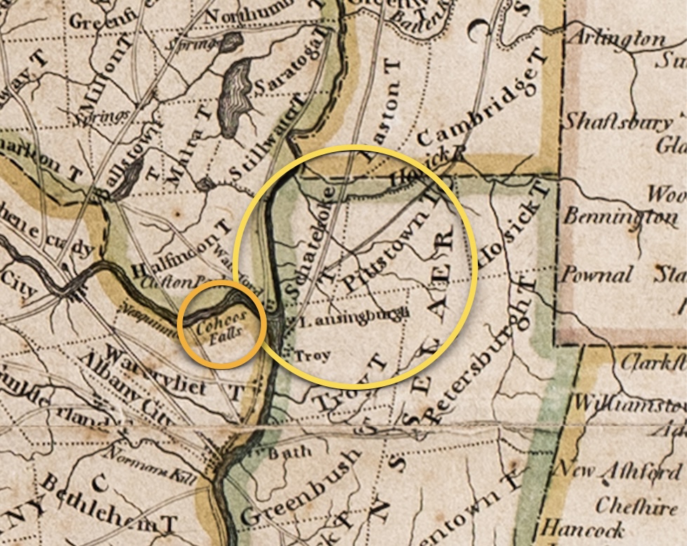
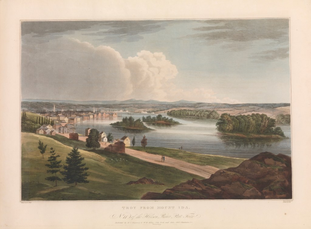

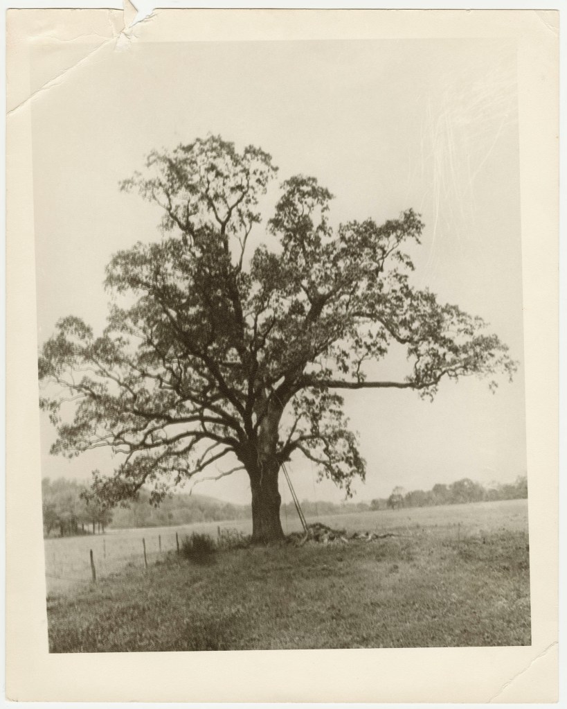
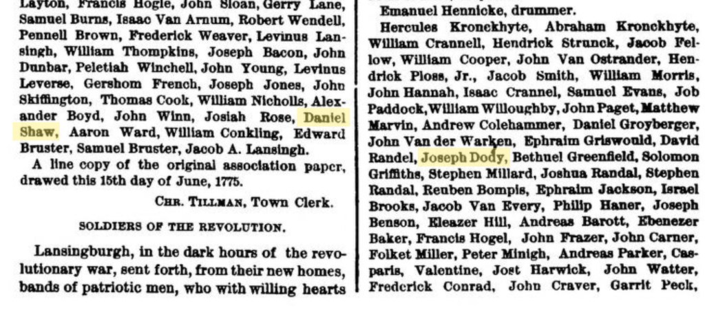

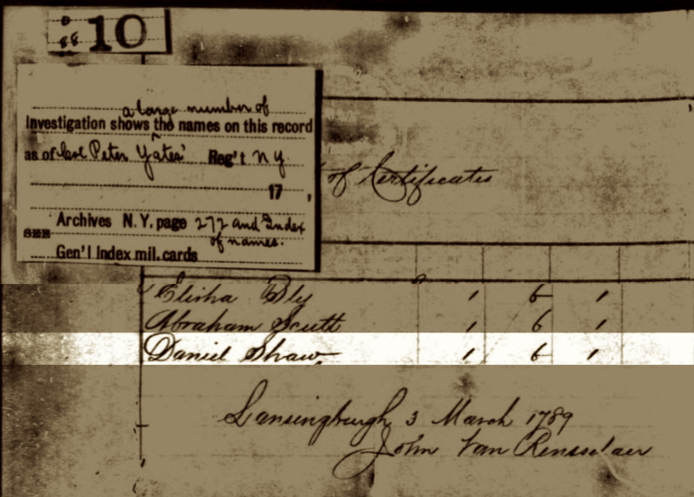
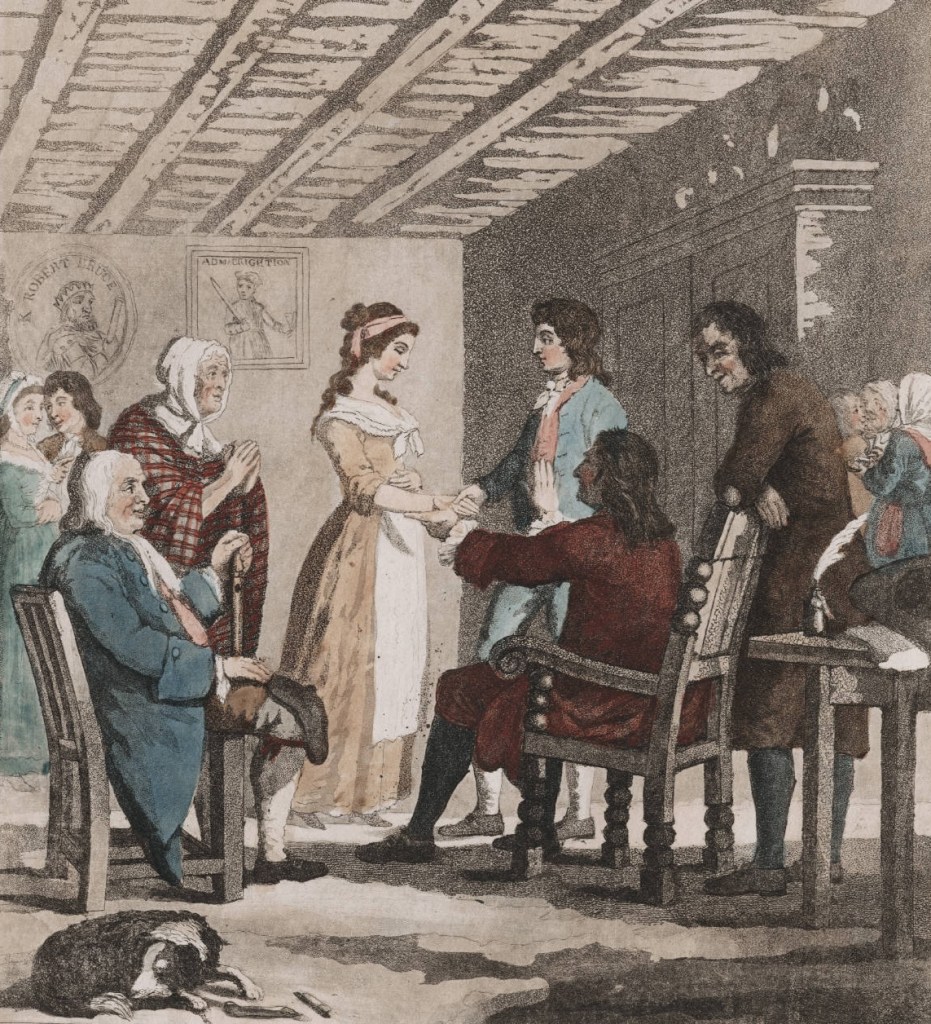


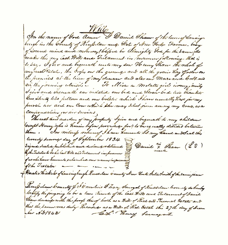
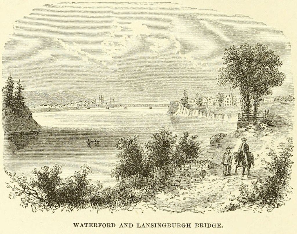
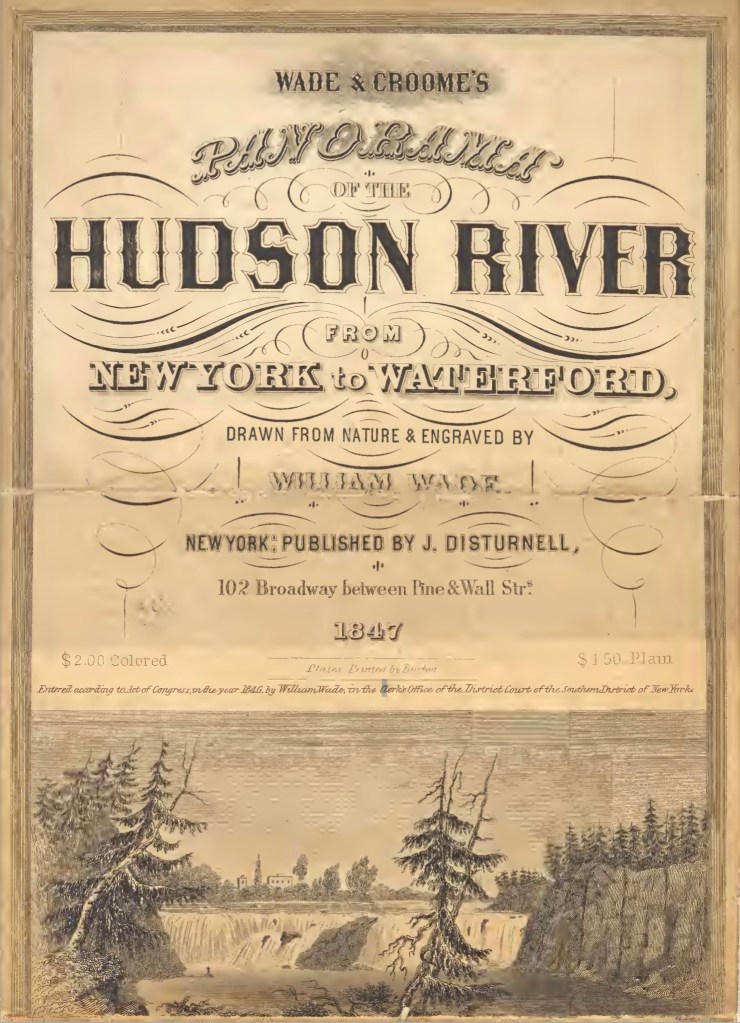


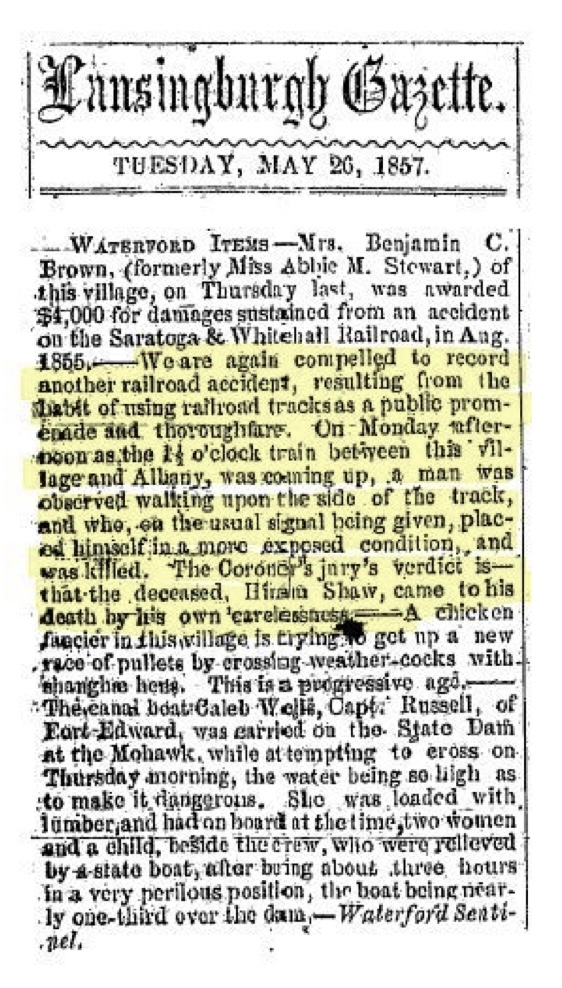
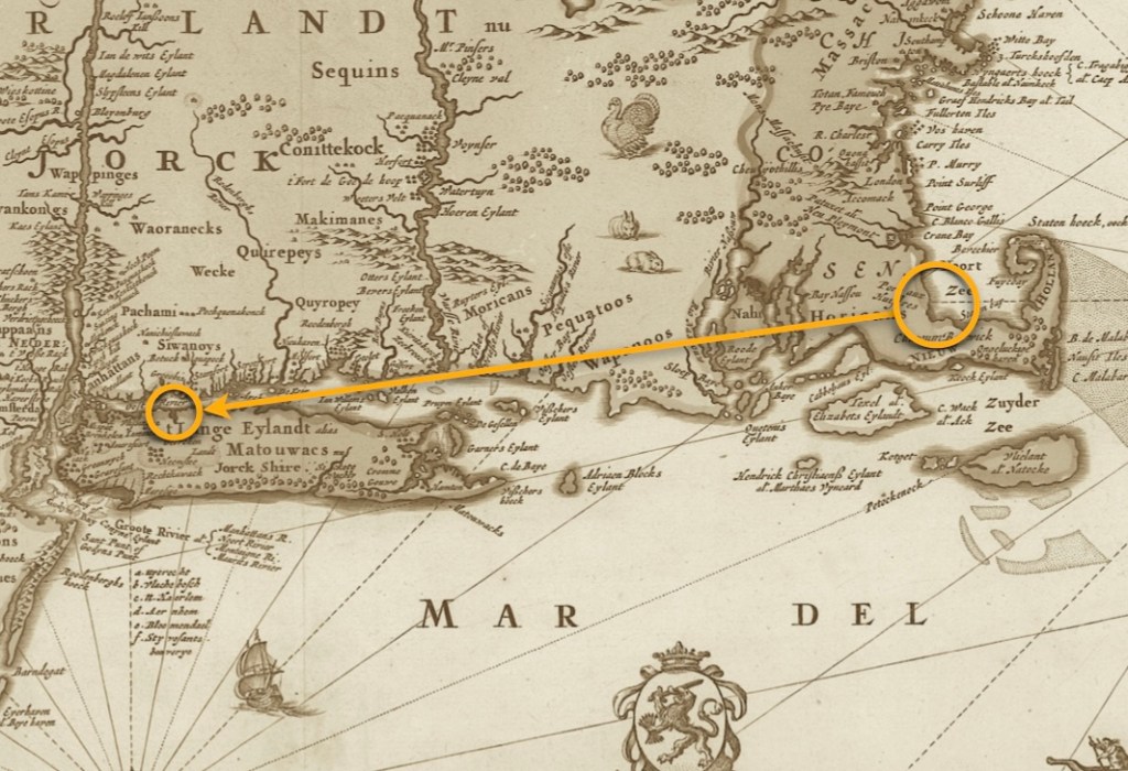

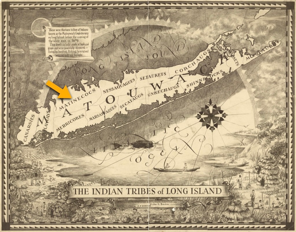


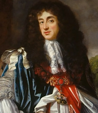

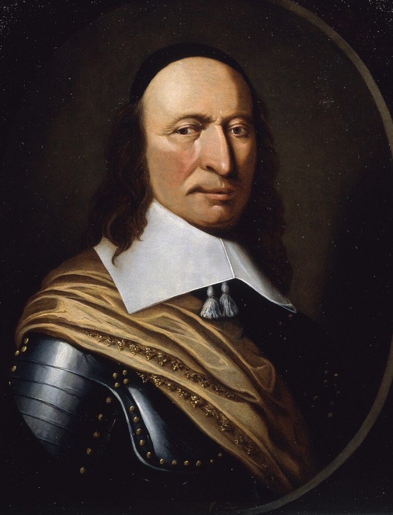
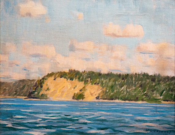
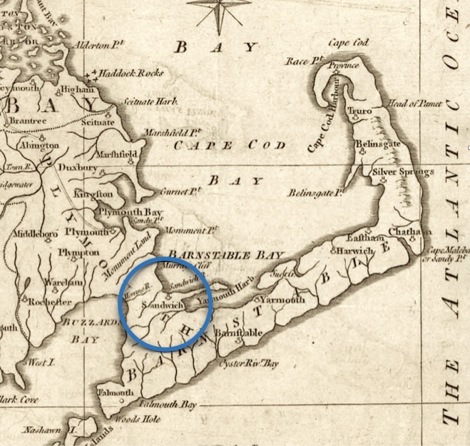

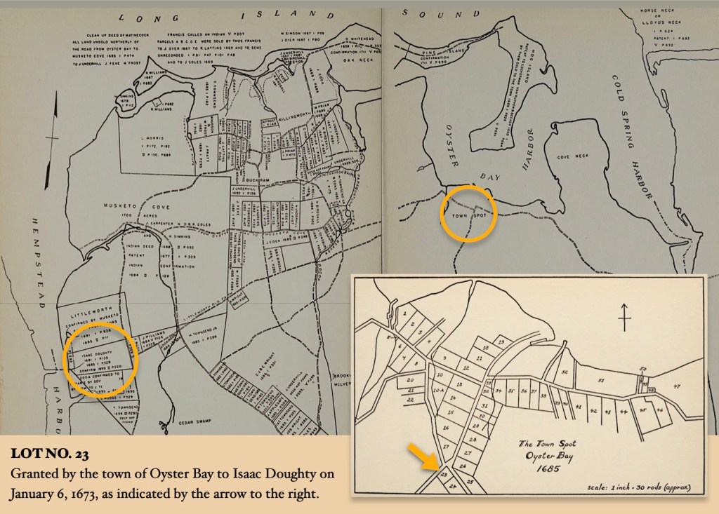
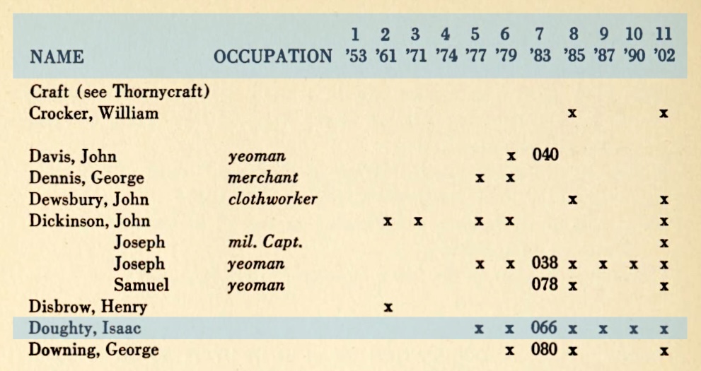

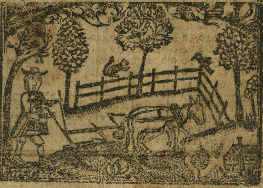
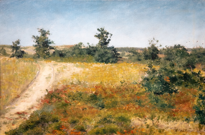

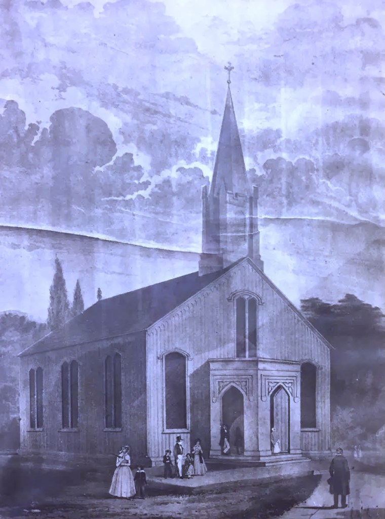

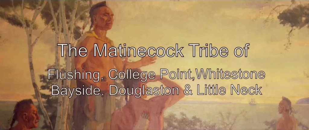
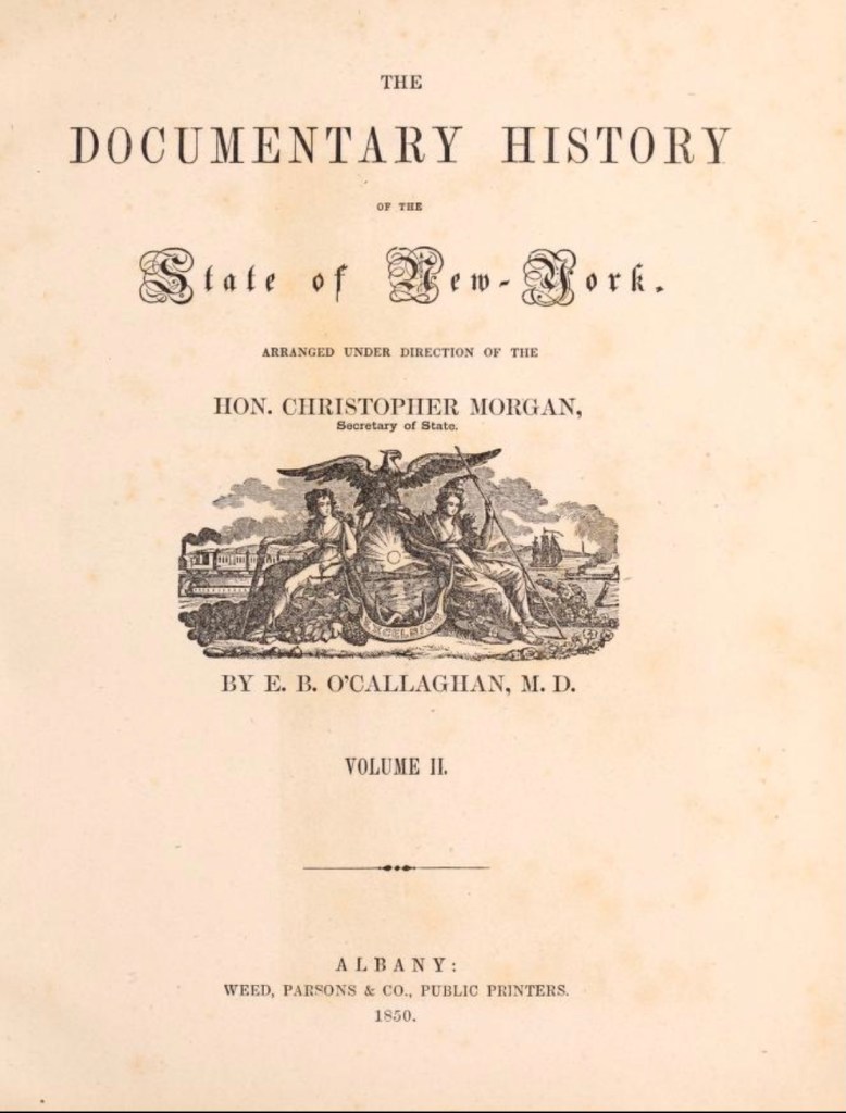


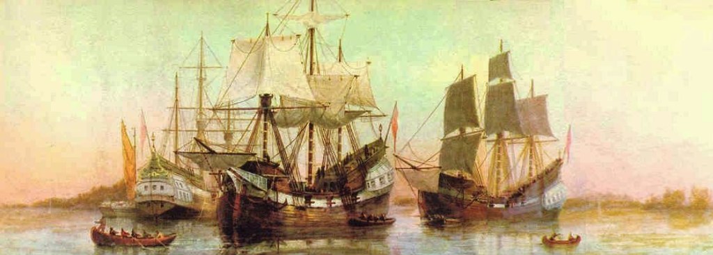
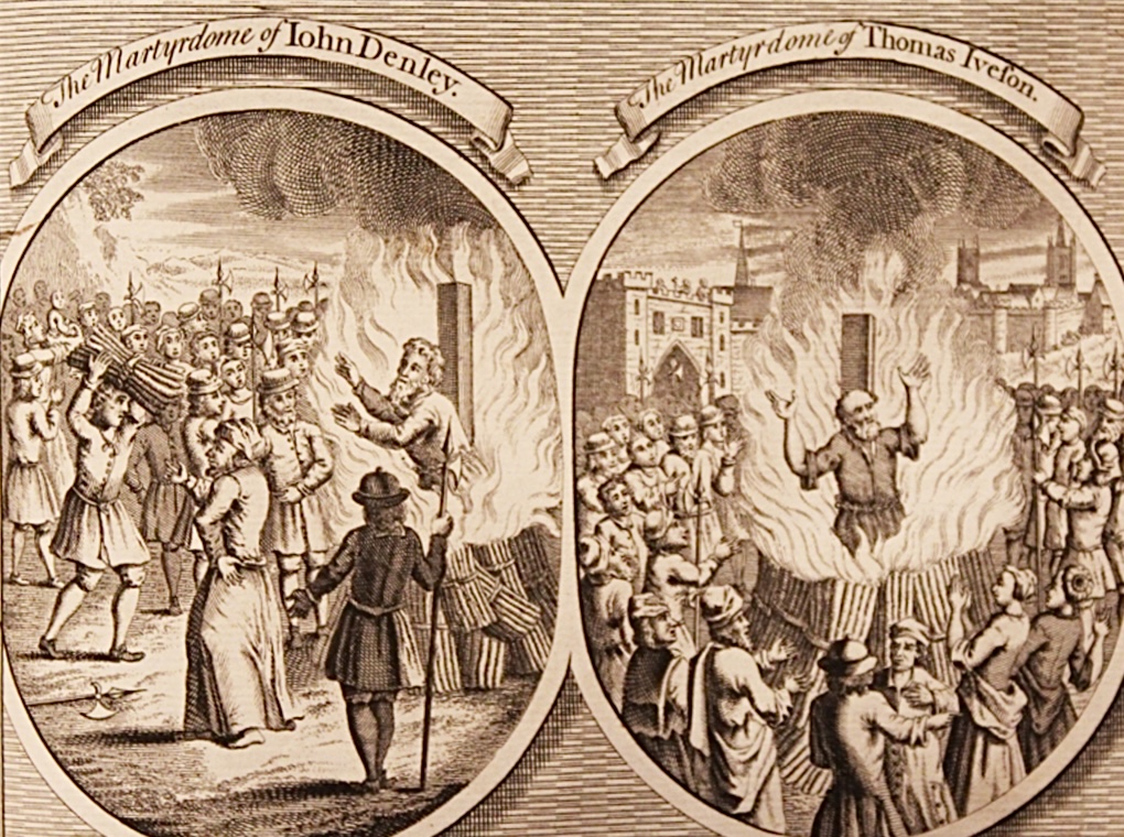


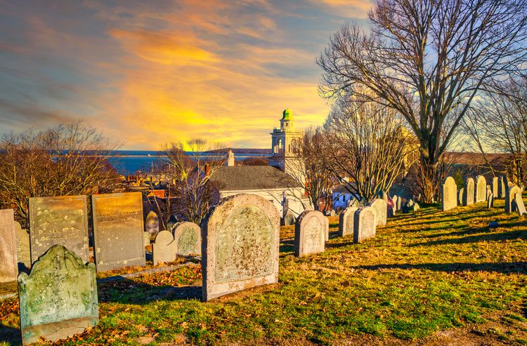


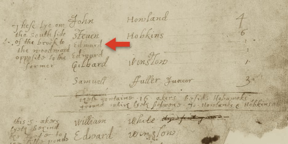


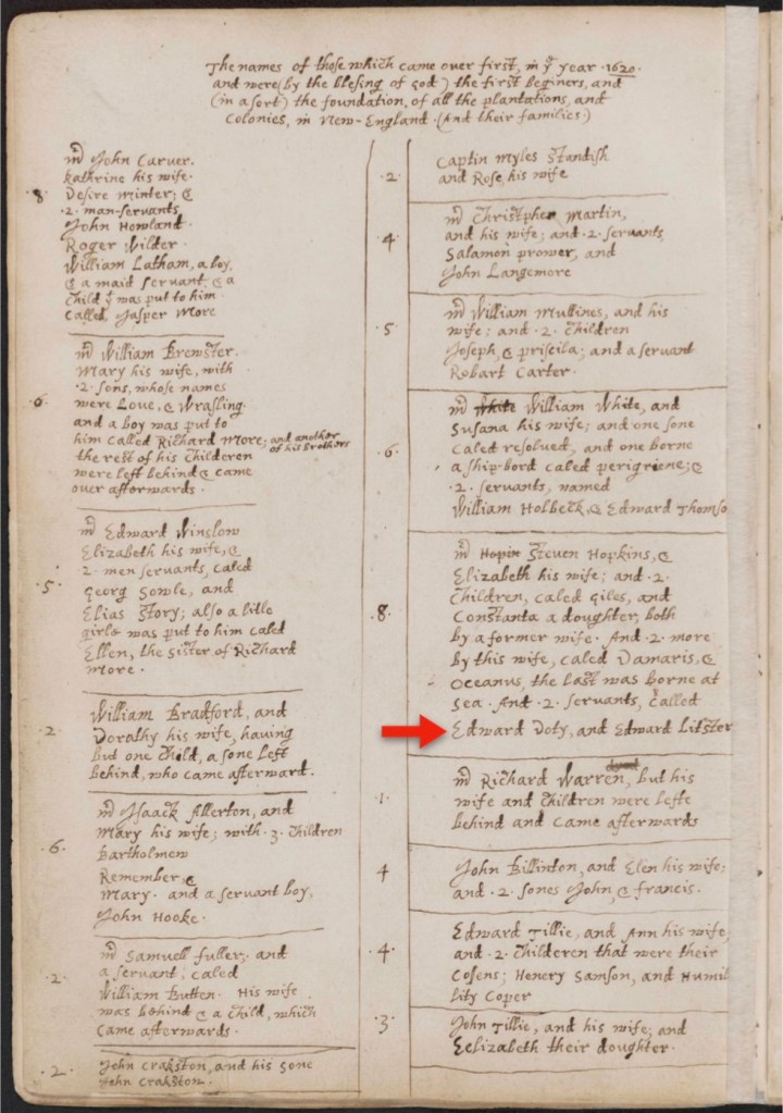
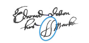


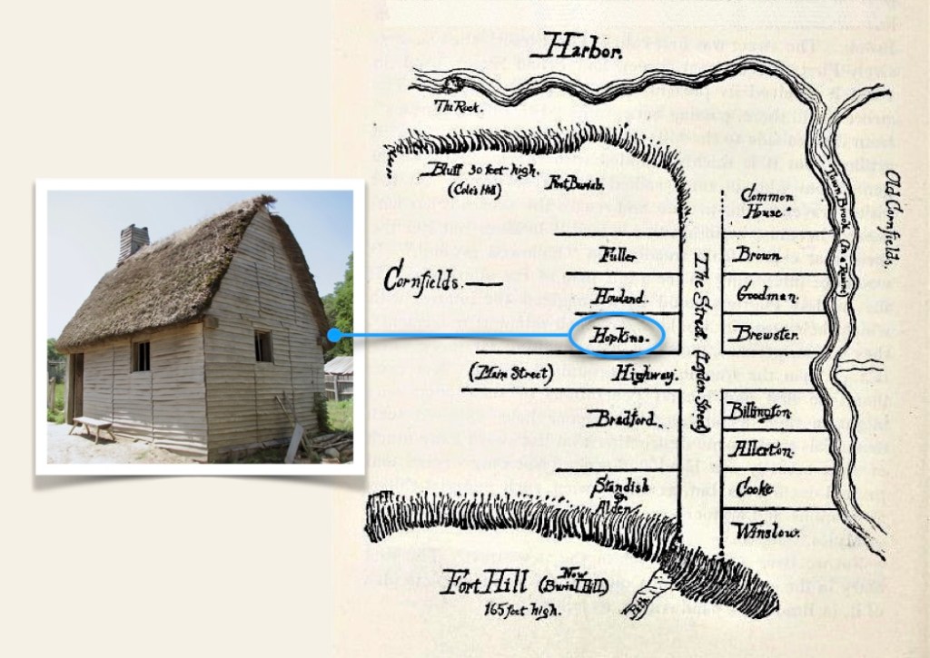

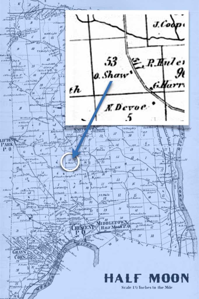


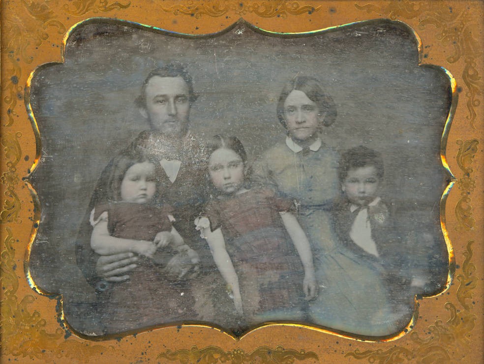


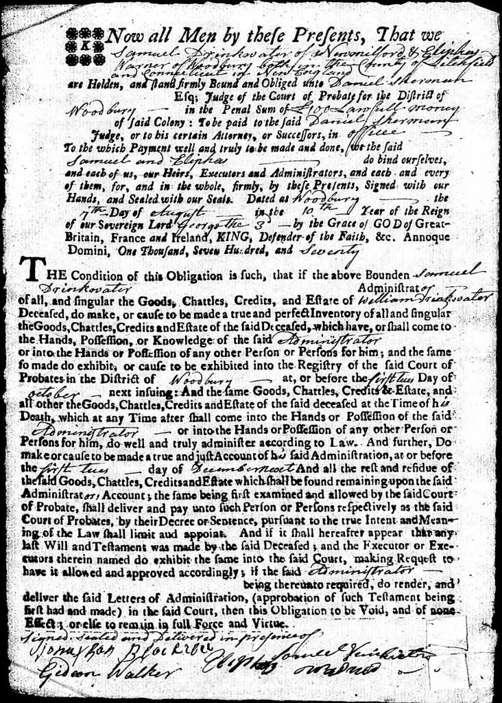


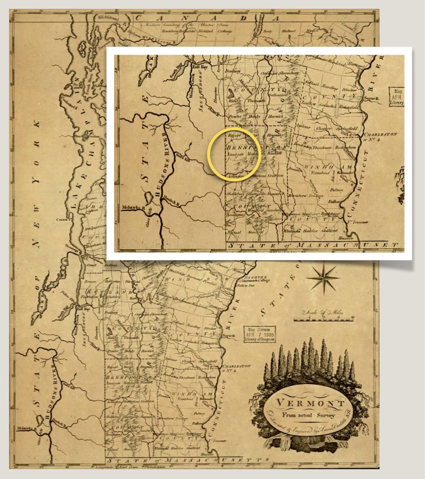

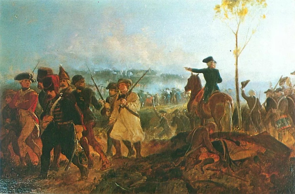
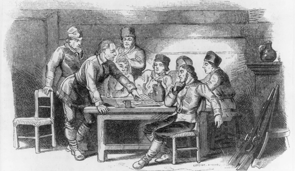
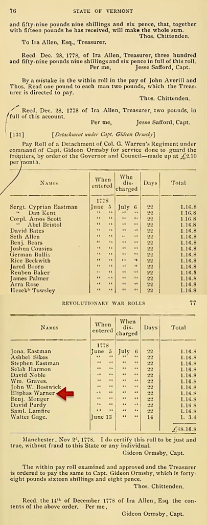

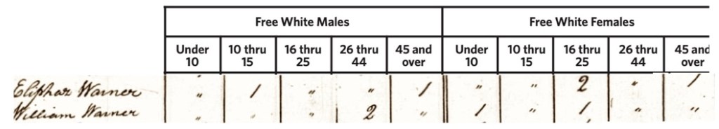


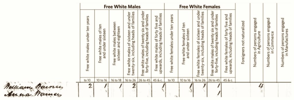
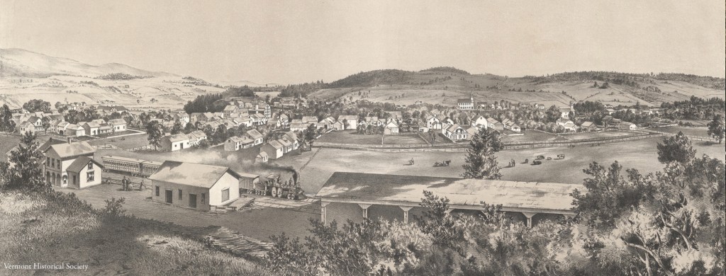


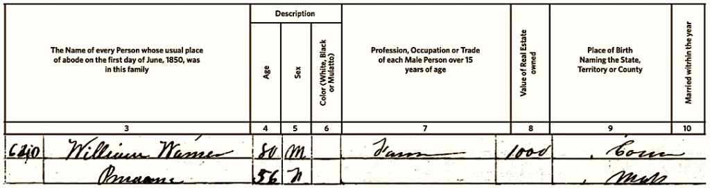


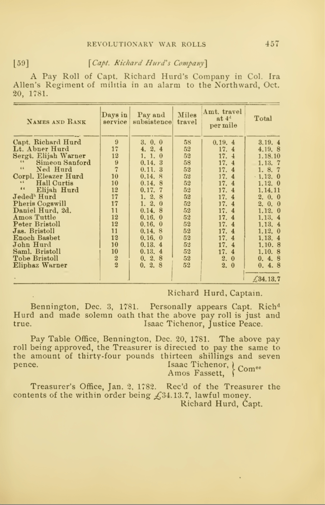


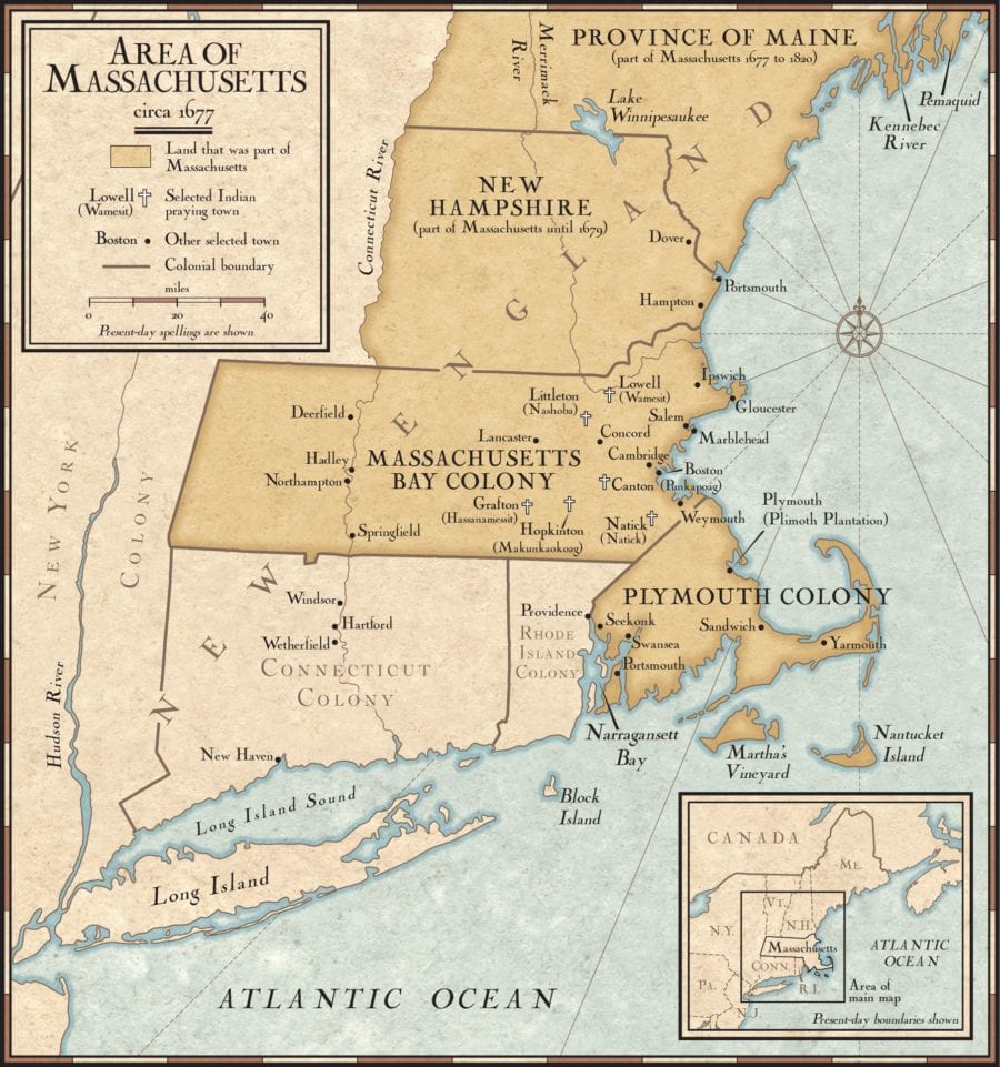


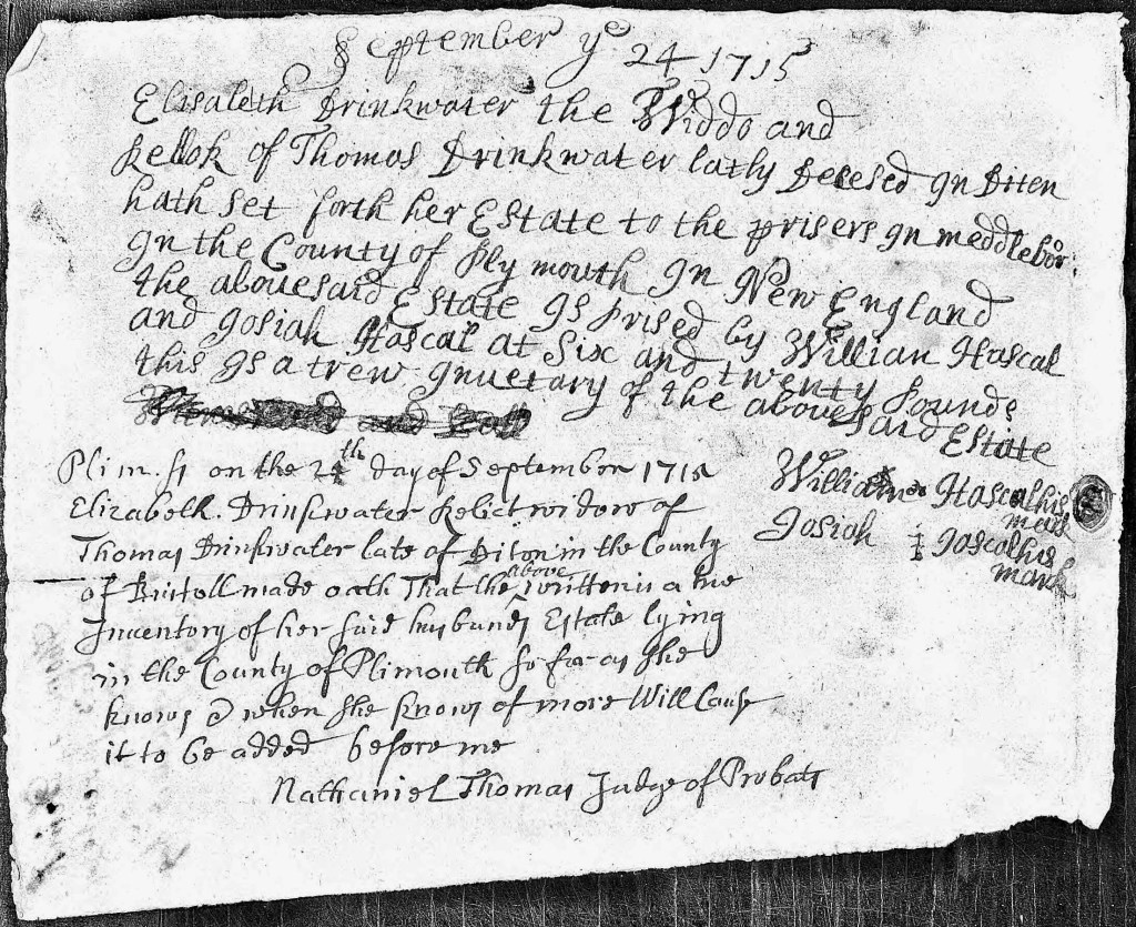


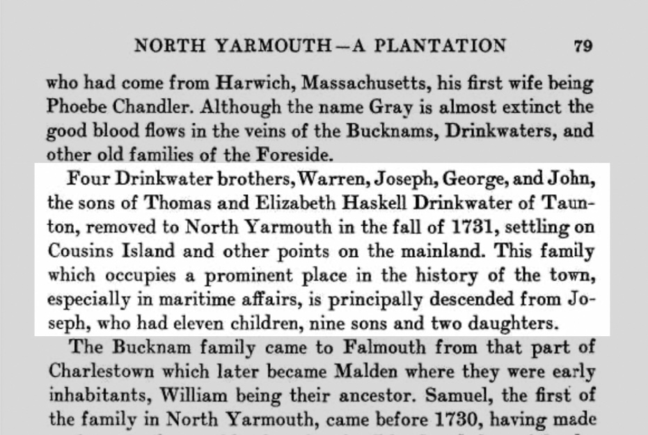


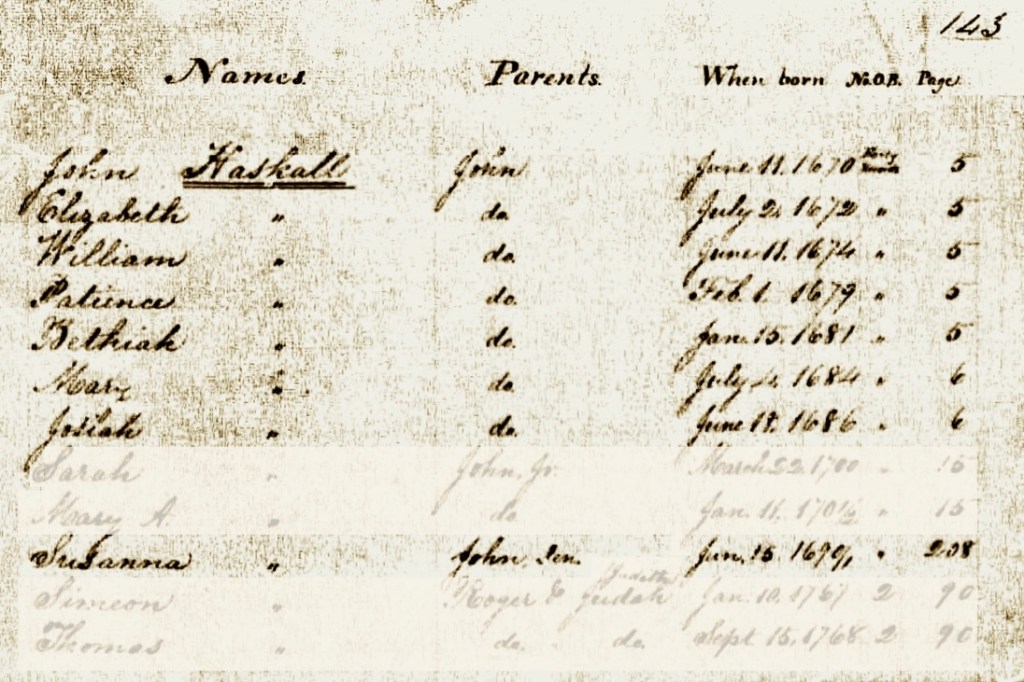
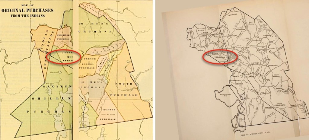


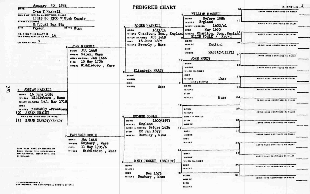

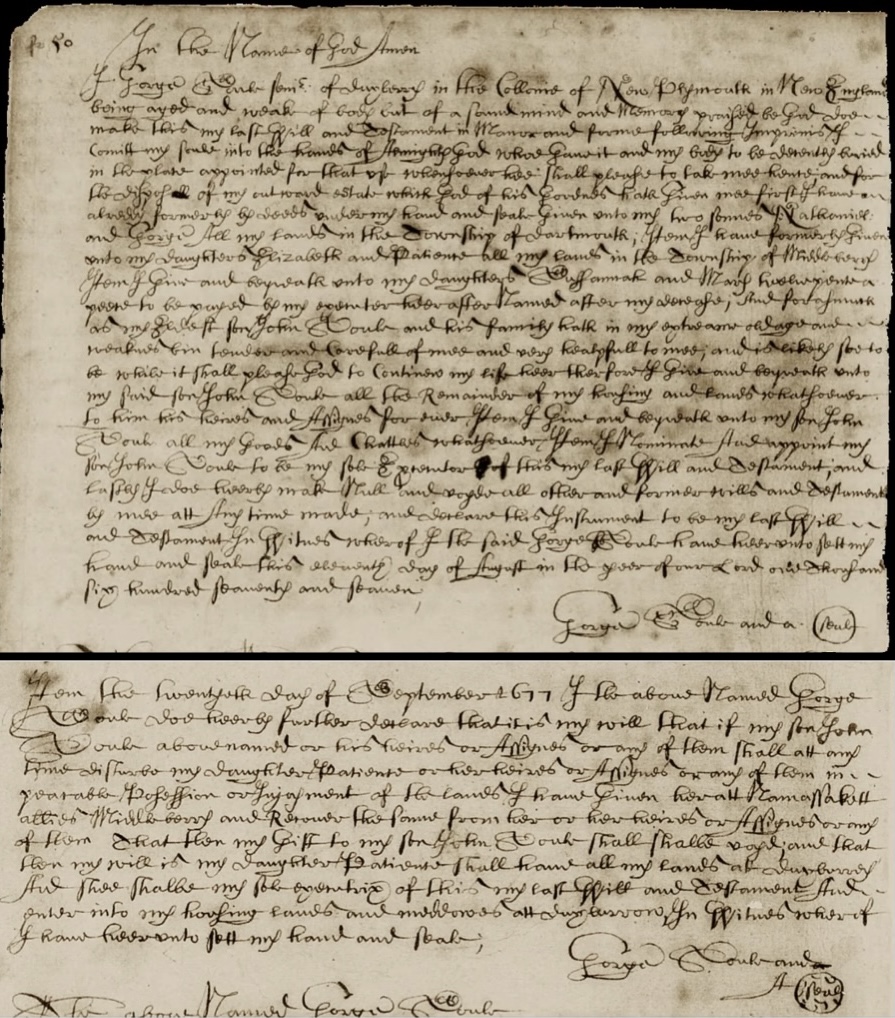

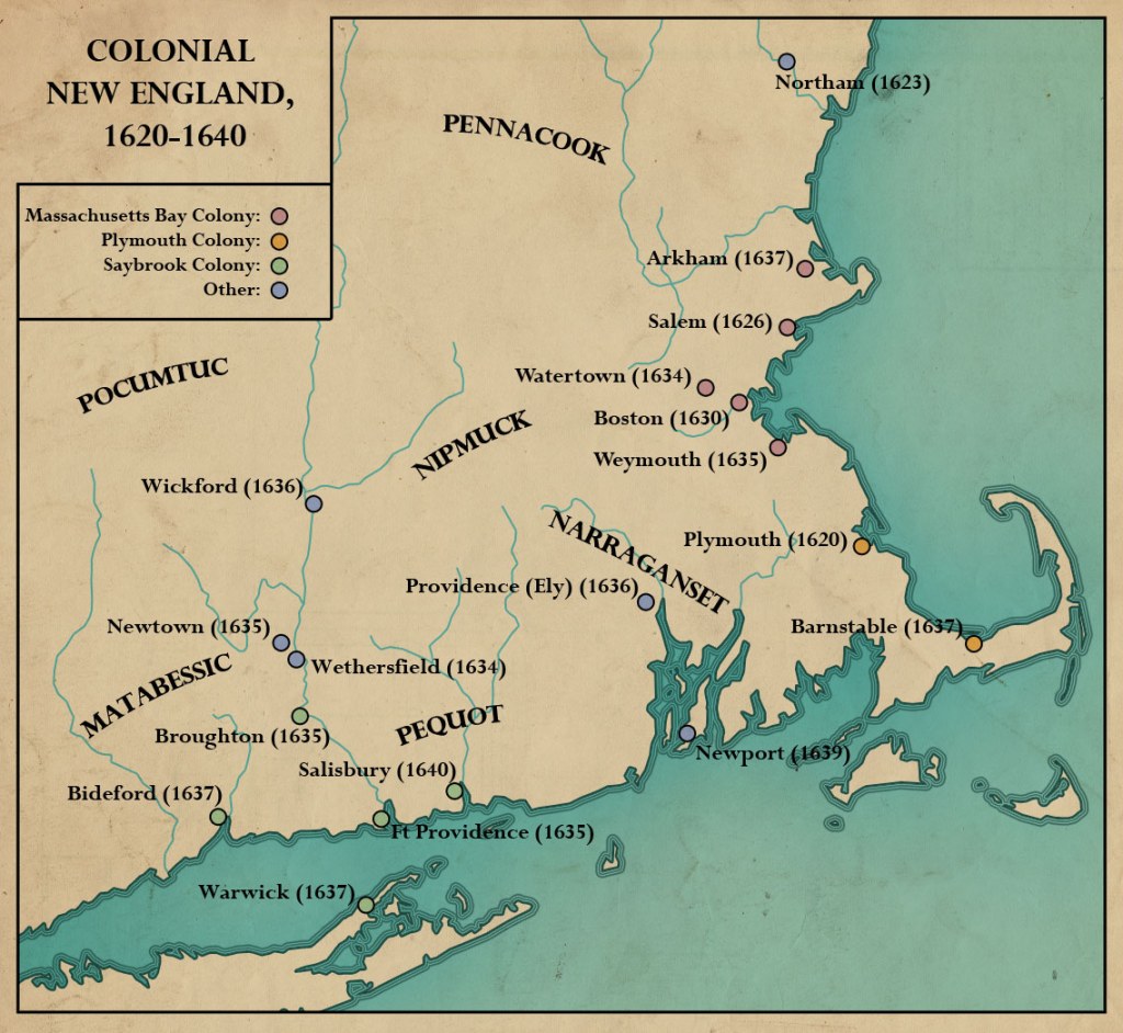


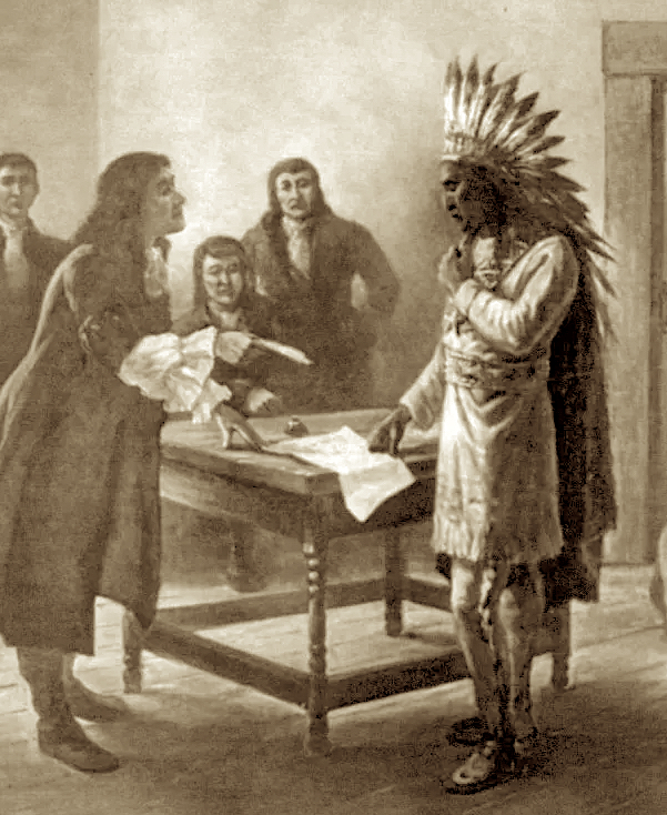
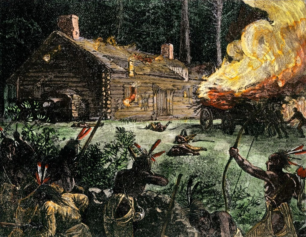

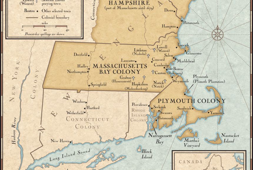

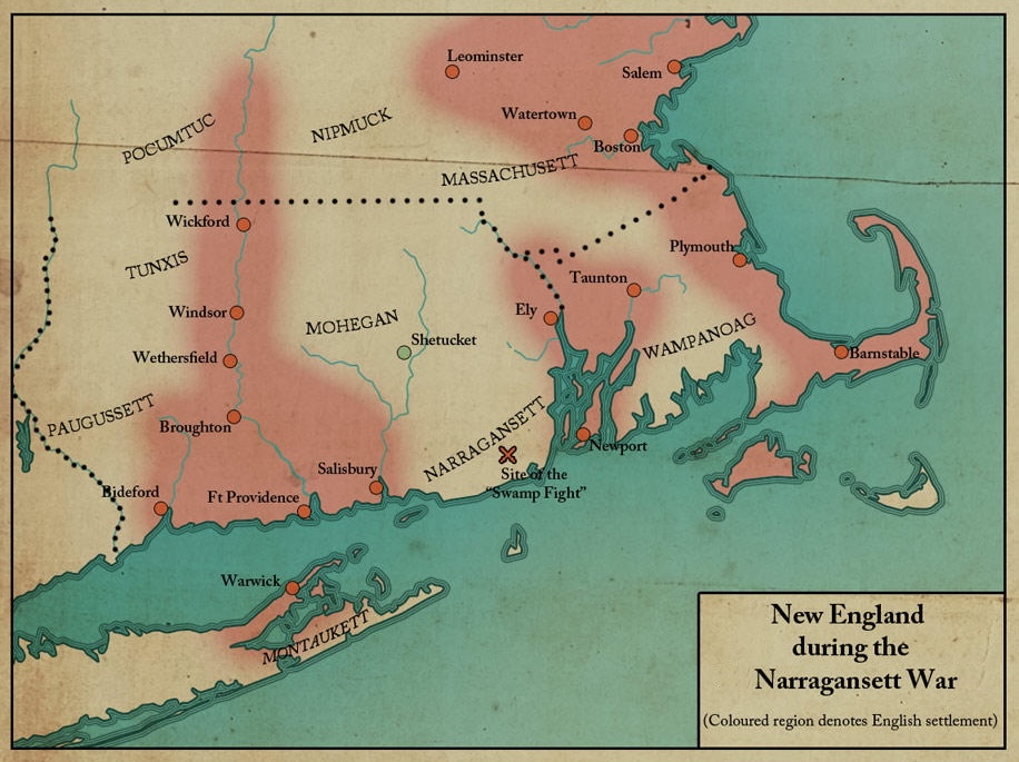


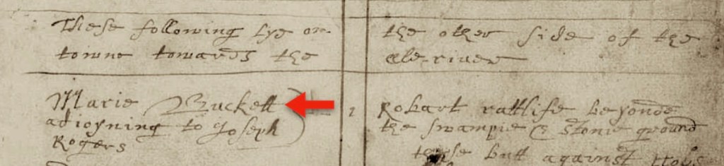


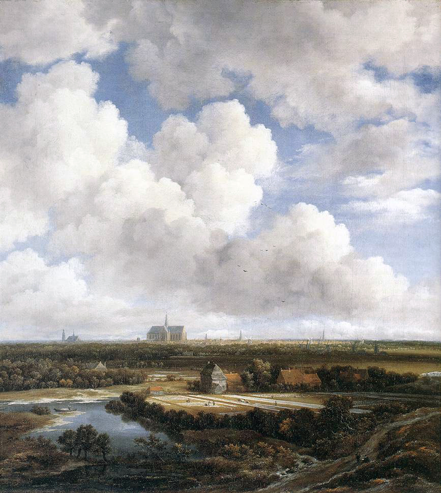


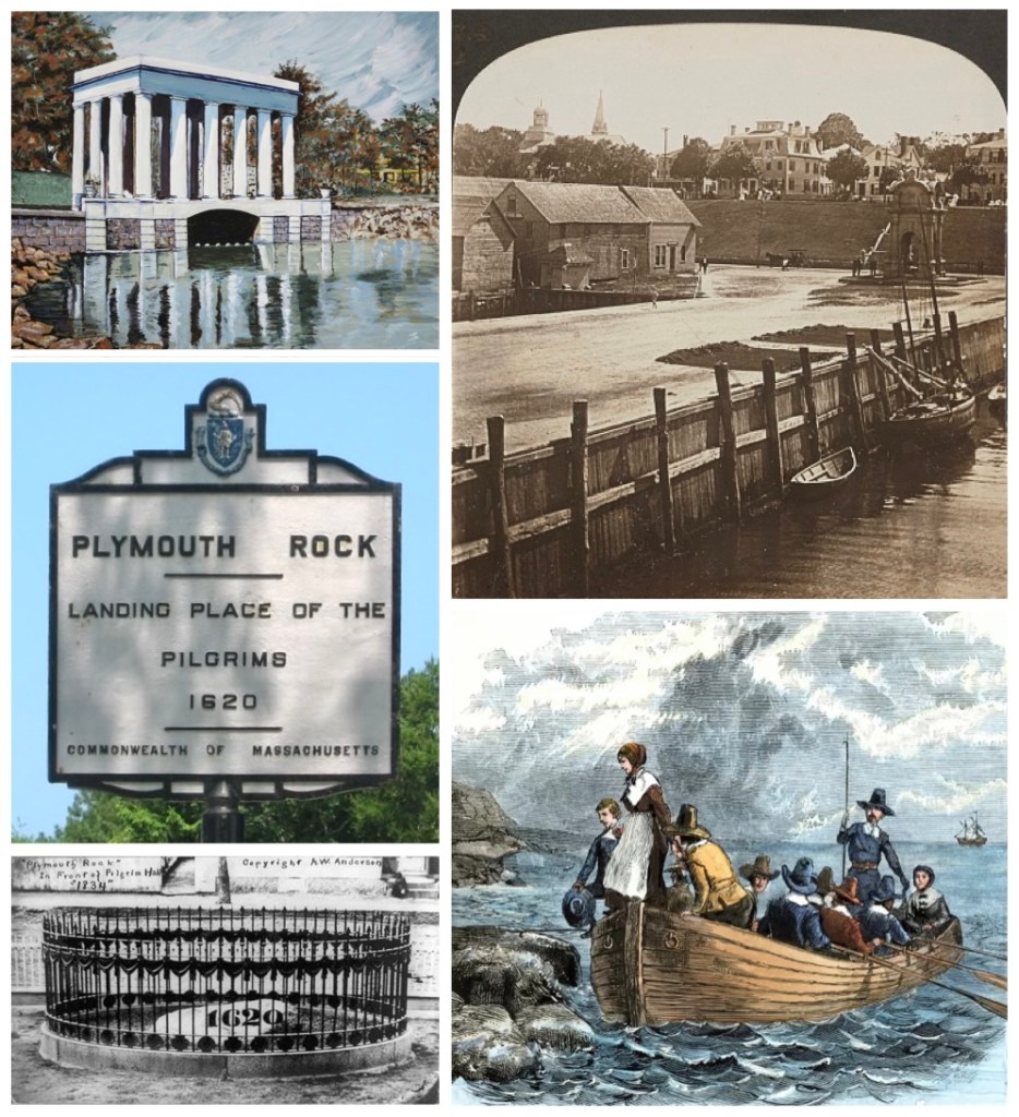


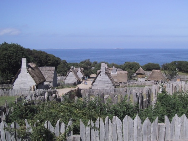


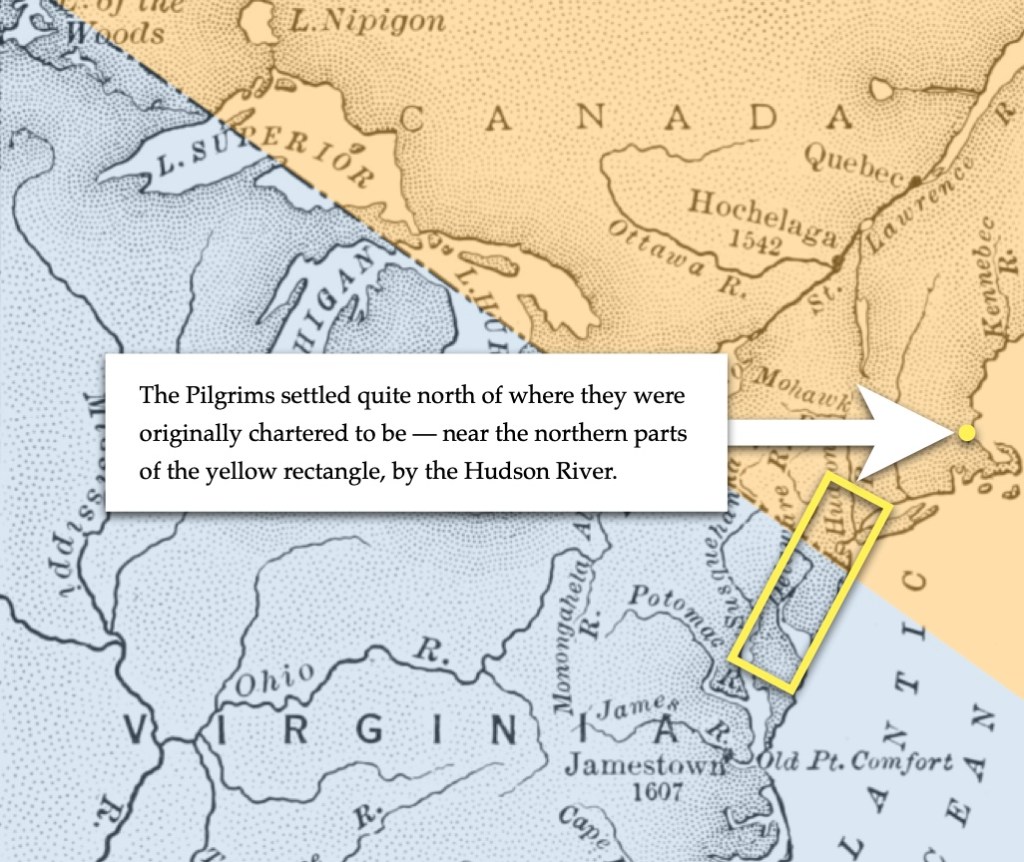


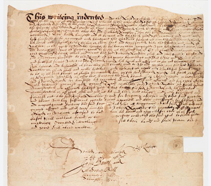


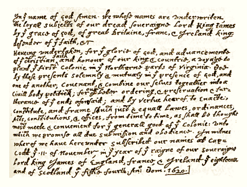


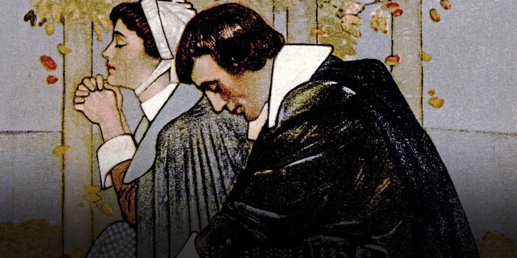
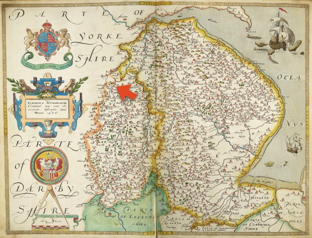
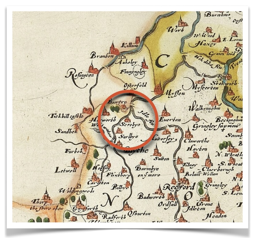


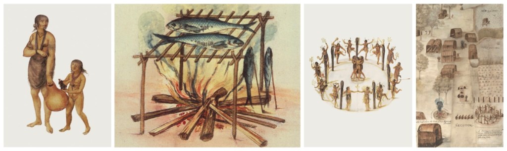


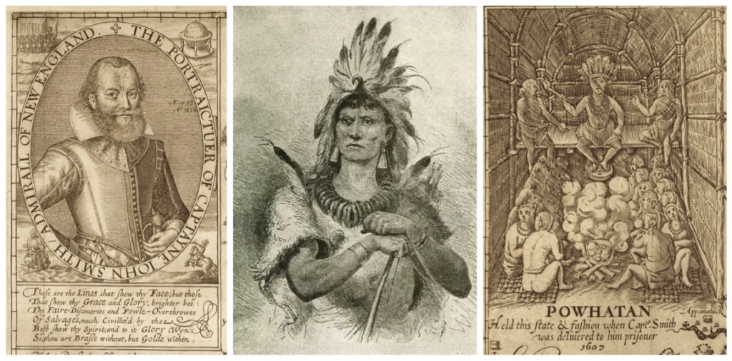


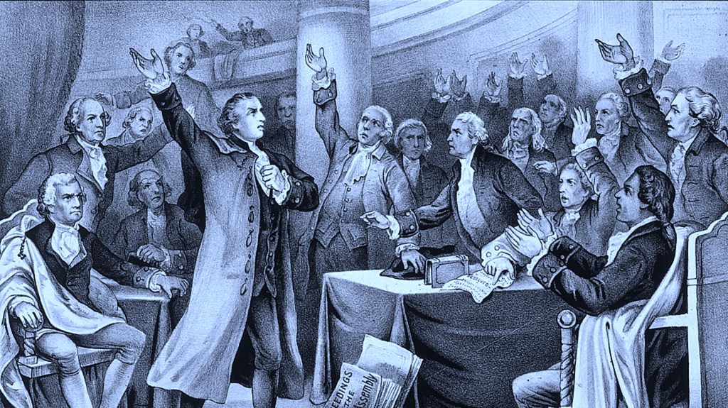


.jpg)
.jpg)
_Stuyvesant_portrait_c1660.jpg)
_-_G.H._Boughton_%2784_LCCN2006678318.jpg)
.jpg)
.jpg)
.jpg)
.jpg)
_by_Henry_A._Bacon.jpg)
.jpg)
.jpg)
_illustration_Alchemic_approach_to_four_humors_in_relation_to_the_four_elements_and_zodiacal_signs.jpg)