This is Chapter Five of eight. In this chapter we will be writing about how our ancestors migrated first into New York State, and then how the next generation spread into other states and territories to the west, outside of New England. This was an era of much conflict with the French and Indian War, the War for Independence, and the War of 1812.
When we were younger, our Grandmother Lulu Gore lived near us for much of our childhood years. As a creative, can-do type of Grandma, she inspired us with her gardens, her interesting holiday decorations, and her interest in family history. We lived in a rural Ohio area, and Lulu was the wife of our Grandfather Harley Gore. He had passed away years before we were born. However, before his death she helped him begin his Gore genealogy work. Toward the end of his life in 1941, as he was dying of heart disease, he asked his wife if she could begin the story of his family’s origins. The work was never finished, (as genealogy work never is…) However, we feel honored to continue what she began.
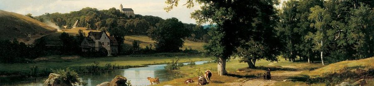
Grandma Moses Certainly Knew How to Paint The Rural Life
Anna Mary Robertson Moses, also known as Grandma Moses was a prolific American painter of the last century. From Wikipedia: “Moses painted scenes of rural life from earlier days, which she called ‘old-timey’ New England landscapes. Moses said that she would ‘get an inspiration and start painting; then I’ll forget everything, everything except how things used to be and how to paint it so people will know how we used to live.’ ” Grandma Moses artwork has appeared in museums and galleries the world over, and often, she painted scenes of New England life.

Anna Mary Robertson Moses, known as ‘Grandma Moses’
(Courtesy of wikiart.org).
We know that our ancestors didn’t live in a pastoral, problem-free world, but the work of Anna May Robinson Moses inspires us to reconnect with our many ancestors who lived before our time. (1)
Elijah Gore Sr., and Desire Safford Have a Big Family
As the third son of Samuel Gore (3) and Desire (Safford) Gore, Elijah Gore Sr., was born on February 11, 1743 in Norwich, Connecticut Colony – died about 1794, probably in Halifax, Windham, Vermont. He married Sarah Little December 11, 1767 in Voluntown, Connecticut Colony, when he was 24 and she was 18. She was born September 5, 1749 in Sutton, Worcester, Massachusetts Colony – died August 26, 1805 in Halifax, Windham, Vermont, aged 60.
*see The 1790 “Census” of Vermont (below)

Massachusetts, Town Clerk, Vital and Town Records, 1626-2001.
Sarah (Little) Gore was the daughter of Ezekiel and Margret (Fitts) Little. She is buried at Stafford Cemetery in Halifax , and it is assumed that Elijah is buried next to her, even though there is no headstone, nor record of his death.
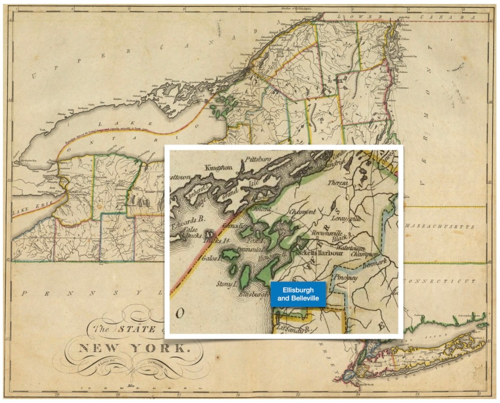
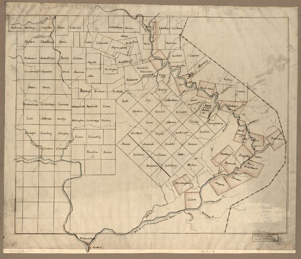
Before 1779, Elijah Gore Sr. and his family left Connecticut for Vermont. They settled in Halifax, Windham (county), Vermont. Here he owned land located on Vermont’s southern border with Massachusetts. As is often the case, as pioneers moved from place to place they named their new towns and counties after the places they had previously lived. As a result, Windham County is in both Connecticut, and Vermont. Some of their family records also cite the adjacent location of Guilford township, which borders Halifax on its eastern side.

Inset image: Halifax and Guilford townships from Vermont’s southern border.
(Image courtesy of the Library of Congress).
Elijah and Sarah Gore had ten children. Their first born, Elijah Jr., was born in Killingly, Connecticut Colony, the next four were born in Voluntown, Connecticut Colony, and the rest in Halifax, Vermont Colony. (2)
- Elijah Gore Jr., born (Killingly, Connecticut Colony), September 5, 1768 – died 1798
- Ezekiel Gore, born November 20, 1770 – died May 14, 1847 in Bernardston, Franklin, Massachusetts
- Margaret (Gore) Stafford, born February 10, 1773 – died March 10, 1864 in Monroe, Franklin, Massachusetts
- Samuel Gore (4), born, April 10, 1775 – died August 10, 1815 in Belleville, Jefferson, New York (We are descended from Samuel 4).
- Obadiah Gore born November 20, 1777 – death date unknown
- Hannah (Gore) Starr, born September 1, 1779 – died 1819 in Halifax, Windham, Vermont
- Lucy (Gore) Bennett, born May 21, 1781 – death date unknown
- Daniel Gore, born October 30, 1783 and died April 10, 1859 in Monroe, Franklin, Massachusetts
- Desire (Gore) Bixby, born November 8, 1786 – died December 8, 1833 in Guilford, Windham, Vermont
- Sarah (Gore) Slater, born August 12, 1789 and died September 19, 1858 in Chardon, Geauga, Ohio
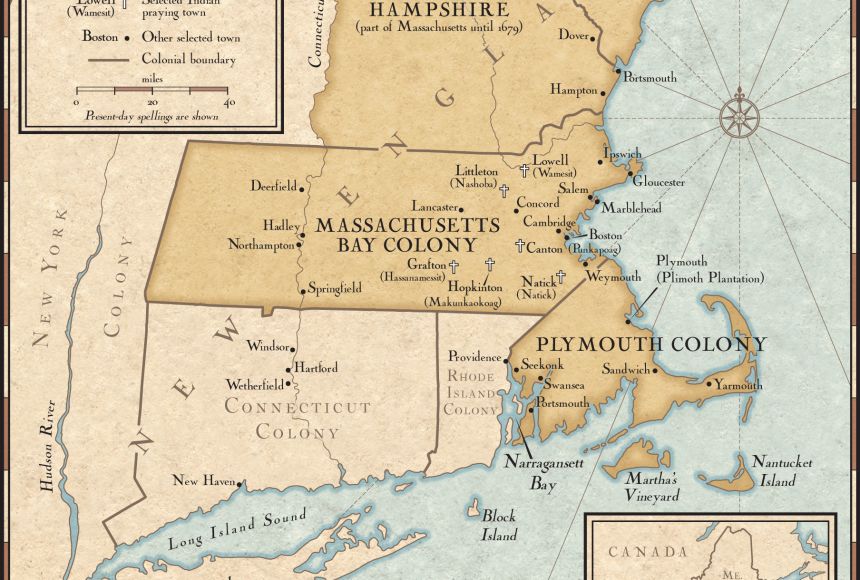
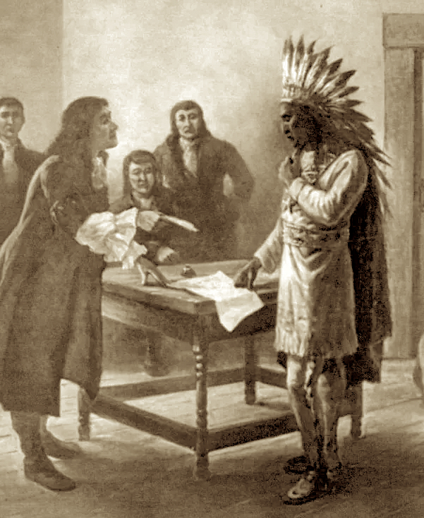
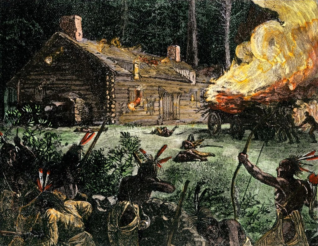
The French and Indian War
Like the previous narrative, The Gore Line — Four, wars were an elemental part of history in the new American Colonies. In 1666, France claimed ‘Vermont’ as part of New France. From Wikipedia: “French explorer Samuel de Champlain claimed the area of what is now Lake Champlain, giving the name, Verd Mont (Green Mountain) to the region he found, on a 1647 map”.

“The French and Indian War (1754–1763) was a theater of the Seven Years’ War, which pitted the North American colonies of the British Empire against those of the French, each side being supported by various Native American tribes. At the start of the war, the French colonies had a population of roughly 60,000 settlers, compared with 2 million in the British colonies. The outnumbered French particularly depended on their native allies. French Canadians call it the guerre de la Conquête — ‘War of the Conquest’.”
“Following France’s loss in the French and Indian War, the 1763 Treaty of Paris gave control of the whole region to the British... The end of the war brought new settlers to Vermont. The first settler of the grants was Samuel Robinson, who began clearing land in Bennington in 1761.. In the 28 years from 1763 to 1791, the non-Indian population of Vermont rose from 300 to 85,000”.
The Elijah Gore Family were living in a territory that was a disputed frontier, likely quite rugged, and similar enough to other areas their forebears had lived in — that it was filled with opportunity. Indeed, this family was living in ‘Vermont’ before Vermont was Vermont. (3)
Many People Had Tried to Claim Land in Vermont
It’s a complicated situation which played out over several decades and involved different English monarchs, Colonial Governors and various legal representatives, as the borders of Vermont were always in dispute — not only with the French, but also with the neighboring colonies, whose settlers seemed to continually want to expand their land holdings. Some of our ancestors probably got up in the morning and thought to themselves, “I feel a bit betwixt and between — wonder who is in charge today?”
From Wikipedia, on the History of Vermont: “A fort at Crown Point had been built in 1759, and the road stretched across the Green Mountains from Springfield to Chimney Point, making traveling from the neighboring British colonies easier than ever before. Three colonies laid claim to the area. The Province of Massachusetts Bay claimed the land on the basis of the 1629 charter of the Massachusetts Bay Colony. The Province of New York claimed Vermont based on land granted to the Duke of York (later King James II & VII) in 1664. The Province of New Hampshire, whose western limits had never been determined, also claimed Vermont, in part based upon a decree of George II in 1740”.
(Image courtesy of Wikipedia.org).
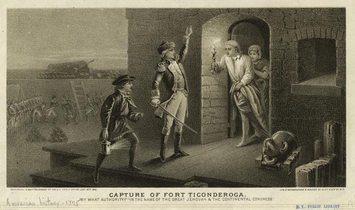
There was a lot of acrimonious behavior: “In 1770, Ethan Allen—along with his brothers Ira and Levi, as well as Seth Warner—recruited an informal militia, the Green Mountain Boys, to protect the interests of the original New Hampshire settlers against the new migrants from New York… The American Revolution changed the face of these various conflicts after the battle of Bennington, Vermont became important. ‘The battle was a major strategic success for the American cause…’ ”
In Guilford, the township adjacent to Halifax, we learn from the website, We Are Vermont: “There was so much controversy between Yorkist and Vermont factions at the beginning of the Revolutionary War that 2 sets of officials were fighting for control in Guilford. The fighting escalated to a point where, in 1783, the Vermont government sent Ethan Allen with a Militia to the town to enforce martial law and collect taxes. This was known as the ‘Guilford War’ and eventually those who opposed Vermont’s laws moved to settle in New York.” (4)
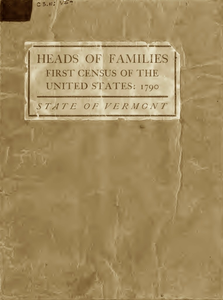
*The ‘Census’ of Vermont
According to the National Archives: “Vermont became a state on March 4, 1791, [as the 14th state] so the census was taken in Vermont in 1791…” Specifically, “The Census was taken in Rhode Island on 7-5-1790 and in Vermont on 3-2-1791 [March 2, 1791], after they ratified the constitution.” [USGenWeb] Even though Vermont had a census, it was after everyone else’s census, and it continues to be mistakenly referred to as the “1790” census.
Our research has concluded that our ancestor Elijah Gore, even though we do not know his exact death date, was still alive after March 1791. We analyzed the census and believe this for the following reasons:

- Their son Elijah Jr. married Susannah Barney on August 17, 1789, in nearby Guilford, so he was likely no longer living with his parents. (When the census was done, it would be highly improbable that his household numbers could match up with the 1791 census data.) Even though he has the same name as his father Elijah Sr., there is only one listing for a man with this name in Halifax Town, Windham County, Vermont, at this time.
- The Free White Males of 16 years and upward including heads of families would be Elijah Gore Sr., our grandfather, and his son Ezekiel, age 20 years.
- The categories show only one Free White Males under 16 years living in the home. That would likely be our ancestor Samuel Gore (4), who was 15 at the time.
- The Free White Females including heads of families indicates one person, who is likely our grandmother Sarah Little.
- All other free persons are everyone else who was living in the home. That number is 8, which corresponds exactly to everyone else, from Margaret through Sarah.
- Lastly, there are no slaves listed. We would expect this from people who identified as Puritans.
Unfortunately, there is scant evidence on the life activities of this ancestor. Elijah’s occupation is unknown, but it’s very likely, he was a farmer. (5)
Two Locations in Windham County?
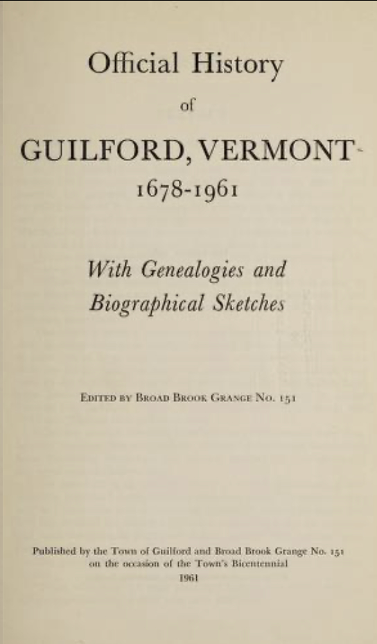
This branch of the Gore family, owned land in Windham county in two adjacent townships: Halifax and Guilford. (This explains why family records intermix the two locations). The Official History of Guilford, Vermont, 1678-1961, cites the sale of land in Guilford, as illustrated below.
Note that Lot 168 is mentioned as being “on the Halifax line”. It also appears that Elijah Gore may have also owned a portion of Lot 167.

Even though these two townships are next door neighbors, because they were in disputed areas, the records are a bit complicated. Initially, the Royal Governor of New Hampshire, Benning Wentworth, was in charge of the area. From Wikipedia: “Halifax was the second town chartered, west of the Connecticut River on May 11, 1750 by New Hampshire Governor Benning Wentworth, meaning Halifax is the second oldest town in the state after Bennington…” and also, Guilford was “Chartered as Guilford New Hampshire in 1754… chartered [again] as Guilford, Vermont in 1791” when Vermont became an official state. Additionally, Guilford is “the most populous town in Vermont from 1791-1820”.
This may also help explain that our research turned up that Elijah Gore Sr. is recorded as having served in the American Revolutionary War, under the banner of Captain Samuel Fillbrick’s Company in (oddly enough) New Hampshire. From the Official history of Guilford, Vermont, 1678-1961, page 135:

This puzzled us at first, but it makes sense that some militias would be organized under the names of other Colonies, since Vermont did not technically exist until after the war, in 1791. (6)
Samuel Gore (4) and Rebeckah Barney Marry
Our ancestor, Samuel Gore (4), born April 10, 1775 Voluntown, Windham, Connecticut Colony – died August 10, 1815 in Belleville, Jefferson County, New York. He married Rebeckah Barney on February 22, 1798, in a ceremony at Halifax, Vermont, officiated by Darius Bullock. She was born April 6, 1782 Guilford, Windham, Vermont – died October 26, 1860 in Belleville, Jefferson, New York. They likely met socially through family or friends because their home townships, Halifax and Guilford, were adjacent to each other.
Rebeckah was the daughter of Deacon Edward Barney, who was a physician and Baptist Deacon. He was born August 18, 1749 in Rehoboth, Bristol, Massachusetts Colony – died August 9, 1839 in Ellisburg, Jefferson, New York. Rebeckah’s mother was Elizabeth Brown, born October 3, 1750 in Middletown, Middlesex, Connecticut – died March 5, 1793 in Guilford, Windham, Vermont. Elizabeth died in childbirth with her 12th pregnancy at the age of 42 — her newborn infant daughter Mabel was buried with her. [William Barney and Familysearch.com footnotes] Together the Barneys had twelve children, with Rebeckah being the 7th child.
Our 4x Great-Grandmother, Rebeckah (Barney) Gore.
Samuel (4) and Rebecca had seven children. The first five were born in Halifax, Windham, Vermont and the youngest two were born in Belleville, Jefferson County, New York.
Observation: Quite notable about this family group, is that these are the first ancestors of whom we have photographic portraits! We’ll meet their children in just a moment, but first, we need to discuss this newly invented portraiture… (7)
The Waking Century — The Advent of Portrait Photography
Suddenly, a new age was upon us…
“Getting painted portraits done used to be exclusive to families in the upper classes of society. That all changed when photography came into existence. In 1839, Robert Cornelius shot the first successful portrait, a self-portrait (a selfie, no less), using the venerable daguerreotype. Cornelius took advantage of the light outdoors to get a faster exposure. Sprinting out of his father’s shop, Robert held this pose for a whole minute before rushing back and putting the lens cap back on”.
“You see, shooting with the daguerreotype required between 3 to 15 minutes of exposure time depending on the available light — making portraiture incredibly impractical if not impossible.” [Soriano, A Brief History of Portrait Photography]

Did you ever wonder why the ancestors in many old photographs are not smiling, which is our custom today? From Time Magazine: “Experts say that the deeper reason for the lack of smiles early on is that photography took guidance from pre-existing customs in painting—an art form in which many found grins uncouth and inappropriate for portraiture. Accordingly, high-end studio photographers would create an elegant setting and direct the subject how to behave, producing the staid expressions which are so familiar in 19th century photographs. The images they created were formal and befitted the expense of paying to have a portrait made, especially when that portrait might be the only image of someone.” Indeed, these are the scant few images we have of these ancestors…
Observation: It is quite notable that this generation, born after the Revolutionary War, began heading west and moved into new states and territories: Iowa, Minnesota, New York, Ohio, and Wisconsin — none of them died in Vermont.
Shown below are each of the Samuel and Rebeckah Gore children, with their families and respective portraits.


Gratia (Gore) Cook, born September 27, 1800, Halifax, Windham, Vermont – died, February 16, 1876, Winneconne, Winnebago, Wisconsin.
Left to right: Gratia (Gore) Cook; her sons Eugene Kincaid Cook, and Malcolm G. Cook.

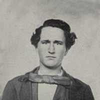


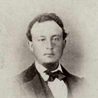
Hart Gore [twin of Clark], born December 13, 1802, Halifax, Windham, Vermont – died February 11, 1892, Rushford, Fillmore, Minnesota.
Top Row, left to right: Hart Gore, his wife Miranda Goodenough, their son Leslie Gore, Bottom row, left to right: Their son Charles W. Gore, his wife Martha E. (Bartley) Gore, and their daughter Mary Jeanette (Gore) Valentine.
Clark Gore [twin of Hart] born December 13, 1803 in Halifax, Windham, Vermont. He married Lydia Burge and they had three children: Martha Lydia Gore, Myron Gore, and Alice Gore.


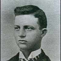
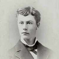
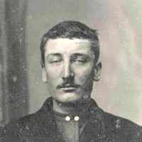
Luke Gore, born April 1, 1805, Halifax, Windham, Vermont – died October 2, 1868, Newbury, Geauga, Ohio (We are descended from Luke.)
Top Row, left to right: Luke Gore, his second wife, Electa (Stanhope) Gore (our grandmother). Milan R. Gore,* Bottom row, left to right: Crockett Gore*, his wife Lois (Haven) Gore, and Crockett’s son Dana D. Gore.
*Milan and Crockett are the children of Luke Gore and his first wife: Mila Gore. She was born in 1813 in Halifax, Windham, Vermont – died September 29, 1848 in Newbury, Geauga, Ohio. Luke and Mila were first cousins.

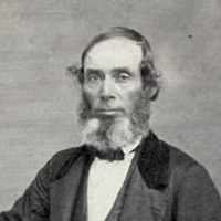


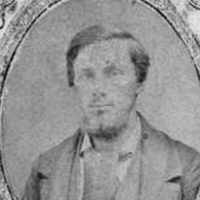
Belinda (Gore) Barton, born July 15, 1807, Halifax, Windham, Vermont – died August 15, 1900, Madison, Lake, Ohio
Top row, left to right: Belinda (Gore) Barton, her husband Horace Barton, and their son Hanford Barton. Bottom row, left to right: Their daughter Frances (Barton) Cook, and her husband Eugene Kincaid Cook. Note: Frances (Barton) Cook married her first cousin Eugene Kincaid Cook [see Gratia (Gore) Cook above].
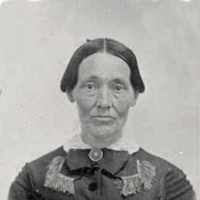


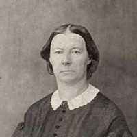
Susan (Gore) Bishop, born February 27, 1812, Belleville, Jefferson, New York – died August 15, 1897, Jefferson County, New York.
Left image: Susan (Gore) Bishop and Center image: Her daughter Emogene Matilda Birdy Bishop.


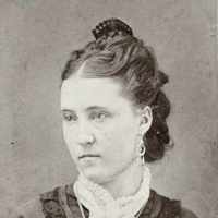
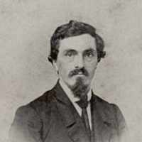
Mary Genette (Gore) Brayman, born June 18, 1814, Belleville, Jefferson, New York – died February 28, 1891, Farmington, Van Burn, Iowa.
Top Row, left to right: Mary Genette (Gore) Brayman, her daughter Victoria Icebenda (Brayman) Goodenough, and Victoria’s husband Gilbert Clark Goodenough. Bottom row, left to right: The Brayman children — their sons Andrew Jackson Brayman, Edward Barney Brayman, and their daughter Flora Arabella (Brayman) Orr. (8)
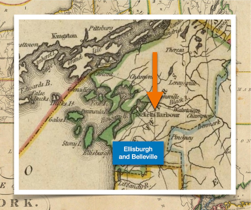
Ellisburgh, and Belleville, Jefferson County, New York
After his wife Elizabeth died in 1793, Deacon Edward Barney eventually remarried. He and his second wife Phebe Bennett had six more children. They also moved from Vermont to New York just after the turn of the 19th century.
From the book, The Growth of A Century: “Deacon Edward Barney came from Guilford, Vermont, about 1803 and settled in the town of Ellisburgh. He was a physician and farmer. He died in 1835, aged 86 years. Three of his sons, substantial business men, settled and raised families in that town, and were foremost in efforts to repel invasion during the War of 1812, especially in defence of Sackets Harbor”. [More on this area below.]
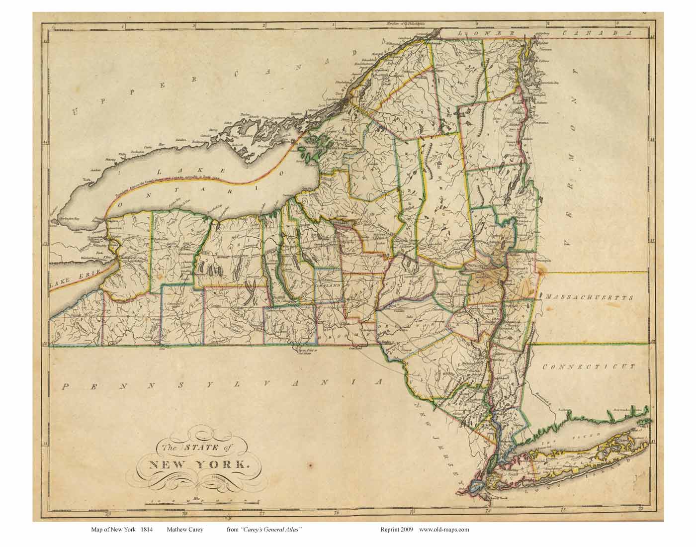
So, it’s clear that he relocated his family to New York State, and it was quite a move(!) They relocated up near the border with Canada at the eastern edge of Lake Ontario. Apparently, Samuel Gore (4) and his wife Rebeckah also followed sometime between 1807 when Belinda was born in Vermont, and 1812 when Susan was born in New York.
the inset image. Map of New York 1814 by Mathew Carey from “Careys General Atlas”
(Image courtesy of Old-maps.com).
We often wondered what made them decide to emigrate to a new area after spending generations in New England. The article The Coming of the Pioneers from newyorkgenealogy.org helped explain what had been in the air: “By 1800 the tide of immigration towards Northern New York had definitely set in. The lure of cheap lands in a new country brought settlers by the hundreds from the New England states and the still new settlements in the vicinity of Utica. Marvelous tales were told there of the fertility of the lands in the Black River Country, of corn planted in the ground without plowing growing to over eleven feet in height and of wheat yielding from twenty-five to thirty-five bushels to the acre. A traveling missionary commenting on the universal contention of the pioneers in their new homes along the Black river said that he had not “seen an unhappy person for 90 miles on that river.”
“These tales and others brought sturdy, young men and their families from Vermont and Plattsburgh over the woodland trail into Chateaugay and finally to the infant settlements springing up along the St. Lawrence, the Grass and the St. Regis rivers. They brought others, their household goods laden on crude wood sleds, drawn by oxen, up through the trackless woods of the Black River Country…”
To this day, according to Wikipedia, Ellisburgh, New York is still considered a village, and Belleville, (just north of Ellisburgh even smaller), is considered a hamlet. Most of our ancestors who were there, left the area, or didn’t stay there for very long. The only exception was Susan (Gore) Bishop, who was a lifelong resident. (9)
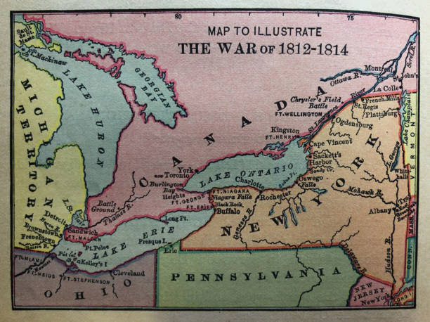
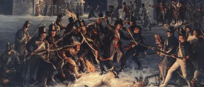
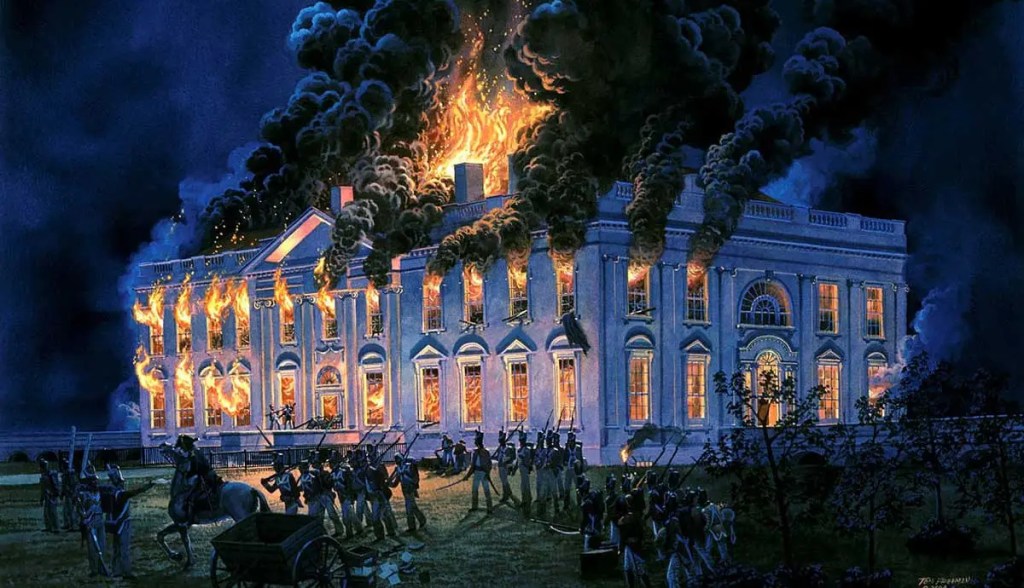
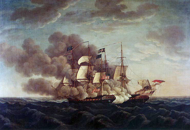
The War of 1812
Like his father Elijah before him, Samuel Gore (4) participated in the new country’s war efforts, as a private in Captain Jonathan Scott’s Company of Colonel Anthony Sprague’s Regiment Jefferson County Militia, New York. (Curiously, his wife Rebeckah never claimed his war pension, likely because he survived unhurt: “All pensions granted to veterans of the War of 1812 and their surviving dependents before 1871 were based exclusively on service-connected death or disability”.)
We had always thought that the War of 1812 was fought because England was rather cranky and upset that they had lost the American Revolutionary War a generation earlier. [Honestly, it just wasn’t deemed to be that important in American high school history classes.] However, there was much more to the conflict.
From the USS Constitution Museum.org: “The War of 1812 pitted the young United States in a war against Great Britain, from whom the American colonies had won their independence in 1783. The conflict was a byproduct of the broader conflict between Great Britain and France over who would dominate Europe and the wider world.” If you recall, in The Gore Line, A Narrative — Four, we had commented on the fact that England had crafted an economic model that benefited them by extracting resources from their Colonies. This changed after the War For Independence, and was aggravated further when President Jefferson passed the Embargo Act of 1807 in retaliation for what was happening to America’s ships and sailors at sea. The embargo was hard on American farmers because it reduced the market for their products, but they weathered the storm, so to speak.


“In Britain’s effort to control the world’s oceans, the British Royal Navy encroached upon American maritime rights and cut into American trade during the Napoleonic Wars. In response, the young republic declared war on Britain on June 18, 1812. The two leading causes of the war were the British Orders-in-Council, which limited American trade with Europe, and impressment, [read as: kidnapping and forced servitude] the Royal Navy’s practice of taking seamen from American merchant vessels to fill out the crews of its own chronically undermanned warships. Under the authority of the Orders in Council, the British seized some 400 American merchant ships and their cargoes between 1807 and 1812”.
It’s hard to believe this today, but in the expansionist era our ancestors lived in, and with everything else that was going on… There were many Hawks in the Continental Congress who believed, The War would allow them to expand American territory into the areas of Canada, which were defined as Upper Canada (essentially Ontario), and Lower Canada (present day Quebec).
The acquisition of Canada this year, as far as the neighborhood of Quebec, will be a mere matter of marching; and will give us experience for the attack of
Thomas Jefferson to William Duane, 4 August 1812
Halifax the next, and the final expulsion of England from
the American continent.
According to the National Park Service: “…many Americans assumed that the Canadian population would welcome the arrival of American forces. In reality, the inhabitants of Canada—a mix of French settlers, American loyalists who had fled north during the War of Independence, and a growing population of ambivalent American transplants – had little reason to embrace an incursion from the south”.
Indeed, “Jefferson also overestimated the readiness of the American armies. Optimists assumed that the U.S. army could be effective as an invading and occupying force… Jefferson also misjudged the effectiveness of the British army. Their own success fighting and defeating the British redcoats during their War of Independence proved a deceptive lesson. Unlike the British troops Americans faced during the Revolution, the British army that arrived in Canada was better led and battle-hardened by twenty years of experience fighting against Napoleonic France”.
However, with our ancestors living where they lived, it was a prime area for much conflict. “Jefferson County early became the theater of active military and naval operations. Sackets Harbor was then the most important point on Lake Ontario. It was made the headquarters of the northern division of the American fleet, and here were fitted out numerous important expeditions against the British in Canada”. [RootsWeb, Child’s Gazetteers 1890]
Furthermore, “The war started in 1812 and lasted until 1815, though a peace treaty had been signed in 1814. Over 2200 US soldiers died and over 1600 British. Jefferson County played a central role in the war, from beginning to end. It was the headquarters of Commodore Isaac Chauncey and the US Navy of the Great Lakes. Six armed engagements were fought in Jefferson County during the war, more so than any other county on American soil. The successful campaigns against York and Niagara (1813) were launched from Sackets Harbor, as were the not so successful campaigns on Montreal and Niagara (1814). Perry’s victory on Lake Erie was also directed from Jefferson County under the command of Isaac Chauncey.” [Jefferson County NY Wiki]
As far as we know, it’s a miracle that none of our family members in this line, died during this time. In Part Six we are writing about our ancestor Luke Gore and his family, as they move west from New England — perhaps following other family members who led the way. (10)
Following are the footnotes for the Primary Source Materials,
Notes, and Observations
A Special Note About This Chapter
There is a wealth of well done documentation completed by other fellow researchers about this family line, in the Familysearch.org website. We would like to bring this work to your attention, as follows:
Note 1: For an excellent traditional muti-generational classical family tree which includes names, dates, marriages, and children, see —
https://www.familysearch.org/tree/pedigree/landscape/LQ5C-1D1
Note 2: The research also contains a robust amount of detail and source information for those researchers who would like to research their ancestors beyond the classical family tree level.
Note 3: Here is an example — again from this link: https://www.familysearch.org/tree/pedigree/landscape/LQ5C-1D1 , then click on the name Samuel Gore found within the center screen block above his wife’s name, Rebeckah Barney. This will open a biography box on the right side of your screen.
From there, click on the PERSON box, just below Samuel’s birth and death information. This will open a new window which displays useful links such as Details, Sources, etc.
Here is the path: Pedigree landscape view (classical tree) > Samuel Gore biography page > PERSON link > Useful links
Grandma Moses Certainly Knew How to Paint The Rural Life
(1) — two records
Moving Day on the Farm
Painting by Anna Mary Robertson Moses, known as ‘Grandma Moses’
https://www.wikiart.org/en/grandma-moses/morning-day-on-the-farm-1951
Grandma Moses
https://en.wikipedia.org/wiki/Grandma_Moses
Elijah Gore Sr., and Desire Safford Have a Big Family
(2) — eight records
Elijah Gore
Birth – Connecticut Births and Christenings, 1649-1906 https://www.familysearch.org/ark:/61903/1:1:F74J-LJY
Note: This is his christening record, one week after his birth.
Sarah Little
Vital – Massachusetts, Town Clerk, Vital and Town Records, 1626-2001
https://www.familysearch.org/ark:/61903/1:1:F4FR-L9K
Book page: 117, Digital page: 65/544. Right page, last entry.
Note: For her birth registration.
Elijah Gore and Sarah Little marriage
Marriage – Connecticut, Vital Records, Prior to 1850
https://www.familysearch.org/ark:/61903/1:1:QPQ7-57TX
Digital page: 8822/10,566
Note: For the data.
Sarah Little Gore
https://www.findagrave.com/memorial/57390841/sarah-gore
Note: For the data.
Elijah Gore
in the Connecticut, U.S., Town Marriage Records, pre-1870 (Barbour Collection)
Voluntown Vital Records 1708-1850
https://www.ancestry.com/discoveryui-content/view/225419:1062?tid=&pid=&queryId=1d2415c4e44686d563db8be245d11749&_phsrc=DZs10&_phstart=successSource
Book page: 180, Digital page: 52/122, Lower portion of page.
Note: For the Gore family children born in Voluntown, Connecticut.

The Descendants of George Little Who Came to Newbury, Massachusetts, in 1640, from the American Genealogical-Biographical Index (AGBI)
by George Thomas Little, A.M., 1892
https://www.ancestry.com/imageviewer/collections/10376/images/dvm_GenMono000214-00002-0?ssrc=&backlabel=Return&pId=2000000000
Book pages: 53-54, Digital pages: 73-74/664 Under Entry 200
Note: This file lists a Joseph Gore born 1797, a child which we have not included because we believe that it is an error.
Elijah Gore
in the Geneanet Community Trees Index
https://www.ancestry.com/discoveryui-content/view/6873371156:62476
Note: This file lists a Joseph Gore born 1797, a child which we have not included because we believe that it is an error.
Library of Congress
McClellan’s Map of Windham County, Vermont
by J. Chace, C. McClellan & Co.
https://www.loc.gov/resource/g3753w.la001192/?r=-0.491,0.249,1.604,0.777,0
Note: For map image.
The French and Indian War
(3) — three records
History of Vermont
https://en.wikipedia.org/wiki/History_of_Vermont
Note: For the data.
French and Indian War
https://en.wikipedia.org/wiki/French_and_Indian_War
Note: For the data and illustration.
We Are The Mighty
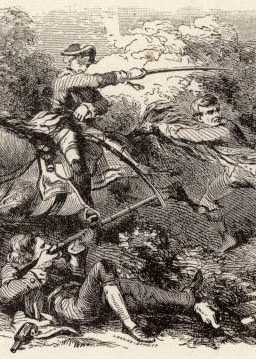
Today in Military History: George Washington spills first blood of French and Indian War
https://www.wearethemighty.com/articles/today-in-military-history-george-washington-spills-first-blood-of-french-and-indian-war/
Note: For the illustration.
Many People Had Tried to Claim Land in Vermont
(4) — four records
History of Vermont
https://en.wikipedia.org/wiki/History_of_Vermont
Note: For the data.
Battle of Bennington
https://en.wikipedia.org/wiki/Battle_of_Bennington
Note: For the data.
File:Fort Ticonderoga 1775.jpg
https://commons.wikimedia.org/wiki/File:Fort_Ticonderoga_1775.jpg
Note: For the Illustration of Ethan Allen.
Vermont.com
Vermont.com Guide to Guilford
https://vermont.com/cities/guilford/
Note: For the data.
The 1790 ‘Census’ of Vermont
(5) — four records
1790 Census: Heads of Families at the First Census of the United States
Taken in the Year 1790
https://www.census.gov/library/publications/1907/dec/heads-of-families.html
Note 1: 5 Downloadable .pdf files
Note 2: Click on Vermont, Published in 1907 > Download All Vermont [21.0 MB]
The National Archives
1790 Census Records
https://www.archives.gov/research/census/1790
Note: For the data.
USGenWeb Free Census Project Help, HISTORY of the United States – Federal Census, 1790-1920
http://www.usgwcensus.org/help/history.html
Note: For the data.
Elijah Gove Jr
in the Vermont, U.S., Vital Records, 1720-1908
https://www.ancestry.com/discoveryui-content/view/345462:4661
Digital page: 2859/4084
Note: For the data.
Two Locations in Windham County?
(6) — four records
Official History of Guilford, Vermont, 1678-1961.
With Genealogies and Biographical Sketches
Edited by National Grange, Vermont State Grange, Broad Brook Grange No. 151, Guilford
https://archive.org/details/officialhistoryo00unse/page/308/mode/2up
Note 1: Gore farm sale, Book page 309, Digital page: 308/585
Note 2: Tipped-in, foldout map of original property lots, Digital page 396/610
Halifax, Vermont
https://en.wikipedia.org/wiki/Halifax,_Vermont#External_links
Note: For the data.
Guilford, Vermont
https://en.wikipedia.org/wiki/Guilford,_Vermont
Note: For the data.
Official History of Guilford, Vermont, 1678-1961.
With Genealogies and Biographical Sketches
Edited by National Grange, Vermont State Grange, Broad Brook Grange No. 151, Guilford
https://archive.org/details/officialhistoryo00unse/page/308/mode/2up
Note: Elijah Gore Revolutionary War service, page 135.
Samuel Gore (4) and Rebeckah Barney Marry
(7) — three records
Genealogy.com
Re: Barneys and Potters and Briggs, Oh My:-)
By William Barney
https://www.genealogy.com/forum/surnames/topics/barney/776/
Note: Home > Forum > Surnames > Barney
Mrs Elizabeth Barney
Vital – Vermont, Vital Records, 1760-1954
https://www.familysearch.org/ark:/61903/1:1:XFFT-335
Digital page: 2891/4008
Note: For her death record.
Family Search Tree (not our files)
https://www.familysearch.org/tree/pedigree/landscape/LQ5C-1D1
Note 1: Our source for only the Gore Family Photograph Portraits.
Note 2: This is not a family tree of our construction, therefore, we have not verified other information here.
The Waking Century — The Advent of Portrait Photography
(8) — two records
Photography by Jay
A Brief History of Portrait Photography
by Jay Soriano
https://jaysoriano.com/a-brief-history-of-portrait-photography/
Note: For the text and image.
Time
Now You Know: Why Do People Always Look So Serious in Old Photos?
by Merrill Fabray
https://time.com/4568032/smile-serious-old-photos/
Note: For the text.
Ellisburgh, and Belleville, Jefferson County, New York
(9) — six records

Growth of a Century: as illustrated in the history of Jefferson County, New York, from 1793 to 1894
by John A. Haddock https://archive.org/details/growthofcenturya00hadd/page/n749/mode/2up
Note: For information on the Barney family and Deacon Edward Barney.
NY Genealogy
The Coming of the Pioneers
Franklin County, Jefferson County, Lewis County, Oswego County, Saint Lawrence County
by New York Genealogy
https://newyorkgenealogy.org/franklin/the-coming-of-the-pioneers.htm
Note: For the data.
Old Maps
Map of New York 1814 by Mathew Carey from “Careys General Atlas”
by Mathew Carey
http://www.old-maps.com/NY/ny-state/NY_1814_Carey-web.jpg
Note: For map image.
ThoughtCo.
History of American Agriculture
American Agriculture 1776–1990
by Mary Bellis
[Under the subhead] Agricultural Advances in the United States, 1775–1889
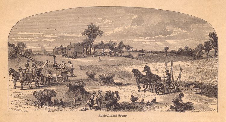
https://www.thoughtco.com/history-of-american-agriculture-farm-machinery-4074385
Note: For the farm scene image.
Ellisburg, New York
https://en.wikipedia.org/wiki/Ellisburg,_New_York
and
Belleville, New York
https://en.wikipedia.org/wiki/Belleville%2C_New_York
Note: For the data.
The War of 1812
(10) — nine records
USS Constitution Museum
The War of 1812 Overview
https://ussconstitutionmuseum.org/major-events/war-of-1812-overview/#:~:text=The%20two%20leading%20causes%20of,its%20own%20chronically%20undermanned%20warships.
Note: For the data.
Samuel Gore
Military – United States War of 1812 Index to Service Records, 1812-1815
https://www.familysearch.org/ark:/61903/3:1:33SQ-G5Z8-9GNM?view=index&action=view&cc=1916219
Digital page: 2210/2843
Note: For the data.
Samuel Gore
in the U.S., War of 1812 Pension Application Files Index, 1812-1815
https://www.ancestry.com/discoveryui-content/view/72654:1133
Digital page: 740/946
Note: For the data.
National Archives and Records Administration
Bounty-Land Warrants for Military Service, 1775–1855
https://www.archives.gov/files/dc-metro/know-your-records/genealogy-fair/2012/handouts/war-of-1812-bounty-lands.pdf
and
Publication Number: M-313
Publication Title: Index to War of 1812 Pension Application Files
https://www.archives.gov/files/research/military/army/dc/m313.pdf
Note: For the data.
Encyclopædia Britannica
Embargo Act , United States [1807]
https://www.britannica.com/topic/Embargo-Act
Note: For the data.
The National Park Service, article —
“The acquisition of Canada this year will be a mere matter of marching”
https://www.nps.gov/articles/a-mere-matter-of-marching.htm
Note: For the data.
Jefferson County NY Wiki
War of 1812
https://jeffcowiki.miraheze.org/wiki/War_of_1812#:~:text=Jefferson%20County%20played%20a%20central,other%20county%20on%20American%20soil.
Note: For the data.
WAR OF 1812
(from Child’s Gazetteer(1890) – pp. 141-171)
https://freepages.rootsweb.com/~twigs2000/genealogy/warchilds.html
Note: For the data.
The War of 1812 Gallery images:
From various sources on Google search.


