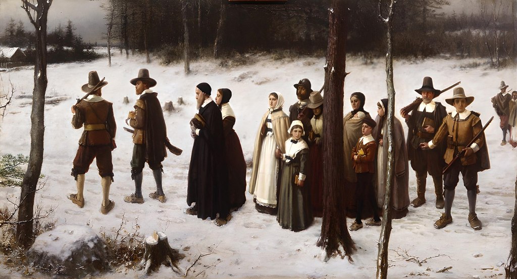
This is Chapter Seven of nine. We have wondered if Joseph Doty, Jr. moved from New Amsterdam, up to the Nine Partners area of the Hudson River Valley due to the influence of the family of his wife Geisje (Lucretia) Van Schaick. Perhaps he somehow connected with her family through the prevalence of the Dutch culture of Manhattan when he lived there? (His militia service was also was affiliated with the Dutch Burgher Guards).
Joseph also had his cousins Charles and Elias Doty from Oyster Bay, living in the Dutchess County area. So, it’s also possible that he and Lucretia could have connected through family, or the Dutch Reformed Church. Who knows, we’re just glad that they met!
(Image courtesy of Shutterstock).
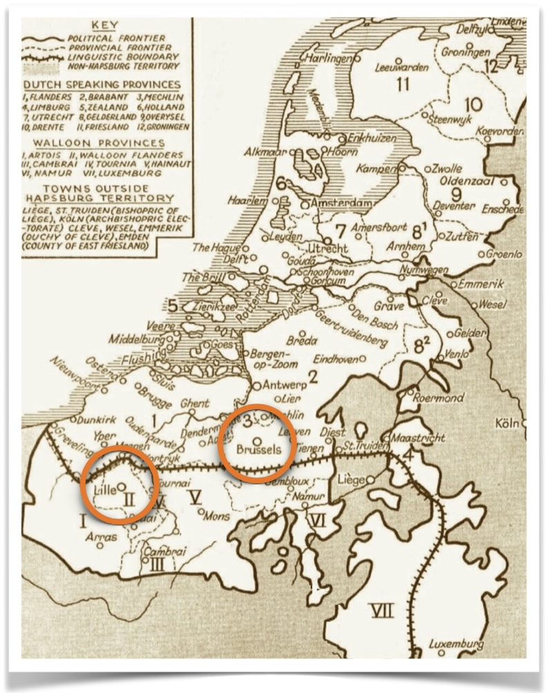
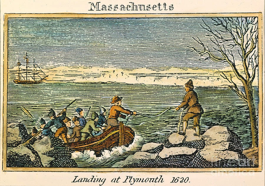
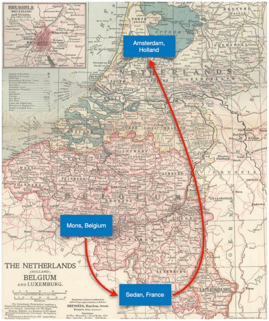
From Wikipedia, The Adventures of Tintin is a series of 24 comic albums created by Belgian cartoonist Georges Remi, who wrote under the pen name Hergé. The series was one of the most popular European comics of the 20th century. The country of Belgium was created in 1830, after it gained independence from the Southern Netherlands.
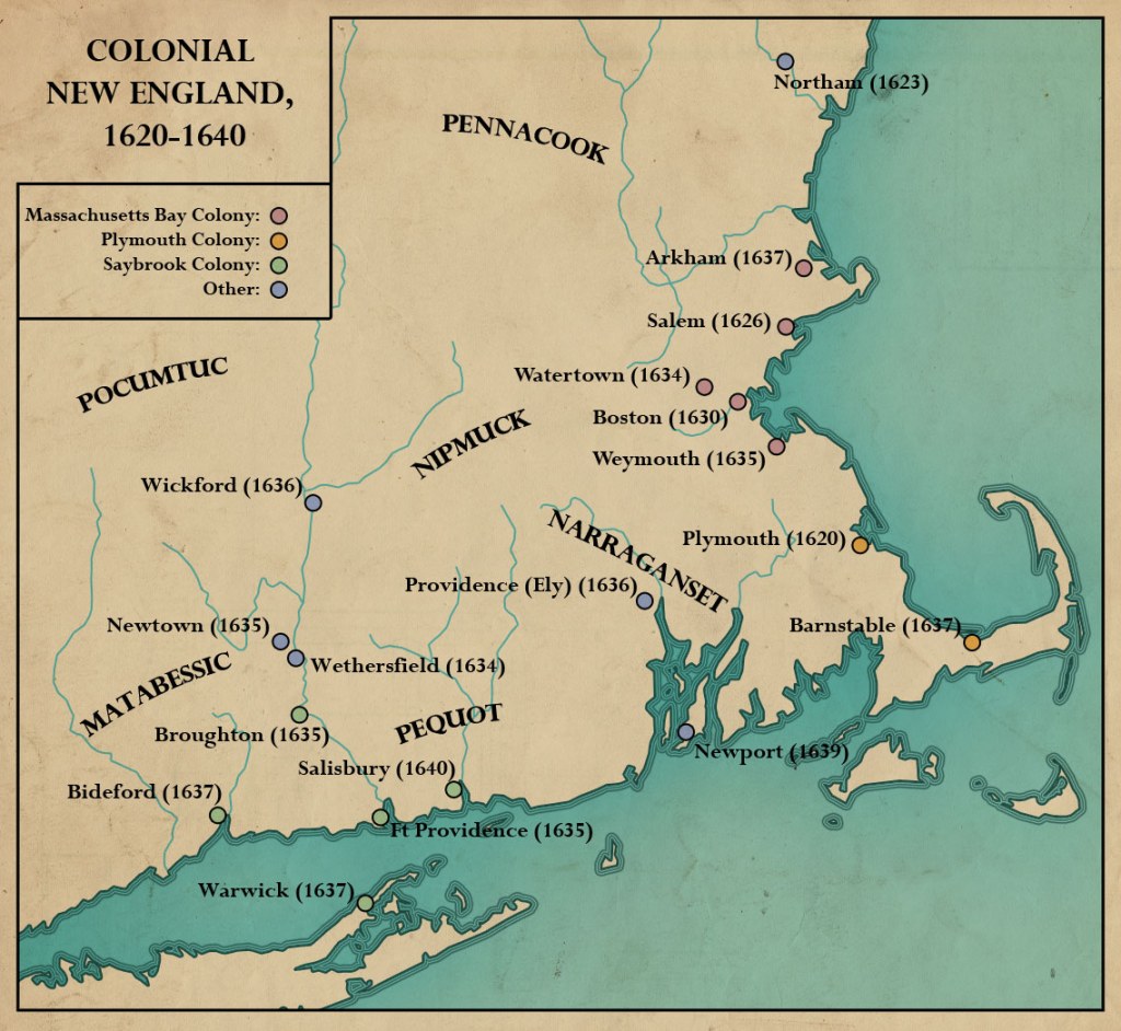
Let’s Talk About Place Names
During their lifetimes, our ancestors lived in locations that changed name(s) quite a few times. This gets quite confusing. We have corrected the history in this chapter to reflect these transformations.
We have observed that many researchers have rather clumsily used inappropriate place names for locations mentioned in this history. Some of this is understandable, since two different countries clashed over who had control of the area. Be that as it may, many past record sources, and then more contemporary records, have not thought about this sufficiently. We are following them in time and have a longer view of how the area names and boundaries evolved. So let’s address this issue —
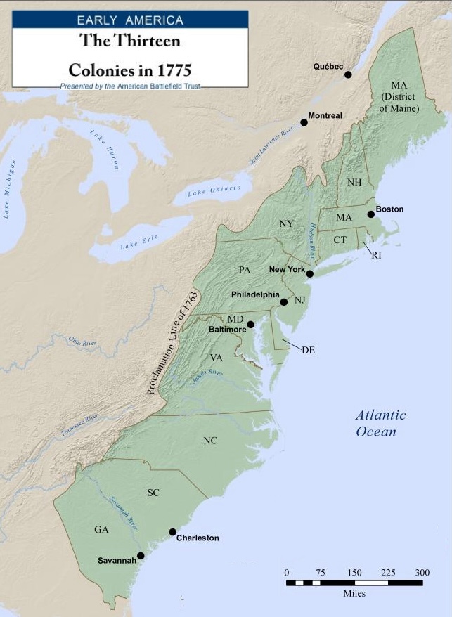
New Netherland vs. The Province of New York
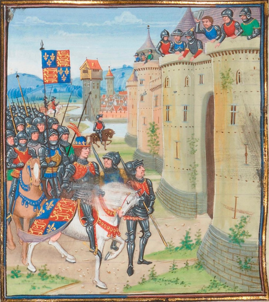
The area was first known as New Netherland, a Dutch colony, until 1664. The English renamed it when they took control in 1664 as the Province of New York, after the Duke of York (later King James II).
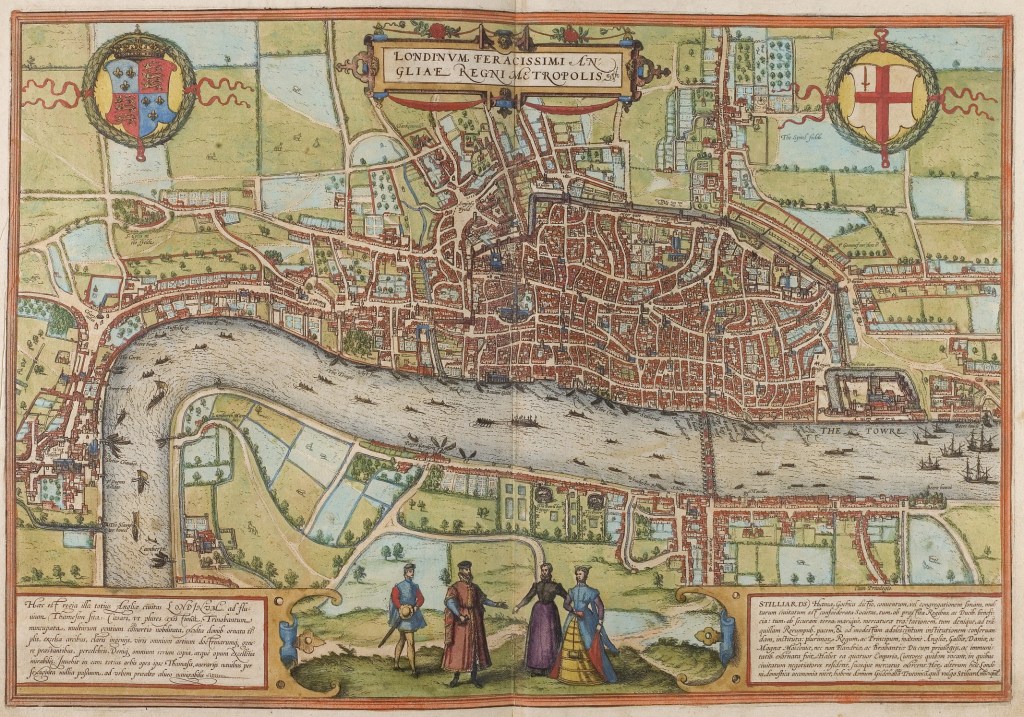
New Amsterdam > Manhattan
First, it was called New Amsterdam, then the English changed the name to New York City in 1664, for the same reason cited above.
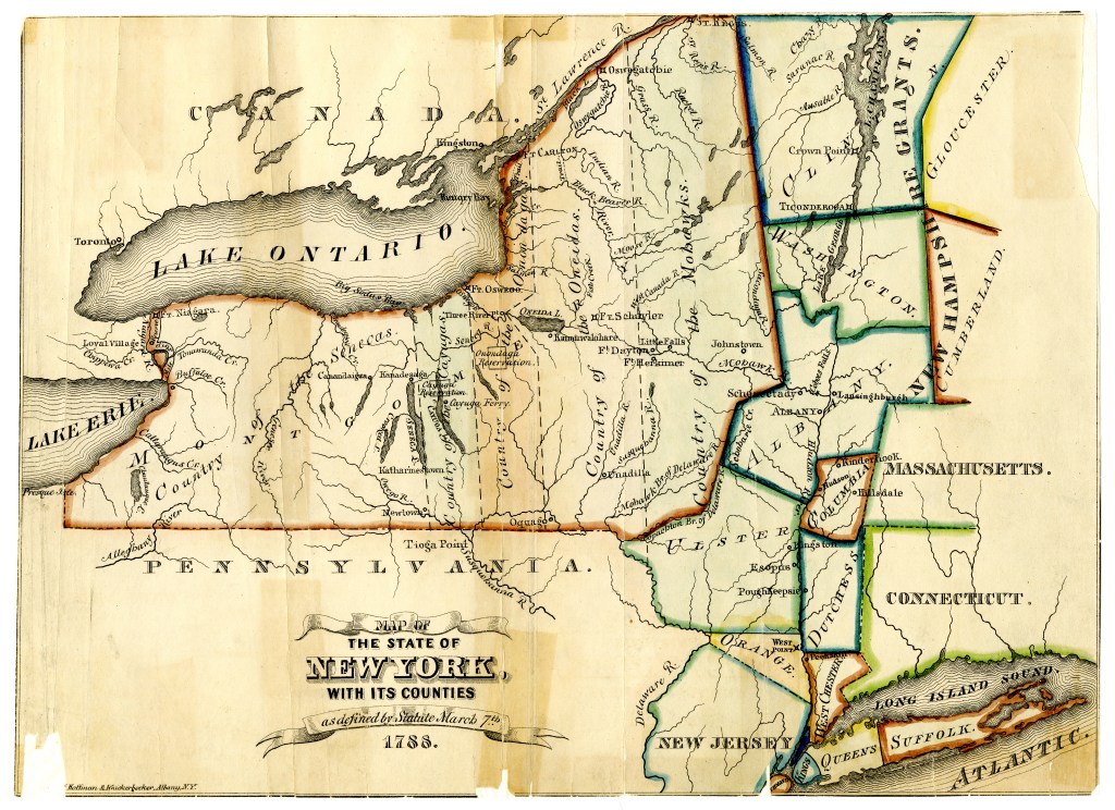
Fort Orange > Albany
Located on the upper Hudson River, it was named as Fort Orange by the Dutch. It was initially founded in 1614-1624 as a fur trading post. The English then renamed it Albany, designating it first as a settlement in 1664, a county in 1686, then as a city in 1686. It is the oldest city in New York State.
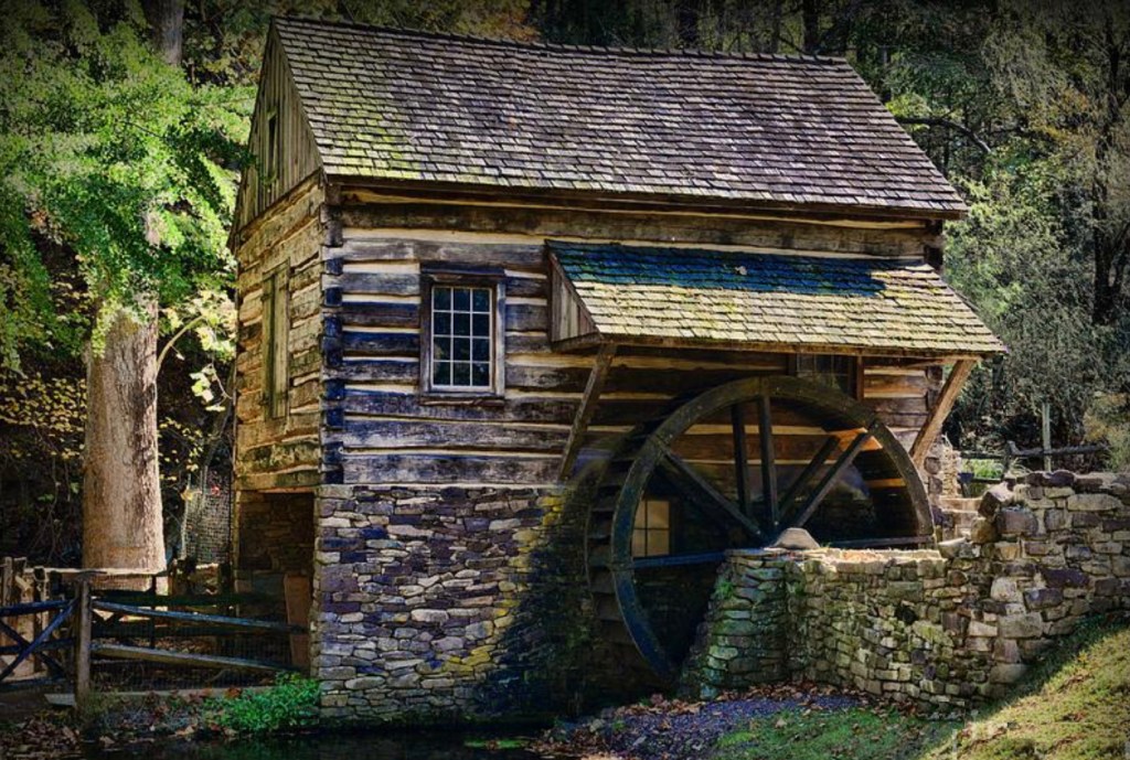
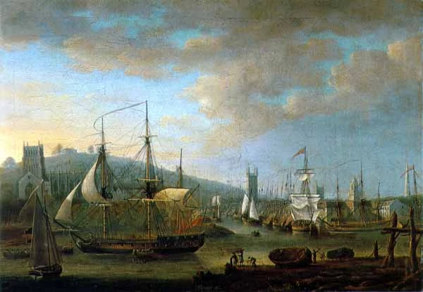
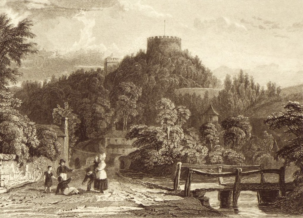
Esopus > Wiltwyck > Kingston
This was a broad area on the upper Hudson River named by Native Peoples to describe a creek. The Dutch used this name because it was convenient to do so. In 1657, Peter Stuyvesant, the director-general of New Netherland, built a stockade to protect the Dutch, and renamed the Esopus village Wiltwyck. A few years later, the English renamed portions of it as Kingston in 1669.
Kinderhook
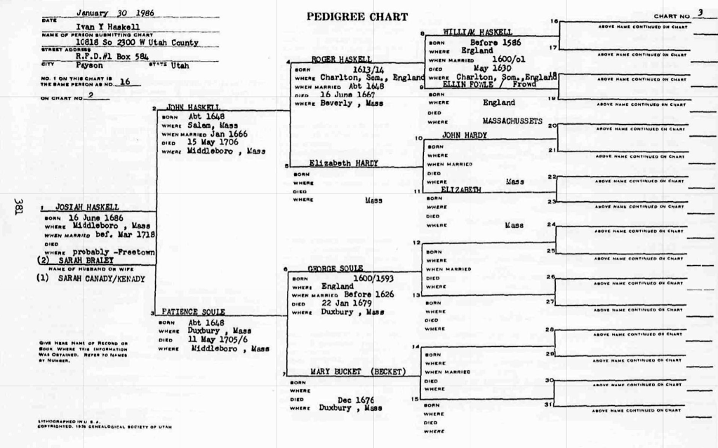
This was a settlement which existed prior to 1651. First it was in Albany County, then this area became Columbia County in 1786, after the American Revolutionary War.
Ulster County
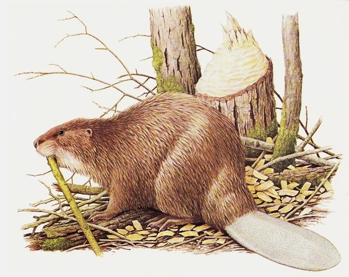
Derived from parts of the Esopus area by the Duke of York in 1683. Prior to that it was simply named Esopus. (Note: The Dutch were not very concerned about the names of interior settlements, since they concentrated mostly on extracting resources, such as beaver pelts from along the Hudson River). (1)
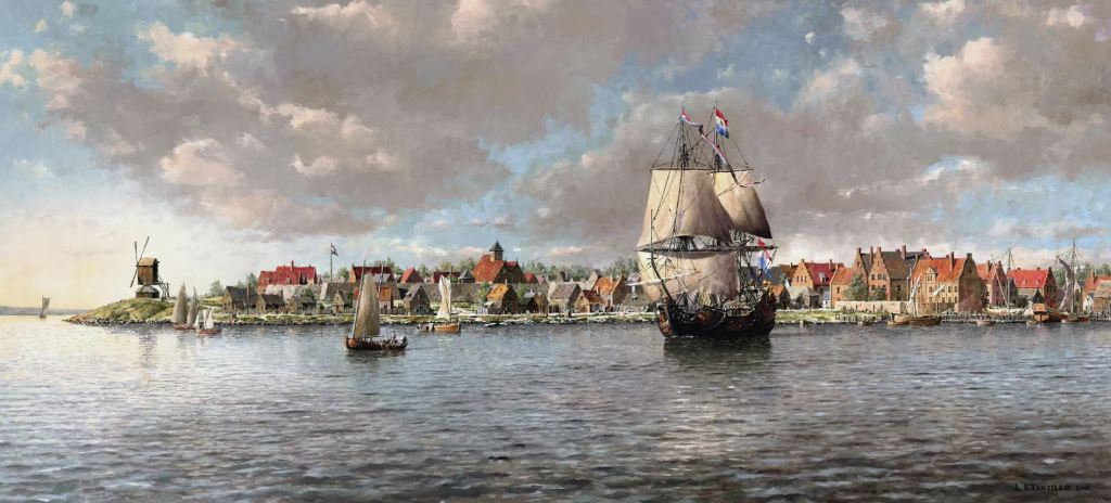
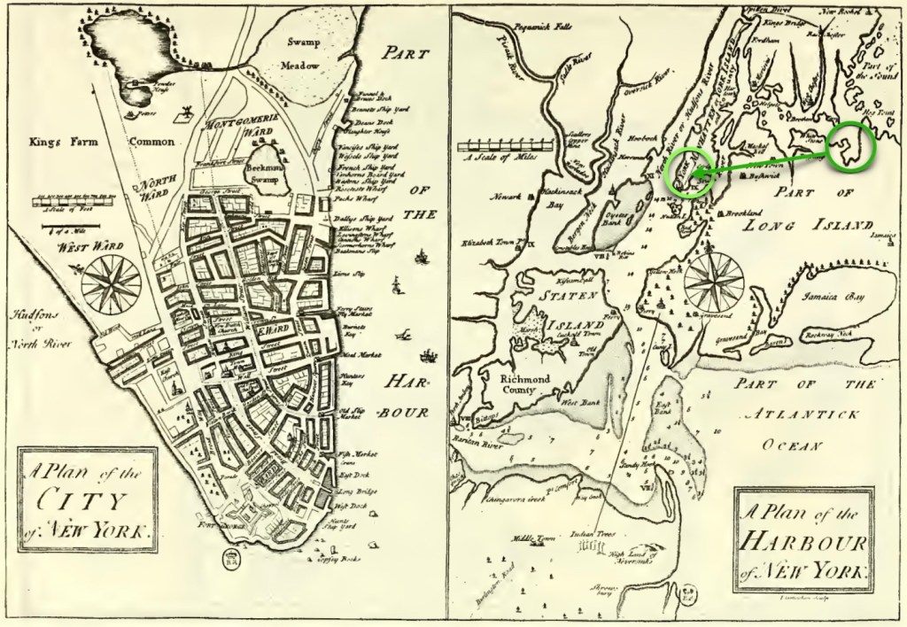
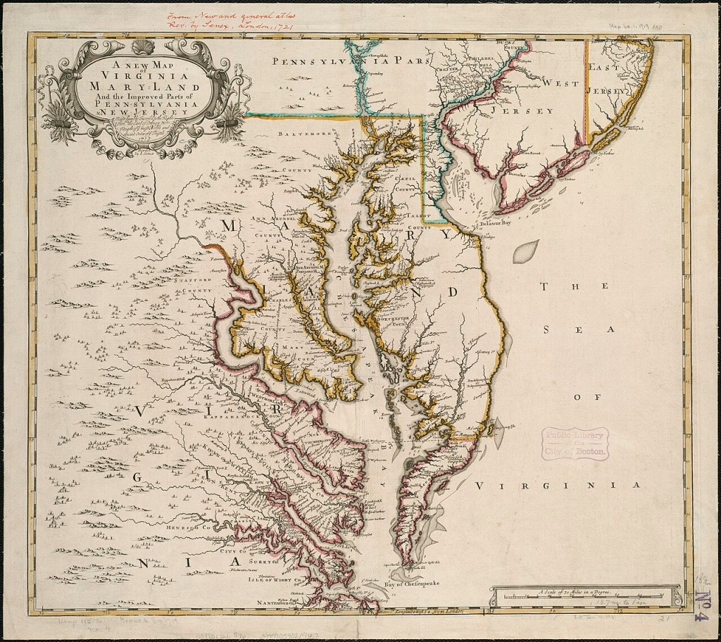
(Image courtesy of the New Amsterdam History Center, via The Dutch Collection of the Metropolitan Museum of Art). *Technically, the location then is New Amsterdam.
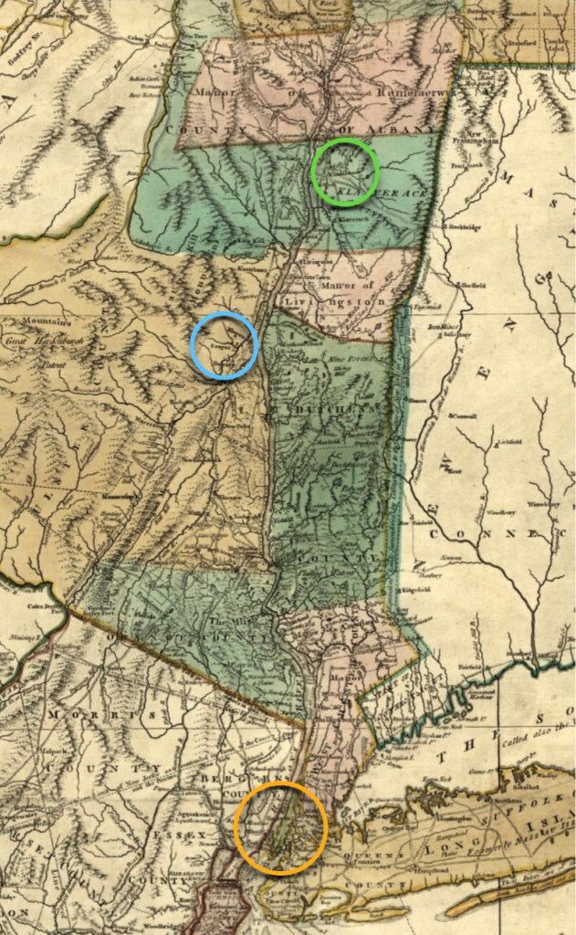
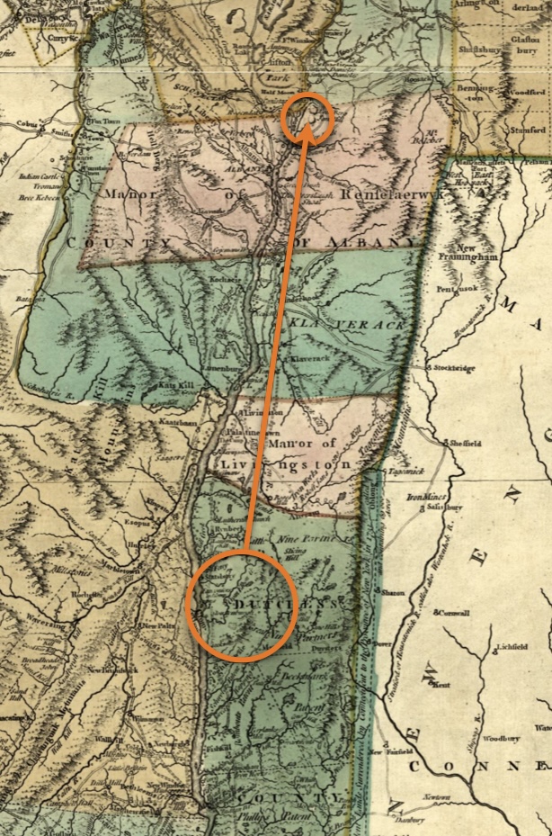
The De Longs, and The Van Schaicks, Come to America
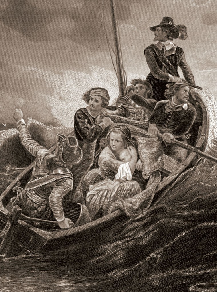
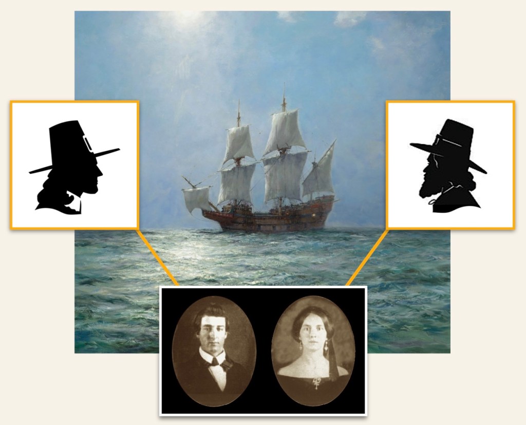
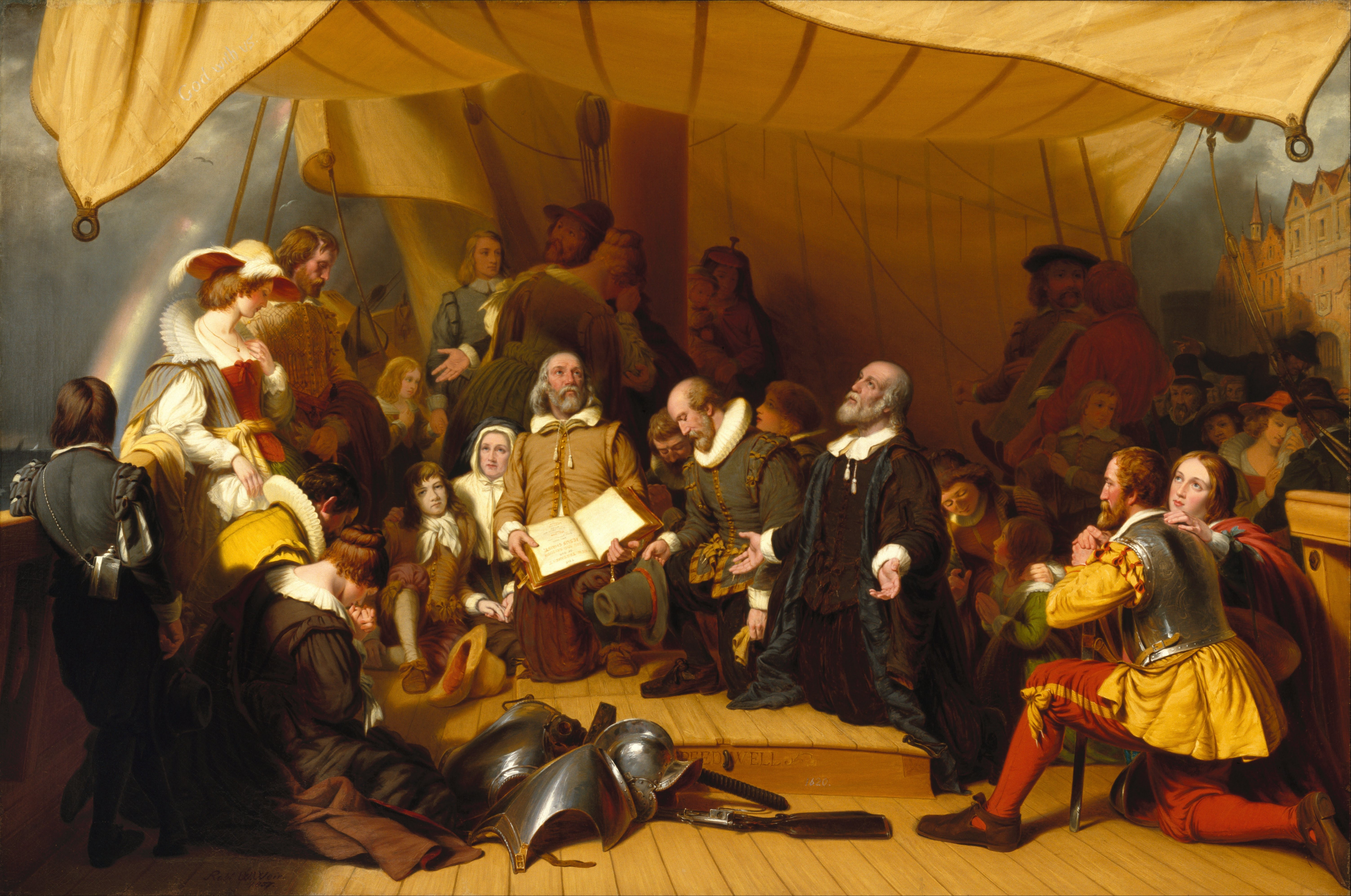
Both family genealogical histories for our 6x Great Grandmother Geisje (Lucretia) DeLong’s maternal and paternal lines begin in The Netherlands (Holland). These lines then cross the Atlantic Ocean to America in a like manner, with them then building new lives in a Dutch-controlled New Amsterdam (Manhattan), in a similar time frame. However, the two families then diverge slightly for a couple of generations, before coming together in the third generation. We’ll start with the De Longs, who are the paternal side. Please note that in all records there are several spellings for this family surname. Among them: Delange, De Lange, Delong, De Long.
The Paternal Line, the De Langes / De Longs —
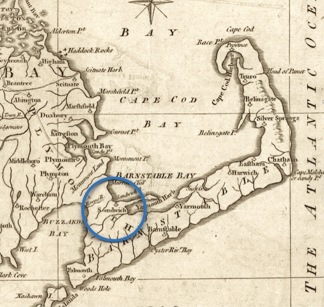
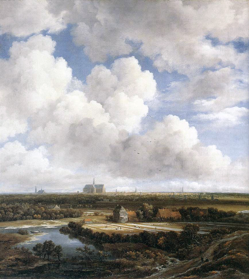
During this period of history, it was completely normal for Dutch immigrants to enter America through New Amsterdam. We don’t know the amount of time this family actually stayed there, but it seems plausible that fairly quickly they chose to relocate again. This time, they moved northward up the Hudson River to the area known by the Dutch as Esopus. In that area, they are considered to be very early pioneers since that area was still a rough frontier.
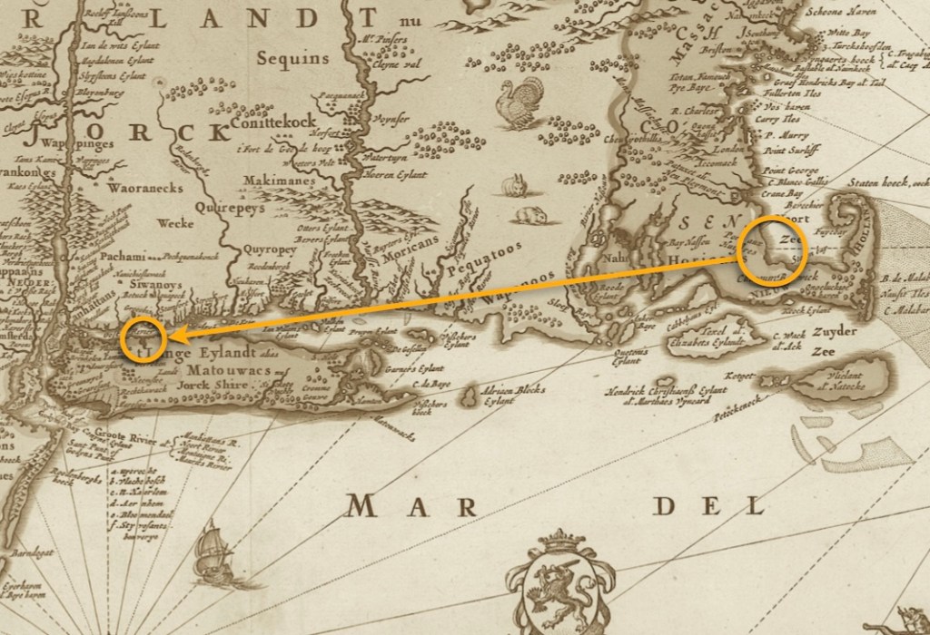
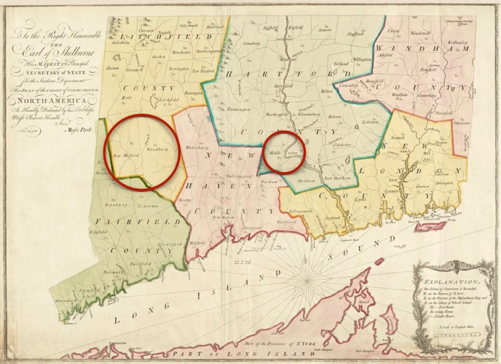
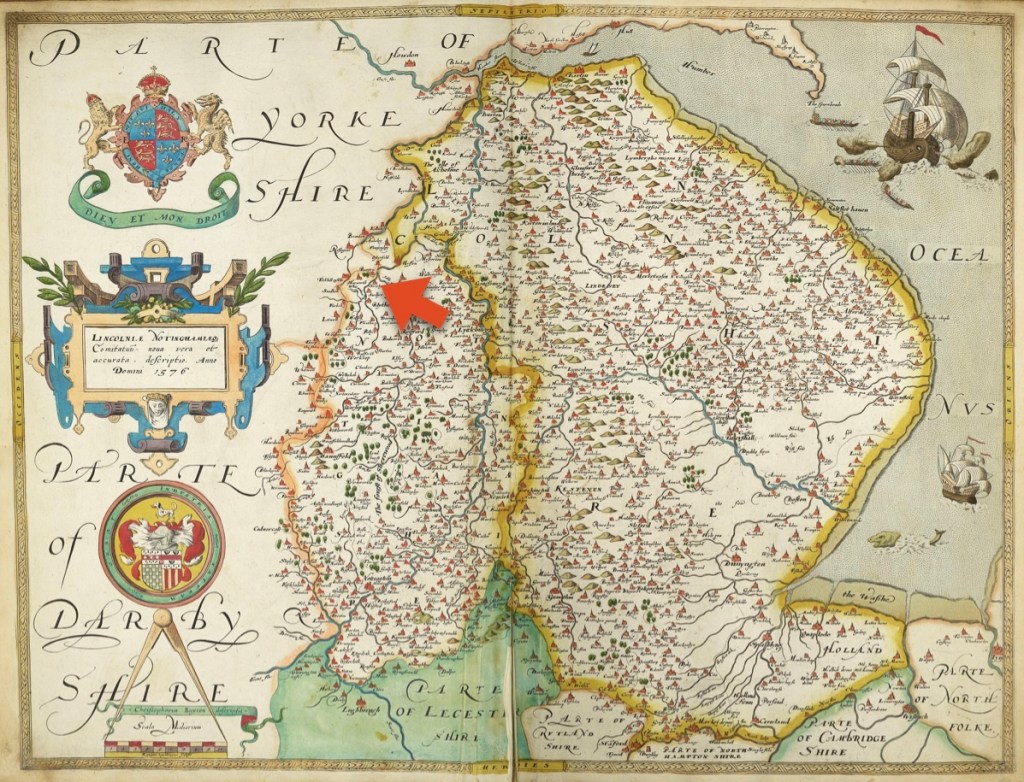
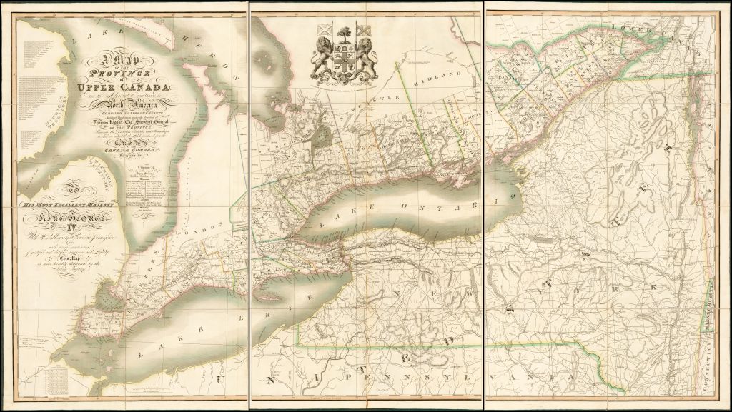
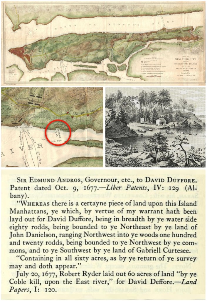
and the Province of Quebec, by Thomas Pownall, and Samuel Holland, circa 1776.
(Image courtesy of the Library of Congress).
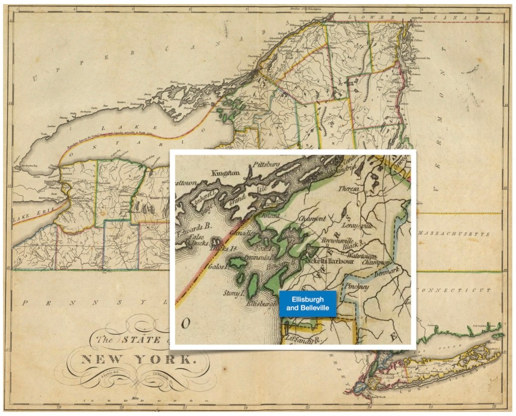
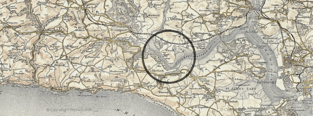
The lower orange circle indicates where the De Longs and the Van Schaicka certainly first entered New Amsterdam. The upper blue circle indicates where the De Long family was active; the upper green circle, where the Van Schaicks were active.
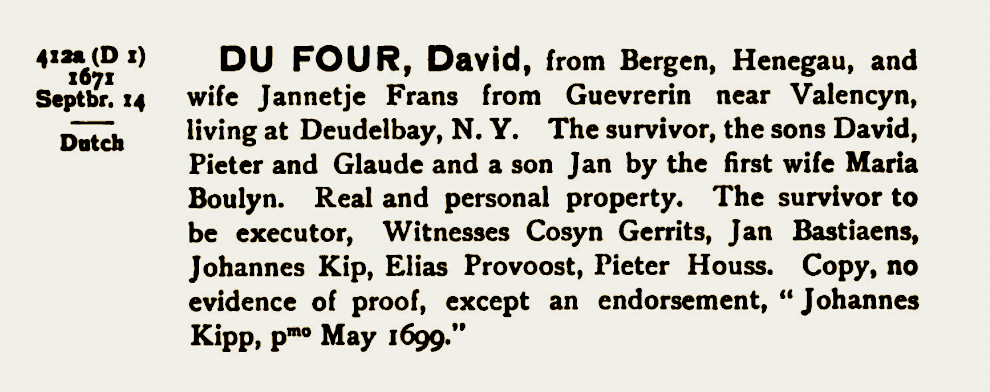
The first DeLange to arrive in America was Franciscus Adrianus (Arie) De Lange, born about 1627 in Leur, Etten-Leur, Noord-Brabant, The Netherlands — died April 17, 1699 in Kingston, the Province of New York. He married Anna (maiden name unknown).
In the next generation, the De Lange line continues on in the Esopus and (then the) Kingston areas. Adrianus Franciscusz De Lange, was born about 1650, in the same location as his father Arie — died before April 17, 1699 in Brabant, an area of Kingston, Ulster County, the Province of New York. He married first Rachel Jansen, date unknown. He married second, Anna (maiden name unknown), date unknown.
The Maternal Line, the Van Schaicks
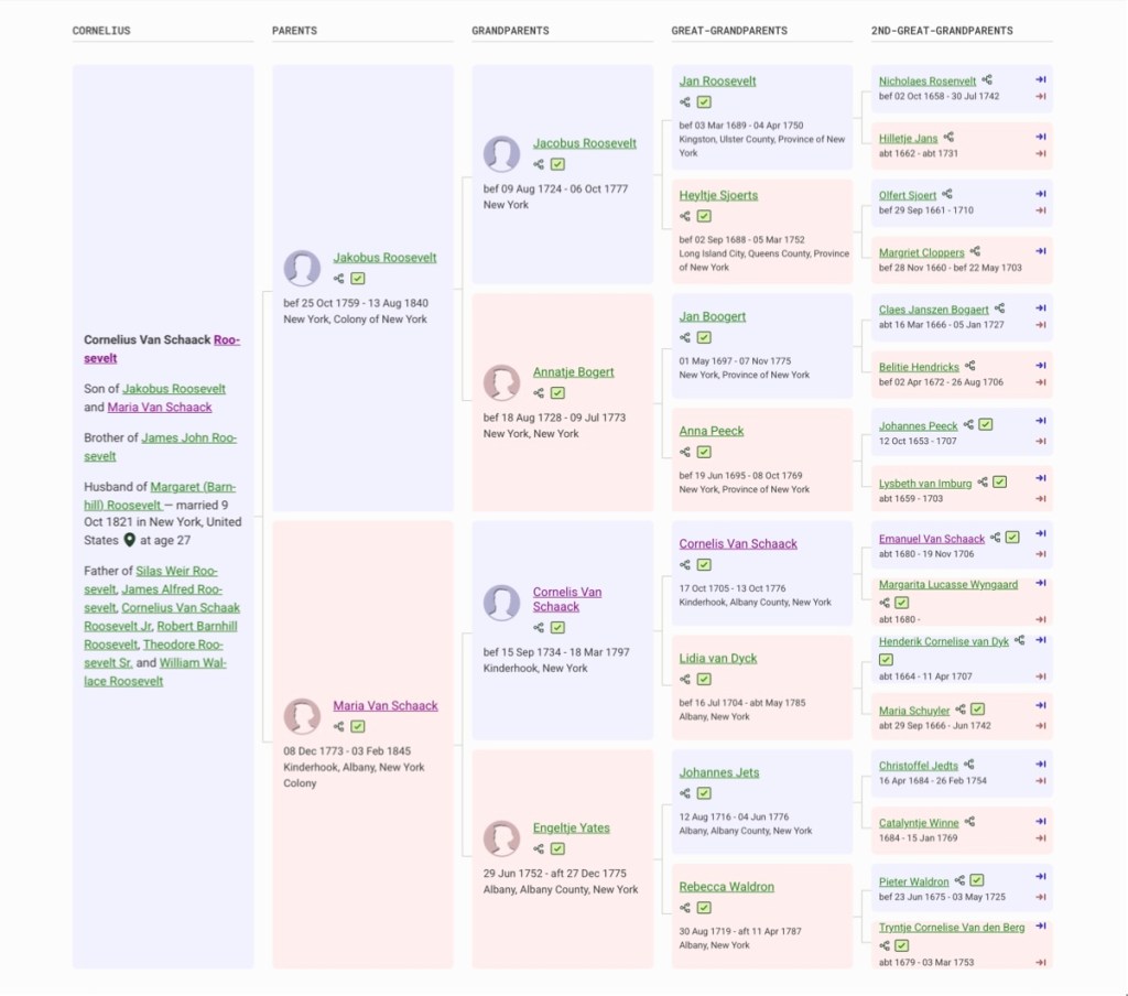
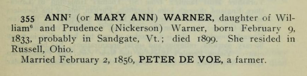
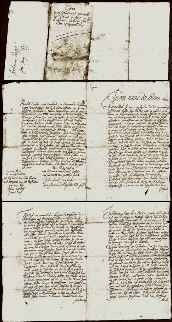
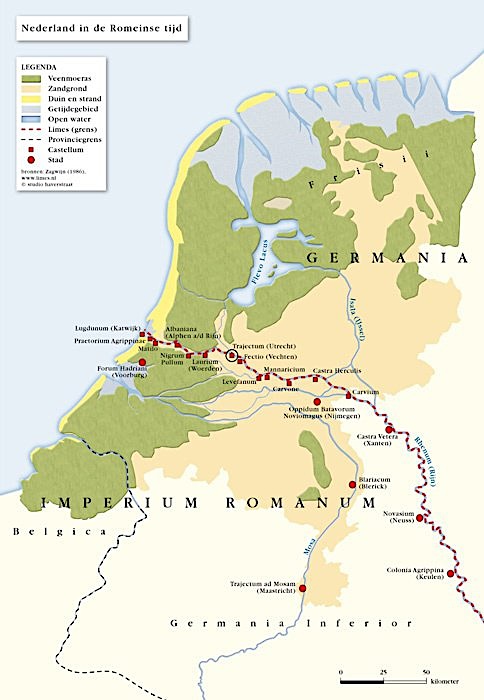
For Geisje (Lucretia) maternal family line, we return to The Netherlands. This history begins with Niclass Laurenzen Van Schaick*, born about 1633 in Utrecht, The Netherlands — died about 1688 at Kinderhook, Albany County, the Province of New York. He married Jennetjie Cornelis* circa 1664, before they immigrated to America. She was born about 1642, (possibly) in Beverwyck, Netherlands — died February 8, 1728, in the same location as her husband.
*Quite interestingly, we learned that through these ancestors, our 8x Great Grandparents, Niclass Laurenzen Van Schaick and Jennetjie Cornelis — that we connect to the famous Roosevelt family of U.S. Presidential fame. (Please see The Roosevelt Family Connection at the very end of this chapter).

(Image courtesy of the New York State Museum).
As with the De Longs, we do not know how long the Van Schaicks were in New Amsterdam. Some of the literature suggests a family connection — and that perhaps Niclass was the brother of Gerrit Goosensz Van Schaick, who was also born in Utrecht, The Netherlands. Known as Goosen, he was one of the original settlers in the community of Fort Orange > Albany. It makes sense that Niclass and Jennetje would live in the same area.
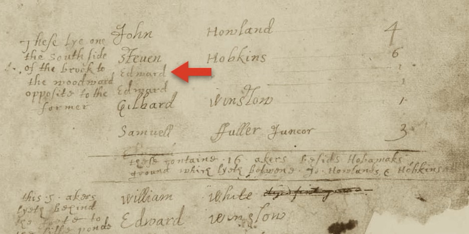
Often, other researchers have not captured the birth of all ten of Niclass and Jannetje’s children. Maritje Van Schaick, our 7x Great Grandmother was the last of their children, born about 1683 at Kinderhook, Albany settlement, (Albany County in 1686). After several generations in America, the DeLange/DeLong family is finally joined by marriage to the Van Schaick family.
(See our Research Observation in the footnotes).

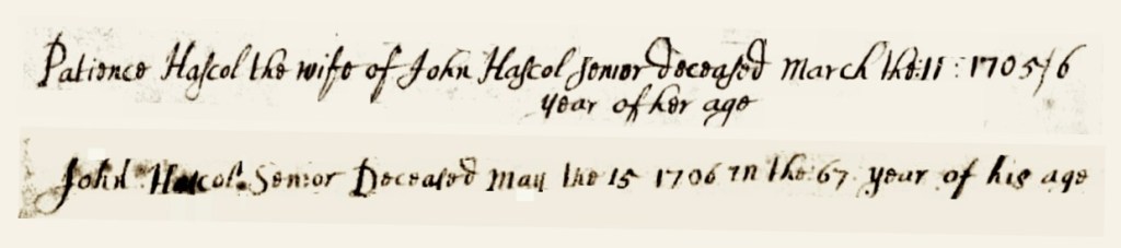
(Note that their names are spelled differently).
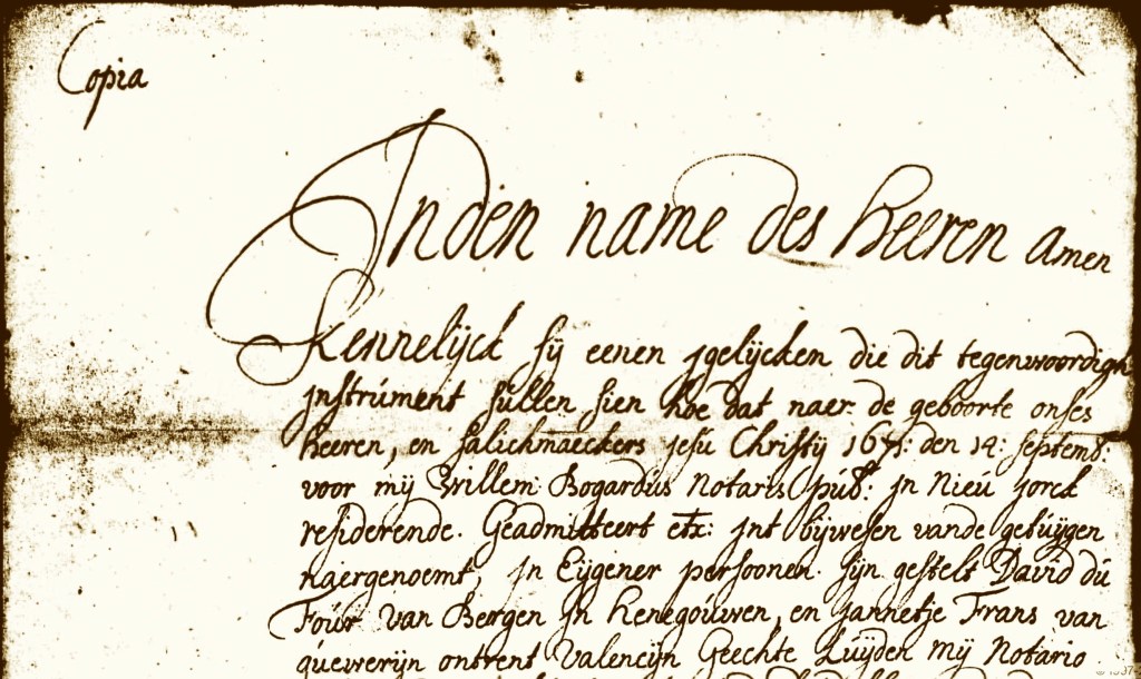
From the records of the Dutch Reformed Church in Albany, the Province of New York.
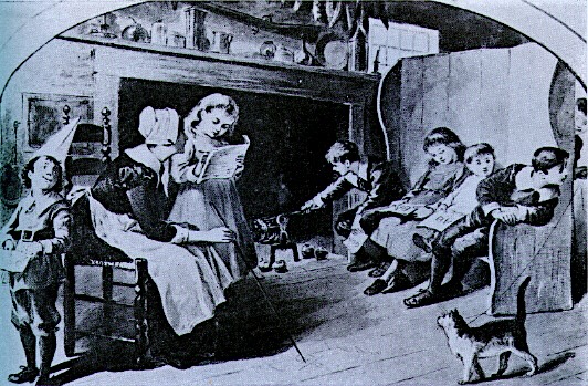
Frans Arie DeLong, born April 24, 1681, in Ulster County, the Province of New York – died May 29, 1755, in Beekman, Dutchess County, same Province. He married Maritje Van Schaick, September 6, 1703. She was born October 19, 1683, in Stuvesant/Kinderhook, Albany County [Columbia County, circa 1786] – died February 1758 in Dutchess County, Province of New York. Frans and Maritje (Van Schaick) DeLong had a large family of twelve children, with the eleventh being our 6x Great Grandmother, Giesje (De Lange/De Long) Doty. (2)

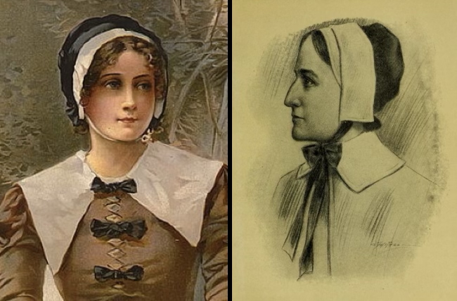
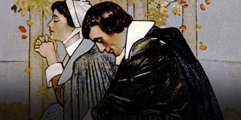
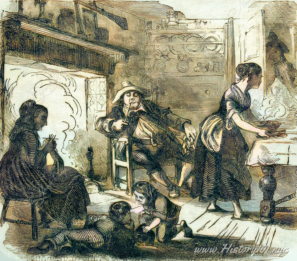
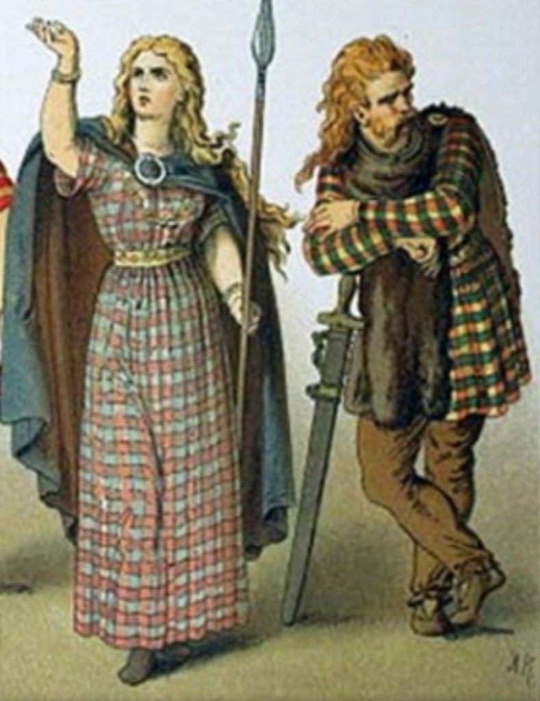
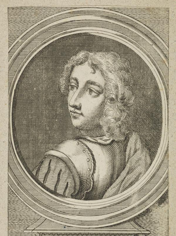
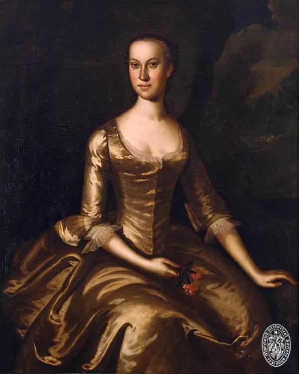
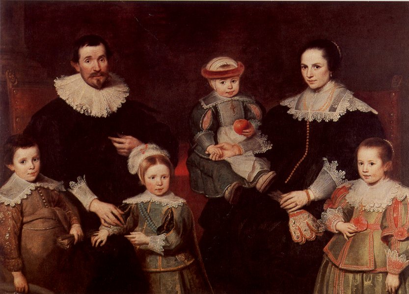
their portraits would have looked somewhat like this.
(Image courtesy of Nicole Kipar’s late 17th Century Costume history).
A Flourishing Family In The Hudson River Valley
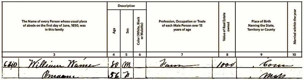
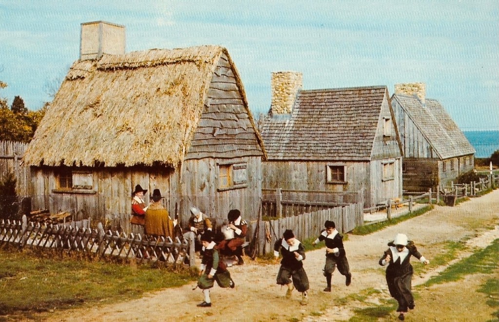
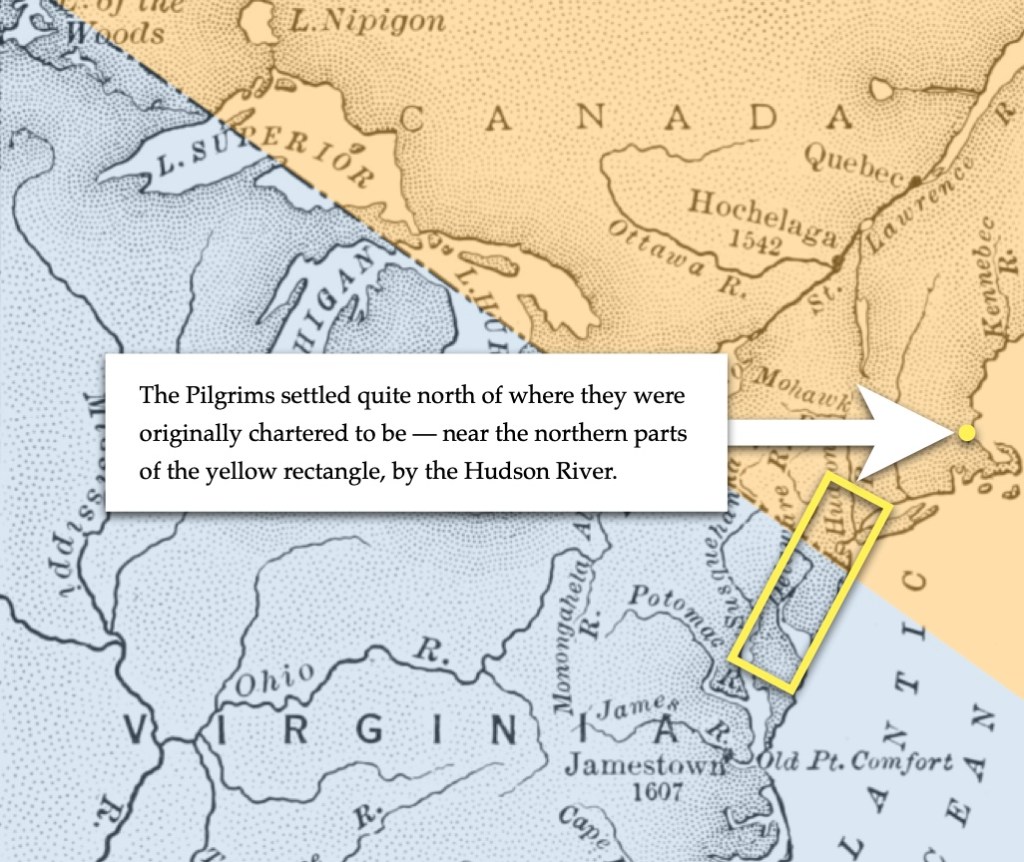
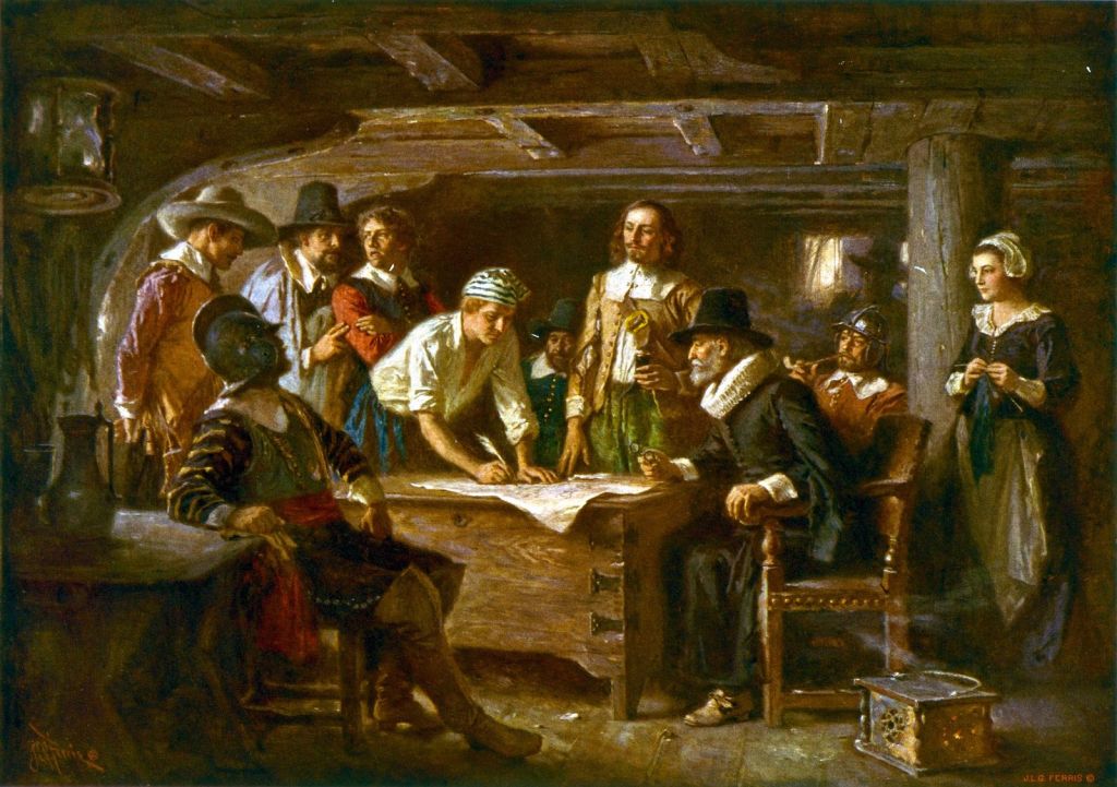
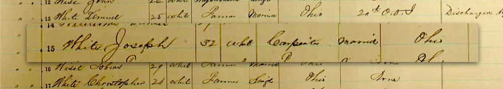
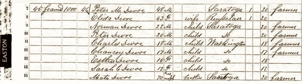
The Joseph Doty Jr. family spent the arc of their lifetimes situated on either Long Island Sound, or within the Hudson River Valley. He was born in 1708 in Oyster Bay, Long Island, New York Province — died about 1788 likely in Lansingburgh, Rensselaer County, New York State.

From the records of the Dutch Reformed Church in Fishkill (Rombout Patent), Dutchess County, the Province of New York.
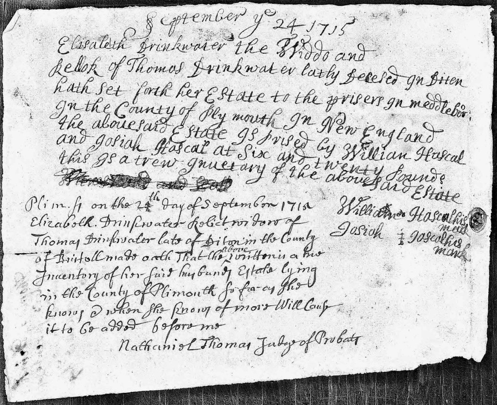
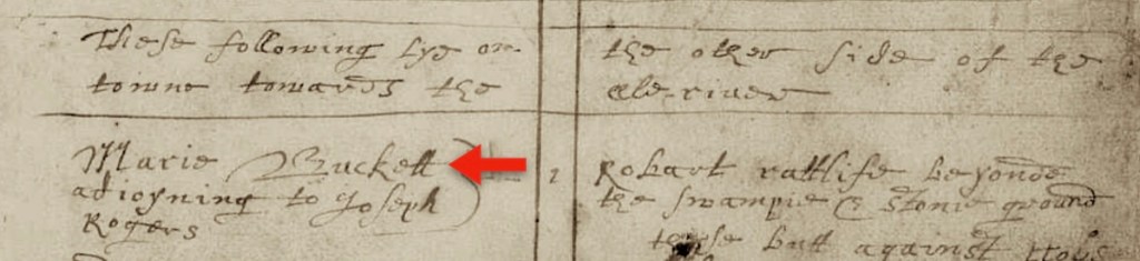
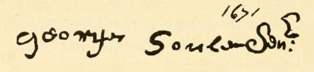
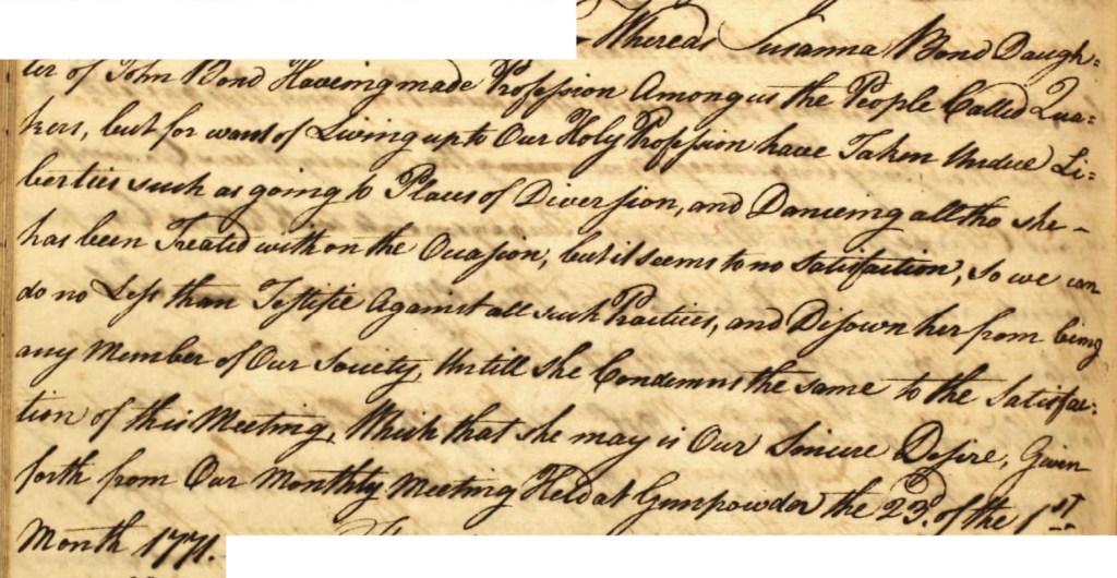
On March 20, 1743, Joseph Doty Jr., married Geisje De Lange* at the Dutch Reformed Church located in the hamlet of Fishkill, Rombount Precinct, Dutchess County, New York Province. She was born in the Crum Elbow Precinct, Dutchess County, the Province of New York, about 1725, daughter of Frans Arie DeLong and Maritje (Van Schaick) DeLong. She died after 1773, likely in Lansingburgh, Rensselaer County.
*Geisje DeLong’s surname became anglicized to De Long (from De Lange). On many records, her first name is recorded as “Lucretia”. This was actually her nickname which she used for most of her life.

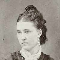
(Image courtesy of Ancestry.com).
Together Joseph and Lucretia had 10 children, who are listed below. The records cited are quoted from the The Doty-Doten Family in America (DDFA) book.
Note: All of their children were born in the Province of New York. We have made corrections to their birth locations.
The first five children, Ormond, Peter, Rebecca, Elizabeth, and Rhoda, were born in the Crum Elbow Precinct, Dutchess County:
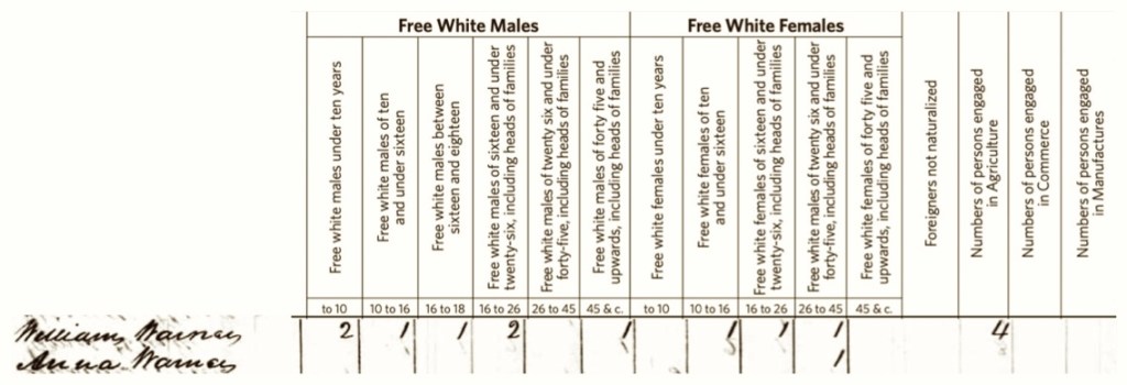
- Ormond Doty was born November 24, 1746 in Crum Elbow Precinct, Dutchess County. He died in South Wallingford, Vermont, November 18, 1826. He married Phoebe Vail; she died at the same location, May 1, 1830. “It is reported that during the Revolution Ormond Doty lived at or in the vicinity of Albany, N. Y.; that he was a Loyalist and was imprisoned at Albany for some time on that charge, but at the intercession of his brothers, who were Patriots, he was released on the condition of going to South Wallingford, Vermont, at that time a wilderness. He removed there with his family, where they settled and remained”.
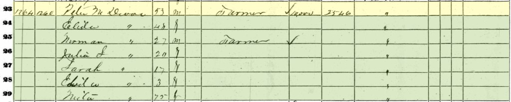
- Peter Doty was born about 1750 in Crum Elbow Precinct, Dutchess County. He died in 1811 after a Will was written dated July 2, 1811. He married Catharine Overrocker, who died January 1820.“They lived Schaghticoke. N. Y. He was a prosperous farmer there. His Will, dated July 2, 1811, is on record at Troy, N. Y.”.
- Rebecca Doty (twin) was born about 1756 in Crum Elbow Precinct, Dutchess, New York. She married (1) John Irish; (2) Stutely Stafford.
“She married first John Irish. He was killed as a British spy at Tinmouth, Vermont, during the Revolution. She married second, Stutely Stafford. They lived South Wallingford, Vermont”. - Elizabeth Doty (twin) was born about 1756 in Crum Elbow Precinct, Dutchess County. She married Daniel Barheit.
- Rhoda Doty (also known as Rhody), was born about 1759 in Crum Elbow Precinct, Dutchess County. She married Jacob Stover.
“They lived Schaghticoke. N. Y., and it is probable that descendants lived Schuylerville, Saratoga County, and Greenwich, Washington County, N. Y.”.
The next three children, Mary, Jacob, and Marian, were born in the same location, but it had been renamed as the Charlotte Precinct, Dutchess County: - Mary Doty (also known as Polly), was born about 1763 in Charlotte Precinct, Dutchess County. She married Leonard Schermerhorn. “They lived Berne, N. Y.”.
- Jacob Doty was born about 1766, in Charlotte Precinct, Dutchess County. He married Zilla Berrie. “He is said to have lived in Albany or vicinity, during the Revolution, but afterward removed to Vermont”.
- Marian Doty was born about 1768 in Charlotte Precinct, Dutchess County. She married Ephraim Putnam.
The last two children, Lydia and Nancy, were born in a new location: Lansingburgh, Rensselaer County: - Lydia Doty was born in December 1769, in Lansingburgh, Rensselaer County. She married Daniel Shaw about 1783. Lydia died November 2, 1830 in Schaghticoke, also in Rensselaer County.
(We are descended from Lydia and Daniel). - Nancy Doty was born about 1773, in Lansingburgh, Rensselaer, County. She married Mark Jimney. (3)
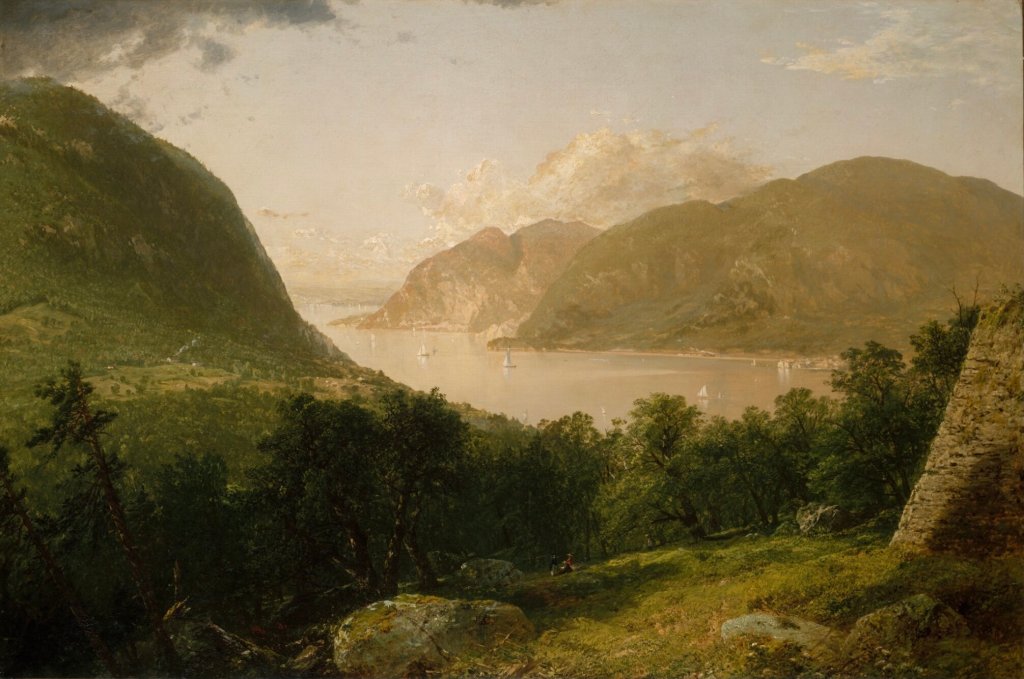
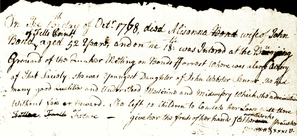
(Image courtesy of the Beacon Historical Society via the Metropolitan Museum of Art).
The Dutch Words Were — Kromme Elleboog
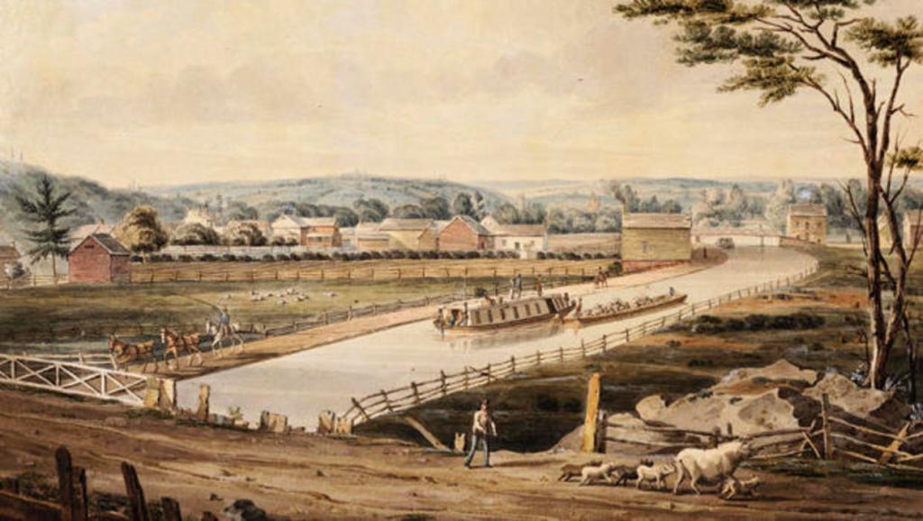
While doing research for this chapter on the Doty Family, we encountered these odd-seeming place names in the Hudson River Valley: Crum Elbow, or Crom Elbow. They seemed like real head scratchers to us, but we’ve seen other odd things — such as trying to interpret quill-pen written manuscripts where the writer was implausibly scribbling away while experiencing a serious medical emergency.
Therefore, we were delighted to learn the following, simply because it made this aspect of our family history, that much more interesting. From the Dutchess County Historical Society Yearbook of 1933 —
In the seventeenth century, while the Dutch held sovereignty over the valley of the Hudson, that is: from 1609 to 1664, they established settlements at three places,—one on the site of the city of New York, one on the site of Albany and one on the site of Kingston. They made no attempt to explore or to clear the forested regions on either side of the river between New York and Albany, chiefly because they were greatly concerned with the trade in furs, and the three settlements just mentioned did an active business as trading posts.
Ignoring the hinterland [the interior land areas], the Dutch plied the river in sailboats, learned to know the river well and had names for many of the sailing courses and for natural features along the shores.
In 1664 sovereignty over the Hudson valley passed to the English. They, after a few years, began to be interested in the regions east and west of the river and in 1683 the colonial legislature passed an Act by which those lands were laid out into counties. Coincidently with the creation of counties there arose an era of speculation in land, during which the desirable tracts along the river were bought up and ultimately opened for settlement.In the course of the development, government officials filed documents and conducted correspondence in English and encouraged the common use of that tongue. It took just about a century for the English language to supplant the Dutch and, while the two were in use at once, original documents were recorded in which may now be found many instances of phonetic spelling, occasions when an Englishman tried to write down the Dutch words he heard in use about him.
An instance of such phonetic spelling and of partial translation is the place-name: Krom Elbow. The Dutch words were: Kromme Elleboog, meaning a bent or crooked elbow. In the seventeenth and eighteenth centuries; Kromme was rendered in the records as: Krom, Krum, Crom, Crum and even Crown (K being a characteristic Dutch letter and C English), while Elleboog was translated in full into Elbow.
[Excerpted from from an article by Helen Wilkinson Reynolds,
in The Dutchess County Historical Society Yearbook for 1933.]
The following bit of information from the excerpt above, became very important with the ongoing history of the Doty Family. “In 1683… coincidently with the creation of counties there arose an era of speculation in land, during which the desirable tracts along the river were bought up and ultimately opened for settlement”. (4)
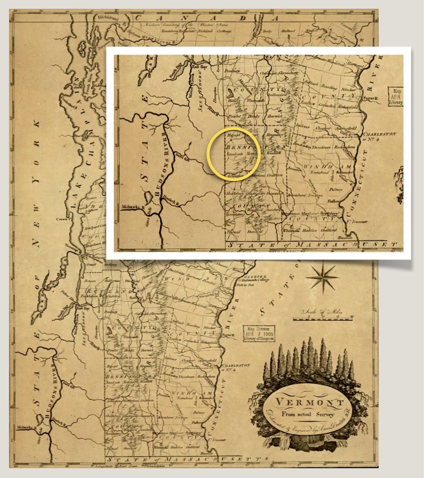
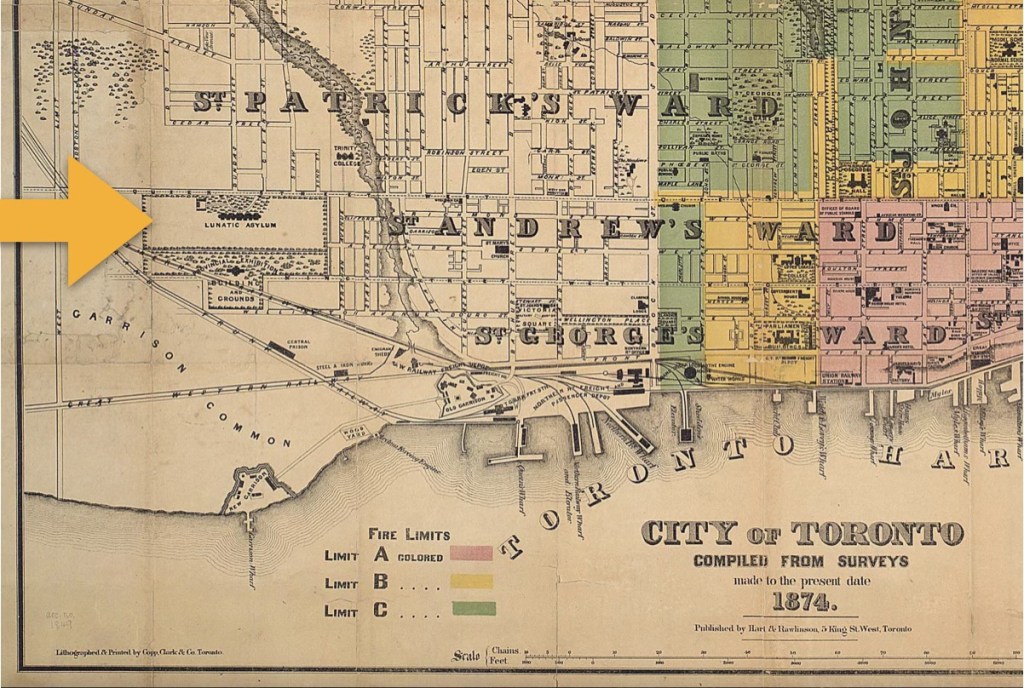
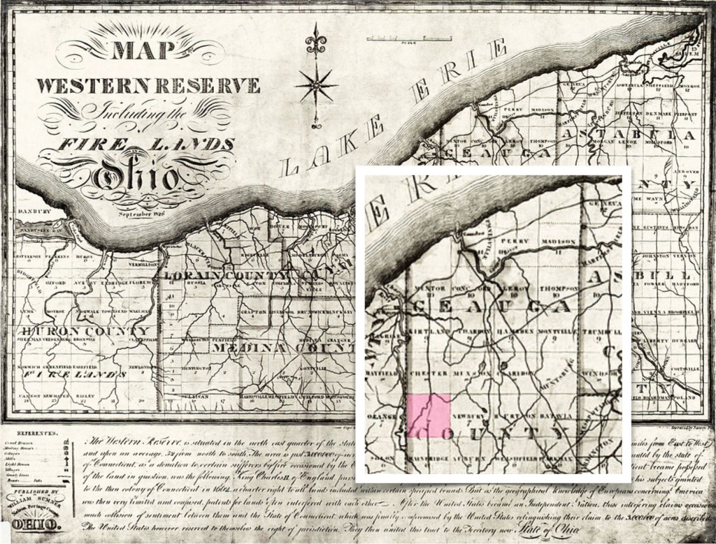
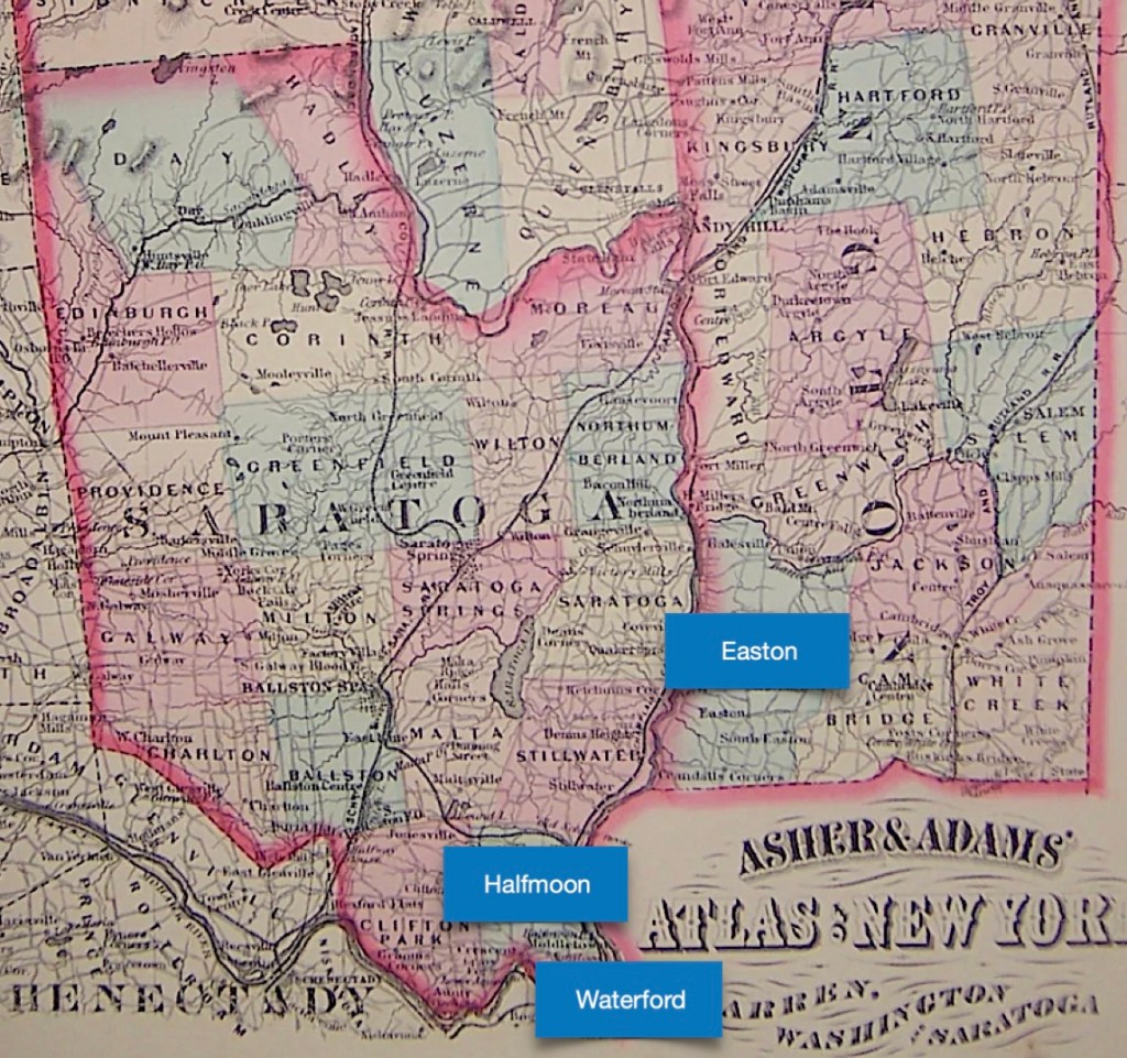
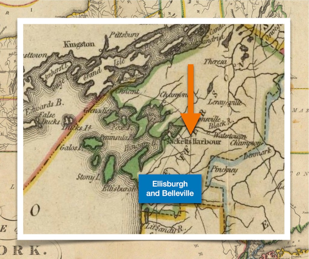
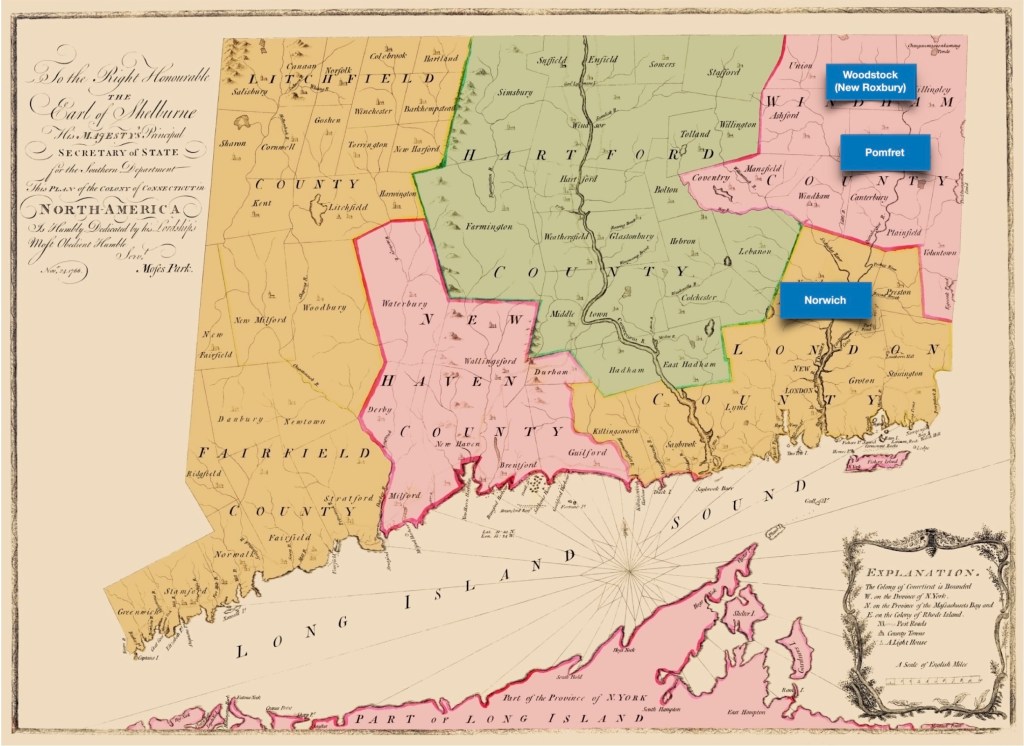
The Nine Partners Patent in Dutchess County
“The Great Nine Partners Patent, also known as the ‘Lower Nine Partners Patent,’ was a land grant in Dutchess County, New York, made on May 27, 1697, by New York governor Benjamin Fletcher. The parcel included about four miles (6 km) along the Hudson River and was eight to ten miles (13 to 16 km) wide, extending from the Hudson River to the Connecticut border…
It was the ninth of fourteen patents granted between 1685 and 1706 which came to cover the entirety of historic Dutchess County [which until 1812 also included today’s Putnam County]”. (Wikipedia, 9 Partners) Some modern writers also refer to the patent as the Nine Partners area.

Note also in the lower left corner of Duchess County is the hamlet of Fishkill in the Rombout Patent. This is the place where Joseph Doty and his wife Giesje De Lange (Lucretia De Long) were married.
The Crum Elbow Precinct
Encouraging settlers to move into the new counties that lined the Hudson River superhighway was very successful.“Prior to 1734, there had been little settlement in the area, but it proceeded rapidly thereafter. Settlers came to the area up the Hudson, but also from New England. When the legislature divided Dutchess County into precincts in 1737, the Nine Partners Grant was included in the Crum Elbow Precinct.” (Wikipedia, 9 Partners)
Observation: The Province of New York used many Precinct Names in this era, but not many town names. ‘Towns’ were quite frequently scattered, and being very tiny hamlets, of not much more than where two paths crossed. Some modern researchers have developed a tendency to magnify and enlarge some of these characteristics of places / hamlets / crossroads in their desire for a sense of a ‘town’.
So the historical place naming sequence (generally speaking) is:
> Counties (commencing in 1683)
> Patents (for Dutchess County, from 1685 until 1706)
> Precincts (or Dutchess County, in 1737, and then ongoing as needed for an administrative function)
> Town names (This varies, but precincts were eliminated in 1788. From that point on, only town names were used).

and the Province of Quebec, by Thomas Pownall, and Samuel Holland, circa 1776.
(Image courtesy of the Library of Congress).
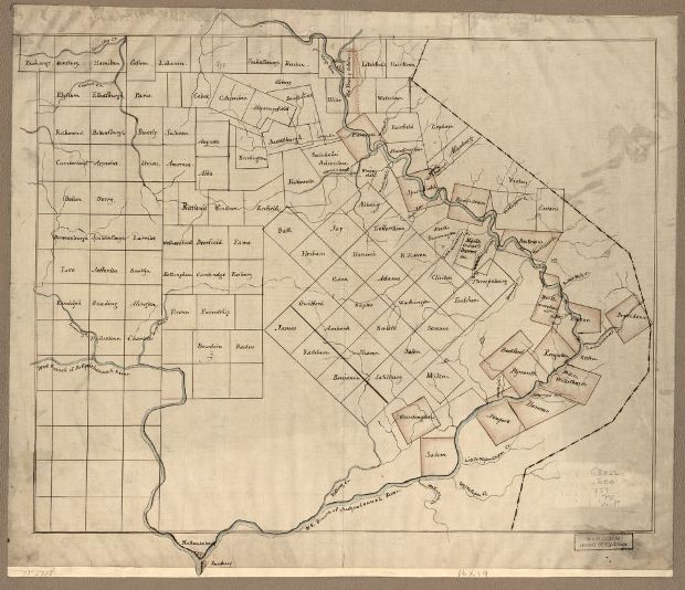
The area outlined in white (above) is the border of the Crum Elbow Precinct from 1697 through 1762. The Doty family lived within this Precinct for most of their time in Dutchess County. Seven years later, in 1769, the entire family relocated north to Lansingburg, Rensselaer County.
The Crum Elbow Precinct Is Divided Twice More
In 1762, the Crum Elbow Precinct was divided into two new precincts, called the Amenia, and the Charlotte Precincts. From that point forward, the Amenia Precinct was a separate entity. In 1786, Charlotte Precinct was divided again into: the Clinton Precinct, and the Washington Precinct. Washington Precinct included the towns presently known as Stanford and Washington. Clinton Precinct included present-day Clinton, Hyde Park, and Pleasant Valley.
The later divisions of 1786 did not affect this family, because, in 1769, the whole family relocated to Lansingburg, Rensselaer County, which was the next county north of Dutchess County moving up the Hudson River.
The Doty family had lived in the Crum Elbow Precinct for many years, but we do not know exactly where. We likely will never know exactly where, unless some new records turn up. Some researchers have mentioned the Charlotte Precinct, but the Dotys only experienced that place name for about seven years before they moved. Some have mentioned the Clinton Precinct, but this precinct did not exist when they lived there. (5)

(Courtesy of the Albany Institute of History & Art).
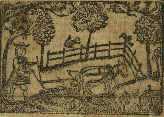
Literally Mending Fences Here And There
This was an era when there was no municipal government to take care of roads so that they were safe and passable. In addition, since many people had livestock, and boundary markers were generally a bit vague, someone had to pay attention to where the fences actually were. Joseph Doty was not alone in this role. Many of his neighbors had similar roles and a few interesting records do survive, such as —
In the book Records of Crum Elbow Precinct, Dutchess County, New York, 1738… President Franklin D. Roosevelt (who knew he liked genealogy?), cited that Joseph Doty [Jr.] was:
- Either an Overseer, or a Path Master of the High Ways in the Crum Elbow Precinct for the years: 1756 and 1759
- Then the same role for the Charlotte Precinct four years later
- The Delong family’s bridge (of his wife’s family) is also mentioned as being in the Charlotte Precinct in 1772
(See footnotes). (6)
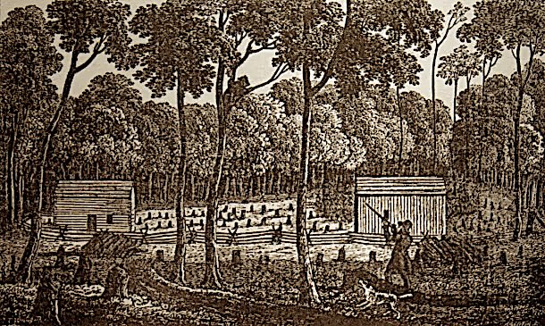
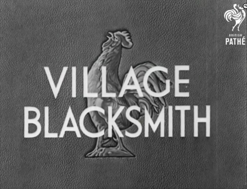
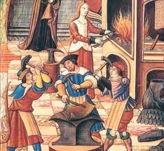
A Blacksmith, Probably in Good Circumstances…
In the later 1760s, Joseph and Lucretia sold some of their properties in the Crum Elbow Precinct (which had recently been renamed as the Charlotte Precinct). There are two records which are written about in the Doty-Doten Family book, on page 505 — “Joseph Doty was a blacksmith, probably in good circumstances, his sons and daughters all being people of good position… June 5, 1767. Joseph Doty, blacksmith, of Crum Elbow, Dutchess Co., N. Y., mortgages land there. March 30, 1769. Joseph Doty, blacksmith, and his wife Cashea [Lucretia] of Charlotte, sell lots there, being part of nine partners, to Samuel Smith, Jr. of Jamaica, Queens Co., and Melancthon Smith of Charlotte”. The Precinct they lived in was populated by farmers and tradesmen. We speculate that Joseph may have learned the blacksmith trade during his time in Manhattan, perhaps as part of his militia service role?
From these old records we were able to learn about his profession as a blacksmith. Also, we recovered an index record for the second land sale (likely due to the fact that we were fortunate to have a distinctive name such as Melancthon Smith to work with). The index indicates that the original deed is found on page 292, but the original record book is not cited. What’s more, we found a tax record for Joseph Doty of Nine Partners / Crum Elbow / Charlotte, for the time period of June 1754 – June 1768. This supports both his residency there, and the fact that since his tax record ends in June 1768, that there was change afoot. (See footnotes).

Observation: Finding colonial era records in New York State is a very hit-or-miss affair, due to both the history of the area, and to be quite honest, the State of New York bureaucracy. They have not been very organized when it comes to digitizing older documents. We don’t have any records for when the Dotys first acquired property. So, we can only speculate as to when they left Fishkill, and moved north to the Crum Elbow Precinct. Does this mean that their residency there began about June 1754, as the tax records could imply? No, not really, because tax records for the years 1749, 1750, 1751, and 1752 are missing.
Records are quite scant. Censuses for the population did not yet exist, nor did income taxes, and you cannot pay property taxes, unless you own property. (7)
and the Province of Quebec, by Thomas Pownall, and Samuel Holland, circa 1776.
(Image courtesy of the Library of Congress).
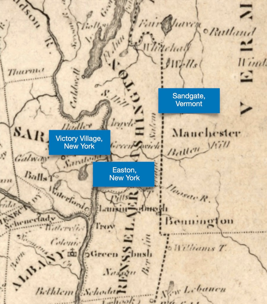
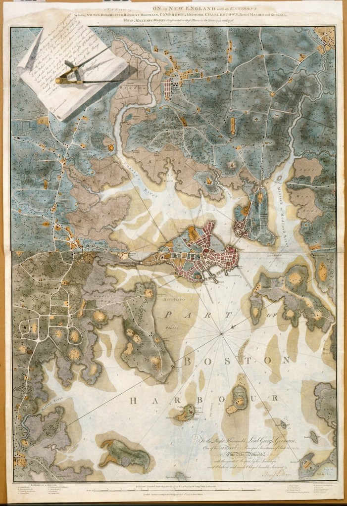
This map documents the family’s transition from the Crum Elbow Precinct in Dutchess County, to the new town of Lansingburg in Rensselaer County in 1769.
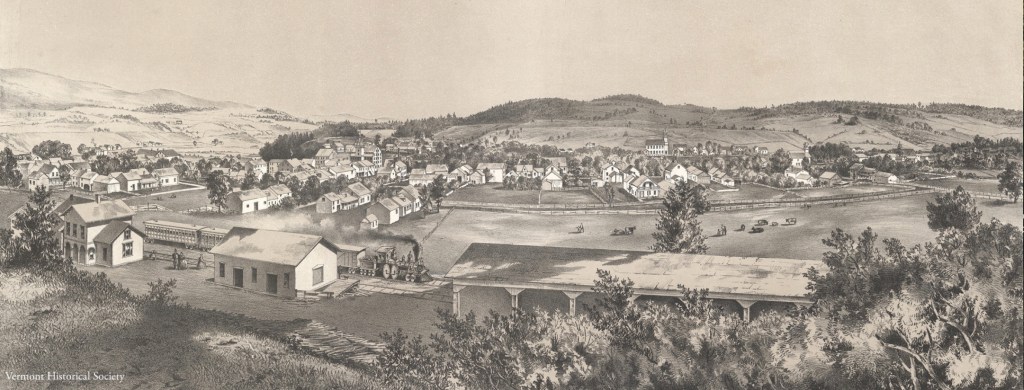
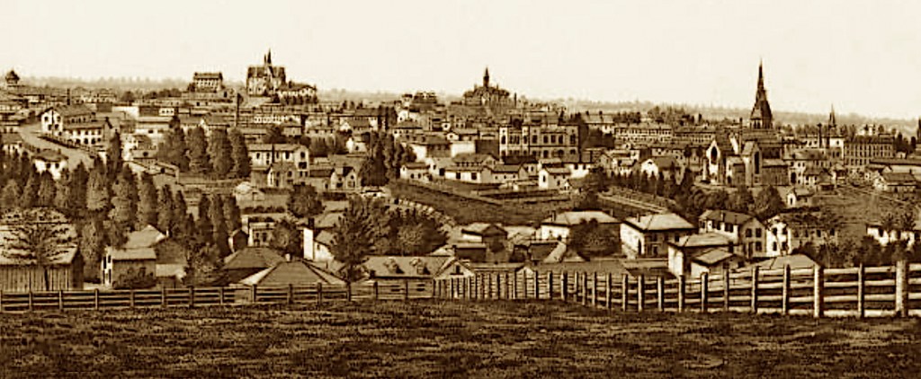
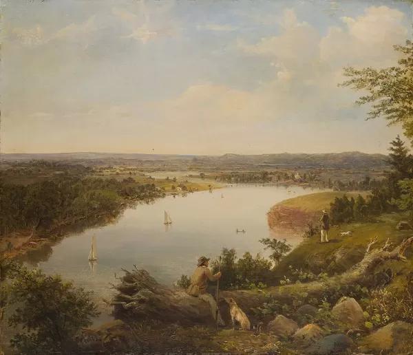
Where the Hudson Meets the Mohawk
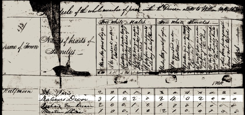
In 1769, they moved to Lansingburgh [Village], New York, located further north in Rensselaer County. The specific area where they moved to was at first, very sparsely settled. This is where the Hudson River meets the Mohawk River. Just slightly north, across the rivers was the established community of Halfmoon, and the town of Albany was to the south. (Albany had long been established; initially as a Dutch trading post in 1614).
The book, the History of Rensselaer County records, “The purchase by Abraham Jacob Lansing on June 21, 1763, was followed soon after by his actual settlement. Two or three other families were already here… and several others soon followed. In seven years quite a settlement was formed. The map of the city plat laid out by Mr. Lansing was tiled May 11, 1771. The survey had taken place a year or two earlier, for quite a number of lots were sold in 1770, and the town-meeting that adopted the ‘proposals’ had met in January before the map was tiled”. This book does not record that they were purchasers of property there.
Initially the area was called the New City. A. J. Weise’s History of Lansingburgh records that there were an estimated 50 people living there in 1771, 400 living there in 1780, and that by 1790, the population had increased to 500 people. In 1788, the year that Joseph Doty, Jr. likely passed away, this enthusiastic description was written: “Elkanah Watson, a traveler, thus writes in his journal concerning New City, in the year 1788: “This place is thronged with merchants, emigrants, principally, from New England, who have enjoyed a very extensive and lucrative trade, supplying Vermont and the region on both banks of the Hudson, as far as Lake George, with merchandise, and receiving in payment wheat, pot [potash] and pearl ashes, and lumber”. (See footnotes). (8)

near the town of Halfmoon, the Province of New York.
(Images courtesy of the Lansingburgh Historical Society).
Our story about the Dotys is nearing its final resolution with the Doty family name giving way to the Shaw family name in the next chapter. Be that as it may, we have one more chapter to go, where the Shaw name then gives way to the Devoe family name, of which we have much, much history. However, before we go there, we have learned some interesting things…
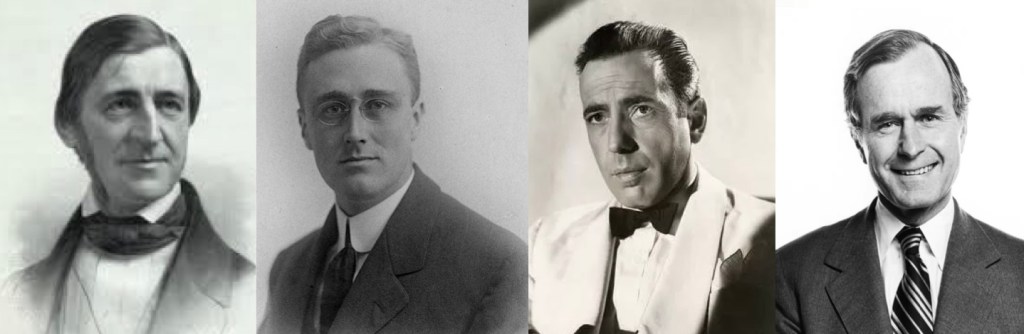
The Roosevelt Family Connection
We connect to the Theodore Roosevelt Jr. family through Great Grandparents — For his generation, they were the 5x Great Grandparents; for our generation, the 8x Great Grandparents.
As a reminder, this is how we introduced them earlier:
The Maternal Line, the Van Schaicks
For Geisje (Lucretia) maternal family line, we return to The Netherlands. This history begins with Niclass Laurenzen Van Schaick*, born about 1633 in Utrecht, The Netherlands — died about 1688 at Kinderhook, Albany County, the Province of New York. He married Jennetjie Cornelis* circa 1664, before they immigrated to America. She was born about 1642, (possibly) in Beverwyck, Netherlands — died February 8, 1728, in the same location as her husband.
The 10 children of Nicholas Van Schaick and Jannetje are as follows:
- Cornelia, who was born about 1668 and married Hendrick <Joris> Van Salsbergen.
- Nicholas was born about 1666
- Fytje was born about 1668 and died 1735; married Dirk Dirksz van der Karre
- Dominicus Van Schaick, who was born 1671 and married Rebecca Groesbeck
- Arent, who was born about 1674 and married Maria Van Loon
- Laurens, who was born about 1675 and married Jannetje Oothout*
- Emanuel, who was born 1678 and married Margrietje Wyngaert*
- Jannetje, who married Johannes Van Hoese.
- Elias
- Marritje, who was born about 1683 and married Frans De Lange*
Of these children, their youngest daughter ‘10. Marritje’ is our 7x Great Grandmother. Her brother, ‘7. Emanuel’ is the one that married into the family line which became the Roosevelt line.
(Image courtesy of Wikimedia Commons).
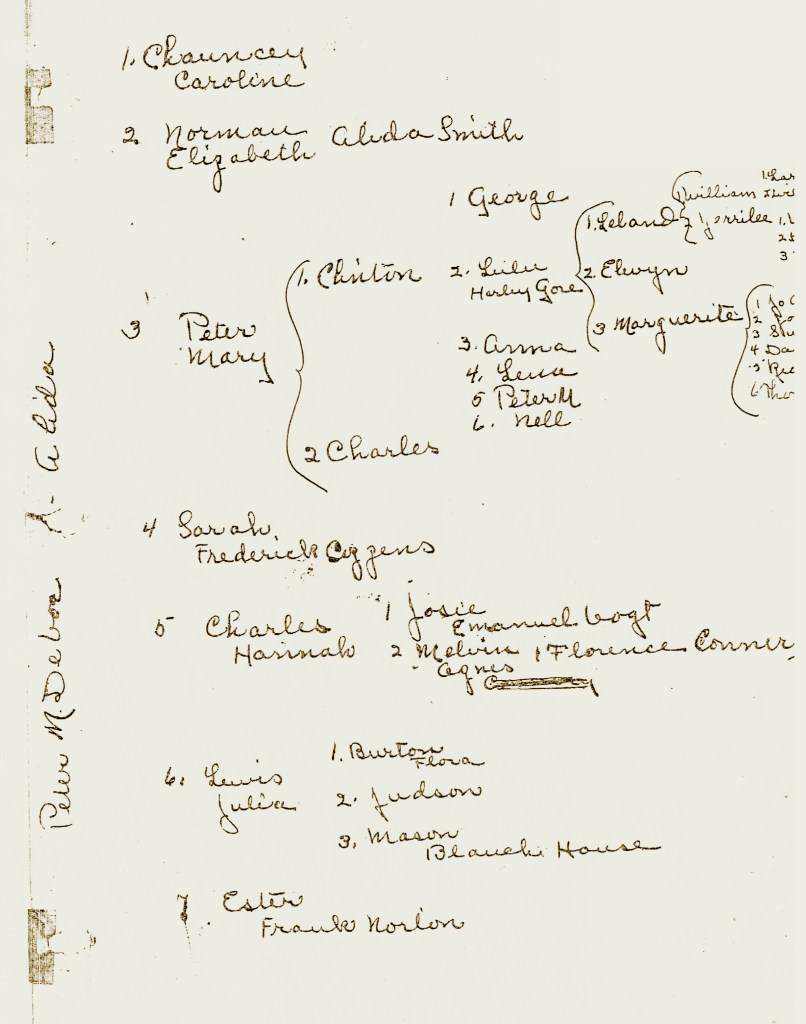
Shown below in two parts, is the family tree related to this lineage:
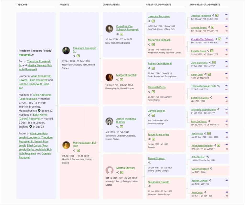
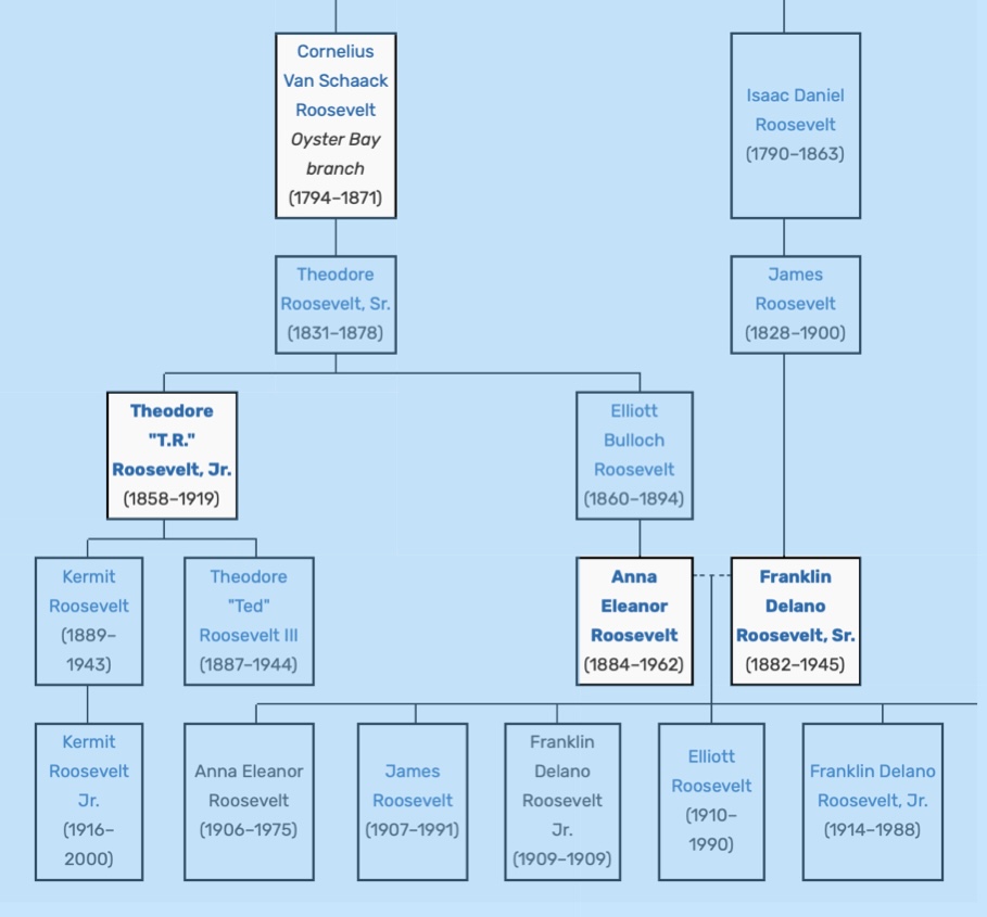
When you look at the family tree for Theodore Roosevelt Jr., working from left to right, you can observe that his 2x Great Grandfather is Cornelius Van Schaak, (upper right in purple text).
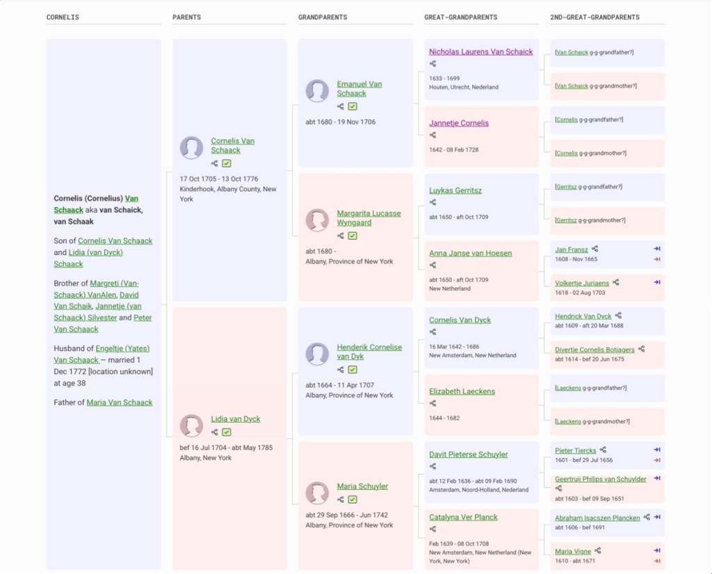
Continuing from Cornelius and moving right to the column of Great Grandparents, we see Theodore’s 5x Great Grandparents, Nicholas Laurens Van Schaick and Jannetjie Cornelis. (Again, they are our 8x Great Grandparents.)
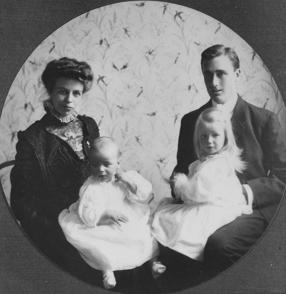
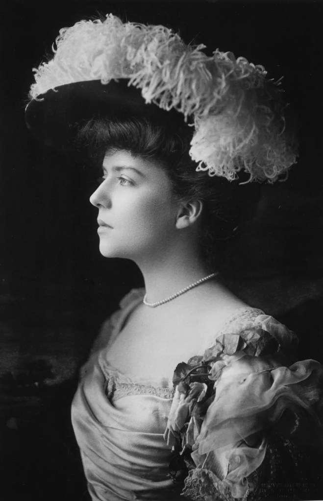
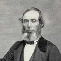
Hyde Park, New York, circa 1908. FDR was the 32nd President of the United States.
(Image courtesy of Wikipedia Commons).
Franklin Delano Roosevelt and his wife Eleanor —
Another Roosevelt connection of note, is the person shown in the upper chart at top center position. The man is named Grandparent: Cornelius Van Schaak Roosevelt and he leads to two connections: Theodore Roosevelt Jr.’s fifth cousin Franklin Delano Roosevelt, and Franklin’s wife Anna Eleanor Roosevelt, who was Theodore’s niece. This is diagrammed simply below:
(Image courtesy of Fandom).
When you look at the family tree for Cornelius Van Schaak Roosevelt, working from left to right with the purple text, you can observe that his 2x Great Grandfather is Emanuel Van Schaak, (Marritje’s brother).
(Image courtesy of Wikimedia Commons).
One More President
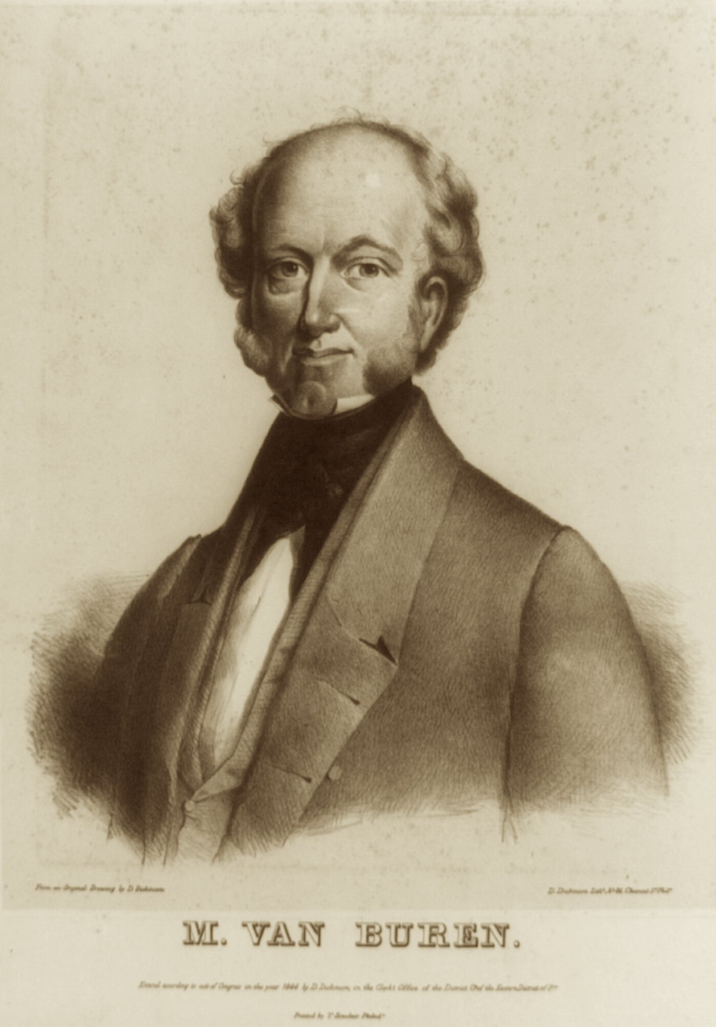
These same Dutch grandparents Nicholas Van Schaick and Jannetje Cornelis, led us to the Roosevelt family, but they also connect us to another United States President. Their son, ‘6. Laurens’ is the one that married into the family line which led to the 8th United States President, Martin Van Buren.
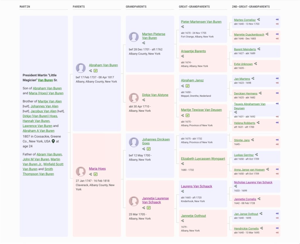
When you look at the family tree for Martin Van Buren Sr., working from left to right with the purple text, you can observe that his Great Grandfather is Laurens Van Schaak, (Marritje’s brother). (9)
So, what would our parents have thought about this?
Throughout their 50 year marriage, our parents used to have some really very absurd arguments about which-side-of-the-family-had-more-important-ancestors. However, they actually knew very little about their true family histories* — so much of these conversations consisted of them blowing cigarette smoke at each other and making offhand comments.
*Much of the research and discovery has emerged in the present generation due to online research capabilities.
But first, a bit of background —
We have all heard the expression that opposites attract, and sometimes it does indeed prove true. Mom and Pop had a mixed-marriage, in the fact that Mom was a country Republican from the mold of: I believe in Civil Rights, but I think we pay too much in taxes! (She always voted Republican). Pop was a Democrat, who grew up in the city during the Great Depression and he felt that FDR had been very helpful to his family. (He always voted Democrat).
Mom would definitely say that Theodore was a Win! for her side, and Pop would counter that FDR was a Win! for his side, and that he had been President for far longer. We never really saw them come to détente on discussions like this… So, when they voted, the actual irony was this: they always ended up canceling-out each other’s vote.
The same hue and pitch entered discussions about family lines, and the same pattern usually continued. In thinking about this, we have pondered, Were they just looking at their various kids’ genes and trying to puzzle-out what they as parents, perceived about each child, one way or another?
Following are the footnotes for the Primary Source Materials,
Notes, and Observations
Let’s Talk About Place Names
(1) — nine records

The Adventures of Tintin
https://en.wikipedia.org/wiki/The_Adventures_of_Tintin
Note: For information on Tintin and his creator Hergé.
Province of New York
https://en.wikipedia.org/wiki/Province_of_New_York
Note: For the data.
History of Manhattan
https://en.wikipedia.org/wiki/History_of_Manhattan
Note: For the data.
Fort Orange (New Netherland)
https://en.wikipedia.org/wiki/Fort_Orange_(New_Netherland)
Note: For the data.
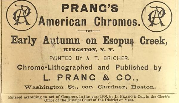
The Old Print Shop
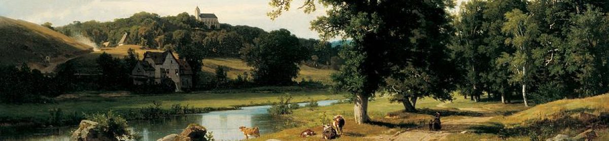
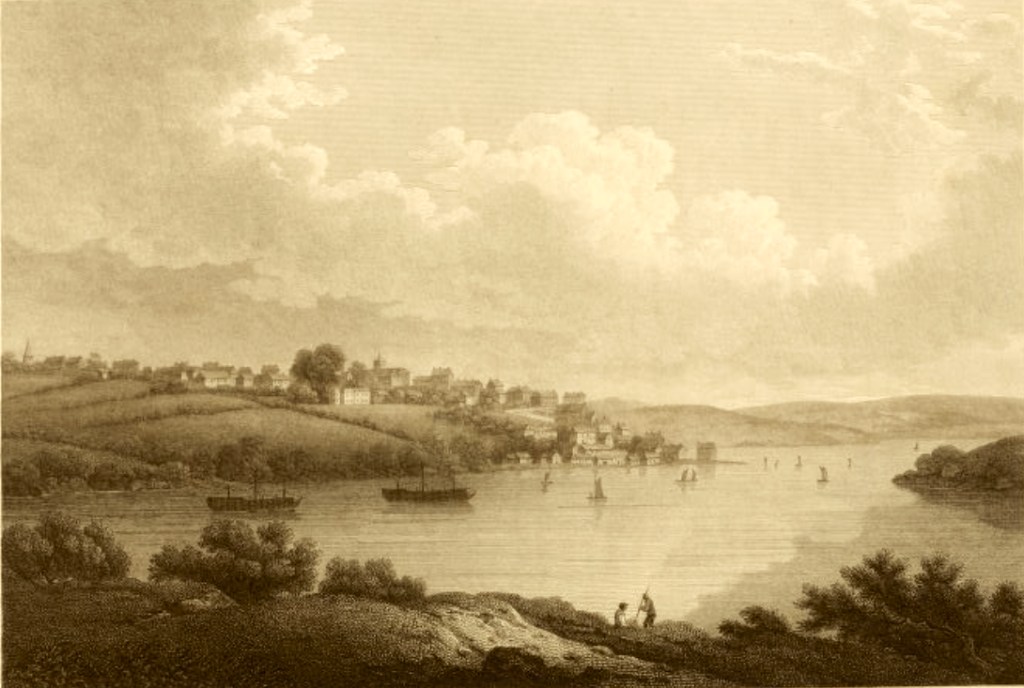
Early Autumn on Esopus Creek
by A. T. Bricher, circa 1875
https://oldprintshop.com/product/147946
Note: For the landscape image.
Esopus Creek
https://en.wikipedia.org/wiki/Esopus_Creek
and
Esopus, New York
https://en.wikipedia.org/wiki/Esopus,_New_York
Notes: For the data.
Kinderhook, New York
https://en.wikipedia.org/wiki/Kinderhook,_New_York
Note: For the data.
Ulster County, New York
https://en.wikipedia.org/wiki/Ulster_County,_New_York
Note: For the data.
The De Longs, and The Van Schaicks Come to America
(2) — eleven records
The New Amsterdam History Center,
via The Dutch Collection of the Metropolitan Museum of Art
Manhattan 1660 (view from Governor’s Island), by L. F. Tantillo Fine Art.
https://newamsterdamhistorycenter.org/fat-event/metropolitan-museum-of-art/
Note: For the panoramic artwork of New Amsterdam.
Library of Congress
The Provinces of New York and New Jersey;
with part of Pensilvania, and the Province of Quebec.
by Thomas Pownall, and Samuel Holland, circa 1776
https://www.loc.gov/resource/g3800.ar104500/?r=0.402,1.183,0.673,0.371,0
Note: For sections of the map which indicate the areas of Esopus and New Amsterdam.
Franciscus Adrianus De Lange
https://www.geni.com/people/Franciscus-De-Lange/6000000002665615528
Note: For the data. (Use this file with caution!)
Adrianus Franciscuzs DeLange
https://www.geni.com/people/Adrianus-Franciscusz-De-Lange/6000000000115739032
Note: For the data. (Use this file with caution!)
Nicholas <Laurens or Gerrit?> Van Schaick
https://freepages.rootsweb.com/~rclarke/genealogy/page1/vschai-n.htm
Note 1: For the birth order of Maritjie with her siblings.
Note 2: She is listed as number eleven in the tracing, but looking closely, you will observe that she is child #10.
Nicholas Laurens Van Schaick (1633 – 1699)
https://www.wikitree.com/wiki/Van_Schaick-116
Note: This document (also) lists Maritje as his daughter.
New York State Museum
Introduction to the Fort Orange Educational Guide
Fort Orange and The Patroon’s House
by L. F. Tantillo.
https://nysm.nysed.gov/fort-orange-educational-guide
Note: For the landscape image.
Frans Arie DeLong
https://www.geni.com/people/Frans-DeLong/6000000002665613104
Note: For the data. (Use this file with caution!)
Maria Van Schaak
in the U.S., Dutch Reformed Church Records in Selected States, 1639-1989
New York > Albany > Albany, Vol II, Book 2
https://www.ancestry.com/search/collections/6961/records/2220205
Book page: 230, Digital page: 234/308
Note: For the marriage record.
Maritje van SCHAAK
Web: Netherlands, GenealogieOnline Trees Index, 1000-2015
https://www.ancestry.com/search/collections/9289/records/20450007
Note: For the data on her birth year.
Research Observation: Unfortunately, many, many, (if not most), genealogical websites and family trees have incorrectly identified Lucretia’s mother, Maritje Van Schaick. Often she is listed as the daughter of Iden Van Schaick and Isabel Bloedgoet. Iden and Isobel did have a daughter named Maritje, but she is not the Maritje Van Schaick who was born in Kinderhook, New York. In fact, it is completely implausible that this mother (Isabel Bloedgoet), uniquely gave birth to Maritje in 1680s Kinderhook, which is about 130 miles further north, when all her other children were born in New Amsterdam.
Nicole Kipar’s 17 the century Costume Archive
The Painter’s Family, circa 1630-35
by Cornelis De Vos
http://www.kipar.org/archive/period-galleries/galleries_dutch_paintings1.html
Note: For the family portrait.
A Flourishing Family In The Hudson River Valley
(3) — nine records
(DDFA)
Doty-Doten Family in America
Descendants of Edward Doty, an Emigrant by the Mayflower, 1620
by Ethan Allan Doty, 1897
https://archive.org/details/dotydotenfamilyi00doty/page/504/mode/2up?view=theater
Book pages: 505-506, Digital pages: 504-506 /1048
Note: For the text.
Giesje De Lange
in the U.S., Dutch Reformed Church Records in Selected States, 1639-1989
New York > Fishkill > Hopewell, Fishkill and MarbleTown, Book 14
https://www.ancestry.com/search/collections/6961/records/2028806
Book page: 127, Digital page: 33/56
Note: For the marriage record of Joseph Doty, Jr, and Giesje De Lange [Lucretia (De Long) Doty]
Fishkill NY Dutch Reformed Church
https://www.ancestry.com/mediaui-viewer/tree/87441358/person/320142427851/media/ecda803e-41ca-42b7-afa8-374708585ea5
Note: For the church image.
Hudson-Mohawk Genealogical and Family Memoirs:
a record of achievements of the people of the Hudson and Mohawk valleys in New York state, included within the present counties of Albany, Rensselaer, Washington, Saratoga, Montgomery, Fulton, Schenectady, Columbia and Greene
Volume 3
Cuyler Reynolds, 1866-1934, ed
https://babel.hathitrust.org/cgi/pt?id=njp.32101030753469&seq=170
Book page: 1058, Digital page: 170/680
Note: On the page, see the entry for Doty-Eaton.
(DDFA)
Doty-Doten Family in America
Descendants of Edward Doty, an Emigrant by the Mayflower, 1620
by Ethan Allan Doty, 1897
https://archive.org/details/dotydotenfamilyi00doty/page/504/mode/2up?view=theater
Book pages: 505-506, Digital pages: 504-506 /1048
Note: For the text, and for the brief biographies of the children.
- Ormond Doty and Phoebe Vail,
Book pages: 511-512, Digital pages: 510-512 /1048
https://archive.org/details/dotydotenfamilyi00doty/page/510/mode/2up
The following are all found on Book pages: 512, Digital pages: 512 /1048:
https://archive.org/details/dotydotenfamilyi00doty/page/512/mode/2up - Peter Doty and Catherine Overrocker
- Rebecca Doty, married two times: 1) John Irish, 2) Stutely Stafford.
- Elizabeth Doty (twin sister of Rebecca), married Daniel Barheit.
- Rhoda Doty, married Jacob Stover.
The following are all found on Book pages: 513, Digital pages: 512 /1048:
https://archive.org/details/dotydotenfamilyi00doty/page/512/mode/2up - Mary, or (Polly), married Leonard Schermerhorn.
- Jacob, married Zilla Berrie.
- Lydia, married Daniel Shaw.
Nicole Kipar’s late 17th Century Costume history
http://www.kipar.org/archive/period-galleries/paintings/dutch/de_vos_family_1635.jpg
Note: For the family image.
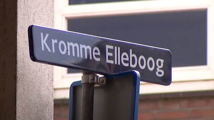
The Dutch Words Were — Kromme Elleboog
(4) — five records
The Dutchess County Historical Society Yearbook for 1933, Volume 18
Kromme Elleboog
A Seventeenth Century Place-Name in the Hudson Valley
by Helen Wilkinson Reynolds
https://issuu.com/dchsny/docs/dchs_yb_v018_1933_masterfile/s/15204965
Note: For the text.
Hudson River Scene
John Frederick Kensett, circa 1857
https://www.metmuseum.org/art/collection/search/11310
Note: For the landscape image.
Library of Congress
The Provinces of New York and New Jersey;
with part of Pensilvania, and the Province of Quebec.
by Thomas Pownall, and Samuel Holland, circa 1776
https://www.loc.gov/resource/g3800.ar104500/?r=0.402,1.183,0.673,0.371,0
Note: For sections of the map which indicate the Great Nine Partners purchase and the Crum Elbow Precinct.
Timeline of Town Creation in the Hudson Valley
https://en.wikipedia.org/wiki/Timeline_of_town_creation_in_the_Hudson_Valley
Note: For the data.
The Nine Partners Patent in Dutchess County
(5) — three records
(Wikipedia, 9 Partners)
Great Nine Partners Patent
https://en.wikipedia.org/wiki/Great_Nine_Partners_Patent
Note: For the text.
Untitled Manuscript Map of Great Nine Partners Patent
in Dutchess County, New York
by Richard Edsall (surveyor), circa 1740
https://digitalcollections.nypl.org/items/140a7300-fcc4-0132-425e-58d385a7b928?canvasIndex=0
Note: For the map image, (Image ID 5376733)
Dutchess County Historical Society
18th Century Maps
by Author unknown
https://dchsny.org/18th-century-maps/
Note: For the DCHS 1939 Yearbook (map)
Literally Mending Fences Here And There
(6) — two records

32nd President of the United States, and Right: Frontispiece for Records of Crum Elbow precinct, Dutchess county, New York… Maybe his interest in genealogy is a genetic trait? There must be something there, because we have it too…
Records of Crum Elbow Precinct, Dutchess County, New York, 1738-1761,
together with records of Charlotte precinct, 1762-1785,
records of Clinton precinct, 1786-1788, and
records of the town of Clinton, 1789-1799
by Franklin Delano Roosevelt, 1882-1945, editor
https://archive.org/details/recordsofcrumelb00roos/page/n7/mode/2up
Note 1: Joseph Doty is listed as either an Overseer, or a Path Master of the High Ways in the Crum Elbow Precinct for the years: 1756 (page 28), 1759 (page 30); then for the Charlotte Precinct in 1763 (page 66).
Note 2: The Delong family’s bridge is mentioned in the Charlotte Precinct in 1772 (page 75).
The Making of the Hudson River School, The Improved Landscape
The Van Allen Homestead
by Henry A. Ferguson
https://www.albanyinstitute.org/online-exhibition/the-making-of-the-hudson-river-school/section/the-improved-landscape
Note: For the painting.
A Blacksmith, Probably in Good Circumstances…
(7) — three records
TuckDB Postcards
The Village Blacksmith
https://www.tuckdbpostcards.org/items/16508-the-village-blacksmith
Note: For the postcard image.
Joseph Doty
Mentioned in the Record of Melancthon Smith
Land – New York, Land Records, 1630-1975
https://www.familysearch.org/ark:/61903/1:1:Z82J-HL6Z?lang=en
Note: For the land deed.
Book page: 2144, Digital page: Image 11 of 347
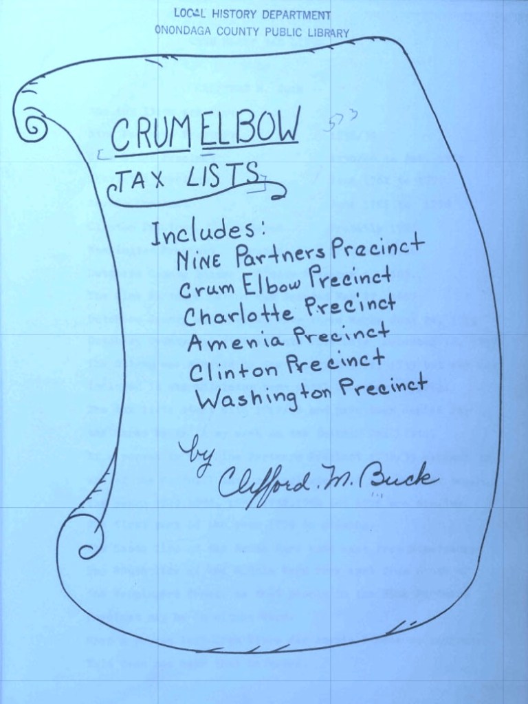
Crum Elbow tax lists: includes Nine Partners precinct, Crum Elbow precinct, Charlotte precinct, Amenia precinct, Clinton precinct, Washington precinct
by Clifford M. Buck
https://www.familysearch.org/library/books/viewer/296090/?offset=0#page=13&viewer=picture&o=info&n=0&q=
Book page 12, Digital page: 13/76
Note 1: Typed tax record for Joseph Doty of Crum Elbow, for the the time period of June 1754 – June 1768.
Note 2: Document identifier number 285952.
Where the Hudson Meets the Mohawk
(8) — five records
Library of Congress
The Provinces of New York and New Jersey;
with part of Pensilvania, and the Province of Quebec.
by Thomas Pownall, and Samuel Holland, circa 1776
https://www.loc.gov/resource/g3800.ar104500/?r=0.402,1.183,0.673,0.371,0
Note: For sections of the map documenting the transition from the Crum Elbow Precinct in Dutchess County, to the hamlet of Lansingburg Village in Rensselaer County in 1769.
History of Rensselaer Co., New York
by Nathaniel Bartlett Sylvester, circa 1880
https://archive.org/details/historyofrenssel00sylv/mode/2up
Book page: 293, Digital page: 292/844
Note: For the text on the history of Lansingburgh Village.
Albany, New York
https://en.wikipedia.org/wiki/Albany,_New_York
Note: For reference.
The History of Lansingburgh, N. Y.
From the Years 1760 to 1877
by A. J. Weise, A. M., circa 1877
https://ia801209.us.archive.org/6/items/historyoflansing00weis/historyoflansing00weis.pdf
Note 1: Book page 39 — for the text regarding population statistics.
Note 2: Book page 11 — for the quote from the traveler Elkanah Watson.
Note 3: Book page 7 — For the description of the original town map, as follows,
“The Map is filed in the Albany County Clerk’s office, and is marked number 18. The following description is attached to it: ‘This Map describeth a tract of land lying on the east side of Hudson’s river, about eight miles above the City of Albany, and is layed out in a regular square for the erecting a City by the name of Lansingburgh; the lots are one hundred and twenty feet long and fifty wide. The streets are seventy feet wide, and the alleys are twenty feet wide the oblong square (the Green or Park) in the center is reserved for publick uses. Laid down by a scale of ninety feet to an inch. June 7, 1771.
Joseph Blanchard, Surveyor. May 11, 1771. A. Jacob Lansingh’.”
Lansingburgh Historical Society
Old Maps of Lansingburgh
https://www.lansingburghhistoricalsociety.org/old-maps
Notes: For the two map images, described accordingly on their website —
“Detail showing New City within boundaries of (unlabeled) Stone Arabia, and Iron Hill north of it. Cropped from ‘A chorographical map of the Northern Department of North-America’ (1780)”
and
“This Map describeth a Tract of Land […] Lay’d out in a Regular form for the Erecting a city by the name of Lansinghburrough”
The Roosevelt Family Connection, and One More President
(9) — ten records
Theodore Roosevelt Jr. (1858 – 1919)
https://www.wikitree.com/wiki/Roosevelt-18
Note: For the Family Tree of Theodore Roosevelt Jr., part one
Cornelis Van Schaack (bef. 1734 – 1797)
https://www.wikitree.com/wiki/Van_Schaack-2
Note: For the Family Tree of Theodore Roosevelt Jr., part two.
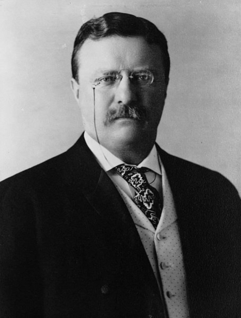
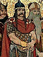
Theodore Roosevelt, circa 1904
File:President Theodore Roosevelt, 1904.jpg
https://commons.wikimedia.org/wiki/File:President_Theodore_Roosevelt,_1904.jpg
Note: For his portrait.
File:Franklin D. Roosevelt and Eleanor Roosevelt with Anna and baby James, formal portrait in Hyde Park, New York 1908.jpg
https://commons.wikimedia.org/wiki/File:Franklin_D._Roosevelt_and_Eleanor_Roosevelt_with_Anna_and_baby_James,_formal_portrait_in_Hyde_Park,_New_York_1908.jpg
Note: For the family portrait.
Roosevelt family
Fandom
https://familypedia.fandom.com/wiki/Roosevelt_family
Note: For the simple FDR family tree.
Franklin Delano Roosevelt (1882 – 1945)
https://www.wikitree.com/wiki/Roosevelt-1
Note: For the Family Tree of Franklin Delano Roosevelt, part one
Cornelius Van Schaack Roosevelt (1794 – 1871)
https://www.wikitree.com/wiki/Roosevelt-72
Note: For the Family Tree of Franklin Delano Roosevelt, part two. Which leads to Emanuel Van Schaack.
History Facts
FDR was related to 11 other presidents
by Michael Nordine
https://historyfacts.com/famous-figures/fact/fdr-related-to-11-presidents/
Note: For the data.
Martin Van Buren Sr. (1782 – 1862)
https://www.wikitree.com/wiki/Van_Buren-1
Note: For the Family Tree of Martin Van Buren Sr., which leads to Laurens Van Schaack.
Martin Van Buren
https://en.wikipedia.org/wiki/Martin_Van_Buren
Note: For his biography and portrait.


.jpg)
.jpg)
_Stuyvesant_portrait_c1660.jpg)
_-_G.H._Boughton_%2784_LCCN2006678318.jpg)
.jpg)
.jpg)
.jpg)
.jpg)
_by_Henry_A._Bacon.jpg)
.jpg)
.jpg)
_illustration_Alchemic_approach_to_four_humors_in_relation_to_the_four_elements_and_zodiacal_signs.jpg)
 - Geauga County - Geauga County - ED 28-1 to 28 - NARA - 26128376.jpg)
.jpg)
.jpg)
#/media/File:FortStJeanPeachey1790.jpg)
#/media/File:Treaty_of_Paris_by_Benjamin_West_1783.jpg)
#/media/File:Tory_Refugees_by_Howard_Pyle.jpg)
_of_New_York_in_1679_at_Pearl_Street.jpg)
_During_the_Revolutionary_War_-_Geographicus_-_NewYorkCity-johnsonbien-1878.jpg)
,_by_Netherlandish_or_South_German_School_of_the_late_15th_Century.jpg)
#/media/File:Oudewater_moord.jpg)
#/media/File:Oudewater_moord.jpg Siege of Oudewater (1575)
https://en.wikipedia.org/wiki/Siege_of_Oudewater_(1575)#:~:text=II of Spain.-,Siege and massacre,leading to a major conflagration.)
 van het Amsterdamse lakenbereidersgilde - Google Art Project.jpg)
.png)
.jpg)
.jpg)
.jpg)